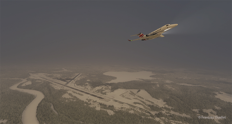
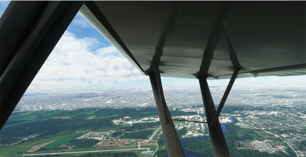
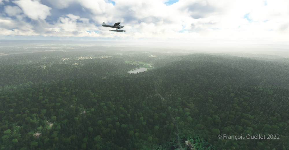
Airborne from the Ivalo virtual airport (EFIV) in northern Finland.
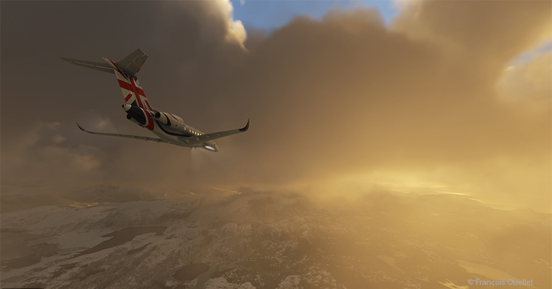
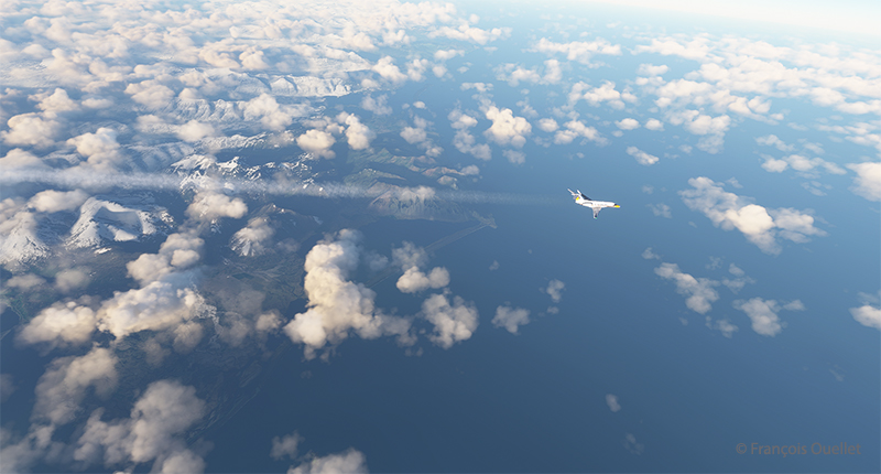
The fifth leg of this world tour in flight simulation continues with a journey from Ivalo airport (EFIV) in Finland to Molde airport (ENML) in southern Norway. It’s hard to see daylight through the cloud cover as we take off.
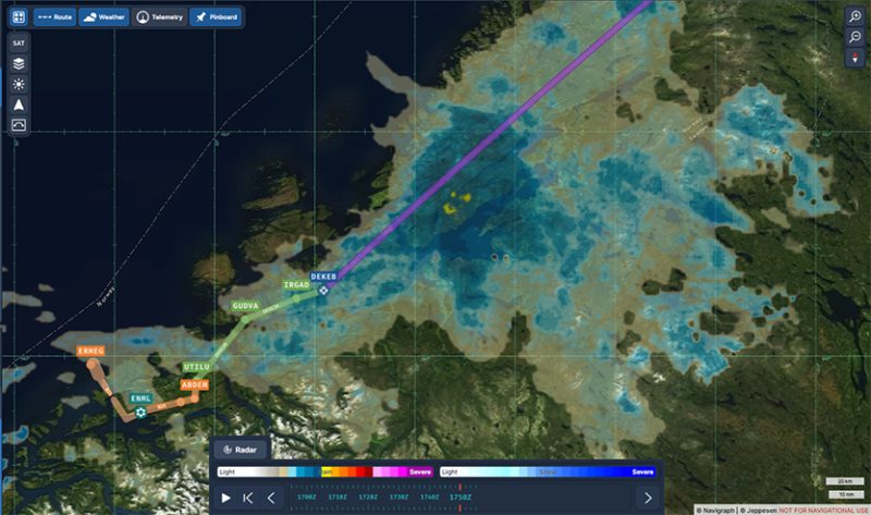
In anticipation of this and subsequent flights, I subscribed to Navigraph to make the experience even more immersive. The map below shows the choices for arrival procedures at Molde airport. In green are the reporting points for the arrival and in orange those for the approach. The aircraft follows these points automatically, thanks to the on-board computer.
Navigraph informations for the arrival in Molde (ENML)
I’m only just getting to grips with Navigraph and am still going through a trial-and-error process when it comes to using the data. But I’m making progress…
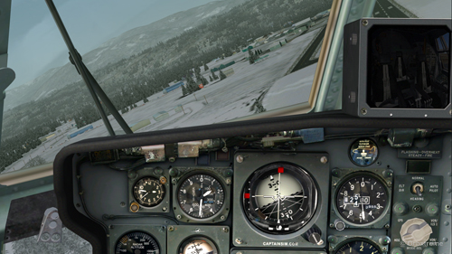
Heading towards the Molde (ENML) airport in Norway with MFS2020.
Once through the cloud layer, the aircraft finally reaches flight level FL380 (38,000 feet).
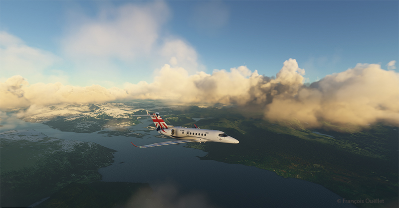
The runway at Molde airport is 2221 metres (7287 feet) long, and lies on the shore of Moldefjorden. It’s perfect for the Cessna Citation Longitude, but there are mountains on the approach.
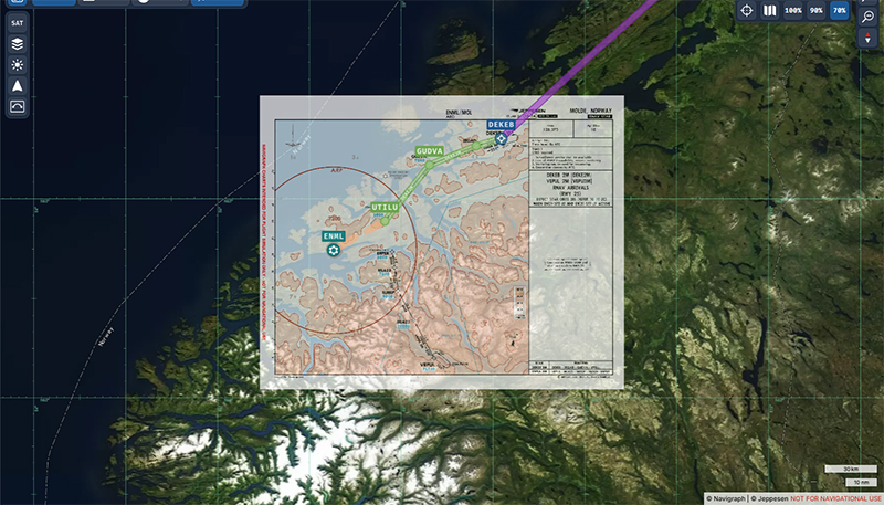
Navigraph map superposed on the geography on approach for the Molde airport (ENML)
The data provided by Navigraph helps the pilot to use the correct altitude limits to maintain a safe height above the terrain at all times. You can also track the aircraft’s progress along the chosen route. Several types of maps are also available to help prepare take-offs and landings. When required, maps can be overlaid with the Navigraph system, while maintaining the aircraft’s planned route over the local geography.
Cessna Citation Longitude descending towards the Molde airport (ENML) airport in Norway in flight simulation.
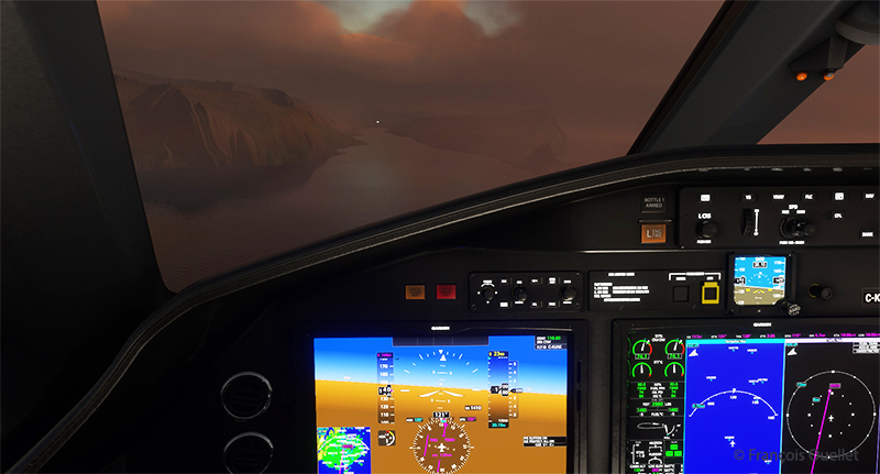
We start the descent to Molde airport. The cloud cover is relatively thin and visibility is not a problem.
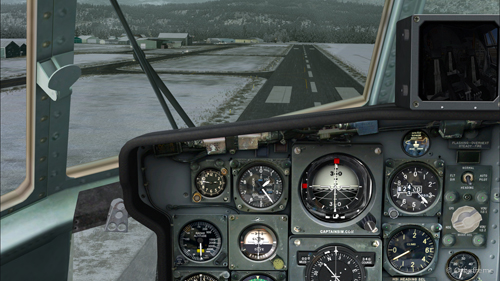
Descending for Molde airport (ENML) in Norway with Microsoft Flight Simulator.
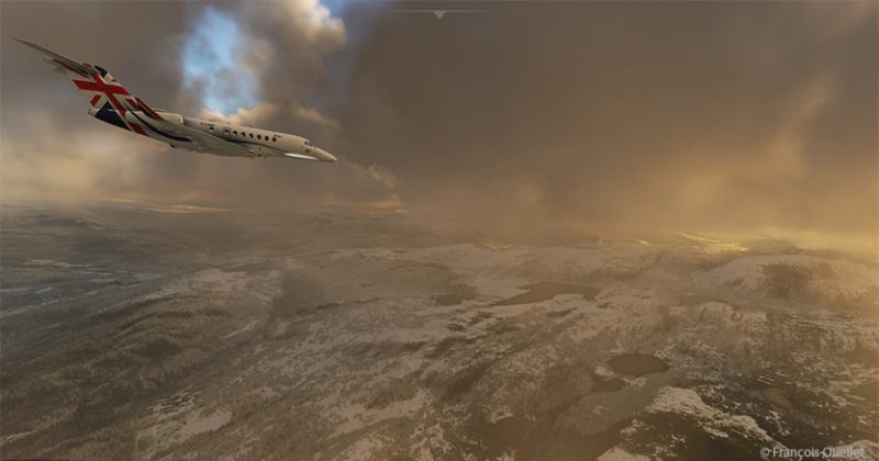
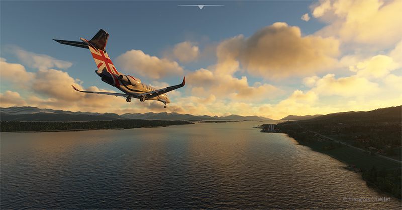
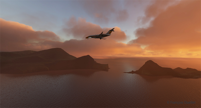
The setting sun makes for beautiful scenes on the descent to Molde.
Approaching the virtual Molde airport (ENML) with the Cessna Citation Longitude
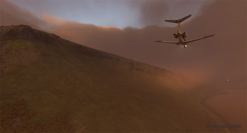
Once out of the clouds and in ideal weather, the autopilot is disconnected and the approach is made visually.
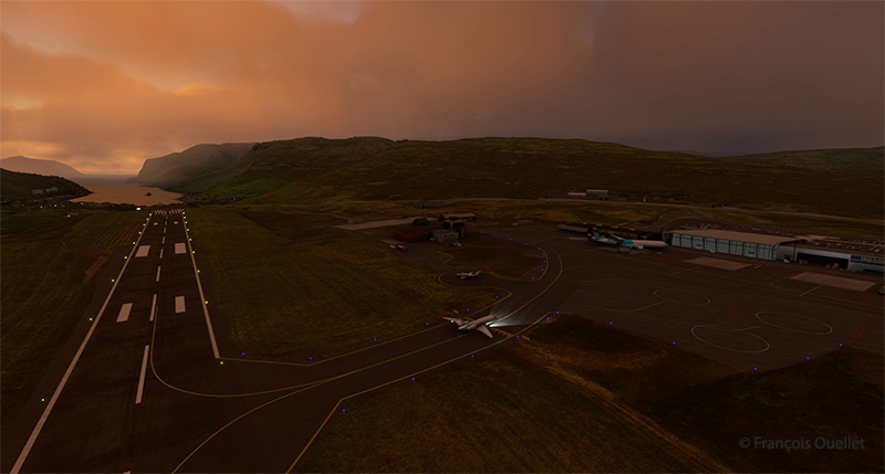
On final for runway 25 at the Molde virtual airport (ENML) in flight simulation.
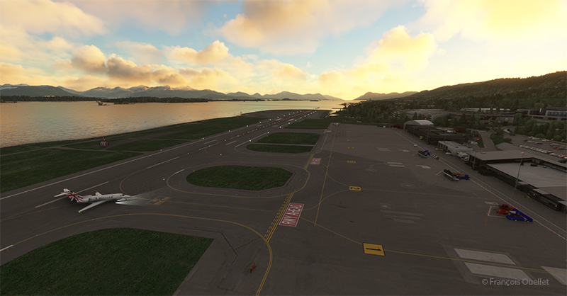
Winds oriented almost in line with runway 25 facilitate the approach.
Exiting runway 25 at the Molde airport (ENML) in Norway.
The Cessna Citation leaves runway 25 and parks for a few days in Molde, a Norwegian town renowned for its beautiful mountains and numerous parks and rose gardens. This town was saved from famine in 1740 by the presence of herrings. The town’s coat of arms features a whale hunting herrings in a barrel as a reminder of this period. Thanks to its position along the fjords and the foehn effect, winters in Molde are relatively mild (and very mild compared to Canada).
Soon the sixth leg of the flight will take place, from Molde to Sandane (ENSD), a Norwegian airport surrounded by beautiful mountains.
Airborne from the Isafjordur airport (BIIS) In Iceland with Microsoft Flight Simulator.
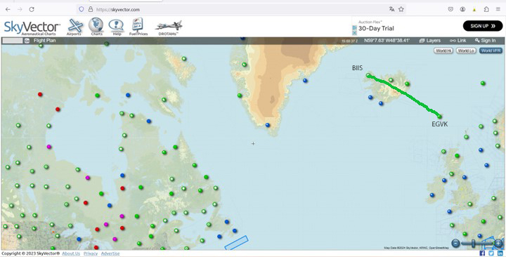
The third leg of the round-the-world flight simulation begins with a departure from Isafjordur (BIIS) in Iceland and ends at Vagar airport (EKVG) in the Faroe Islands, an autonomous archipelago belonging to the Kingdom of Denmark.
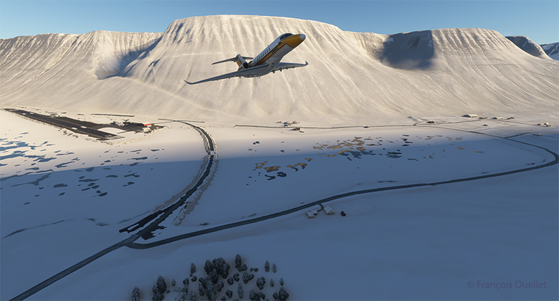
The departure from Isafjordur faces a mountain. You can see the shadows on the ground. But as visibility is perfect, this is no problem at all, as long as the rate of climb is sufficient.
Virtual flight BIIS EGVK
The Cessna Citation Longitude is airborne from the Isafjordur airport (BIIS) in Iceland with Microsoft Flight Simulator.
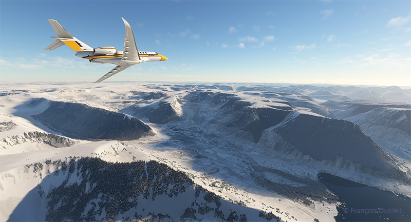
A left turn over the superb Icelandic landscape establishes the Cessna Citation Longitude on course for the Faroe Islands. The FMS ensures that the aircraft will stay on course. But it’s important to remain vigilant: there’s a lot of other equipment that can cause surprises along the way.
The Cessna Citation is climbing slowly over Iceland.
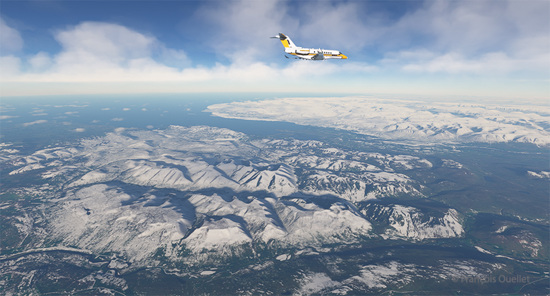
The climb continues over a magnificent landscape. There’s no turbulence today; if there were, the flight simulator would make sure the plane was harder to control, even for the autopilot. I set the virtual flight to observe real air traffic during the flight, but the route between Iceland and the Faroe Islands is off the most popular routes, so it’s normal not to encounter too many aircrafts.
The Cessna Citation Longitude is heading to the Vagar airport (EKVG) in Feroe Islands
We are now established at our cruising altitude, leaving Iceland’s eastern border to fly over the Atlantic Ocean.
Visual approach for runway 12 at the Vagar airport (EKVG) Feroe Islands
We disconnect the autopilot to give us a free hand on the visual approach to Vagar (EKVG) airport. A small white dot, the lights of runway 12, can be seen straight ahead in the distance. The landing gear is down, as are the flaps, and the speed has stabilized at around 140 knots for the moment.
The Cessna Citation is on long final for runway 12 of the Vagar airport (EKVG) Faroe Islands
It’s an ideal time to arrive in the Faroe Islands, with the setting sun coloring all the surrounding clouds.
The Citation Longitude on visual approach to runway 12 at the Vagar airport (EKVG)
Runway 12 is visible on the far right in the photo above. The uneven cloud cover sometimes blocks the view of the airport for a few seconds, but the wind quickly blows the clouds away, preventing a missed approach. Virtual weather ensures a constant renewal of weather conditions.
The Cessna Citation exits runway 12 at the Vagar airport (EKVG) in Faroe Islands with Microsoft Flight Simulator
Landing is trouble-free, as the Vagar runway is long enough (5902 x 98 feet) to accommodate such a private jet.
Some 53,000 people lived in the Faroe Islands as of 2021. One of the most popular activities is bird and plant watching. To make it easier for residents and tourists to get around, tunnels have been built between some of the archipelago’s 18 islands.
The fourth leg of the round-the-world virtual flight will take place between Vagar and Ivalo (EFIV) in Finland. This is Finland’s northernmost airport.
Decades ago, Canadian authorities used this island in the middle of the St. Lawrence River as a quarantine site for immigrants arriving in Canada. Many Irish people, among others, made an obligatory stop on this strip of land before being allowed to continue their journey to Canada.
At one time, a section of the island was reserved for Canadian and American researchers for their top secret research on Anthrax.The most amazing thing about reading the article is realizing that the entire production of this bacteriological weapon (439 liters) was mixed with formaldehyde and put in barrels that were dumped somewhere in the St. Lawrence River when it was decided that it would no longer be useful, as the Second World War took a turn in favor of the Allies. It seems to me that formaldehyde does not prevent barrels from rusting, but hey… back to the point.
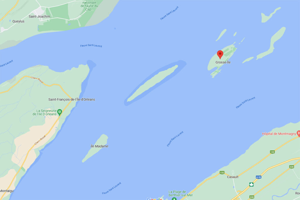
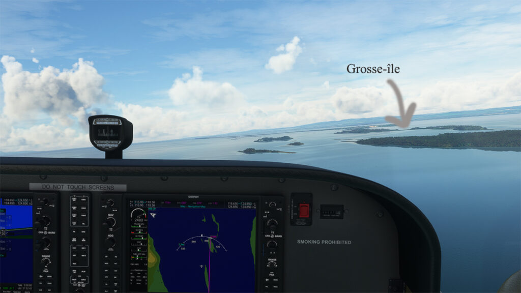
Where is Grosse-Île located? In the province of Quebec, a little east of Quebec City. It is one of the many islands that you can fly over once you have left Île d’Orléans behind. Below, a screenshot from Google Maps.
Grosse-Île in Quebec on Google Maps.
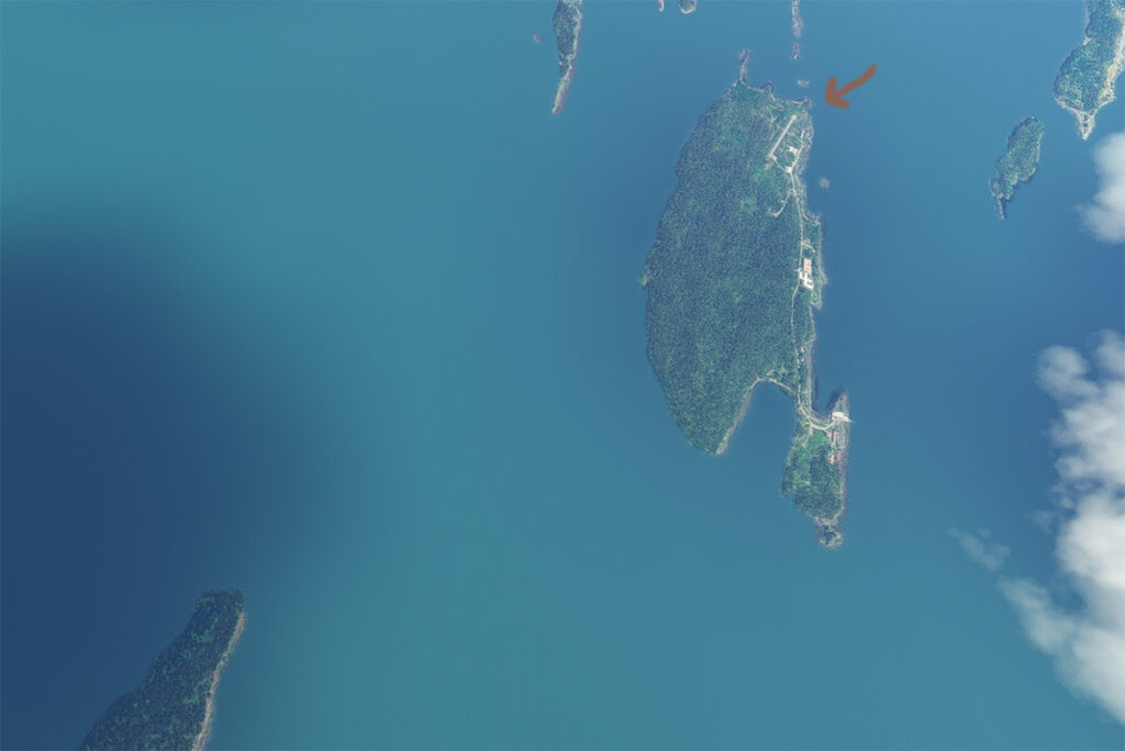
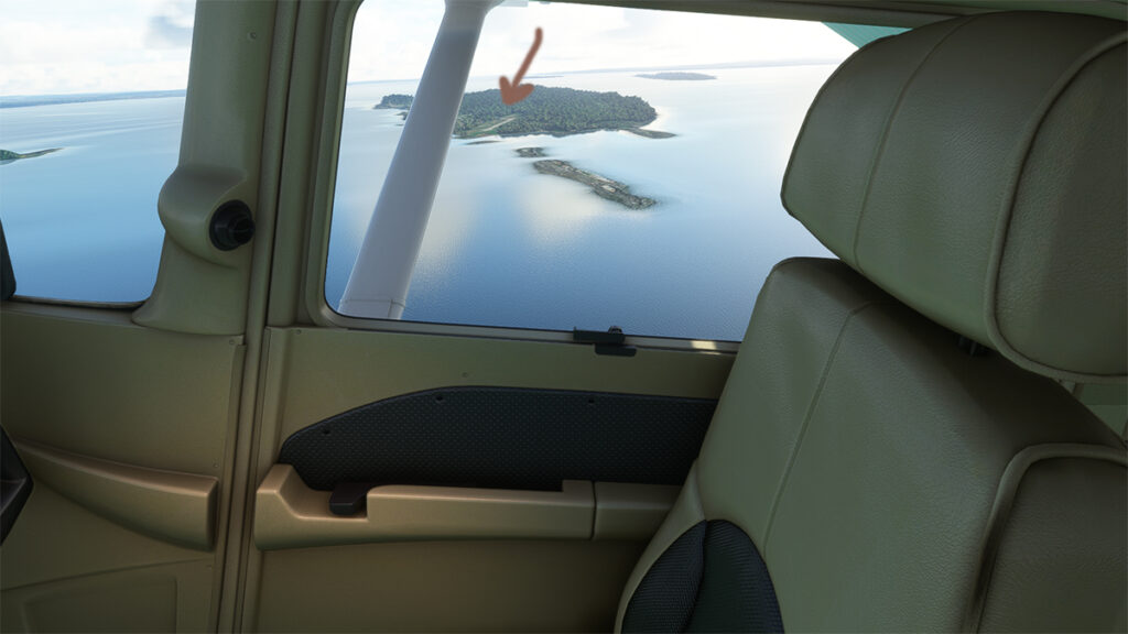
The satellite image below clearly shows that this is not an invention. Microsoft designates this runway as CYMN Montmagny: a mistake that one can easily live with, since by giving an official code to this Grosse-Île runway, the pilot can use it as a navigation point in his GPS.
Satellite view of Grosse-Île and its runway.
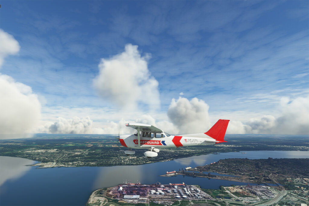
So, let’s use a small Cessna in US Coast Guard colors to make a virtual flight from Quebec City airport (CYQB) to Grosse-Île (CYMN). It was a bit chilly on this February day in Quebec City, so I decided to transport us to July for this flight, adding a few cumuliform clouds in the process.
Leaving Quebec City for Grosse-Île with MSFS 2020.
This short flight will allow us to fly over Île d’Orléans, Île Madame (owned by Laurent Beaudoin, former major shareholder of Bombardier), Île au Ruau (purchased in 2019 by the rich owner of the Gildan empire) to finally arrive at Grosse-Île.
Approaching Grosse-Île over the St Lawrence Seaway with the MSFS 2020 flight simulator.
The picture below shows the aircraft on a right base for the Grosse-Île runway. I do not know the official dimensions of this dirt airstrip, but it can easily accept a Cessna aircraft such as ours.
Cessna in base for the Grosse-Île runway with the MSFS 2020 flight simulator.
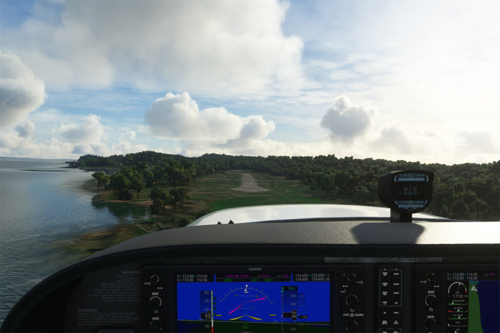
Below, the aircraft is on final for the runway.
On final for the Grosse-Île runway.
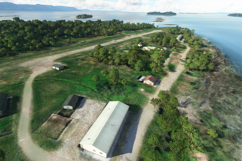
A final screenshot shows the Cessna taxiing down the runway after landing. As you can see, the runway can accommodate much larger aircraft. If you want to make a real flight to this island, find out beforehand about the condition of the runway and the restrictions surrounding its use by visiting pilots.
Cessna aircraft on Grosse-Île after the landing.
Click on the link for more flight simulation experiences on my blog.
Taking of from Rivière des Mille-Îles near Marina Venise
Today’s flight is part of my blog’s standard virtual flight category. The take-off is from the Mille-Îles River in Quebec. There will be a touch and go at Mirabel (CYMX) and a flight over Quebec and Ontario to the Cascades hydrobase (CTY3).
Towards the Mirabel international airport (CYMX) with the MSFS 2020 flight simulator.
Flying at low altitude towards Mirabel airport, for a touch and go.
The Mirabel (CYMX) runway is in sight.
One of the CYMX runways can be seen straight ahead. If a virtual pilot does not find the runway long enough to do a touch and go, then a refresher course is in order.
Touch and go at the Mirabel airport with MSFS 2020
Takeoff from Mirabel. This is the advantage of an amphibious aircraft; you can land anywhere.
The virtual weather shows the difference between the snow in the north and the green vegetation in the south.
The Lachute airport (CSE4) is visible (buildings in red in the foreground). Flying in April in Quebec allows to notice the demarcation between the still white landscapes (the snow persists) in the north and the areas where everything has already melted.
Over Hawksbury, Ontario, with the MSFS 2020 flight simulator.
The flight continues to the Cascades waterbase (CTY3). The Ottawa River separates Quebec from Ontario. The aircraft is currently over the town of , Ontario, with Hamilton Island on the left.
Realism of the flight simulation under MSFS 2020
The screenshot above shows the very realistic effect of the virtual landscape, both in terms of the virtual weather, the multiple color tones of the ground and the shading on the ground and on the aircraft caused by the breaks between the clouds.
Overflying the Plaisance National Park in Quebec with MSFS 2020
Descending for 1500 feet. Near Gatineau, the weather conditions deteriorate slightly. But it will be short-lived.
Turning towards the Gatineau river with the MSFS 2020 flight simulator.
Right turn for a water landing on the Gatineau River. The destination is in sight.
Water landing of the Gatineau river near the Wakefield hydrobase (CTY3)
The plane progresses slowly towards the hydrobase.
Aerial view of the Wakefield hydrobase (CTY3) with MSFS 2020
There is not yet a virtual waterbase worthy of the name for Cascades under Microsoft. At low altitude, the virtual pilot notes that he is only flying over a photo with aircraft footprints. An aerial view shows the CTY3 hydrobase.
Those who wish to repeat the experience will find the ride quite interesting.
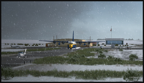
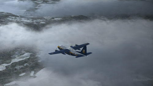
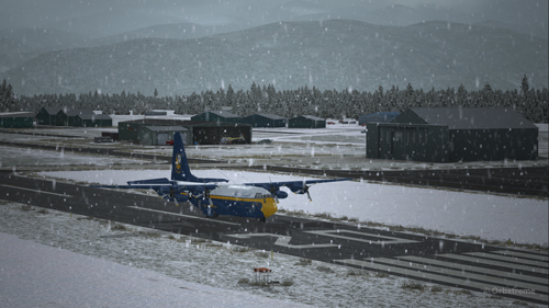
A virtual C-130 belonging to the Blue Angels is taxiing at the High River airport, in Alberta.
Wanting to add an almost impossible flight in the “unhinged virtual flights” section of my web site, I tried a flight with the Blue Angels C-130 Hercules (Captain Sim) where the aircraft gradually lost all of its engines.
The Blue Angels C-130 Hercules waiting in line behind a single engine aircraft at the High River airport.
I am aware that the Blue Angels mechanics are real professionals, so I assumed that the engine failures were caused by an unknown reason.
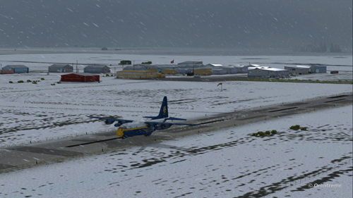
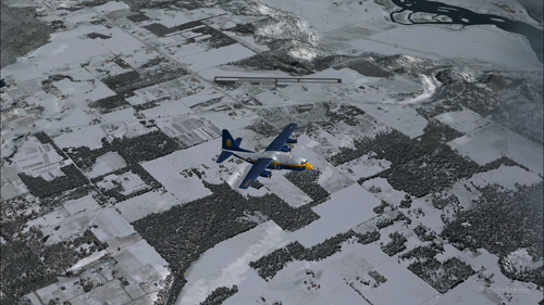
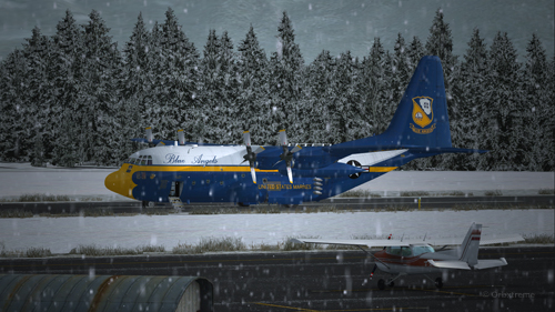
A virtual Blue Angels Lockheed C-130 Hercules takes-off from the High River (CEN4) Canadian airport in Alberta.
The take-off was made without problem from the Canadian High River (CEN4) airport. This free airport was designed by Vlad Maly and is available through ORBX. The aircraft leaves the 4150 feet runway heading to the Coeur d’Alène airport (KCOE) in United States.
Eventually, the first engine stops. This does not cause a problem. The propeller is feathered and the gradual climbing continues.
The C-130 Hercules loses its first engine.
The second engine stops. The pilot must forget the initial destination. Bonners Ferry (65S) becomes the alternate airport since the 4000×75 feet runway is good enough for the C-130.
The second engine has just stopped on this C-130 Hercules.
Double engine failure for this virtual Blue Angles C-130 Hercules.
The third engines gives way. A slow descent starts. Bonners Ferry is not very far. The airport is at an altitude of 2337 ft asl.
The aircraft is volontarily flown at a higher altitude than what would normally be requested for a normal approach, just in case the fourth engine stops. When three engines stop after the same refueling, the pilot has the right to think that what feeds the fourth engine can also cause problems.
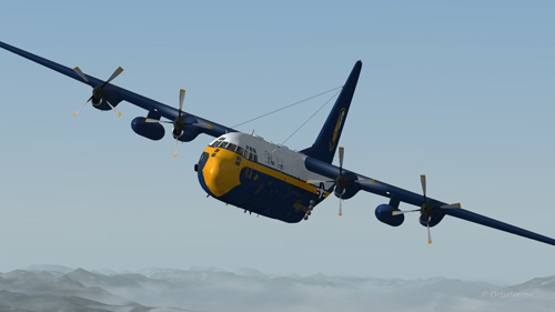
Three engine failures on this virtual Blue Angels C-130 Hercules.
The highest mountains are now behind the aircraft.
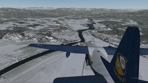
Virtual C-130 Hercules aircraft with three engine failures enroute to the Bonners Ferry airport.
The Bonners Ferry (65S) runway is in sight.
Virtual C-130 Hercules aircraft with three engine failures, by the Bonners Ferry’s runway.
The fourth engine stops. The flaps will not be functional for the landing.
From now on, the pilot should save the virtual flight a few times since it is possible that several trials will be necessary to glide sucessfully to the airport. This is the fun of virtual flight.
The four engines have now failed on that virtual C-130 aircraft.
The C-130 Hercules has become a big glider. When the speed is maintained, the aircraft loses more 1000 feet per minute. It is easier to feel the aircraft’s inertia.
The wheels will be brought out only when necessary since the gear adds a lot of drag.
From the position indicated in the picture below, it is impossible to arrive to the airport in a straight line: the aircraft will glide over the airport. In the picture, the aircraft seems to be on a good path for landing, but it is an illusion caused by the wide-angle format chosen for the screen capture.
The aircraft is definitely too high. It is impossible to use the flaps to increase the rate of descent.
Lockheed C-130 Hercules virtual aircraft with four engine failures on the approach to the Bonners Ferry’s virtual airport (65S).
One must choose between 1) sideslips 2) a 360 degree turn to lose altitude or 3) multiple steep turns perpendicular to the runway to increase to distance to the airport.
What would you choose?
There is no universal method. The 360 degree turn is riskier but can prove efficient. An Airbus A330-200 flown by Quebecer Robert Piché that had lost all of its engines landed successfully in the Açores in 2001 after attempting a last minute 360 degree turn to lose altitude. But here, I did not believe there was enough altitude to safely complete the turn and reach the runway.
A few steep turns were made to extend to ride to the airport. Why steep turns? In order to avoid getting closer to the airport before an acceptable altitude was reached. This method helped keep an eye on the runway at all times to verify if the slope to the airport was still acceptable.
Fourty degree turn to the right on the approach to the Bonners Ferry’s airport.
Steep turn to the left to extend the distance to the Bonners Ferry airport.
I tried the three methods, always starting from the same saved flight (photo 10). After several sideslips, the aircraft was always approaching the airport too quickly. There was not enough time to lose altitude. The final speed always happened to be too high to stop a C-130 without flaps or thrust reversers.
The 360 degree turn, be it right or left, with different angles and a reasonable speed, always incurred a loss of altitude that brought the aircraft 200 to 300 feet short of the threshold.
Finally, after a few steep turns, the aircraft was positioned on final with the appropriate speed and altitude.
View of the Lockheed C-130 Hercules with four engine failures, on the approach for Bonners Ferry (65S).
A few last seconds adjustments, to reposition the aircraft in the center of the runway.
Speed 150 knots. End of the turn for the Bonners Ferry’s airport.
At 140 kts, but without any reverse thrust, the whole runway should be necessary to stop the aircraft.
Speed 140 knots, aligned with the Bonners Ferry’s runway.
The landing was smooth and the aircraft stopped short of the threshold.
For an unknown reason, the anemometer was still indicating a 10 kts airspeed, even when the aircraft had stopped.
C-130 cargo aircraft on the Bonners Ferry’s runway.
Lockheed C-130 Hercules virtual aircraft after landing at the Bonners Ferry (65S) airport.
C-130 Hercules aircraft in Bonners Ferry.
Try such a flight in the virtual mode. The worst that can happen is that you have fun!
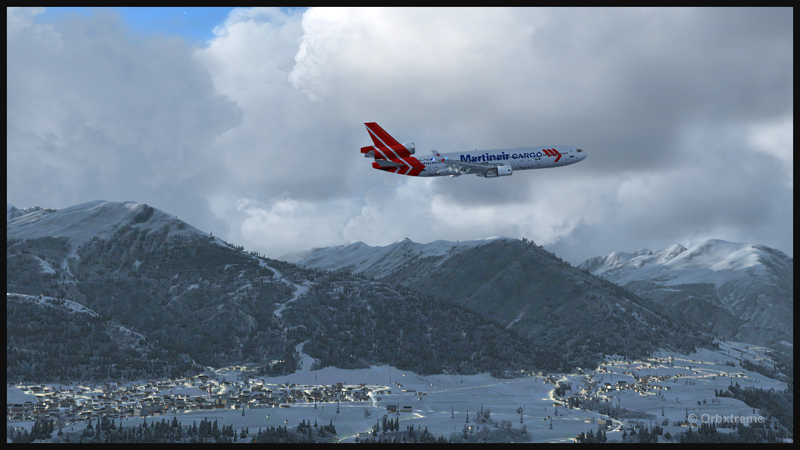
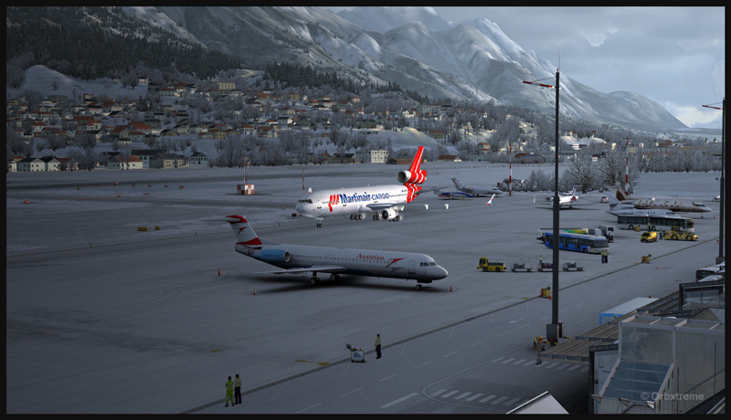
Manually flying a huge aircraft like the MD-11F to make a virtual landing in Innsbruck surely will be fun for most flight simulation enthusiasts. Since the Innsbruck airport and its surroundings have been redesigned under ORBX Innsbruck, the immersion feeling is total. The landscape is absolutely fantastic.
A virtual Martinair Cargo MD-11F is airborne from runway 26 at the Innsbruck airport (LOWI)
Start by taking-off from runway 08. Anybody standing near the fence at the end of the runway will feel the blast. Then, gain enough altitude to be able to do a 180 degree turn to realign the aircraft for runway 26.
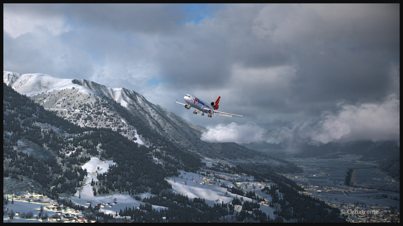
A PMDG MD-11F preparing for a visual approach runway 08 at Innsbruck
Make sure to activate the “air turbulence” option on your virtual weather engine, since an approach near the mountains in Innsbruck generates enough turbulence to make your approach more difficult. The pilot must also, for this exercise, deal with the actual winds even if they do not favor runway 26.
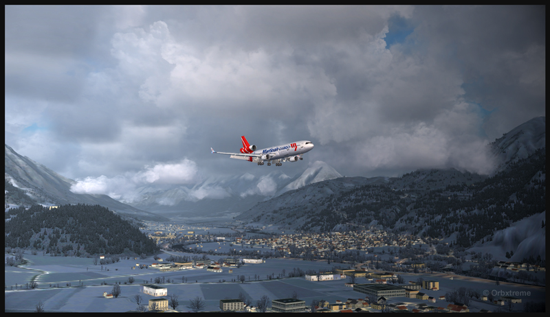
Virtual Martinair Cargo MD-11F approaching the Innsbruck airport (LOWI)
The flaps must be adjusted to 50 degrees for the MD-11F. Insure that the “Autopilot” function is set at “OFF”. The intensity of the automatic breaking is chosen according to the actual winds, the aircraft’s cargo load and the altitude of the airport. The margin of manoeuver with regards to the approach speed is not very large. I tried to maintain 150 kts.
A virtual PMDG MD-11F with full flaps (50 degrees) on final for runway 08 in Innsbruck
The Innsbruck runway is 2000 meters long. There is not much leeway for the MD-11F.
Virtual PMDG MD-11F arriving for runway 08 at Innsbruck
Virtual PMDG MD-11F breaking runway 08 in Innsbruck
Once on the ground, you must continue until the end of runway 26 in order to do a 180 degree turn. There is just enough space for the MD-11F.
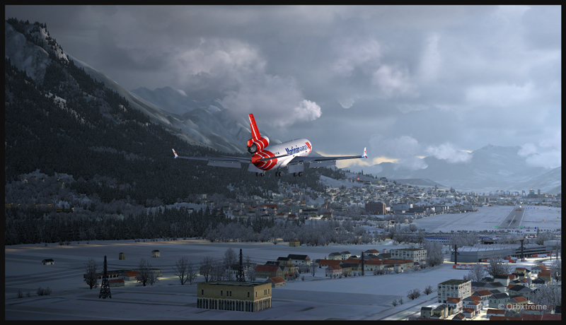
Virtual Martinair Cargo MD-11F backtracking runway 08 at Innsbruck
As you can see in the image below, looking at the windsock, the landing was made with a good tailwind.
Virtual Martinair Cargo MD-11F exiting the runway at Innsbruck
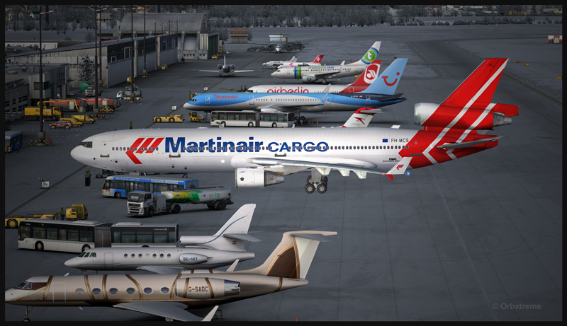
The airport is superbly represented and a parking space is already reserved for bigger aircrafts. Employees are waiting for your arrival.
Innsbruck virtual airport and the Martinair Cargo MD-11F
PMDG virtual MD-11F parked at the Innsbruck airport in Austria
Virtual Martinair Cargo MD-11F parked at the Innsbruck airport
You can try landing with any other big carrier if you do not already own a PMDG virtual MD-11. If you would like to acquire this aircraft, you will realize that it is no longer offered by PMDG, at least for now. Try to put some pressure on the company so that they restart offering the aircraft on which they have put in so much effort. A message on their Facebook site should show your interest: PMDG
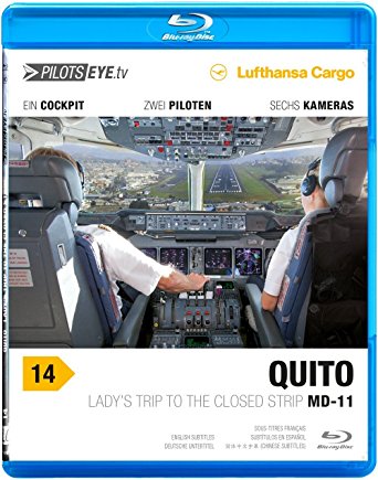
If you would like to see an exceptional two hour aviation video on a real flight that lasted ten days across the world, there is none better than the one made by PilotsEYE.tv: Lufthansa Cargo MD-11F in Quito
PilotsEye DVD on a ten day worldwide trip with a Lufthansa Cargo MD-11F
You witness part of the crew’s planning for a landing on the old Quito runway, in Ecuador. The airport’s altitude is so high that the MD-11F margin of manoeuver is extremely limited. Make sure to own a player that can decode European videos.
The reason for the delays and the positive side for the consumers
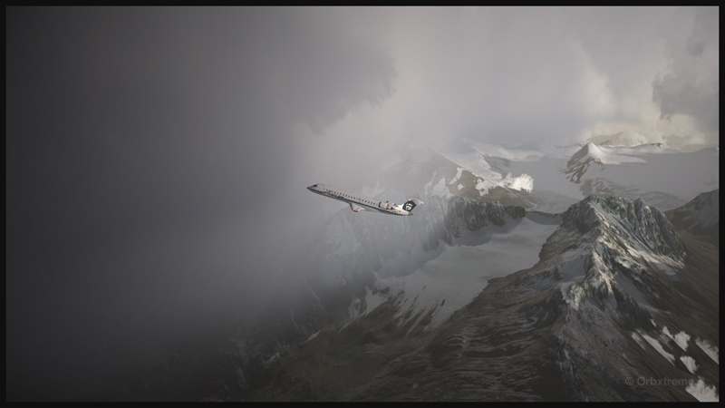
A virtual Bombardier regional jet CRJ-900ER (Aerosoft) with the Alaska Airlines colors is climbing after its departure from the Valdez virtual airport in Alaska (ORBX).
Digital Aviation & Aerosoft have finally completed their long awaited project to make a virtual CRJ-900ER and CRJ-700ER Bombardier regional jets. Months later than expected, the flight simulation enthusiasts can now try those two new virtual aircrafts. The CRJ is mostly used to link smaller airports and remote areas to the main hubs. The aircraft can rapidly reach its cruising altitude and stay there a long time, but it is not intended to be a really fast aircraft.
The company explains that, since the beginning, it had underestimated the complexity of the project and, because of ongoing delays, ended up having to catch up with the competition. In order to offer a superior product than the competition, Digital Aviation and Aerosoft had to review what it initially considered as an almost completed project.
Virtual CRJ-700ER aircraft (Aerosoft) with the Alaska Airlines colors airborne from the Valdez virtual airport (ORBX)
The CRJ-900ER and CRJ-700ER had their exterior almost completely redone; the consumer now ends up with a much better looking aircraft. The project manager says that it is only due to the patience and kindness of potential customers that the project was saved. It pays to be nice!
The first flight with the CRJ
Virtual CRJ-900ER aircraft with the Air Nostrum colors departing the St. Maarten international airport (Fly Tampa St.Maarten)
For the first flight, the manual recommends to first choose and activate one of the default FSX aircraft with the engine running. The pilot then selects the CRJ of his choice. It seems that doing so will prevent a lot of problems.
The virtual 2D cockpit
The virtual 2D cockpit helps save a few FPS. An easy access to the different sections of the cockpit is available since it is divided in several logical panels numbered from 1 to 9.
Navigation
The virtual pilot has access to an updated NavDataPro (May 2017) database for air navigation. It is the world’s most used database in aircraft. The aircraft is also compatible with the popular Navigraph database.
How does a standard computer deals with the new CRJ?
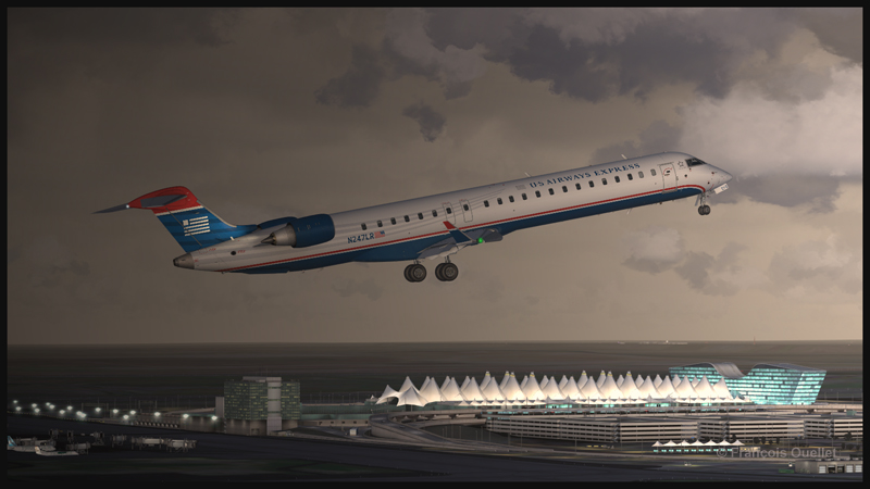
Virtual CRJ-900ER aircraft (Aerosoft) with the U.S. Airways colors airborne from the Denver International airport (Flightbeam Studios)
I have flown both aircrafts on several virtual airports like St. Maarten (Fly Tampa St. Maarten), Montreal international (Fly Tampa Montreal), Denver international (Flightbeam Studios) and Valdez (ORBX) without problems with regards to the computer’s processors and FPS. It was certainly out of question to try to land at the Courchevel airport (LLH Creations), with its short sloped runway, but a low pass at high speed caused no stutters.
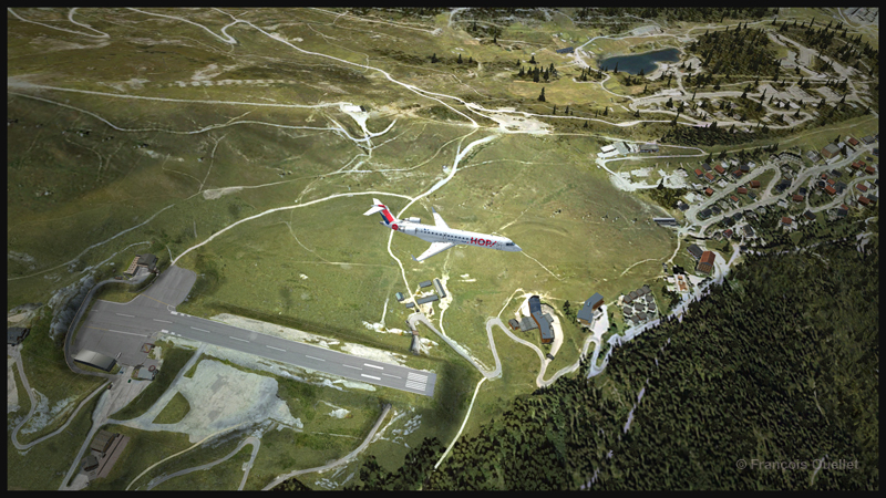
A virtual CRJ-700ER aircraft (Aerosoft) with the Air France HOP colors is in flight over the Courchevel virtual airport in France (LLH Creations)
Flying the CRJ at low speed
The CRJ offers a good margin of manoeuver when it comes to flying at low speed. But due to the position of the engines, the aircraft’s nose will raise rapidly when the throttle is brought back to idle. In a constant and progressive descent, that does not cause a problem. But if the manoeuver is done on short final when the aircraft is still above 50 feet, the rapid change in the aircraft’s attitude could induce a stall.
The air brakes
One cannot rely too much on the air brakes to slow down the CRJ. They have limited efficiency, both for the virtual and the real aircraft.
Floating tendency
If the aircraft arrives over the threshold at a higher speed than recommended, it will float for a long distance before finally touching down.
Landing and take-off distances
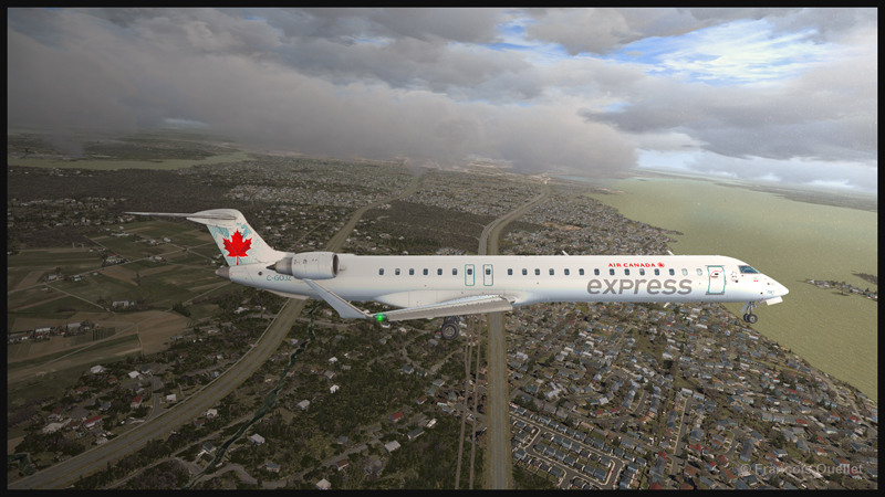
A virtual CRJ-900ER aircraft with the Air Canada colours (Aerosoft) is approaching the Montreal Pierre-Elliott-Trudeau virtual airport (Fly Tampa Montreal)
The CRJ-900 and CRJ-700 operate on relatively short runways. The CRJ-700 needs 5040 feet for take-off (at maximum weight) and landing, under the standard ICAO conditions. The CRJ-900 requires 6060 feet for take-off and 5260 feet for landing. The maximum range has been established to be around 1300 and 1400 nm.
Managers that facilitate the use of the CRJ
For the CRJ, Digital Aviation & Aerosoft have created managers that allow choosing the number of passengers, cargo, as well as calculating the fuel weight, the center of gravity and the amount of trim required. There is even a FS2 Crew option if desired. Another manager facilitated the addition of liveries.
The flight simulation enthusiasts had been anticipating the arrival of that regional jet for a long time; some did not believe anymore that it would one day become a reality (that includes the company too!). The flight simmers now have access to a world class and high quality regional jet.
For more articles on flight simulation on my web site, click on the following link : Flight simulation
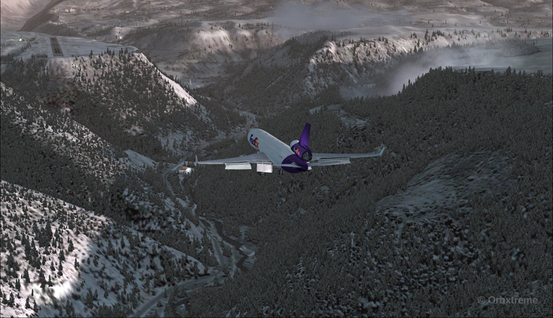
The flight simulator enthousiast will have fun trying this short flight ( 14 minutes) from the Eagle County virtual airport (KEGE) to the Telluride virtual airport (KTEX). The virtual flight, using FSX, was made during winter, on January 8th. The shots below represent an idea of what is visible while flying toTelluride. Use 14,000 feet, it should do it…
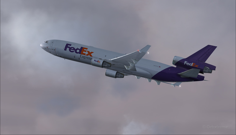
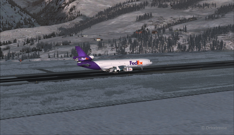
FedEx MD-11 on the take-off run at the Eagle County airport (KEGE) (FSX)
FedEx MD-11 airborne from the Eagle County airport (KEGE) (FSX)
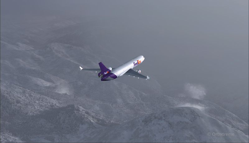
FedEx MD-11 between Eagle County airport (KEGE) and Telluride airport (KTEX) (FSX)
There are lots of beautiful mountains between KEGE and Telluride, and also some unpredictable weather…
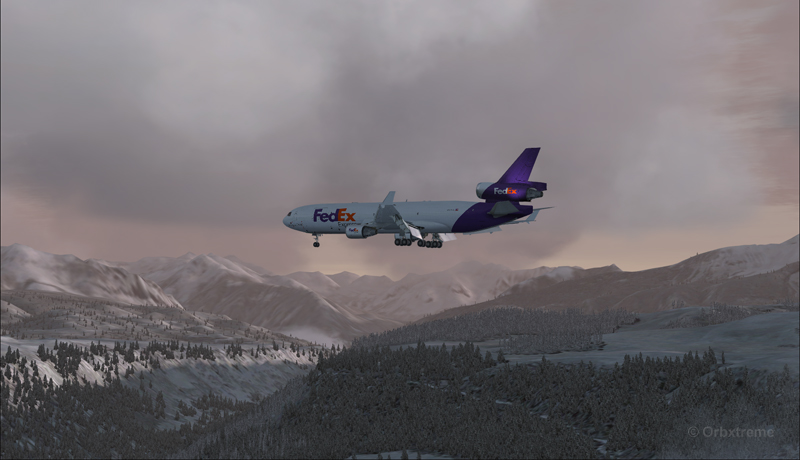
FedEX Md-11 entering bad weather
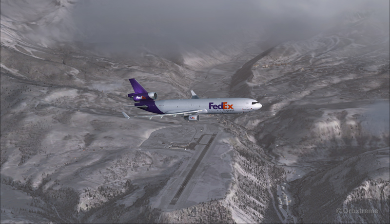
The expected ceiling at Telluride was 8500 ft. On the way to the airport, the clouds and visibility were sometimes obscuring the mountains.
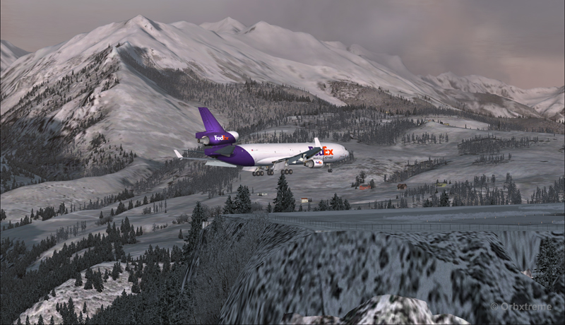
A FedEx MD-11 on a flight Eagle County (KEGE) to Telluride (KTEX) (FSX)
Telluride is a very inviting airport for a MD-11. The 7000 feet runway itself does not represent a big challenge, although its 100 feet are a bit narrow: this aircraft would normally require a 150 feet wide landing surface.
The virtual VFR approach made with the MD-11 was the most expensive way to do the trip, since it required a fly-by and a 270 degree turn to the right to align with runway 09.
FedEx MD-11 flies by the Telluride airport KTEX) (FSX)
The 270 degree turn at a 10-20 degree bank allowed to transit from 14,000 to 10,000 ft without doing anything radical. Just a turn while descending and gradually loosing speed to arrive at around 160 kts on final. The aircraft was now installed on long final, with flaps set at 50 degrees.
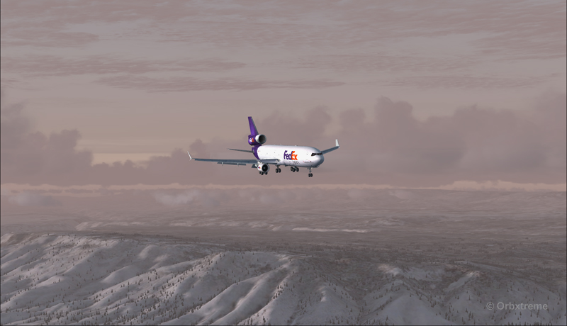
A FedEx MD-11 on long final runway 09 for the Telluride airport (KTEX) (FSX)
The high altitude runway’s 9078 feet msl elevation meant the pilots dealt with lower air density and heavy weight when approaching and, as such, the airspeed had to be adjusted accordingly to prevent stalling on final.
A FedEx MD-11 on final runway 09 for the Telluride airport (KTEX) (FSX)
Here is a view from the Telluride tower…
View from the Telluride airport (KTEX) (FSX) of a FedEx MD-11 on final for runway 09
Now with a view like that, you would not consider coming in IFR…!
A FedEx MD-11 inbound from KEGE on final for runway 09 at the Telluride airport (KTEX) (FSX)
To prevent an overshoot and some additional expenses in fuel (which are already skyrocketing), an optimal approach was required.
Most accidents with the MD-11 happen when the pilot pushes on the stick when there is a rebound with the nose wheel, thus creating an even stronger rebound. When there is a rebound, there is no need to push on the stick, just wait and the aircraft sets itself quickly.
A FedEx MD-11 over the threshold runway 09 at the Telluride airport (KTEX) (FSX)
Now with max breaking and thrust reversers…
A FedEX MD-11 slowing down at the Telluride airport (KTEX) (FSX)
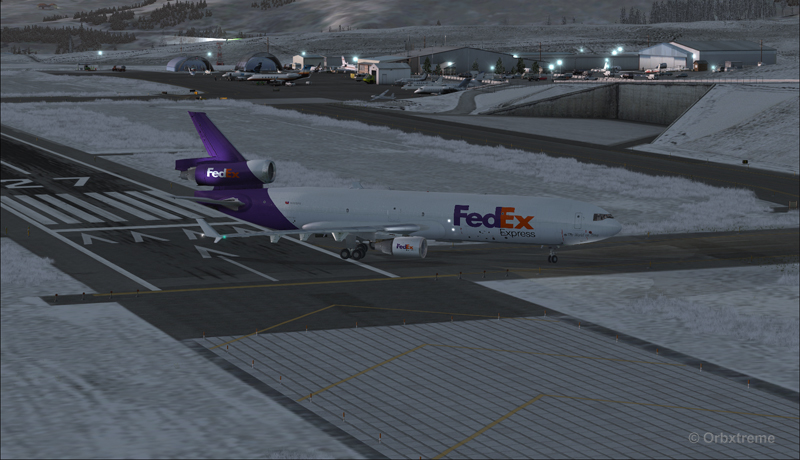
The MD-11 can easily turn at the first taxiway at Telluride. But in order to capture a wider view of the airport, I exited at the last taxiway (again adding to the already enormous expense in fuel…)
A FedEX Md-11 is exiting runway 09 at the Telluride airport (KTEX) (FSX)
The employee on the ramp was worried that the MD-11 lower winglet would scratch N900SS while taxiing. But there was plenty of space (11 inches)…
A FedEX Md-11 is taxiing on the ramp at the Telluride airport (KTEX) (FSX)
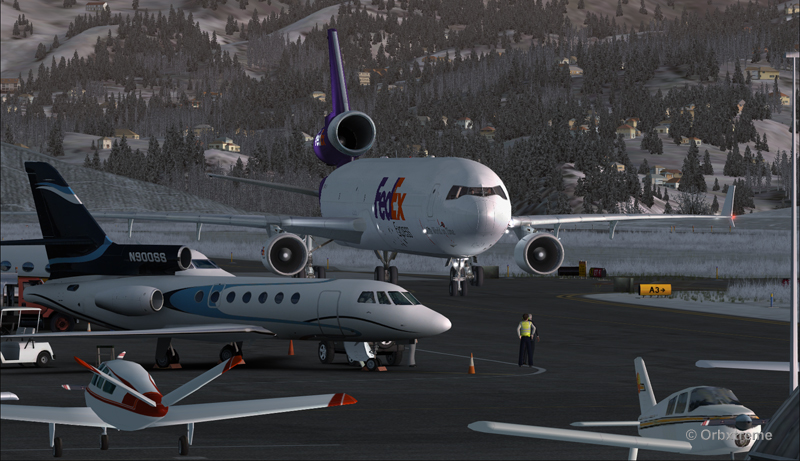
The MD-11 was parked temporarily in a spot needed by every aircraft. It was necessary to unload quickly the precious cargo and get out of the way.
Temporary parking for a FedEx MD-11 at the Telluride airport (KTEX) (FSX)
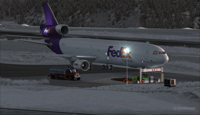
Some expert handling would be needed to help move back that MD-11 close to the runway. But that was the Telluride’s airport manager problem and he had promised he would have something ready!
FedEx Md-11 parked at the Telluride airport (KTEX) (FSX)
The virtual scenery from departure to destination is a creation of ORBX programmers and the virtual MD-11 is made by PMDG Simulations (I am not sure it works with P3D though). For the weather, I used REX Simulations as the weather engine and REX and Cumulus X for the cloud textures. (Edit: PMDG does not support it’s MD-11 anymore).
For other challenging virtual flights, head towards the flight simulation section of my web site, under “challenging virtual flights”: there is something for everyone!
For more articles on flight simulation on my web site, click on the following link : Flight simulation
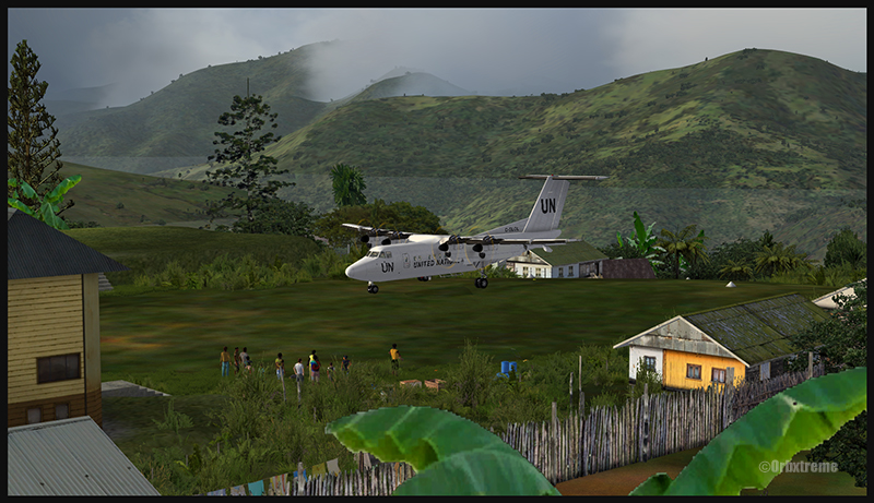
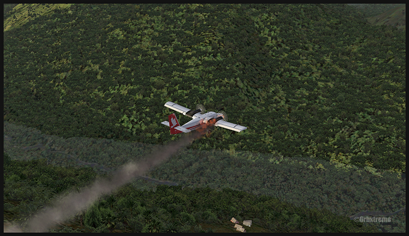
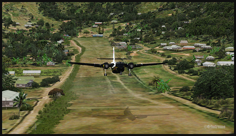
A virtual DHC-6 Twin Otter enroute for Kokoda after a fire on the right engine while departing Yongai (KGH) in Papua New Guinea PNG (FSX)
Ken Hall and Tim Harris have created a new virtual scenery for flight simulation enthousiasts. It is called “Tapini” and sold by ORBX. Their penultimate creation, AYPY Jackson’s International, allowed the virtual pilot to fly in very demanding virtual airports along the Kokoda Trail in Papua New Guinea. “Tapini” represents a whole new challenge and I have included several screen captures to show you how the different runways look in this new virtual scenery.
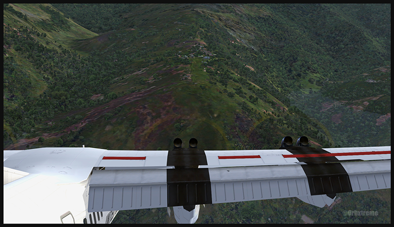
“Tapini”, still in Papua New Guinea, allows the virtual pilot to test his skills on seven new runways located in difficult areas of the Owen Stanley Range. Those airports also constitute a serious test for any aircraft, like in the picture above where damages to the right engine were sustained at Yongai.
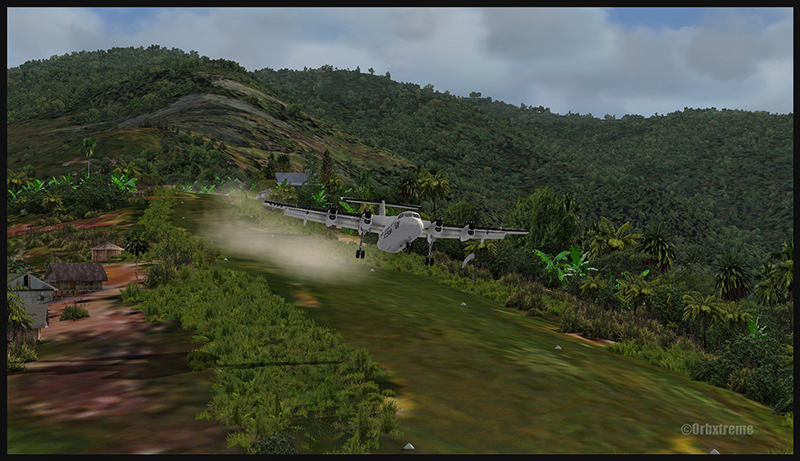
A virtual Piper Pacer virtuel is about to land on the Ononge (ONB) curved runway in Papua New Guinea PNG (FSX). (It is possible to see the curve starting on the top of the image)
To improve the virtual clouds while flying between the different airports, I used either REX or FSGRW weather engines. The cloud textures and weather effects were improved by one or many of the following products: Cumulus X, PrecipitFX, REX Texture Direct and REX Soft Clouds.
A virtual Dash 7 has just landed in Woitape (WTP) in Papua New Guinea PNG (FSX)
As variety is more fun, and also due to the different challenges created by those runways, the following virtual aircrafts were used: Carenado C-185F, Lionheart Creations PA-18, Virtavia DHC-4, Aerosoft DHC-6 Twin Otter and Milton Shupe DHC-7.
The “Tapini” scenery gives the pilot a choice between the seven following runways:
ASB (Asimba)
A tricky, very short runway near a river.
A DHC-4 Caribou virtual aircraft is on approach for Asimba’s sloped runway (ASB) in Papua New Guinea PNG (FSX)
This is a very interesting runway, best done with a STOL aircraft like the Caribou DHC-4. The inhabitants might have to help you clear out some branches along the runway, considering the size of the aircraft. The runway slopes down on take-off, which helps to build up speed.
A DHC-4 Caribou virtual aircraft is on a stopover at Asimba (ASB) in Papua New Guinea PNG (FSX)
A DHC-4 Caribou virtual aircraft is airborne from Asimba (ASB) in Papua New Guinea PNG (FSX)
FNE (Fane)
A one-way, really challenging 12 degree sloped runway, with unpredictable winds.
A De Havilland DHC-7 virtual aircraft on final for the Fane (FNE) airport’s sloped runway in Papua New Guinea PNG (FSX)
The runway sits on top of a hill. It is an amazing experience to land there. No wonder there are a lot of people watching the arrivals and departures.
If you slow down too quickly with an aircraft as big as the DHC-7 on that sloped runway, the twelve degree angle prevents you from moving forward. You must let the aircraft come down the runway very slowly, using the power to control the descent and the rudder to stay aligned on the runway, then apply take-off power for a few seconds to build just enough momentum to get above the hill.
A De Havilland DHC-7 virtual aircraft just finished taxiing uphill on the Fane (FNE) airport’s sloped runway in Papua New Guinea PNG (FSX)
To turn the aircraft around, it’s a combination of power and reverse thrust until you clear all the obstacles (any humans venturing behind the aircraft will also be cleared during the operation…).
A De Havilland DHC-7 virtual aircraft is airborne from the Fane (FNE) airport’s sloped runway in Papua New Guinea PNG (FSX)
There is a not so friendly man with a rifle watching the airport’s operations. Even the United Nations staff do not stay longer than necessary…
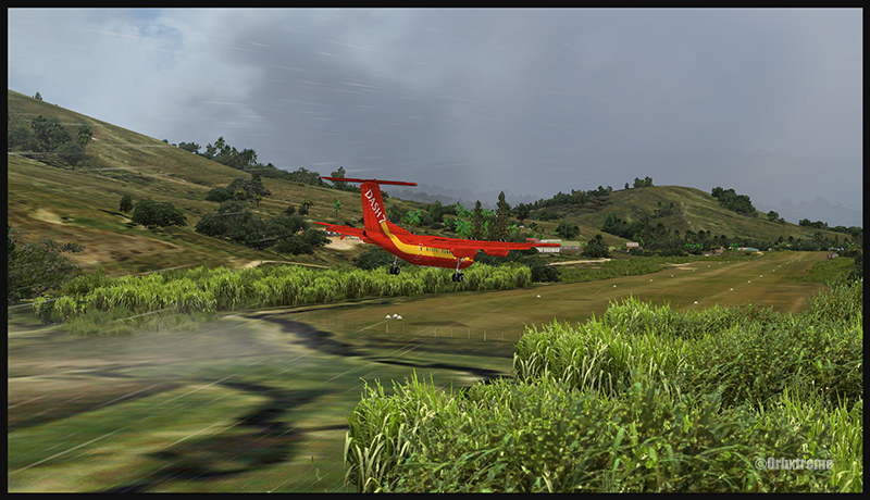
KGH (Yongai)
A very bumpy one-way sloped runway. A real bush aircraft is needed here!
A virtual DHC-6 Twin Otter on approach for the Yongai (KGH) bumpy runway in Papua New Guinea PNG (FSX)
Even with a real bush aircraft, there is a possibility that one of the aircraft’s propellers hits the ground while taxiing on the runway. There are so many deep holes that are hard to see, I can only wish the best of lucks to everyone trying out this airport!
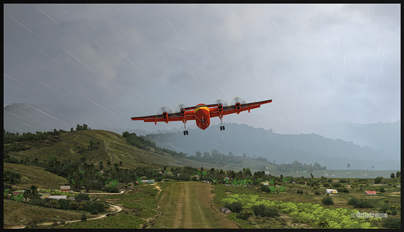
A virtual DHC-6 Twin Otter on the Yongai (KGH) bumpy runway in Papua New Guinea PNG (FSX)
Keep a close watch on the area near the little house at the end of the runway. The DHC-6 was really shaken while turning around for take-off. One of the propellers hit the ground but no problems were detected…until the aircraft was airborne. The fire alarm then went off, just as the aircraft was passing the runway threshold, seconds before flying over a cliff.
A virtual DHC-6 Twin Otter with its right engine on fire is just airborne from the Yongai (KGH) bumpy runway in Papua New Guinea PNG (FSX)
So much for the planned trip… and it was out of the question to return to Yongai on one engine. I had to pull the handle to stop the fire, feather the prop, cut the fuel where it was not needed anymore then head to the Kokoda airport as it was a sure alternative, having a long runway and an elevation that did not require the use of extra power.
KSP (Kosipe)
A relatively short runway that requires good calculations from the pilot, since it is located high in the mountains.
A virtual Cessna C-185F is enroute to the Kosipe (KSP) airport in Papua New Guinea PNG (FSX)
The Cessna C-185F is a very well suited aircraft for that runway. Make sure not to be too heavy on the brakes, as new C-185 propellers are hard to find in Kosipe. You can land in both directions. Ensure that the mixture is set properly as the airport is above 6300 feet.
A virtual Cessna C-185F is rolling after touching down on the Kosipe (KSP) runway in Papua New Guinea PNG (FSX)
A virtual Cessna C-185F is airborne from the Kosipe (KSP) runway in Papua New Guinea PNG (FSX)
ONB (Ononge)
A curved and very bumpy runway! For those who like low flying. Make sure you choose the good aircraft here; there is not much manoeuvering area once on the ground.
A Virtual Piper Pacer on approach for the Ononge (ONB) curved runway in Papua New Guinea PNG (FSX)
Ononge looks really scary when you show up on final for the first time. You wonder if the little trail that you see can really be a runway. For that kind of situation, the little Piper Pacer is an excellent aircraft, approaching slowly and braking on a dime. The runway is curved in the middle so you will need a bit of right rudder to keep the aircraft aligned with the runway.
A Virtual Piper Pacer on the Ononge curved runway in Papua New Guinea PNG (FSX)
I guess all those people with their cargo are waiting for a bigger airplane than mine…
A Virtual Piper Pacer is airborne from the Ononge curved runway in Papua New Guinea PNG (FSX)
TAP (Tapini)
A challenging one-way sloped runway nestled in a tight valley. You can even use an ILS to arrive there!
A virtual DHC-4 Caribou on short final for the Tapini (TAP) sloped runway in Papua New Guinea PNG (FSX)
This is a superbly designed area and airport. I visited it with the DHC-4 Caribou but any other big STOL aircraft would have fitted there. There is enough room to manoeuver. It is not too bumpy. There is an interesting slope: it starts downward and ends upward: this helps to slow down the aircraft after landing.
A virtual DHC-4 Caribou on the ground at the Tapini (TAP) airport in Papua New Guinea PNG (FSX)
A virtual DHC-4 Caribou is airborne from the Tapini (TAP) airport in Papua New Guinea PNG (FSX)
WTP (Woitape)
Looks like a no brainer, but there is no margin of error on this one-way slightly sloped runway. Very precise calculations and settings are required if you want to land there with something else than a small aircraft.
A virtual De Havilland DHC-7 on final approach for the Woitape airport (WTP) virtual airport in Papua New Guinea (FSX)
I found the runway to be very slippery with the De Havilland DHC-7. I must say that there was a good crosswind, as I was flying with real life weather and winds. The DHC-7 behaves like a big boat while decelerating on such a runway.
A virtual De Havilland DHC-7 on the ground with two Twin Otters at the Woitape airport (WTP) in Papua New Guinea (FSX)
The Woitape scenery is gorgeous. It is nice to have all those well designed virtual aircrafts, people and animals on site as this makes the scenery so much more realistic.
A De Havilland Virtual DHC-7 is airborne from the Woitape airport (WTP) in Papua New Guinea (FSX)
I love this new Orbx product. When you fly in such a realistic scenery, the brain does not make much difference between what is real and what is virtual. It really works! And if you use real life weather downloaded from the internet, it’s even better.
I tried the seven airports included in the “Tapini” virtual scenery and they are quite demanding. Yongai was the most challenging airport of them all. I had to do two missed approaches there since I ended up too high on the approach. I eventually got it right, like in real life!
I used the Microsoft flight simulator X (FSX) for all the virtual flights, but other platforms would have worked as well (Dovetail Games FSX Steam edition (FSX: SE) and all versions of P3D). The following products were also installed on my flight simulator: FTX Global, FTX Global Vector and Holgermesh, as well as Pilot’s FS Global 2010.
It is a totally immersive virtual experience and you have to forget everything else when undertaking those challenging virtual flights… if you want to make it “virtually” alive!
For more articles on flight simulation on my web site, click on the following link : Flight simulation
The weather engine ASN (Active Sky Next), like FSGRW, OpusFSI or REX updates the weather by downloading the latest information from the internet. There is also a possibility to use historical data (up to two years back).
ASN, FSGRW and OpusFSI use the default FSX cloud texture sets. So those weather engines can benefit from additional cloud texture sets (from REX for example) for a better visual depiction.
The cloud locations and coverage are accurate as well as realist. Thick overcast layers can be displayed. The cloud transitions are smooth, as well as the vertical variations in temperature, wind speed and wind direction.
Cloud-based effects include in-cloud reduced visibility, related turbulence (in cloud or when entering or exiting a cloud formation), accurate position of precipitation according to the type of clouds and to your position relative to the cloud formation.
Microbursts, wind shears, hail, turbulence as well as updrafts and downdrafts effects are modelled for thunderstorms. There are aural wind shear alerts when flying through a thunderstorm cell: That will nonetheless not be of great help if you attempt to cross a strong thunderstorm as, like in real life, you might not succeed…
You can use the radar to navigate through bad weather since radar and cloud positions are synchronized. The radar shows the intensity of precipitations as well as the echo tops.
Voiced warnings will be triggered when new Airmets and Sigmets are issued. They cover the world and can be viewed on a map. Associated icing and turbulence are added according to the warnings.
In flight, you can receive voiced weather updates through ATIS, FlightWatch or FSS.
ASN corrects the problems sometimes associated with low-level clouds, like inaccurate coverage and wrong position of the clouds, or layers that are really too thin.
Like with other weather engines, there is a flight planning mode. You can enter, import, or build a flight plan, as well as change the flight plan and waypoints at any time before or during a flight.
The weather, airports and navaids are displayed and can be edited, added or erased. The forecasts are available through graphics or text. If, along your route, there is no Metar issued for few hours, the engine will use the forecast to update the weather.
The thermals are modeled using the temperature and surface of terrain.
The wake turbulence trails are visible and, like in real life, are moving with the wind.
ASN does not rely only on interpolation to cover the oceanic areas and other territories where there are few weather stations.
The developers of ASN say that they have created a realistic hurricane simulation based on actual hurricane data. Their program would automatically disregard the ground data that seems incorrect. I cannot comment about the realism of that simulation since I have not tried it yet. But if it is correctly modelled, this function should interest whoever wants to experiment what it is to fly in or near a hurricane.
ASN is compatible with FSX, FSX: SE and the P3D versions up to P3DV4. It can support a multi-monitor setup.
I am not listing all the characteristics of this interesting software since there are always new options added. If you want more details, I provided the link below. Like with all the other weather engines, take the time to see what each has to offer since they have quite different features and spectrum of options.