The reason for the delays and the positive side for the consumers
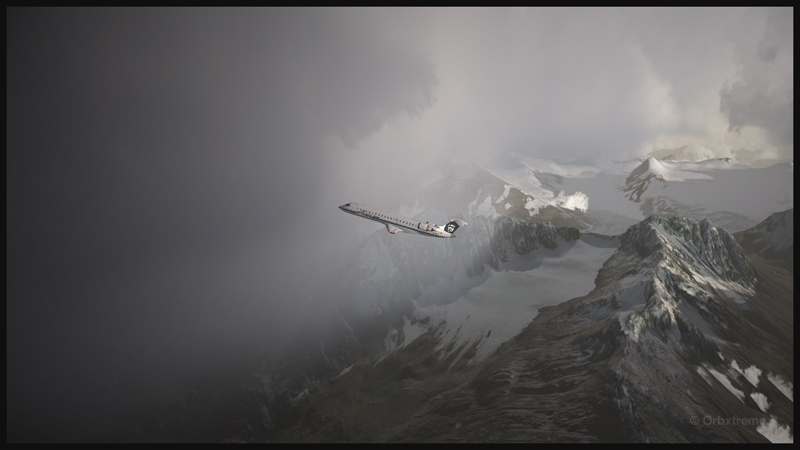
A virtual Bombardier regional jet CRJ-900ER (Aerosoft) with the Alaska Airlines colors is climbing after its departure from the Valdez virtual airport in Alaska (ORBX).
Digital Aviation & Aerosoft have finally completed their long awaited project to make a virtual CRJ-900ER and CRJ-700ER Bombardier regional jets. Months later than expected, the flight simulation enthusiasts can now try those two new virtual aircrafts. The CRJ is mostly used to link smaller airports and remote areas to the main hubs. The aircraft can rapidly reach its cruising altitude and stay there a long time, but it is not intended to be a really fast aircraft.
The company explains that, since the beginning, it had underestimated the complexity of the project and, because of ongoing delays, ended up having to catch up with the competition. In order to offer a superior product than the competition, Digital Aviation and Aerosoft had to review what it initially considered as an almost completed project.
Virtual CRJ-700ER aircraft (Aerosoft) with the Alaska Airlines colors airborne from the Valdez virtual airport (ORBX)
The CRJ-900ER and CRJ-700ER had their exterior almost completely redone; the consumer now ends up with a much better looking aircraft. The project manager says that it is only due to the patience and kindness of potential customers that the project was saved. It pays to be nice!
The first flight with the CRJ
Virtual CRJ-900ER aircraft with the Air Nostrum colors departing the St. Maarten international airport (Fly Tampa St.Maarten)
For the first flight, the manual recommends to first choose and activate one of the default FSX aircraft with the engine running. The pilot then selects the CRJ of his choice. It seems that doing so will prevent a lot of problems.
The virtual 2D cockpit
The virtual 2D cockpit helps save a few FPS. An easy access to the different sections of the cockpit is available since it is divided in several logical panels numbered from 1 to 9.
Navigation
The virtual pilot has access to an updated NavDataPro (May 2017) database for air navigation. It is the world’s most used database in aircraft. The aircraft is also compatible with the popular Navigraph database.
How does a standard computer deals with the new CRJ?
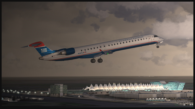
Virtual CRJ-900ER aircraft (Aerosoft) with the U.S. Airways colors airborne from the Denver International airport (Flightbeam Studios)
I have flown both aircrafts on several virtual airports like St. Maarten (Fly Tampa St. Maarten), Montreal international (Fly Tampa Montreal), Denver international (Flightbeam Studios) and Valdez (ORBX) without problems with regards to the computer’s processors and FPS. It was certainly out of question to try to land at the Courchevel airport (LLH Creations), with its short sloped runway, but a low pass at high speed caused no stutters.
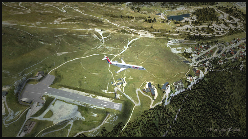
A virtual CRJ-700ER aircraft (Aerosoft) with the Air France HOP colors is in flight over the Courchevel virtual airport in France (LLH Creations)
Flying the CRJ at low speed
The CRJ offers a good margin of manoeuver when it comes to flying at low speed. But due to the position of the engines, the aircraft’s nose will raise rapidly when the throttle is brought back to idle. In a constant and progressive descent, that does not cause a problem. But if the manoeuver is done on short final when the aircraft is still above 50 feet, the rapid change in the aircraft’s attitude could induce a stall.
The air brakes
One cannot rely too much on the air brakes to slow down the CRJ. They have limited efficiency, both for the virtual and the real aircraft.
Floating tendency
If the aircraft arrives over the threshold at a higher speed than recommended, it will float for a long distance before finally touching down.
Landing and take-off distances
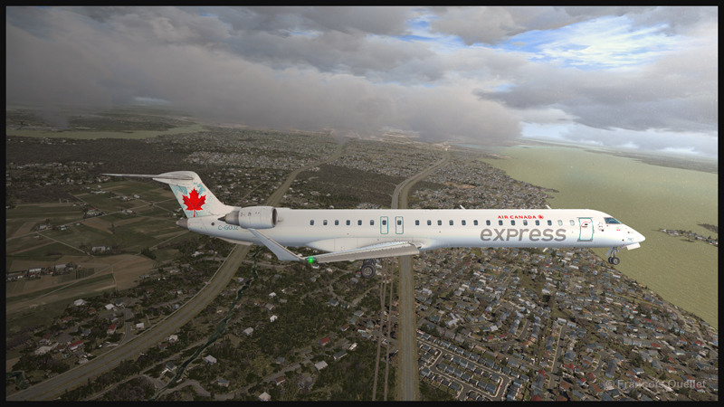
A virtual CRJ-900ER aircraft with the Air Canada colours (Aerosoft) is approaching the Montreal Pierre-Elliott-Trudeau virtual airport (Fly Tampa Montreal)
The CRJ-900 and CRJ-700 operate on relatively short runways. The CRJ-700 needs 5040 feet for take-off (at maximum weight) and landing, under the standard ICAO conditions. The CRJ-900 requires 6060 feet for take-off and 5260 feet for landing. The maximum range has been established to be around 1300 and 1400 nm.
Managers that facilitate the use of the CRJ
For the CRJ, Digital Aviation & Aerosoft have created managers that allow choosing the number of passengers, cargo, as well as calculating the fuel weight, the center of gravity and the amount of trim required. There is even a FS2 Crew option if desired. Another manager facilitated the addition of liveries.
The flight simulation enthusiasts had been anticipating the arrival of that regional jet for a long time; some did not believe anymore that it would one day become a reality (that includes the company too!). The flight simmers now have access to a world class and high quality regional jet.
For more articles on flight simulation on my web site, click on the following link : Flight simulation
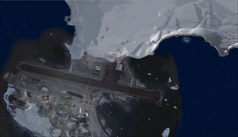
Aerial view of the Rothera research station in Antarctica.
For this flight, you will need the Antarctica X flight simulation software made by Aerosoft.
The maintenance of BAS Twin Otters and their Dash-7 is done in Calgary, Canada, and head to Antarctica during the austral summer, between October and March. So if you want to try a flight simulation with a Twin Otter or a Dash-7 from Chile to Antarctica, pick one of those months as it is more realistic.
Since it would be a bit long to make all the virtual flights from Canada to Antarctica, I chose to do the last three legs to see what the landscape looks like.
A Twin Otter is normally approved for a maximum take-off weight of 12,500 pounds. But with skis weighing 800 pounds and additional fuel required to fly longer legs, BAS (British Antarctic Survey) has arranged to have their Twin Otters approved at 14,000 pounds. Even at this weight, the aircraft could still operate on one engine.
First, the aircraft departs La Florida airport (SCSE) in Chile, after a mandatory fuel stop before its next destination, the El Tepual de Puerto Montt airport (SCTE), also in Chile.
Airborne from La Florida, Chile, after refueling.
This virtual flight with the Twin Otter last about 4:25 hours (696 nm) with a heading of 185 degrees.
In flight towards El Tepual de Puerto Montt, Chile.
For the screen captures, FTX Global, FTX Vector and Pilot’s FS Global 2010 were installed. Orbx has also reworked the original El Tepual de Puerto Montt airport to include some people, aircrafts and new buildings. It makes for a more interesting destination.
Twin Otter on final approach for El Tepual de Puerto Montt, Chile.
Ready for refueling at the El Tepual de Puerto Montt, Chile.
The next flight is from the El Tepual de Puerto Montt airport (SCTE) to Punta Arenas (SCCI), both in Chile.
Twin Otter aircraft airborne and heading to Punta Arenas, Chile.
This flight, made low across the Andes, absolutely requires good weather. You will have to climb to 17,000 feet to make the direct route between the airports.
Twin Otter over the Andes climbing for17,000 feet
There are often spectacular views available to the virtual pilot. Yes, the BAS Twin Otter is flown by only one pilot, but there is always somebody else accompanying him.
Don’t forget to lean the mixture during the climb. Also use some additional oxygen (!!) if you don’t want to start singing and flying in circles after a while. Again, pay attention to the mixture during the descent, considering that you will be losing close to 17,000 feet.
Refueling at Punta Arenas, Chile.
The Punta Arenas airport, straight from FSX, is not an interesting airport to look at. It is a very bare airport, with just a single building and a VOR.
But since the BAS pilot do that mandatory leg just before heading to Antarctica, I chose not to change the route. The general direction for the flight to Punta Arenas was 164 degrees and the duration approximately 4:28 hours. You can obviously accelerate the process once the aircraft is established at its flying altitude.
The last flight is from Punta Arenas, Chile, to Rothera, Antarctica.
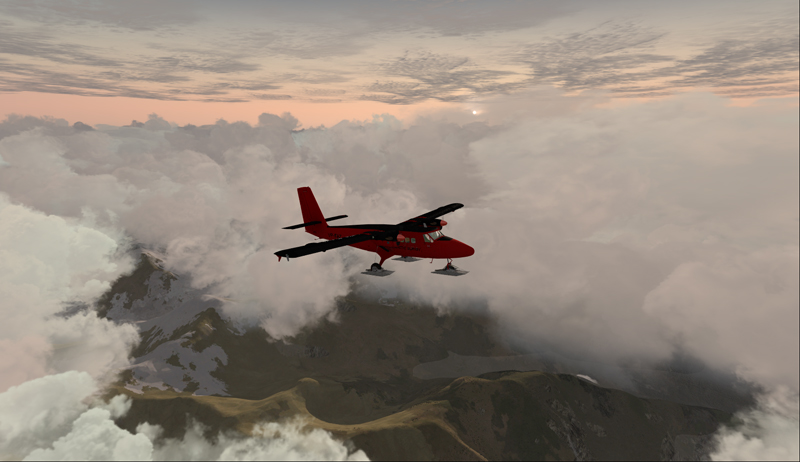
Twin Otter aircraft heading for the Rothera airport in Antarctica.
The Twin Otter will take between six and seven hours on an average heading of 162 degrees to cover the distance between Punta Arenas (SCCI) and Rothera (EGAR).
Over the snowy mountains of Chile towards Rothera, Antarctica
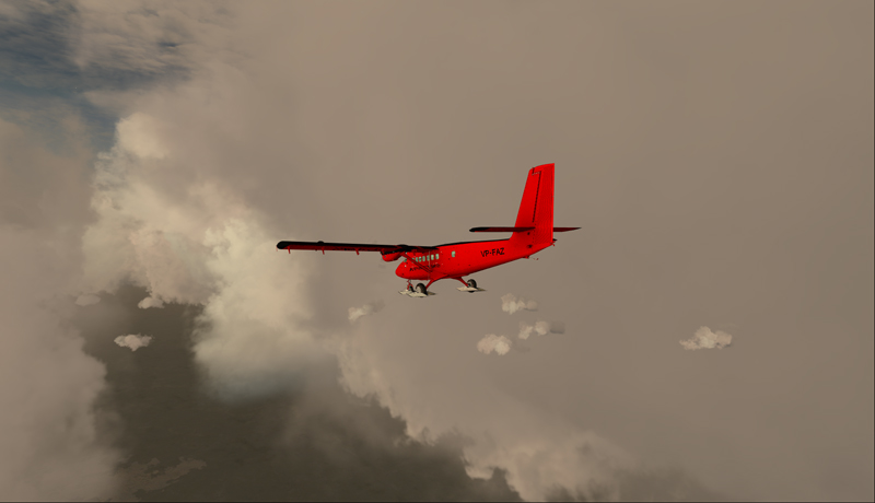
Carrying extra fuel on the flight towards Rothera, Antarctica.
The runway at Rothera is made of gravel and is 2953 feet long. That is plenty for the Twin Otter and the DASH-7. Before you make the flight, go into the aerosoft/Antarctica X file in your flight simulator and click on the “LOD 8.5” option (the default is at LOD 4.5). It will give you much better details when you are approaching Antarctica.
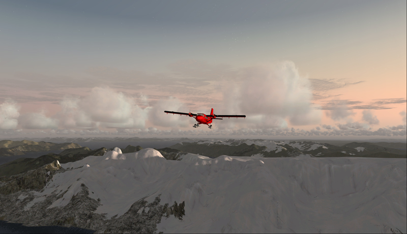
The antarctic Rothera research station is in sight
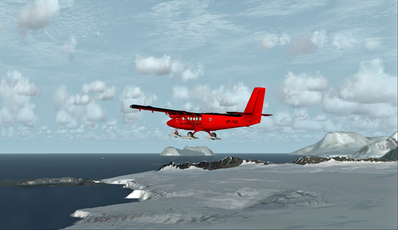
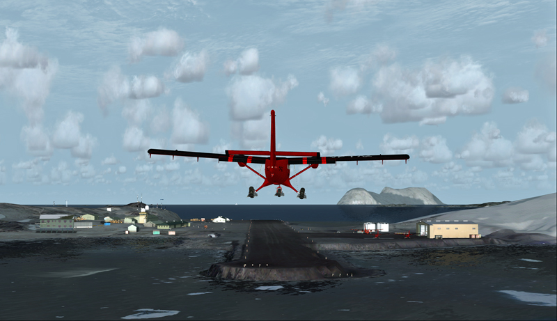
Twin Otter aircraft on final at Rothera, Antarctica.
The Airliner World magazine had an excellent article on the BAS operations in Antarctica in its March 2017 edition. It included plenty of interesting pictures and detailed explanations on what is expected from pilots and personnel working for BAS. I compared the Rothera virtual airport with the real one through the available pictures in Airliner World and was pleasantly surprised with the level of accuracy of the details.
A British Antarctic Survey Twin Otter aircraft is landing on the Rothera runway, Antarctica
The BAS always prepares itself for the worst: “[It] carries parts valued at around $5m, including a replacement engine for each aircraft, spare props and undercarriage components”.
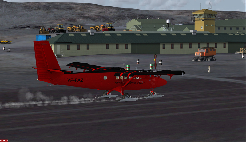
Twin Otter aircraft after a landing on the Rothera runway, Antarctica
“A new development for the Air Unit has been its work with the RAF, using C-130 Hercules transports to airdrop supplies into the field. They fly from Punta Arenas and drop fuel to support our science programmes on the Ronne Ice Shelf. […] It is all part of their training system and the accuracy they drop to is very impressive. They might drop 250 drums, think how many Twin Otter trips that would have been for us (48 or more than 400 flying hours)”.
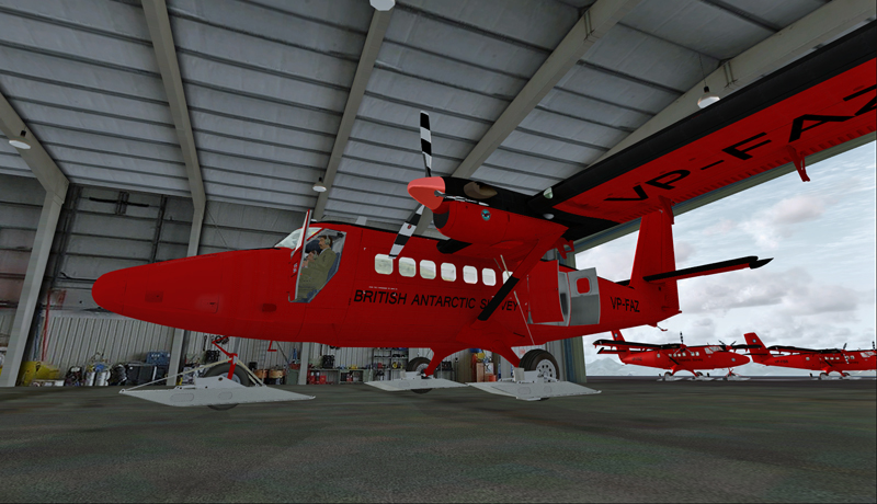
The main hangar in Rothera, Antarctica.
Aerosoft has made an excellent job in replicating the buildings in Rothera, BAS’s main research station in Antarctica. The biggest hangar can accommodate three Twin Otters and a Dash-7 altogether.
Inside the main hangar at the Rothera research station, Antarctica.
When your flight is over, do not forget to change the settings back to LOD 4.5 for Antarctica in your aerosoft/Antarctica X files.
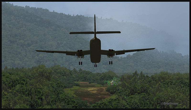
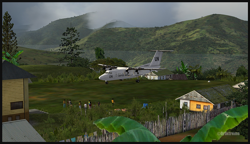
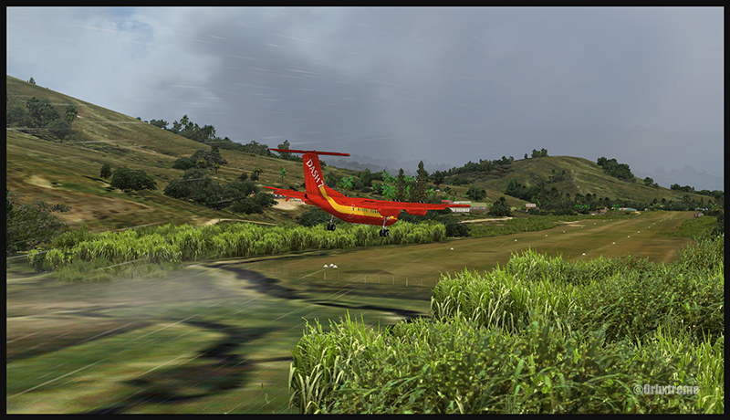
A virtual DHC-6 Twin Otter enroute for Kokoda after a fire on the right engine while departing Yongai (KGH) in Papua New Guinea PNG (FSX)
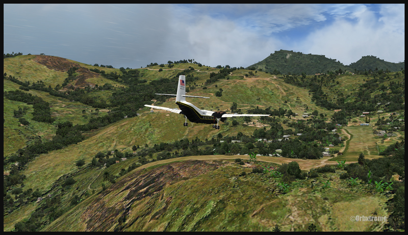
Ken Hall and Tim Harris have created a new virtual scenery for flight simulation enthousiasts. It is called “Tapini” and sold by ORBX. Their penultimate creation, AYPY Jackson’s International, allowed the virtual pilot to fly in very demanding virtual airports along the Kokoda Trail in Papua New Guinea. “Tapini” represents a whole new challenge and I have included several screen captures to show you how the different runways look in this new virtual scenery.
“Tapini”, still in Papua New Guinea, allows the virtual pilot to test his skills on seven new runways located in difficult areas of the Owen Stanley Range. Those airports also constitute a serious test for any aircraft, like in the picture above where damages to the right engine were sustained at Yongai.
A virtual Piper Pacer virtuel is about to land on the Ononge (ONB) curved runway in Papua New Guinea PNG (FSX). (It is possible to see the curve starting on the top of the image)
To improve the virtual clouds while flying between the different airports, I used either REX or FSGRW weather engines. The cloud textures and weather effects were improved by one or many of the following products: Cumulus X, PrecipitFX, REX Texture Direct and REX Soft Clouds.
A virtual Dash 7 has just landed in Woitape (WTP) in Papua New Guinea PNG (FSX)
As variety is more fun, and also due to the different challenges created by those runways, the following virtual aircrafts were used: Carenado C-185F, Lionheart Creations PA-18, Virtavia DHC-4, Aerosoft DHC-6 Twin Otter and Milton Shupe DHC-7.
The “Tapini” scenery gives the pilot a choice between the seven following runways:
ASB (Asimba)
A tricky, very short runway near a river.
A DHC-4 Caribou virtual aircraft is on approach for Asimba’s sloped runway (ASB) in Papua New Guinea PNG (FSX)
This is a very interesting runway, best done with a STOL aircraft like the Caribou DHC-4. The inhabitants might have to help you clear out some branches along the runway, considering the size of the aircraft. The runway slopes down on take-off, which helps to build up speed.
A DHC-4 Caribou virtual aircraft is on a stopover at Asimba (ASB) in Papua New Guinea PNG (FSX)
A DHC-4 Caribou virtual aircraft is airborne from Asimba (ASB) in Papua New Guinea PNG (FSX)
FNE (Fane)
A one-way, really challenging 12 degree sloped runway, with unpredictable winds.
A De Havilland DHC-7 virtual aircraft on final for the Fane (FNE) airport’s sloped runway in Papua New Guinea PNG (FSX)
The runway sits on top of a hill. It is an amazing experience to land there. No wonder there are a lot of people watching the arrivals and departures.
If you slow down too quickly with an aircraft as big as the DHC-7 on that sloped runway, the twelve degree angle prevents you from moving forward. You must let the aircraft come down the runway very slowly, using the power to control the descent and the rudder to stay aligned on the runway, then apply take-off power for a few seconds to build just enough momentum to get above the hill.
A De Havilland DHC-7 virtual aircraft just finished taxiing uphill on the Fane (FNE) airport’s sloped runway in Papua New Guinea PNG (FSX)
To turn the aircraft around, it’s a combination of power and reverse thrust until you clear all the obstacles (any humans venturing behind the aircraft will also be cleared during the operation…).
A De Havilland DHC-7 virtual aircraft is airborne from the Fane (FNE) airport’s sloped runway in Papua New Guinea PNG (FSX)
There is a not so friendly man with a rifle watching the airport’s operations. Even the United Nations staff do not stay longer than necessary…
KGH (Yongai)
A very bumpy one-way sloped runway. A real bush aircraft is needed here!
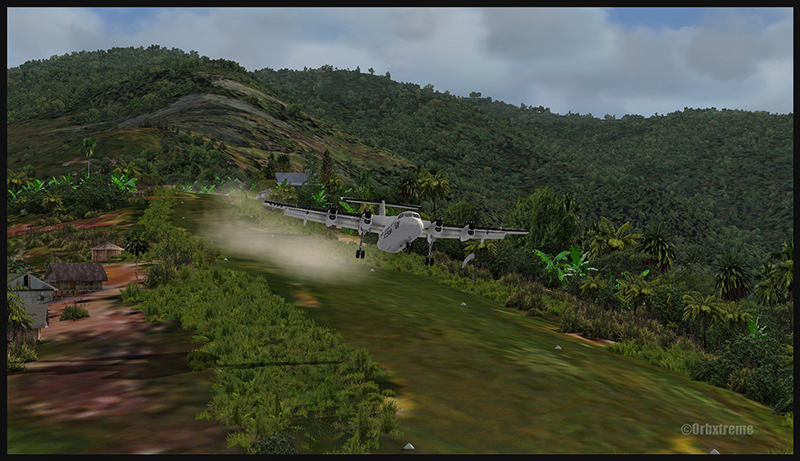
A virtual DHC-6 Twin Otter on approach for the Yongai (KGH) bumpy runway in Papua New Guinea PNG (FSX)
Even with a real bush aircraft, there is a possibility that one of the aircraft’s propellers hits the ground while taxiing on the runway. There are so many deep holes that are hard to see, I can only wish the best of lucks to everyone trying out this airport!
A virtual DHC-6 Twin Otter on the Yongai (KGH) bumpy runway in Papua New Guinea PNG (FSX)
Keep a close watch on the area near the little house at the end of the runway. The DHC-6 was really shaken while turning around for take-off. One of the propellers hit the ground but no problems were detected…until the aircraft was airborne. The fire alarm then went off, just as the aircraft was passing the runway threshold, seconds before flying over a cliff.
A virtual DHC-6 Twin Otter with its right engine on fire is just airborne from the Yongai (KGH) bumpy runway in Papua New Guinea PNG (FSX)
So much for the planned trip… and it was out of the question to return to Yongai on one engine. I had to pull the handle to stop the fire, feather the prop, cut the fuel where it was not needed anymore then head to the Kokoda airport as it was a sure alternative, having a long runway and an elevation that did not require the use of extra power.
KSP (Kosipe)
A relatively short runway that requires good calculations from the pilot, since it is located high in the mountains.
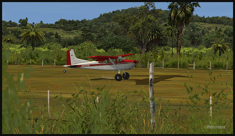
A virtual Cessna C-185F is enroute to the Kosipe (KSP) airport in Papua New Guinea PNG (FSX)
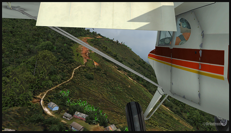
The Cessna C-185F is a very well suited aircraft for that runway. Make sure not to be too heavy on the brakes, as new C-185 propellers are hard to find in Kosipe. You can land in both directions. Ensure that the mixture is set properly as the airport is above 6300 feet.
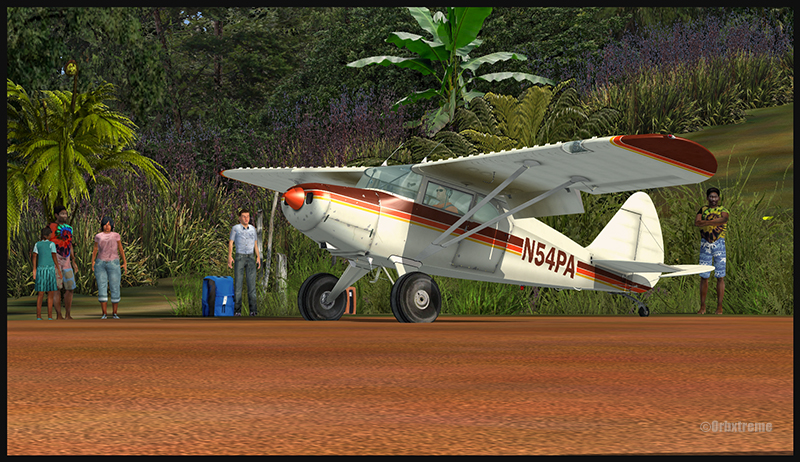
A virtual Cessna C-185F is rolling after touching down on the Kosipe (KSP) runway in Papua New Guinea PNG (FSX)
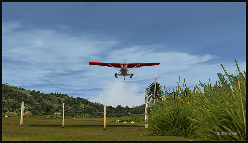
A virtual Cessna C-185F is airborne from the Kosipe (KSP) runway in Papua New Guinea PNG (FSX)
ONB (Ononge)
A curved and very bumpy runway! For those who like low flying. Make sure you choose the good aircraft here; there is not much manoeuvering area once on the ground.
A Virtual Piper Pacer on approach for the Ononge (ONB) curved runway in Papua New Guinea PNG (FSX)
Ononge looks really scary when you show up on final for the first time. You wonder if the little trail that you see can really be a runway. For that kind of situation, the little Piper Pacer is an excellent aircraft, approaching slowly and braking on a dime. The runway is curved in the middle so you will need a bit of right rudder to keep the aircraft aligned with the runway.
A Virtual Piper Pacer on the Ononge curved runway in Papua New Guinea PNG (FSX)
I guess all those people with their cargo are waiting for a bigger airplane than mine…
A Virtual Piper Pacer is airborne from the Ononge curved runway in Papua New Guinea PNG (FSX)
TAP (Tapini)
A challenging one-way sloped runway nestled in a tight valley. You can even use an ILS to arrive there!
A virtual DHC-4 Caribou on short final for the Tapini (TAP) sloped runway in Papua New Guinea PNG (FSX)
This is a superbly designed area and airport. I visited it with the DHC-4 Caribou but any other big STOL aircraft would have fitted there. There is enough room to manoeuver. It is not too bumpy. There is an interesting slope: it starts downward and ends upward: this helps to slow down the aircraft after landing.
A virtual DHC-4 Caribou on the ground at the Tapini (TAP) airport in Papua New Guinea PNG (FSX)
A virtual DHC-4 Caribou is airborne from the Tapini (TAP) airport in Papua New Guinea PNG (FSX)
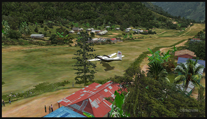
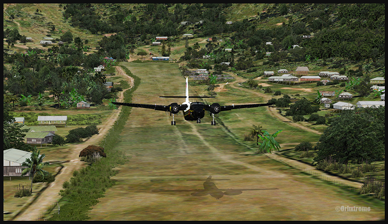
WTP (Woitape)
Looks like a no brainer, but there is no margin of error on this one-way slightly sloped runway. Very precise calculations and settings are required if you want to land there with something else than a small aircraft.
A virtual De Havilland DHC-7 on final approach for the Woitape airport (WTP) virtual airport in Papua New Guinea (FSX)
I found the runway to be very slippery with the De Havilland DHC-7. I must say that there was a good crosswind, as I was flying with real life weather and winds. The DHC-7 behaves like a big boat while decelerating on such a runway.
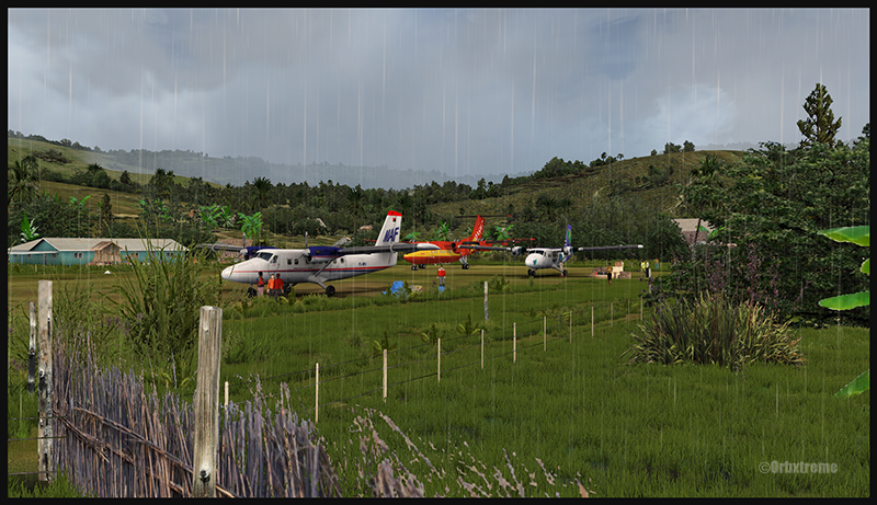
A virtual De Havilland DHC-7 on the ground with two Twin Otters at the Woitape airport (WTP) in Papua New Guinea (FSX)
The Woitape scenery is gorgeous. It is nice to have all those well designed virtual aircrafts, people and animals on site as this makes the scenery so much more realistic.
A De Havilland Virtual DHC-7 is airborne from the Woitape airport (WTP) in Papua New Guinea (FSX)
I love this new Orbx product. When you fly in such a realistic scenery, the brain does not make much difference between what is real and what is virtual. It really works! And if you use real life weather downloaded from the internet, it’s even better.
I tried the seven airports included in the “Tapini” virtual scenery and they are quite demanding. Yongai was the most challenging airport of them all. I had to do two missed approaches there since I ended up too high on the approach. I eventually got it right, like in real life!
I used the Microsoft flight simulator X (FSX) for all the virtual flights, but other platforms would have worked as well (Dovetail Games FSX Steam edition (FSX: SE) and all versions of P3D). The following products were also installed on my flight simulator: FTX Global, FTX Global Vector and Holgermesh, as well as Pilot’s FS Global 2010.
It is a totally immersive virtual experience and you have to forget everything else when undertaking those challenging virtual flights… if you want to make it “virtually” alive!
For more articles on flight simulation on my web site, click on the following link : Flight simulation
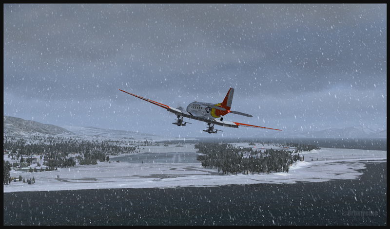
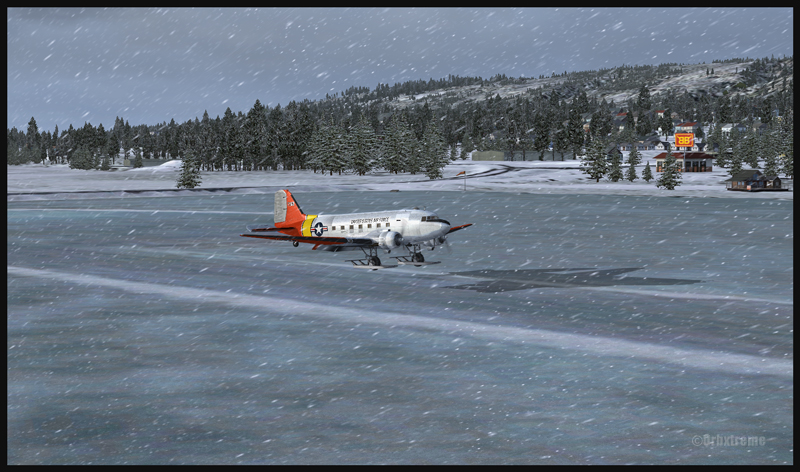
DC-3 at the Homer (PAHO) virtual airport in Alaska (FSX)
If you feel like attempting a virtual landing on an ice runway, an opportunity is offered by ORBX through their Homer (PAHO), Alaska virtual airport. For the flight, I used the FSX platform but it could have been also done under P3D.
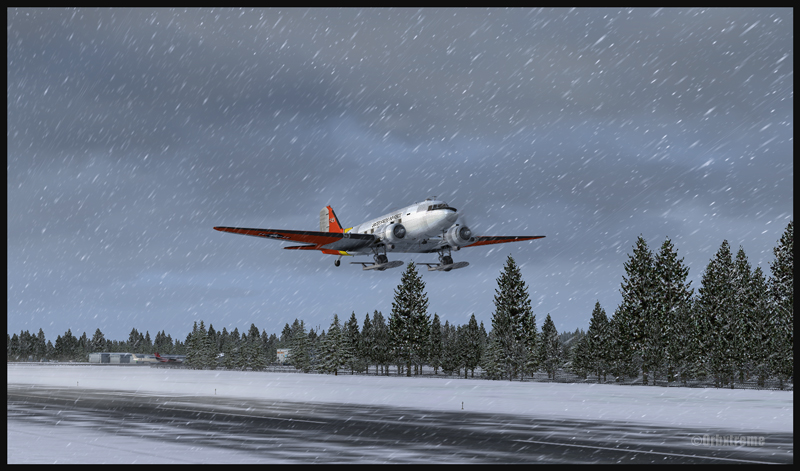
DC-3 on skis airborne from the Homer (PAHO) virtual airport in Alaska (FSX)
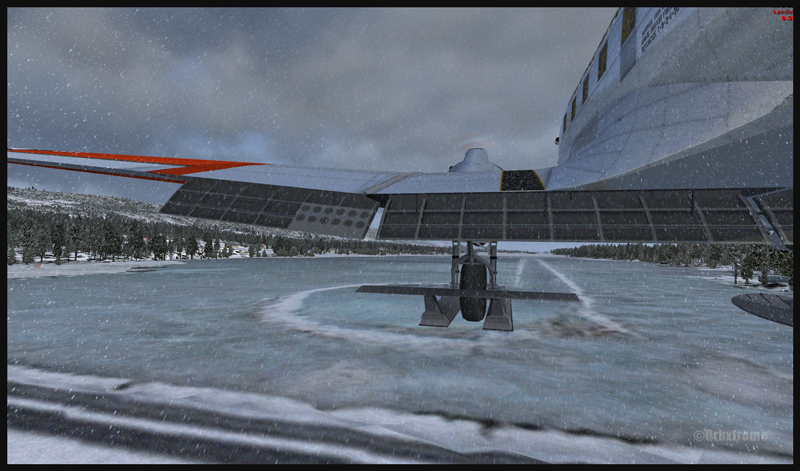
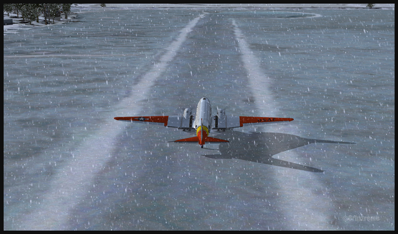
The ice runway is just a short distance away from the regular Homer asphalted runway. The DC-3 is an excellent aircraft for the task since its approach speed is very low and it is one of the few virtual aircrafts equipped with skis.
A DC-3 on skis is turning final for the Homer ice runway in Alaska (FSX)
If you want to try that flight, make sure to adjust the flight simulator configuration settings so that the Homer ice runway option is activated, otherwise you’ll end up under water…
In order to add a bit of challenge as well as winter realism, you can add a bit of crosswinds or some snow using the standard « heavy snow » option in FSX. The program PrecipitFX helps a lot if you are looking for a better definition of precipitations, be it snow or rain. For this flight, the Cumulus X program was also activated.
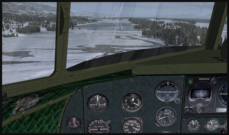
Cockpit view of a virtual DC-3 on final for the Homer (PAHO) ice runway in Alaska (FSX)
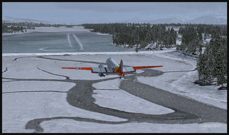
Virtual DC-3 on skis on short final for the Homer (PAHO) ice runway in Alaska (FSX)
Virtual DC-3 on skis about to touch the threshold of the Homer ice runway in Alaska (FSX)
The short flight proved to be an interesting experience, since the runway was narrow and there were some crosswinds. I thought that it would be very slippery but it was not the case. Maybe one day Orbx, in association with the FSX Steam (Dovetail Games) professionals, will work at modifying the flight simulation platform and add a CRFI (JBI) index of .40 or less to increase the difficulty in slowing down and controlling the virtual aircraft?
A DC-3 on skis flying few feet over the Homer (PAHO) (FSX) ice runway, a product of the ORBX company
A virtuel DC-3 on skis after a landing on the Homer (PAHO) ice runway in Alaska (FSX)
A DC-3 virtual on skis backtracking the Homer (PAHO) ice runway in Alaska (FSX)
As this flight is not a super though exercise, I have placed it in the “standard virtual flights”, in the flight simulation section of my website. For more of those flights, click on the following link: Other standard virtual flights
Have fun trying this one! Later on, I’ll present another ice runway located on Antarctica, which virtual scenery was made by Aerosoft. Even the C-17 Globemaster III is approved there…
For more articles on flight simulation on my web site, click on the following link : Flight simulation
Well, let’s start with a real life video showing that there is no margin for error when landing in St.Barths :
In that video, you can clearly see that the speed on the approach seemed excessive and the aircraft floated precious seconds over the runway. Very soon, there wasn’t enough runway left to stop the aircraft safely. So the trick is to use a reasonable approach speed and be ready to do a missed approach if the wheels do not touch early on the runway.
40014 Runway in sight at St Barths TFFJ on the left and in the middle of the island (FSX)
40015 A Solomons Twin Otter is on final for runway 10 at St Barths TFFJ (FSX)
An approach with a virtual aircraft of your choice can be done in St.Barths (TFFJ) since FlyTampa St Maarten scenery includes that airport. I tried a circuit with the Aerosoft Twin Otter, under FSX, and it went very well, since this aircraft can fly at a very low speed and can break on a dime. It might have been a different story with the same aircraft that pilot was flying in the video…
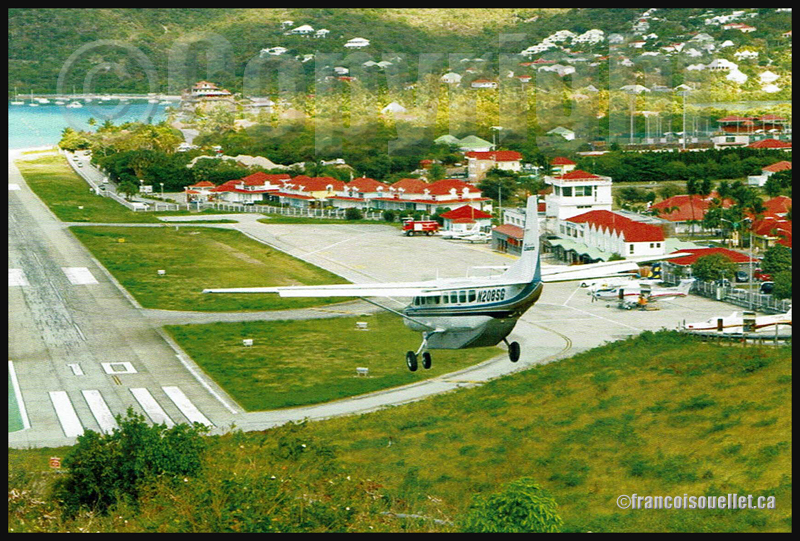
Cessna 208B N208SG landing at Saint Barthelemy Airport, Guadeloupe (on aviation postcard)
40016 The Twin Otter is now on short final for runway 10 in St Barths TFFJ (FSX)
40017 The Twin Otter lands on the threshold of runway 10 at St Barths TFFJ (FSX)
For your information, the St.Barths 10-28 runway is 2133 ft long. For the landing, the winds where blowing from 031/10G20, which provides for a good crosswind. The biggest aircraft to have landed in St Barthélémy is a Canadian built de Havilland DHC-7.
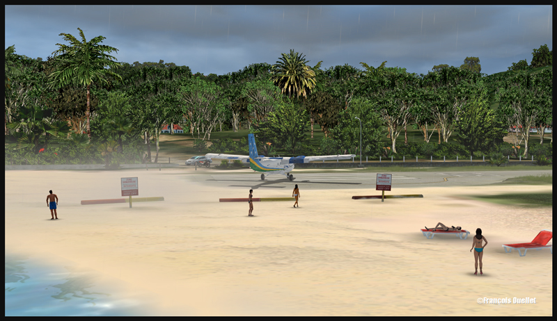
40021 A bit of sand is blown on tourists in St Barths TFFJ (FSX)
40022 A Solomons Twin Otter leaves the runway at St Barths TFFJ (FSX)
Good luck and have fun trying out that virtual flight!
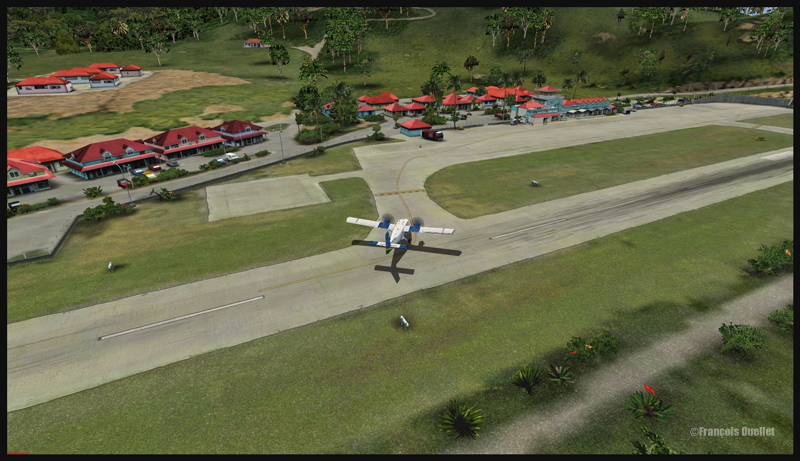
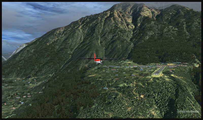
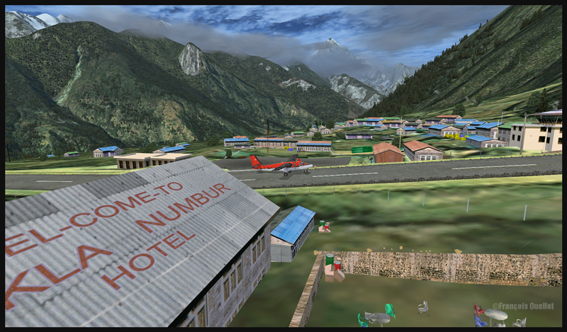
If you are looking for a challenging virtual flight, why don’t you try the route Syangboche –Lukla with the Aerosoft Twin Otter? It is a very short flight, few minutes only, where the aircraft will be constantly descending until its destination.
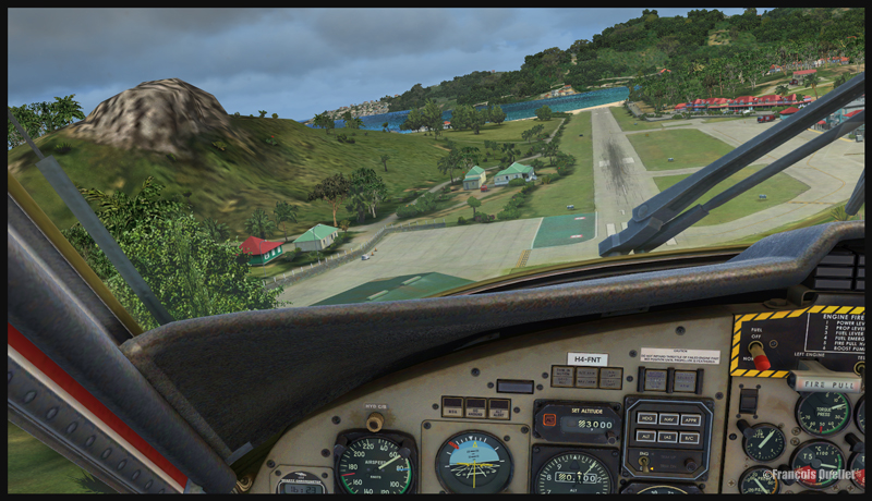
A Twin Otter aircraft is on descent from Syangboche towards the Lukla runway
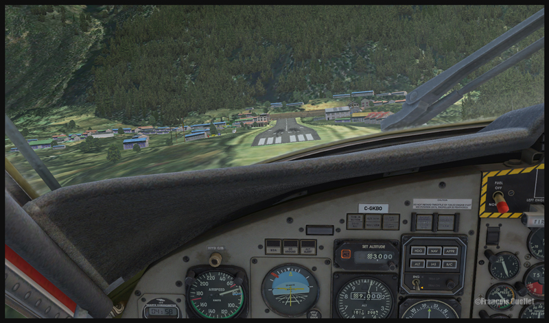
A Twin Otter aircraft is on approach for runway 06 at Lukla
The approach in Lukla can be tricky due to a 12 degree sloping runway. You have a feeling of coming in too quickly, but you must resist the temptation to reduce speed since, at this altitude, the stalling speed increases with all aircrafts.
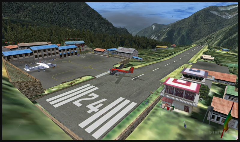
Runway 06 is used for landing, and 24 is for departures. There is no possibility of a missed approach. You either succeed or you crash since there is a high rock wall at the end of runway 06.
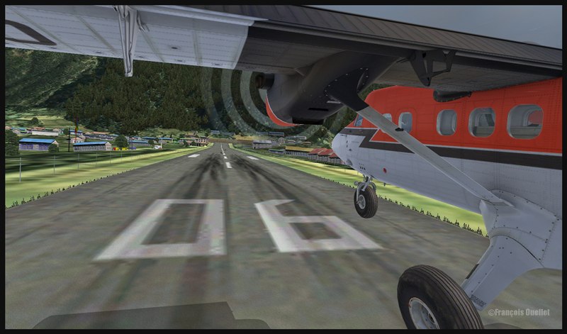
A Twin Otter aircraft is on final for runway 06 at Lukla
A Twin Otter is about to land on runway 06 in Lukla
So the flight is made from Syangboche (OACI code:VNSB, altitude : 3748m and a 400m runway) towards Lukla (OACI code:VNLK, altitude 2860m and a 460m runway).
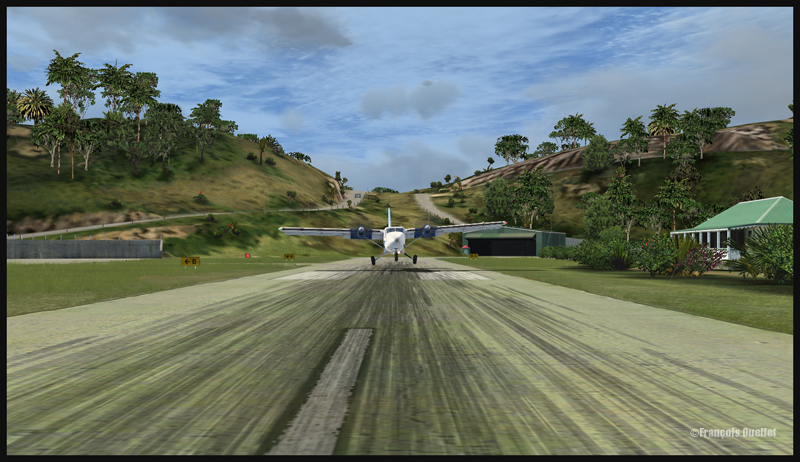
A Twin Otter aircraft is landing on runway 06 in Lukla
The scenery and objects around Syangboche are a creation of ORBX. Once you get closer to Lukla, you will notice a change in the scenery details, since you are entering the Aerosoft Lukla scenery (you have to buy this additional scenery to make the flight more realistic).
A Twin Otter aircraft has just landed on the runway at Lukla
A Twin Otter aircraft exits the runway in Lukla
The integration of the two scenery styles is very well achieved.
This flight will require all your attention. Good luck! For other challenging virtual flights, visit my website.
For more articles on flight simulation on my web site, click on the following link : Flight simulation