Today, rain and fog disrupt operations at Quebec City’s Jean Lesage International Airport. The conditions are at their minimum for take off and landing. But the captain of this Air Transat’s flight decides to proceed as the weather improves momentarily.
The passenger jet will take off from runway 06. But the airstrip is soaked. When the pilot applies power, we will only see water spray across the entire picture. A better choice is to focus on the A321neo as it taxis slowly.
Photography Tips
Since the sky isn’t particularly captivating due to its uniform gray colour, it becomes imperative to find something else to increase interest to the scene. The runway lights will do the trick. By including them in the foreground of the photo, they add life and frame the aircraft as it joins the runway.
I avoid photographing the plane directly from the side or from behind, as the effect is a bit static. Entering the runway at an angle offers a better alternative. Furthermore, it is not necessary to show the entire fuselage of the Airbus for a good shot.
With just a uniform gray sky, part of the aircraft, and a few runway lights, it becomes possible to produce a shot with more dynamism.
Click on the link for more aviation-related photos on my blog. There are also photo galleries for enthusiasts in the menu.
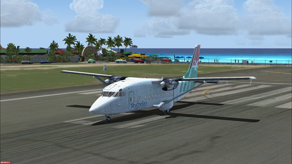
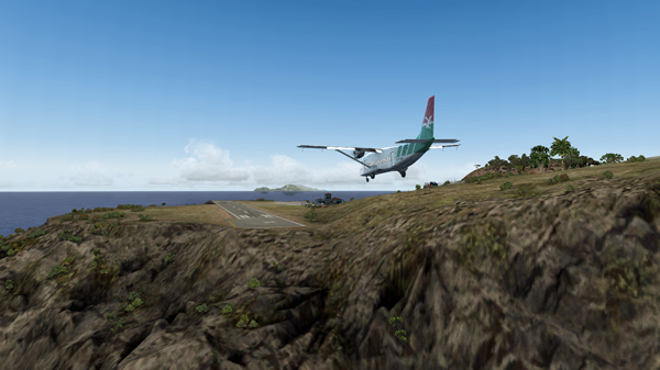
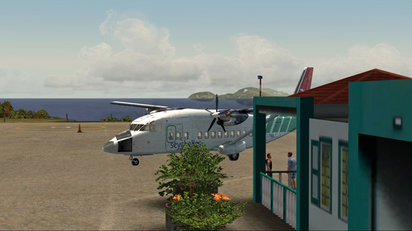
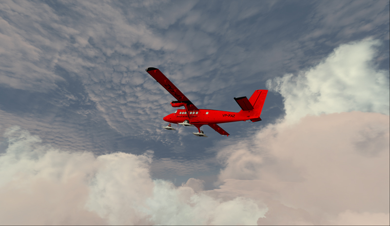
In the unhinged virtual flights section of my blog, you can now find a flight with the Shorts 360 between the St.Maartens (Princess Juliana Intl) airport and the Juancho E. Yrausquin (SABA, SAB or TNCS) airport.
The Shorts 360 at the Princess Juliana Intl, ready for take-off for the Juancho E. Yrausquin airport.
The Juancho E. Yrausquin is normally used by a DHC-6, a BN-2 and some helicopters.
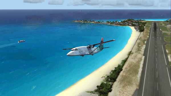
The Shorts 360 is airborne from the Princess Juliana Intl airport.
The island is in sight…
The Shorts 360 and the Saba island in sight.
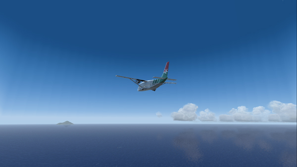
The official landing and take-off distances required for the Shorts 360 are longer than what the Juancho E. Yrausquin (SAB), with its 1299 ft short runway, has to offer.
But for the flight simulation enthousiast (FSX), SABA offers an interesting challenge since a very well adjusted approach, at about 90 knots, is necessary in order to use only the authorized part of the runway.
Le Shorts 360 and the SABA island.
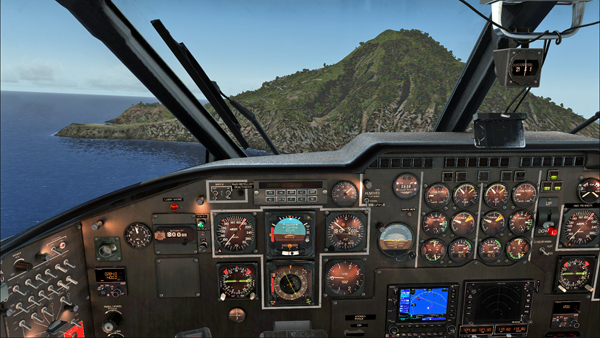
Runway 12 in sight, on the extreme left side of the photo. The speed and altitude are adjusted.
The approach is made on runway 12. The winds blow from 180/07. The approach is made with full flaps.
The Shorts 360 is on short final for runway 12 at the Juancho E. Yrausquin airport.The Shorts 360 is about to land at the SABA airport.
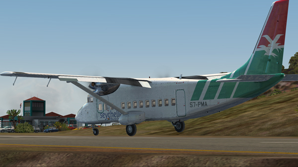
The aircraft is immobilized within the authorized portion of the runway. The rest of the runway is used to turn around and head for the apron.
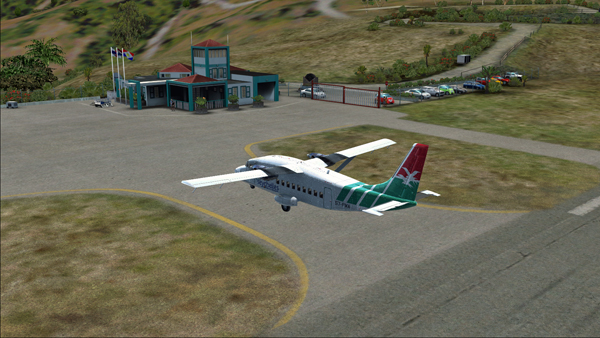
The Shorts 360 after its landing on runway 12 at the Juancho E. Yrausquin airport.The Shorts 360 is exiting runway 12 at the Juancho E. Yrausquin airport.The Shorts 360 is parked at the Juancho E. Yrausquin airport.
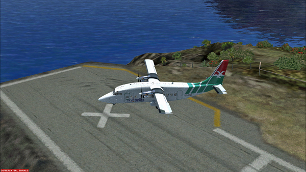
The Shorts 360 can also barely leave the airport using the authorized portion of the runway. The speed on take-off varies between 100 and 110 kts and the flaps are adjusted to 2/3.
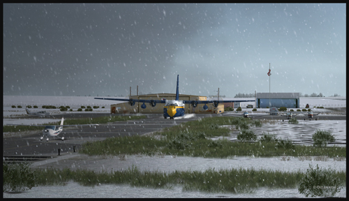
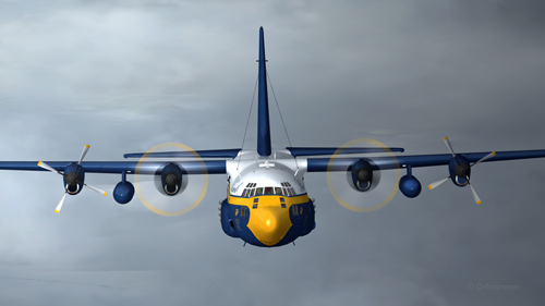
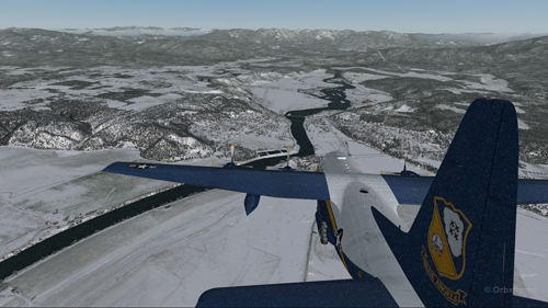
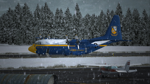
A virtual C-130 belonging to the Blue Angels is taxiing at the High River airport, in Alberta.
Wanting to add an almost impossible flight in the “unhinged virtual flights” section of my web site, I tried a flight with the Blue Angels C-130 Hercules (Captain Sim) where the aircraft gradually lost all of its engines.
The Blue Angels C-130 Hercules waiting in line behind a single engine aircraft at the High River airport.
I am aware that the Blue Angels mechanics are real professionals, so I assumed that the engine failures were caused by an unknown reason.
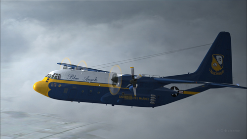
A virtual Blue Angels Lockheed C-130 Hercules takes-off from the High River (CEN4) Canadian airport in Alberta.
The take-off was made without problem from the Canadian High River (CEN4) airport. This free airport was designed by Vlad Maly and is available through ORBX. The aircraft leaves the 4150 feet runway heading to the Coeur d’Alène airport (KCOE) in United States.
Eventually, the first engine stops. This does not cause a problem. The propeller is feathered and the gradual climbing continues.
The C-130 Hercules loses its first engine.
The second engine stops. The pilot must forget the initial destination. Bonners Ferry (65S) becomes the alternate airport since the 4000×75 feet runway is good enough for the C-130.
The second engine has just stopped on this C-130 Hercules.
Double engine failure for this virtual Blue Angles C-130 Hercules.
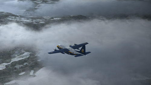
The third engines gives way. A slow descent starts. Bonners Ferry is not very far. The airport is at an altitude of 2337 ft asl.
The aircraft is volontarily flown at a higher altitude than what would normally be requested for a normal approach, just in case the fourth engine stops. When three engines stop after the same refueling, the pilot has the right to think that what feeds the fourth engine can also cause problems.
Three engine failures on this virtual Blue Angels C-130 Hercules.
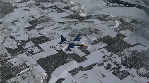
The highest mountains are now behind the aircraft.
Virtual C-130 Hercules aircraft with three engine failures enroute to the Bonners Ferry airport.
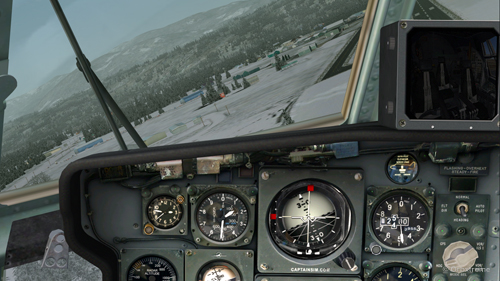
The Bonners Ferry (65S) runway is in sight.
Virtual C-130 Hercules aircraft with three engine failures, by the Bonners Ferry’s runway.
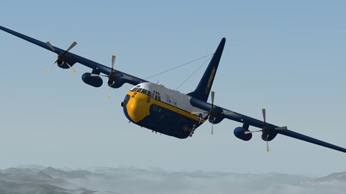
The fourth engine stops. The flaps will not be functional for the landing.
From now on, the pilot should save the virtual flight a few times since it is possible that several trials will be necessary to glide sucessfully to the airport. This is the fun of virtual flight.
The four engines have now failed on that virtual C-130 aircraft.
The C-130 Hercules has become a big glider. When the speed is maintained, the aircraft loses more 1000 feet per minute. It is easier to feel the aircraft’s inertia.
The wheels will be brought out only when necessary since the gear adds a lot of drag.
From the position indicated in the picture below, it is impossible to arrive to the airport in a straight line: the aircraft will glide over the airport. In the picture, the aircraft seems to be on a good path for landing, but it is an illusion caused by the wide-angle format chosen for the screen capture.
The aircraft is definitely too high. It is impossible to use the flaps to increase the rate of descent.
Lockheed C-130 Hercules virtual aircraft with four engine failures on the approach to the Bonners Ferry’s virtual airport (65S).
One must choose between 1) sideslips 2) a 360 degree turn to lose altitude or 3) multiple steep turns perpendicular to the runway to increase to distance to the airport.
What would you choose?
There is no universal method. The 360 degree turn is riskier but can prove efficient. An Airbus A330-200 flown by Quebecer Robert Piché that had lost all of its engines landed successfully in the Açores in 2001 after attempting a last minute 360 degree turn to lose altitude. But here, I did not believe there was enough altitude to safely complete the turn and reach the runway.
A few steep turns were made to extend to ride to the airport. Why steep turns? In order to avoid getting closer to the airport before an acceptable altitude was reached. This method helped keep an eye on the runway at all times to verify if the slope to the airport was still acceptable.
Fourty degree turn to the right on the approach to the Bonners Ferry’s airport.
Steep turn to the left to extend the distance to the Bonners Ferry airport.
I tried the three methods, always starting from the same saved flight (photo 10). After several sideslips, the aircraft was always approaching the airport too quickly. There was not enough time to lose altitude. The final speed always happened to be too high to stop a C-130 without flaps or thrust reversers.
The 360 degree turn, be it right or left, with different angles and a reasonable speed, always incurred a loss of altitude that brought the aircraft 200 to 300 feet short of the threshold.
Finally, after a few steep turns, the aircraft was positioned on final with the appropriate speed and altitude.
View of the Lockheed C-130 Hercules with four engine failures, on the approach for Bonners Ferry (65S).
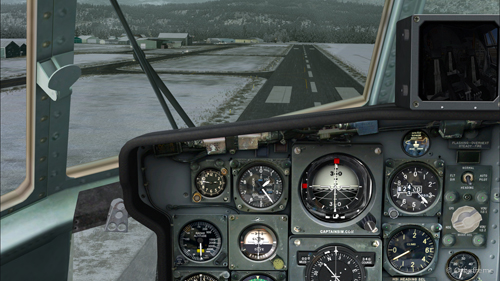
A few last seconds adjustments, to reposition the aircraft in the center of the runway.
Speed 150 knots. End of the turn for the Bonners Ferry’s airport.
At 140 kts, but without any reverse thrust, the whole runway should be necessary to stop the aircraft.
Speed 140 knots, aligned with the Bonners Ferry’s runway.
The landing was smooth and the aircraft stopped short of the threshold.
For an unknown reason, the anemometer was still indicating a 10 kts airspeed, even when the aircraft had stopped.
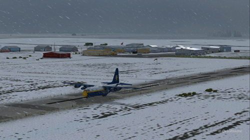
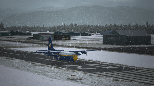
C-130 cargo aircraft on the Bonners Ferry’s runway.
Lockheed C-130 Hercules virtual aircraft after landing at the Bonners Ferry (65S) airport.
C-130 Hercules aircraft in Bonners Ferry.
Try such a flight in the virtual mode. The worst that can happen is that you have fun!
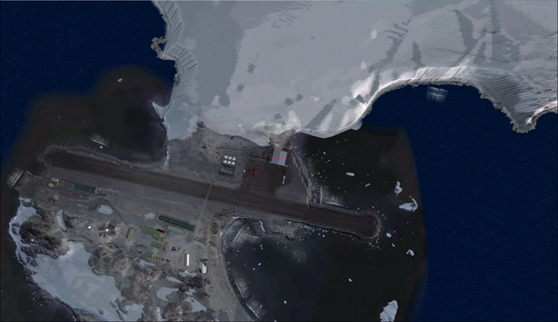
Aerial view of the Rothera research station in Antarctica.
For this flight, you will need the Antarctica X flight simulation software made by Aerosoft.
The maintenance of BAS Twin Otters and their Dash-7 is done in Calgary, Canada, and head to Antarctica during the austral summer, between October and March. So if you want to try a flight simulation with a Twin Otter or a Dash-7 from Chile to Antarctica, pick one of those months as it is more realistic.
Since it would be a bit long to make all the virtual flights from Canada to Antarctica, I chose to do the last three legs to see what the landscape looks like.
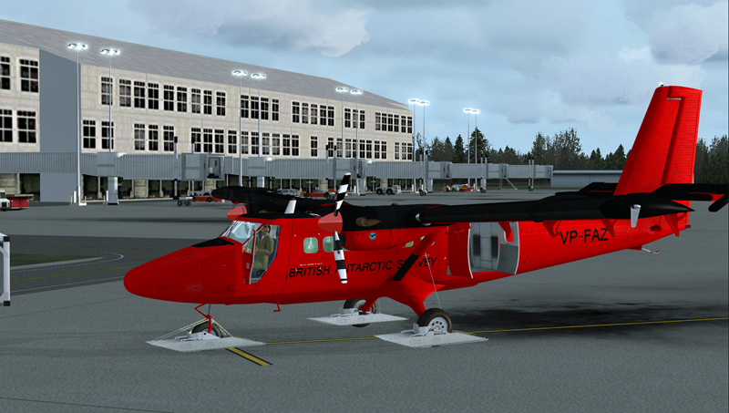
A Twin Otter is normally approved for a maximum take-off weight of 12,500 pounds. But with skis weighing 800 pounds and additional fuel required to fly longer legs, BAS (British Antarctic Survey) has arranged to have their Twin Otters approved at 14,000 pounds. Even at this weight, the aircraft could still operate on one engine.
First, the aircraft departs La Florida airport (SCSE) in Chile, after a mandatory fuel stop before its next destination, the El Tepual de Puerto Montt airport (SCTE), also in Chile.
Airborne from La Florida, Chile, after refueling.
This virtual flight with the Twin Otter last about 4:25 hours (696 nm) with a heading of 185 degrees.
In flight towards El Tepual de Puerto Montt, Chile.
For the screen captures, FTX Global, FTX Vector and Pilot’s FS Global 2010 were installed. Orbx has also reworked the original El Tepual de Puerto Montt airport to include some people, aircrafts and new buildings. It makes for a more interesting destination.
Twin Otter on final approach for El Tepual de Puerto Montt, Chile.
Ready for refueling at the El Tepual de Puerto Montt, Chile.
The next flight is from the El Tepual de Puerto Montt airport (SCTE) to Punta Arenas (SCCI), both in Chile.
Twin Otter aircraft airborne and heading to Punta Arenas, Chile.
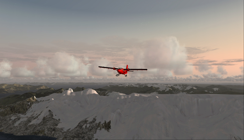
This flight, made low across the Andes, absolutely requires good weather. You will have to climb to 17,000 feet to make the direct route between the airports.
Twin Otter over the Andes climbing for17,000 feet
There are often spectacular views available to the virtual pilot. Yes, the BAS Twin Otter is flown by only one pilot, but there is always somebody else accompanying him.
Don’t forget to lean the mixture during the climb. Also use some additional oxygen (!!) if you don’t want to start singing and flying in circles after a while. Again, pay attention to the mixture during the descent, considering that you will be losing close to 17,000 feet.
Refueling at Punta Arenas, Chile.
The Punta Arenas airport, straight from FSX, is not an interesting airport to look at. It is a very bare airport, with just a single building and a VOR.
But since the BAS pilot do that mandatory leg just before heading to Antarctica, I chose not to change the route. The general direction for the flight to Punta Arenas was 164 degrees and the duration approximately 4:28 hours. You can obviously accelerate the process once the aircraft is established at its flying altitude.
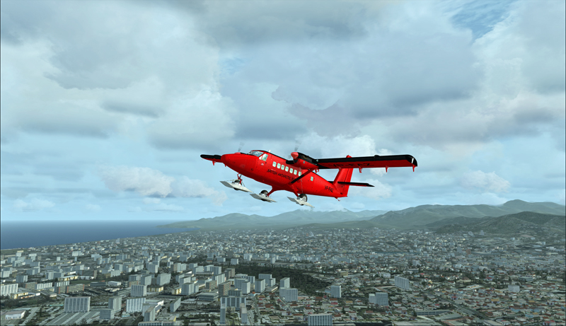
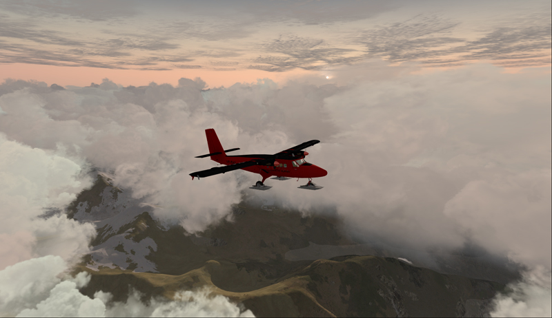
The last flight is from Punta Arenas, Chile, to Rothera, Antarctica.
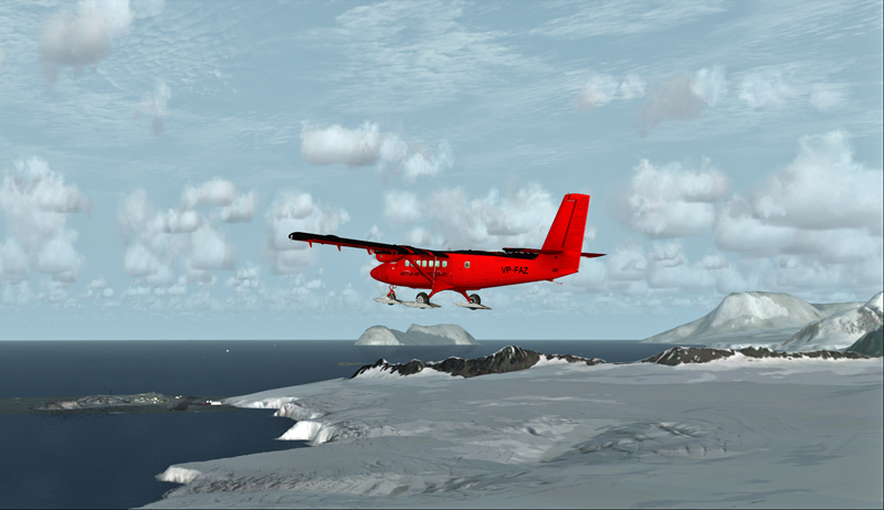
Twin Otter aircraft heading for the Rothera airport in Antarctica.
The Twin Otter will take between six and seven hours on an average heading of 162 degrees to cover the distance between Punta Arenas (SCCI) and Rothera (EGAR).
Over the snowy mountains of Chile towards Rothera, Antarctica
Carrying extra fuel on the flight towards Rothera, Antarctica.
The runway at Rothera is made of gravel and is 2953 feet long. That is plenty for the Twin Otter and the DASH-7. Before you make the flight, go into the aerosoft/Antarctica X file in your flight simulator and click on the “LOD 8.5” option (the default is at LOD 4.5). It will give you much better details when you are approaching Antarctica.
The antarctic Rothera research station is in sight
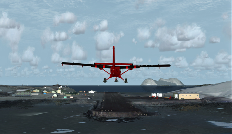
Twin Otter aircraft on final at Rothera, Antarctica.
The Airliner World magazine had an excellent article on the BAS operations in Antarctica in its March 2017 edition. It included plenty of interesting pictures and detailed explanations on what is expected from pilots and personnel working for BAS. I compared the Rothera virtual airport with the real one through the available pictures in Airliner World and was pleasantly surprised with the level of accuracy of the details.
A British Antarctic Survey Twin Otter aircraft is landing on the Rothera runway, Antarctica
The BAS always prepares itself for the worst: “[It] carries parts valued at around $5m, including a replacement engine for each aircraft, spare props and undercarriage components”.
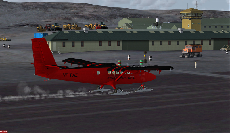
Twin Otter aircraft after a landing on the Rothera runway, Antarctica
“A new development for the Air Unit has been its work with the RAF, using C-130 Hercules transports to airdrop supplies into the field. They fly from Punta Arenas and drop fuel to support our science programmes on the Ronne Ice Shelf. […] It is all part of their training system and the accuracy they drop to is very impressive. They might drop 250 drums, think how many Twin Otter trips that would have been for us (48 or more than 400 flying hours)”.
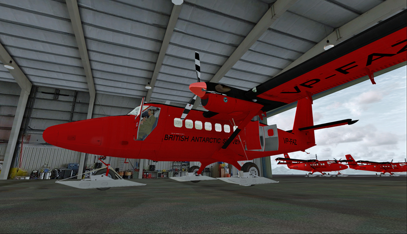
The main hangar in Rothera, Antarctica.
Aerosoft has made an excellent job in replicating the buildings in Rothera, BAS’s main research station in Antarctica. The biggest hangar can accommodate three Twin Otters and a Dash-7 altogether.
Inside the main hangar at the Rothera research station, Antarctica.
When your flight is over, do not forget to change the settings back to LOD 4.5 for Antarctica in your aerosoft/Antarctica X files.
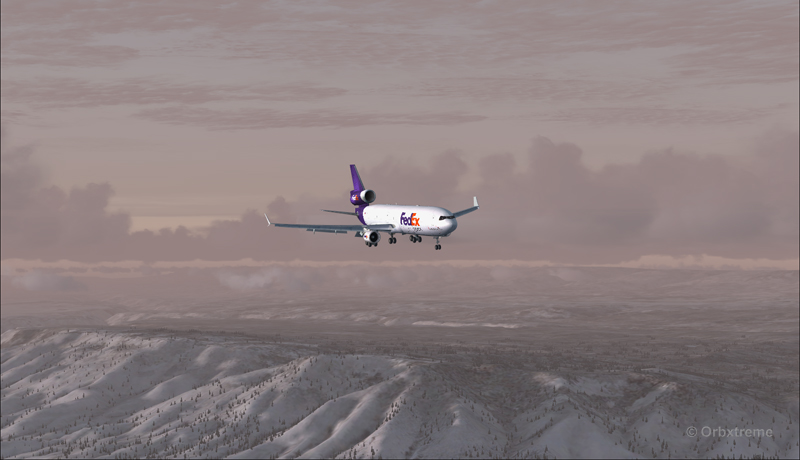
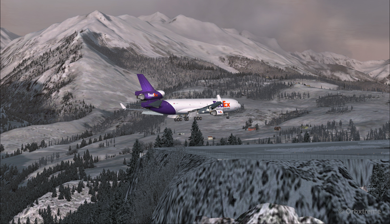
The flight simulator enthousiast will have fun trying this short flight ( 14 minutes) from the Eagle County virtual airport (KEGE) to the Telluride virtual airport (KTEX). The virtual flight, using FSX, was made during winter, on January 8th. The shots below represent an idea of what is visible while flying toTelluride. Use 14,000 feet, it should do it…
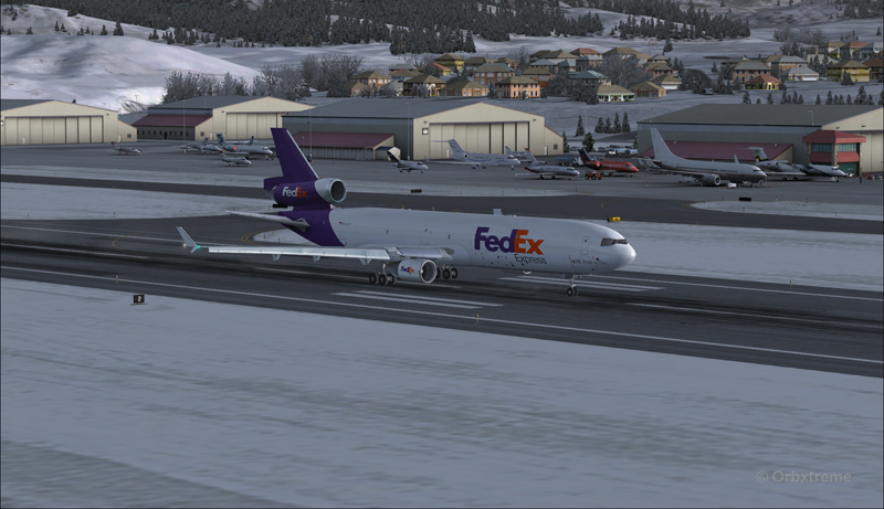
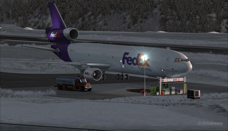
FedEx MD-11 on the take-off run at the Eagle County airport (KEGE) (FSX)
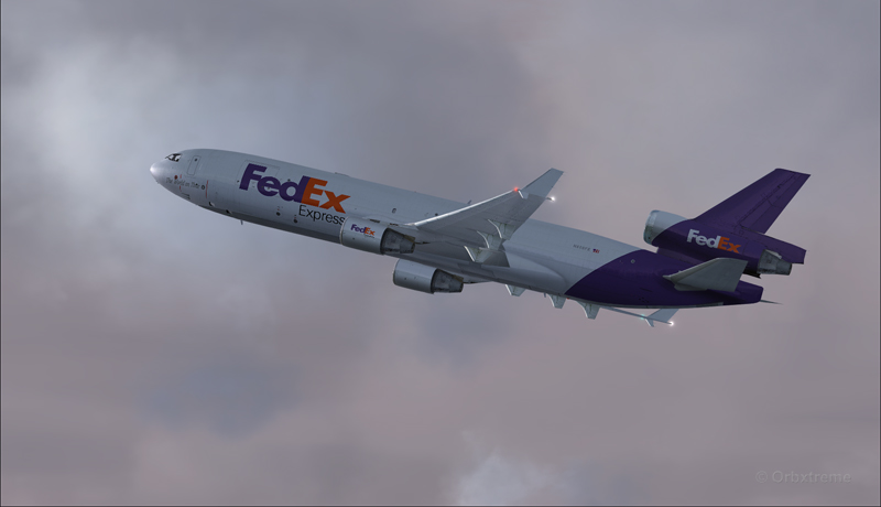
FedEx MD-11 airborne from the Eagle County airport (KEGE) (FSX)
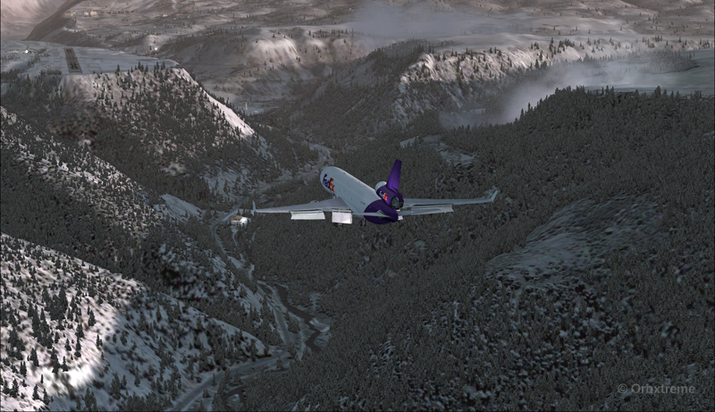
FedEx MD-11 between Eagle County airport (KEGE) and Telluride airport (KTEX) (FSX)
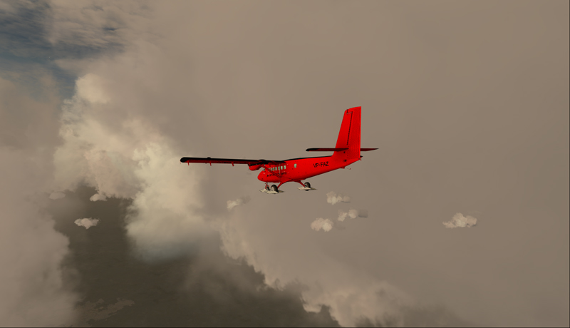
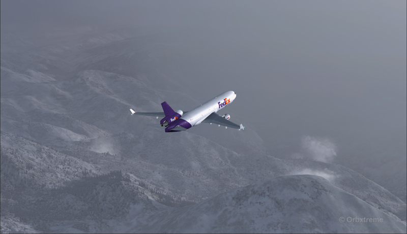
There are lots of beautiful mountains between KEGE and Telluride, and also some unpredictable weather…
FedEX Md-11 entering bad weather
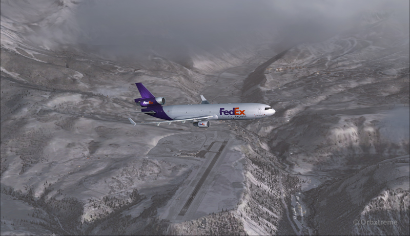
The expected ceiling at Telluride was 8500 ft. On the way to the airport, the clouds and visibility were sometimes obscuring the mountains.
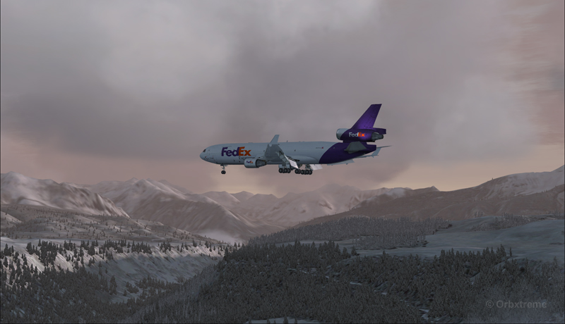
A FedEx MD-11 on a flight Eagle County (KEGE) to Telluride (KTEX) (FSX)
Telluride is a very inviting airport for a MD-11. The 7000 feet runway itself does not represent a big challenge, although its 100 feet are a bit narrow: this aircraft would normally require a 150 feet wide landing surface.
The virtual VFR approach made with the MD-11 was the most expensive way to do the trip, since it required a fly-by and a 270 degree turn to the right to align with runway 09.
FedEx MD-11 flies by the Telluride airport KTEX) (FSX)
The 270 degree turn at a 10-20 degree bank allowed to transit from 14,000 to 10,000 ft without doing anything radical. Just a turn while descending and gradually loosing speed to arrive at around 160 kts on final. The aircraft was now installed on long final, with flaps set at 50 degrees.
A FedEx MD-11 on long final runway 09 for the Telluride airport (KTEX) (FSX)
The high altitude runway’s 9078 feet msl elevation meant the pilots dealt with lower air density and heavy weight when approaching and, as such, the airspeed had to be adjusted accordingly to prevent stalling on final.
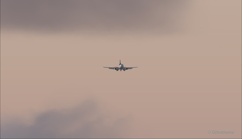
A FedEx MD-11 on final runway 09 for the Telluride airport (KTEX) (FSX)
Here is a view from the Telluride tower…
View from the Telluride airport (KTEX) (FSX) of a FedEx MD-11 on final for runway 09
Now with a view like that, you would not consider coming in IFR…!
A FedEx MD-11 inbound from KEGE on final for runway 09 at the Telluride airport (KTEX) (FSX)
To prevent an overshoot and some additional expenses in fuel (which are already skyrocketing), an optimal approach was required.
Most accidents with the MD-11 happen when the pilot pushes on the stick when there is a rebound with the nose wheel, thus creating an even stronger rebound. When there is a rebound, there is no need to push on the stick, just wait and the aircraft sets itself quickly.
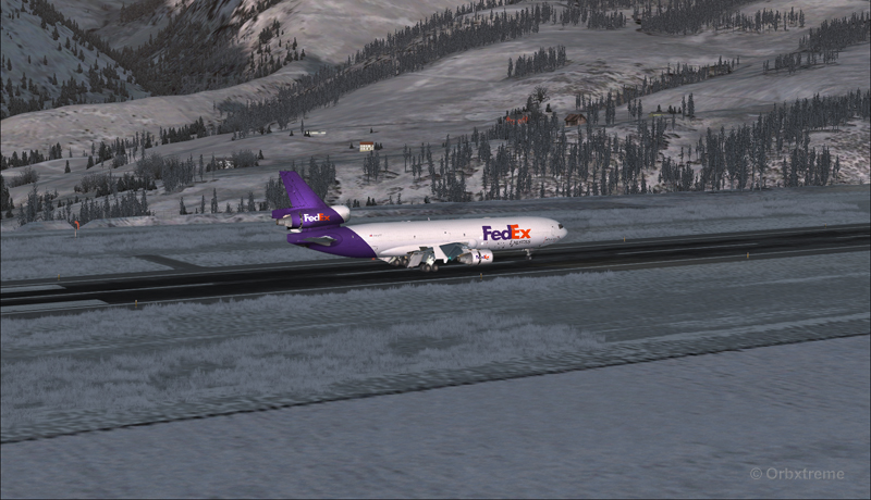
A FedEx MD-11 over the threshold runway 09 at the Telluride airport (KTEX) (FSX)
Now with max breaking and thrust reversers…
A FedEX MD-11 slowing down at the Telluride airport (KTEX) (FSX)
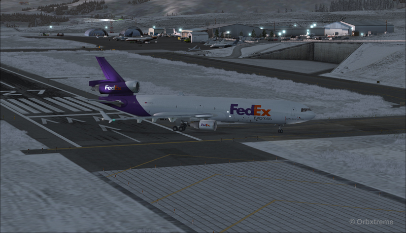
The MD-11 can easily turn at the first taxiway at Telluride. But in order to capture a wider view of the airport, I exited at the last taxiway (again adding to the already enormous expense in fuel…)
A FedEX Md-11 is exiting runway 09 at the Telluride airport (KTEX) (FSX)
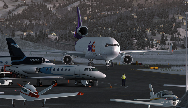
The employee on the ramp was worried that the MD-11 lower winglet would scratch N900SS while taxiing. But there was plenty of space (11 inches)…
A FedEX Md-11 is taxiing on the ramp at the Telluride airport (KTEX) (FSX)
The MD-11 was parked temporarily in a spot needed by every aircraft. It was necessary to unload quickly the precious cargo and get out of the way.
Temporary parking for a FedEx MD-11 at the Telluride airport (KTEX) (FSX)
Some expert handling would be needed to help move back that MD-11 close to the runway. But that was the Telluride’s airport manager problem and he had promised he would have something ready!
FedEx Md-11 parked at the Telluride airport (KTEX) (FSX)
The virtual scenery from departure to destination is a creation of ORBX programmers and the virtual MD-11 is made by PMDG Simulations (I am not sure it works with P3D though). For the weather, I used REX Simulations as the weather engine and REX and Cumulus X for the cloud textures. (Edit: PMDG does not support it’s MD-11 anymore).
For other challenging virtual flights, head towards the flight simulation section of my web site, under “challenging virtual flights”: there is something for everyone!
For more articles on flight simulation on my web site, click on the following link : Flight simulation
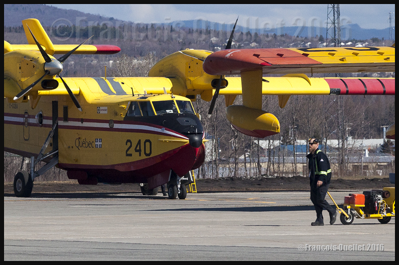
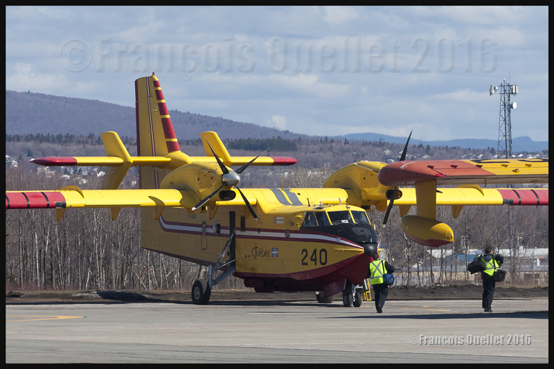
A Bombardier CL-415 water bomber, property of the Government of Quebec, is being prepared for its flight towards Fort McMurray, May 2016
Quebec’s CL-415s helping out in Fort McMurray
On May 5th, 2016, according to what had been announced by the Government of Quebec, four CL-415s took off from the Quebec Jean-Lesage international airport (CYQB) heading to Fort McMurray, Alberta, to help in the fight against widespread forest fires in that province. It is the worst natural disaster that Canada has known in its history.
Preparing flight crews and aircrafts for such a long cross-country trip naturally demands much coordination from the SOPFEU (Society for the protection of forests against fires). Once they will have landed at the Fort McMurray airport, the pilots of those CL-415s will be under the direct command of the Albertan authorities in charge of fighting the wildfires, since the latter are best positioned to know exactly what the local needs are.
I figure that the flight service specialists (FSS) of the Nav Canada flight information center (FIC) in Edmonton must have quite busy days with the increased aerial activity associated with the numerous fires…
Crew members are walking towards the Government of Quebec CL-415; they will soon be airborne and heading to Fort McMurray in Alberta, to fight the forest fires (2016)
The picture above shows crew members heading towards their assigned aircraft. Once they start working in the Fort McMurray region, they will not only have to directly fight the forest fires but also head to sectors that have not yet been touched by fire and water the area thoroughly to prevent new wildfires.
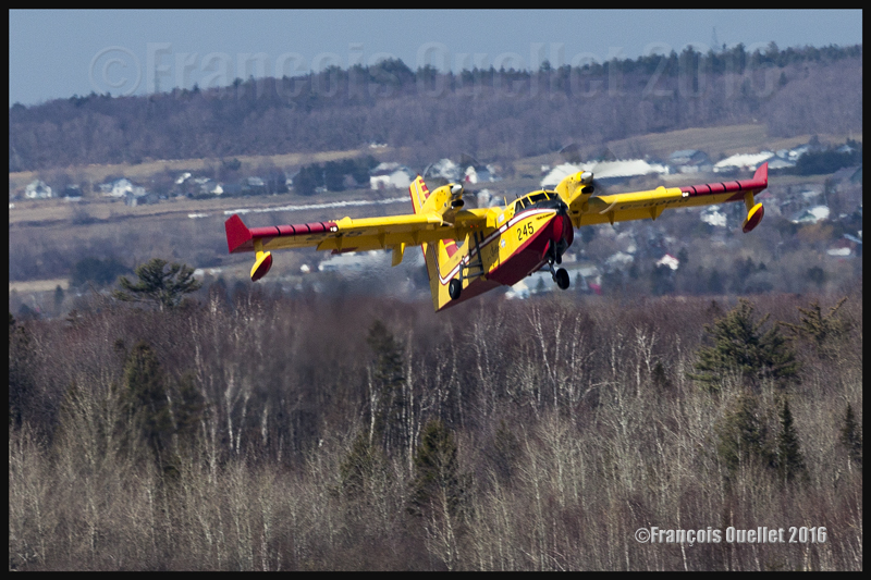
A Government of Quebec CL-415 number 245 is taxiing at the Quebec Jean-Lesage international airport to take-off towards Fort McMurray, in Alberta, to help fight the out of control forest fires in that province during May 2016.
Taking pictures of propeller-driven aircrafts
A Bombardier CL-415 water bomber takes off from the Quebec Jean-Lesage international airport heading to Fort McMurray, in Alberta, to help fight the forest fires (2016)
It is a bit touchy to photograph propeller-driven aircrafts while making sure that there is a sensation of movement. In a natural reflex to want to avoid blurred pictures, the photographer uses a shutter speed that corresponds to the focal used for the shot. In the case of the picture above, the focal was 400mm. But if a shutter speed of 1/400 had been used, the propellers would have been totally immobilized and the aircraft would have looked like its climbing while not using its engines.
It was necessary to reduce the speed to 1/160, thus increasing the risk of obtaining a blurred picture. In order to get both image sharpness and moving propellers visual effect, the photographer has to follow exactly the movement of the aircraft with the camera so that it looks totally immobile in the viewfinder. This asks for a bit of practice but allows for more realistic photos.
The CL-415 in a black and white photo
Black and white photo of a Bombardier CL-415 (C-GQBG) flying over Quebec City in 2015
The government of Canada helping out Alberta’s citizens
The government of Canada, under Justin Trudeau, has promised to match the amounts of money offered by all Canadians to the Red Cross society toward helping the Fort McMurray population.
Obviously, its contribution will not stop there (in fact, far from it), but the message is for the whole Canadian population to contribute generously to support the efforts of the Red Cross. It is already estimated that the material damages will reach at least nine billion dollars and that numerous years will be required to rebuild everything. The Liberal Party of Canada had built its political campaign around the need to invest for the renewal of infrastructures. With the Fort McMurray fires, there will be plenty of new unplanned expenses ahead.
More than 1,400 firemen are fighting the wildfires. So few, there has been very few lives lost, although “very few” is always too much. The crisis is, according to everyone, well managed by the government of Alberta.
At the time of writing, there was still no rain forecasted for days to come and the drought was also extending to the southern half of Saskatchewan and part of Manitoba. The winds were expected to increase, which would mean that even more resources would be needed in the near future to bring those wildfires under control.
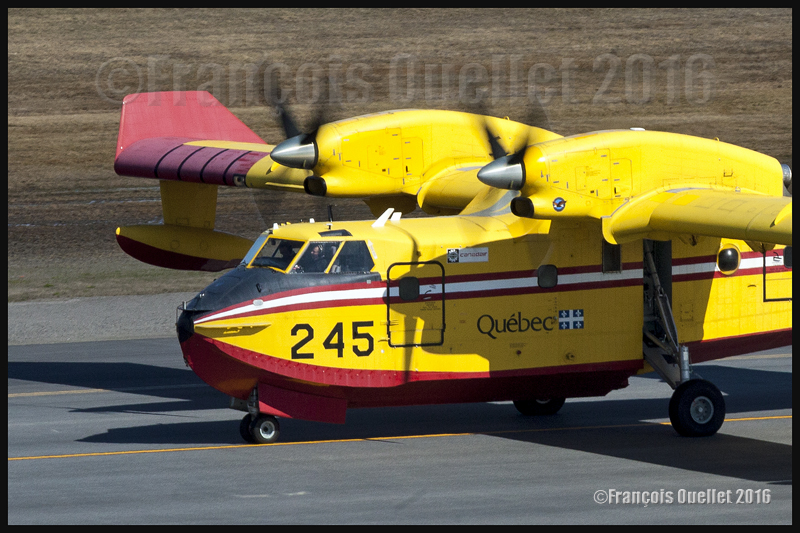
It seems to me that the government of many Canadian provinces would benefit in acquiring new water bombers like the CL-415 to give them an increased margin of manoeuver that would allow them to react more quickly, if we take into account the tendency for the ever growing number and size of forest fires. In the picture below, the government of Quebec CL-415 number 247 is just airborne from Quebec to Fort McMurray.
A Bombardier CL-415 C-GQBK airborne from the Quebec Jean-Lesage international airport heading to Fort McMurray, Alberta, in May 2016
The CL-215s will not head to Fort McMurray
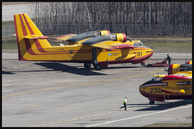
While several CL-415s are leaving for Alberta, few water bombers, like the two Canadair CL-215s shown below, stay at the Quebec Jean-Lesage international airport in case of forest fires in the province and also to be used for the seasonal rehearsal needed for every pilot before they are dispatched across the province of Quebec.
Two Canadair CL-215 water bombers parked at the Quebec Jean-Lesage international airport in May 2016.
Global warming
Some people can say that global warming is not responsible for the increasing number of extended wildfires. They might be right, but I prefer to adopt a wider view than only what is going on in Alberta. Heat transfer between the north and south are now more extreme in order to equalize the temperatures around the globe. All means to reduce the difference in temperatures between the equator and the poles are at work and this causes increasing problems to particular regions.
The Kamloops region in British-Columbia, when numerous forest fires were raging 2014.
A powerful El Nino phenomenon, repetitive Omega blocks, the air circulation in different cells (Hadley, Ferrell, polar, Walker) all participate in the heat exchange. At a more reduced scale, we also regularly hear of cold and warm fronts in the meteorological forecasts.
It is certainly not local warm fronts that are responsible for the fact that a thinner layer of permafrost is unable to ensure the stability of Arctic runways anymore. Nor are fronts responsible for the fact that houses on stilts do not have a stable foundation anymore. Many heat records have been established these past years in northern Canada. There will certainly be large amounts of money to spend to rebuild the Nordic infrastructures.
Brush fires as soon as April in Alberta
This year, as soon as April, there were widespread brush fires in a region as north as Fort McMurray in Alberta because winter has not brought much snow to humidify the land during Spring. I thus wondered what would happen once in July. Albertans did not need to wait that long to get the answer.
Western Canada forest after a fire (2014)
The modelization of climatic changes indicates that, in the Fort McMurray region, the forest fire season is already fifteen days longer that it used to be. More heat might favor more droughts. But an increase in temperature also favors the development of thunderstorms and with them comes lighting that will start up new fires.
One thing is sure: insurance companies will not lose time with the different theories on global warming. The reinsurers (those who insure the insurance companies) have the obligation to limit their losses to stay afloat and premiums will quickly increase to answer to the thousands of claims following an increasing number of natural disasters.
Photos of the local air traffic in Quebec, just after the CL-415s departed to Fort McMurray
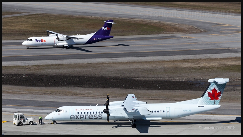
FedEx ATR 72-202F C-FTAR and Air Canada Express Bombardier DHC-8-Q-402NG (C-GIJZ) at the Quebec Jean-Lesage international airport in May 2016
At the Quebec airport, between the take offs of the four Bombardier CL-415 towards Fort McMurray, I was able to take few pictures of the local air traffic. In the photo above, it is possible to see a FedEx ATR 72 (C-FTAR) taxiing toward the ramp after a landing runway 06. An Air Canada Express Bombardier DHC-8-402 (Q-400) (C-GIJZ) was also being towed for is imminent departure.
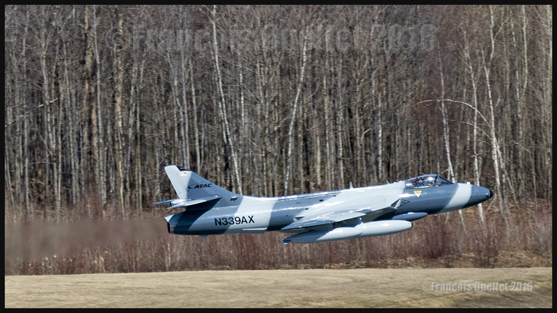
ATAC’s Hawker Hunter N339AX
Being in luck, I was able to capture a Hawker Hunter (N339AX) belonging to the American company ATAC, just airborne from Quebec. As for any military jet, it is difficult to ignore them on take-off: the reactor’s noise is there to remind you of their presence…
A Hawker Hunter belonging to the american company ATAC is airborne from the Quebec Jean-Lesage international airport (CYQB), May 2016
A Hawker Hunter, from the american company ATAC, is airborne from the Quebec Jean-Lesage international airport (CYQB) in May 2016
The pictures above have been taken with a Canon 5D MKII camera, equipped with a telephoto lens Canon 70-200 f2.8L IS II USM with a polarizing filter and a Canon Extender EF 2X III which brought the focal length to 400 mm. Even then, more cropping was necessary to enlarge the aircraft since I was quite far away from the runway.
Wishing to ensure that the image was sharp (a blurred picture is more probable with a 400 mm focal length while the photographer attempts to follow a fast flying jet), I adjusted the shutter speed to 1/1600 and made sure that the automatic focus was set on AI servo.
I now realized that a slower speed could have worked a bit better since it would have allowed showing a blurred forest in the background while keeping the aircraft sharp. But it is not often that you have the opportunity to see a Hawker Hunter in flight these days and I played safe with the shutter speed. The ideal shot will be for another day…
CL-415s and CL-215s together in Quebec (2012 photo)
CL-415 and CL-215 water bombers belonging to the Gouvernment of Quebec. Quebec Jean-Lesage international airport (CYQB) 2012
A last picture, taken few years ago, during autumn 2012, shows numerous water bombers CL-415 and CL-215 parked at the Quebec Jean-Lesage international airport (CYQB). During the off- season, the water bombers are brought back to Quebec City from the different bases were they have been in operation during summertime.
For other articles on aviation and photography, click on the following link: Aviation photography
April 2013, at the Nav Canada Flight Information Center (FIC) in Québec City. This morning’s meterological forecasts indicate the possibility of dust devils. This type of obstacle to visibility is rare. The pilots call the flight service specialists (FSS) to know what “PO” means on the weather charts.
In spite of the calm winds and blue sky all over southern Quebec, the weather conditions can give birth to local wind shears. If they lift sand, dust or other small particles, those wind shears will become visible and cause dust devils five to ten meters in diameter.
A pilot would have to be unlucky to cross a rare dust devil. However, I remember an event I witnessed thirty years ago while I was working at the Transport Canada Rouyn-Noranda flight service station.
On a hot summer day, an aircraft landed in Rouyn-Noranda after a cross-country flight from Montreal. The pilot was making a short stopover to have his logbook stamped at the flight service station. The weather conditions were ideal at the airport: dry air, calm winds and a cloudless sky.
Once his run-up was completed on the taxiway, the pilot slowly headed for the runway 26 threshold. Once aligned and ready for take-off, he made the last few adjustments.
Few seconds later, the flight service specialists heard an emergency locater transmitter signal. Looking again at the runway, they saw that the aircraft was still on the threshold, but upside down.
A strong windshear had overturned the single-engine aircraft. The airport wind speed indicator being located farther away from the threshold only indicated calm winds.
The souvenir of this story reminded me that nature can always surprise the best prepared pilot. I imagine that this event shocked the student pilot as he tried, like us, to figure out what had just happened. I do hope that this adventure did not discourage him from flying.
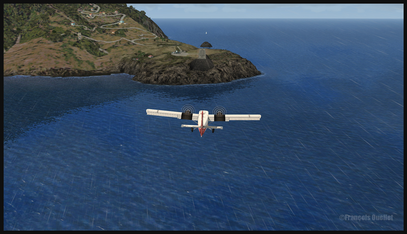
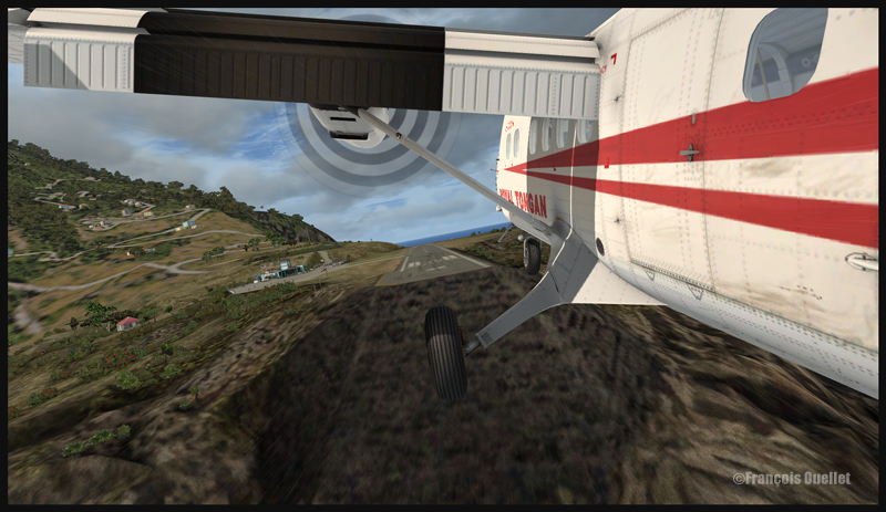
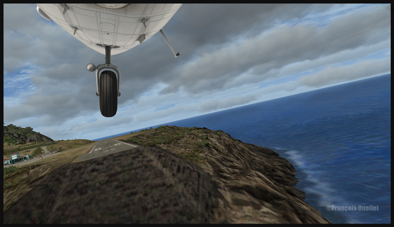
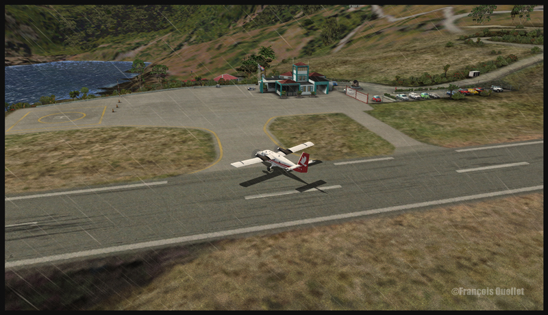
One nice challenging virtual flight in FSX is to operate from the Juancho E. Yrausquin Airport, the shortest commercial runway in the world.
The runway is 1299 ft long (396m) and 60 ft (18m) above sea level. The IATA code is SAB, and the ICAO code TNCS.
30314 A Twin Otter aircraft is on long final for Saba (FSX)
30315 A Twin Otter aircraft is on short final for Saba (FSX)
The ideal virtual aircraft for that runway is the Twin Otter (DHC-6) or the Britten Islander (BN-2). If you want something bigger, the De Havilland DHC-7 is going to be your perfect choice. Forget about jet aircrafts, the runway is too short.
30316 A last correction for the wind in Saba (FSX)
To add to the pleasure, use runway 30 and add a strong crosswind component, with gusts. In the screen captures below, I set the winds to 030 degrees at 10G20. For the flight, I also used Cumulus X and PrecipitFX to improve the visual effects.
30317 A Twin Otter aircraft is arriving in Saba (FSX)
30320 A Royal Tongan Twin Otter aircraft is leaving the runway in Saba (FSX)
For an even more realistic experience, I suggest you get the FlyTampa St.Maarten scenery, which will offer you three airports, which are all very well designed and present real challenging approaches : the Juancho E. Yrausquin airport, on Saba Island,the spectacular St.Barths airport and the Princess Juliana international airport in St.Maarten.
In the « challenging virtual flights » section of my website, I have already included an approach to Princess Juliana airport in St.Maarten, with the MD-11. The approach to St.Barths (TFFJ) will soon be included.
You will enjoy every minute trying to make perfect landings at those three airports. For other challenging virtual flights, visit the flight simulation page of my website.
Have fun!
For more articles on flight simulation on my web site, click on the following link : Flight simulation
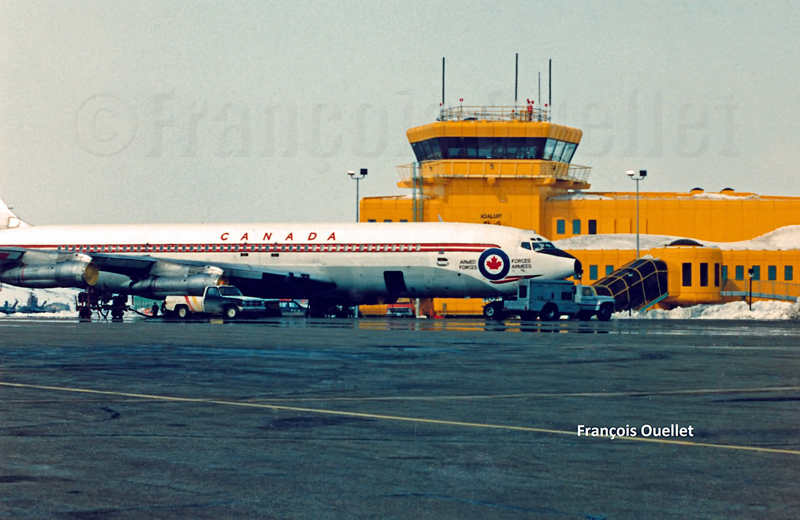
(Precedent story: carrying a .357 Magnum to Iqaluit)
An American Trans Air Lockheed L-1011being refueled in Iqaluit, Canada, in 1989. I had the opportunity to leave the flight service station (the yellow tower) for few minutes to take this picture.
Before retelling some of the events that happened while I was working at the Transport Canada flight service station in Iqaluit, in the Nunavut (1989-1991), it is mandatory to present few important dates that will allow the reader to understand why the airport was initially an American military base.
1938. Hitler’s ambitions are such that Roosevelt deemed necessary to announce the following: “I give you assurance that the people of the United States will not stand idly by if domination of Canadian soil is threatened by any other empire ».
1939. Beginning of discussions between Canada and United States with regards to joint defense of the North American continent.
1940. Great-Britain was at risk of losing the war against a Germany that was progressing rapidly in its conquest of the European soil. When Denmark was defeated in autumn 1940, fear grew that the Germans would progress westward and establish operational military bases on the newly acquired territories.
Greenland belonging to a defeated Denmark, Germans would be using it to get closer to Canada. At the time, Greenland was the sole commercial source of cryolite, an essential component of aluminum used in aircraft production.
There was also a province which was not part of Canada in 1940 and which presented a strategic interest for an enemy in its war against Canada and United States: Newfoundland and Labrador.
In order for the war not to be fought directly on the North American territory, one had to keep the Germans busy in Europe. It therefore meant that Great-Britain must not be defeated.
1941. Ships carrying short range fighting aircrafts from America to Europe were regularly attacked and sunk by U-boats. It was imperative to change the route. Canadians and Americans were looking for the best sites that could accommodate the construction of runways allowing short range military aircrafts to fly up to Prestwick, Scotland.
This new route was called “Crimson Route” and the stopovers were Goose Bay in Labrador, Fort Chimo (Kuujjuaq) in Quebec, Frobisher Bay (Iqaluit), on Baffin Island in the Nunavut as well as three sites in Greenland (Narsarsuaq, Angmagssalik and Sondre Stromfjord (Kangerlussuaq). The Frobisher Bay coded name became “Crystal Two” base.
1941-42. Germans established the first inhabited weather bases on the Greenland coast in order to facilitate U-Boats operations across the North Atlantic. When those sites were discovered, they were destroyed by American commandos.
1942. U-Boats entered the St-Lawrence seaway and sank Canadian ships.
1942. The site initially chosen to establish the Frobisher Bay airport (the Crystal Two base) was Cromwell Island, located 20 miles south-west of today’s actual site for Iqaluit. This was until a new site was discovered (today’s site) that favored the construction of longer runways and allowed the beaching of flatboats loaded with cargo during the summer period.
A McAllister flat-bottomed barge will soon be unloaded in Iqaluit, during low tide.
A ships convoy carrying thousands of tons of cargo planned for the construction of the Frobisher Bay base arrived at destination. This convoy was nonetheless attacked by the U-517 U-Boat and the cargo-ship Chatham, carrying 6000 tons of material destined for Crystal One and Crystal Two bases was sank.
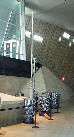
1943. An German automated weather station was built at Martin Bay, in Labrador, to facilitate the U-Boats operations. This weather station is now in permanent exhibition at the war museum in Ottawa. Pictures have been found were we can see smiling but armed German soldiers taking the pose near the automated weather station. Canada accidently learned about the existence of that weather station in 1980.
German automated weather station in exibit at the War Museum in Ottawa
Many German officers and soldiers who were captured in Europe were sent abroad while waiting for the end of the war. My grandparents, who owned a farm in St-Ignace, Quebec, became responsible, over time, for one German officer and two soldiers. They had only good comments on the behavior and desire of the prisoners to help on the farm.
1943. Both Frobisher Bay runways were now operational, although without being totally completed. The engineers did not have the knowledge of the Russians when it came to maintaining airport runways in the Arctic. Damages caused by permafrost were significant and the runways necessitated a lot of maintenance. The water present under the runways would sometimes surface suddenly and create five meter deep holes. Those runways needed a constant effort to remain usable.
The first runway to be built was eventually abandoned due to a wrong evaluation of the prevailing winds and the dangers associated with the surrounding elevated terrain. Today only remains the runway that we know in Iqaluit, although extended to 9000 feet. The year 1943 recorded 323 aircraft arrivals, of which only a small number made the complete trip to Europe.
1944. War took a new turn. The newly developed long range radars, allied to advanced technology in the detection and attack of submarines, radically diminished the U-Boats threat in North Atlantic. The “Crimson Route” airports were suddenly losing their pertinence. The Canadian government, worried about the massive presence of Americans in the Canadian Arctic, bought the airports from the American government.
1950. Canadians officially took control of the Frobisher Bay airport, but authorized an American presence since this airport had a new strategic importance in the cold war that followed Second World War. The weather station and runway maintenance were taken care of by American forces.
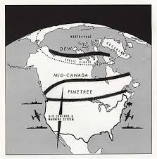
1951-53. A radar station was built on a hill northeast of runway 17-35. This station completed what was then known as the Pinetree line. This line was made of several long range surveillance radar stations; it covered all of southern Canada and gradually curved towards the north to end up in Frobisher Bay. All those stations were inhabited and could order interceptions at all times against potential enemy forces, by means of jet aircrafts.
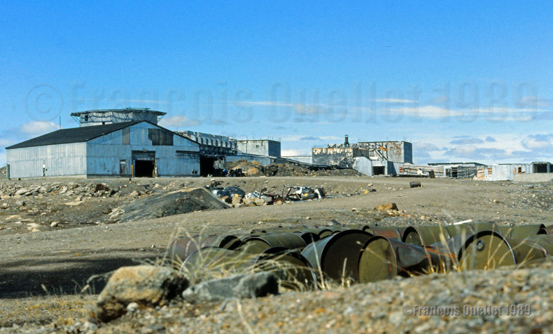
What is left of the old American military base in Frobisher Bay (Iqaluit), Canada. I took the picture in 1989.
1955. Americans received the authorization from Canada to build a SAC [Strategic Air Command] military base where numerous KC-97 tankers were stationed in support of B-47 bombers operations carrying nuclear armament. The base was built in 1958 and, until the end of its operations in 1963, parking space was occupied by at least seven KC-97. The SAC base was not needed anymore after the new Boeing B-52 bombers and KC-135 tankers were developed.
A French-Canadian military from Quebec at work in Frobisher Bay
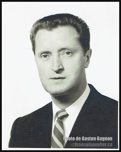
Gaston Gagnon during the period where he served as a Canadian military in the communication field, at the Frobisher Bay station of the Pinetree Line in Canada in 1955. He died in 2016.
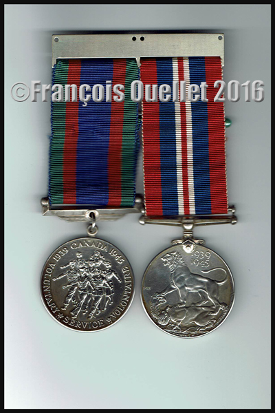
My uncle Gaston Gagnon was part of the French-Canadian military staff who was in service in Frobisher Bay. He volunteered for service during the Second World War (1939-1945).
War medals (volontary service and honorable service during the Second World War (1939-1945) belonging to the French Canadian Gaston Gagnon who died in 2016
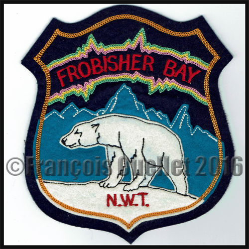
Frobisher Bay, N.W.T., Canada crest
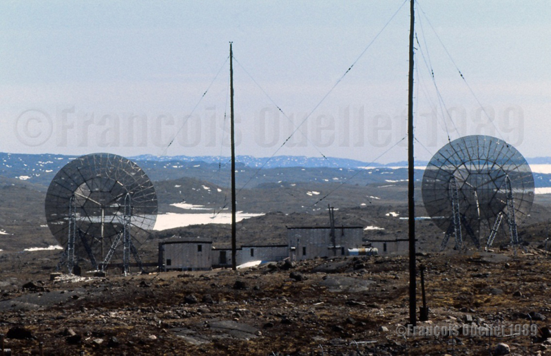
He worked in the communication field during the Cold War and, after he died in 2016, I received some pictures that were taken in 1955 in Frobisher Bay. Those photos also witness of the American presence in Frobisher Bay.
Radar dish at the Frobisher Bay, NWT, Canada Pinetree Line Station in 1955
American soldier posted at the Frobisher Bay NWT Canada Pinetree Line site in 1955
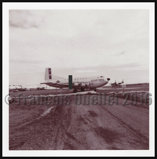
Globe Master C-124 aircraft of the Military Transport Air Service (U.S. Air Force) in Frobisher Bay, NWT, Canada in 1955 serving the Pinetree Line stations during the Cold War.
C-124 Globemaster. Military Air Transport Service in United States (around 1957)
Frobisher Bay, N.W.T., Canada crest
1960. The runway was extended from 6000 to 9000 feet.
1961. The Frobisher Bay radar station, part of the Pinetree line, was closed but the Polevault station remained in activity.
DEW and Pinetree lines over Northern Canada
1963. Americans left Frobisher Bay and gave control of the Polevault station to the DOT [Department of Transport], an older designation of Transport Canada.
Old American military base in Frobisher Bay (Iqaluit)
1964. The radio operator, and later flight service specialist (FSS) Georges McDougall, arrived in Frobisher Bay. All the village inhabitants eventually got to know Georges since he provided air traffic services there for at least thirty-seven years, seven days a week, on shifts work. He progressively became a privileged witness of all the unusual events to happen in the village and at the airport.
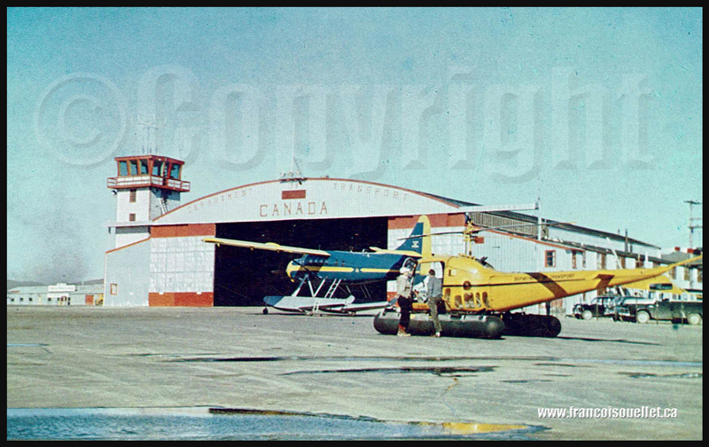
Below is a picture of the old DOT hangar and tower.
People and DOT Canada in Frobisher Bay NWT aviation postcard
1987. Frobisher Bay was renamed Iqaluit.
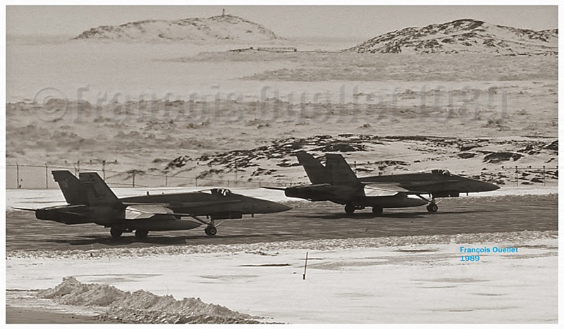
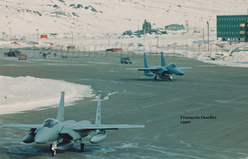
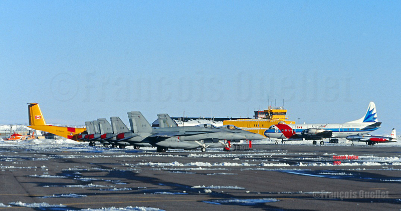
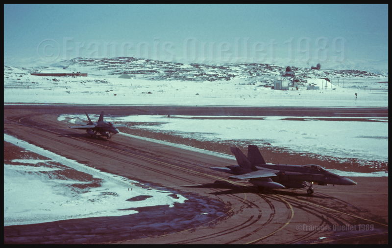
Two Canadian CF-18s holding short of runway in Iqaluit (1989)
1989. Stacey Campbell wrote an article in News North that she titled: “Military Jets Fill the Arctic Skies”. She explained that NORAD (North American Air Defence) regularly held exercises aimed at testing the capacity of Canada’s new radar defense system to detect potential enemies approaching from the north.
The interviewed military officer told Stacey that CF-18 fighter jets, tankers and B-52 bombers, among other types, would be part of the operation. The CF-18’s would temporarily be stationed in Iqaluit, on Baffin Island, and Inuvik for the duration of the exercise. Other types of aircrafts were also involved in that annual test, like the F-15, T-33 and possibly the AWAC although the latter did not land in Iqaluit.
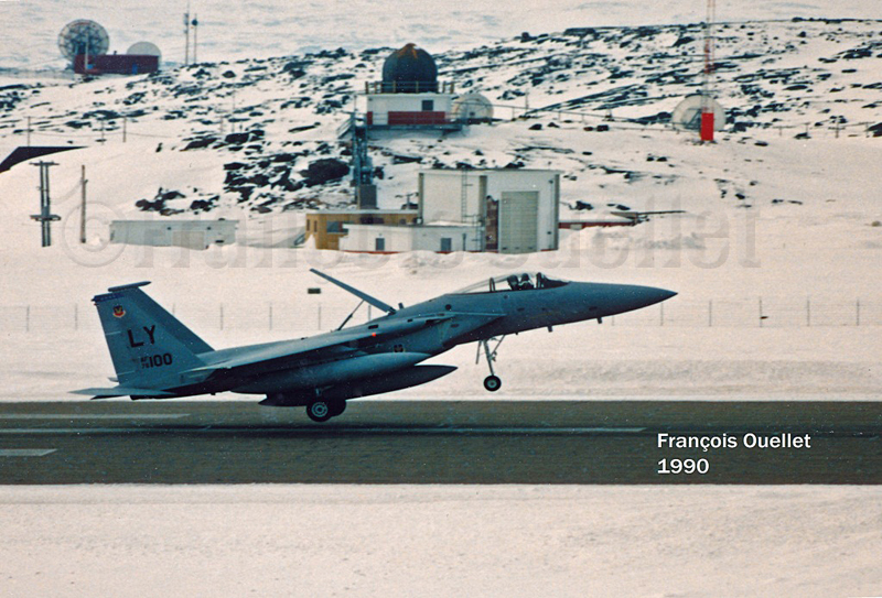
American F-15 landing in Iqaluit
The local Transport Canada flight service specialists (FSS) had to deal with the tight operating schedule provided by a military officer as well as integrate the daily arrivals and departures of private and commercial aircrafts.
At the time, the most useful taxiway, one which was located near the end of runway 35, could not be used since the terrain was too soft. All the aircrafts using runway 35 were forced to backtrack that runway before it could be cleared for other incoming or departing aircrafts. The additional time required for that procedure sometimes gave headaches to the military officer sitting by our side.
American F-15 Eagle airborne from Iqaluit
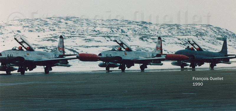
Canadian T-33s in Iqaluit (1990)
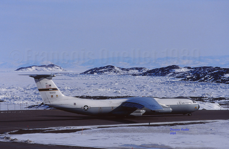
American Starlifter cargo aircraft ready for take-off in Iqaluit (1989)
I remember that the military officer in charge of the mission told us: “If the jets cannot takeoff within the next minute, the mission will be aborted”. It just happened that during the tight window within which the CF-18’s had to be airborne that day, there were many commercial aircrafts like the Avro 748, Twin Otter, Boeing 727 and 737 and other executive aircrafts operating around Iqaluit. There was always a way to please everybody and the military exercise ended the way it was initially planned.
Two Canadian CF-18s in Iqaluit (1989)
Two American F-15 Eagle taxiing for departure in Iqaluit (1990)
This was a period much appreciated by the flight service specialists (FSS) since, for one week during the year, our operations changed radically: we had to respect the imperative needs related to the military exercise as well as continue to provide regular air traffic services.
Six Canadian CF-18s, one Lockheed Electra Ice Patrol aircraft, a Dash-7 and a T-33 in Iqaluit
It was brought to our attention, for having discussed with many pilots involved in the exercise that military forces were kind enough to offer, through our Transport Canada manager, few posters signed by pilots of squadrons involved in the “Amalgam Chief” exercise. Although the manager never deemed necessary to show his staff even one of those posters, I appreciated the gesture from the pilots.
Canadian Armed Forces Boeing B-707 in Iqaluit, in front of the flight service station tower
1993. In order to replace a DEW line that had become obsolete, Canadians and Americans jointly built a new base that would now be used for logistical support for the new North Warning System.
Two Canadian fighter aircrafts CF-18 leaving the runway in Iqaluit.
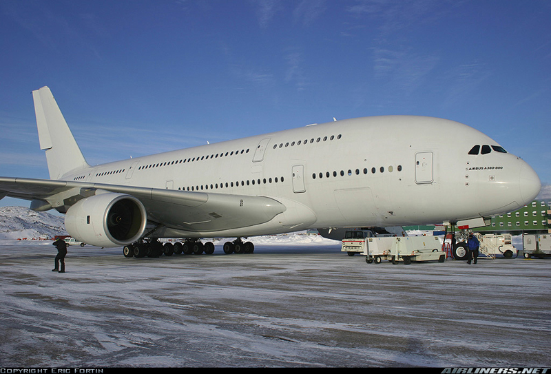
2006. Extreme cold tests were held in Iqaluit by Airbus for the A-380, the biggest passenger aircraft in the world.
Airbus A380-841 in Iqaluit, Canada, during cold weather testing
2014. Extreme cold tests were held by Airbus for its new A-350 XWB.
2015. Canada was the host of the Arctic Council Ministerial Meeting in Iqaluit. The Council is composed of the following countries: Canada, Sweden, Denmark, Finland, Iceland, Norway, Russia and United States. Joining the meeting were senior representatives of indigenous organisations holding the status of permanent participants.
Dassault completes several cold-soak trials in Iqaluit for its Falcon 6X
Pope Francis visits Iqaluit during his Canadian trip aimed at healing and reconciliation with Indigenous groups and residential school survivors.
2024. An Air France Boeing 797-900 makes an emergency landing in Iqaluit due to a burning smell reported by passengers.
(Next story: The military exercise “Amalgam Chief”: B-52 bombers in northern Canada)
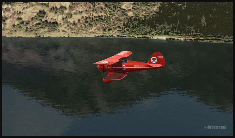
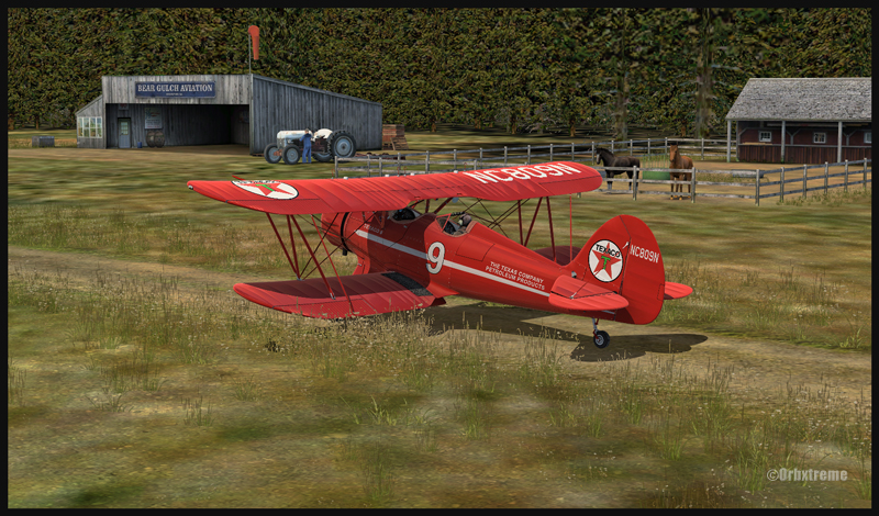
I’ve just added a new VFR flight in the “flight simulation” section, under “standard virtual flights”. An Alabeo WACO takes off from Cushman Meadows, heads south-east towards the Skokomish Reservation, then flies over the Bremerton airport to the north-east and ends up landing at the Bear Gulch aerodrome, just in time for a BBQ. This was done using FSX. The first part of the cross country is for a starting virtual pilot but the last part requires a bit more experience.
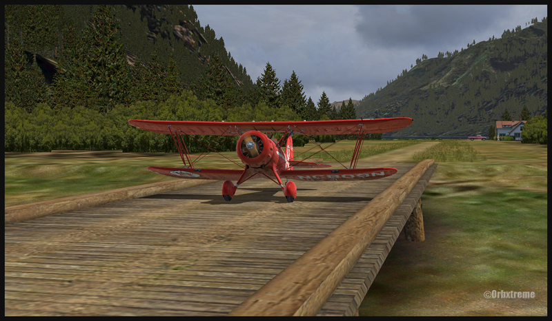
Waco on short final for Bear Gulch WA38 (fsx)
WACO landing in Bear Gulch WA38 (FSX)
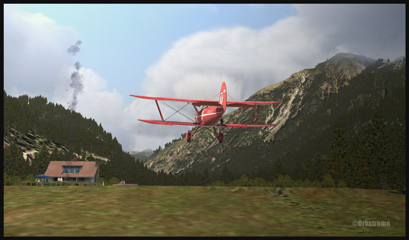
It is a more demanding experience than what is normally found in the “standard flights” section, since it involves a final landing at Bear Gulch. The runway at that airport is only 1411 ft long, and quite narrow. So you have to plan your approach carefully. A little wooden bridge is part of the runway! Since the flight is done in nice VFR conditions and does not involve engine failures or using a really fast aircraft arriving on a short runway, I decided that the “standard virtual flights” section was more appropriate. Still, it is not an easy approach.
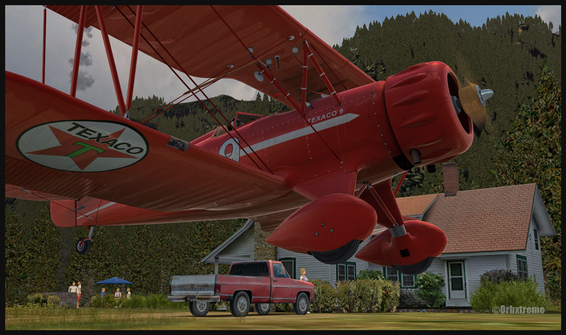
A Texaco WACO aircraft is taxiing on a wooden bridge at Bear Gulch, WA38
A Waco aircraft belonging to Texaco is taxiing in Bear Gulch, WA38
Cushman Meadows (KCMW) and the Bear Gulch (WA38) runways do not exist in real life but am I ever glad Bill Womack took the time to create them. His site can be found under Iblueyonder. The screen captures show both airports and the PNW region sold by ORBX. If you want nice shadows on the ground while not using P3D, just get CumulusX and set the season to summer, with scattered clouds in mid afternoon.
A Waco aircraft with a tractor in the foreground is parked at Bear Gulch, WA38
Some guests have already arrived in Bear Gulch. You will see the smoke rising from the BBQ being prepared while you are on short final. The guests will certainly be taking pictures of your approach, as you are flying a vintage aircraft. So, if there was ever a time to do things correctly, now it is!
For more articles on flight simulation on my web site, click on the following link : Flight simulation