The Dash 8-400 is also known as the DH8D or Q400 (Q standing for “quiet”). It is pictured here at the threshold of Runway 29 at Quebec City’s Jean Lesage International Airport. It is awaiting takeoff clearance.
PAL Airlines DH8D aircraft and Pascan Saab-340B at the Québec Jean-Lesage international airport.
Photography technique
I focus on the back of the aircraft. The limited depth of field blurs the rest of the image. The shutter speed is between 1/80 and 1/125, so as not to freeze the propellers. The result is a more dynamic photo.
With the plane’s back to the camera, interest is limited unless something special is happening. The frequency scanner indicates that a Pascan Saab-340 (SF32) will shortly be taking off from runway 24. With a bit of luck, I’ll be able to capture it and include it in the shot of the Q400.
A few seconds later, the aircraft enters the lens’ field of vision. The idea is to capture it while it’s still vis-a-vis the gasoline fumes from the engines. I took a few photos and kept the one with the best photographic composition.
Below is a photo of an Air Canada Rouge aircraft taking off from 24 after a heavy downpour.
An Air Canada Rouge Airbus jet takes-off from a wet runway at the Québec Jean-Lesage international airport.
This time, there’s no question of limiting the shutter speed to 1/125. The plane has no propellers, so you can choose 1/1000 without making a mistake. For greater dynamism, wait until the nose of the plane starts to lift. You can also keep a long trail of water splashes.
Finally, it’s often best to show a bit of landscape in the foreground to better situate the aircraft in its environment.
Click on the link for more aircraft photos on my blog. There are also photo galleries in the menu.
Of the 55 aircraft of this model built in the 1980s, only 26 remain in service worldwide. The Antonov 124 can carry a load 17% greater than that of the C-5A Galaxy.
I took the first photo in close-up to emphasize the enormity of the aircraft compared to a human. Note also the “Be brave like Kharkiv” logo on the nose of the aircraft, in reference to the war between Ukraine and Russia.
Antonov AN 124-100M departing the Québec Jean-Lesage international airport (CYQB) for Harrisburg (KMDT) in the United States.
Tips in photography
The aircraft took off from runway 24 bound for Harrisburg (KMDT) in Pennsylvania. As the runway was wet, a photographer positioned at the threshold of runway 24 to observe the takeoff would have seen only water being lifted by the engines.
The thresholds of runways 06 and 29 were therefore an excellent choice. Runway 29 provided a nice side-on shot with no visual contaminants. Curiously, while many photography enthusiasts were massed near the thresholds of 06 and 24, I was alone near 29. This made it possible to get a shot from an original angle.
As the cargo plane was quite a distance from my position, I used a Canon 70-200mm f2.8L IS II USM telephoto lens. An acceptable shutter speed to avoid motion blur meant sacrificing depth of field.
The full-frame sensor’s 50.6 megapixels then made it possible to crop the subject sufficiently without compromising photo quality.
Photography technique
A good photography session goes hand in hand with proper planning. Listen to ground frequency 121.9, control tower 118.65 and terminal 127.85 to improve your chances of success.
A cell phone allows you to use the Flightradar24 application (for scheduled arrivals and departures and current trajectories). Flightaware is also an excellent choice. The cell phone can also be used to find out if there are any road closures around the airport that would prevent us from getting to our desired destination. It also provides information on current weather conditions and forecasts. In Canada, the AWWS site is a mine of information for aviation enthusiasts.
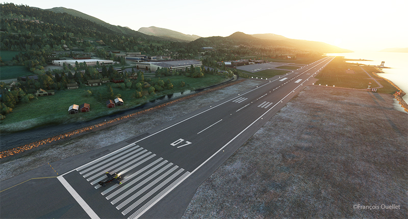
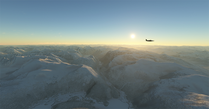
The sixth leg of this world tour of flight simulation continues with a journey from the Molde (ENML) airport to the Sandane/Anda (ENSD) airport in southern Norway.
Ready for departure from Molde (ENML) virtual airport to Sandane (ENSD) airport.
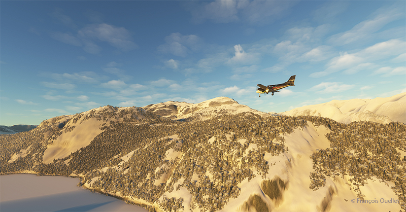
The destination can’t accommodate a private jet like the Cessna Citation Longitude, as runway 08/26 is only 3182 feet long. A good old light twin-engine plane, repainted a hundred times over, will have to be rented for the trip, and we’ll just have to hope the engines hold out.
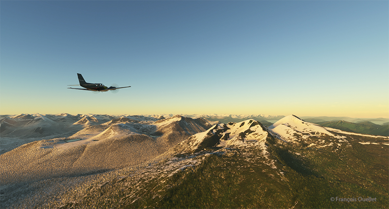
Enroute to the virtual Sandane airport (ENSD) in Norway with Microsoft Flight Simulator
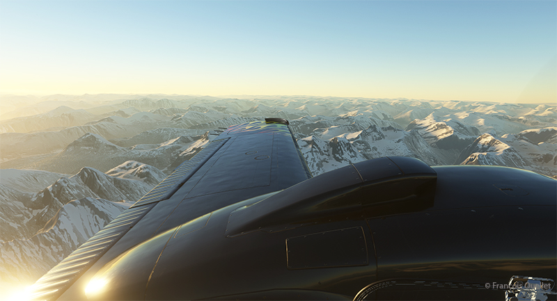
The mountains of Norway come into view, and the ascent continues gradually to ensure that the highest peaks along the route pose no problems.
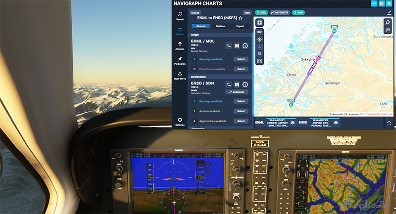
The navigraph tool for flight simulation and the VFR map from ENML to ENSD.
Above, a view of the aircraft’s instrument panel as it climbs, with a Navigraph map showing the route flown in visual flight. Virtual weather is integrated in real time whenever a new weather report is issued by a ground observation station around the world.
View of the Norwegian mountains from the pilot seat
Morning sun over the Norwegian mountains with Microsoft Flight Simulator.
Another sunrise view that brings Norway’s magnificent mountain landscape to life.
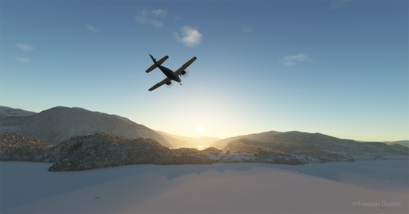
Approaching the Sandane virtual airport in flight simulation.
We are now almost at our destination. The plane is in left base for runway 08 at Sandane/Alda airport.
Turning final for runway 08 at Sandane (ENSD) virtual airport in Norway.
Over the still-frozen Innvikfjorden, the final turn is made to stabilize the aircraft on final runway 08. On short final, there’s a cliff just short of threshold 08, and a difference in runway height to take into account for the landing.
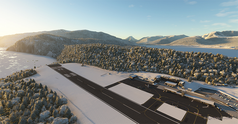
View of the Sandane (ENSD) virtual airport with Microsoft Flight Simulator.
Above, a view of the Sandane/Alda virtual airport (ENSD) using Microsoft Flight Simulator. There is no margin for error, as the two runway thresholds are bordered by a cliff and a stretch of water.
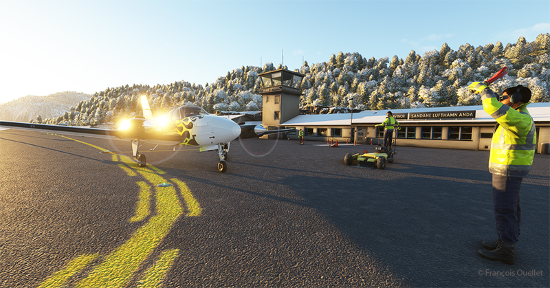
Help for parking is offered at the Sandane (ENSD) virtual airport in Norway.
Service at the airport is excellent. Two employees are waiting to help us park our aircraft.
Sandane is known for its magnificent panoramas, waterfalls, Briksdalsbreen glacier and horseback riding. The village is nestled inland from the Gloppe Fjord. If you’re traveling there in summer, you’ll need to be prepared for a fair amount of precipitation.
The next flight is from Sandane to Stockholm-Bromma in Sweden with a Beechcraft King Air 350I which has not flown for a long time. We’ll have to fly over the high mountains of the Jostedalsbreen Nasjonalpark before reaching our destination.
These machines, which were not designed to operate from an aircraft carrier, would not be able to reach their targets and return safely to port for lack of sufficient fuel. All the pilots were well aware of this, and volunteered.
The fleet of sixteen aircraft, commanded by Jimmy Doolittle, successfully achieved its objective of confusing the enemy and showing that Japan remained vulnerable to surprise attacks. The Japanese wondered how it was possible that American bombers could have reached and hit their country. Where did they take off from? They know that the B-25 Mitchells were not designed to take off from an aircraft carrier, and that they were incapable of landing on one.
The genius of the operation laid in the combination of a number of highly risky decisions which, taken together, took the enemy by surprise. Firstly, as it was impossible to land the planes on the Hornet, they were installed with a crane, knowing full well that they would never return to the ship.
In addition, the captains were trained to take off over distances unthinkable for them, using a technique pushed to the extreme. The ship sailed at high speed into the wind, improving the headwind component so essential for such perilous maneuvers.
The pilots had to be extremely skilful to keep to the departure trajectory on a platform that moved from left to right in the middle of a storm. Buildings on the Hornet’s side had to be avoided at all costs, and the available gap between the wing tip and the ship’s tower was no more than two meters. Despite all the obstacles, all the B-25s managed to take off. It was to be a one-way mission to Japan.
Doolittle piloted the first B-25 to take off from the carrier. He had only a very small portion of the deck to work with, as there were still fifteen other bombers waiting their turn to take off. The second pilot to leave the deck narrowly avoided a water landing, as the aircraft sank slightly and a landing gear wheel touched the water. But the plane gained just enough speed to stay airborne.
Bombers and crews suffered different fates once the bombing raids on Japanese targets had been completed. The authors conclude: “The raid destroyed 112 buildings and killed 87 people, in about 6 minutes. […] The destruction of 15 of the 16 B-25s, unable to reach Chinese airfields for landing, was nevertheless to be deplored, the 16th B-25 having landed safely in the USSR. Also to be deplored was the accidental death of three airmen (planes 3 and 6) and the capture of 8 others (planes 6 and 16) by the Japanese, 4 of whom never returned home, 3 having been executed as “war criminals” and the 4th having died in captivity. Worse still, the Japanese took revenge on the Chinese, who had helped all the surviving airmen, by organizing the massacre of some 250,000 civilians in the Zhejiang and Jiangxi provinces then under their control. This was to leave its mark…”.
Landing and takeoff tests on an aircraft carrier, the Forrestal, were also made decades later for a C-130 Hercules. I tried to repeat the experience in flight simulation. The flight can be found in the “challenging virtual flights” section of my blog. As the Forrestal is not available in virtual mode, I used the aircraft carrier USS Enterprise.
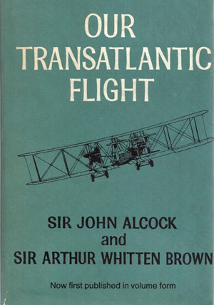
Our transatlantic flight, by Sir John Alcock and Sir Arthur Whitten Brown
Newfoundland
Before 1949, Newfoundland was called Dominion of Newfoundland and was part of the British Commonwealth . In 1949, it became a Canadian province.
The first non-stop flight eastward across the Atlantic.
The book « Our transatlantic flight » tells the story of the historic flight that was made in 1919, just after the First World War, from Newfoundland to Ireland. There was a 10,000 £ prize offered by Lord Northcliffe from Great Britain for whoever would succeed on the first non-stop flight eastward across the Atlantic.
A triumph for British aviation
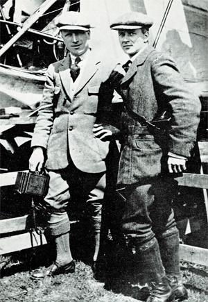
Sir John Alcock and Sir Arthur Whitten Brown , respectively pilot and navigator, wrote the story of their successful flight in this book which was published in 1969. The followings are pilot quotes from the book : « For the first time in the history of aviation the Atlantic had been crossed in direct, non-stop flight in the record time of 15 hours, 57 minutes. » (p.13) « The flight was a triumph for British aviation; the pilot and navigator were both British, the aircraft was a Vickers-Vimy and the twin engines were made by Rolls-Royce. » (p.13)
Sir John Alcock and Sir Arthur Whitten Brown
As with all great human achievements, a very good flight planning and some luck was needed to make this flight a success. If there was an engine failure during the flight, even if the planning was excellent, there was only one outcome : downward.
In order to make the flight, Alcock and Brown boarded a ship from England bound to Halifax. They then headed to Port aux Basques and finally arrived in St.John’s. There, they joined a small group of British aviators who had arrived a few days before and who were also preparing for the competition. « The evenings were mostly spent in playing cards with the other competitors at the Cochrane Hotel, or in visits to the neighbouring film theatres. St.John’s itself showed us every kindness. » (p.60)
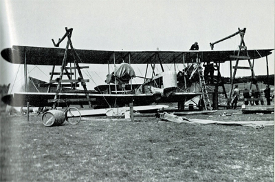
Maritime transport was used to carry the Vickers-Vimy biplane to Newfoundland on May 4th. It was assembled in Newfoundland. « The reporters representing the Daily Mail, the New York Times, and the New York World were often of assistance when extra manpower was required. » (p.61).
While the aircraft was being built, there were more and more visiters coming to the site. Brown says : « Although we remained unworried so long as the crowd contented itself with just watching, we had to guard against petty damage. The testing of the fabric’s firmness with the point of an umbrella was a favourite pastime of the spectators […]. » (p.61)
The Vickers-Vimy is being reassembled at Quidi Vidi in Newfoundland.
It was difficult to find a field that could be improvised into an aerodrome : « Newfoundland is a hospitable place, but its best friends cannot claim that it is ideal for aviation. The whole of the island has no ground that might be made into a first-class aerodrome. The district around St.John’s is especially difficult. Some of the country is wooded, but for the most part it shows a rolling, switchback surface, across which aeroplanes cannot taxi with any degree of smoothness. The soil is soft and dotted with boulders, as only a light layer covers the rock stratum. Another handicap is the prevalence of thick fogs, which roll westward from the sea. » (p.59)
They flight tested the airplane on June 9th at Quidi Vidi. During the short flight, the crew could see icebergs near the coast. They did a second trial on June 12th and found that the transmitter constantly caused problems. But, at least, the engines seemed to be reliable…
The departure
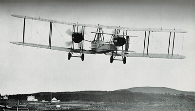
The two men left Newfoundland on June 14th 1919. In order to fight the cold air in flight, they wore electrically heated clothing. A battery located between two seats provided for the necessary energy.
The Vickers-Vimy departs from Newfoundland in 1919
The short take-off was very difficult due to the wind and the rough surface of the aerodrome. Brown writes : « Several times I held my breath, from fear that our under-carriage would hit a roof or a tree-top. I am convinced that only Alcock’s clever piloting saved us from such an early disaster. » (p.73)
It took them 8 minutes to reach 1000 ft. Barely one hour after departure and once over the ocean, the generator broke and the flight crew was cut off from all means of communication.
As the airplane consumed petrol, the centre of gravity changed and since there was no trim on the machine, the pilot had to exert a permanent backward pressure on the joystick.
Flying in clouds, fog and turbulence.
During the flight with much clouds and fog, Brown, having almost no navigation aid, had real problems to estimate the aircraft’s position and limit the flying errors. He had to wait for a higher altitude and for the night to come to improve his calculations : « I waited impatiently for the first sight of the moon, the Pole Star and other old friends of every navigator. » (p.84). The fog and clouds were so thick that at times they « cut off from view parts of the Vickers-Vimy. » (p.95)
Without proper instruments to fly in clouds, they were relying on a « revolution-counter » to establish the climbing or the falling rate. That is pretty scary. « A sudden increase in revolutions would indicate that the plane was diving; a sudden loss of revs would show that she was climbing dangerously steeply. » (p.176)
But that was not enough. They also had to deal with turbulence that rocked the plane while they could not see anything outside. They became desoriented : « The airspeed indicator failed to register, and bad bumps prevented me from holding to our course. From side to side rocked the machine, and it was hard to know in what position we really were. A spin was the inevitable result. From an altitude of 4,000 feet we twirled rapidly downward.[…]. « Apart from the changing levels marked by aneroid, only the fact that our bodies were pressed tightly against the seats indicated that we were falling. How and at what angle we were falling, we knew not. Alcock tried to centralise the controls, but failed because we had lost all sense of what was central. I searched in every direction for an external sign, and saw nothing but opaque nebulousness. » (p.88)
« It was a tense moment for us, and when at last we emerged from the fog we were close down over the water at an extremely dangerous angle. The white-capped waves were rolling along too close to be comfortable, but a quick glimpse of the horizon enabled me to regain control of the machine. » (p.40).
De-icing a gauge installed outside of the cockpit.
Snow and sleet were falling. They didn’t realize how lucky they were to continue flying in such a weather. Nowadays, there are many ways to dislodge ice from a wing while the aircraft is in flight. Here is what Brown says about their situation : « […] The top sides of the plane were covered completely by a crusting of frozen sleet. The sleet imbedded itself in the hinges of the ailerons and jammed them, so that for about an hour the machine had scarcely any lateral control. Fortunately, the Vickers-Vimy possesses plenty of inherent lateral stability; and, as the rudder controls were never clogged by sleet, we were able to hold to the right direction. » (p.95)
After twelve hours of flying, the glass of a gauge outside the cockpit became obscured by clotted snow. Brown had to deal with it, while Alcock was flying. « The only way to reach it was by climbing out of the cockpit and kneeling on top of the fuselage, while holding a strut for the maintenance of balance. […] The violent rush of air, which tended to push me backward, was another discomfort. […] Until the storm ended, a repetition of this performance, at fairly frequent intervals, continued to be necessary. » (p.94)
In order to save themselves, they executed a descent from 11,000 to 1000 feet and in the warmer air the ailerons started to operate again. As they continued their descent below 1000 feet over the ocean, they were still surrounded by fog. They had to do some serious low altitude flying : « Alcock was feeling his way downward gently and alertly, not knowing whether the cloud extended to the ocean, nor at what moment the machine’s undercarriage might touch the waves. He had loosened his safety belt, and was ready to abandon ship if we hit the water […]. » (p.96)
The arrival.
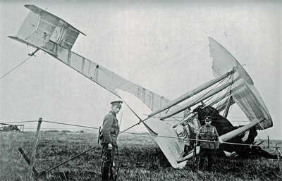
They saw Ireland at 8.15 am on June 15th and crossed the coast ten minutes later. They did not expect a very challenging landing as the field looked solid enough to support an aircraft. They landed at 8 :40 am at Clifden on top of what happened to be a bog; the aircraft rolled on its nose and suffered serious material damages. The first non-stop transatlantic flight ended in a crash. Both both crewmen were alive and well, although they were dealing with fatigue…
The transatlantic flight ends up in Ireland in a soft field
Initially, nobody in Ireland believed that the plane arrived from North America. But when they saw mail-bags from Newfoundland, there were « cheers and painful hand-shakes » (p.102).
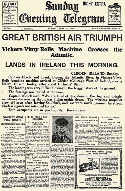
First page of the Sunday Evening Telegraph in 1919.
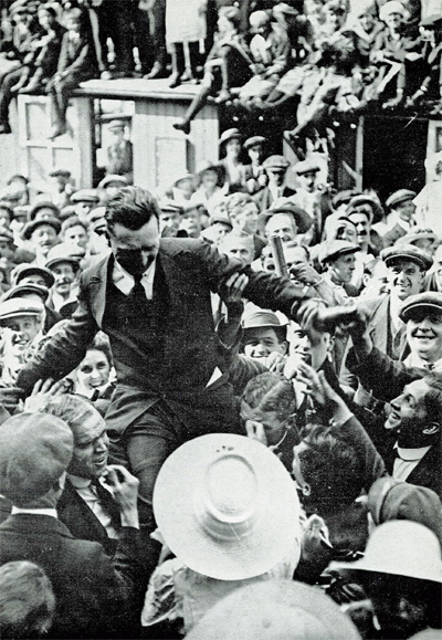
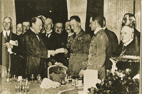
They were cheered by the crowds in Ireland and England and received their prize from Winston Churchill.
John Alcock chaired by the crowd
Winston Churchill is presenting the Daily Mail Check to the two pilots.
Their record stood unchallenged for eight years until Lindbergh’s flight in 1927.
The future of transatlantic flight.
Towards the end of the book, the authors risk a prediction on the future of transatlantic flight. But aviation made such a progress in a very short time that, inevitably, their thoughts on the subject was obsolete in a matter of a few years. Here are some examples :
« Nothwithstanding that the first two flights across the Atlantic were made respectively by a flying boat and an aeroplane, it is evident that the future of transatlantic flight belongs to the airship. » (p.121)
« […] The heavy type of aeroplane necessary to carry an economical load for long distances would not be capable of much more than 85 to 90 miles an hour. The difference between this and the present airship speed of 60 miles an hour would be reduced by the fact that an aeroplane must land at intermediate stations for fuel replenishment. » (p.123)
« It is undesirable to fly at great heights owing to the low temperature; but with suitable provision for heating there is no reason why flying at 10,000 feet should not be common. » (p.136)
The Air Age.
There is a short section in the book on the « Air Age ». I chose two small excerpts on Germany and Canada :
On Germany’s excellent Zeppelins : « The new type of Zeppelin – the Bodensee – is so efficient that no weather conditions, except a strong cross-hangar wind, prevents it from making its daily flight of 390 miles between Friedrichshafen and Staalsen, thirteen miles from Berlin. » (p.140)
On Canada’s use of aeroplanes : « Canada has found a highly successful use for aeroplanes in prospecting the Labrador timber country. A group of machines returned from an exploration with valuable photographs and maps of hundreds of thousands of pound’s worth of forest land. Aerial fire patrols, also, are sent out over forests.» (p.142) and « Already, the Canadian Northwest Mounted Police [today the RCMP] have captured criminals by means of aeroplane patrols. » (p.146)
Conclusion
The Manchester Guardian stated, on June 16th 1919 : « […] As far as can be foreseen, the future of air transport over the Atlantic is not for the aeroplane. It may be used many times for personal feats of daring. But to make the aeroplane safe enough for business use on such sea routes we should have to have all the cyclones of the Atlantic marked on the chart, and their progress marked in from hour to hour. »(p.169)
Title : Our Transatlantic Flight
Authors : Sir John Alcock and Sir Arthur Whitten Brown
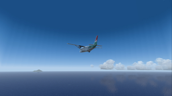
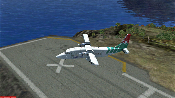
In the unhinged virtual flights section of my blog, you can now find a flight with the Shorts 360 between the St.Maartens (Princess Juliana Intl) airport and the Juancho E. Yrausquin (SABA, SAB or TNCS) airport.
The Shorts 360 at the Princess Juliana Intl, ready for take-off for the Juancho E. Yrausquin airport.
The Juancho E. Yrausquin is normally used by a DHC-6, a BN-2 and some helicopters.
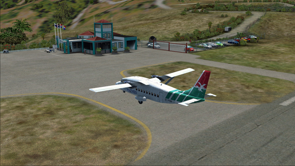
The Shorts 360 is airborne from the Princess Juliana Intl airport.
The island is in sight…
The Shorts 360 and the Saba island in sight.
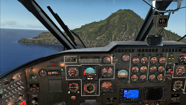
The official landing and take-off distances required for the Shorts 360 are longer than what the Juancho E. Yrausquin (SAB), with its 1299 ft short runway, has to offer.
But for the flight simulation enthousiast (FSX), SABA offers an interesting challenge since a very well adjusted approach, at about 90 knots, is necessary in order to use only the authorized part of the runway.
Le Shorts 360 and the SABA island.
Runway 12 in sight, on the extreme left side of the photo. The speed and altitude are adjusted.
The approach is made on runway 12. The winds blow from 180/07. The approach is made with full flaps.
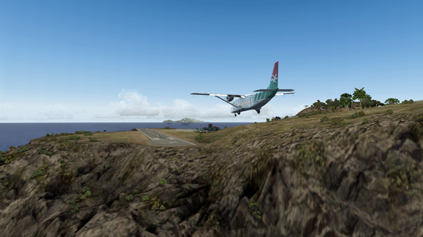
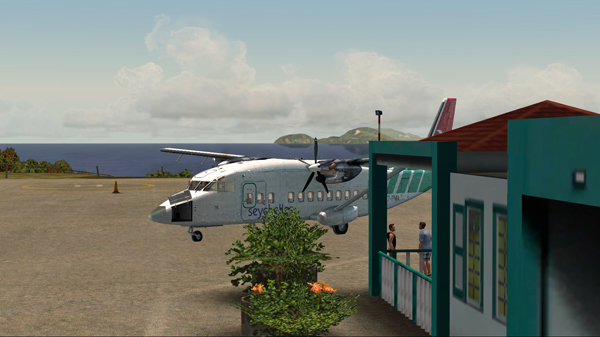
The Shorts 360 is on short final for runway 12 at the Juancho E. Yrausquin airport.The Shorts 360 is about to land at the SABA airport.
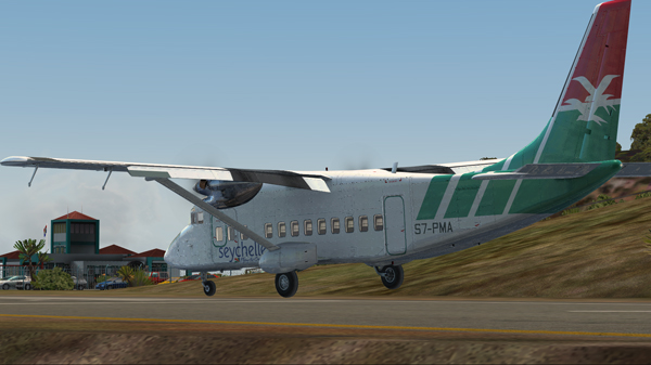
The aircraft is immobilized within the authorized portion of the runway. The rest of the runway is used to turn around and head for the apron.
The Shorts 360 after its landing on runway 12 at the Juancho E. Yrausquin airport.The Shorts 360 is exiting runway 12 at the Juancho E. Yrausquin airport.The Shorts 360 is parked at the Juancho E. Yrausquin airport.
The Shorts 360 can also barely leave the airport using the authorized portion of the runway. The speed on take-off varies between 100 and 110 kts and the flaps are adjusted to 2/3.
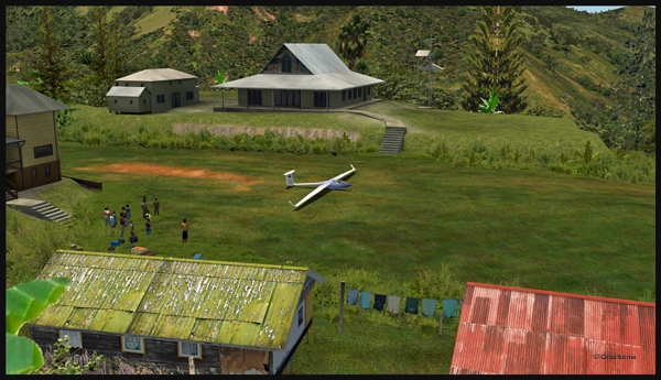
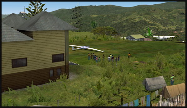
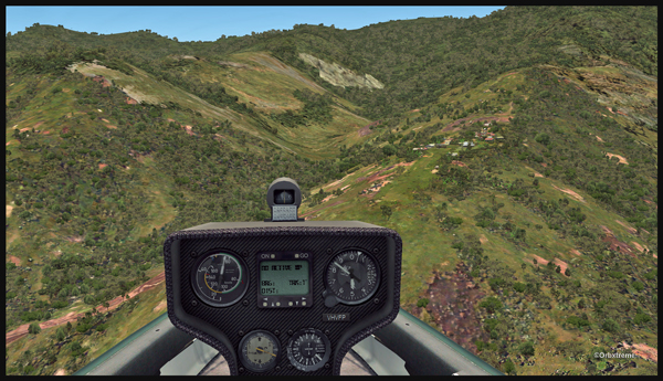
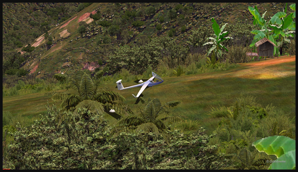
Well, that is it! The first glider just arrived at the Fane Parish airport in Papua New Guinea…
Glider on the Fane Parish short grass runway in Papua New Guinea.
Before it is officially offered as a tourist attraction for the region, some attempts at taking-off and landing must be done. The first trial attracts a few people!
Aircraft and glider on the Fane Parish mountain airfield.
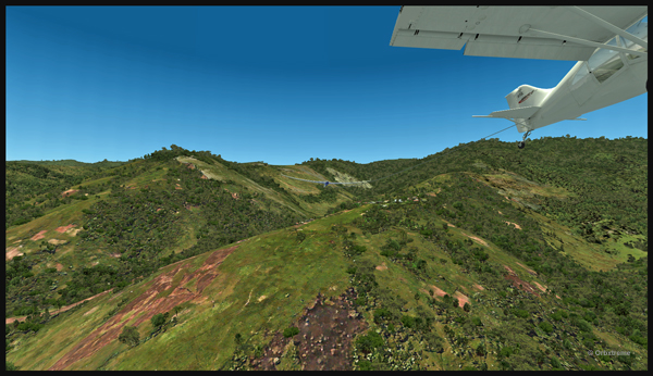
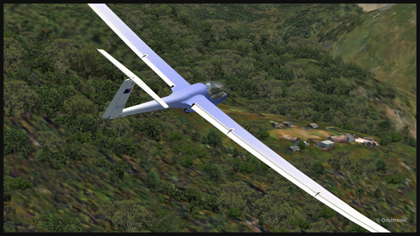
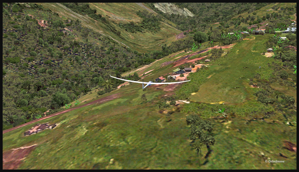
The descent along the twelve degree sloped runway is a bit rough for the glider’s low wings, as there are some bushes that will have to be trimmed!
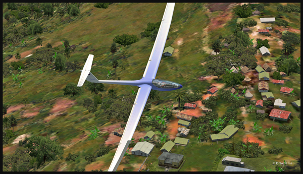
An aircraft pulls a glider after the take-off from the Fane Parish sloped runway in Papua New Guinea.
The weather is nice and very warm. The only potential problem is the mountain ahead.
Glider being towed by an aircraft after the take-off from the Fane Parish mountain airfield.
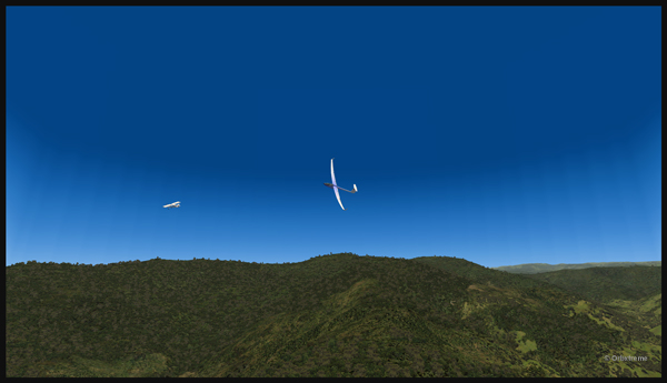
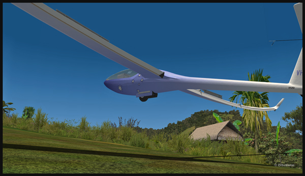
Finally, the pilot cuts the link. He is free to go!
The link is cut between the plane and the glider after the take-off from Fane Parish.
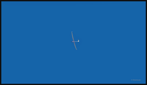
The glider flies silently over the lush area of Papua New Guinea.
Virtually gliding over the Papua New Guinea territory (FSX).
Using the rising warm air currents, the glider gains altitude.
The glider gains altitude.
Why not a pass over Fane?
Gliding over the Fane Parish village.
Here is another isolated village alongside a mountain.
Flight with a virtual glider over an isolated village of Papua New Guinea.
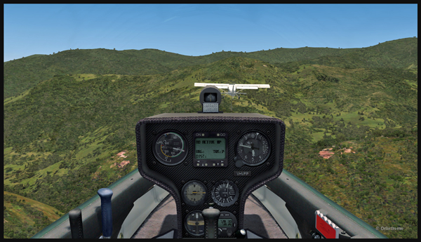
A last steep turn in order to realign for the approach at Fane Parish.
Last steep turn for a short landing on the Fane Parish mountain sloped runway.
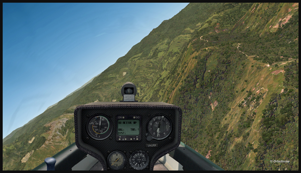
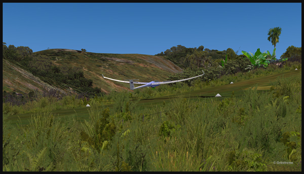
The airbrakes are out and the speed reasonable. The sloped runway is just ahead, on top of the mountain to the right.
Approach of a glider on the elevated airfield at Fane Parish in Papua New Guinea. The speed and angle of approach are right on target.
Keeping just enough altitude on the approach to be safe.
Glider approaching the 12 degree sloped runway of the Fane Parish aerodrome.
Now that the landing is a sure thing, it is time to use the airbrakes again to slow down as much as possible.
Virtual glider arriving over the Fane Parish runway in Papua New Guinea. The airbrakes are being used.
Keeping in mind that this mountain airfield as a good slope, it is better to have a bit of extra speed. Nobody likes to stall a few feet over a runway!
Virtual glider with airbrakes over the Fane Parish runway
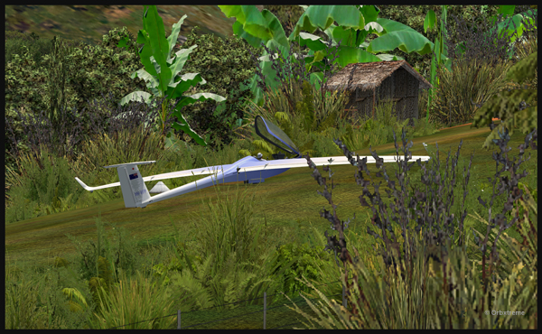
What an experience it was! But I’ll need some help to pull the glider up the slope!
Glider on the Fane Parish runway
The virtual flight was great, the view was worth every penny, and I think that this could become a new touristic attraction for the region and the more wealthy visitors…
The glider has landed on the runway at the Fane Parish airport in Papua New Guinea.
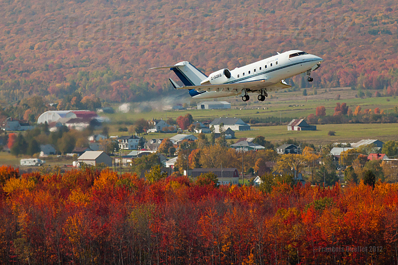
Government of Quebec Challenger CL-600 C-GQBQ airborne from the Québec Jean-Lesage international airport
I return in the past with this photo of the Governement of Quebec Challenger 600 C-GQBQ. It is seen here after the take-off from the Quebec Jean-Lesage international airport. The picture was taken during fall 2012 with a Canon 5D MKII full frame camera, from the stairway surrounding the Quebec control tower.
With regards to photographic composition, the rule of thirds can be detected in the two wooden zones in the background, one at the top and the other at the bottom of the photo. The aircraft’s position in the frame happens to also meet the same rule of thirds.
I used the spectacular colors of fall to add some interest to the scene.
The reason for the delays and the positive side for the consumers
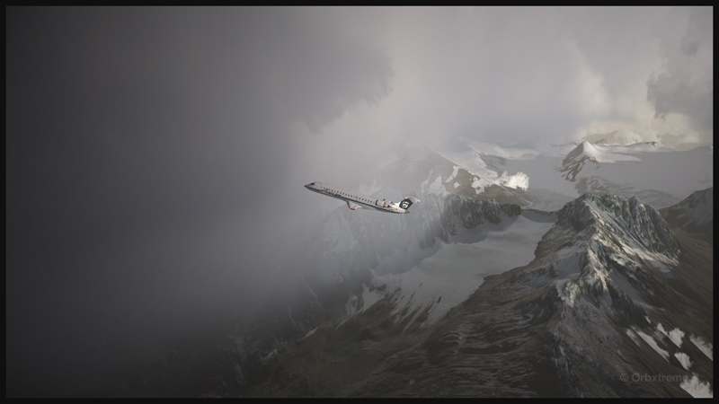
A virtual Bombardier regional jet CRJ-900ER (Aerosoft) with the Alaska Airlines colors is climbing after its departure from the Valdez virtual airport in Alaska (ORBX).
Digital Aviation & Aerosoft have finally completed their long awaited project to make a virtual CRJ-900ER and CRJ-700ER Bombardier regional jets. Months later than expected, the flight simulation enthusiasts can now try those two new virtual aircrafts. The CRJ is mostly used to link smaller airports and remote areas to the main hubs. The aircraft can rapidly reach its cruising altitude and stay there a long time, but it is not intended to be a really fast aircraft.
The company explains that, since the beginning, it had underestimated the complexity of the project and, because of ongoing delays, ended up having to catch up with the competition. In order to offer a superior product than the competition, Digital Aviation and Aerosoft had to review what it initially considered as an almost completed project.
Virtual CRJ-700ER aircraft (Aerosoft) with the Alaska Airlines colors airborne from the Valdez virtual airport (ORBX)
The CRJ-900ER and CRJ-700ER had their exterior almost completely redone; the consumer now ends up with a much better looking aircraft. The project manager says that it is only due to the patience and kindness of potential customers that the project was saved. It pays to be nice!
The first flight with the CRJ
Virtual CRJ-900ER aircraft with the Air Nostrum colors departing the St. Maarten international airport (Fly Tampa St.Maarten)
For the first flight, the manual recommends to first choose and activate one of the default FSX aircraft with the engine running. The pilot then selects the CRJ of his choice. It seems that doing so will prevent a lot of problems.
The virtual 2D cockpit
The virtual 2D cockpit helps save a few FPS. An easy access to the different sections of the cockpit is available since it is divided in several logical panels numbered from 1 to 9.
Navigation
The virtual pilot has access to an updated NavDataPro (May 2017) database for air navigation. It is the world’s most used database in aircraft. The aircraft is also compatible with the popular Navigraph database.
How does a standard computer deals with the new CRJ?
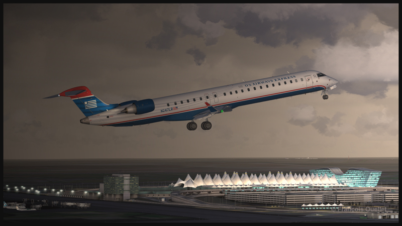
Virtual CRJ-900ER aircraft (Aerosoft) with the U.S. Airways colors airborne from the Denver International airport (Flightbeam Studios)
I have flown both aircrafts on several virtual airports like St. Maarten (Fly Tampa St. Maarten), Montreal international (Fly Tampa Montreal), Denver international (Flightbeam Studios) and Valdez (ORBX) without problems with regards to the computer’s processors and FPS. It was certainly out of question to try to land at the Courchevel airport (LLH Creations), with its short sloped runway, but a low pass at high speed caused no stutters.
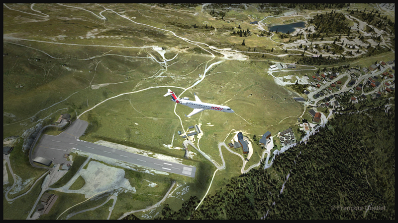
A virtual CRJ-700ER aircraft (Aerosoft) with the Air France HOP colors is in flight over the Courchevel virtual airport in France (LLH Creations)
Flying the CRJ at low speed
The CRJ offers a good margin of manoeuver when it comes to flying at low speed. But due to the position of the engines, the aircraft’s nose will raise rapidly when the throttle is brought back to idle. In a constant and progressive descent, that does not cause a problem. But if the manoeuver is done on short final when the aircraft is still above 50 feet, the rapid change in the aircraft’s attitude could induce a stall.
The air brakes
One cannot rely too much on the air brakes to slow down the CRJ. They have limited efficiency, both for the virtual and the real aircraft.
Floating tendency
If the aircraft arrives over the threshold at a higher speed than recommended, it will float for a long distance before finally touching down.
Landing and take-off distances
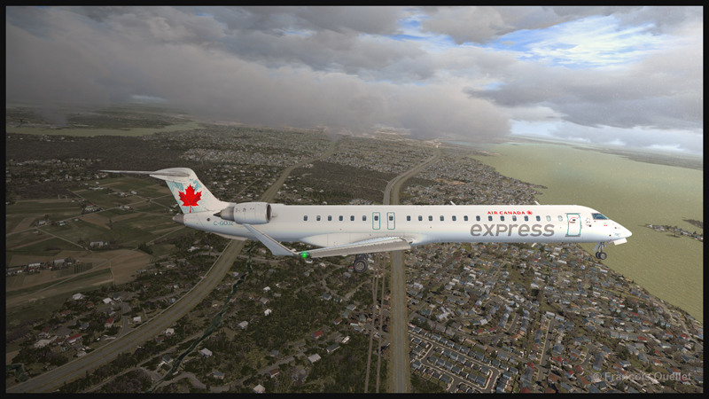
A virtual CRJ-900ER aircraft with the Air Canada colours (Aerosoft) is approaching the Montreal Pierre-Elliott-Trudeau virtual airport (Fly Tampa Montreal)
The CRJ-900 and CRJ-700 operate on relatively short runways. The CRJ-700 needs 5040 feet for take-off (at maximum weight) and landing, under the standard ICAO conditions. The CRJ-900 requires 6060 feet for take-off and 5260 feet for landing. The maximum range has been established to be around 1300 and 1400 nm.
Managers that facilitate the use of the CRJ
For the CRJ, Digital Aviation & Aerosoft have created managers that allow choosing the number of passengers, cargo, as well as calculating the fuel weight, the center of gravity and the amount of trim required. There is even a FS2 Crew option if desired. Another manager facilitated the addition of liveries.
The flight simulation enthusiasts had been anticipating the arrival of that regional jet for a long time; some did not believe anymore that it would one day become a reality (that includes the company too!). The flight simmers now have access to a world class and high quality regional jet.
For more articles on flight simulation on my web site, click on the following link : Flight simulation
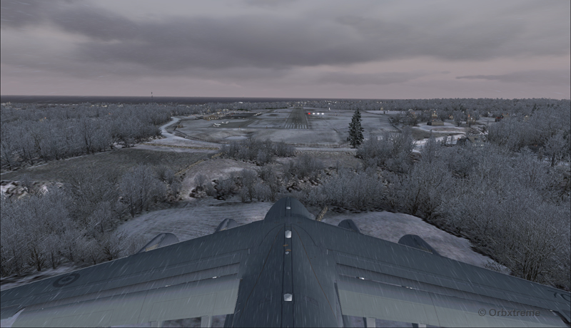
Alex Geoff, the ORBX Block Island (KBID) virtual airport designer, asked flight simulator enthousiasts to try to operate the biggest aircraft possible on that airport ‘s 2502 ft runway.
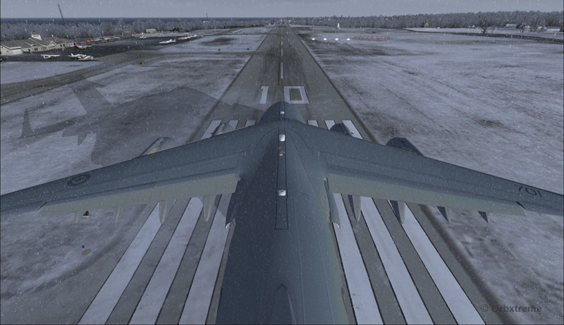
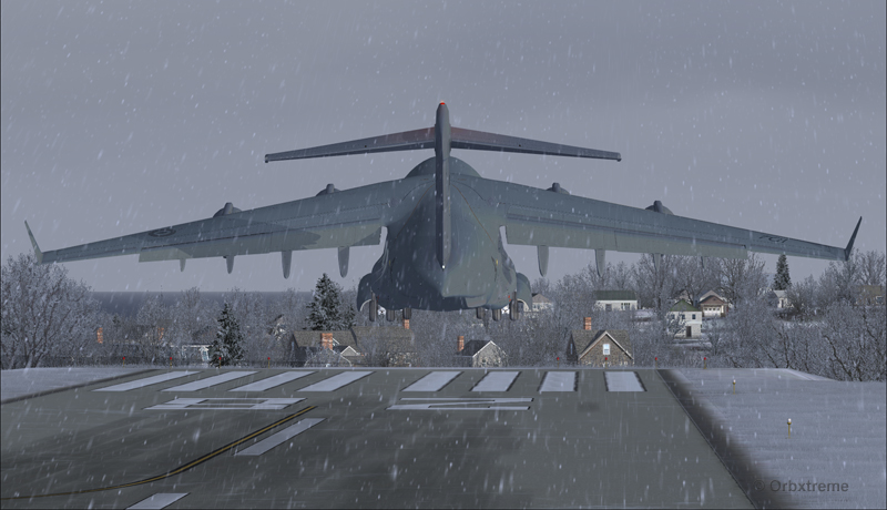
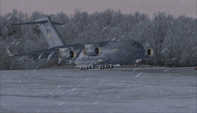
Canadian military aircraft C17-A ready for take-off runway 10 at the Block Island (KBID) virtual airport in United States (FSX)
Naturally, we are talking about a virtual flight. You must then forgive the landing of an aircraft which, in real life, would destroy the runway. You also have to disregard the fact that numerous trees would have to be chopped if the aircraft would elect to use the taxiway. I was almost forgetting the pilots and airport manager that would have to be fired following the authorized manoeuver.
The context of the flight having been presented, here is the data that will allow flight simulator enthousiasts to replicate the circuit around the Block Island airport with a Virtavia C-17A.
Contrary to the Cessna type aircrafts normally evolving around the airport, the total weight of the canadian military C-17A used for the flight was 405,000 pounds. The fuel was adjusted to 50% in all four tanks. Both pilots agreed to skip lunch in order to avoid adding any extra weight to the beast…
Flaps were adjusted to 2/3. I backed the aircraft to the beginning of the runway, applied the brakes, applied full throttle, waited for maximum regime, released the brakes and used ground effect to lift the aircraft before it was too late. The take-off was done on runway 10 with a 12 kts and 70 degree crosswind.
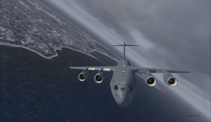
Canadian military aircraft C17-A airborne runway 10 at the Block Island (KBID) virtual airport in United States (FSX)
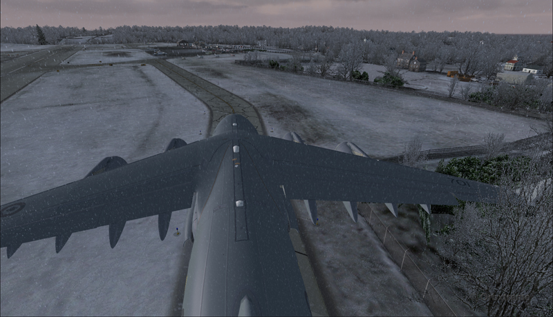
Then, four right turns were made : 190°, 280°, 010° and 100°. During the flight, the aircraft’s altitude never went above 2000 feet.
Canadian military aircraft C17-A turning downwind runway 10 at the Block Island (KBID) virtual airport in United States (FSX)
Wheels and flaps were brought down in base so that I did not have to make serious adjustments on final.
Canadian military aircraft C17-A turning base runway 10 at the Block Island (KBID) virtual airport in United States (FSX)
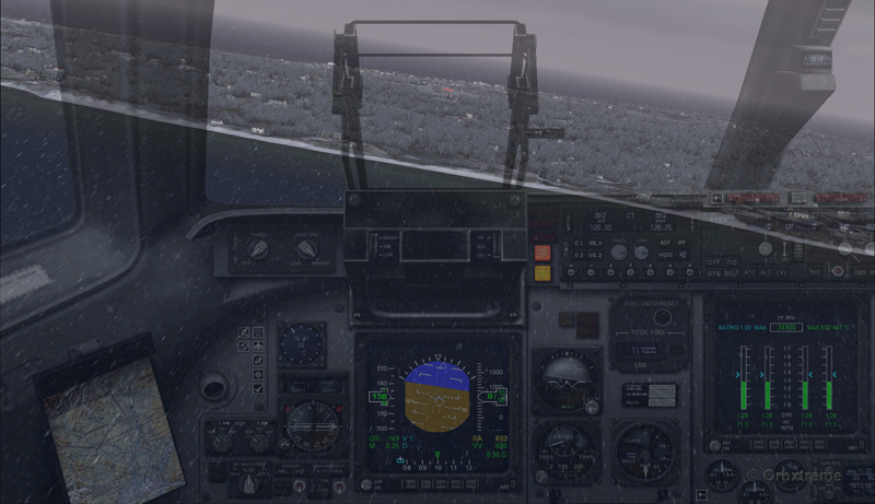
Canadian military aircraft C17-A on long final runway 10 at the Block Island (KBID) virtual airport in United States (FSX)
Canadian military aircraft C17-A short final runway 10 at the Block Island (KBID) virtual airport in United States (FSX)
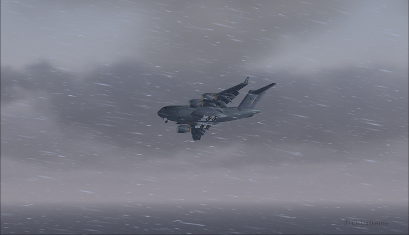
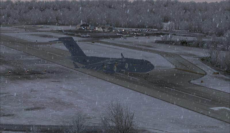
The speed eventually went down to 128 kts and, while the aircraft was still about two feet in the air, I used the airbrakes. The thrust reversers were fully activated two feet before touch-down (continued pressure on F2) since they take time to rev up. That is not necessarily the proper way to do it and you can wait one more second, until the wheels touch the runway, to use the reversers. The main gear touched at the very beginning of the runway and maximum breaking was then applied.
Canadian military aircraft C17-A landing at the Block Island (KBID) virtual airport in United States (FSX)
It was possible to exit on the taxiway without having to back-track on the runway. The environment always coming second, some trees were cut so that there were no contacts with the aircraft.
Canadian military aircraft C17-A exiting runway 10 at the Block Island (KBID) virtual airport (FSX) in United States
Canadian military aircraft C17-A taxiing at the Block Island (KBID) virtual airport (FSX) in United States
If you decide to try it out, think of saving the flight when you are on final, in case you are not satisfied with your performance during the landing (scrapped aircraft, destroyed houses and vehicles in the neighborhood, burned forest at the end of runway 10, collateral victims, etc.).
Canadian military aircraft C17-A at the Block Island (KBID) virtual airport (FSX) in United States
Good luck!
For other challenging virtual flights, head towards the flight simulation section of the present web site.
For more articles on flight simulation on my web site, click on the following link : Flight simulation