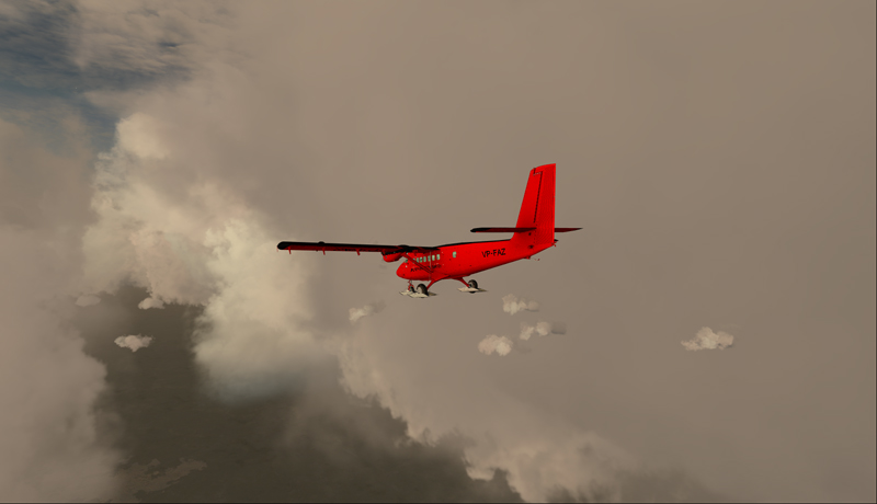
The sixth leg of this world tour of flight simulation continues with a journey from the Molde (ENML) airport to the Sandane/Anda (ENSD) airport in southern Norway.
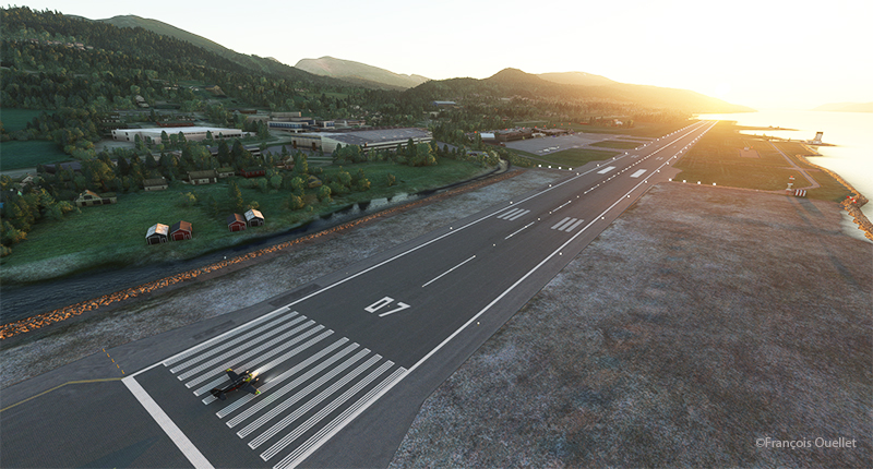
Ready for departure from Molde (ENML) virtual airport to Sandane (ENSD) airport.
The destination can’t accommodate a private jet like the Cessna Citation Longitude, as runway 08/26 is only 3182 feet long. A good old light twin-engine plane, repainted a hundred times over, will have to be rented for the trip, and we’ll just have to hope the engines hold out.
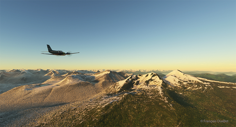
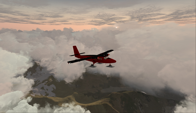
Enroute to the virtual Sandane airport (ENSD) in Norway with Microsoft Flight Simulator
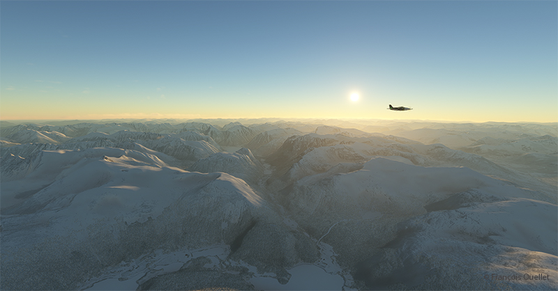
The mountains of Norway come into view, and the ascent continues gradually to ensure that the highest peaks along the route pose no problems.
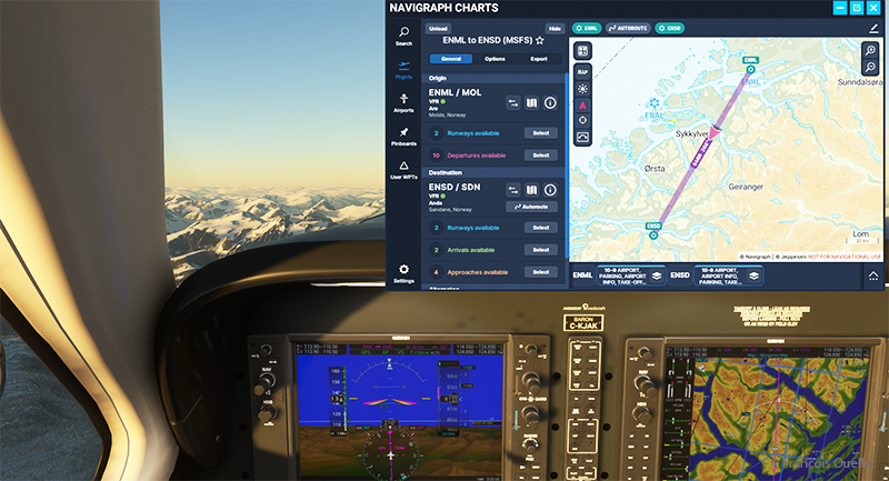
The navigraph tool for flight simulation and the VFR map from ENML to ENSD.
Above, a view of the aircraft’s instrument panel as it climbs, with a Navigraph map showing the route flown in visual flight. Virtual weather is integrated in real time whenever a new weather report is issued by a ground observation station around the world.
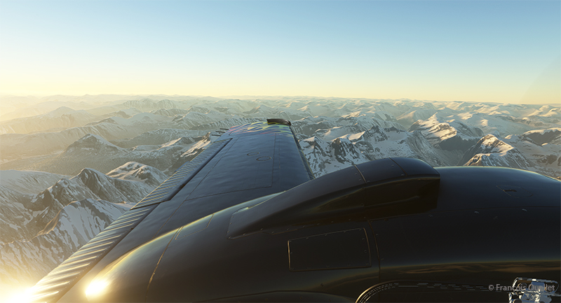
View of the Norwegian mountains from the pilot seat
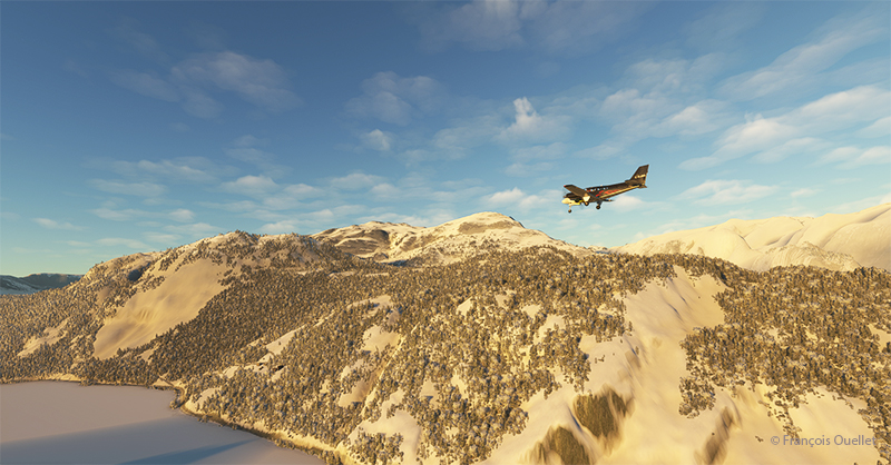
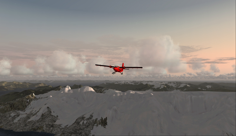
Morning sun over the Norwegian mountains with Microsoft Flight Simulator.
Another sunrise view that brings Norway’s magnificent mountain landscape to life.
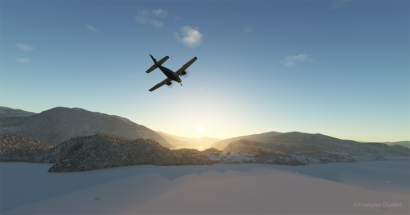
Approaching the Sandane virtual airport in flight simulation.
We are now almost at our destination. The plane is in left base for runway 08 at Sandane/Alda airport.
Turning final for runway 08 at Sandane (ENSD) virtual airport in Norway.
Over the still-frozen Innvikfjorden, the final turn is made to stabilize the aircraft on final runway 08. On short final, there’s a cliff just short of threshold 08, and a difference in runway height to take into account for the landing.
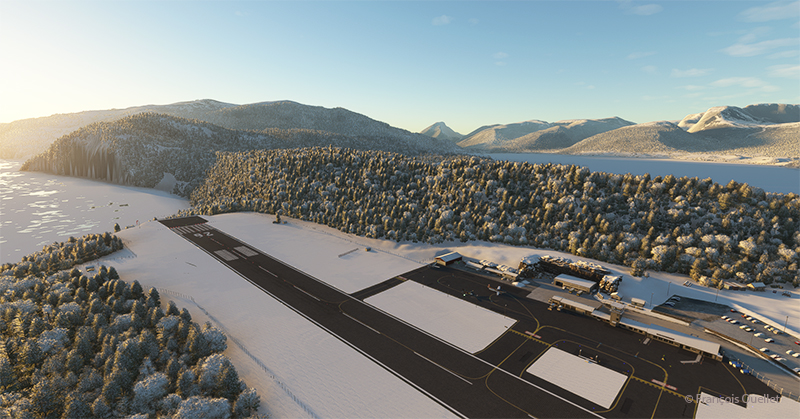
View of the Sandane (ENSD) virtual airport with Microsoft Flight Simulator.
Above, a view of the Sandane/Alda virtual airport (ENSD) using Microsoft Flight Simulator. There is no margin for error, as the two runway thresholds are bordered by a cliff and a stretch of water.
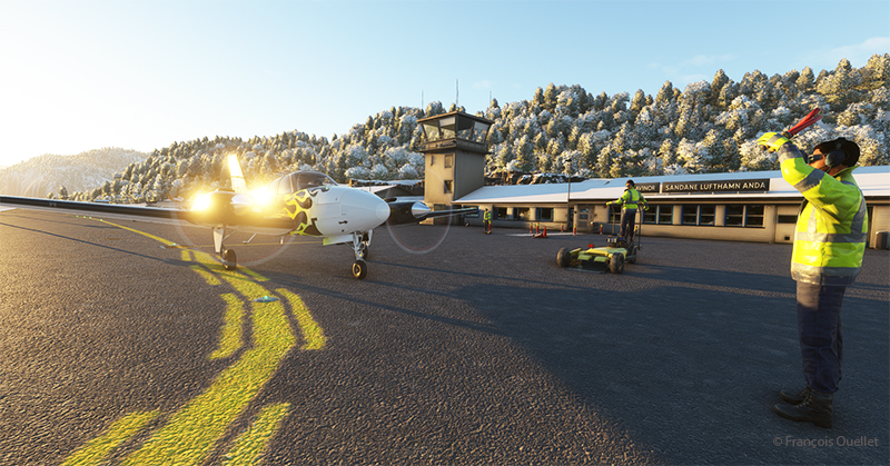
Help for parking is offered at the Sandane (ENSD) virtual airport in Norway.
Service at the airport is excellent. Two employees are waiting to help us park our aircraft.
Sandane is known for its magnificent panoramas, waterfalls, Briksdalsbreen glacier and horseback riding. The village is nestled inland from the Gloppe Fjord. If you’re traveling there in summer, you’ll need to be prepared for a fair amount of precipitation.
The next flight is from Sandane to Stockholm-Bromma in Sweden with a Beechcraft King Air 350I which has not flown for a long time. We’ll have to fly over the high mountains of the Jostedalsbreen Nasjonalpark before reaching our destination.
Decades ago, Canadian authorities used this island in the middle of the St. Lawrence River as a quarantine site for immigrants arriving in Canada. Many Irish people, among others, made an obligatory stop on this strip of land before being allowed to continue their journey to Canada.
At one time, a section of the island was reserved for Canadian and American researchers for their top secret research on Anthrax.The most amazing thing about reading the article is realizing that the entire production of this bacteriological weapon (439 liters) was mixed with formaldehyde and put in barrels that were dumped somewhere in the St. Lawrence River when it was decided that it would no longer be useful, as the Second World War took a turn in favor of the Allies. It seems to me that formaldehyde does not prevent barrels from rusting, but hey… back to the point.
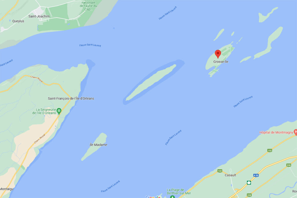
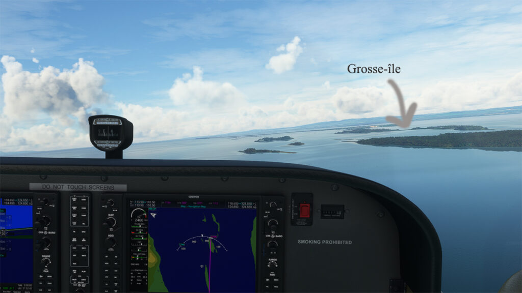
Where is Grosse-Île located? In the province of Quebec, a little east of Quebec City. It is one of the many islands that you can fly over once you have left Île d’Orléans behind. Below, a screenshot from Google Maps.
Grosse-Île in Quebec on Google Maps.
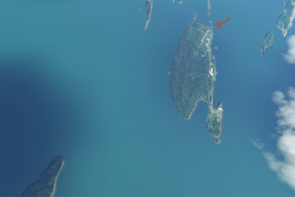
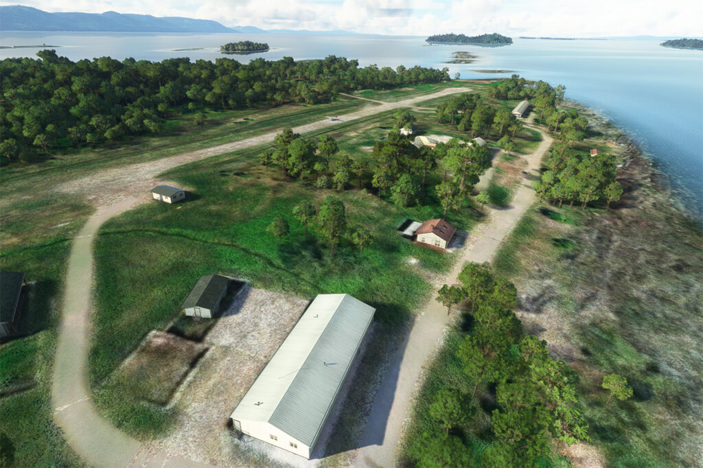
The satellite image below clearly shows that this is not an invention. Microsoft designates this runway as CYMN Montmagny: a mistake that one can easily live with, since by giving an official code to this Grosse-Île runway, the pilot can use it as a navigation point in his GPS.
Satellite view of Grosse-Île and its runway.
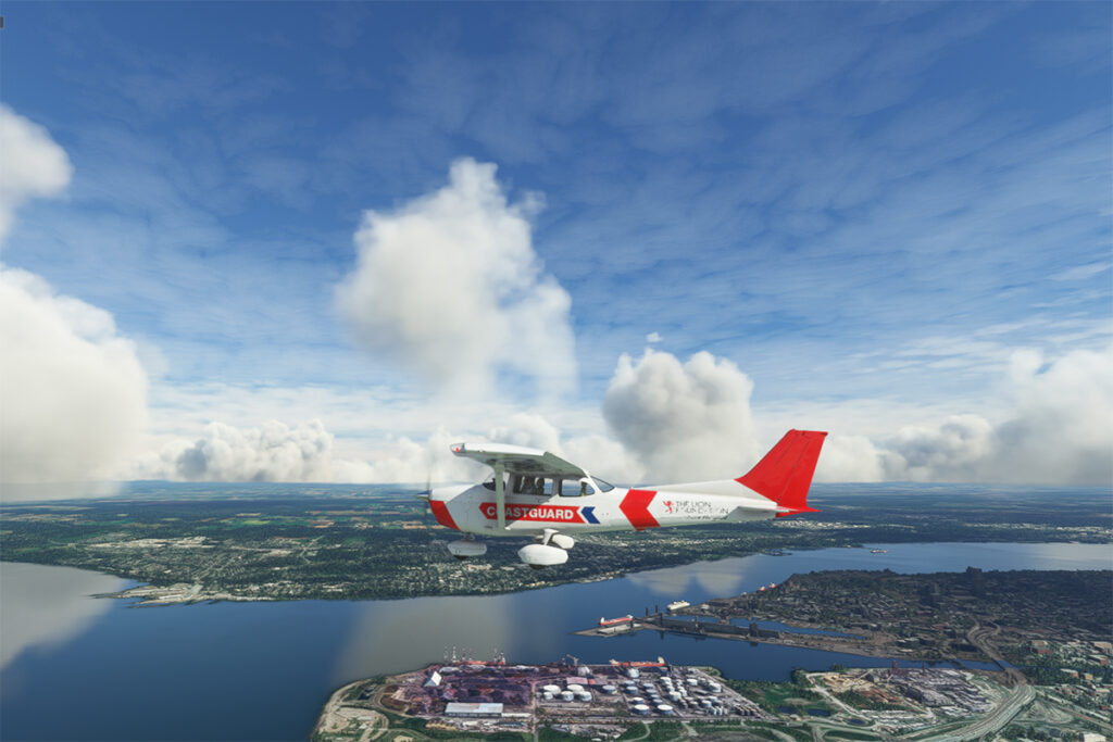
So, let’s use a small Cessna in US Coast Guard colors to make a virtual flight from Quebec City airport (CYQB) to Grosse-Île (CYMN). It was a bit chilly on this February day in Quebec City, so I decided to transport us to July for this flight, adding a few cumuliform clouds in the process.
Leaving Quebec City for Grosse-Île with MSFS 2020.
This short flight will allow us to fly over Île d’Orléans, Île Madame (owned by Laurent Beaudoin, former major shareholder of Bombardier), Île au Ruau (purchased in 2019 by the rich owner of the Gildan empire) to finally arrive at Grosse-Île.
Approaching Grosse-Île over the St Lawrence Seaway with the MSFS 2020 flight simulator.
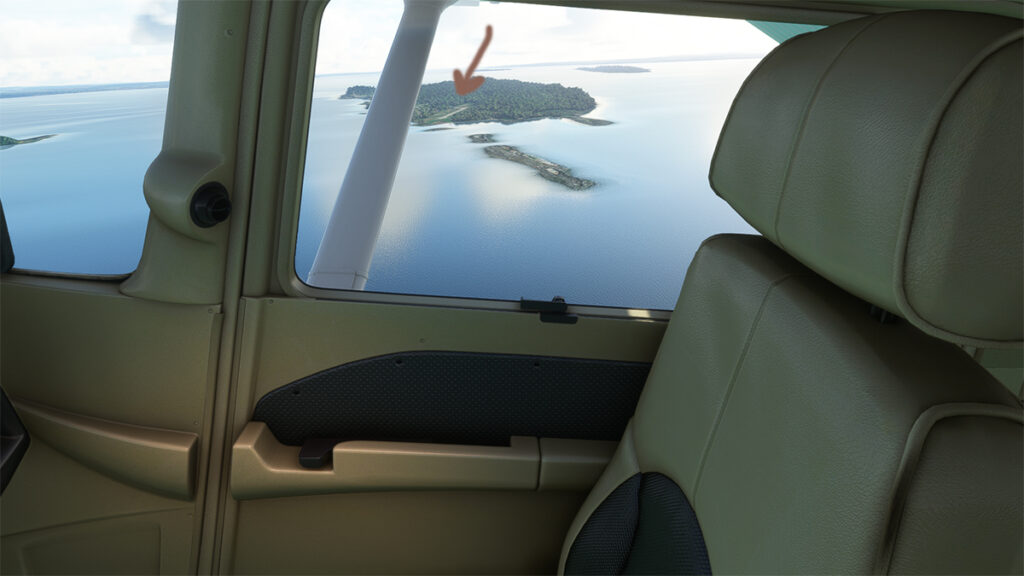
The picture below shows the aircraft on a right base for the Grosse-Île runway. I do not know the official dimensions of this dirt airstrip, but it can easily accept a Cessna aircraft such as ours.
Cessna in base for the Grosse-Île runway with the MSFS 2020 flight simulator.
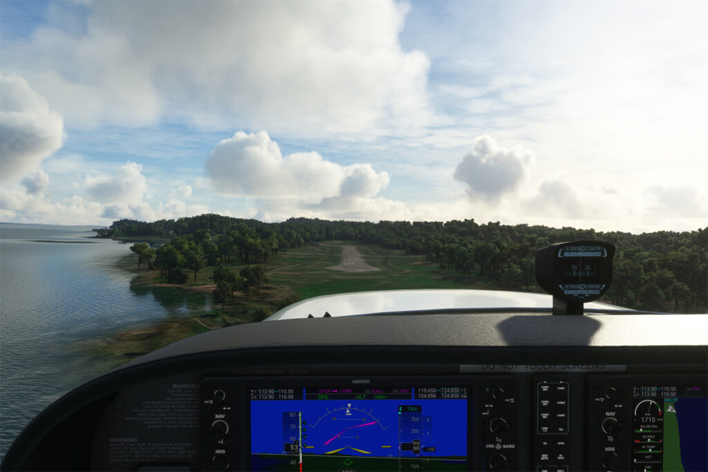
Below, the aircraft is on final for the runway.
On final for the Grosse-Île runway.
A final screenshot shows the Cessna taxiing down the runway after landing. As you can see, the runway can accommodate much larger aircraft. If you want to make a real flight to this island, find out beforehand about the condition of the runway and the restrictions surrounding its use by visiting pilots.
Cessna aircraft on Grosse-Île after the landing.
Click on the link for more flight simulation experiences on my blog.
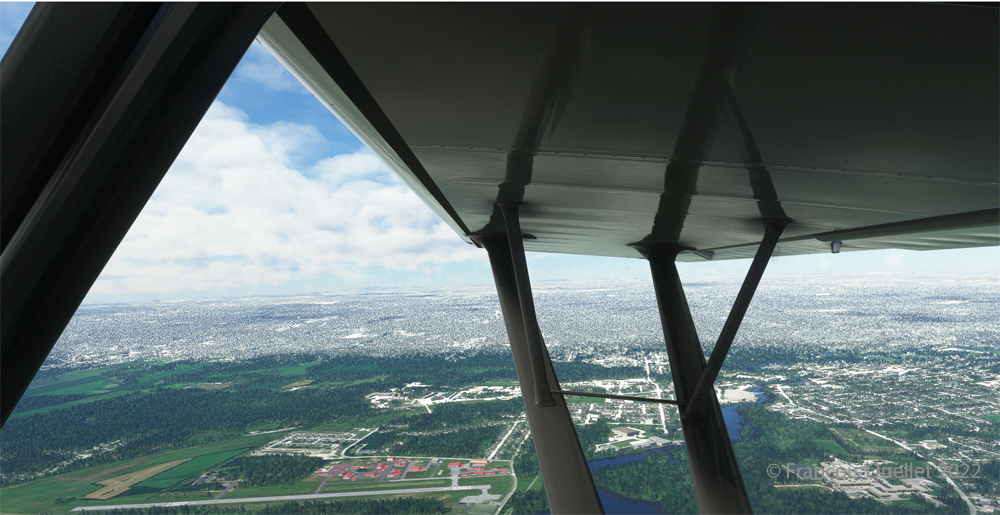
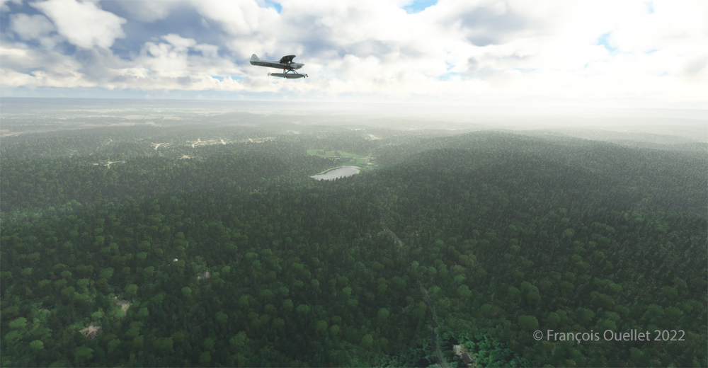
Taking of from Rivière des Mille-Îles near Marina Venise
Today’s flight is part of my blog’s standard virtual flight category. The take-off is from the Mille-Îles River in Quebec. There will be a touch and go at Mirabel (CYMX) and a flight over Quebec and Ontario to the Cascades hydrobase (CTY3).
Towards the Mirabel international airport (CYMX) with the MSFS 2020 flight simulator.
Flying at low altitude towards Mirabel airport, for a touch and go.
The Mirabel (CYMX) runway is in sight.
One of the CYMX runways can be seen straight ahead. If a virtual pilot does not find the runway long enough to do a touch and go, then a refresher course is in order.
Touch and go at the Mirabel airport with MSFS 2020
Takeoff from Mirabel. This is the advantage of an amphibious aircraft; you can land anywhere.
The virtual weather shows the difference between the snow in the north and the green vegetation in the south.
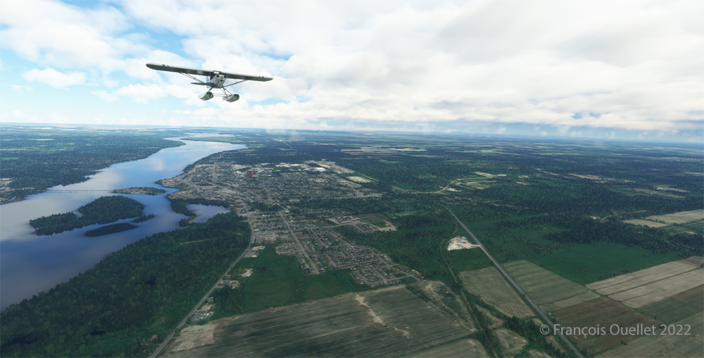
The Lachute airport (CSE4) is visible (buildings in red in the foreground). Flying in April in Quebec allows to notice the demarcation between the still white landscapes (the snow persists) in the north and the areas where everything has already melted.
Over Hawksbury, Ontario, with the MSFS 2020 flight simulator.
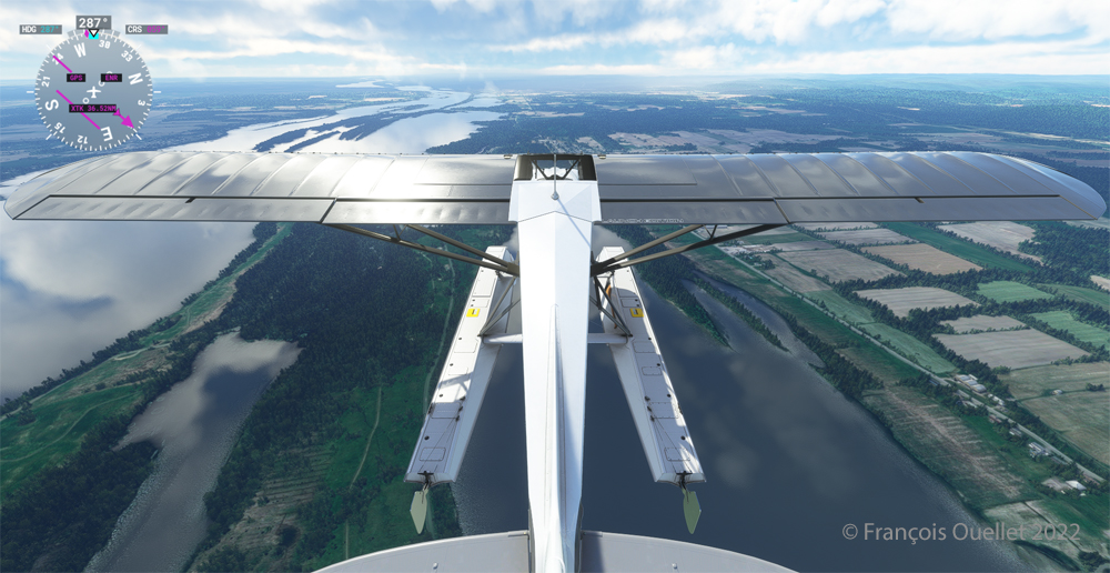
The flight continues to the Cascades waterbase (CTY3). The Ottawa River separates Quebec from Ontario. The aircraft is currently over the town of , Ontario, with Hamilton Island on the left.
Realism of the flight simulation under MSFS 2020
The screenshot above shows the very realistic effect of the virtual landscape, both in terms of the virtual weather, the multiple color tones of the ground and the shading on the ground and on the aircraft caused by the breaks between the clouds.
Overflying the Plaisance National Park in Quebec with MSFS 2020
Descending for 1500 feet. Near Gatineau, the weather conditions deteriorate slightly. But it will be short-lived.
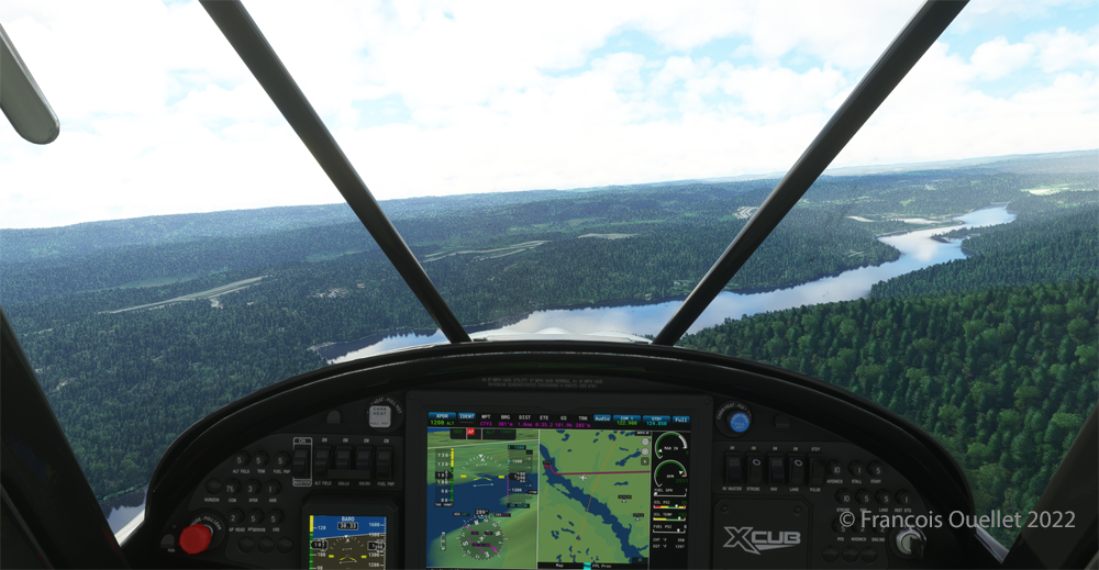
Turning towards the Gatineau river with the MSFS 2020 flight simulator.
Right turn for a water landing on the Gatineau River. The destination is in sight.
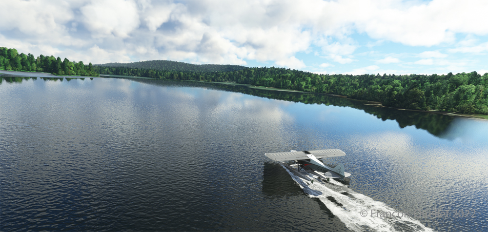
Water landing of the Gatineau river near the Wakefield hydrobase (CTY3)
The plane progresses slowly towards the hydrobase.
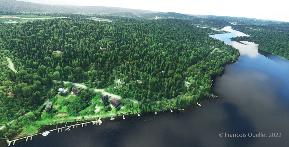
Aerial view of the Wakefield hydrobase (CTY3) with MSFS 2020
There is not yet a virtual waterbase worthy of the name for Cascades under Microsoft. At low altitude, the virtual pilot notes that he is only flying over a photo with aircraft footprints. An aerial view shows the CTY3 hydrobase.
Those who wish to repeat the experience will find the ride quite interesting.
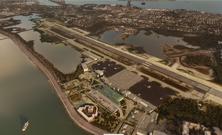
The Key West (KEYW) virtual airport by FSDreamteam for the MSFS 2020 flight simulator.
This is the Key West Airport (KEYW) in Florida, as reproduced for flight simulation by FSDreamteam for the Microsoft MSFS2020 flight simulator.
There is a clear advantage to acquiring this virtual airport rather than using the MSFS2020 airport. Indeed, the FSDreamteam KEYW airport doesn’t come alone: the company offers two other sites in accompaniment and for the same price: Fort Jefferson and the Loggerhead lighthouse.
A small virtual flight with a Cessna C-172 on floats allows you to fly over these sites and land on the water when appropriate.
Airborne from Key West KEYW with the MSFS 2020 flight simulator.
The Cessna takes off from Key West under ideal weather conditions.
Part of the Key West Wildlife National Refuge using MSFS 2020
Shortly after takeoff and established at 3000 feet, we fly over the Key West National Wildlife Refuge.
Descending towards Fort Jefferson with MSFS 2020
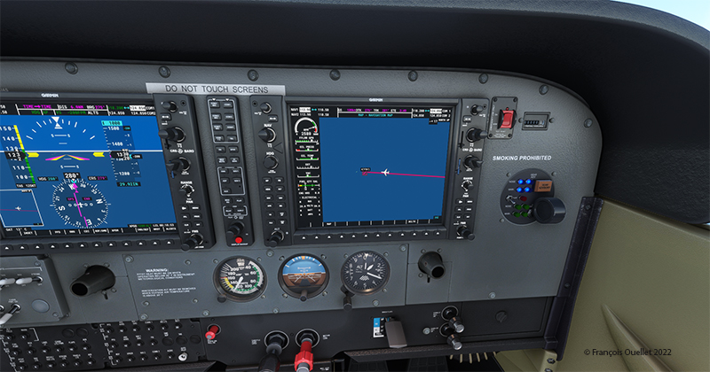
The Garmin G-1000 allows a stable flight during screen captures.
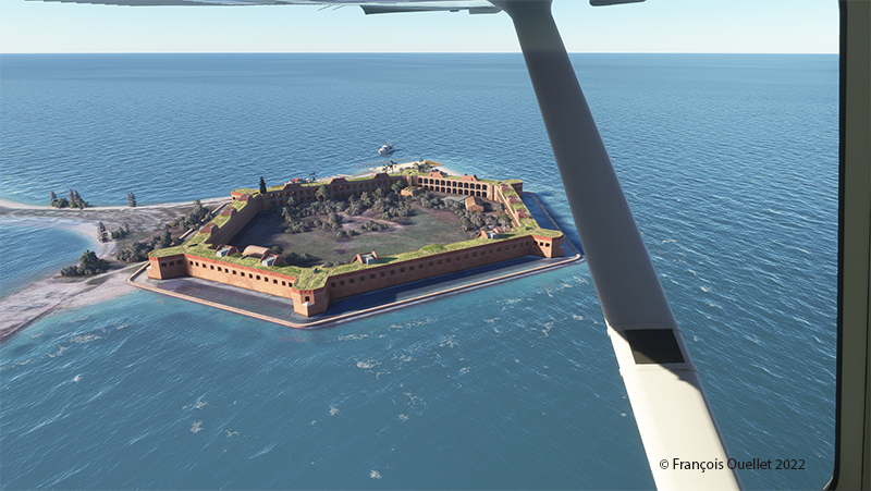
Flying over Fort Jefferson in Key West with MSFS 2020.
This is Fort Jefferson photographed as the Cessna flies at about 1500 feet ASL. The winds have increased slightly and foam is becoming visible on the waves.
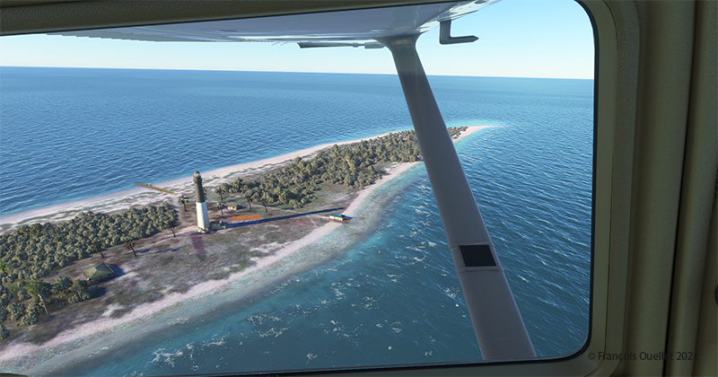
Flying over Loggerhead Lighthouse in Key West using thge MSFS 2020 flight simulator.
A little further along the flight path is the Loggerhead Lighthouse. The beach is beautiful and gently sloping. It will be possible to do a water landing, put the landing gear down while on the water and then park on the beach.
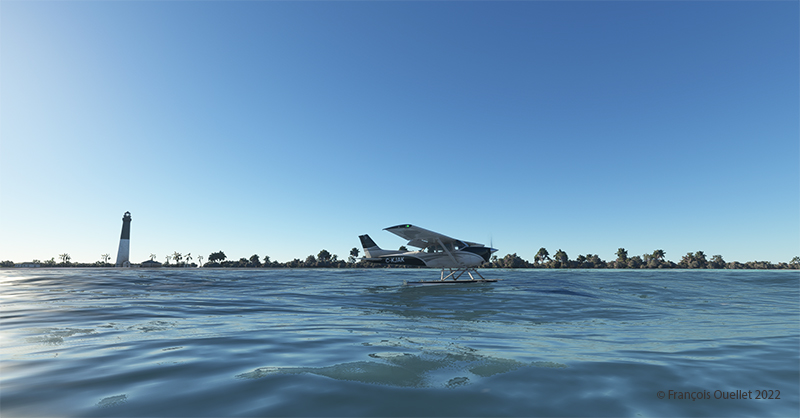
Making a sea-landing by Loggerhead Lighthouse in Key West, with MSFS 2020.
The landing is done without too much difficulty.
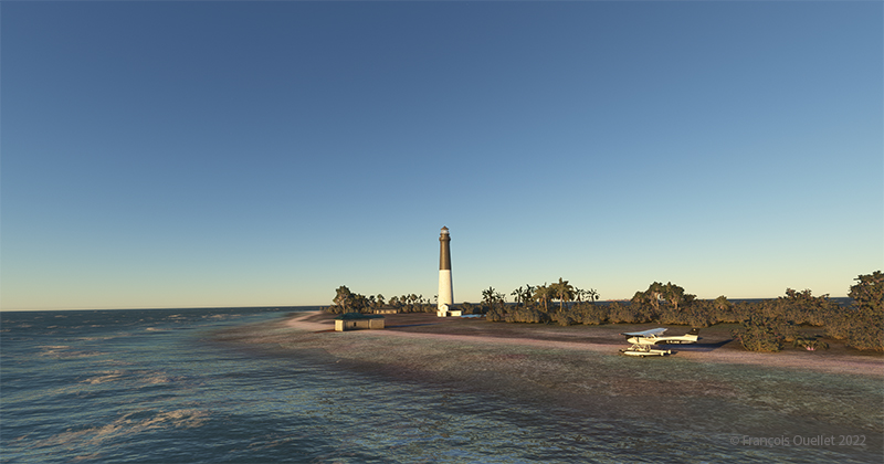
On the beach at Loggerhead Lighthouse, in Florida, using MSFS 2020.
With a little engine power, it is possible to get out of the water and park on the beach for a while. After turning off the engine, the MSFS2020 flight simulator allows the pilot to listen to the sound of the waves and wind in a realistic way. If there are birds in the area, it will also be possible to hear them.
For those who want to repeat the experience, it is only a matter of programming the starting point in MSFS2020 as KEYW and the destination KYW1 (Fort Jefferson). Once through Fort Jefferson, continue straight for a few minutes and you’ll arrive at the Loggerhead Lighthouse. Take a few moments to relax and listen to the waves before taking off again…!
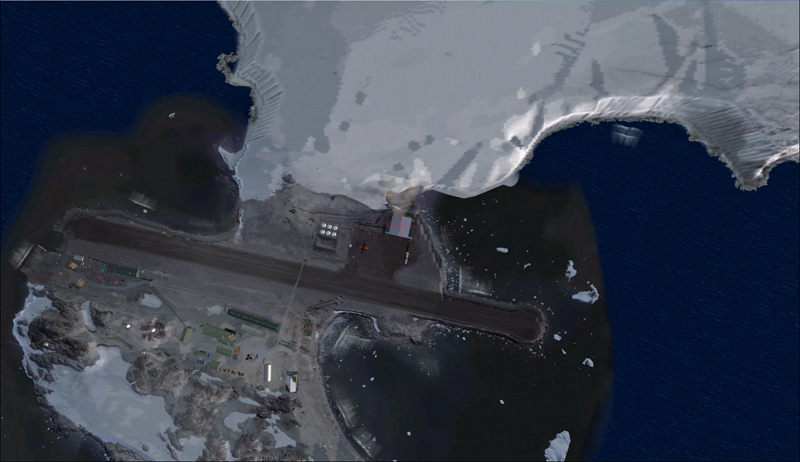
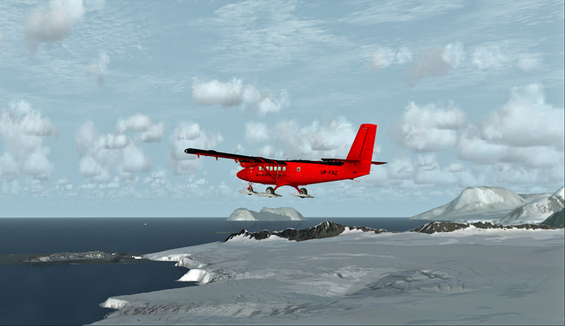
Aerial view of the Rothera research station in Antarctica.
For this flight, you will need the Antarctica X flight simulation software made by Aerosoft.
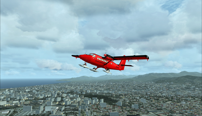
The maintenance of BAS Twin Otters and their Dash-7 is done in Calgary, Canada, and head to Antarctica during the austral summer, between October and March. So if you want to try a flight simulation with a Twin Otter or a Dash-7 from Chile to Antarctica, pick one of those months as it is more realistic.
Since it would be a bit long to make all the virtual flights from Canada to Antarctica, I chose to do the last three legs to see what the landscape looks like.
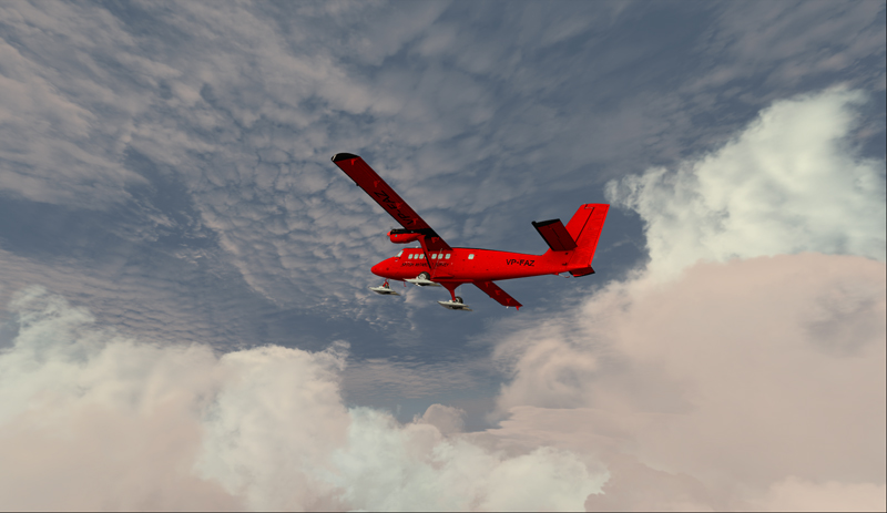
A Twin Otter is normally approved for a maximum take-off weight of 12,500 pounds. But with skis weighing 800 pounds and additional fuel required to fly longer legs, BAS (British Antarctic Survey) has arranged to have their Twin Otters approved at 14,000 pounds. Even at this weight, the aircraft could still operate on one engine.
First, the aircraft departs La Florida airport (SCSE) in Chile, after a mandatory fuel stop before its next destination, the El Tepual de Puerto Montt airport (SCTE), also in Chile.
Airborne from La Florida, Chile, after refueling.
This virtual flight with the Twin Otter last about 4:25 hours (696 nm) with a heading of 185 degrees.
In flight towards El Tepual de Puerto Montt, Chile.
For the screen captures, FTX Global, FTX Vector and Pilot’s FS Global 2010 were installed. Orbx has also reworked the original El Tepual de Puerto Montt airport to include some people, aircrafts and new buildings. It makes for a more interesting destination.
Twin Otter on final approach for El Tepual de Puerto Montt, Chile.
Ready for refueling at the El Tepual de Puerto Montt, Chile.
The next flight is from the El Tepual de Puerto Montt airport (SCTE) to Punta Arenas (SCCI), both in Chile.
Twin Otter aircraft airborne and heading to Punta Arenas, Chile.
This flight, made low across the Andes, absolutely requires good weather. You will have to climb to 17,000 feet to make the direct route between the airports.
Twin Otter over the Andes climbing for17,000 feet
There are often spectacular views available to the virtual pilot. Yes, the BAS Twin Otter is flown by only one pilot, but there is always somebody else accompanying him.
Don’t forget to lean the mixture during the climb. Also use some additional oxygen (!!) if you don’t want to start singing and flying in circles after a while. Again, pay attention to the mixture during the descent, considering that you will be losing close to 17,000 feet.
Refueling at Punta Arenas, Chile.
The Punta Arenas airport, straight from FSX, is not an interesting airport to look at. It is a very bare airport, with just a single building and a VOR.
But since the BAS pilot do that mandatory leg just before heading to Antarctica, I chose not to change the route. The general direction for the flight to Punta Arenas was 164 degrees and the duration approximately 4:28 hours. You can obviously accelerate the process once the aircraft is established at its flying altitude.
The last flight is from Punta Arenas, Chile, to Rothera, Antarctica.
Twin Otter aircraft heading for the Rothera airport in Antarctica.
The Twin Otter will take between six and seven hours on an average heading of 162 degrees to cover the distance between Punta Arenas (SCCI) and Rothera (EGAR).
Over the snowy mountains of Chile towards Rothera, Antarctica
Carrying extra fuel on the flight towards Rothera, Antarctica.
The runway at Rothera is made of gravel and is 2953 feet long. That is plenty for the Twin Otter and the DASH-7. Before you make the flight, go into the aerosoft/Antarctica X file in your flight simulator and click on the “LOD 8.5” option (the default is at LOD 4.5). It will give you much better details when you are approaching Antarctica.
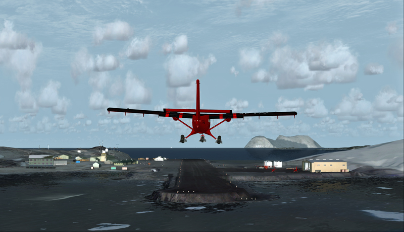
The antarctic Rothera research station is in sight
Twin Otter aircraft on final at Rothera, Antarctica.
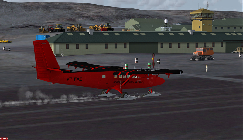
The Airliner World magazine had an excellent article on the BAS operations in Antarctica in its March 2017 edition. It included plenty of interesting pictures and detailed explanations on what is expected from pilots and personnel working for BAS. I compared the Rothera virtual airport with the real one through the available pictures in Airliner World and was pleasantly surprised with the level of accuracy of the details.
A British Antarctic Survey Twin Otter aircraft is landing on the Rothera runway, Antarctica
The BAS always prepares itself for the worst: “[It] carries parts valued at around $5m, including a replacement engine for each aircraft, spare props and undercarriage components”.
Twin Otter aircraft after a landing on the Rothera runway, Antarctica
“A new development for the Air Unit has been its work with the RAF, using C-130 Hercules transports to airdrop supplies into the field. They fly from Punta Arenas and drop fuel to support our science programmes on the Ronne Ice Shelf. […] It is all part of their training system and the accuracy they drop to is very impressive. They might drop 250 drums, think how many Twin Otter trips that would have been for us (48 or more than 400 flying hours)”.
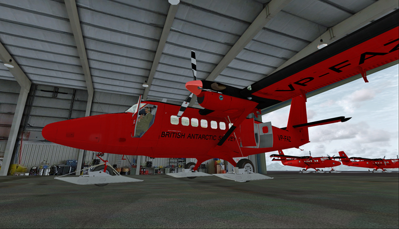
The main hangar in Rothera, Antarctica.
Aerosoft has made an excellent job in replicating the buildings in Rothera, BAS’s main research station in Antarctica. The biggest hangar can accommodate three Twin Otters and a Dash-7 altogether.
Inside the main hangar at the Rothera research station, Antarctica.
When your flight is over, do not forget to change the settings back to LOD 4.5 for Antarctica in your aerosoft/Antarctica X files.
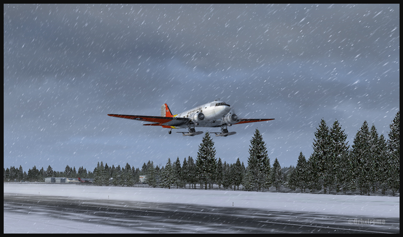
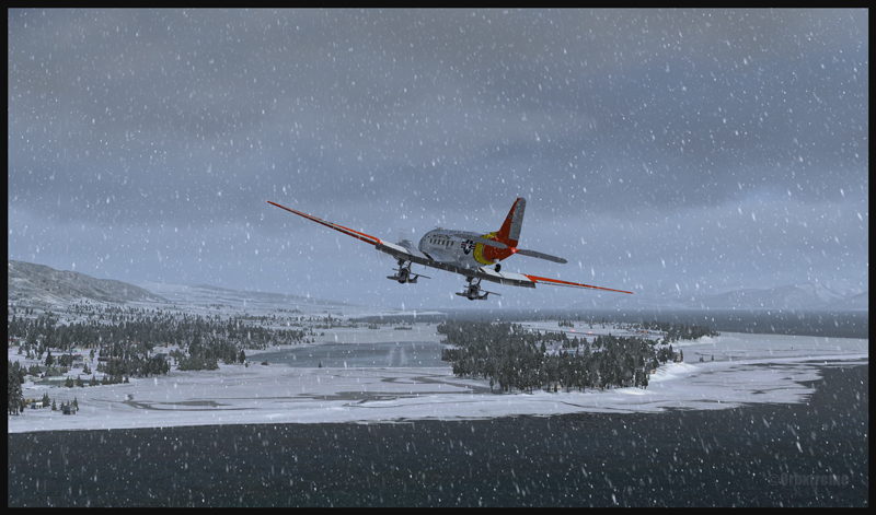
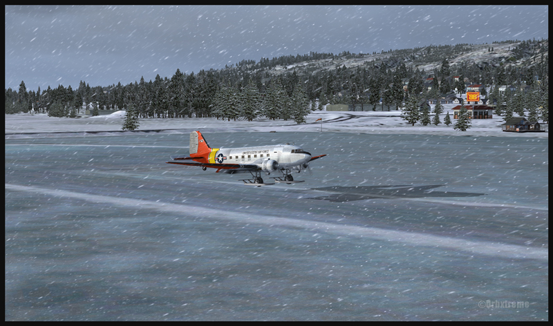
DC-3 at the Homer (PAHO) virtual airport in Alaska (FSX)
If you feel like attempting a virtual landing on an ice runway, an opportunity is offered by ORBX through their Homer (PAHO), Alaska virtual airport. For the flight, I used the FSX platform but it could have been also done under P3D.
DC-3 on skis airborne from the Homer (PAHO) virtual airport in Alaska (FSX)
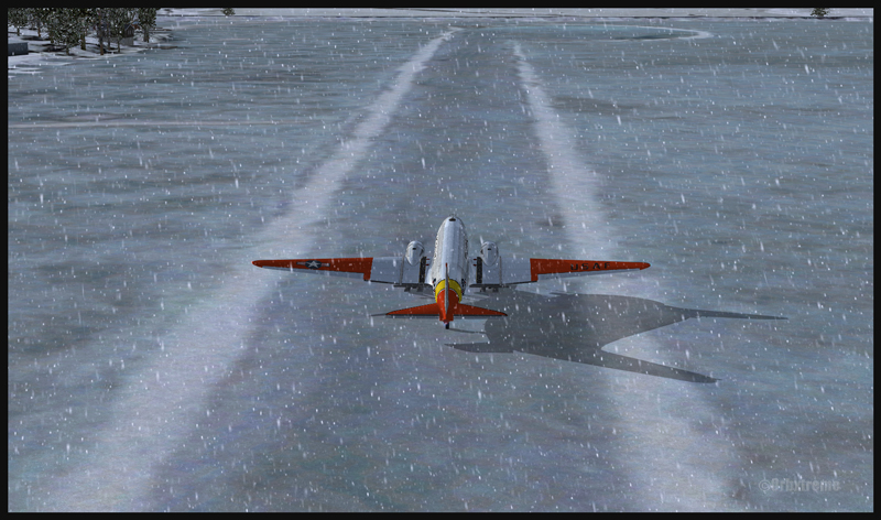
The ice runway is just a short distance away from the regular Homer asphalted runway. The DC-3 is an excellent aircraft for the task since its approach speed is very low and it is one of the few virtual aircrafts equipped with skis.
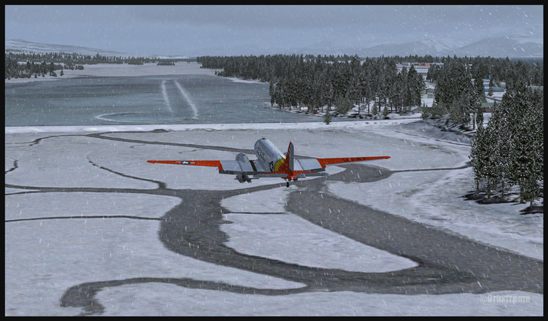
A DC-3 on skis is turning final for the Homer ice runway in Alaska (FSX)
If you want to try that flight, make sure to adjust the flight simulator configuration settings so that the Homer ice runway option is activated, otherwise you’ll end up under water…
In order to add a bit of challenge as well as winter realism, you can add a bit of crosswinds or some snow using the standard « heavy snow » option in FSX. The program PrecipitFX helps a lot if you are looking for a better definition of precipitations, be it snow or rain. For this flight, the Cumulus X program was also activated.
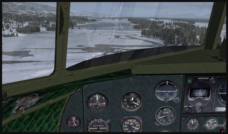
Cockpit view of a virtual DC-3 on final for the Homer (PAHO) ice runway in Alaska (FSX)
Virtual DC-3 on skis on short final for the Homer (PAHO) ice runway in Alaska (FSX)
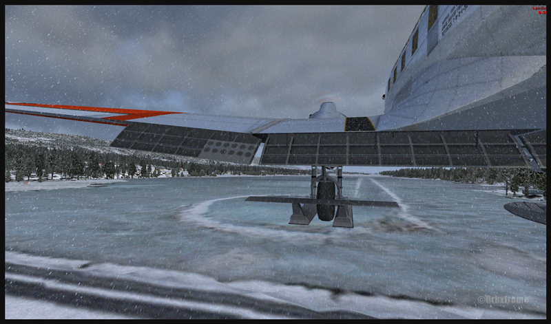
Virtual DC-3 on skis about to touch the threshold of the Homer ice runway in Alaska (FSX)
The short flight proved to be an interesting experience, since the runway was narrow and there were some crosswinds. I thought that it would be very slippery but it was not the case. Maybe one day Orbx, in association with the FSX Steam (Dovetail Games) professionals, will work at modifying the flight simulation platform and add a CRFI (JBI) index of .40 or less to increase the difficulty in slowing down and controlling the virtual aircraft?
A DC-3 on skis flying few feet over the Homer (PAHO) (FSX) ice runway, a product of the ORBX company
A virtuel DC-3 on skis after a landing on the Homer (PAHO) ice runway in Alaska (FSX)
A DC-3 virtual on skis backtracking the Homer (PAHO) ice runway in Alaska (FSX)
As this flight is not a super though exercise, I have placed it in the “standard virtual flights”, in the flight simulation section of my website. For more of those flights, click on the following link: Other standard virtual flights
Have fun trying this one! Later on, I’ll present another ice runway located on Antarctica, which virtual scenery was made by Aerosoft. Even the C-17 Globemaster III is approved there…
For more articles on flight simulation on my web site, click on the following link : Flight simulation
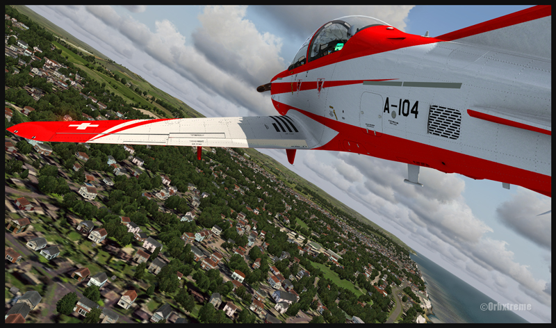
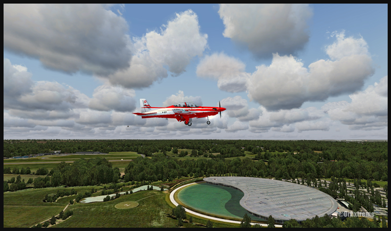
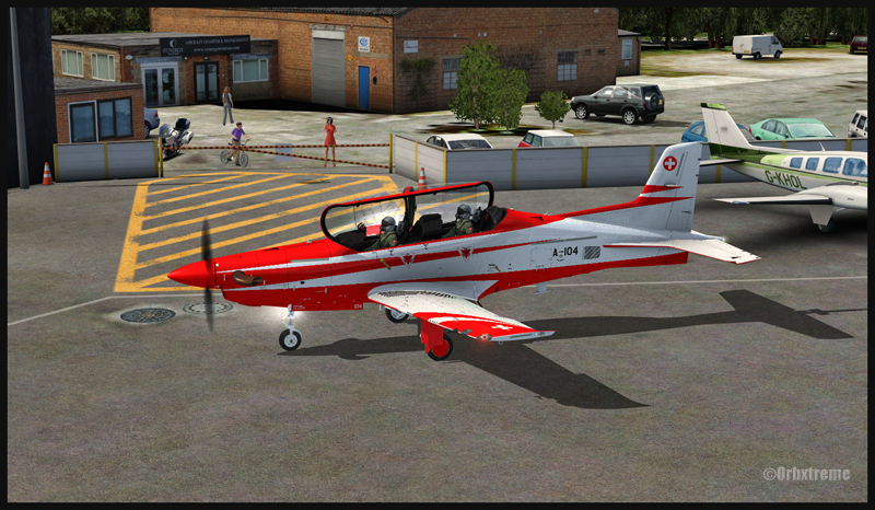
A Pilatus PC-21 aircraft over Shoreham, United Kingdom
Near the Fairoaks airport, United Kingdom. Flaps and gear down on the Pilatus PC-21
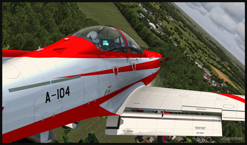
The IRIS Pilatus PC-21 Pro Training Series is a high performance aircraft. It is equipped with a five blade graphite propeller as well as a Pratt-Whitney PT6A-68B engine able to develop 1600 SHP. Until the PC-21 was created, there were only jet aircrafts that could provide such performance when it comes to pilot training. The PC-21’s maximum airspeed is 370 knots, its service ceiling 38,000 feet and it can climb at a rate of 4000 feet/minute.
PC-21 aircraft near the Fairoaks airport, United Kingdom
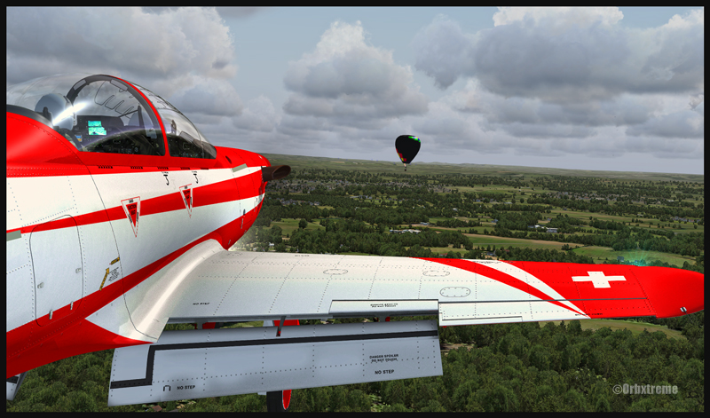
The above sequence of pictures represents a familiarization flight with that aircraft, before trying to attempt to land in Fairoaks. I have included this flight under the “flight simulation” section of the site, under “standard virtual flights”.
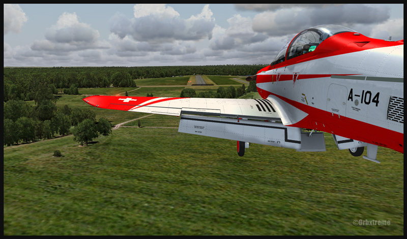
PC-21 turning final for Fairoaks airport, United Kingdom
The takeoff was done from Southampton and the route included Shoreham, Gatwick, Heathrow to finally end in Fairoaks. Along the route, different exercises were practiced like slow flight, inverted flight and other manoeuvers that allowed to learn the behavior of the machine under all kind of configurations.
PC-21 aircraft on final for the Fairoaks airport, United Kingdom
A PC-21 aircraft and the Fairoaks airport, United Kingdom
IRIS created that virtual Pilatus. ORBX is responsible for the Southampton, Shoreham and Fairoaks virtual airports, as well as sceneries generated by their well known Global, Vector, Open LC and Trees HD products. FSX was used for the flight. Clouds were generated by REX and CumulusX. For an even more realistic experience, UK2000 virtual airports like London Gatwick and London Heathrow could have been used since they are of excellent quality.
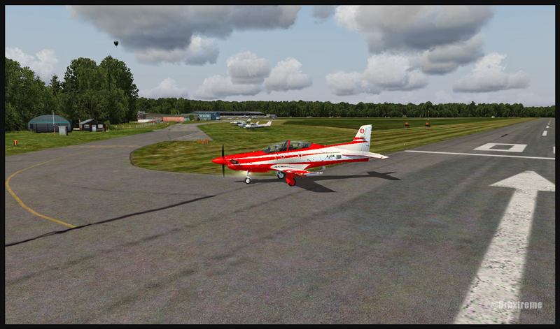
Pilatus PC-21 on the Fairoaks airport (FSX)
Beware of the approach in Fairoaks. There are trees near the threshold of the runway and the landing surface is relatively short, measuring only 813m (2667 feet). Flying an aircraft equipped with such a powerful engine and whose stall speed approximates 150 kmh with flaps and gear down will require much attention on the approach. It will be the difference between a successful landing or having your name in the first page of Fairoaks local newspaper the next day.
For other ideas of virtual flights that do not require a lot of experience, click on the following link: Standard virtual flights
For more articles on flight simulation on my web site, click on the following link : Flight simulation
I’ve just added a new VFR flight in the “flight simulation” section, under “standard virtual flights”. An Alabeo WACO takes off from Cushman Meadows, heads south-east towards the Skokomish Reservation, then flies over the Bremerton airport to the north-east and ends up landing at the Bear Gulch aerodrome, just in time for a BBQ. This was done using FSX. The first part of the cross country is for a starting virtual pilot but the last part requires a bit more experience.
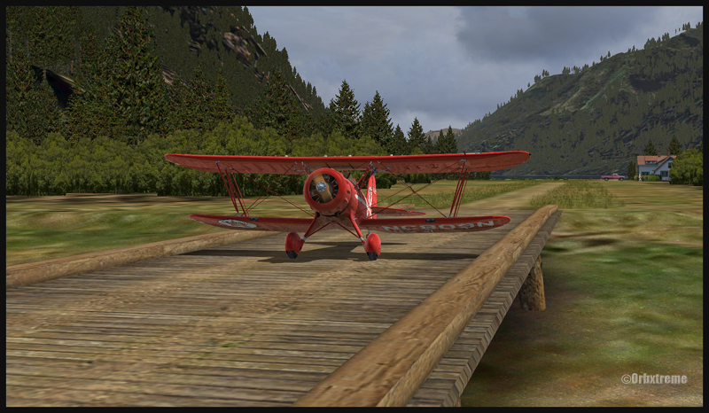
Waco on short final for Bear Gulch WA38 (fsx)
WACO landing in Bear Gulch WA38 (FSX)
It is a more demanding experience than what is normally found in the “standard flights” section, since it involves a final landing at Bear Gulch. The runway at that airport is only 1411 ft long, and quite narrow. So you have to plan your approach carefully. A little wooden bridge is part of the runway! Since the flight is done in nice VFR conditions and does not involve engine failures or using a really fast aircraft arriving on a short runway, I decided that the “standard virtual flights” section was more appropriate. Still, it is not an easy approach.
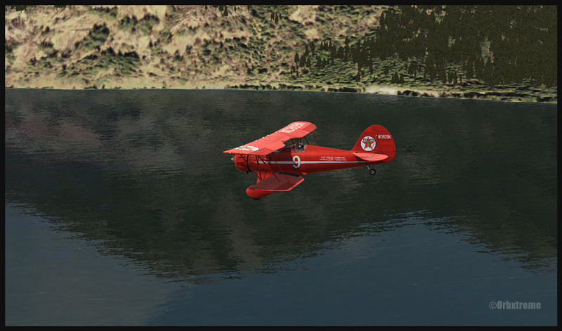
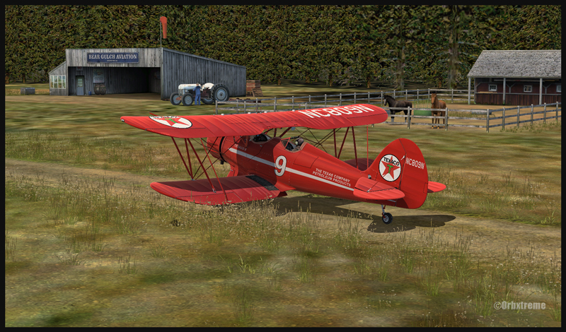
A Texaco WACO aircraft is taxiing on a wooden bridge at Bear Gulch, WA38
A Waco aircraft belonging to Texaco is taxiing in Bear Gulch, WA38
Cushman Meadows (KCMW) and the Bear Gulch (WA38) runways do not exist in real life but am I ever glad Bill Womack took the time to create them. His site can be found under Iblueyonder. The screen captures show both airports and the PNW region sold by ORBX. If you want nice shadows on the ground while not using P3D, just get CumulusX and set the season to summer, with scattered clouds in mid afternoon.
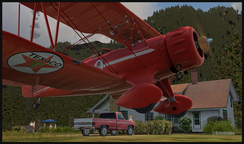
A Waco aircraft with a tractor in the foreground is parked at Bear Gulch, WA38
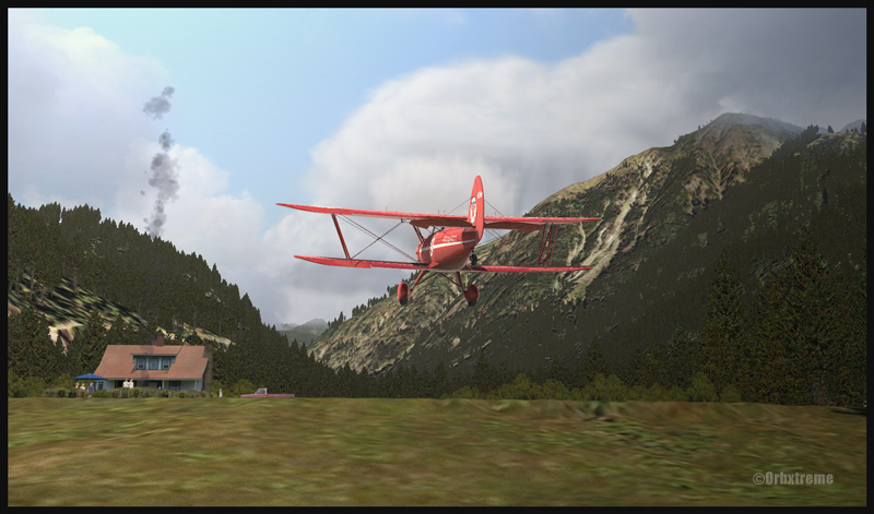
Some guests have already arrived in Bear Gulch. You will see the smoke rising from the BBQ being prepared while you are on short final. The guests will certainly be taking pictures of your approach, as you are flying a vintage aircraft. So, if there was ever a time to do things correctly, now it is!
For more articles on flight simulation on my web site, click on the following link : Flight simulation
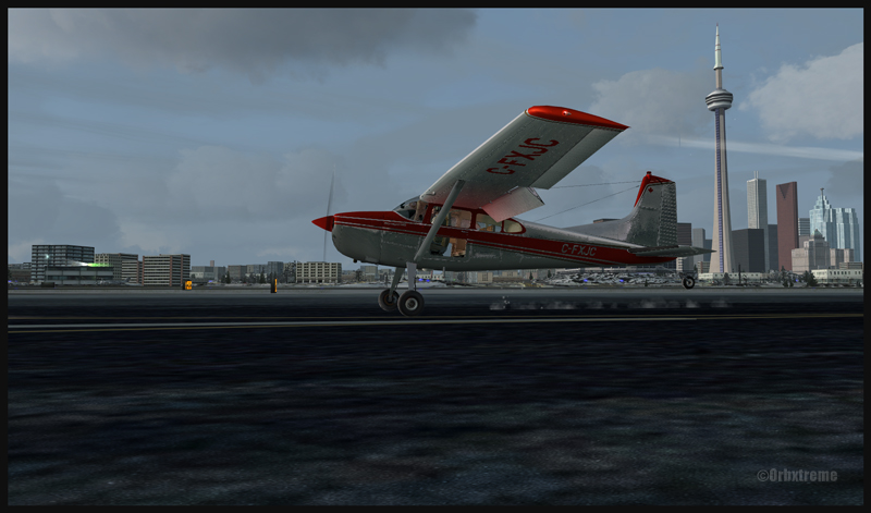
Flying over Toronto downtown shortly before the landing in Toronto Island (CYTZ)
I recently added, in the standard virtual flight section, a flight leaving Parry Sound for Toronto Billy Bishop.Here is an opportunity to learn a bit more about the Great Lakes region in Ontario. The Parry Sound airport, from ORBX, is a first creation by Vlad Maly for this province. The runway length is 4000 feet. Just beside the airport, there is a lake, Robert’s Lake (CRL8), with many cottages, floatplanes and sailboats that are visible when you select the appropriate season. The lake also offers 4000 feet for takeoffs and landings.
The actual flight has been made while the clouds were low enough that the flying altitude forbid the adequate reception of the Toronto Island (Billy Bishop) NDB (257khz) in the first half of the flight. A touch-and-go was made at Toronto International (CYYZ). MyTraffic2013 provided the airport with many AI aircrafts. Once over downtown Toronto, it was now time for Pilot’s FS Global 2010 to automatically install a maximum of buildings, for more realism.
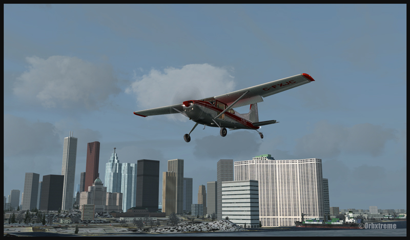
On final for the Toronto Billy Bishop (Toronto Island) airport (CYTZ)
Landing at CYTZ with the CN tower in the background (FSX)
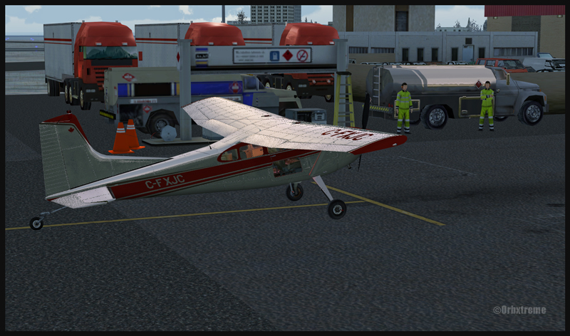
Finally, theToronto Billy Bishop (formerly Toronto Island) was modified by ORBX in order to make it more interesting and alive. You will thus find, on arrival, some staff to take care of the refueling process. Somes vehicules have also been added. Naturally, MyTraffic2013 took charge of AI aircrafts as CYTZ is quite a busy airport and needs some air traffic to enhance the realism.
Time to refuel at Toronto Billy Bishop (CYTZ)
I wish you a good flight, if you wish to try it out. I would suggest though, for a more interesting experience, that you install ORBX FTX Global Vector on your computer, as the Microsoft Flight Simulator (FSX)software does not do a good job when it comes to representing the Great Lakes area. ORBX Open LC for North America further improves the flying experience.
For more articles on flight simulation on my web site, click on the following link : Flight simulation
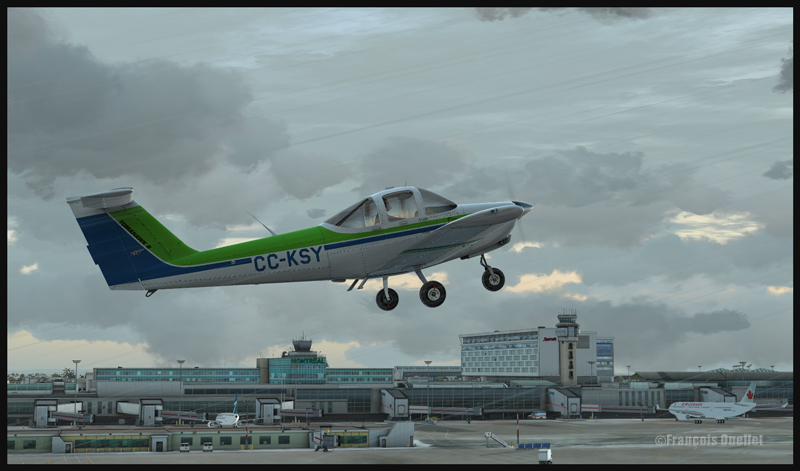
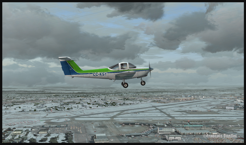
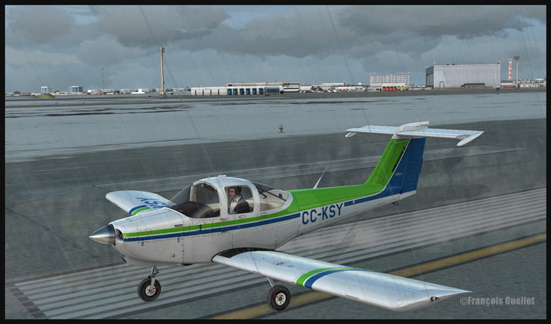
Piper Tomahawk PA-38 airborne from runway 28 at the Montreal Pierre-Elliott-Trudeau international airport, with the Montreal terminal in the background. (FSX)
All student pilots must practice touch-and-goes for hours . FlyTampa Montreal scenery for FSX, used jointly with MyTraffic2013 software and real weather makes for a realistic exercice for anybody who knows the metropolitan area around Montreal.
Piper Tomahawk PA-38 airborne from runway 28 for a left hand circuit at the Montreal Pierre-Elliott-Trudeau international airport (FSX)
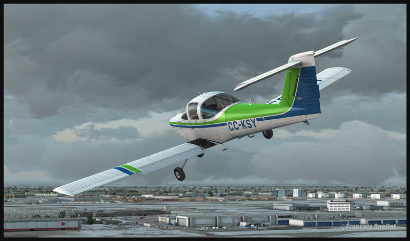
A small aircraft like the ALABEO Piper PA-38 Tomahawk is a perfect choice. I chose a left hand circuit for runway28 since it allows a nice view of the terminal when taking-off or landing. Fly Tampa Montreal allows the virtual pilot to see local landmarks when flying around the airport, like the olympic stadium, the St-Joseph’s Oratory and Place Ville Marie.
Piper Tomahawk PA-38 on downwind for runway 28 at the Montreal Pierre-Elliott-Trudeau international airport (FSX)
Piper Tomahawk PA-38 turning on final for runway 28 at the Montreal Pierre-Elliott-Trudeau international airport (FSX)
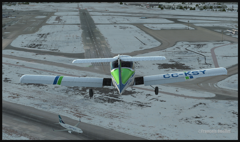
Piper Tomahawk PA-38 on final for runway 28 at the Montreal Pierre-Elliott-Trudeau international airport , while Westjet is rolling on runway 06R (FSX)
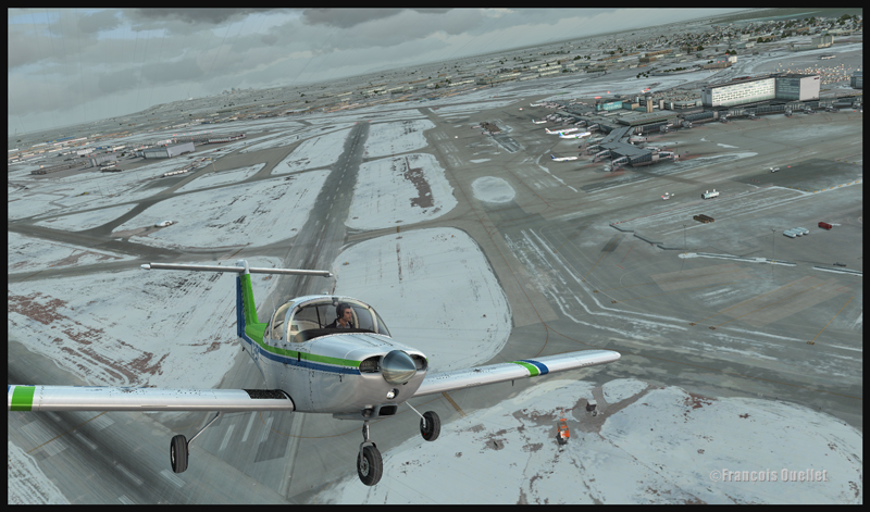
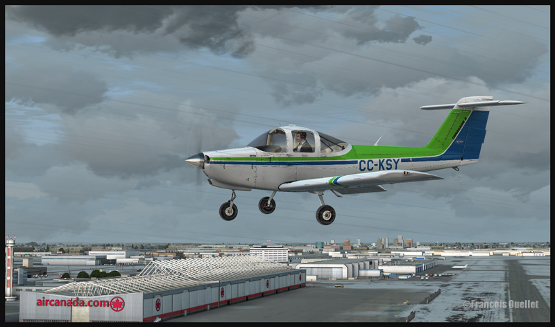
On downwind 28, if you fly during winter, you will be able to see that only parts of Lac St-Louis are frozen. On left base, Air Canada and Bombardier very well rendered buildings are visible. If you had landed on runway 24L, you would have seen other well known company names posted here and there on the surrounding buildings. That is a really well made scenery.
Piper Tomahawk PA-38 and the Bombardier and AirCanada buildings at the Montréal Pierre-Elliott-Trudeau international airport (FSX)
Piper Tomahawk PA-38 about to leave runway 28 of the Montréal Pierre-Elliott-Trudeau international airport (FSX)
The use of My Traffic software allows aircraft movements around the airport during your exercice; that makes the experience even more interesting. You will also be surprised by the realism in the depection of the snow patches along the runway sides when you are on the approach. So, have fun with this easy exercice in a really interesting setting made available by Fly Tampa Montreal.
Piper Tomahawk PA-38 parked at the Montréal Pierre-Elliott-Trudeau international airport (FSX)
For more articles on flight simulation on my web site, click on the following link : Flight simulation