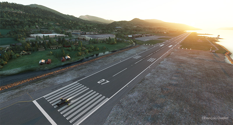
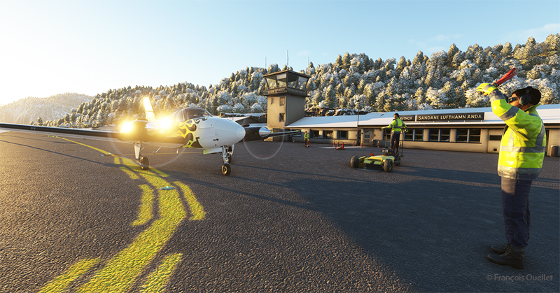
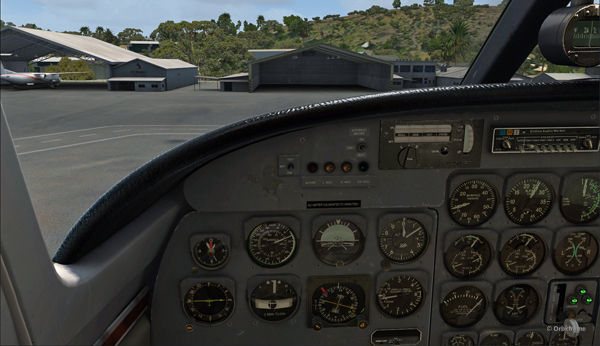
The sixth leg of this world tour of flight simulation continues with a journey from the Molde (ENML) airport to the Sandane/Anda (ENSD) airport in southern Norway.
Ready for departure from Molde (ENML) virtual airport to Sandane (ENSD) airport.
The destination can’t accommodate a private jet like the Cessna Citation Longitude, as runway 08/26 is only 3182 feet long. A good old light twin-engine plane, repainted a hundred times over, will have to be rented for the trip, and we’ll just have to hope the engines hold out.
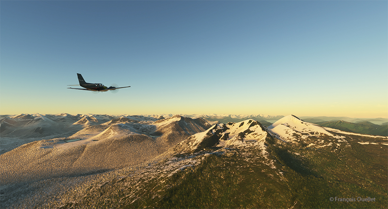
Enroute to the virtual Sandane airport (ENSD) in Norway with Microsoft Flight Simulator
The mountains of Norway come into view, and the ascent continues gradually to ensure that the highest peaks along the route pose no problems.
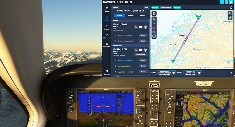
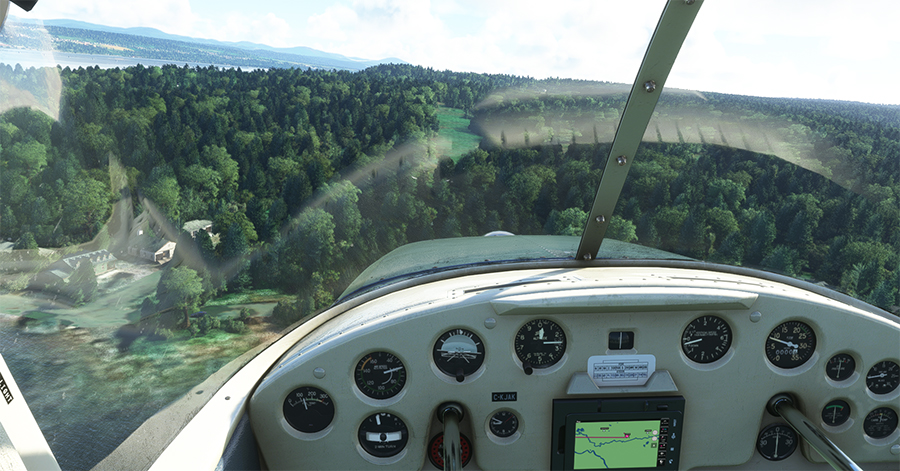
The navigraph tool for flight simulation and the VFR map from ENML to ENSD.
Above, a view of the aircraft’s instrument panel as it climbs, with a Navigraph map showing the route flown in visual flight. Virtual weather is integrated in real time whenever a new weather report is issued by a ground observation station around the world.
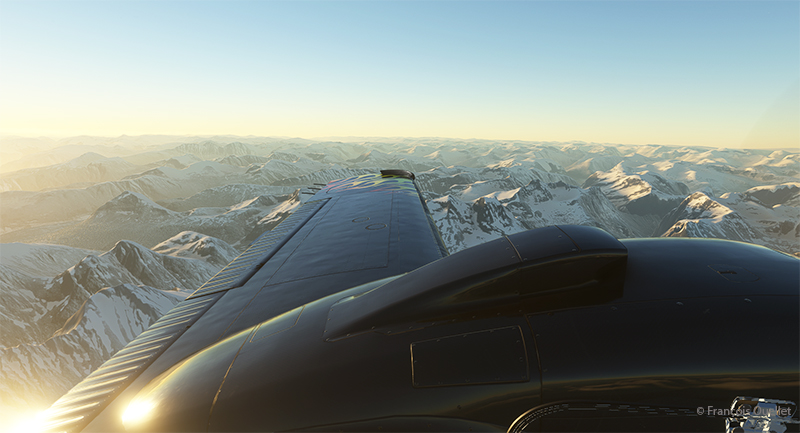
View of the Norwegian mountains from the pilot seat
Morning sun over the Norwegian mountains with Microsoft Flight Simulator.
Another sunrise view that brings Norway’s magnificent mountain landscape to life.
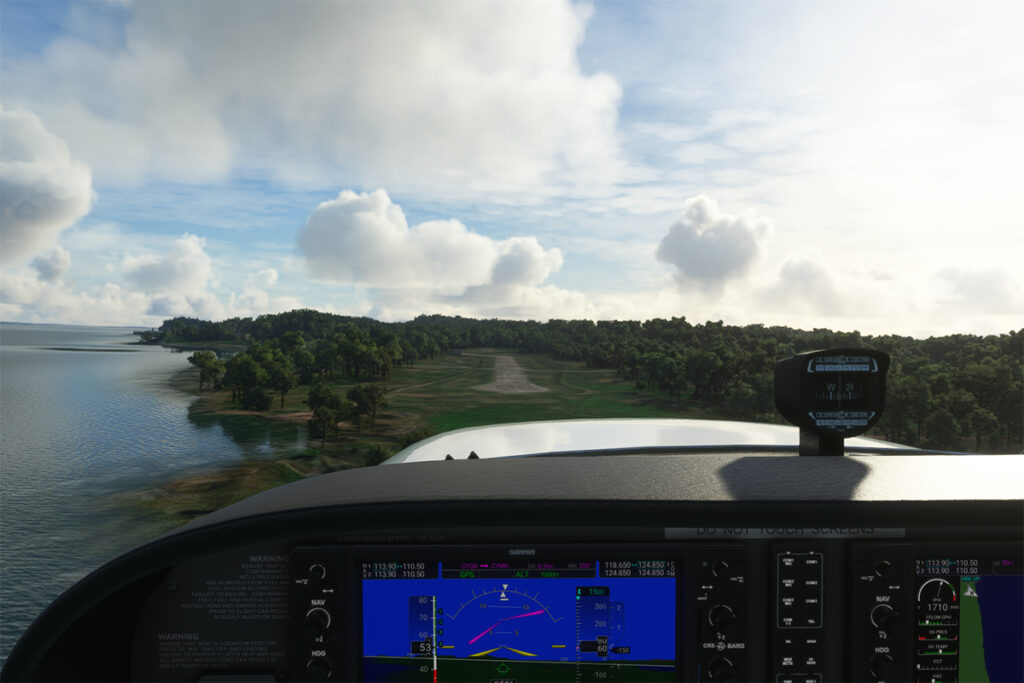
Approaching the Sandane virtual airport in flight simulation.
We are now almost at our destination. The plane is in left base for runway 08 at Sandane/Alda airport.
Turning final for runway 08 at Sandane (ENSD) virtual airport in Norway.
Over the still-frozen Innvikfjorden, the final turn is made to stabilize the aircraft on final runway 08. On short final, there’s a cliff just short of threshold 08, and a difference in runway height to take into account for the landing.
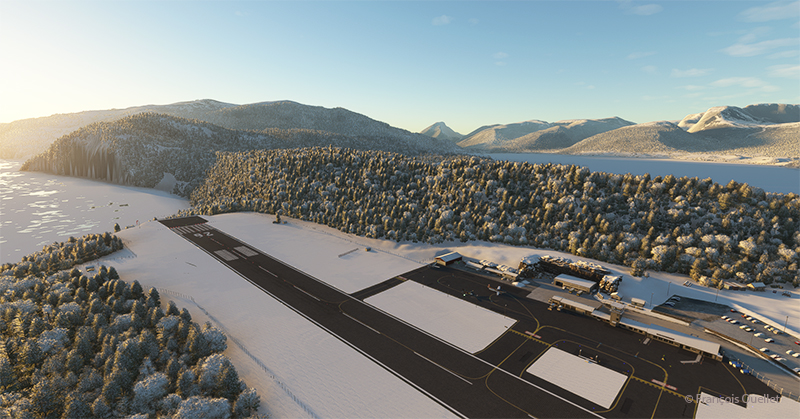
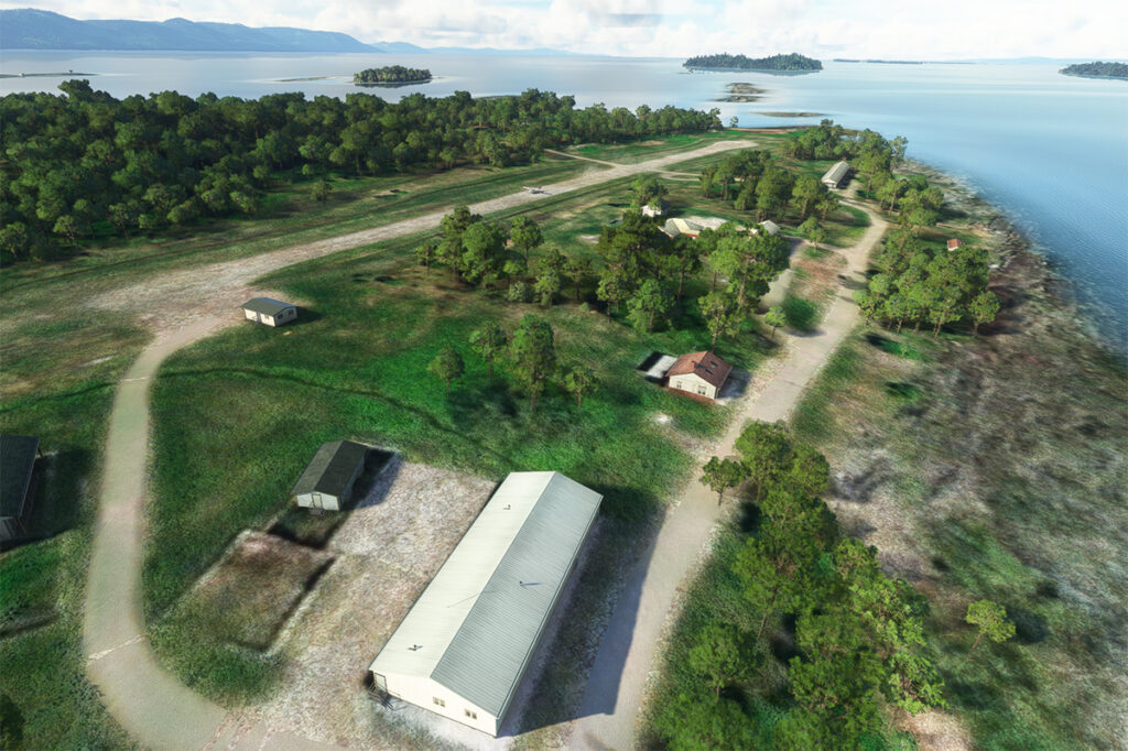
View of the Sandane (ENSD) virtual airport with Microsoft Flight Simulator.
Above, a view of the Sandane/Alda virtual airport (ENSD) using Microsoft Flight Simulator. There is no margin for error, as the two runway thresholds are bordered by a cliff and a stretch of water.
Help for parking is offered at the Sandane (ENSD) virtual airport in Norway.
Service at the airport is excellent. Two employees are waiting to help us park our aircraft.
Sandane is known for its magnificent panoramas, waterfalls, Briksdalsbreen glacier and horseback riding. The village is nestled inland from the Gloppe Fjord. If you’re traveling there in summer, you’ll need to be prepared for a fair amount of precipitation.
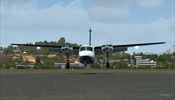
The next flight is from Sandane to Stockholm-Bromma in Sweden with a Beechcraft King Air 350I which has not flown for a long time. We’ll have to fly over the high mountains of the Jostedalsbreen Nasjonalpark before reaching our destination.
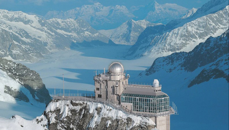
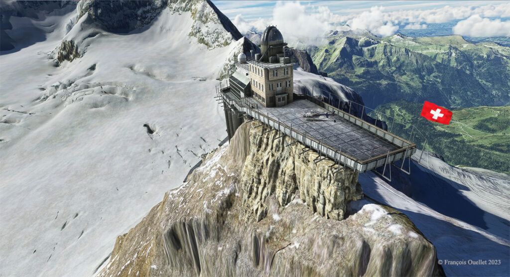
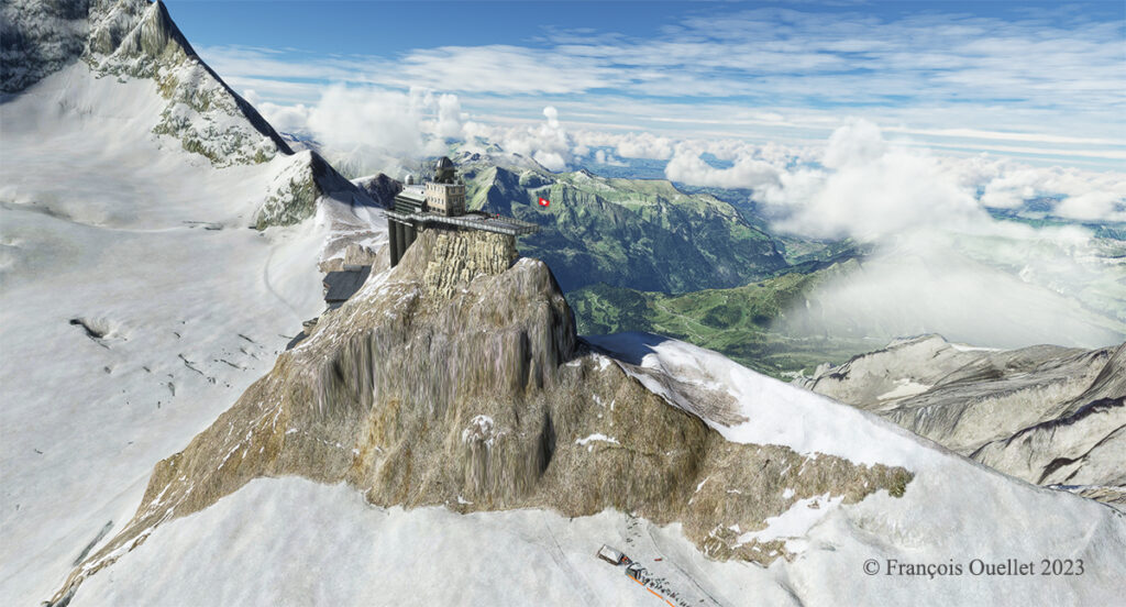
Sphinx astronomical observatory on the Jungfraujoch in Switzerland.
The latter is located in the Jungfraujoch pass in Switzerland, at an altitude of 3571 meters (11,716 feet MSL).
The construction of this station was a feat of engineering at the time, but cost the lives of many workers. One does not make one’s way through a mountain range with sticks of dynamite without the occasional unforeseen agenda imposed by nitroglycerine.
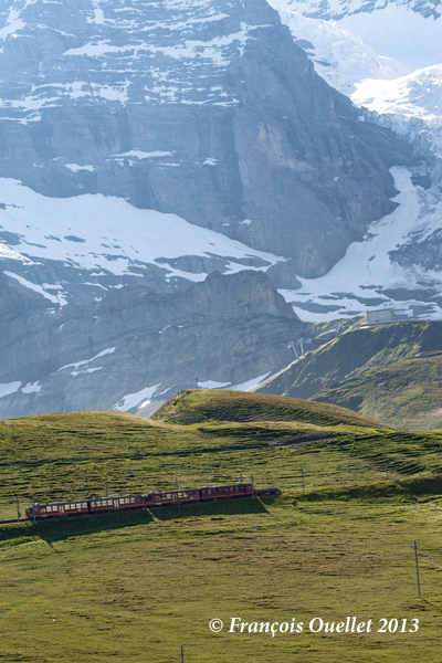
The train can therefore only reach this station by traveling inside the mountains on a steep slope requiring a hydraulic mechanism to pull the train forward. The tourist must trust the engineers and the technical support…
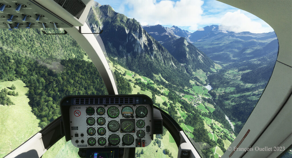
To remind myself of our trip to this region, I thought of taking a virtual helicopter flight from Lauterbrunnen to land directly on the platform of the Sphinx astronomical observatory, this world famous tourist attraction of the Jungfraujoch. Fortunately for me, the company Red Wing Simulations recently created a virtual scene including these two magnificent sites.
Lauterbrunnen, Switzerland and the Microsoft Flight Simulator Bell 407.
Flight simulation enthusiasts will be well advised to use the Bell 407, as the operating limit of the Guimbal Cabri G2 provided by the Microsoft flight simulator is capped at 13,000 feet. It is best to fly with a slightly more powerful aircraft when maneuvering at this altitude.
Airborne from Lauterbrunnen, Switzerland, with Microsoft Flight Simulator 2020.
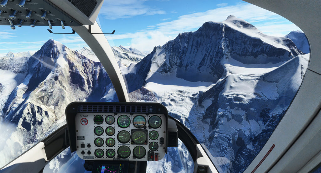
From a green landscape in the summer one gradually flies towards the eternal snow of the highest peaks in the Valais.
Getting closer to the Jungfraujoch, Switzerland.
The scenery was spectacular on the train and it is just as spectacular in virtual flight. A mechanical problem with the helicopter in this environment of grandiose cliffs would leave little chance for the pilot.
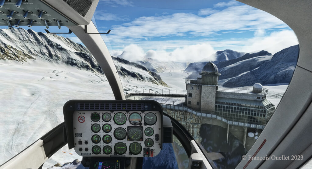
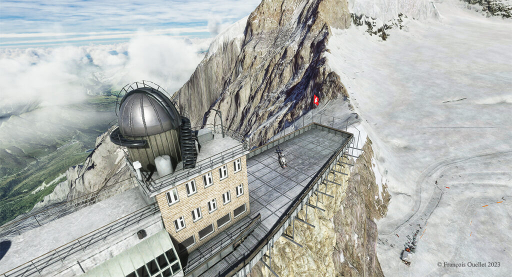
Approaching the Sphinx Observatory on the Jungfraujoch, Switzerland.
Here we are on approach: it is possible to land on the platform of the Sphinx observatory, but the pilot needs to be prepared for wind shear and unforeseen clouds at this altitude while taking care during the approach to avoid touching the flagpole and the protective fences surrounding the platform.
The Sphinx observatory on the Jungfraujoch with the Bell 407 helicopter on the platform using Microsoft Flight Simulator.
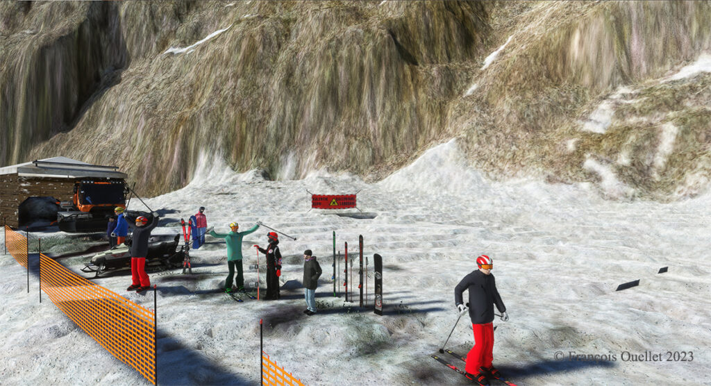
The Red Wing Simulations company has done an outstanding job designing this virtual scenery. In the photo below, you can even see skiers at the bottom of the cliff warming up before their first run.
Red Wing Simulations skiers at the base of the Jungfraujoch observatory on Microsoft Flight Simulator.
Even if the virtual scene includes something other than Lauterbrunnen and the Jungfraujoch, the pleasure of making a successful approach on the Sphinx platform alone is worth the cost of acquiring the software.
The Sphinx observatory on the Jungfraujoch and the helicopter on the platform using Microsoft Flight Simulator
Microsoft Flight Simulator and Red Wing Simulations representation of the Jungfraujoch Observatory platform.
Decades ago, Canadian authorities used this island in the middle of the St. Lawrence River as a quarantine site for immigrants arriving in Canada. Many Irish people, among others, made an obligatory stop on this strip of land before being allowed to continue their journey to Canada.
At one time, a section of the island was reserved for Canadian and American researchers for their top secret research on Anthrax.The most amazing thing about reading the article is realizing that the entire production of this bacteriological weapon (439 liters) was mixed with formaldehyde and put in barrels that were dumped somewhere in the St. Lawrence River when it was decided that it would no longer be useful, as the Second World War took a turn in favor of the Allies. It seems to me that formaldehyde does not prevent barrels from rusting, but hey… back to the point.
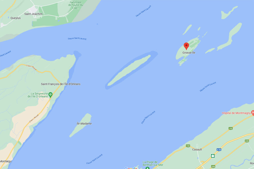
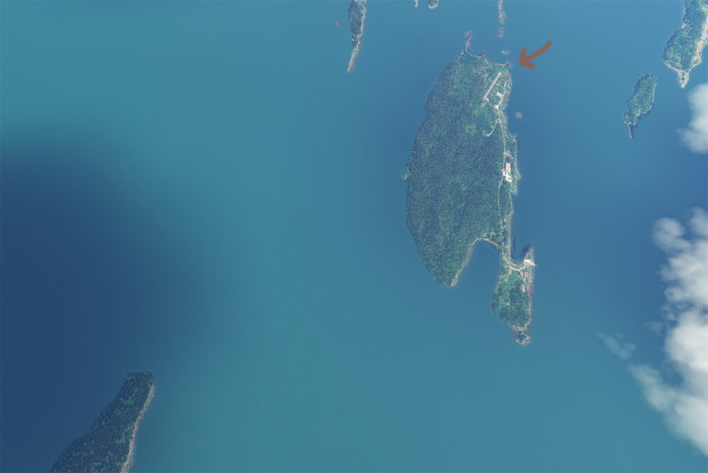
Where is Grosse-Île located? In the province of Quebec, a little east of Quebec City. It is one of the many islands that you can fly over once you have left Île d’Orléans behind. Below, a screenshot from Google Maps.
Grosse-Île in Quebec on Google Maps.
The satellite image below clearly shows that this is not an invention. Microsoft designates this runway as CYMN Montmagny: a mistake that one can easily live with, since by giving an official code to this Grosse-Île runway, the pilot can use it as a navigation point in his GPS.
Satellite view of Grosse-Île and its runway.
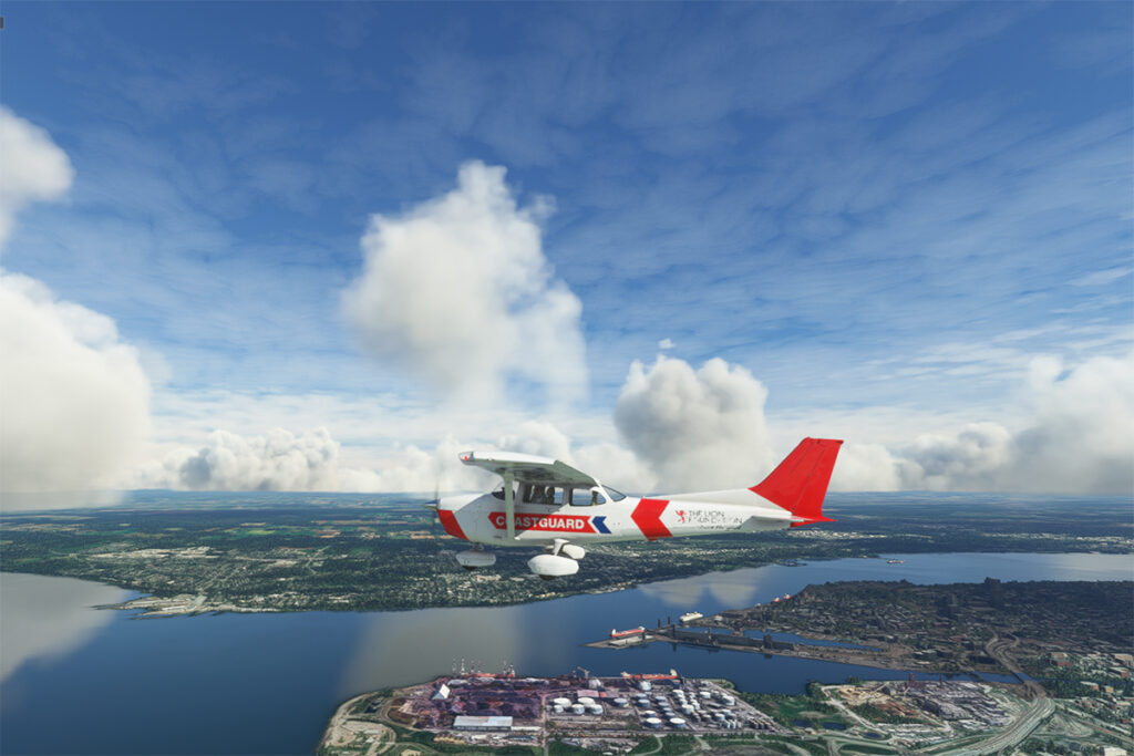
So, let’s use a small Cessna in US Coast Guard colors to make a virtual flight from Quebec City airport (CYQB) to Grosse-Île (CYMN). It was a bit chilly on this February day in Quebec City, so I decided to transport us to July for this flight, adding a few cumuliform clouds in the process.
Leaving Quebec City for Grosse-Île with MSFS 2020.
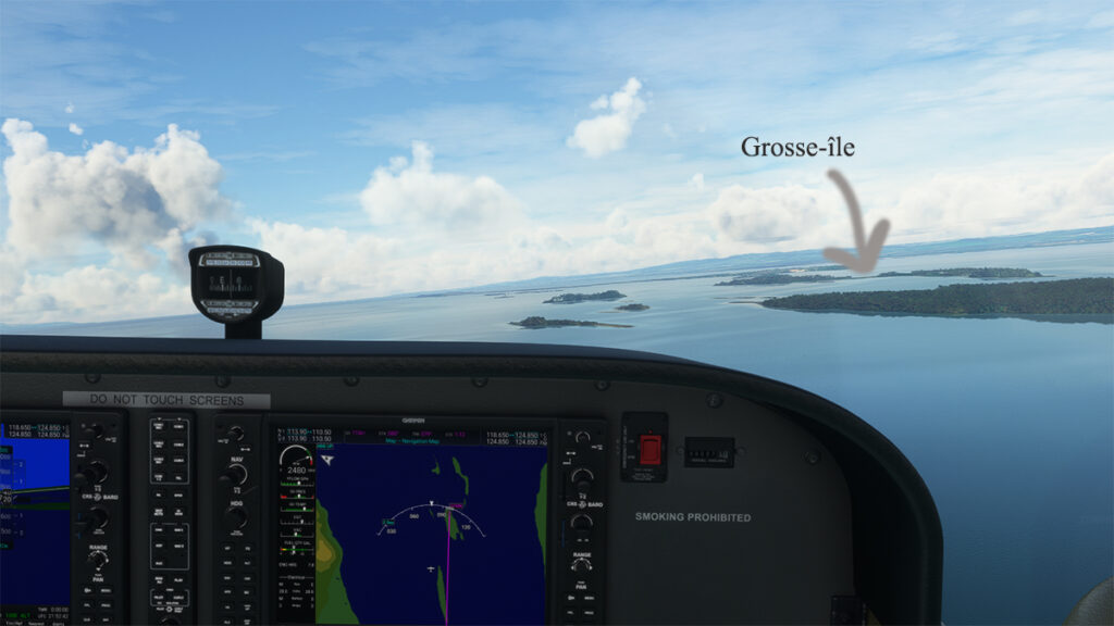
This short flight will allow us to fly over Île d’Orléans, Île Madame (owned by Laurent Beaudoin, former major shareholder of Bombardier), Île au Ruau (purchased in 2019 by the rich owner of the Gildan empire) to finally arrive at Grosse-Île.
Approaching Grosse-Île over the St Lawrence Seaway with the MSFS 2020 flight simulator.
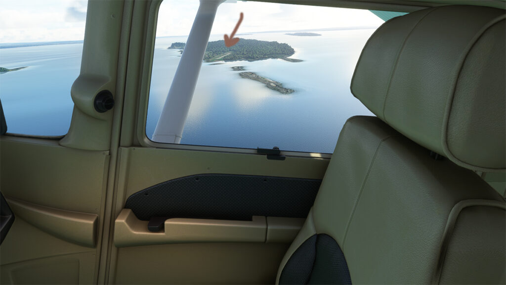
The picture below shows the aircraft on a right base for the Grosse-Île runway. I do not know the official dimensions of this dirt airstrip, but it can easily accept a Cessna aircraft such as ours.
Cessna in base for the Grosse-Île runway with the MSFS 2020 flight simulator.
Below, the aircraft is on final for the runway.
On final for the Grosse-Île runway.
A final screenshot shows the Cessna taxiing down the runway after landing. As you can see, the runway can accommodate much larger aircraft. If you want to make a real flight to this island, find out beforehand about the condition of the runway and the restrictions surrounding its use by visiting pilots.
Cessna aircraft on Grosse-Île after the landing.
Click on the link for more flight simulation experiences on my blog.
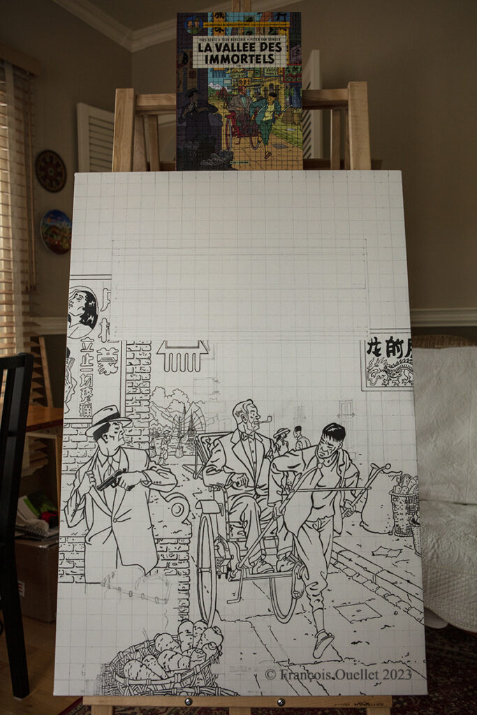
Enlarging the Blake and Mortimer album: La vallée des immortels tome 1
In February 2023, I began transferring the cover of the Blake and Mortimer album “The Valley of the Immortals – Part 1” to a 24 x 36 inch canvas.
The photo above shows the original album sitting on top of the canvas and the work in progress. There is still a lot of work to do before the drawing and lettering are finished.
Then comes the coloring stage, to get the tones as close as possible to the original album. The cover has a lot of colors, which is not the case with many other Blake and Mortimer albums.
This particular album resonates with me for several reasons. First of all, the authors use in the scenario a Cessna C-170B type plane, which brings back memories of flying. Indeed, by a happy coincidence, in 1981 I flew across Canada in this small aircraft dating from 1952. The plane was not equipped with any air navigation instruments, except for an old compass. We were not yet in the GPS era! I published the story of this flight from St-Jean to Edmonton on my blog.
Another reason that increases my interest in the album is also related to a memory. On the cover, Mortimer is in Wan Chai District, a district I visited in 1990 during a trip to Hong Kong and the New Territories. At that time, the Cathay Pacific Boeing B-747 used the legendary Kai Tak airport and flew the approach over a huge demonstration of more than 100,000 people commemorating the anniversary of the Tiananmen Square massacre.
I will be posting more photos of “The valley of the immortals” painting over the next few months, numbering the title of each article so that those interested in the subject can find their way around.
First of all, I admit that the Cessna 170B’s windows are dirty. For realism, the designer Carenado left a little dirt here and there to show the wear and tear of this very old aircraft.
The picture above shows Île d’Orléans as seen from the Cessna. Since there is no landing strip but a golf club in the area, we will use the open fairways to land the aircraft. If there is a golfer on the course, I will open the window and yell, as is customary, “Fore!” (Falling Object Returning to Earth).
On final for Île d’Orléans
We are established on final for the small portion of open ground ahead. With 40 degrees of flaps, the stall speed is particularly low and the landing should not be too difficult.
On Île d’Orléans ready for take-off.
Although the available strip was not very wide, it was long enough for the landing, the taxiing and the maneuvering to turn the aircraft 180 degrees for its take-off to Quebec City.
Airborne from Île d’Orléans with a Cessna 170B
Back in the air, direction Quebec City. The take-off on soft ground requires about 20 degrees of flaps.
Enroute towards Quebec City.
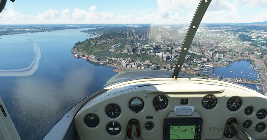
Quebec City is in sight. In the Cessna C-170B I flew in 1981 across Canada from St-Jean-sur-Richelieu to Edmonton, Alberta, there was no modern navigation aid installed on board as in the photo above, where the GPS helps the pilot find his way. The flight was flown using 14 VFR charts and nothing more. (If you are interested, click to read more about real-life flying stories on my blog).
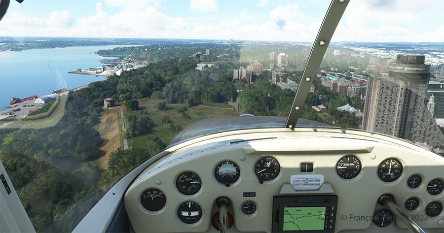
Hôtel le Concorde and its revolving restaurant, visible on the right.
We are now above the Plains of Abraham. On the picture above, on the right, you can see the Hotel le Concorde and its revolving restaurant. We will possibly disturb the quiet atmosphere of the meal as we fly by…
The MNBAQ and the Battlefields Park are in sight.
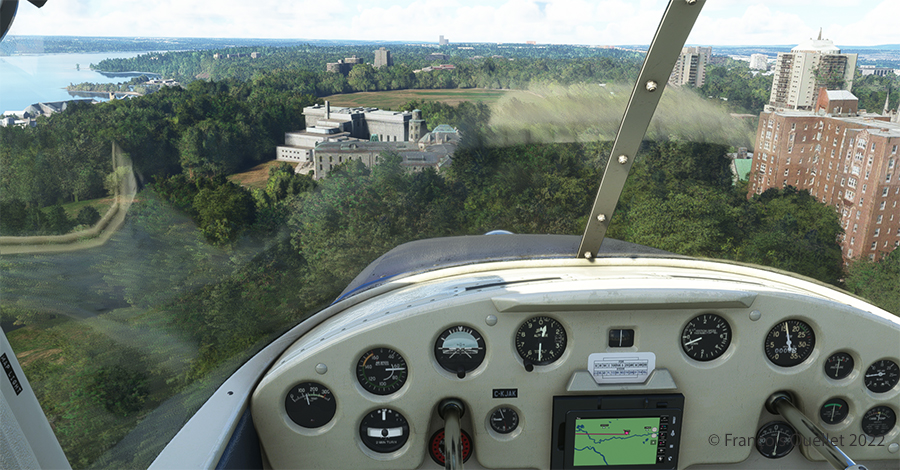
Above, straight ahead, the gray buildings represent a portion of the Musée National des Beaux-Arts de Québec (MNBAQ). A little further on is the open area of the Battlefields Park. In 1928, Lindbergh landed on that field to bring badly needed medicine for his friend Floyd Bennett. Can we normally land on the Battlefields Park, in the heart of Quebec City? Of course not. But that’s the beauty of a flight simulation; you can do whatever you want!
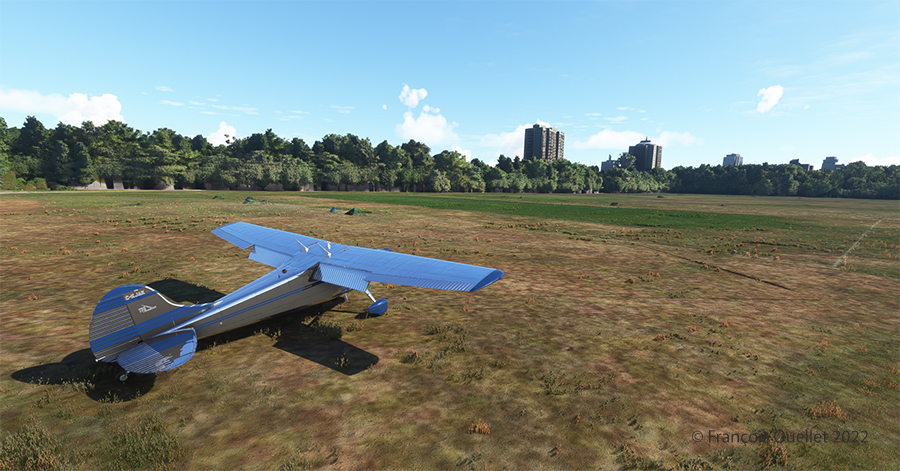
Cessna 170B on the Battlefields Park in Québec City.
Once landed, the aircraft is allowed to decelerate gradually and then turned 180 degrees for the next takeoff. When winds are light, there is no need to worry about the direction of the takeoff.
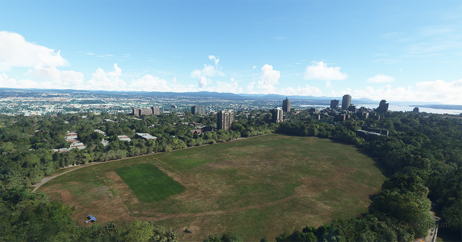
Aerial view of Battlefield Parks with the Cessna 170B under MSFS 2020.
Above, an aerial view of the Battlefields Park, with the virtual Cessna C-170B ready to take off again.
Partial view of Quebec City in flight simulation with MSFS 2020
One last picture, this time with some additional buildings. The realism of the virtual scene with FS2020 is amazing!
I hope you enjoyed these two short flights. Whether you use the short landing technique for the Battlefields Park is really up to you, as there is enough space for a normal landing. But it is good to practice landing in the shortest distance possible. You never know when your engine will quit!
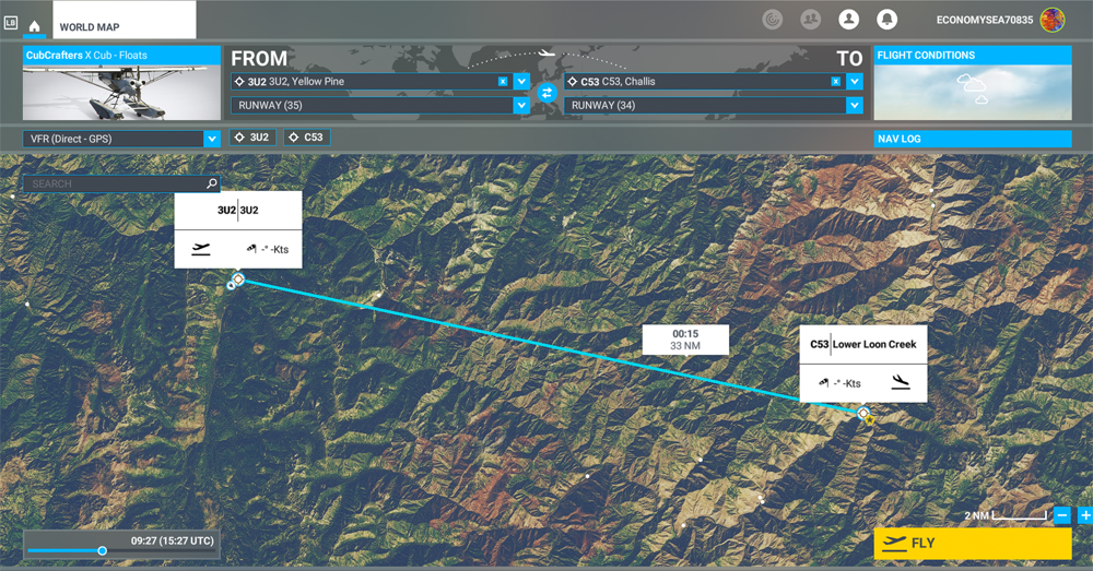
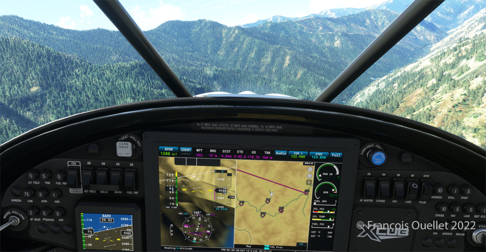
MSFS 2020 map for the flight 3U2 to C53 in United States
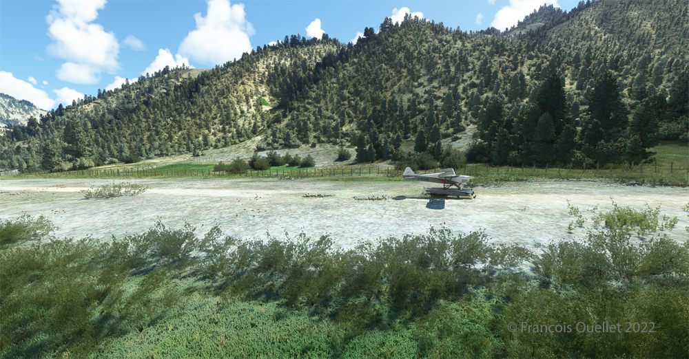
The challenging virtual flight is from Johnson Creek Airport (3U2) to the Lower Loon Creek Airstrip (C53) in the United States, using the MSFS 2020 flight simulator. The software map shows the type of aircraft chosen, a CubCrafters X Cub on floats, as well as the trajectory over the Idaho mountains.
The idea of using an amphibious aircraft for this flight is a bit far-fetched, but the goal is to make the pilot’s job a little more difficult by adding weight to the aircraft.
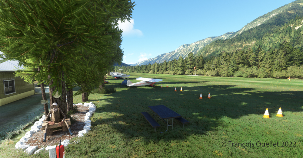
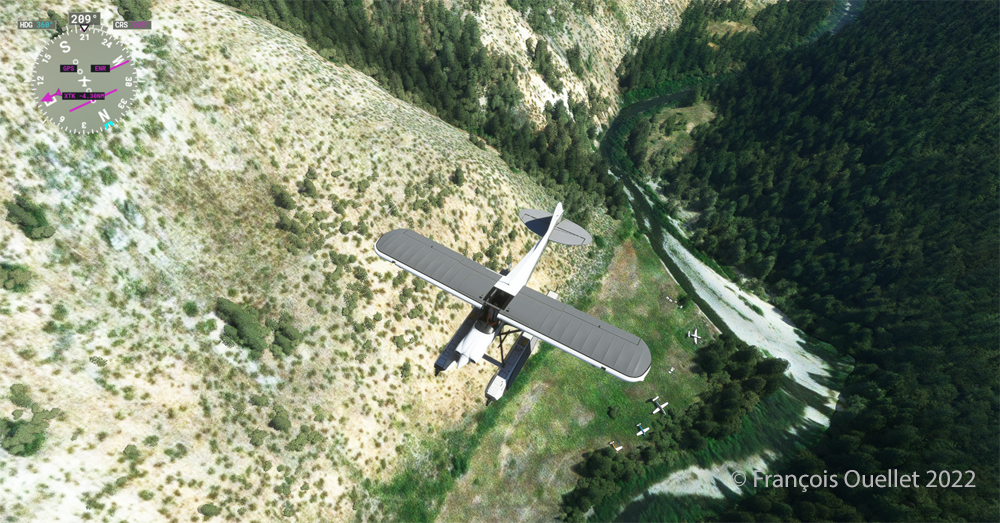
Johnson Creek (Yellow Pine) airport 3U2 with MSFS 2020
Johnson Creek Airport (3U2) is a creation of Creative Mesh. It is charming, with tents here and there planted near the planes. The runway is 3480 feet long by 150 feet wide. It is oriented on a 17/35 axis and still quite high at 4960 feet above sea level (MSL).
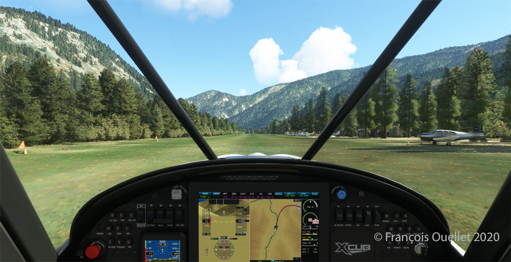
Amphibian CubCrafters X Cub ready for departure at the Johnson Creek 3U2 virtual airport with MSFS 2020.
Given the departure altitude, one must not forget to adjust the air/fuel mixture so as not to lose power on takeoff, especially since there is a mountain at the end of the runway and the floats increase the weight of this small aircraft. The air is also thinner as the flight takes place in summer and at a high altitude; this represents another obstacle to the aircraft’s performance.
Avoiding obstacles after take-off from the 3U2 Johnson Creek virtual airport using MSFS 2020.
The mountains near the runway present a significant obstacle. The virtual pilot must use the best possible angle of climb without worrying about the route recommended by the GPS. The flaps are kept slightly extended during the initial climb.
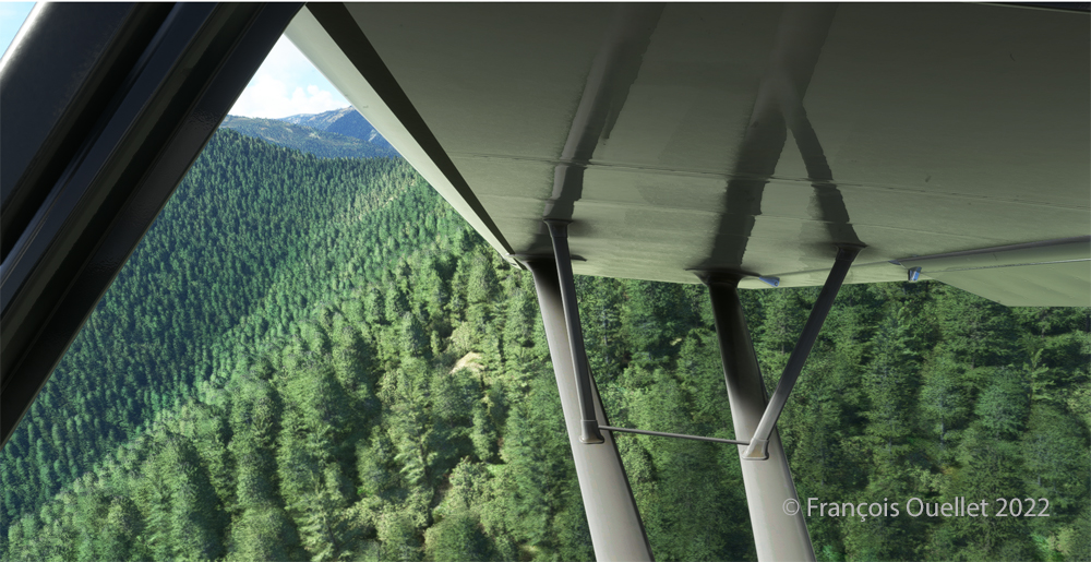
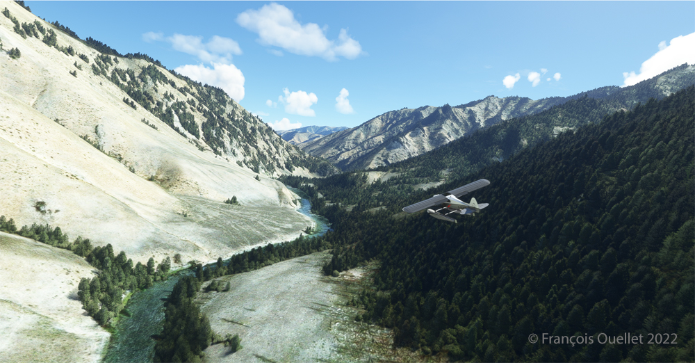
Flying over the Idaho mountains in flight simulation with MSFS 2020.
Once at a safe altitude and back on the GPS suggested route, the view of Idaho’s spectacular mountains is more enjoyable. Throughout the climb, the air-fuel mixture and altimeter (“B” on MSFS 2020) have to be adjusted.
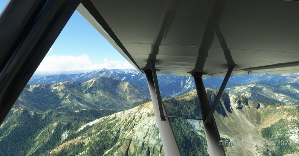
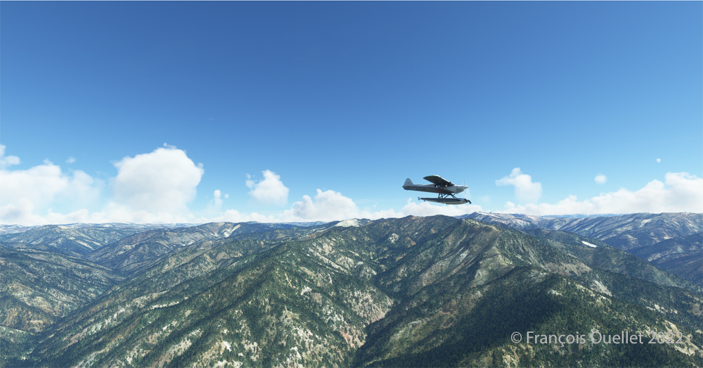
CubCrafters X Cub floatplane over the Idaho mountains in flight simulation MSFS 2020
An altitude of almost 10,000 feet ASL makes it possible to fly over the mountains without risk of collision.
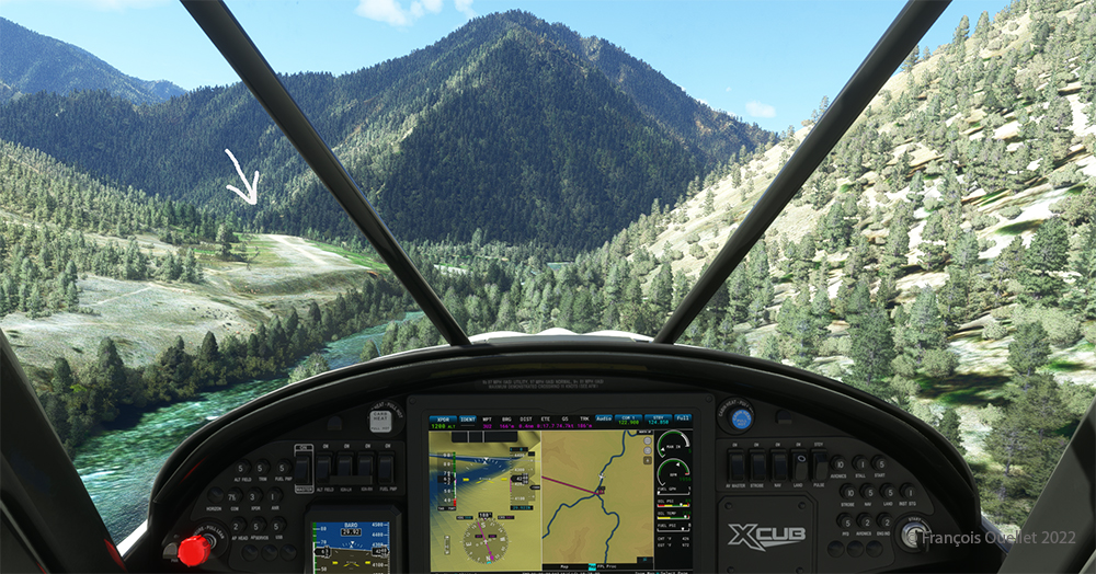
Descending in the valley towards the ID8 Marble Creek airport in Idaho in fligh simulation.
At the right moment, when the small surrounding airports and the river appear on the GPS, we leave our GPS road, until now in straight line, and we align in the valley to fly over the river until our destination, avoiding the surrounding mountains. In the photo above, the descent has already begun, with a necessary gradual adjustment of the air-fuel mixture.
Flying over the (ID8) Marble Creek airport in Idaho using the MSFS 2020 flight simulator.
We fly over a first small airport. The picture above shows the planes parked on the runway of Marble Creek airport (ID8), which dimension is 1160 x 20 feet. For those which would be interested in trying a landing there, the orientation of the runway is 03/21 and the altitude of 4662 feet MSL.
Flying over the 2U8 Thomas Creek Airport in Idaho using the MSFS 2020 flight simulator.
On the way towards our final destination, we also fly at low altitude over the Thomas Creek (2U8).
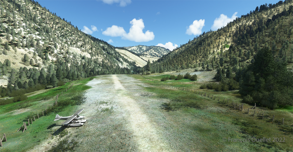
Following the river towards the C53 Lower Loon Creek airstrip using the MSFS 2020 flight simulator.
The mountains on either side of the river require close attention, as the poor performance of a small aircraft equipped with floats does not allow for easy correction of navigational errors.
By the time the runway suddenly becomes visible, the plane will not be on course but 90 degrees off the ideal course. It will be necessary to quickly turn left into the valley, make a fairly sharp 180-degree turn to the right to avoid the mountains, and then get back on course to land. It is only at this point that the landing gear will be extended.
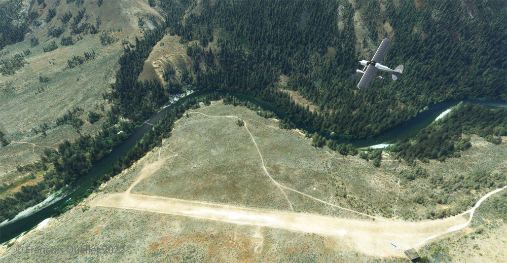
On final for Lower Loon Creek airstrip with MSFS 2020
The photo above shows the aircraft on final for the Lower Loon Creek dirt and grass runway (C53). It is located at 4084 feet MSL and is only 1200 feet long by 25 feet wide. Note that the approach should be made on runway 16 when possible.
Amphibian CubCrafters X Cub rolling down the C53 Lower Loon Creek airstrip in Idaho after landing.
As always, a stabilized aircraft on final makes landing easier, regardless of the conditions.
Amphibian CubCrafters X Cub parked at the C53 Lower Loon Creek airstrip using MSFS 2020 flight simulator.
We park the plane and rest a bit. Today, there is no one else here. But that’s not always the case in real life, as this video of a landing at Lower Loon Creek shows it.
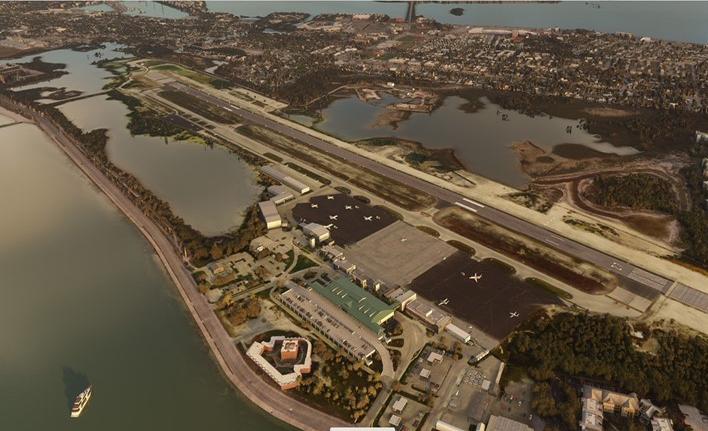
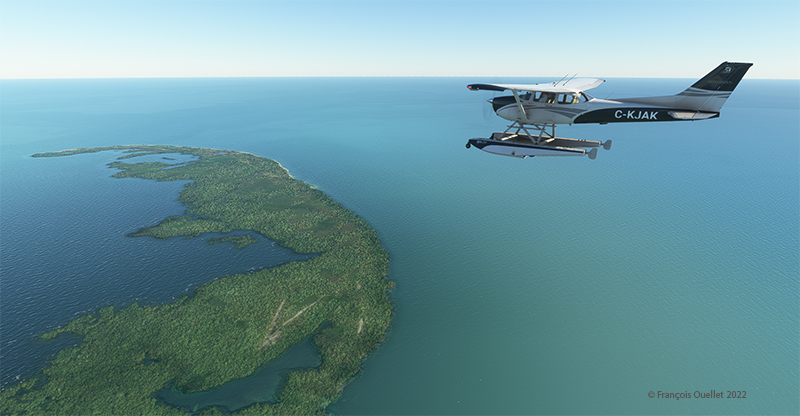
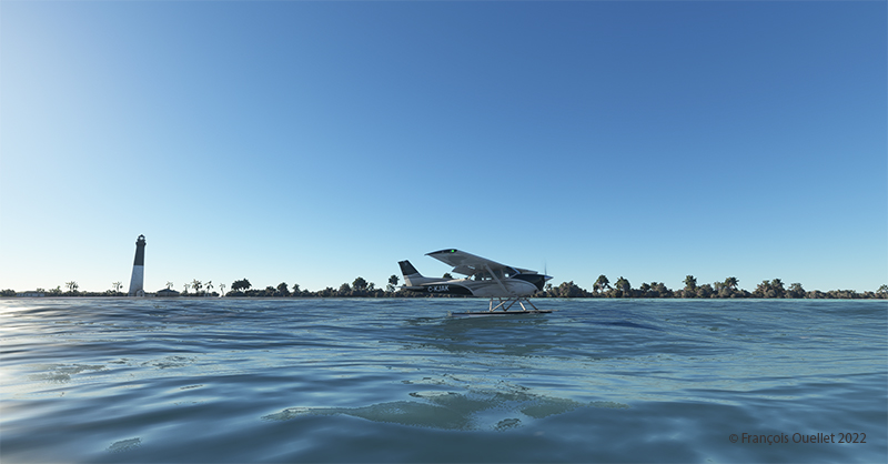
The Key West (KEYW) virtual airport by FSDreamteam for the MSFS 2020 flight simulator.
This is the Key West Airport (KEYW) in Florida, as reproduced for flight simulation by FSDreamteam for the Microsoft MSFS2020 flight simulator.
There is a clear advantage to acquiring this virtual airport rather than using the MSFS2020 airport. Indeed, the FSDreamteam KEYW airport doesn’t come alone: the company offers two other sites in accompaniment and for the same price: Fort Jefferson and the Loggerhead lighthouse.
A small virtual flight with a Cessna C-172 on floats allows you to fly over these sites and land on the water when appropriate.
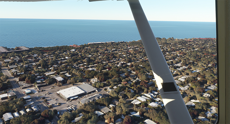
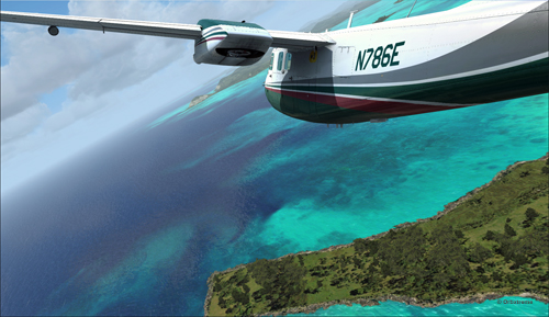
Airborne from Key West KEYW with the MSFS 2020 flight simulator.
The Cessna takes off from Key West under ideal weather conditions.
Part of the Key West Wildlife National Refuge using MSFS 2020
Shortly after takeoff and established at 3000 feet, we fly over the Key West National Wildlife Refuge.
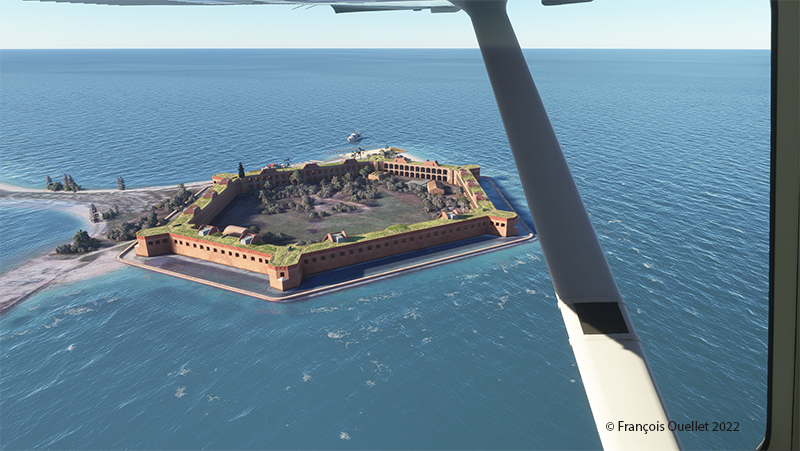
Descending towards Fort Jefferson with MSFS 2020
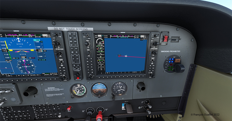
The Garmin G-1000 allows a stable flight during screen captures.
Flying over Fort Jefferson in Key West with MSFS 2020.
This is Fort Jefferson photographed as the Cessna flies at about 1500 feet ASL. The winds have increased slightly and foam is becoming visible on the waves.
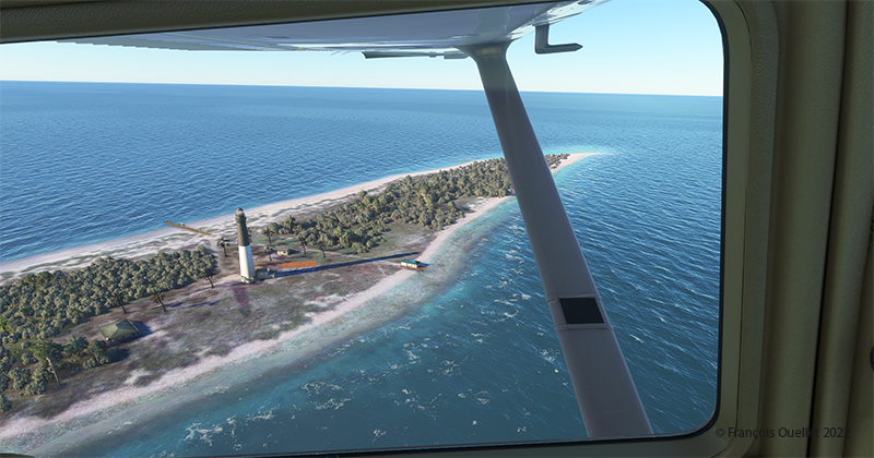
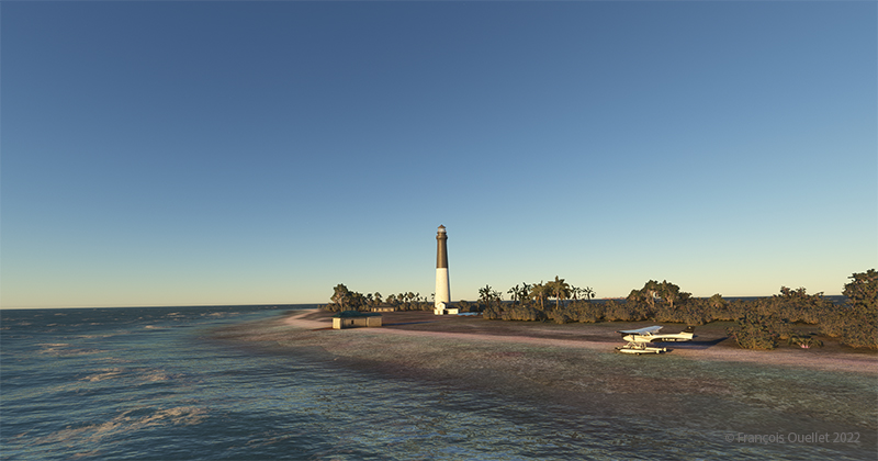
Flying over Loggerhead Lighthouse in Key West using thge MSFS 2020 flight simulator.
A little further along the flight path is the Loggerhead Lighthouse. The beach is beautiful and gently sloping. It will be possible to do a water landing, put the landing gear down while on the water and then park on the beach.
Making a sea-landing by Loggerhead Lighthouse in Key West, with MSFS 2020.
The landing is done without too much difficulty.
On the beach at Loggerhead Lighthouse, in Florida, using MSFS 2020.
With a little engine power, it is possible to get out of the water and park on the beach for a while. After turning off the engine, the MSFS2020 flight simulator allows the pilot to listen to the sound of the waves and wind in a realistic way. If there are birds in the area, it will also be possible to hear them.
For those who want to repeat the experience, it is only a matter of programming the starting point in MSFS2020 as KEYW and the destination KYW1 (Fort Jefferson). Once through Fort Jefferson, continue straight for a few minutes and you’ll arrive at the Loggerhead Lighthouse. Take a few moments to relax and listen to the waves before taking off again…!
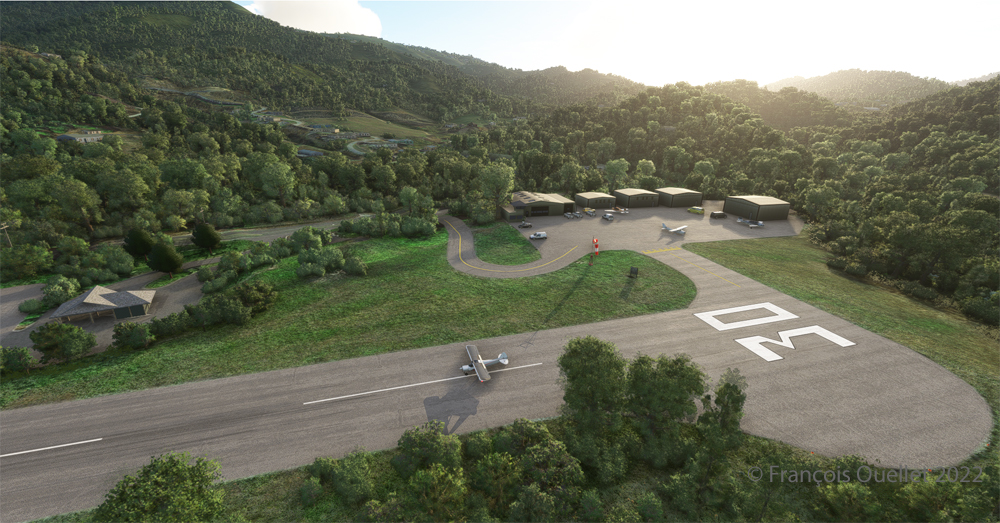
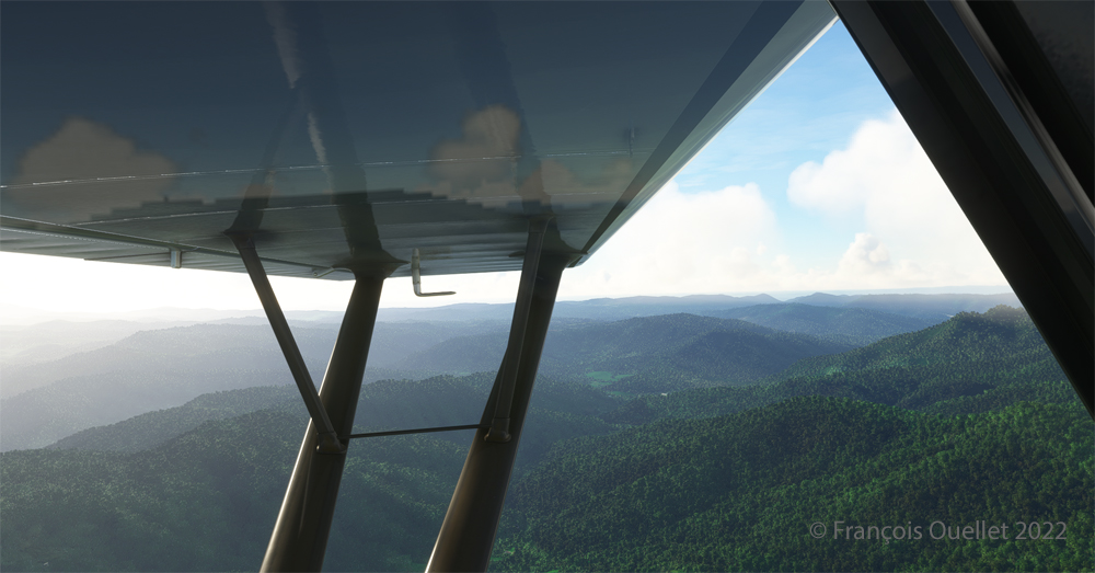
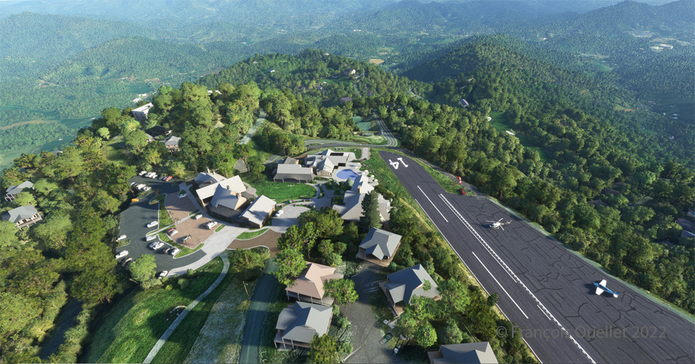
Ready for departure at the Elk River airport (NC06) created by Cloud Studio.
Today’s twenty-minute virtual flight is conducted using Microsoft MSFS 2020 flight simulation software. The virtual airport at Elk River (NC06) in the United States, modeled here by Pilot’s, is located at approximately 3468 feet (ft) above sea level (MSL). Its sloped 12/30 runway can accommodate many types of aircraft as its dimensions are still 4600 feet long by 75 feet wide. A golf course is located near the airport facilities.
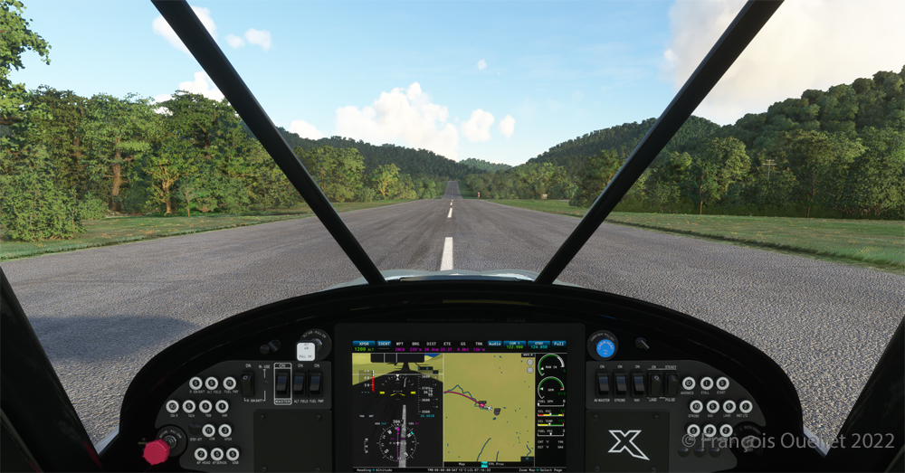
The sloped runway of the Elk River airport (NC06) with the MSFS 2020 flight simulator.
In the distance, the end of runway 30 can be seen rising rapidly. The trip to Mountain Air County Club Airport (2NC0), modeled by Cloud Studio, is made with a single engine Cubcrafters NX Cub.
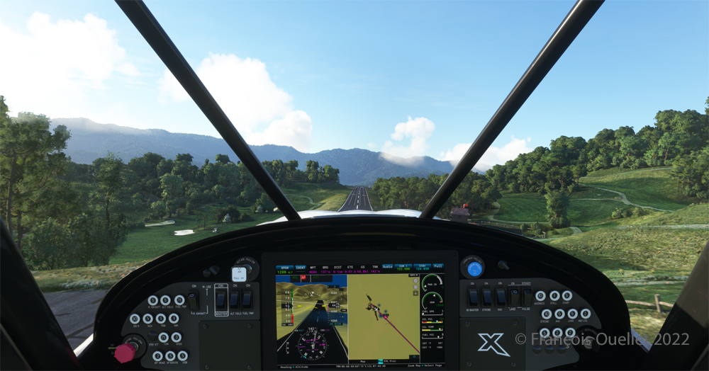
Enroute towards the Mountain Air County Club (2NC0) airport from Elk River (NC06) with MSFS 2020.
In direct flight with GPS, the virtual pilot will have to climb at around 7000 feet msl to avoid the surrounding mountains. It is therefore important to adjust the air/fuel mixture during climb and descent for the destination. Also, don’t forget to adjust the altimeter (press “B”) as you move away from the point of departure. Near the summits, you will experience mechanical turbulence, which is normal.
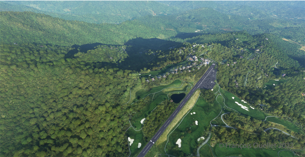
Aerial view of the Mountain Air County Club (2NC0) airport created by Pilot’s.
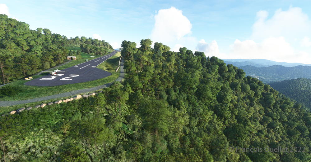
The photo above shows the virtual airport of Mountain Air County Club (2NC0) with the MSFS 2020 flight simulator. The sloped runway is 2900 feet long and only 50 feet wide. A golf course surrounds this airport located at 4432 feet MSL. Since the winds are light, the approach will be on runway 14.
On final for the sloped runway of the Mountain Air County Club (2NC0) airport using MSFS 2020.
On final approach, it is easy to see the uphill angle of this airstrip, which is slightly more damaged than the one at Elk River.
A view of the cliff at the threshold of runway 32 at the 2NC0 Mountain County Air Club airport created by Pilot’s pour MSFS 2020.
As we continue to taxi to the end of runway 14, we notice the cliff that awaits the pilot who has not properly prepared his landing. No forgiveness!
View from above of the Mountain Air County Club airport 2NC0 with the MSFS 2020 flight simulator.
An elevated view shows the threshold of runway 14 and the buildings associated with the golf club. A few golf loving pilots have already parked their aircraft to the left of runway 14. For this screenshot, I used the excellent X-BOX drone.
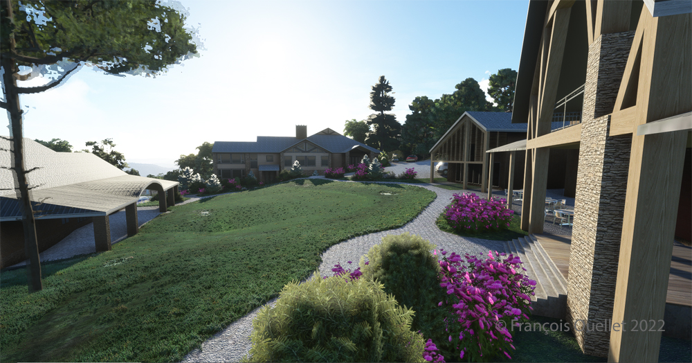
Buildings and flowers at the Mountain Air County Club airport (2NC0) created by Pilot’s for MSFS 2020.
A final photo shows the buildings and flowers associated with the golf club. The bird recordings are easily heard, which enhance the scene. Flight simulation enthusiasts wishing to repeat the experience should do so under VFR conditions to keep an eye on the mountain tops during the approach.
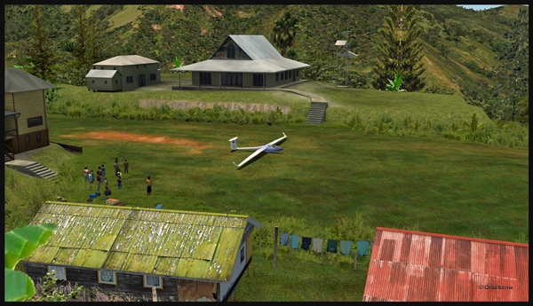
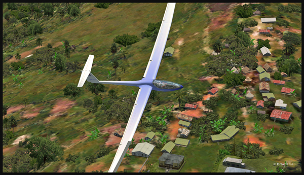
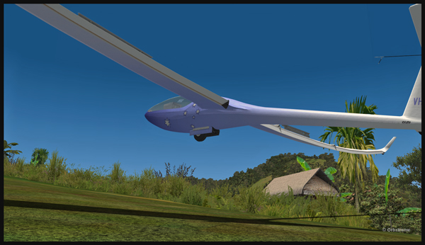
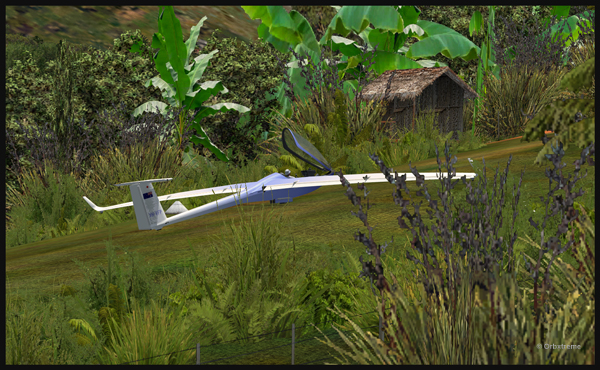
Well, that is it! The first glider just arrived at the Fane Parish airport in Papua New Guinea…
Glider on the Fane Parish short grass runway in Papua New Guinea.
Before it is officially offered as a tourist attraction for the region, some attempts at taking-off and landing must be done. The first trial attracts a few people!
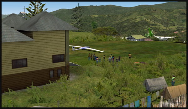
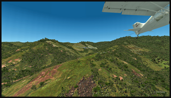
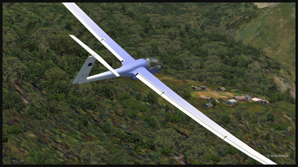
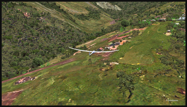
Aircraft and glider on the Fane Parish mountain airfield.
The descent along the twelve degree sloped runway is a bit rough for the glider’s low wings, as there are some bushes that will have to be trimmed!
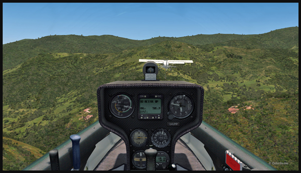
An aircraft pulls a glider after the take-off from the Fane Parish sloped runway in Papua New Guinea.
The weather is nice and very warm. The only potential problem is the mountain ahead.
Glider being towed by an aircraft after the take-off from the Fane Parish mountain airfield.
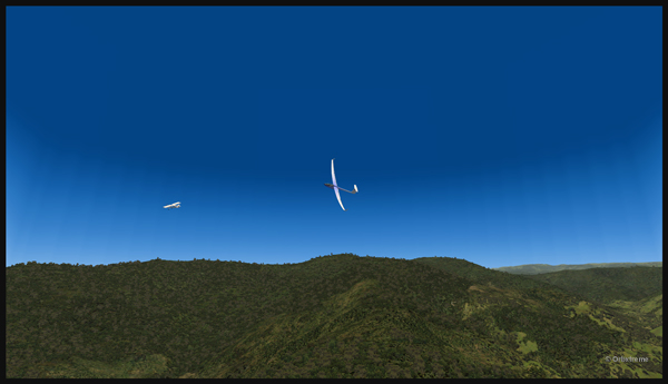
Finally, the pilot cuts the link. He is free to go!
The link is cut between the plane and the glider after the take-off from Fane Parish.
The glider flies silently over the lush area of Papua New Guinea.
Virtually gliding over the Papua New Guinea territory (FSX).
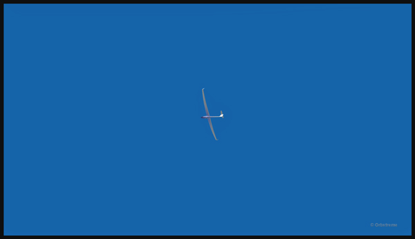
Using the rising warm air currents, the glider gains altitude.
The glider gains altitude.
Why not a pass over Fane?
Gliding over the Fane Parish village.
Here is another isolated village alongside a mountain.
Flight with a virtual glider over an isolated village of Papua New Guinea.
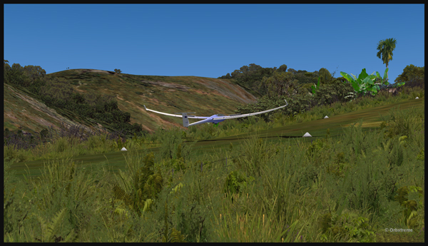
A last steep turn in order to realign for the approach at Fane Parish.
Last steep turn for a short landing on the Fane Parish mountain sloped runway.
The airbrakes are out and the speed reasonable. The sloped runway is just ahead, on top of the mountain to the right.
Approach of a glider on the elevated airfield at Fane Parish in Papua New Guinea. The speed and angle of approach are right on target.
Keeping just enough altitude on the approach to be safe.
Glider approaching the 12 degree sloped runway of the Fane Parish aerodrome.
Now that the landing is a sure thing, it is time to use the airbrakes again to slow down as much as possible.
Virtual glider arriving over the Fane Parish runway in Papua New Guinea. The airbrakes are being used.
Keeping in mind that this mountain airfield as a good slope, it is better to have a bit of extra speed. Nobody likes to stall a few feet over a runway!
Virtual glider with airbrakes over the Fane Parish runway
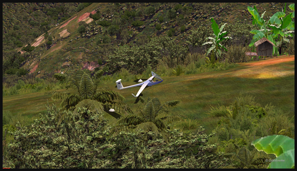
What an experience it was! But I’ll need some help to pull the glider up the slope!
Glider on the Fane Parish runway
The virtual flight was great, the view was worth every penny, and I think that this could become a new touristic attraction for the region and the more wealthy visitors…
The glider has landed on the runway at the Fane Parish airport in Papua New Guinea.
There is no aircraft in the sky around the Port Moresby Jacksons (AYPY) virtual airport today. No aircraft in the sky but one, a medevac flight.
Arrival of the Medevac towards the Port Moresby Jacksons (AYPY) airport. The winds forbid a normal landing.
The winds blow from 240 degree at 50G60 kts and the runways are oriented 14/32. It is way above the maximum crosswind authorized for any aircraft.
But the Shrike Commander’s crew cannot wait until the wind calms down. They must land in the next few minutes in order to save a patient’s life.
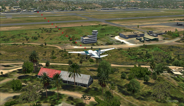
The Port Moresby Jacksons (AYPY) is in sight in the center top of the screen capture.
As there is no traffic around, the captain has told ATC he intends to do a safe, efficient but non-standard approach.
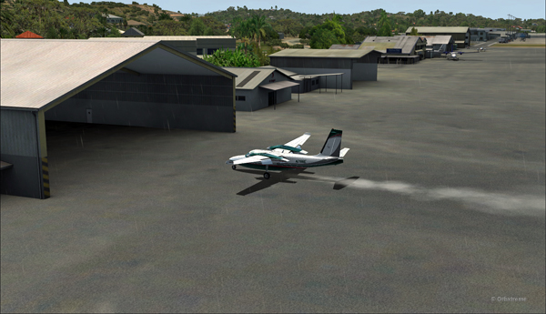
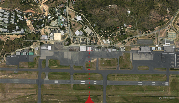
The aircraft is gradually positioned to arrive in a straight line for the AYPY hangar.
The aircraft aligns itself to face the wind blowing across the runways.
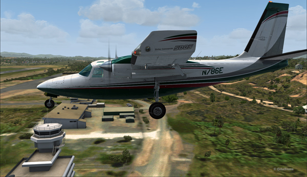
Arriving straight across the runways, facing the wind, the crew intends to land the aircraft a few feet short of a hangar. The captain requests that someone opens the hangar doors right away. The captain will terminate the approach in the hangar, protected from the wind.
Trajectory of the Shrike Commander 500S towards the hangar at the Port Moresby Jacksons airport. The hangar door has been open for the arrival.
It is safer to arrive facing the wind and immediately enter the hangar, straight ahead. No taxiing with a 60 knots crosswind.
Useless to say, ATC has already refused the request. But the pilot is the only one who decides of the best landing surface, for the safety of the passengers and himself. He proceeds with the approach after having clearly indicated which path will be followed.
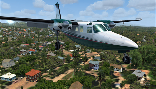
The Shrike Commander 500S over the houses near the Port Moresby Jacksons airport.
The main problem for the approach is the low level mechanical turbulence caused by the gusty 60 kts winds.
If ATC wants to file a complaint, now is a good time to take a picture of the aircraft and its registration to support the case.
Flying by the AYPY control tower.
The actual ground speed of the airplane is around 20 kts.
The Shrike Commander 500S approaching across the runways at the Port Moresby Jacksons airport. The winds blow from 240 degree at 50G60.
The steady high wind speed is actually safer for the crew than if the winds were 240 at 35G60.
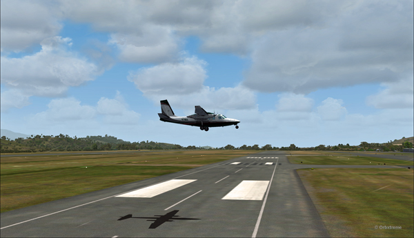
Ground speed of about 20 knots for the Shrike Commander 500S on final for the Port Moresby Jacksons hangar (AYPY).
Still a bit above the runway and with a 10-20 knots ground speed. The airspeed indicator shows the strength of the wind itself plus the ground speed.
Indicated airspeed 70 knots.
Frontal view of the Shrike Commander 500S about to land in front of the hangar at AYPY.
Floating like a hot air balloon or almost!
Side view of the Shrike Commander 500S on final for the Port Moresby Jacksons airport’s hangar.
The Shrike Commander will soon land in Port Moresby Jacksons.
As the aircraft touches the ground, it stops almost immediately. It is necessary to apply power to reach the hangar, as you can see with the white trail on the ground behind the aircraft.
In real life, the touch-down would have had to be as soon as the asphalt start since the presence of the hangar lowers the wind speed a bit.
The Shrike Commander lands a few feet before the hangar. Additional power is mandatory to reach the hangar.
A few seconds after the touch-down, the aircraft is in the hangar, protected from the wind, and both doctor and patient can quickly head out to the hospital.
The Shrike Commander 500S in the hangar at Port Moresby (AYPY).
Once in the hangar, the winds were adjusted to zero, which is kind of logical, unless the opposite wall is missing!
View of the Port Moresby Jacksons (AYPY)
It was now time to brace for another storm, which was the inquiry that would possibly follow the landing!
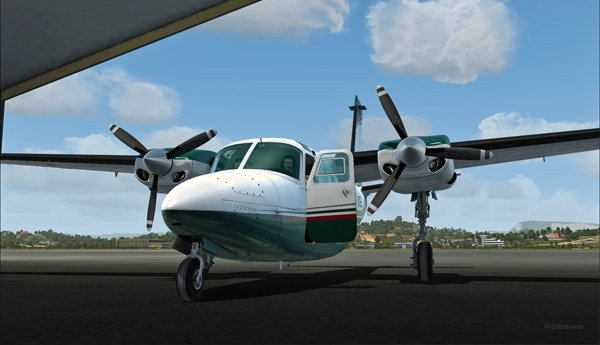
(P.S.: Tim Harris and Ken Hall were the creators of this virtual Port Moresby Jacksons international airport) and it is sold by ORBX. The aircraft is sold by Carenado).