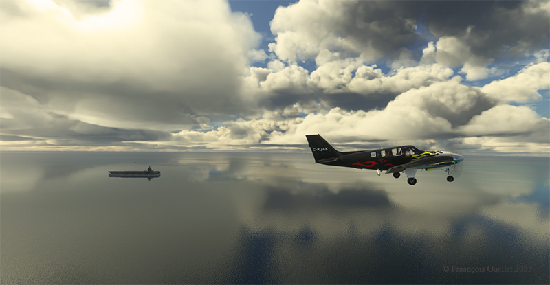
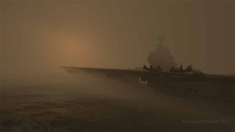
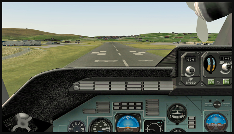
In the real world, this just isn’t done. But in flight simulation, anything goes. Above, the aircraft completes the downwind leg of its approach to the carrier.
On stabilized final with full flaps and landing gear down, the focus is on the approach angle and stall speed, which stands at 73 knots.
Beech Baron Be-58 on final for the Gerarld R. Ford aircraft carrier
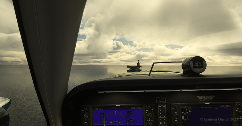
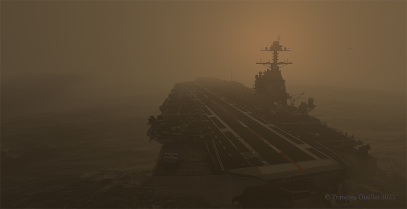
You can’t rely on a cable to stop the plane, so you need the lowest possible speed and good brakes to land it on the 333-meter bridge. Below, the Beech attracts a little curiosity as it circulates to find temporary parking.
Taxiing to park the BE-58 on the aircraft carrier
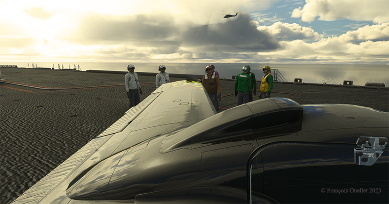
The virtual pilot then parks the aircraft for the next day.
Parked for the night on the CVN78 Gerald R. Ford
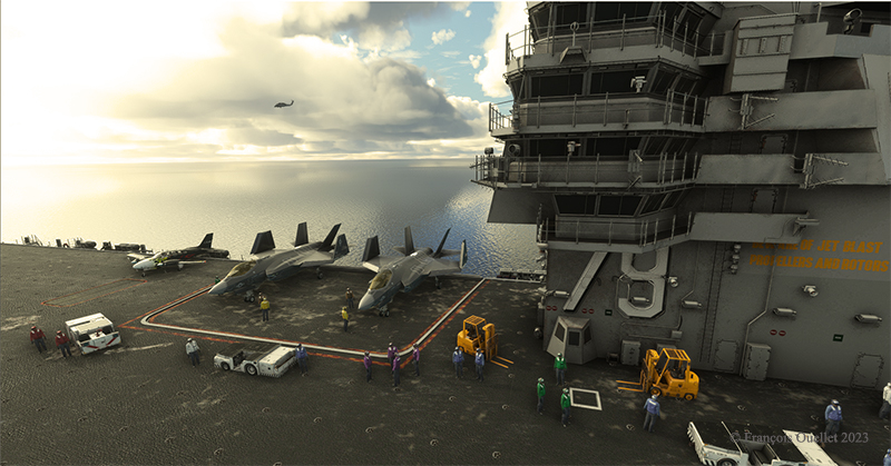
The next two images show the aircraft carrier facing a storm the following evening, with winds blowing at 35 knots during a thunderstorm. On deck, the first aircraft on the left is our Baron Be-58, holding its own. If the storm doesn’t blow it overboard, the military will soon!
The aircraft carrier CVN 78 Gerald R. Ford in a storm
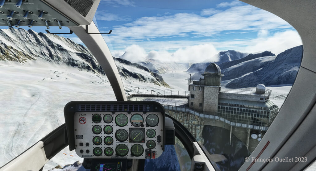
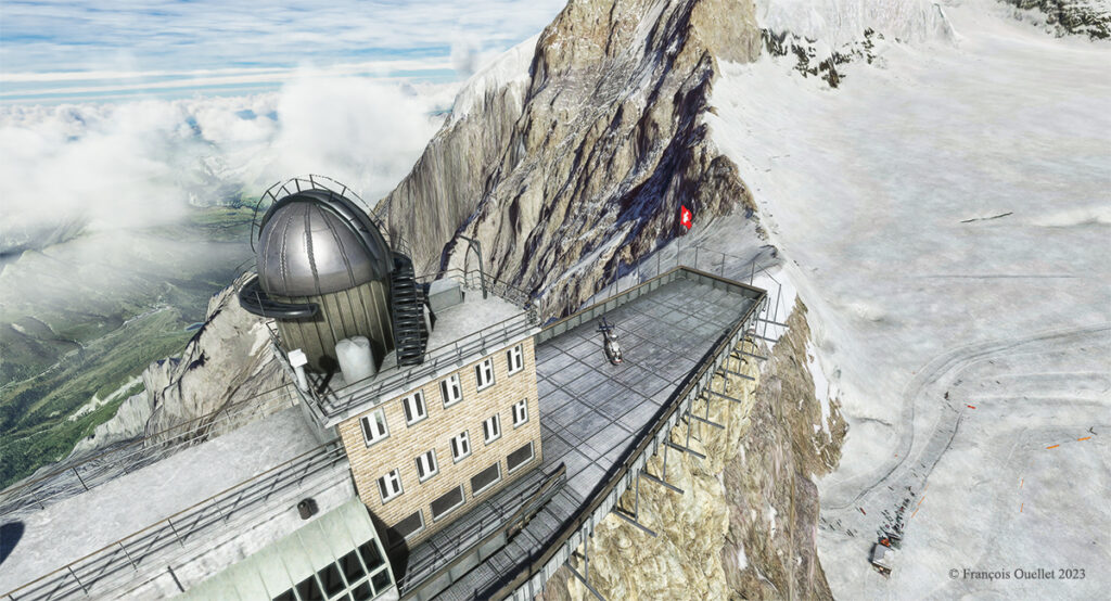
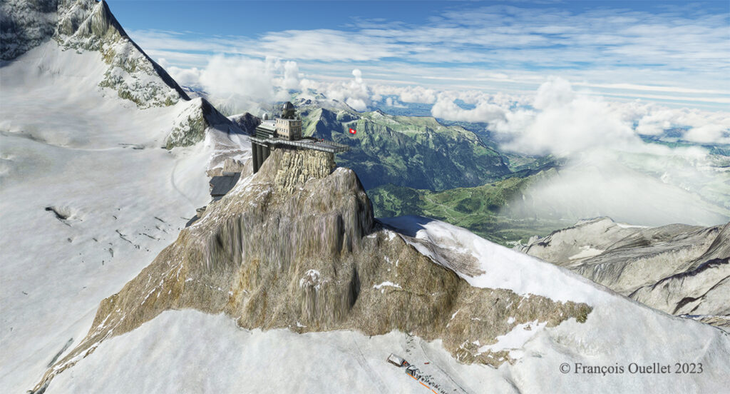
Sphinx astronomical observatory on the Jungfraujoch in Switzerland.
The latter is located in the Jungfraujoch pass in Switzerland, at an altitude of 3571 meters (11,716 feet MSL).
The construction of this station was a feat of engineering at the time, but cost the lives of many workers. One does not make one’s way through a mountain range with sticks of dynamite without the occasional unforeseen agenda imposed by nitroglycerine.
The train can therefore only reach this station by traveling inside the mountains on a steep slope requiring a hydraulic mechanism to pull the train forward. The tourist must trust the engineers and the technical support…
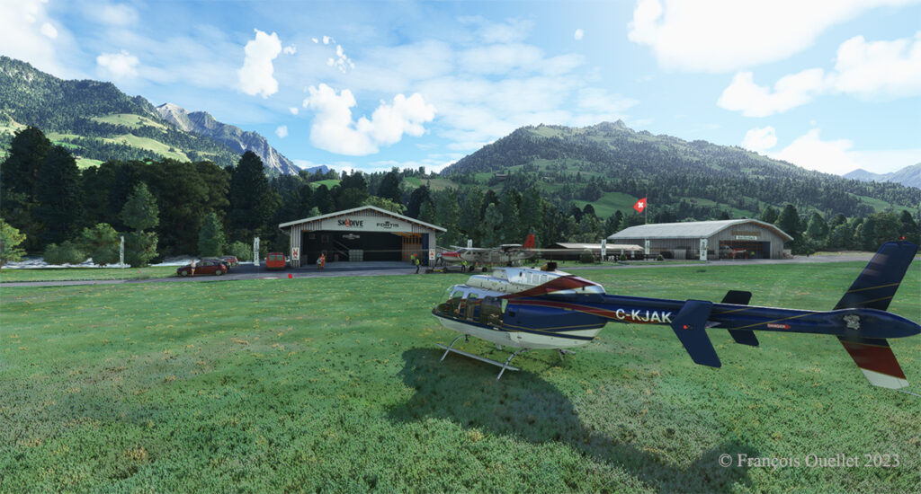
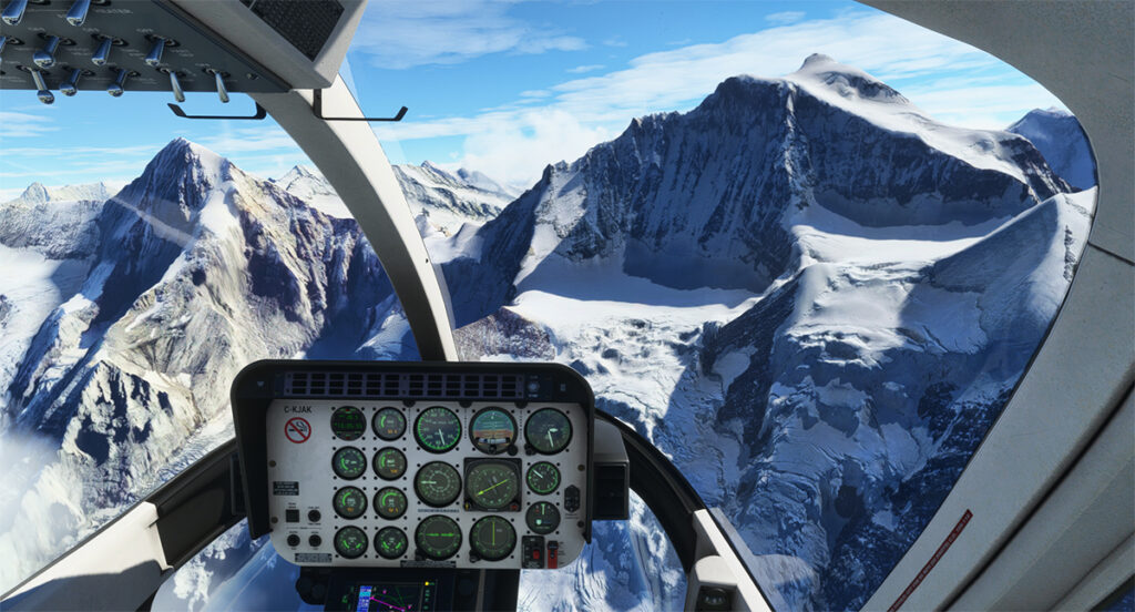
To remind myself of our trip to this region, I thought of taking a virtual helicopter flight from Lauterbrunnen to land directly on the platform of the Sphinx astronomical observatory, this world famous tourist attraction of the Jungfraujoch. Fortunately for me, the company Red Wing Simulations recently created a virtual scene including these two magnificent sites.
Lauterbrunnen, Switzerland and the Microsoft Flight Simulator Bell 407.
Flight simulation enthusiasts will be well advised to use the Bell 407, as the operating limit of the Guimbal Cabri G2 provided by the Microsoft flight simulator is capped at 13,000 feet. It is best to fly with a slightly more powerful aircraft when maneuvering at this altitude.
Airborne from Lauterbrunnen, Switzerland, with Microsoft Flight Simulator 2020.
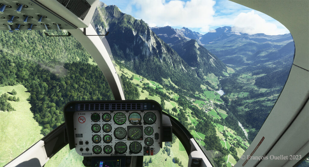
From a green landscape in the summer one gradually flies towards the eternal snow of the highest peaks in the Valais.
Getting closer to the Jungfraujoch, Switzerland.
The scenery was spectacular on the train and it is just as spectacular in virtual flight. A mechanical problem with the helicopter in this environment of grandiose cliffs would leave little chance for the pilot.
Approaching the Sphinx Observatory on the Jungfraujoch, Switzerland.
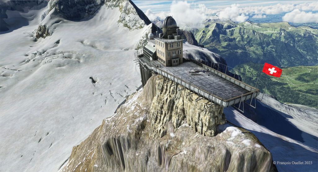
Here we are on approach: it is possible to land on the platform of the Sphinx observatory, but the pilot needs to be prepared for wind shear and unforeseen clouds at this altitude while taking care during the approach to avoid touching the flagpole and the protective fences surrounding the platform.
The Sphinx observatory on the Jungfraujoch with the Bell 407 helicopter on the platform using Microsoft Flight Simulator.
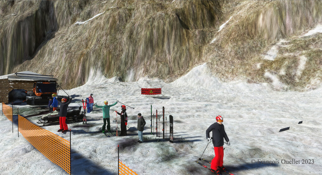
The Red Wing Simulations company has done an outstanding job designing this virtual scenery. In the photo below, you can even see skiers at the bottom of the cliff warming up before their first run.
Red Wing Simulations skiers at the base of the Jungfraujoch observatory on Microsoft Flight Simulator.
Even if the virtual scene includes something other than Lauterbrunnen and the Jungfraujoch, the pleasure of making a successful approach on the Sphinx platform alone is worth the cost of acquiring the software.
The Sphinx observatory on the Jungfraujoch and the helicopter on the platform using Microsoft Flight Simulator
Microsoft Flight Simulator and Red Wing Simulations representation of the Jungfraujoch Observatory platform.
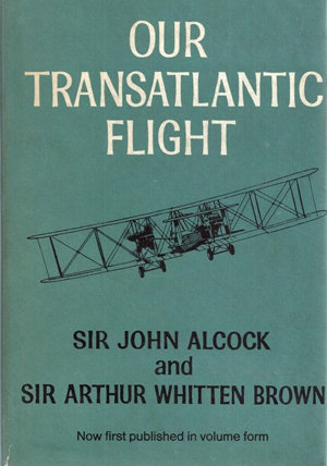
Our transatlantic flight, by Sir John Alcock and Sir Arthur Whitten Brown
Newfoundland
Before 1949, Newfoundland was called Dominion of Newfoundland and was part of the British Commonwealth . In 1949, it became a Canadian province.
The first non-stop flight eastward across the Atlantic.
The book « Our transatlantic flight » tells the story of the historic flight that was made in 1919, just after the First World War, from Newfoundland to Ireland. There was a 10,000 £ prize offered by Lord Northcliffe from Great Britain for whoever would succeed on the first non-stop flight eastward across the Atlantic.
A triumph for British aviation
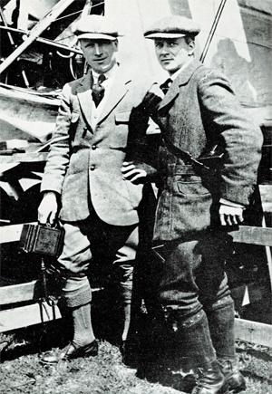
Sir John Alcock and Sir Arthur Whitten Brown , respectively pilot and navigator, wrote the story of their successful flight in this book which was published in 1969. The followings are pilot quotes from the book : « For the first time in the history of aviation the Atlantic had been crossed in direct, non-stop flight in the record time of 15 hours, 57 minutes. » (p.13) « The flight was a triumph for British aviation; the pilot and navigator were both British, the aircraft was a Vickers-Vimy and the twin engines were made by Rolls-Royce. » (p.13)
Sir John Alcock and Sir Arthur Whitten Brown
As with all great human achievements, a very good flight planning and some luck was needed to make this flight a success. If there was an engine failure during the flight, even if the planning was excellent, there was only one outcome : downward.
In order to make the flight, Alcock and Brown boarded a ship from England bound to Halifax. They then headed to Port aux Basques and finally arrived in St.John’s. There, they joined a small group of British aviators who had arrived a few days before and who were also preparing for the competition. « The evenings were mostly spent in playing cards with the other competitors at the Cochrane Hotel, or in visits to the neighbouring film theatres. St.John’s itself showed us every kindness. » (p.60)
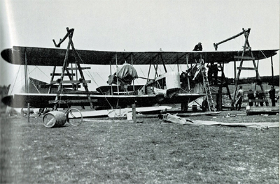
Maritime transport was used to carry the Vickers-Vimy biplane to Newfoundland on May 4th. It was assembled in Newfoundland. « The reporters representing the Daily Mail, the New York Times, and the New York World were often of assistance when extra manpower was required. » (p.61).
While the aircraft was being built, there were more and more visiters coming to the site. Brown says : « Although we remained unworried so long as the crowd contented itself with just watching, we had to guard against petty damage. The testing of the fabric’s firmness with the point of an umbrella was a favourite pastime of the spectators […]. » (p.61)
The Vickers-Vimy is being reassembled at Quidi Vidi in Newfoundland.
It was difficult to find a field that could be improvised into an aerodrome : « Newfoundland is a hospitable place, but its best friends cannot claim that it is ideal for aviation. The whole of the island has no ground that might be made into a first-class aerodrome. The district around St.John’s is especially difficult. Some of the country is wooded, but for the most part it shows a rolling, switchback surface, across which aeroplanes cannot taxi with any degree of smoothness. The soil is soft and dotted with boulders, as only a light layer covers the rock stratum. Another handicap is the prevalence of thick fogs, which roll westward from the sea. » (p.59)
They flight tested the airplane on June 9th at Quidi Vidi. During the short flight, the crew could see icebergs near the coast. They did a second trial on June 12th and found that the transmitter constantly caused problems. But, at least, the engines seemed to be reliable…
The departure
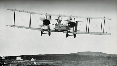
The two men left Newfoundland on June 14th 1919. In order to fight the cold air in flight, they wore electrically heated clothing. A battery located between two seats provided for the necessary energy.
The Vickers-Vimy departs from Newfoundland in 1919
The short take-off was very difficult due to the wind and the rough surface of the aerodrome. Brown writes : « Several times I held my breath, from fear that our under-carriage would hit a roof or a tree-top. I am convinced that only Alcock’s clever piloting saved us from such an early disaster. » (p.73)
It took them 8 minutes to reach 1000 ft. Barely one hour after departure and once over the ocean, the generator broke and the flight crew was cut off from all means of communication.
As the airplane consumed petrol, the centre of gravity changed and since there was no trim on the machine, the pilot had to exert a permanent backward pressure on the joystick.
Flying in clouds, fog and turbulence.
During the flight with much clouds and fog, Brown, having almost no navigation aid, had real problems to estimate the aircraft’s position and limit the flying errors. He had to wait for a higher altitude and for the night to come to improve his calculations : « I waited impatiently for the first sight of the moon, the Pole Star and other old friends of every navigator. » (p.84). The fog and clouds were so thick that at times they « cut off from view parts of the Vickers-Vimy. » (p.95)
Without proper instruments to fly in clouds, they were relying on a « revolution-counter » to establish the climbing or the falling rate. That is pretty scary. « A sudden increase in revolutions would indicate that the plane was diving; a sudden loss of revs would show that she was climbing dangerously steeply. » (p.176)
But that was not enough. They also had to deal with turbulence that rocked the plane while they could not see anything outside. They became desoriented : « The airspeed indicator failed to register, and bad bumps prevented me from holding to our course. From side to side rocked the machine, and it was hard to know in what position we really were. A spin was the inevitable result. From an altitude of 4,000 feet we twirled rapidly downward.[…]. « Apart from the changing levels marked by aneroid, only the fact that our bodies were pressed tightly against the seats indicated that we were falling. How and at what angle we were falling, we knew not. Alcock tried to centralise the controls, but failed because we had lost all sense of what was central. I searched in every direction for an external sign, and saw nothing but opaque nebulousness. » (p.88)
« It was a tense moment for us, and when at last we emerged from the fog we were close down over the water at an extremely dangerous angle. The white-capped waves were rolling along too close to be comfortable, but a quick glimpse of the horizon enabled me to regain control of the machine. » (p.40).
De-icing a gauge installed outside of the cockpit.
Snow and sleet were falling. They didn’t realize how lucky they were to continue flying in such a weather. Nowadays, there are many ways to dislodge ice from a wing while the aircraft is in flight. Here is what Brown says about their situation : « […] The top sides of the plane were covered completely by a crusting of frozen sleet. The sleet imbedded itself in the hinges of the ailerons and jammed them, so that for about an hour the machine had scarcely any lateral control. Fortunately, the Vickers-Vimy possesses plenty of inherent lateral stability; and, as the rudder controls were never clogged by sleet, we were able to hold to the right direction. » (p.95)
After twelve hours of flying, the glass of a gauge outside the cockpit became obscured by clotted snow. Brown had to deal with it, while Alcock was flying. « The only way to reach it was by climbing out of the cockpit and kneeling on top of the fuselage, while holding a strut for the maintenance of balance. […] The violent rush of air, which tended to push me backward, was another discomfort. […] Until the storm ended, a repetition of this performance, at fairly frequent intervals, continued to be necessary. » (p.94)
In order to save themselves, they executed a descent from 11,000 to 1000 feet and in the warmer air the ailerons started to operate again. As they continued their descent below 1000 feet over the ocean, they were still surrounded by fog. They had to do some serious low altitude flying : « Alcock was feeling his way downward gently and alertly, not knowing whether the cloud extended to the ocean, nor at what moment the machine’s undercarriage might touch the waves. He had loosened his safety belt, and was ready to abandon ship if we hit the water […]. » (p.96)
The arrival.
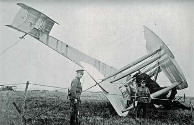
They saw Ireland at 8.15 am on June 15th and crossed the coast ten minutes later. They did not expect a very challenging landing as the field looked solid enough to support an aircraft. They landed at 8 :40 am at Clifden on top of what happened to be a bog; the aircraft rolled on its nose and suffered serious material damages. The first non-stop transatlantic flight ended in a crash. Both both crewmen were alive and well, although they were dealing with fatigue…
The transatlantic flight ends up in Ireland in a soft field
Initially, nobody in Ireland believed that the plane arrived from North America. But when they saw mail-bags from Newfoundland, there were « cheers and painful hand-shakes » (p.102).
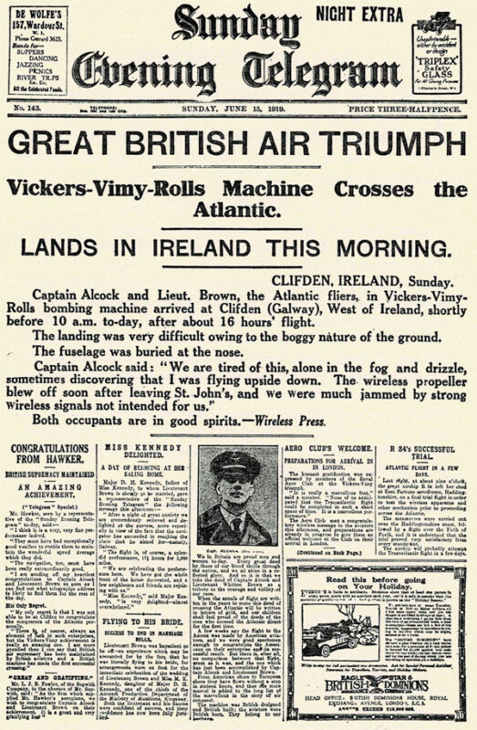
First page of the Sunday Evening Telegraph in 1919.
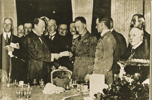
They were cheered by the crowds in Ireland and England and received their prize from Winston Churchill.
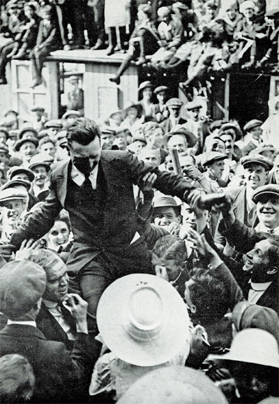
John Alcock chaired by the crowd
Winston Churchill is presenting the Daily Mail Check to the two pilots.
Their record stood unchallenged for eight years until Lindbergh’s flight in 1927.
The future of transatlantic flight.
Towards the end of the book, the authors risk a prediction on the future of transatlantic flight. But aviation made such a progress in a very short time that, inevitably, their thoughts on the subject was obsolete in a matter of a few years. Here are some examples :
« Nothwithstanding that the first two flights across the Atlantic were made respectively by a flying boat and an aeroplane, it is evident that the future of transatlantic flight belongs to the airship. » (p.121)
« […] The heavy type of aeroplane necessary to carry an economical load for long distances would not be capable of much more than 85 to 90 miles an hour. The difference between this and the present airship speed of 60 miles an hour would be reduced by the fact that an aeroplane must land at intermediate stations for fuel replenishment. » (p.123)
« It is undesirable to fly at great heights owing to the low temperature; but with suitable provision for heating there is no reason why flying at 10,000 feet should not be common. » (p.136)
The Air Age.
There is a short section in the book on the « Air Age ». I chose two small excerpts on Germany and Canada :
On Germany’s excellent Zeppelins : « The new type of Zeppelin – the Bodensee – is so efficient that no weather conditions, except a strong cross-hangar wind, prevents it from making its daily flight of 390 miles between Friedrichshafen and Staalsen, thirteen miles from Berlin. » (p.140)
On Canada’s use of aeroplanes : « Canada has found a highly successful use for aeroplanes in prospecting the Labrador timber country. A group of machines returned from an exploration with valuable photographs and maps of hundreds of thousands of pound’s worth of forest land. Aerial fire patrols, also, are sent out over forests.» (p.142) and « Already, the Canadian Northwest Mounted Police [today the RCMP] have captured criminals by means of aeroplane patrols. » (p.146)
Conclusion
The Manchester Guardian stated, on June 16th 1919 : « […] As far as can be foreseen, the future of air transport over the Atlantic is not for the aeroplane. It may be used many times for personal feats of daring. But to make the aeroplane safe enough for business use on such sea routes we should have to have all the cyclones of the Atlantic marked on the chart, and their progress marked in from hour to hour. »(p.169)
Title : Our Transatlantic Flight
Authors : Sir John Alcock and Sir Arthur Whitten Brown
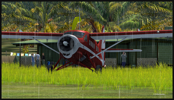
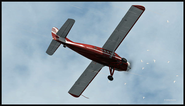
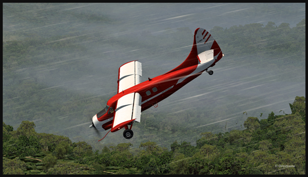
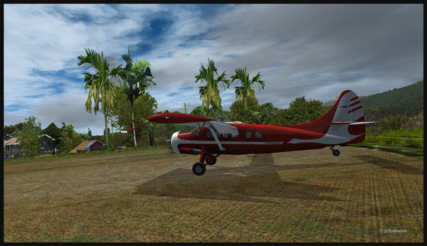
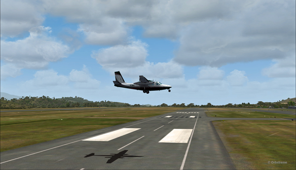
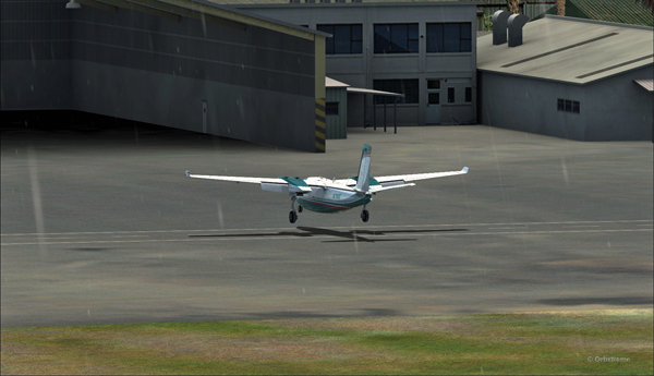
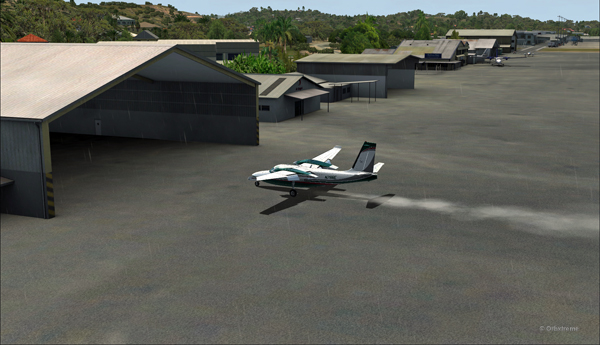
An Air Saguenay DHC-3 Otter has made it from Québec to Kokoda, in Papua New Guinea. It is expected to work around the remote mountain airfields for a while.
The Air Saguenay Otter is taxiing for the Kokoda runway towards Launumu in Papua New Guinea.
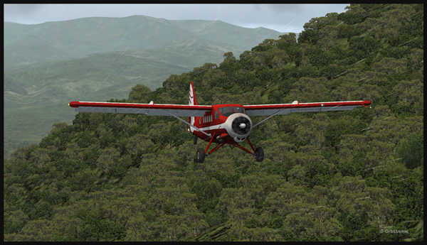
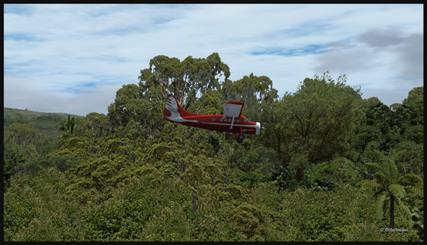
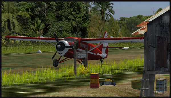
Today, the Otter heads for Launumu, a mountain airfield that is at an elevation of 5082 ft asl and 1200 feet long.
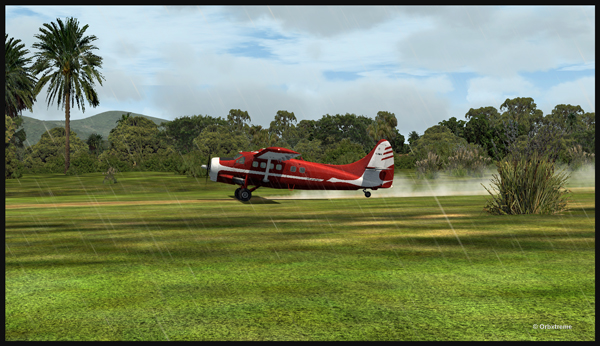
The Air Saguenay Otter departing Kokoda.
The pilot has to watch for the birds in order to avoid any collision in flight…
Otter aircraft and birds.
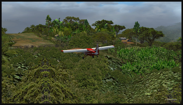
Following the Kokoda trail is a good way to reach Launumu.
The Otter in the Papua New Guinea mountains, following the Kokoda Trail.
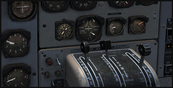
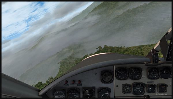
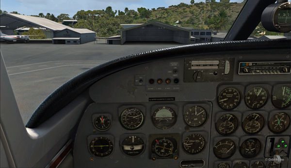
If the mixture is not adjusted, the Otter will lose a lot of steam trying to climb up to 7,500 feet to cross the first line of mountains.
Inside the Otter cockpit, with the mixture adjusted.
Anybody landing and departing from Launumu deals with high density altitude. This is not only due to the elevation of the airfield but also to the very warm and moist air present in the region. Consequently, some additional airspeed is required on the approach and on the departure.
The Launumu runway is in sight.
When a pilot lands southwestward in Launumu coming from Kokoda, he must dive in a valley to lose altitude, which will increase the aircraft’s airspeed. The Launumu runway is in sight.
If the airspeed is not promptly corrected, the approach to the Launumu runway will be too fast. Any airspeed above 60 knots forces the pilot to overshoot (unless you are ready to virtually die a few times while trying).
Losing altitude while respecting the flaps speed limit.
So, once the higher mountains are crossed, a good way of losing altitude without gaining airspeed is to use flaps (at the corresponding airspeed) and do a tight 360 degree coordinated turn while descending. That way, the pilot will end up in line with the runway and at the speed you want, which is around 50 knots.
Turning and descending in the valley during an approach for Launumu.
The Otter floats endlessly because of its huge wings.
The Air Saguenay Otter is on approach for the Launumu short runway in Papua New Guinea.
On final for Launumu, the pilot might end up having to deal with the bushes that are close to the runway. It is not unusual for the Otter or the Beaver to complete a difficult approach with bushes wrapped around the landing gear.
A Air Saguenay Otter is on final for the Launumu mountain runway.
A Otter aircraft is arriving on the Launumu high altitude runway.
Launumu has a surprise for the newcomers. If the pilot lands southwestward, like it was just done here, and the aircraft is not stopped within approximately 600 feet, it starts accelerating since there is a pronounced slope downward in the second half of the runway. This slope leads to a cliff. In case of a missed approach, the pilot can use the slope downwards and dive in the valley at the end of the runway to build up airspeed and start a new approach.
Now that the hard work is done, it is time to wait for the passengers and cargo, and plan the next leg…
A Otter aircraft is backtracking the Launumu runway after landing.
A Otter aircraft is parked on the Launumu runway in Papua New Guinea.
The virtual scenery and clouds required softwares like REX, REX Texture Direct, Cumulus X, FTX Global, FTX Global Vector and Pilot’s FS Global 2010.
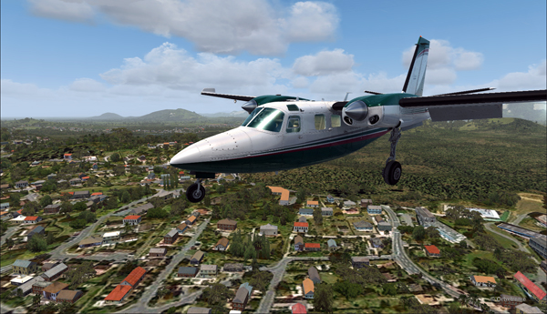
There is no aircraft in the sky around the Port Moresby Jacksons (AYPY) virtual airport today. No aircraft in the sky but one, a medevac flight.
Arrival of the Medevac towards the Port Moresby Jacksons (AYPY) airport. The winds forbid a normal landing.
The winds blow from 240 degree at 50G60 kts and the runways are oriented 14/32. It is way above the maximum crosswind authorized for any aircraft.
But the Shrike Commander’s crew cannot wait until the wind calms down. They must land in the next few minutes in order to save a patient’s life.
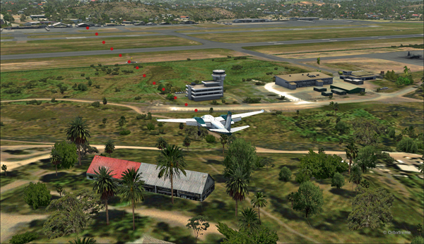
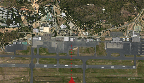
The Port Moresby Jacksons (AYPY) is in sight in the center top of the screen capture.
As there is no traffic around, the captain has told ATC he intends to do a safe, efficient but non-standard approach.
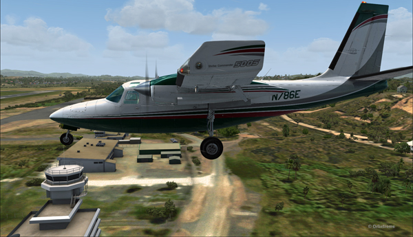
The aircraft is gradually positioned to arrive in a straight line for the AYPY hangar.
The aircraft aligns itself to face the wind blowing across the runways.
Arriving straight across the runways, facing the wind, the crew intends to land the aircraft a few feet short of a hangar. The captain requests that someone opens the hangar doors right away. The captain will terminate the approach in the hangar, protected from the wind.
Trajectory of the Shrike Commander 500S towards the hangar at the Port Moresby Jacksons airport. The hangar door has been open for the arrival.
It is safer to arrive facing the wind and immediately enter the hangar, straight ahead. No taxiing with a 60 knots crosswind.
Useless to say, ATC has already refused the request. But the pilot is the only one who decides of the best landing surface, for the safety of the passengers and himself. He proceeds with the approach after having clearly indicated which path will be followed.
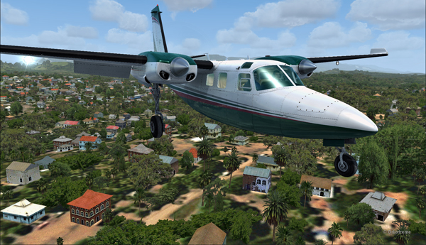
The Shrike Commander 500S over the houses near the Port Moresby Jacksons airport.
The main problem for the approach is the low level mechanical turbulence caused by the gusty 60 kts winds.
If ATC wants to file a complaint, now is a good time to take a picture of the aircraft and its registration to support the case.
Flying by the AYPY control tower.
The actual ground speed of the airplane is around 20 kts.
The Shrike Commander 500S approaching across the runways at the Port Moresby Jacksons airport. The winds blow from 240 degree at 50G60.
The steady high wind speed is actually safer for the crew than if the winds were 240 at 35G60.
Ground speed of about 20 knots for the Shrike Commander 500S on final for the Port Moresby Jacksons hangar (AYPY).
Still a bit above the runway and with a 10-20 knots ground speed. The airspeed indicator shows the strength of the wind itself plus the ground speed.
Indicated airspeed 70 knots.
Frontal view of the Shrike Commander 500S about to land in front of the hangar at AYPY.
Floating like a hot air balloon or almost!
Side view of the Shrike Commander 500S on final for the Port Moresby Jacksons airport’s hangar.
The Shrike Commander will soon land in Port Moresby Jacksons.
As the aircraft touches the ground, it stops almost immediately. It is necessary to apply power to reach the hangar, as you can see with the white trail on the ground behind the aircraft.
In real life, the touch-down would have had to be as soon as the asphalt start since the presence of the hangar lowers the wind speed a bit.
The Shrike Commander lands a few feet before the hangar. Additional power is mandatory to reach the hangar.
A few seconds after the touch-down, the aircraft is in the hangar, protected from the wind, and both doctor and patient can quickly head out to the hospital.
The Shrike Commander 500S in the hangar at Port Moresby (AYPY).
Once in the hangar, the winds were adjusted to zero, which is kind of logical, unless the opposite wall is missing!
View of the Port Moresby Jacksons (AYPY)
It was now time to brace for another storm, which was the inquiry that would possibly follow the landing!
(P.S.: Tim Harris and Ken Hall were the creators of this virtual Port Moresby Jacksons international airport) and it is sold by ORBX. The aircraft is sold by Carenado).
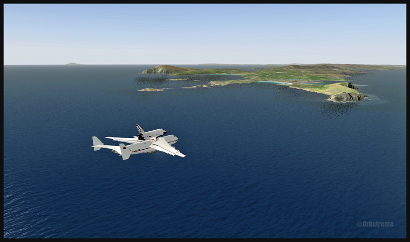
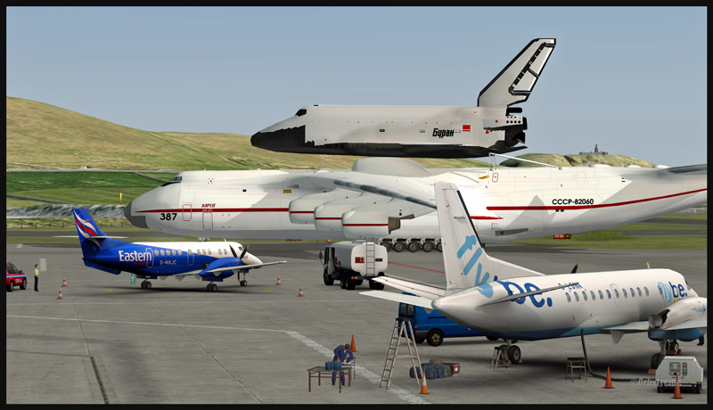
Antonov 225 with the Russian shuttle Bourane inbound for Sumburgh, Scotland (FSX)
Antonov 225 with the Bourane shuttle on final approach to Sumburgh, Scotland (FSX)
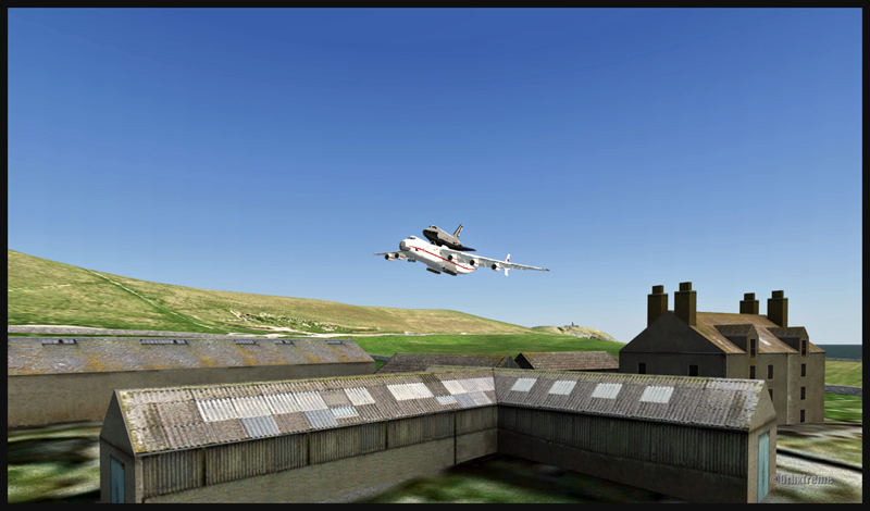
I know, Sumburgh is not an airport meant to receive the Antonov 225, even less with the Russian space shuttle Buran as cargo. In fact, this aircraft and Sumburgh exclude each other mutually. But if you want to try an almost impossible virtual flight , now is the opportunity.
Antonov 225 with the Bourane shuttle on short final approach to Sumburgh, Scotland (FSX)
You must forget about the weight of the aircraft on the runway, the limited space to taxy and park, and the required distance for an eventual take-off. It is probable that once in Sumburgh, this aircraft will stay there forever.
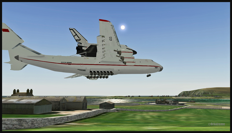
Antonov 225 with the Russian shuttle Bourane over the runway in Sumburgh, Scotland (FSX)
It is interesting, though, to remember the exceptional performances of the Antonov 225. While flying over the Bourget for a demonstration, it was able to maintain a 45 degree turn with the 62 tons Russian shuttle mounted on top.
Speed 126 kts on the Sumburgh runway, Scotland, with the Antonov 225 and the Russian shuttle Bourane (FSX)
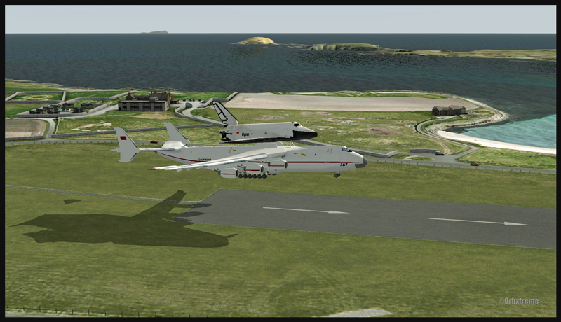
Antonov 225 taxiing in Sumburgh, Scotland (FSX)
The approach can be made at a surprisingly slow speed for an aircraft of that weight and the breaking performance is known to be excellent. In Sumburgh, you have the choice between two runways (4700 to 4900 feet). Forget about a safe final approach, you must fly it like a daredevil. It is possible to download the Antonov 225 and the shuttle for free. As for the Sumburgh airport, it is a creation of ORBX and is available for a very reasonable fee.
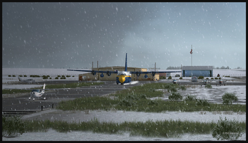
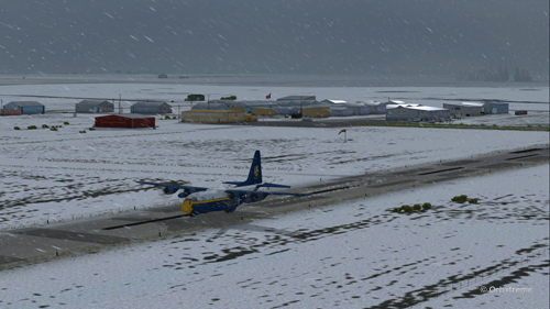
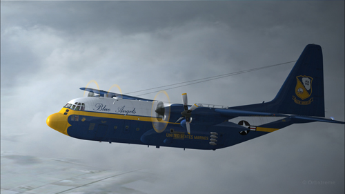
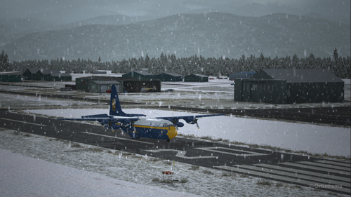
A virtual C-130 belonging to the Blue Angels is taxiing at the High River airport, in Alberta.
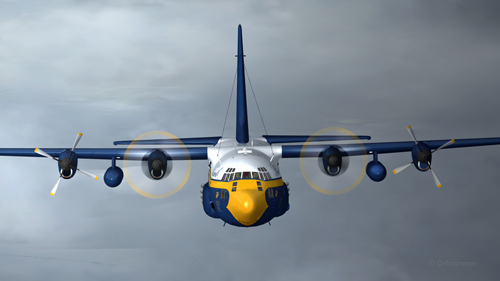
Wanting to add an almost impossible flight in the “unhinged virtual flights” section of my web site, I tried a flight with the Blue Angels C-130 Hercules (Captain Sim) where the aircraft gradually lost all of its engines.
The Blue Angels C-130 Hercules waiting in line behind a single engine aircraft at the High River airport.
I am aware that the Blue Angels mechanics are real professionals, so I assumed that the engine failures were caused by an unknown reason.
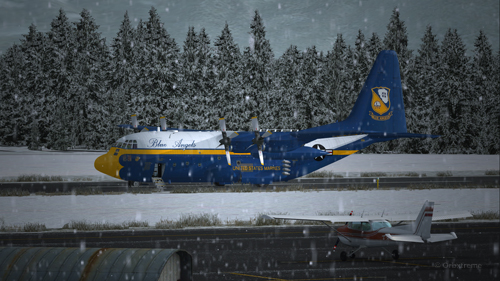
A virtual Blue Angels Lockheed C-130 Hercules takes-off from the High River (CEN4) Canadian airport in Alberta.
The take-off was made without problem from the Canadian High River (CEN4) airport. This free airport was designed by Vlad Maly and is available through ORBX. The aircraft leaves the 4150 feet runway heading to the Coeur d’Alène airport (KCOE) in United States.
Eventually, the first engine stops. This does not cause a problem. The propeller is feathered and the gradual climbing continues.
The C-130 Hercules loses its first engine.
The second engine stops. The pilot must forget the initial destination. Bonners Ferry (65S) becomes the alternate airport since the 4000×75 feet runway is good enough for the C-130.
The second engine has just stopped on this C-130 Hercules.
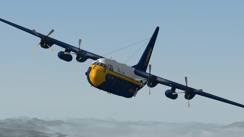
Double engine failure for this virtual Blue Angles C-130 Hercules.
The third engines gives way. A slow descent starts. Bonners Ferry is not very far. The airport is at an altitude of 2337 ft asl.
The aircraft is volontarily flown at a higher altitude than what would normally be requested for a normal approach, just in case the fourth engine stops. When three engines stop after the same refueling, the pilot has the right to think that what feeds the fourth engine can also cause problems.
Three engine failures on this virtual Blue Angels C-130 Hercules.
The highest mountains are now behind the aircraft.
Virtual C-130 Hercules aircraft with three engine failures enroute to the Bonners Ferry airport.
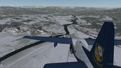
The Bonners Ferry (65S) runway is in sight.
Virtual C-130 Hercules aircraft with three engine failures, by the Bonners Ferry’s runway.
The fourth engine stops. The flaps will not be functional for the landing.
From now on, the pilot should save the virtual flight a few times since it is possible that several trials will be necessary to glide sucessfully to the airport. This is the fun of virtual flight.
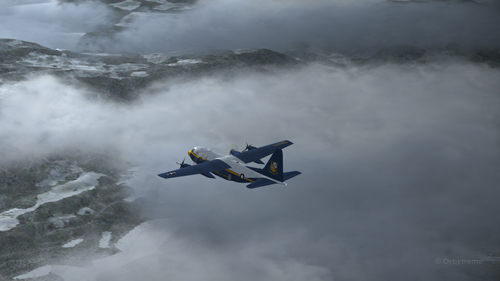
The four engines have now failed on that virtual C-130 aircraft.
The C-130 Hercules has become a big glider. When the speed is maintained, the aircraft loses more 1000 feet per minute. It is easier to feel the aircraft’s inertia.
The wheels will be brought out only when necessary since the gear adds a lot of drag.
From the position indicated in the picture below, it is impossible to arrive to the airport in a straight line: the aircraft will glide over the airport. In the picture, the aircraft seems to be on a good path for landing, but it is an illusion caused by the wide-angle format chosen for the screen capture.
The aircraft is definitely too high. It is impossible to use the flaps to increase the rate of descent.
Lockheed C-130 Hercules virtual aircraft with four engine failures on the approach to the Bonners Ferry’s virtual airport (65S).
One must choose between 1) sideslips 2) a 360 degree turn to lose altitude or 3) multiple steep turns perpendicular to the runway to increase to distance to the airport.
What would you choose?
There is no universal method. The 360 degree turn is riskier but can prove efficient. An Airbus A330-200 flown by Quebecer Robert Piché that had lost all of its engines landed successfully in the Açores in 2001 after attempting a last minute 360 degree turn to lose altitude. But here, I did not believe there was enough altitude to safely complete the turn and reach the runway.
A few steep turns were made to extend to ride to the airport. Why steep turns? In order to avoid getting closer to the airport before an acceptable altitude was reached. This method helped keep an eye on the runway at all times to verify if the slope to the airport was still acceptable.
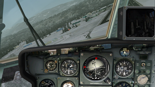
Fourty degree turn to the right on the approach to the Bonners Ferry’s airport.
Steep turn to the left to extend the distance to the Bonners Ferry airport.
I tried the three methods, always starting from the same saved flight (photo 10). After several sideslips, the aircraft was always approaching the airport too quickly. There was not enough time to lose altitude. The final speed always happened to be too high to stop a C-130 without flaps or thrust reversers.
The 360 degree turn, be it right or left, with different angles and a reasonable speed, always incurred a loss of altitude that brought the aircraft 200 to 300 feet short of the threshold.
Finally, after a few steep turns, the aircraft was positioned on final with the appropriate speed and altitude.
View of the Lockheed C-130 Hercules with four engine failures, on the approach for Bonners Ferry (65S).
A few last seconds adjustments, to reposition the aircraft in the center of the runway.
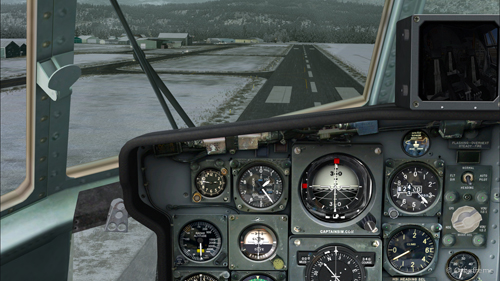
Speed 150 knots. End of the turn for the Bonners Ferry’s airport.
At 140 kts, but without any reverse thrust, the whole runway should be necessary to stop the aircraft.
Speed 140 knots, aligned with the Bonners Ferry’s runway.
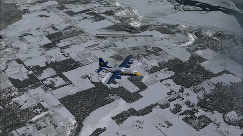
The landing was smooth and the aircraft stopped short of the threshold.
For an unknown reason, the anemometer was still indicating a 10 kts airspeed, even when the aircraft had stopped.
C-130 cargo aircraft on the Bonners Ferry’s runway.
Lockheed C-130 Hercules virtual aircraft after landing at the Bonners Ferry (65S) airport.
C-130 Hercules aircraft in Bonners Ferry.
Try such a flight in the virtual mode. The worst that can happen is that you have fun!