Categories
Flight Simulation

The Jungfraujoch in flight simulation.

On the train heading for the Jungfraujoch, Switzerland 2013.

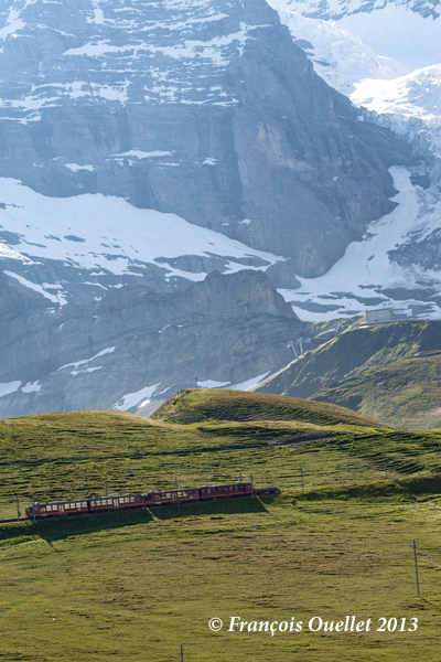
Ten years ago this year, we took the train to the Jungfraujoch Top of Europe station.

Sphinx astronomical observatory on the Jungfraujoch in Switzerland.

The latter is located in the Jungfraujoch pass in Switzerland, at an altitude of 3571 meters (11,716 feet MSL).

The construction of this station was a feat of engineering at the time, but cost the lives of many workers. One does not make one’s way through a mountain range with sticks of dynamite without the occasional unforeseen agenda imposed by nitroglycerine.

The train can therefore only reach this station by traveling inside the mountains on a steep slope requiring a hydraulic mechanism to pull the train forward. The tourist must trust the engineers and the technical support…

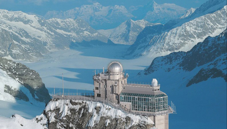
To remind myself of our trip to this region, I thought of taking a virtual helicopter flight from Lauterbrunnen to land directly on the platform of the Sphinx astronomical observatory, this world famous tourist attraction of the Jungfraujoch. Fortunately for me, the company Red Wing Simulations recently created a virtual scene including these two magnificent sites.

Lauterbrunnen, Switzerland and the Microsoft Flight Simulator Bell 407.

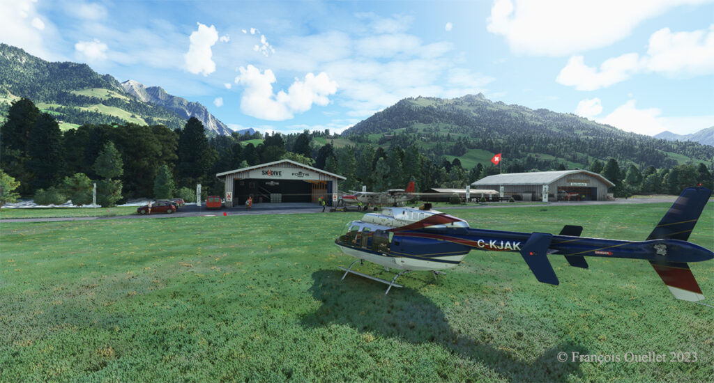
Flight simulation enthusiasts will be well advised to use the Bell 407, as the operating limit of the Guimbal Cabri G2  provided by the Microsoft flight simulator is capped at 13,000 feet. It is best to fly with a slightly more powerful aircraft when maneuvering at this altitude.

Airborne from Lauterbrunnen, Switzerland, with Microsoft Flight Simulator 2020.

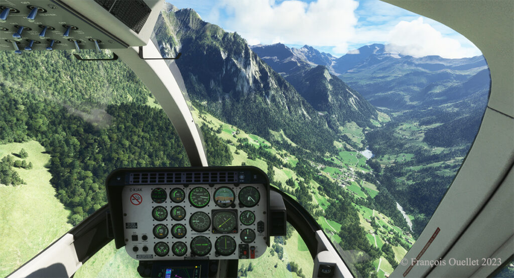
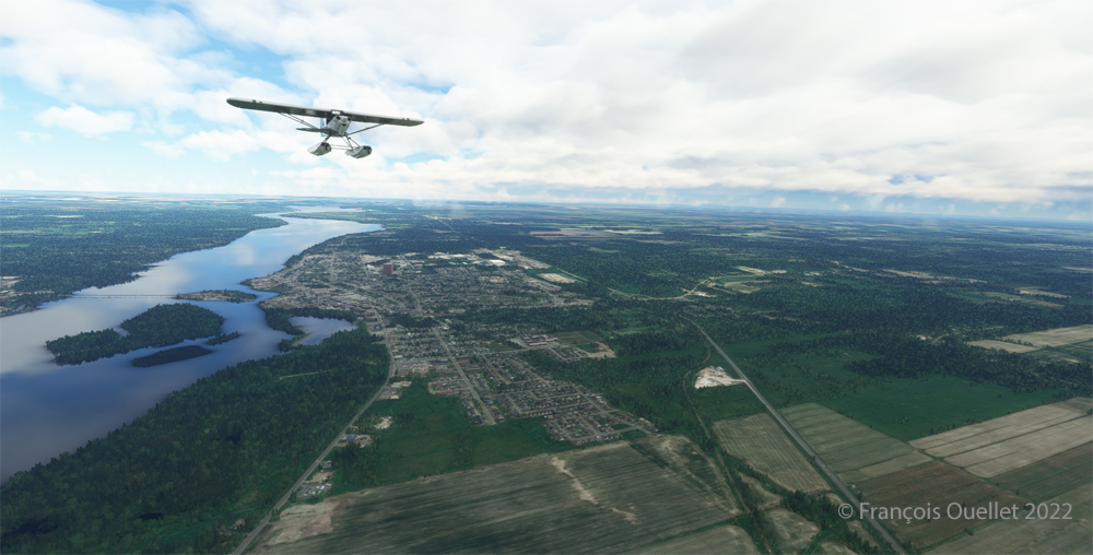
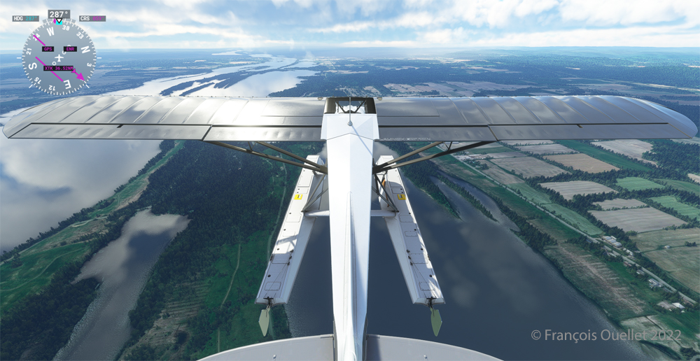
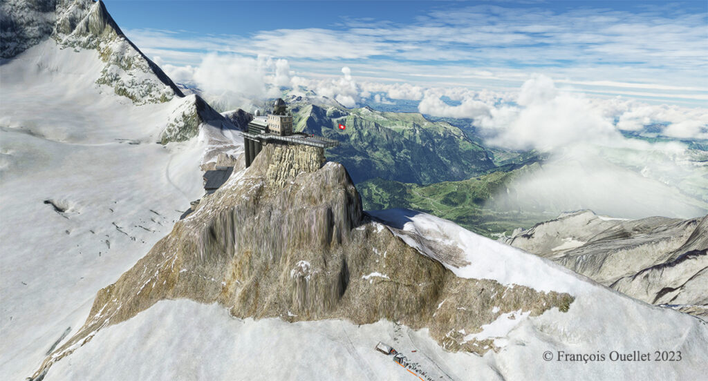
From a green landscape in the summer one gradually flies towards the eternal snow of the highest peaks in the Valais.

Getting closer to the Jungfraujoch, Switzerland.

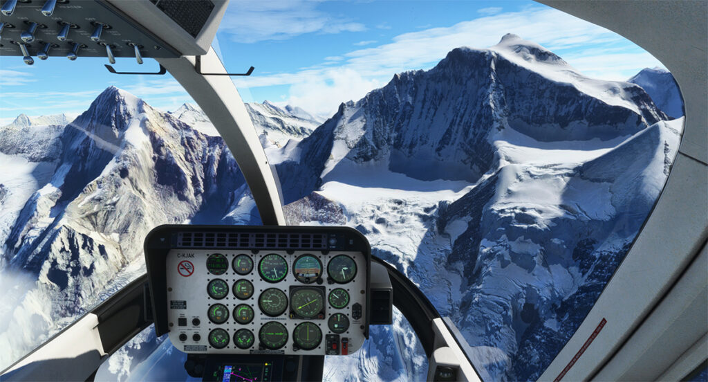
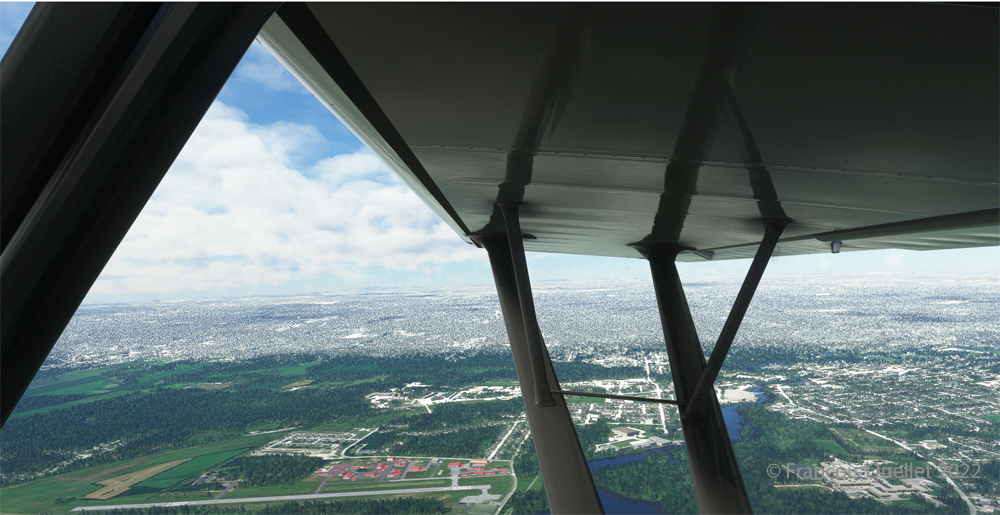
The scenery was spectacular on the train and it is just as spectacular in virtual flight. A mechanical problem with the helicopter in this environment of grandiose cliffs would leave little chance for the pilot.

Approaching the Sphinx Observatory on the Jungfraujoch, Switzerland.

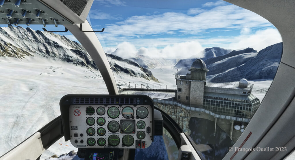
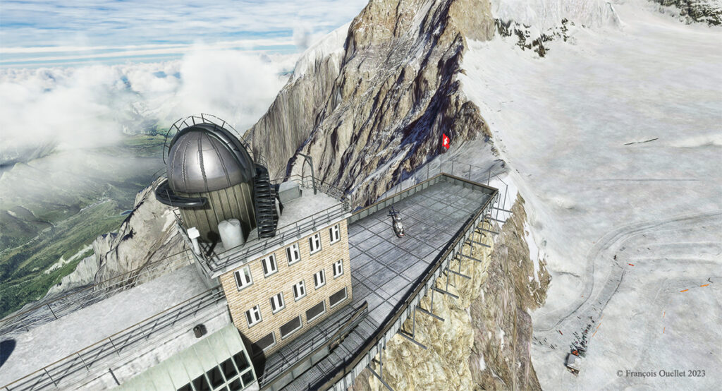
Here we are on approach: it is possible to land on the platform of the Sphinx observatory, but the pilot needs to be prepared for wind shear and unforeseen clouds at this altitude while taking care during the approach to avoid touching the flagpole and the protective fences surrounding the platform.

The Sphinx observatory on the Jungfraujoch with the Bell 407 helicopter on the platform using Microsoft Flight Simulator.

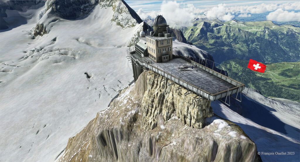
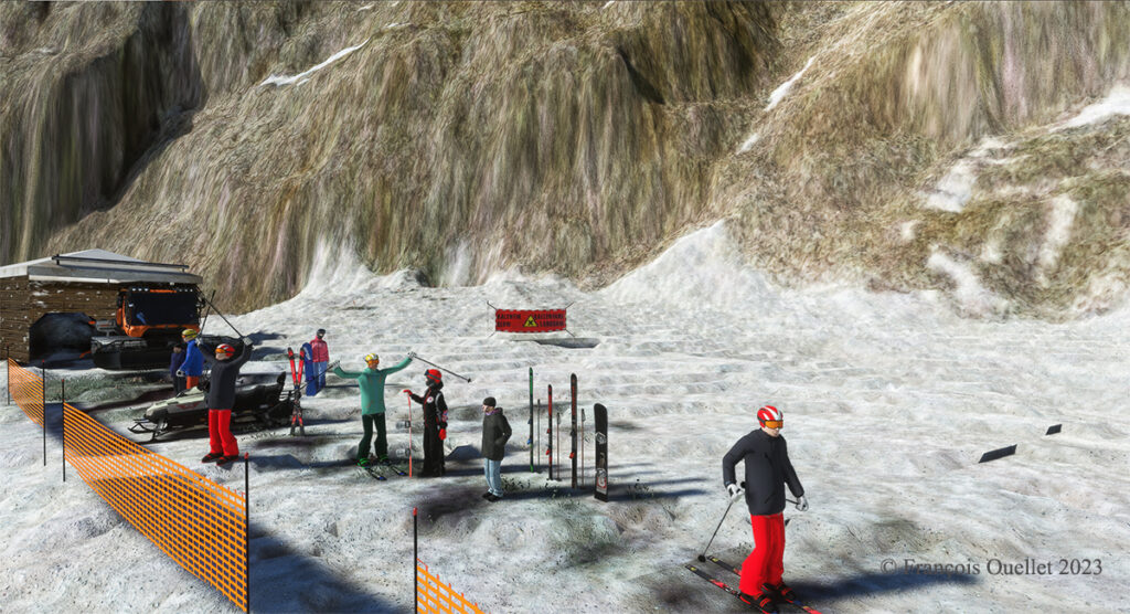
The Red Wing Simulations company has done an outstanding job designing this virtual scenery. In the photo below, you can even see skiers at the bottom of the cliff warming up before their first run.

Red Wing Simulations skiers at the base of the Jungfraujoch observatory on Microsoft Flight Simulator.

Even if the virtual scene includes something other than Lauterbrunnen and the Jungfraujoch, the pleasure of making a successful approach on the Sphinx platform alone is worth the cost of acquiring the software.

The Sphinx observatory on the Jungfraujoch and the helicopter on the platform using Microsoft Flight Simulator
Microsoft Flight Simulator and Red Wing Simulations representation of the Jungfraujoch Observatory platform.

Click on the links for more challenging virtual flights or flight simulation information on my blog.

Categories
Flight Simulation

Virtual flight with the MSFS 2020 flight simulator.

Taking of from Rivière des Mille-Îles near Marina Venise

Today’s flight is part of my blog’s standard virtual flight category. The take-off is from the Mille-Îles River in Quebec. There will be a touch and go at Mirabel (CYMX) and a flight over Quebec and Ontario to the Cascades hydrobase (CTY3).

Towards the Mirabel international airport (CYMX) with the MSFS 2020 flight simulator.

Flying at low altitude towards Mirabel airport, for a touch and go.

The Mirabel (CYMX) runway is in sight.

One of the CYMX runways can be seen straight ahead. If a virtual pilot does not find the runway long enough to do a touch and go, then a refresher course is in order.

Touch and go at the Mirabel airport with MSFS 2020

Takeoff from Mirabel. This is the advantage of an amphibious aircraft; you can land anywhere.

The virtual weather shows the difference between the snow in the north and the green vegetation in the south.

The Lachute airport (CSE4) is visible (buildings in red in the foreground). Flying in April in Quebec allows to notice the demarcation between the still white landscapes (the snow persists) in the north and the areas where everything has already melted.

Over Hawksbury, Ontario, with the MSFS 2020 flight simulator.

The flight continues to the Cascades waterbase (CTY3). The Ottawa River separates Quebec from Ontario. The aircraft is currently over the town of , Ontario, with Hamilton Island on the left.

Realism of the flight simulation under MSFS 2020

The screenshot above shows the very realistic effect of the virtual landscape, both in terms of the virtual weather, the multiple color tones of the ground and the shading on the ground and on the aircraft caused by the breaks between the clouds.

Overflying the Plaisance National Park in Quebec with MSFS 2020

Above Parc national Plaisance, a Quebec property.

Visibilty lowers slightly near Gatineau (CYND)

Descending for 1500 feet. Near Gatineau, the weather conditions deteriorate slightly. But it will be short-lived.

Turning towards the Gatineau river with the MSFS 2020 flight simulator.

Right turn for a water landing on the Gatineau River. The destination is in sight.

Water landing of the Gatineau river near the Wakefield hydrobase (CTY3)

The plane progresses slowly towards the hydrobase.

Aerial view of the Wakefield hydrobase (CTY3) with MSFS 2020

There is not yet a virtual waterbase worthy of the name for Cascades under Microsoft. At low altitude, the virtual pilot notes that he is only flying over a photo with aircraft footprints. An aerial view shows the CTY3 hydrobase.

Those who wish to repeat the experience will find the ride quite interesting.

Click on the link for more standard virtual flights on my blog.