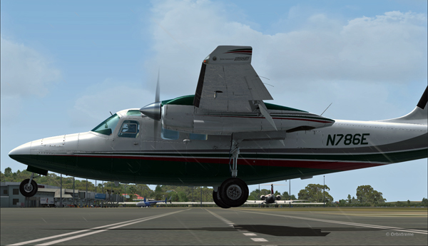
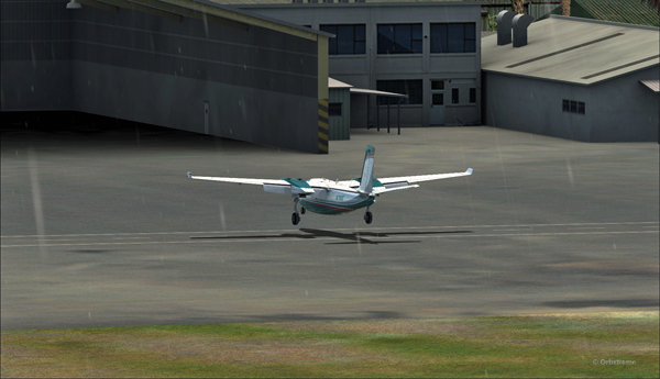
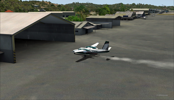
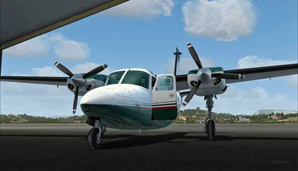
Below are a few Microsoft Flight Simulator 2020 (MFS 2020) screen captures taken during virtual flights.
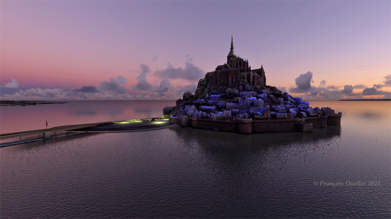
Le Mont St-Michel en France, sous MFS 2020.
Mont St-Michel is a very nice addition to the France virtual scenery provided by MFS 2020. Such great sites can be found in many places in the Microsoft Flight Simulator 2020 program, but many more are also available for free through the flight simulation community : they can then be downloaded and installed in MFS 2020, thus ever improving the overall experience.
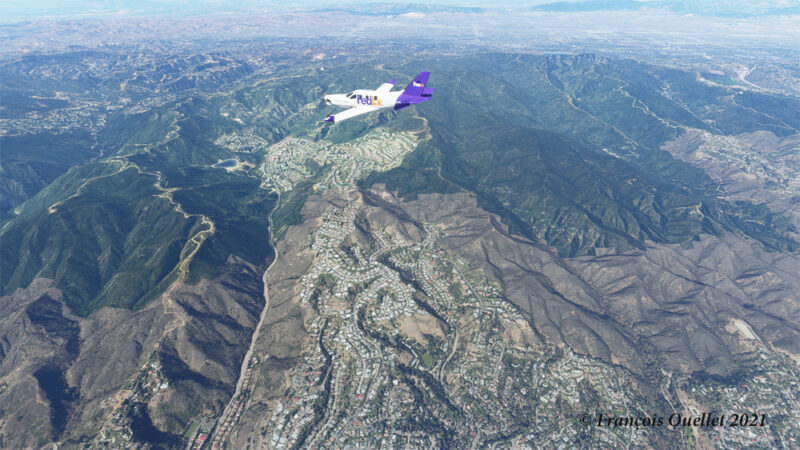
Heading to KLAX from KBUR with a TBM 930 on the flight simulator MFS 2020.
The haze is quite present in the Los Angeles area and adds to the realism in the screenshot above. The FedEx livery comes from « Liveries Mega Pack Manager ».
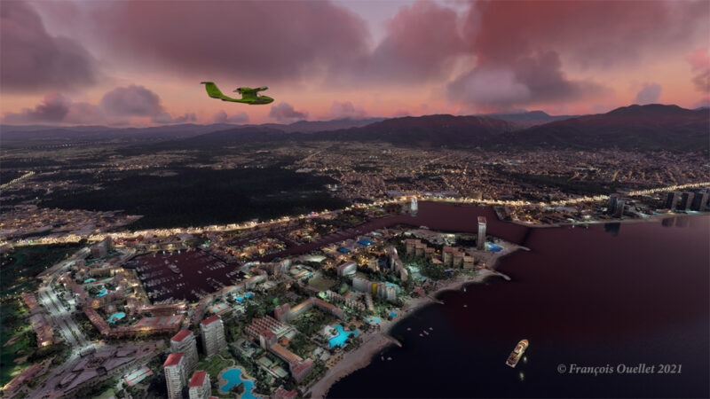
Puerto Vallarta with MFS 2020 and improved scenery by John Lovell
The Icon A5 Kingfisher is seen flying along the Puerto Vallarta coast in Mexico. The scenery was hugely improved by John Lovell and is available through Flightsim.to. But it will require 5 GiG on your hard disk!
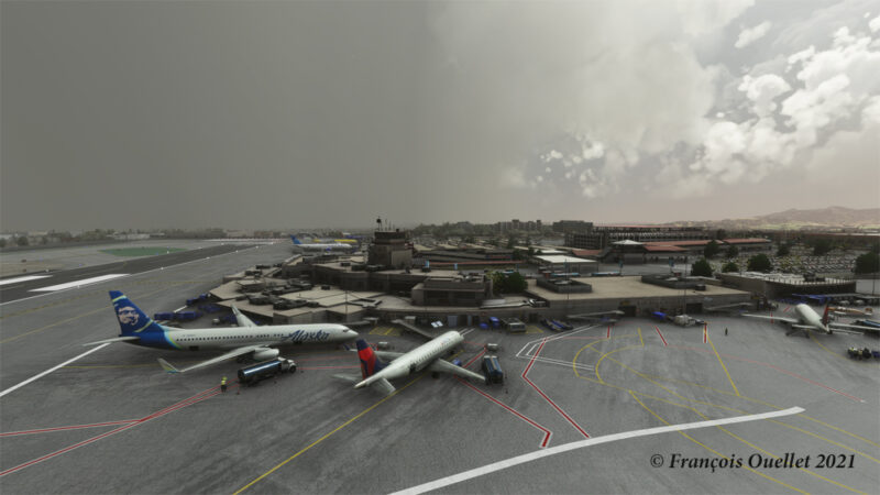
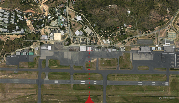
The Burbank Bob Hope (KBUR) modelized by Orbx on the flight simulator MFS 2020.
The picture above shows a small part of the Burbank Bob Hope airport (KBUR) modelized by Orbx. The screen capture was taken with the X-Box drone. This drone is a fantastic addition to what is now available to flight simulation enthousiasts when comes the time to bring back souvenirs from a flight.
Heading to Iqaluit with the flight simulator MFS 2020.
Enroute to Iqaluit (CYFB), the jet just got out of the cloud deck and some rime icing is still visible on the nose and the wing’s leading edge. That evening, there was a sigmet reporting high level turbulence and it is exactly what I experienced during the flight, using REX Weather Force 2020 as a weather engine.
I’ll be back with more flight simulation screen captures soon. Meanwhile, have a good virtual flight!
I have reviewed and edited my list of the Orbx freeware and payware airports, with runway description and airport elevation. It includes most airports that were created as of March 27th, 2020.
I have added many airports based on what Orbx has released since last year on its “OrbxDirect Release Announcements” section. I have also corrected some mistakes that I noted on my list. Every new virtual airport for X-Plane, P3DV4, AFS2 and FSX has been added to this list.
Payware airports often come with secondary, smaller virtual airports included in their package. I reviewed several payware airports and added those smaller airports with their runway description and elevation.
I use the list to plan my virtual flights and find possible challenging situations. The list might not be perfect but it is certainly good enough to be enjoyed by most flight simulation enthusiasts.
You have access to a free download PDF file on my website. Just click on the following secured link.
The complete edition of the Orbx freeware and payware virtual airports, dated June 09 2019, is in the downloadable file below. The runway details and airport elevation is included. It will be updated regularly.
The information in the PDF file is in colour. The airports in black are part of the global pack freewares. The airports in green are freewares that are not part of the global packs. The airports in blue are payware airports.
When a runway is in orange, it means that the length of the runway is 2000 ft or below, and/or the width is 60 ft or below. The water aerodrome are defined by the word “water” in blue. Finally, the elevation of the airport is in red at the end of the runway details.
The fourth edition of the Orbx freeware and payware virtual airports, dated June 02 2019 is in the downloadable file below. The list of airports is complete. I still have to add runway details to several airports.
The information in the PDF file is in colour. The airports in black are part of the global pack freewares. The airports in green are freewares that are not part of the global packs. The airports in blue are payware airports.
When a runway is in orange, it means that the length of the runway is 2000 ft or below, and/or the width is 60 ft or below. The water aerodrome are defined by the word “water” in blue. Finally, the elevation of the airport is in red at the end of the runway details.
The third edition of the Orbx freeware and payware virtual airports, dated May 26 2019 is in the downloadable file below. The list is not completed yet, but there is constant progress.
The information in the PDF file is in colour. The airport in black is part of the global pack freeware. The airport in green is a freeware that is not part of the global pack. The airport in blue is a payware airport.
When a runway is in orange, it means that the length of the runway is 2000 ft or below, and/or the width is 60 ft or below. The water aerodrome are defined by the word “water” in blue. Finally, the elevation of the airport is in red at the end of the runway details.
My second edition of the Orbx freeware and payware virtual airports, dated May 19 2019 is in the downloadable file below (the link in green). The list is not completed yet.
The information in the PDF file is in colour. The airport in black is part of the global pack freeware. The airport in green is a freeware that is not part of the global pack. The airport in blue is a payware airport.
When a runway is in orange, it means that the length of the runway is 2000 ft or below, and/or the width is 60 ft or below. The water aerodrome are defined by the word “water” in blue. Finally, the elevation of the airport is in red at the end of the runway details.
The virtual sceneries shown below were used for flight simulation exercises. They are all available online, for sale or free, at ORBX.
Piper Pacer approaching the dock at Robert’s Lake in Ontario, Canada.
In the scenery above, the red Piper Pacer, which is made by Lionheart Creations Ltd , arrives at a Pier at Robert’s Lake, in Canada. This lake was modelized jointly with the Parry Sound (CNK4) virtual scenery.
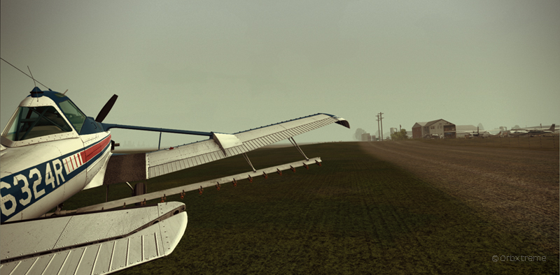
Virtual Cessna C188B Agtruck near Claresholm Industrial Park in Alberta, Canada.
In the picture above, a virtual Cessna C188B Agtruck created by the Alabeo company is parked near the Claresholm Industrial Park (CEJ4), in Canada. The virtual airport is available for free download at ORBX. Who said that nothing in life is free?!
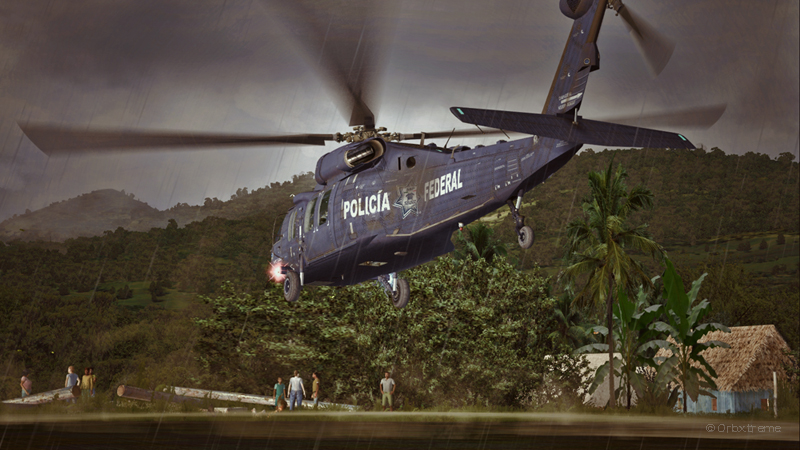
A virtual UH-60L Black Hawk belonging to the Columbian Police Force is hovering in the jungle.
Above, a UH-60L Black Hawk virtual helicopter created by the Cerasim company is flying over the Papua New Guinea territory. It should normally be hovering over Columbia, but the ORBX company has not yet developed very well defined airports for that country. It was more interesting to fly over an area that was already well modelized.
The three screen captures were slightly digitally improved following each virtual flight. The FSX flight simulation platform, although still interesting, is getting a bit old. The original screen captures often benefit from additional digital processing, especially when it comes to posting for the international contest held monthly by the ORBX company.
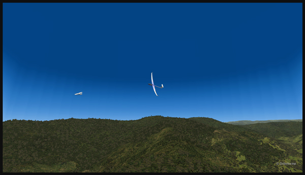
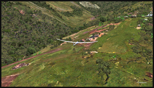
Well, that is it! The first glider just arrived at the Fane Parish airport in Papua New Guinea…
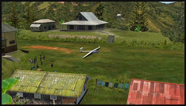
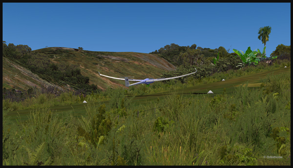
Glider on the Fane Parish short grass runway in Papua New Guinea.
Before it is officially offered as a tourist attraction for the region, some attempts at taking-off and landing must be done. The first trial attracts a few people!
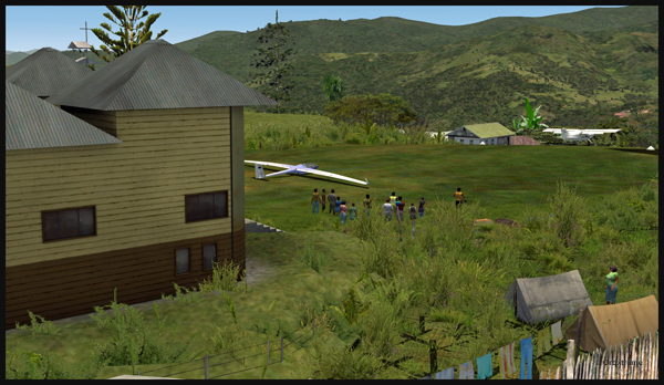
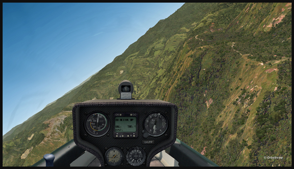
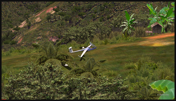
Aircraft and glider on the Fane Parish mountain airfield.
The descent along the twelve degree sloped runway is a bit rough for the glider’s low wings, as there are some bushes that will have to be trimmed!
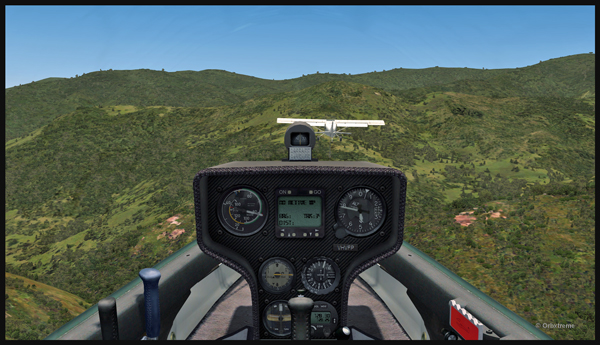
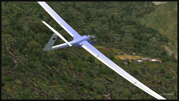
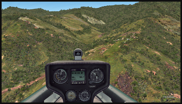
An aircraft pulls a glider after the take-off from the Fane Parish sloped runway in Papua New Guinea.
The weather is nice and very warm. The only potential problem is the mountain ahead.
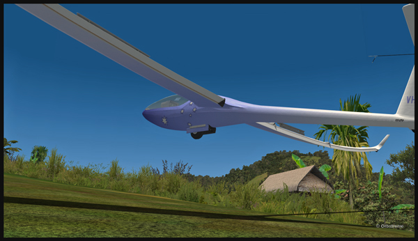
Glider being towed by an aircraft after the take-off from the Fane Parish mountain airfield.
Finally, the pilot cuts the link. He is free to go!
The link is cut between the plane and the glider after the take-off from Fane Parish.
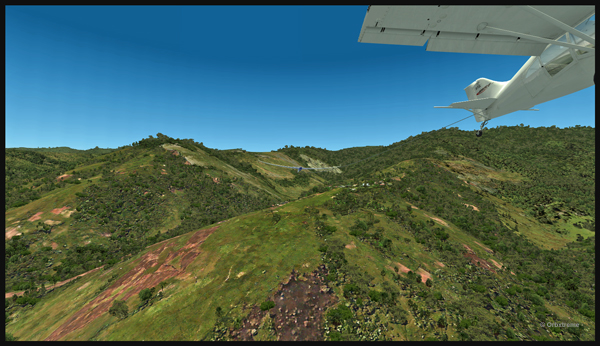
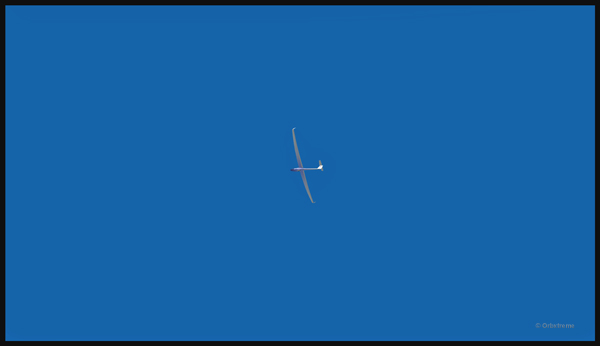
The glider flies silently over the lush area of Papua New Guinea.
Virtually gliding over the Papua New Guinea territory (FSX).
Using the rising warm air currents, the glider gains altitude.
The glider gains altitude.
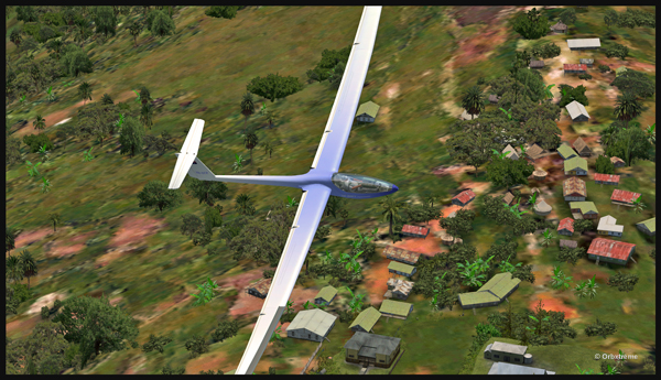
Why not a pass over Fane?
Gliding over the Fane Parish village.
Here is another isolated village alongside a mountain.
Flight with a virtual glider over an isolated village of Papua New Guinea.
A last steep turn in order to realign for the approach at Fane Parish.
Last steep turn for a short landing on the Fane Parish mountain sloped runway.
The airbrakes are out and the speed reasonable. The sloped runway is just ahead, on top of the mountain to the right.
Approach of a glider on the elevated airfield at Fane Parish in Papua New Guinea. The speed and angle of approach are right on target.
Keeping just enough altitude on the approach to be safe.
Glider approaching the 12 degree sloped runway of the Fane Parish aerodrome.
Now that the landing is a sure thing, it is time to use the airbrakes again to slow down as much as possible.
Virtual glider arriving over the Fane Parish runway in Papua New Guinea. The airbrakes are being used.
Keeping in mind that this mountain airfield as a good slope, it is better to have a bit of extra speed. Nobody likes to stall a few feet over a runway!
Virtual glider with airbrakes over the Fane Parish runway
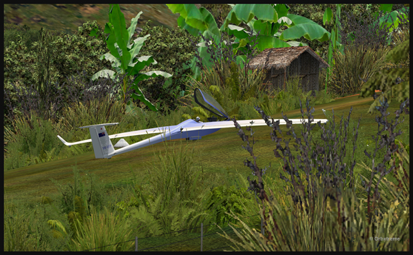
What an experience it was! But I’ll need some help to pull the glider up the slope!
Glider on the Fane Parish runway
The virtual flight was great, the view was worth every penny, and I think that this could become a new touristic attraction for the region and the more wealthy visitors…
The glider has landed on the runway at the Fane Parish airport in Papua New Guinea.
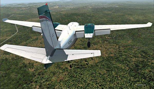
There is no aircraft in the sky around the Port Moresby Jacksons (AYPY) virtual airport today. No aircraft in the sky but one, a medevac flight.
Arrival of the Medevac towards the Port Moresby Jacksons (AYPY) airport. The winds forbid a normal landing.
The winds blow from 240 degree at 50G60 kts and the runways are oriented 14/32. It is way above the maximum crosswind authorized for any aircraft.
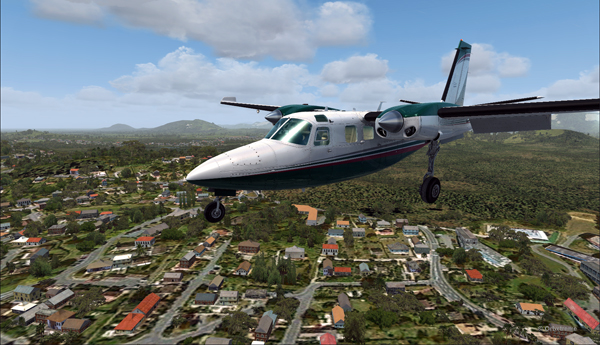
But the Shrike Commander’s crew cannot wait until the wind calms down. They must land in the next few minutes in order to save a patient’s life.
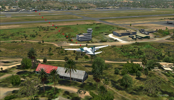
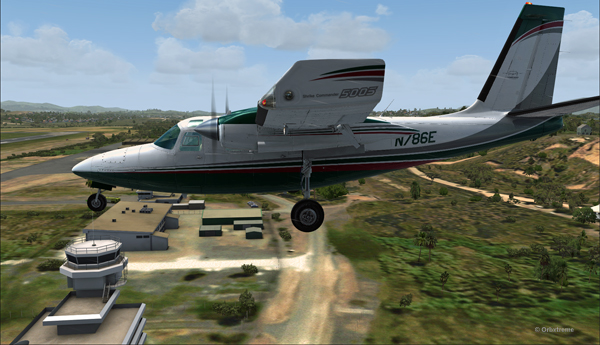
The Port Moresby Jacksons (AYPY) is in sight in the center top of the screen capture.
As there is no traffic around, the captain has told ATC he intends to do a safe, efficient but non-standard approach.
The aircraft is gradually positioned to arrive in a straight line for the AYPY hangar.
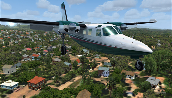
The aircraft aligns itself to face the wind blowing across the runways.
Arriving straight across the runways, facing the wind, the crew intends to land the aircraft a few feet short of a hangar. The captain requests that someone opens the hangar doors right away. The captain will terminate the approach in the hangar, protected from the wind.
Trajectory of the Shrike Commander 500S towards the hangar at the Port Moresby Jacksons airport. The hangar door has been open for the arrival.
It is safer to arrive facing the wind and immediately enter the hangar, straight ahead. No taxiing with a 60 knots crosswind.
Useless to say, ATC has already refused the request. But the pilot is the only one who decides of the best landing surface, for the safety of the passengers and himself. He proceeds with the approach after having clearly indicated which path will be followed.
The Shrike Commander 500S over the houses near the Port Moresby Jacksons airport.
The main problem for the approach is the low level mechanical turbulence caused by the gusty 60 kts winds.
If ATC wants to file a complaint, now is a good time to take a picture of the aircraft and its registration to support the case.
Flying by the AYPY control tower.
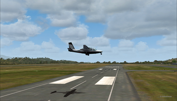
The actual ground speed of the airplane is around 20 kts.
The Shrike Commander 500S approaching across the runways at the Port Moresby Jacksons airport. The winds blow from 240 degree at 50G60.
The steady high wind speed is actually safer for the crew than if the winds were 240 at 35G60.
Ground speed of about 20 knots for the Shrike Commander 500S on final for the Port Moresby Jacksons hangar (AYPY).
Still a bit above the runway and with a 10-20 knots ground speed. The airspeed indicator shows the strength of the wind itself plus the ground speed.
Indicated airspeed 70 knots.
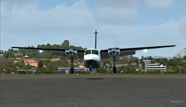
Frontal view of the Shrike Commander 500S about to land in front of the hangar at AYPY.
Floating like a hot air balloon or almost!
Side view of the Shrike Commander 500S on final for the Port Moresby Jacksons airport’s hangar.
The Shrike Commander will soon land in Port Moresby Jacksons.
As the aircraft touches the ground, it stops almost immediately. It is necessary to apply power to reach the hangar, as you can see with the white trail on the ground behind the aircraft.
In real life, the touch-down would have had to be as soon as the asphalt start since the presence of the hangar lowers the wind speed a bit.
The Shrike Commander lands a few feet before the hangar. Additional power is mandatory to reach the hangar.
A few seconds after the touch-down, the aircraft is in the hangar, protected from the wind, and both doctor and patient can quickly head out to the hospital.
The Shrike Commander 500S in the hangar at Port Moresby (AYPY).
Once in the hangar, the winds were adjusted to zero, which is kind of logical, unless the opposite wall is missing!
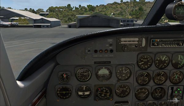
View of the Port Moresby Jacksons (AYPY)
It was now time to brace for another storm, which was the inquiry that would possibly follow the landing!
(P.S.: Tim Harris and Ken Hall were the creators of this virtual Port Moresby Jacksons international airport) and it is sold by ORBX. The aircraft is sold by Carenado).
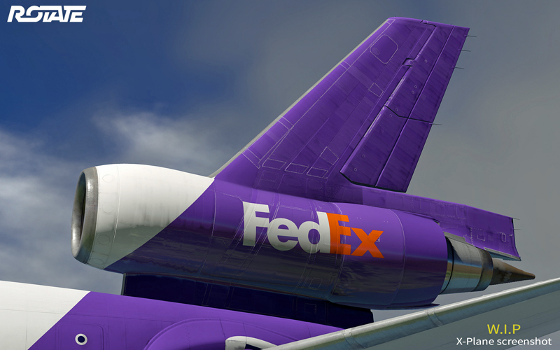
The virtual MD-11 being created by the Rotate company for the X-Plane flight simulation platform.
Good news for flight simulation enthousiasts! Those who had stopped looking for a virtual MD-11 will have an opportunity to fly this legendary aircraft.
The Rotate company, which makes virtual aircrafts for the X-Plane flight simulation platform, has decided to make a virtual MD-11. It is quite a challenge but the progress is steady.
A few years ago, another company, PMDG, created a virtual MD-11 but decided to drop the product and let down the customers who had bought their excellent aircraft. They stopped providing updates and eventually erased the MD-11 from their list of products.
Since then, many flight simmers have been wondering if they could one day learn to fly the MD-11. Numerous crashes of MD-11s have happened in real life since its creation by Mc Donnell Douglas. They were mostly due to pilots unable to master the aircraft, except in the case of Swissair 111.
The Rotate’s staff have recently published a new photo (see above) on their WEB page to show that the virtual aircraft is slowly taking shape. The graphic quality is really superb.
In an interview given to PC Pilot in the March/April edition, Rotate said that they want to achieve a high level of simulation with the MD-11, but that they still have a long way to go. They stated that the MD-11 is much bigger and much more complex than the MD-80 (that they are already offering) and that they want the MD-11 to reflect those characteristics.
Those who fly using FSX will now be able to add X-Plane as another flight simulator to their computer and thus use the MD-11 when it will be ready (probably around the end of 2019).
The beauty with X-plane is that the 64 bits platform uses all six cores of the new CPUs on the market. The FPS (frame per second) number is thus very high, which will allow users of the MD-11 to fly around huge virtual airports when the weather is complex without having to compromise.
Another positive aspect is that ORBX now offers products for X-Plane, which will greatly increase the choice of quality virtual sceneries.