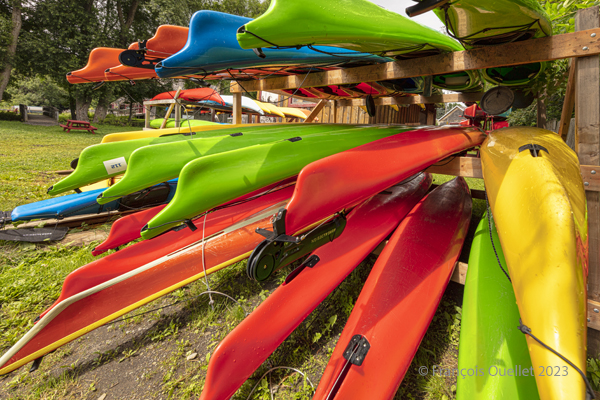
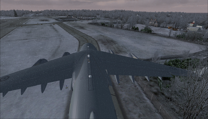
Sea kayaks at Saint-Laurent-de-l’Île d’Orléans 2023
On Sunday, September 24, 2023, the company Quatre Natures organized a certified level 1 sea kayaking course the St. Lawrence River, starting from Île d’Orléans. As registration was done well in advance, we had to be a bit lucky during the activity, as it would take place as much in good weather as in bad.
So, I take a chance. Fortunately, an incredible day awaits the six students: full sun and twenty degrees Celsius. How should we dress for the circumstances? We know that the human body temperature is 37 degrees Celsius. The kayaker adds up the water and air temperatures and compares the total to the temperature of the human body. With the river that day at 18 degrees and the air around 20 degrees, this gives a total of 38. As this figure is slightly higher than normal body temperature, we can wear normal clothing for water activities, rather than a wetsuit.
The morning is used to cover theory. No one sets foot in the water. The instructor discusses what the kayaker must have on board, the relative quality of different equipment, preparation, communications and radio frequencies, safety and hypothermia prevention, and so on.
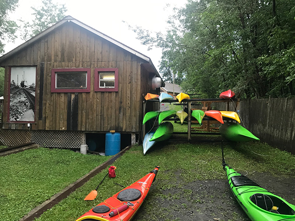
Sea kayaking activity at l’île d’Orléans (photo Vadym Kravchenko)
After lunch, the kayaks are placed on the lawn and the vocabulary related to each part of the kayak is learned. The student then settles into the kayak and learns how to adjust the footbraces, hold the paddle, install the spray skirt, and so on. The boats are then brought to shore and kayaking begins.
First, we learn the basic maneuvers. How to embark and disembark, the trajectory the paddle should follow in the water depending on whether you want to go forward, backward or turn. We discuss the correct position of the body, arms and wrists on the paddle, and the importance of rotating the pelvis to force the paddle properly. We quickly realize the influence of side winds on the kayak, especially when it has no centerboard or rudder.
The river is considered level 2 for kayaking. The current is strong, and we have to deal with three-metre tides. The wind around the island is also stronger than in Quebec City. Level 1 kayakers are encouraged to seek out Level 1 locations to gain experience, and never to set off alone at this stage of their learning process.
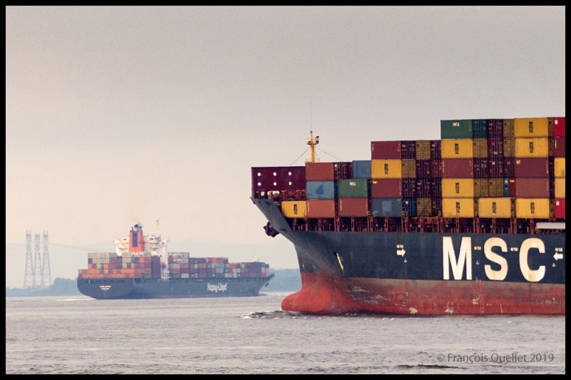
During the exercises, you can see the container ships and the various pleasure boats offshore. The larger vessels generate waves that take between five and ten minutes to reach the shore. When these approach, the instructor warns novice kayakers to turn to face the wave, so as to limit the effects on the boat.
The container ship Hapag_Lloyd Quebec Express and the container ship MSC Paola are sailing around Île d’Orléans near Quebec City.
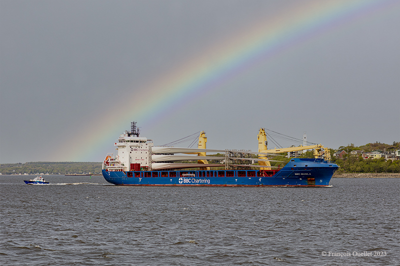
The BBC Manila carries wind turbine blades on the St.Lawrence Seaway near Quebec City.
Then come the emergency maneuvers: what’s the procedure for getting out of a kayak that’s just capsized? How do you help someone who has capsized?
I didn’t have time to get to this stage of the course. I capsized before. I don’t remember how I managed to extricate myself from the kayak and get back to the surface, but we’re not talking about an approved method here. The brain immediately detects the danger and organizes itself so that the body gets out of the kayak and the head doesn’t stay underwater for too long.
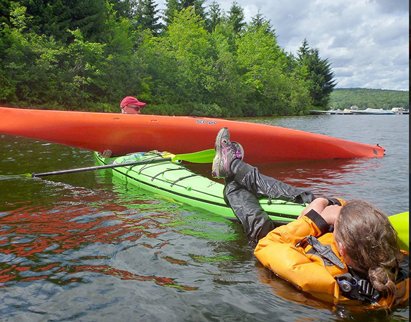
In the minutes that follow, the instructor teaches us how to perform the classic exit from a capsized kayak. We work in pairs. At Level 1, there’s no question of using the paddle to force the kayak to turn.
To obtain KDM 1 certification, everyone must lean sideways so that the kayak tips over. Once submerged, the student leans forward, unhooks the spray skirt attached to the kayak, and slowly taps the kayak’s hull three times to signal that he is in control of what he is doing. The instructor wants to avoid unpredictable reactions. We then push ourself out of the kayak by placing our hands at hip height on the coaming. As soon as we are out of the water, it’s imperative that we hold on to our kayak, thanks to the lifeline. It only takes a few seconds. Here and there, you can hear a little coughing as the student surfaces, but nothing more. A good sip of St. Lawrence River boosts the immune system.
Next comes the recovery of the person in the water. As we work as a team, the kayaker in difficulty clings to the front of our kayak and stays there until we catch up with his or her kayak, lift it onto our boat, empty it of water, turn it over and position it correctly.
Sea kayaking course level 1 with Quatre Natures (photo Quatre Natures)
The person clinging to the kayak then releases his or her grip, and depending on the method taught, climbs back into the boat while the latter is being held securely. The important thing here is to keep the center of gravity as low as possible. If the person doesn’t hurry and proceed step by step, the operation is a success every time.
A few more exercises follow, and it’s back to the beach on Île d’Orléans a few hours later. Once all participants have dried off and put on their warm clothes, the course concludes with a few weather notions, including the need to consult weather forecasts and radars, and to return quickly to shore when storm cells are present.
We also cover tide calculation (rule of 12) and how to attach a kayak to a car roof. How many attachment points? What equipment is available to make the job easier? Where should harnesses go to avoid breaking the kayak? Etc.
The KDM 1 certificate is awarded approximately eight to nine hours after the start of the course, depending on the instructor’s assessment. I noticed that on the way home, in the heat of the car, I really didn’t feel like rushing on the road. But you quickly come back to reality when you see how fast the cars are coming up behind you.
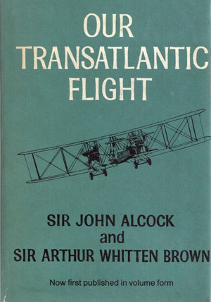
Our transatlantic flight, by Sir John Alcock and Sir Arthur Whitten Brown
Newfoundland
Before 1949, Newfoundland was called Dominion of Newfoundland and was part of the British Commonwealth . In 1949, it became a Canadian province.
The first non-stop flight eastward across the Atlantic.
The book « Our transatlantic flight » tells the story of the historic flight that was made in 1919, just after the First World War, from Newfoundland to Ireland. There was a 10,000 £ prize offered by Lord Northcliffe from Great Britain for whoever would succeed on the first non-stop flight eastward across the Atlantic.
A triumph for British aviation
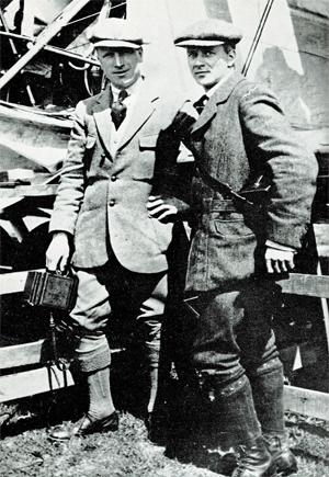
Sir John Alcock and Sir Arthur Whitten Brown , respectively pilot and navigator, wrote the story of their successful flight in this book which was published in 1969. The followings are pilot quotes from the book : « For the first time in the history of aviation the Atlantic had been crossed in direct, non-stop flight in the record time of 15 hours, 57 minutes. » (p.13) « The flight was a triumph for British aviation; the pilot and navigator were both British, the aircraft was a Vickers-Vimy and the twin engines were made by Rolls-Royce. » (p.13)
Sir John Alcock and Sir Arthur Whitten Brown
As with all great human achievements, a very good flight planning and some luck was needed to make this flight a success. If there was an engine failure during the flight, even if the planning was excellent, there was only one outcome : downward.
In order to make the flight, Alcock and Brown boarded a ship from England bound to Halifax. They then headed to Port aux Basques and finally arrived in St.John’s. There, they joined a small group of British aviators who had arrived a few days before and who were also preparing for the competition. « The evenings were mostly spent in playing cards with the other competitors at the Cochrane Hotel, or in visits to the neighbouring film theatres. St.John’s itself showed us every kindness. » (p.60)
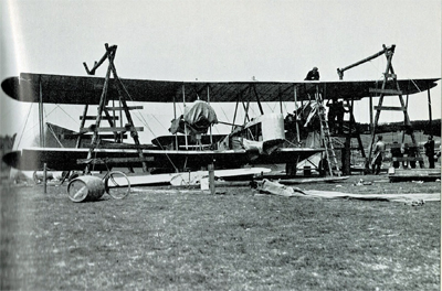
Maritime transport was used to carry the Vickers-Vimy biplane to Newfoundland on May 4th. It was assembled in Newfoundland. « The reporters representing the Daily Mail, the New York Times, and the New York World were often of assistance when extra manpower was required. » (p.61).
While the aircraft was being built, there were more and more visiters coming to the site. Brown says : « Although we remained unworried so long as the crowd contented itself with just watching, we had to guard against petty damage. The testing of the fabric’s firmness with the point of an umbrella was a favourite pastime of the spectators […]. » (p.61)
The Vickers-Vimy is being reassembled at Quidi Vidi in Newfoundland.
It was difficult to find a field that could be improvised into an aerodrome : « Newfoundland is a hospitable place, but its best friends cannot claim that it is ideal for aviation. The whole of the island has no ground that might be made into a first-class aerodrome. The district around St.John’s is especially difficult. Some of the country is wooded, but for the most part it shows a rolling, switchback surface, across which aeroplanes cannot taxi with any degree of smoothness. The soil is soft and dotted with boulders, as only a light layer covers the rock stratum. Another handicap is the prevalence of thick fogs, which roll westward from the sea. » (p.59)
They flight tested the airplane on June 9th at Quidi Vidi. During the short flight, the crew could see icebergs near the coast. They did a second trial on June 12th and found that the transmitter constantly caused problems. But, at least, the engines seemed to be reliable…
The departure
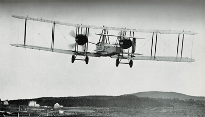
The two men left Newfoundland on June 14th 1919. In order to fight the cold air in flight, they wore electrically heated clothing. A battery located between two seats provided for the necessary energy.
The Vickers-Vimy departs from Newfoundland in 1919
The short take-off was very difficult due to the wind and the rough surface of the aerodrome. Brown writes : « Several times I held my breath, from fear that our under-carriage would hit a roof or a tree-top. I am convinced that only Alcock’s clever piloting saved us from such an early disaster. » (p.73)
It took them 8 minutes to reach 1000 ft. Barely one hour after departure and once over the ocean, the generator broke and the flight crew was cut off from all means of communication.
As the airplane consumed petrol, the centre of gravity changed and since there was no trim on the machine, the pilot had to exert a permanent backward pressure on the joystick.
Flying in clouds, fog and turbulence.
During the flight with much clouds and fog, Brown, having almost no navigation aid, had real problems to estimate the aircraft’s position and limit the flying errors. He had to wait for a higher altitude and for the night to come to improve his calculations : « I waited impatiently for the first sight of the moon, the Pole Star and other old friends of every navigator. » (p.84). The fog and clouds were so thick that at times they « cut off from view parts of the Vickers-Vimy. » (p.95)
Without proper instruments to fly in clouds, they were relying on a « revolution-counter » to establish the climbing or the falling rate. That is pretty scary. « A sudden increase in revolutions would indicate that the plane was diving; a sudden loss of revs would show that she was climbing dangerously steeply. » (p.176)
But that was not enough. They also had to deal with turbulence that rocked the plane while they could not see anything outside. They became desoriented : « The airspeed indicator failed to register, and bad bumps prevented me from holding to our course. From side to side rocked the machine, and it was hard to know in what position we really were. A spin was the inevitable result. From an altitude of 4,000 feet we twirled rapidly downward.[…]. « Apart from the changing levels marked by aneroid, only the fact that our bodies were pressed tightly against the seats indicated that we were falling. How and at what angle we were falling, we knew not. Alcock tried to centralise the controls, but failed because we had lost all sense of what was central. I searched in every direction for an external sign, and saw nothing but opaque nebulousness. » (p.88)
« It was a tense moment for us, and when at last we emerged from the fog we were close down over the water at an extremely dangerous angle. The white-capped waves were rolling along too close to be comfortable, but a quick glimpse of the horizon enabled me to regain control of the machine. » (p.40).
De-icing a gauge installed outside of the cockpit.
Snow and sleet were falling. They didn’t realize how lucky they were to continue flying in such a weather. Nowadays, there are many ways to dislodge ice from a wing while the aircraft is in flight. Here is what Brown says about their situation : « […] The top sides of the plane were covered completely by a crusting of frozen sleet. The sleet imbedded itself in the hinges of the ailerons and jammed them, so that for about an hour the machine had scarcely any lateral control. Fortunately, the Vickers-Vimy possesses plenty of inherent lateral stability; and, as the rudder controls were never clogged by sleet, we were able to hold to the right direction. » (p.95)
After twelve hours of flying, the glass of a gauge outside the cockpit became obscured by clotted snow. Brown had to deal with it, while Alcock was flying. « The only way to reach it was by climbing out of the cockpit and kneeling on top of the fuselage, while holding a strut for the maintenance of balance. […] The violent rush of air, which tended to push me backward, was another discomfort. […] Until the storm ended, a repetition of this performance, at fairly frequent intervals, continued to be necessary. » (p.94)
In order to save themselves, they executed a descent from 11,000 to 1000 feet and in the warmer air the ailerons started to operate again. As they continued their descent below 1000 feet over the ocean, they were still surrounded by fog. They had to do some serious low altitude flying : « Alcock was feeling his way downward gently and alertly, not knowing whether the cloud extended to the ocean, nor at what moment the machine’s undercarriage might touch the waves. He had loosened his safety belt, and was ready to abandon ship if we hit the water […]. » (p.96)
The arrival.
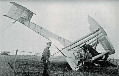
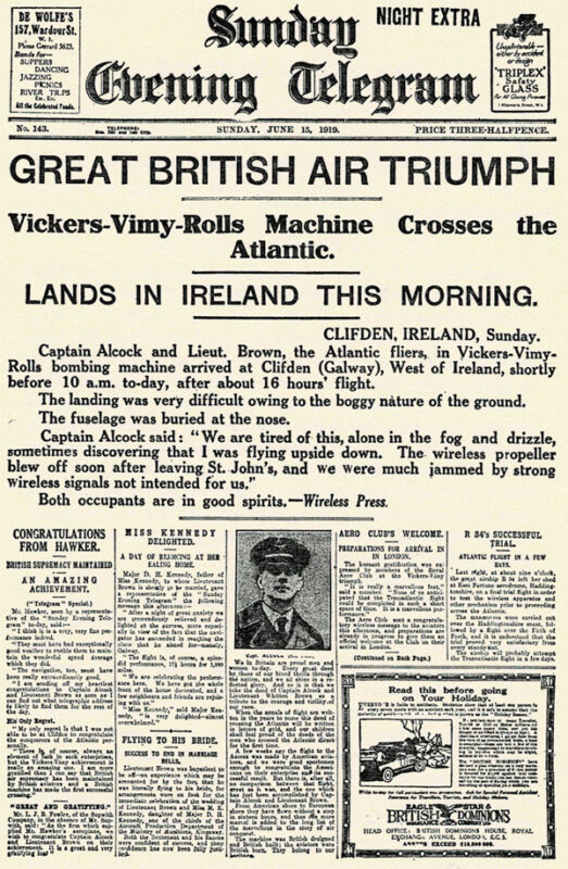
They saw Ireland at 8.15 am on June 15th and crossed the coast ten minutes later. They did not expect a very challenging landing as the field looked solid enough to support an aircraft. They landed at 8 :40 am at Clifden on top of what happened to be a bog; the aircraft rolled on its nose and suffered serious material damages. The first non-stop transatlantic flight ended in a crash. Both both crewmen were alive and well, although they were dealing with fatigue…
The transatlantic flight ends up in Ireland in a soft field
Initially, nobody in Ireland believed that the plane arrived from North America. But when they saw mail-bags from Newfoundland, there were « cheers and painful hand-shakes » (p.102).
First page of the Sunday Evening Telegraph in 1919.
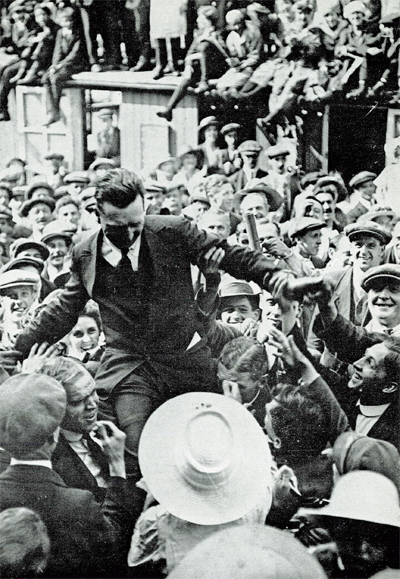
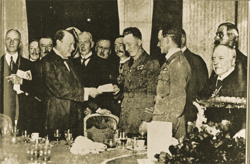
They were cheered by the crowds in Ireland and England and received their prize from Winston Churchill.
John Alcock chaired by the crowd
Winston Churchill is presenting the Daily Mail Check to the two pilots.
Their record stood unchallenged for eight years until Lindbergh’s flight in 1927.
The future of transatlantic flight.
Towards the end of the book, the authors risk a prediction on the future of transatlantic flight. But aviation made such a progress in a very short time that, inevitably, their thoughts on the subject was obsolete in a matter of a few years. Here are some examples :
« Nothwithstanding that the first two flights across the Atlantic were made respectively by a flying boat and an aeroplane, it is evident that the future of transatlantic flight belongs to the airship. » (p.121)
« […] The heavy type of aeroplane necessary to carry an economical load for long distances would not be capable of much more than 85 to 90 miles an hour. The difference between this and the present airship speed of 60 miles an hour would be reduced by the fact that an aeroplane must land at intermediate stations for fuel replenishment. » (p.123)
« It is undesirable to fly at great heights owing to the low temperature; but with suitable provision for heating there is no reason why flying at 10,000 feet should not be common. » (p.136)
The Air Age.
There is a short section in the book on the « Air Age ». I chose two small excerpts on Germany and Canada :
On Germany’s excellent Zeppelins : « The new type of Zeppelin – the Bodensee – is so efficient that no weather conditions, except a strong cross-hangar wind, prevents it from making its daily flight of 390 miles between Friedrichshafen and Staalsen, thirteen miles from Berlin. » (p.140)
On Canada’s use of aeroplanes : « Canada has found a highly successful use for aeroplanes in prospecting the Labrador timber country. A group of machines returned from an exploration with valuable photographs and maps of hundreds of thousands of pound’s worth of forest land. Aerial fire patrols, also, are sent out over forests.» (p.142) and « Already, the Canadian Northwest Mounted Police [today the RCMP] have captured criminals by means of aeroplane patrols. » (p.146)
Conclusion
The Manchester Guardian stated, on June 16th 1919 : « […] As far as can be foreseen, the future of air transport over the Atlantic is not for the aeroplane. It may be used many times for personal feats of daring. But to make the aeroplane safe enough for business use on such sea routes we should have to have all the cyclones of the Atlantic marked on the chart, and their progress marked in from hour to hour. »(p.169)
Title : Our Transatlantic Flight
Authors : Sir John Alcock and Sir Arthur Whitten Brown
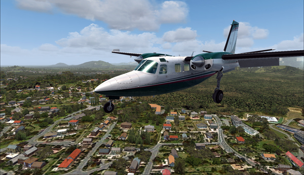
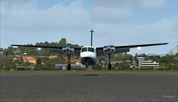
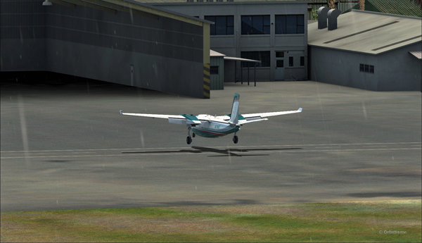
There is no aircraft in the sky around the Port Moresby Jacksons (AYPY) virtual airport today. No aircraft in the sky but one, a medevac flight.
Arrival of the Medevac towards the Port Moresby Jacksons (AYPY) airport. The winds forbid a normal landing.
The winds blow from 240 degree at 50G60 kts and the runways are oriented 14/32. It is way above the maximum crosswind authorized for any aircraft.
But the Shrike Commander’s crew cannot wait until the wind calms down. They must land in the next few minutes in order to save a patient’s life.
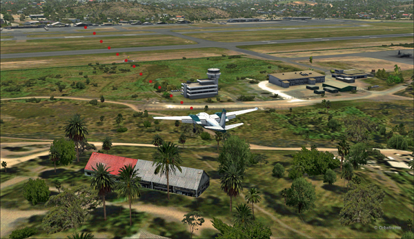
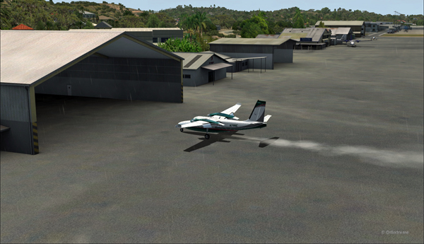
The Port Moresby Jacksons (AYPY) is in sight in the center top of the screen capture.
As there is no traffic around, the captain has told ATC he intends to do a safe, efficient but non-standard approach.
The aircraft is gradually positioned to arrive in a straight line for the AYPY hangar.
The aircraft aligns itself to face the wind blowing across the runways.
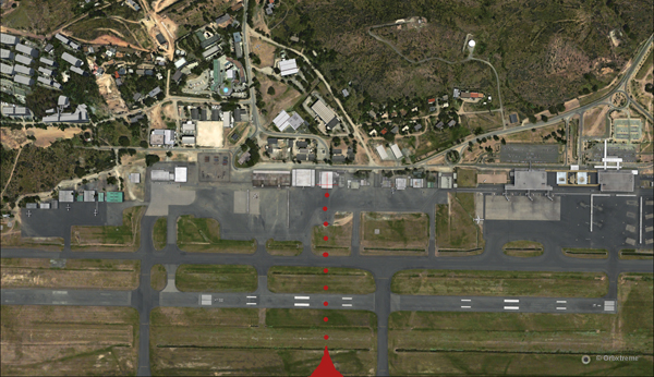
Arriving straight across the runways, facing the wind, the crew intends to land the aircraft a few feet short of a hangar. The captain requests that someone opens the hangar doors right away. The captain will terminate the approach in the hangar, protected from the wind.
Trajectory of the Shrike Commander 500S towards the hangar at the Port Moresby Jacksons airport. The hangar door has been open for the arrival.
It is safer to arrive facing the wind and immediately enter the hangar, straight ahead. No taxiing with a 60 knots crosswind.
Useless to say, ATC has already refused the request. But the pilot is the only one who decides of the best landing surface, for the safety of the passengers and himself. He proceeds with the approach after having clearly indicated which path will be followed.
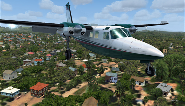
The Shrike Commander 500S over the houses near the Port Moresby Jacksons airport.
The main problem for the approach is the low level mechanical turbulence caused by the gusty 60 kts winds.
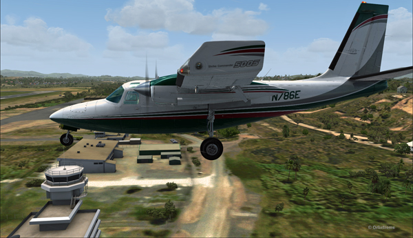
If ATC wants to file a complaint, now is a good time to take a picture of the aircraft and its registration to support the case.
Flying by the AYPY control tower.
The actual ground speed of the airplane is around 20 kts.
The Shrike Commander 500S approaching across the runways at the Port Moresby Jacksons airport. The winds blow from 240 degree at 50G60.
The steady high wind speed is actually safer for the crew than if the winds were 240 at 35G60.
Ground speed of about 20 knots for the Shrike Commander 500S on final for the Port Moresby Jacksons hangar (AYPY).
Still a bit above the runway and with a 10-20 knots ground speed. The airspeed indicator shows the strength of the wind itself plus the ground speed.
Indicated airspeed 70 knots.
Frontal view of the Shrike Commander 500S about to land in front of the hangar at AYPY.
Floating like a hot air balloon or almost!
Side view of the Shrike Commander 500S on final for the Port Moresby Jacksons airport’s hangar.
The Shrike Commander will soon land in Port Moresby Jacksons.
As the aircraft touches the ground, it stops almost immediately. It is necessary to apply power to reach the hangar, as you can see with the white trail on the ground behind the aircraft.
In real life, the touch-down would have had to be as soon as the asphalt start since the presence of the hangar lowers the wind speed a bit.
The Shrike Commander lands a few feet before the hangar. Additional power is mandatory to reach the hangar.
A few seconds after the touch-down, the aircraft is in the hangar, protected from the wind, and both doctor and patient can quickly head out to the hospital.
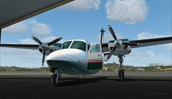
The Shrike Commander 500S in the hangar at Port Moresby (AYPY).
Once in the hangar, the winds were adjusted to zero, which is kind of logical, unless the opposite wall is missing!
View of the Port Moresby Jacksons (AYPY)
It was now time to brace for another storm, which was the inquiry that would possibly follow the landing!
(P.S.: Tim Harris and Ken Hall were the creators of this virtual Port Moresby Jacksons international airport) and it is sold by ORBX. The aircraft is sold by Carenado).
Alex Geoff, the ORBX Block Island (KBID) virtual airport designer, asked flight simulator enthousiasts to try to operate the biggest aircraft possible on that airport ‘s 2502 ft runway.
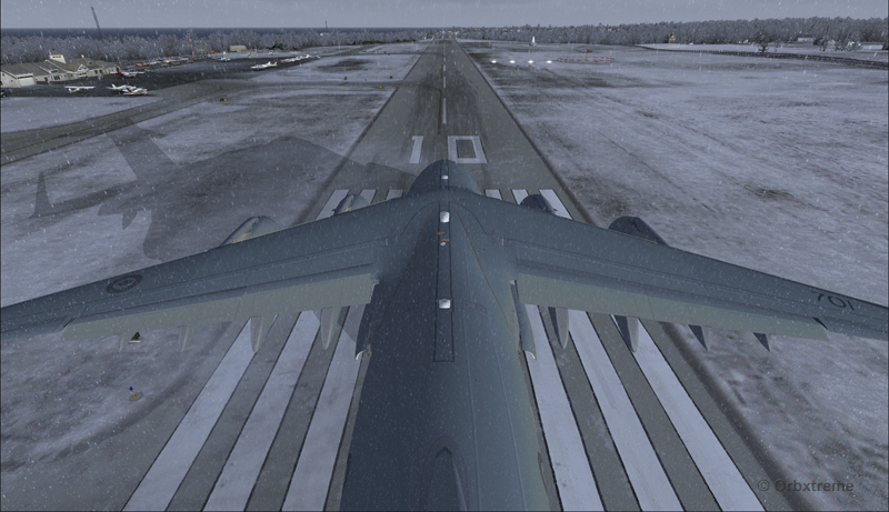
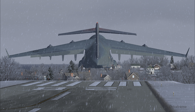
Canadian military aircraft C17-A ready for take-off runway 10 at the Block Island (KBID) virtual airport in United States (FSX)
Naturally, we are talking about a virtual flight. You must then forgive the landing of an aircraft which, in real life, would destroy the runway. You also have to disregard the fact that numerous trees would have to be chopped if the aircraft would elect to use the taxiway. I was almost forgetting the pilots and airport manager that would have to be fired following the authorized manoeuver.
The context of the flight having been presented, here is the data that will allow flight simulator enthousiasts to replicate the circuit around the Block Island airport with a Virtavia C-17A.
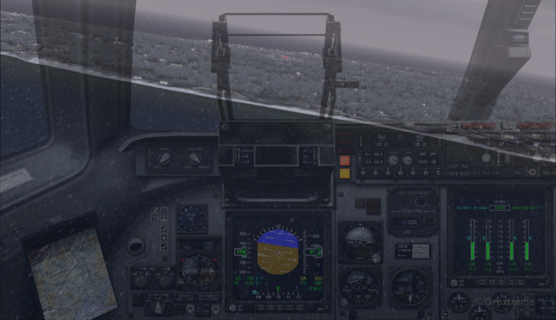
Contrary to the Cessna type aircrafts normally evolving around the airport, the total weight of the canadian military C-17A used for the flight was 405,000 pounds. The fuel was adjusted to 50% in all four tanks. Both pilots agreed to skip lunch in order to avoid adding any extra weight to the beast…
Flaps were adjusted to 2/3. I backed the aircraft to the beginning of the runway, applied the brakes, applied full throttle, waited for maximum regime, released the brakes and used ground effect to lift the aircraft before it was too late. The take-off was done on runway 10 with a 12 kts and 70 degree crosswind.
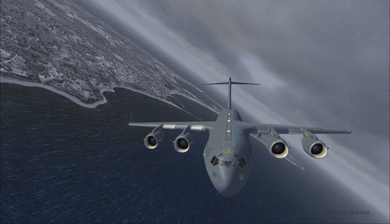
Canadian military aircraft C17-A airborne runway 10 at the Block Island (KBID) virtual airport in United States (FSX)
Then, four right turns were made : 190°, 280°, 010° and 100°. During the flight, the aircraft’s altitude never went above 2000 feet.
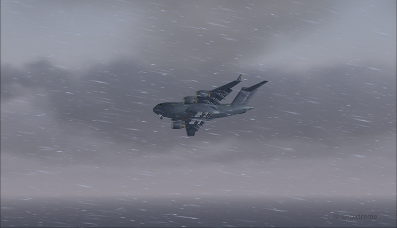
Canadian military aircraft C17-A turning downwind runway 10 at the Block Island (KBID) virtual airport in United States (FSX)
Wheels and flaps were brought down in base so that I did not have to make serious adjustments on final.
Canadian military aircraft C17-A turning base runway 10 at the Block Island (KBID) virtual airport in United States (FSX)
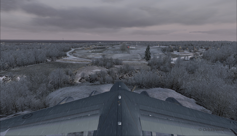
Canadian military aircraft C17-A on long final runway 10 at the Block Island (KBID) virtual airport in United States (FSX)
Canadian military aircraft C17-A short final runway 10 at the Block Island (KBID) virtual airport in United States (FSX)
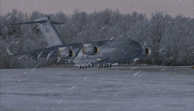
The speed eventually went down to 128 kts and, while the aircraft was still about two feet in the air, I used the airbrakes. The thrust reversers were fully activated two feet before touch-down (continued pressure on F2) since they take time to rev up. That is not necessarily the proper way to do it and you can wait one more second, until the wheels touch the runway, to use the reversers. The main gear touched at the very beginning of the runway and maximum breaking was then applied.
Canadian military aircraft C17-A landing at the Block Island (KBID) virtual airport in United States (FSX)
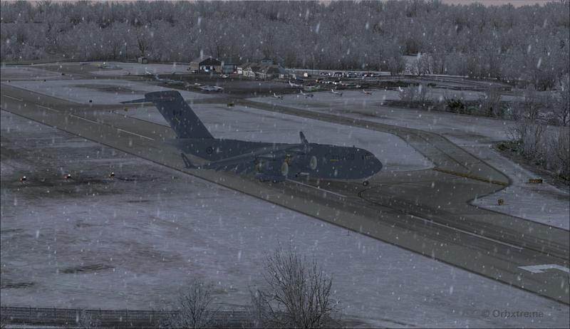
It was possible to exit on the taxiway without having to back-track on the runway. The environment always coming second, some trees were cut so that there were no contacts with the aircraft.
Canadian military aircraft C17-A exiting runway 10 at the Block Island (KBID) virtual airport (FSX) in United States
Canadian military aircraft C17-A taxiing at the Block Island (KBID) virtual airport (FSX) in United States
If you decide to try it out, think of saving the flight when you are on final, in case you are not satisfied with your performance during the landing (scrapped aircraft, destroyed houses and vehicles in the neighborhood, burned forest at the end of runway 10, collateral victims, etc.).
Canadian military aircraft C17-A at the Block Island (KBID) virtual airport (FSX) in United States
Good luck!
For other challenging virtual flights, head towards the flight simulation section of the present web site.
For more articles on flight simulation on my web site, click on the following link : Flight simulation
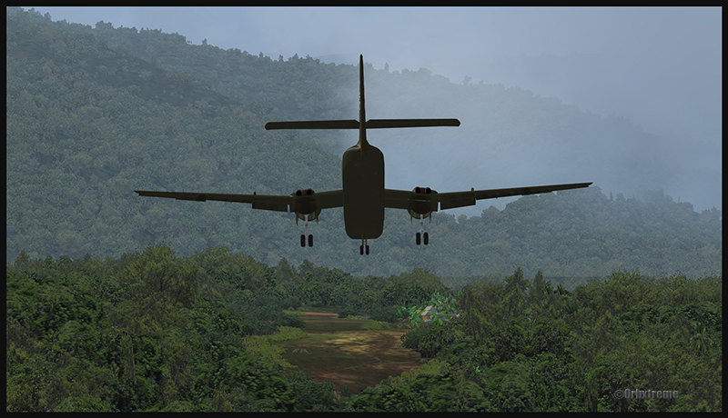
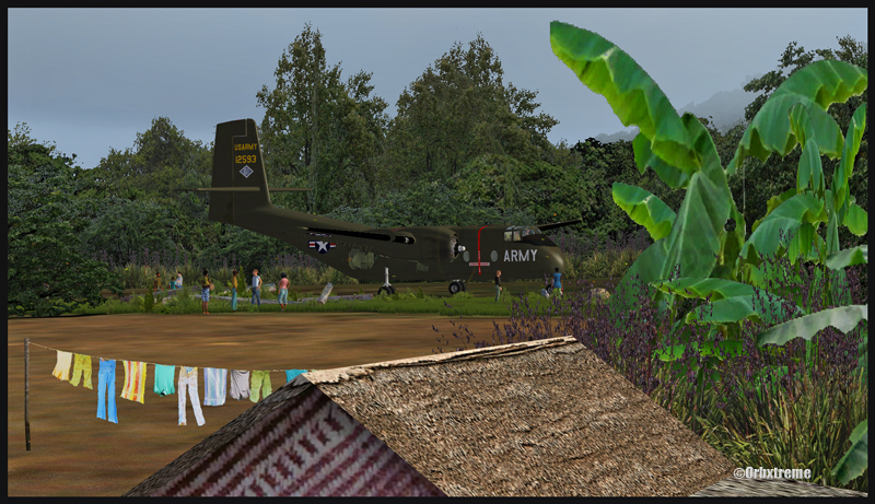
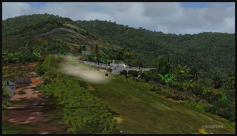
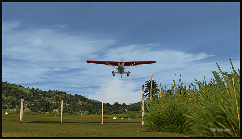
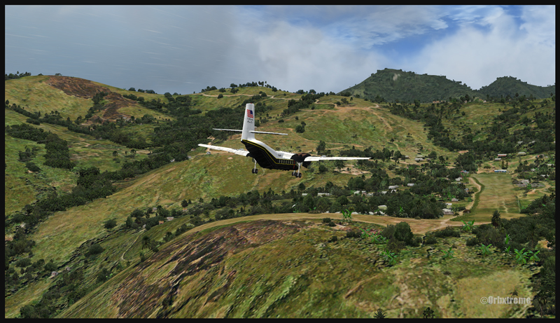
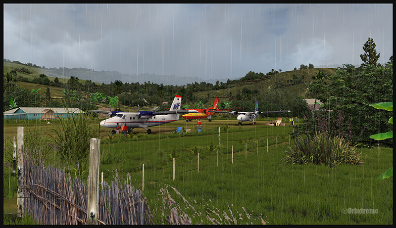
A virtual DHC-6 Twin Otter enroute for Kokoda after a fire on the right engine while departing Yongai (KGH) in Papua New Guinea PNG (FSX)
Ken Hall and Tim Harris have created a new virtual scenery for flight simulation enthousiasts. It is called “Tapini” and sold by ORBX. Their penultimate creation, AYPY Jackson’s International, allowed the virtual pilot to fly in very demanding virtual airports along the Kokoda Trail in Papua New Guinea. “Tapini” represents a whole new challenge and I have included several screen captures to show you how the different runways look in this new virtual scenery.
“Tapini”, still in Papua New Guinea, allows the virtual pilot to test his skills on seven new runways located in difficult areas of the Owen Stanley Range. Those airports also constitute a serious test for any aircraft, like in the picture above where damages to the right engine were sustained at Yongai.
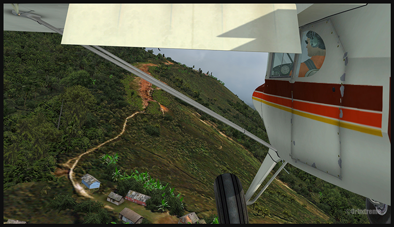
A virtual Piper Pacer virtuel is about to land on the Ononge (ONB) curved runway in Papua New Guinea PNG (FSX). (It is possible to see the curve starting on the top of the image)
To improve the virtual clouds while flying between the different airports, I used either REX or FSGRW weather engines. The cloud textures and weather effects were improved by one or many of the following products: Cumulus X, PrecipitFX, REX Texture Direct and REX Soft Clouds.
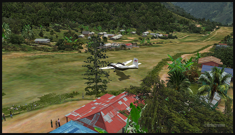
A virtual Dash 7 has just landed in Woitape (WTP) in Papua New Guinea PNG (FSX)
As variety is more fun, and also due to the different challenges created by those runways, the following virtual aircrafts were used: Carenado C-185F, Lionheart Creations PA-18, Virtavia DHC-4, Aerosoft DHC-6 Twin Otter and Milton Shupe DHC-7.
The “Tapini” scenery gives the pilot a choice between the seven following runways:
ASB (Asimba)
A tricky, very short runway near a river.
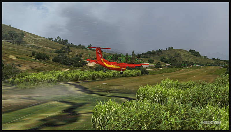
A DHC-4 Caribou virtual aircraft is on approach for Asimba’s sloped runway (ASB) in Papua New Guinea PNG (FSX)
This is a very interesting runway, best done with a STOL aircraft like the Caribou DHC-4. The inhabitants might have to help you clear out some branches along the runway, considering the size of the aircraft. The runway slopes down on take-off, which helps to build up speed.
A DHC-4 Caribou virtual aircraft is on a stopover at Asimba (ASB) in Papua New Guinea PNG (FSX)
A DHC-4 Caribou virtual aircraft is airborne from Asimba (ASB) in Papua New Guinea PNG (FSX)
FNE (Fane)
A one-way, really challenging 12 degree sloped runway, with unpredictable winds.
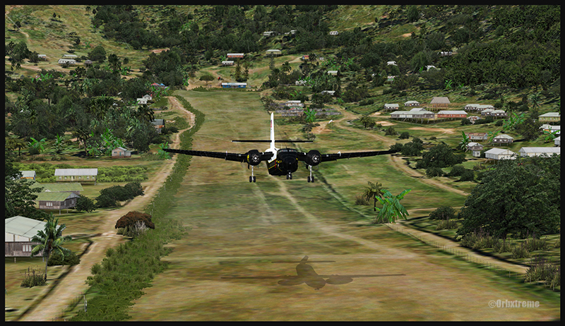
A De Havilland DHC-7 virtual aircraft on final for the Fane (FNE) airport’s sloped runway in Papua New Guinea PNG (FSX)
The runway sits on top of a hill. It is an amazing experience to land there. No wonder there are a lot of people watching the arrivals and departures.
If you slow down too quickly with an aircraft as big as the DHC-7 on that sloped runway, the twelve degree angle prevents you from moving forward. You must let the aircraft come down the runway very slowly, using the power to control the descent and the rudder to stay aligned on the runway, then apply take-off power for a few seconds to build just enough momentum to get above the hill.
A De Havilland DHC-7 virtual aircraft just finished taxiing uphill on the Fane (FNE) airport’s sloped runway in Papua New Guinea PNG (FSX)
To turn the aircraft around, it’s a combination of power and reverse thrust until you clear all the obstacles (any humans venturing behind the aircraft will also be cleared during the operation…).
A De Havilland DHC-7 virtual aircraft is airborne from the Fane (FNE) airport’s sloped runway in Papua New Guinea PNG (FSX)
There is a not so friendly man with a rifle watching the airport’s operations. Even the United Nations staff do not stay longer than necessary…
KGH (Yongai)
A very bumpy one-way sloped runway. A real bush aircraft is needed here!
A virtual DHC-6 Twin Otter on approach for the Yongai (KGH) bumpy runway in Papua New Guinea PNG (FSX)
Even with a real bush aircraft, there is a possibility that one of the aircraft’s propellers hits the ground while taxiing on the runway. There are so many deep holes that are hard to see, I can only wish the best of lucks to everyone trying out this airport!
A virtual DHC-6 Twin Otter on the Yongai (KGH) bumpy runway in Papua New Guinea PNG (FSX)
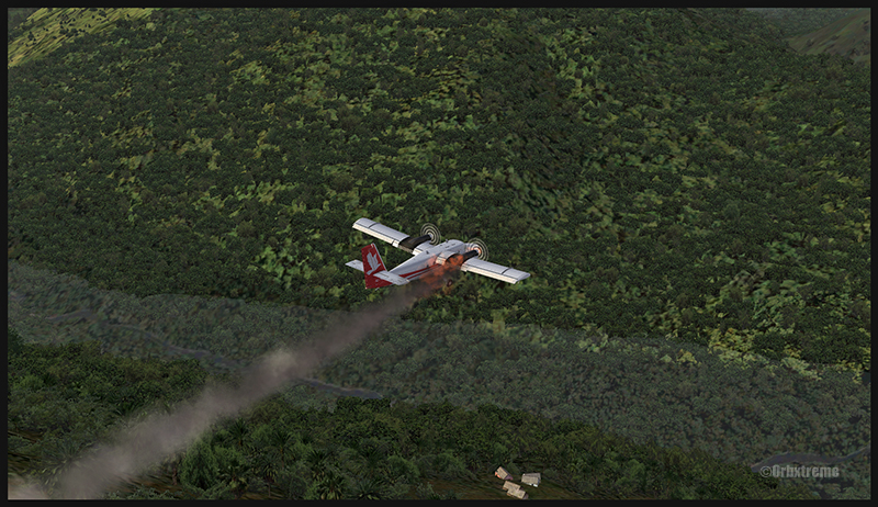
Keep a close watch on the area near the little house at the end of the runway. The DHC-6 was really shaken while turning around for take-off. One of the propellers hit the ground but no problems were detected…until the aircraft was airborne. The fire alarm then went off, just as the aircraft was passing the runway threshold, seconds before flying over a cliff.
A virtual DHC-6 Twin Otter with its right engine on fire is just airborne from the Yongai (KGH) bumpy runway in Papua New Guinea PNG (FSX)
So much for the planned trip… and it was out of the question to return to Yongai on one engine. I had to pull the handle to stop the fire, feather the prop, cut the fuel where it was not needed anymore then head to the Kokoda airport as it was a sure alternative, having a long runway and an elevation that did not require the use of extra power.
KSP (Kosipe)
A relatively short runway that requires good calculations from the pilot, since it is located high in the mountains.
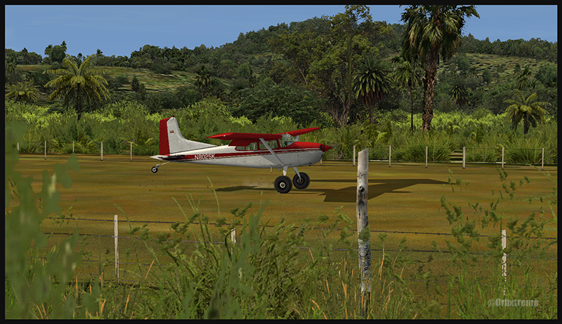
A virtual Cessna C-185F is enroute to the Kosipe (KSP) airport in Papua New Guinea PNG (FSX)
The Cessna C-185F is a very well suited aircraft for that runway. Make sure not to be too heavy on the brakes, as new C-185 propellers are hard to find in Kosipe. You can land in both directions. Ensure that the mixture is set properly as the airport is above 6300 feet.
A virtual Cessna C-185F is rolling after touching down on the Kosipe (KSP) runway in Papua New Guinea PNG (FSX)
A virtual Cessna C-185F is airborne from the Kosipe (KSP) runway in Papua New Guinea PNG (FSX)
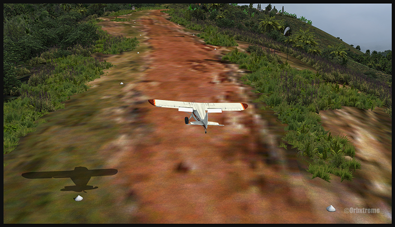
ONB (Ononge)
A curved and very bumpy runway! For those who like low flying. Make sure you choose the good aircraft here; there is not much manoeuvering area once on the ground.
A Virtual Piper Pacer on approach for the Ononge (ONB) curved runway in Papua New Guinea PNG (FSX)
Ononge looks really scary when you show up on final for the first time. You wonder if the little trail that you see can really be a runway. For that kind of situation, the little Piper Pacer is an excellent aircraft, approaching slowly and braking on a dime. The runway is curved in the middle so you will need a bit of right rudder to keep the aircraft aligned with the runway.
A Virtual Piper Pacer on the Ononge curved runway in Papua New Guinea PNG (FSX)
I guess all those people with their cargo are waiting for a bigger airplane than mine…
A Virtual Piper Pacer is airborne from the Ononge curved runway in Papua New Guinea PNG (FSX)
TAP (Tapini)
A challenging one-way sloped runway nestled in a tight valley. You can even use an ILS to arrive there!
A virtual DHC-4 Caribou on short final for the Tapini (TAP) sloped runway in Papua New Guinea PNG (FSX)
This is a superbly designed area and airport. I visited it with the DHC-4 Caribou but any other big STOL aircraft would have fitted there. There is enough room to manoeuver. It is not too bumpy. There is an interesting slope: it starts downward and ends upward: this helps to slow down the aircraft after landing.
A virtual DHC-4 Caribou on the ground at the Tapini (TAP) airport in Papua New Guinea PNG (FSX)
A virtual DHC-4 Caribou is airborne from the Tapini (TAP) airport in Papua New Guinea PNG (FSX)
WTP (Woitape)
Looks like a no brainer, but there is no margin of error on this one-way slightly sloped runway. Very precise calculations and settings are required if you want to land there with something else than a small aircraft.
A virtual De Havilland DHC-7 on final approach for the Woitape airport (WTP) virtual airport in Papua New Guinea (FSX)
I found the runway to be very slippery with the De Havilland DHC-7. I must say that there was a good crosswind, as I was flying with real life weather and winds. The DHC-7 behaves like a big boat while decelerating on such a runway.
A virtual De Havilland DHC-7 on the ground with two Twin Otters at the Woitape airport (WTP) in Papua New Guinea (FSX)
The Woitape scenery is gorgeous. It is nice to have all those well designed virtual aircrafts, people and animals on site as this makes the scenery so much more realistic.
A De Havilland Virtual DHC-7 is airborne from the Woitape airport (WTP) in Papua New Guinea (FSX)
I love this new Orbx product. When you fly in such a realistic scenery, the brain does not make much difference between what is real and what is virtual. It really works! And if you use real life weather downloaded from the internet, it’s even better.
I tried the seven airports included in the “Tapini” virtual scenery and they are quite demanding. Yongai was the most challenging airport of them all. I had to do two missed approaches there since I ended up too high on the approach. I eventually got it right, like in real life!
I used the Microsoft flight simulator X (FSX) for all the virtual flights, but other platforms would have worked as well (Dovetail Games FSX Steam edition (FSX: SE) and all versions of P3D). The following products were also installed on my flight simulator: FTX Global, FTX Global Vector and Holgermesh, as well as Pilot’s FS Global 2010.
It is a totally immersive virtual experience and you have to forget everything else when undertaking those challenging virtual flights… if you want to make it “virtually” alive!
For more articles on flight simulation on my web site, click on the following link : Flight simulation
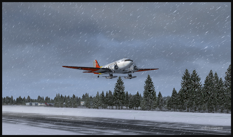
DC-3 at the Homer (PAHO) virtual airport in Alaska (FSX)
If you feel like attempting a virtual landing on an ice runway, an opportunity is offered by ORBX through their Homer (PAHO), Alaska virtual airport. For the flight, I used the FSX platform but it could have been also done under P3D.
DC-3 on skis airborne from the Homer (PAHO) virtual airport in Alaska (FSX)
The ice runway is just a short distance away from the regular Homer asphalted runway. The DC-3 is an excellent aircraft for the task since its approach speed is very low and it is one of the few virtual aircrafts equipped with skis.
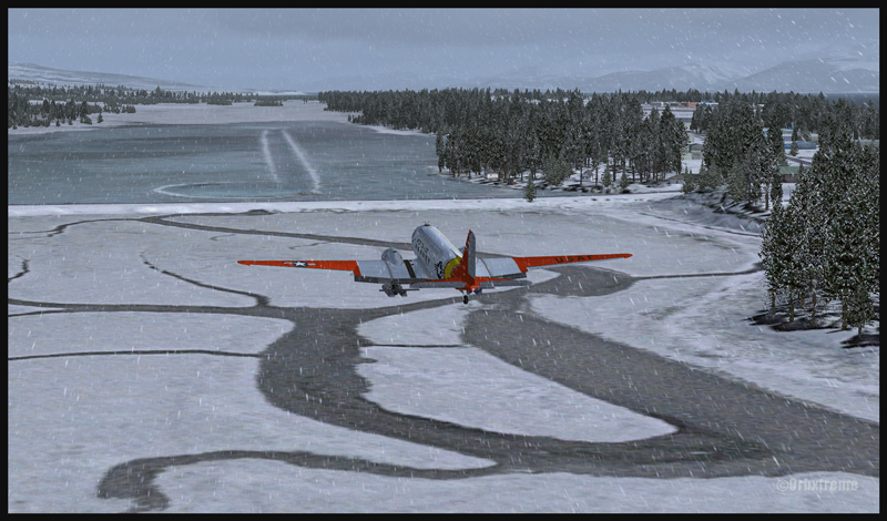
A DC-3 on skis is turning final for the Homer ice runway in Alaska (FSX)
If you want to try that flight, make sure to adjust the flight simulator configuration settings so that the Homer ice runway option is activated, otherwise you’ll end up under water…
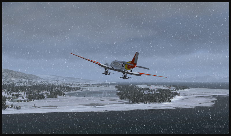
In order to add a bit of challenge as well as winter realism, you can add a bit of crosswinds or some snow using the standard « heavy snow » option in FSX. The program PrecipitFX helps a lot if you are looking for a better definition of precipitations, be it snow or rain. For this flight, the Cumulus X program was also activated.
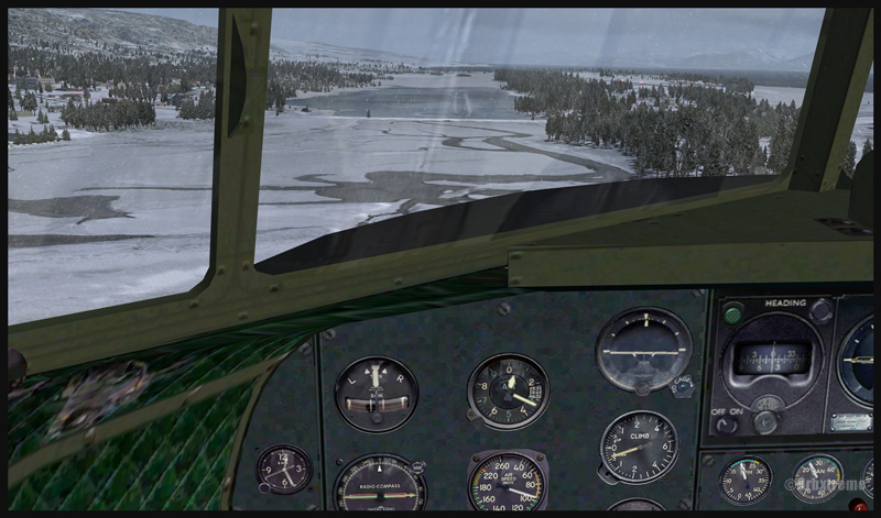
Cockpit view of a virtual DC-3 on final for the Homer (PAHO) ice runway in Alaska (FSX)
Virtual DC-3 on skis on short final for the Homer (PAHO) ice runway in Alaska (FSX)
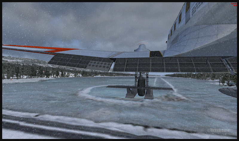
Virtual DC-3 on skis about to touch the threshold of the Homer ice runway in Alaska (FSX)
The short flight proved to be an interesting experience, since the runway was narrow and there were some crosswinds. I thought that it would be very slippery but it was not the case. Maybe one day Orbx, in association with the FSX Steam (Dovetail Games) professionals, will work at modifying the flight simulation platform and add a CRFI (JBI) index of .40 or less to increase the difficulty in slowing down and controlling the virtual aircraft?
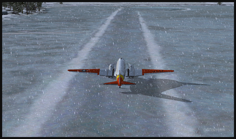
A DC-3 on skis flying few feet over the Homer (PAHO) (FSX) ice runway, a product of the ORBX company
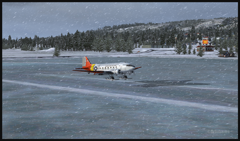
A virtuel DC-3 on skis after a landing on the Homer (PAHO) ice runway in Alaska (FSX)
A DC-3 virtual on skis backtracking the Homer (PAHO) ice runway in Alaska (FSX)
As this flight is not a super though exercise, I have placed it in the “standard virtual flights”, in the flight simulation section of my website. For more of those flights, click on the following link: Other standard virtual flights
Have fun trying this one! Later on, I’ll present another ice runway located on Antarctica, which virtual scenery was made by Aerosoft. Even the C-17 Globemaster III is approved there…
For more articles on flight simulation on my web site, click on the following link : Flight simulation
After a proficiency check, I soon find myself flying a Cessna 170B (tail wheel) on a flight across Canada, from St -Jean-sur- Richelieu, Quebec, to Edmonton, Alberta. I am accompanied by the aircraft’s owner who has not yet completed his private pilot course. The 1952 Cessna flies well, but has absolutely no instruments for air navigation, not even a VOR nor ADF. And the era of the portable GPS is not yet upon us.
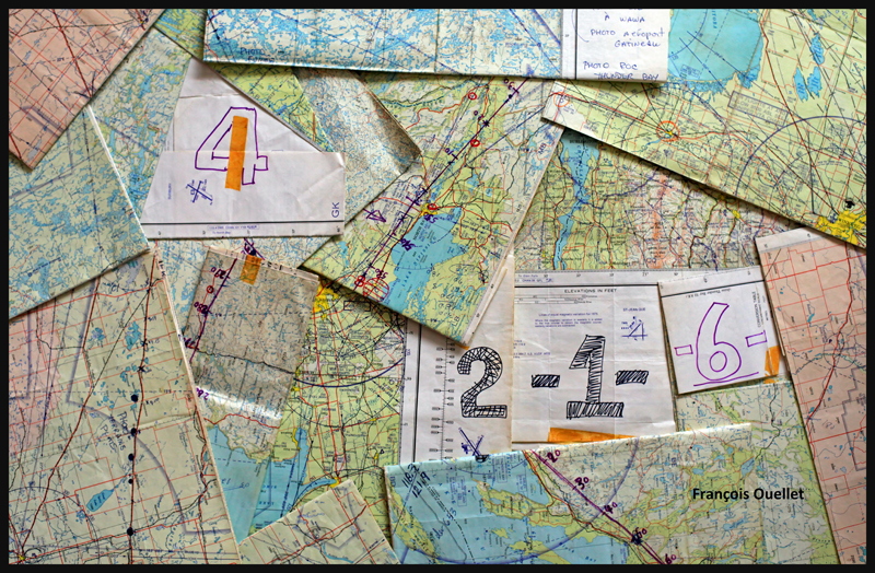
Fourteen 1:500,000 VFR charts, covering the planned flight, are folded, glued and numbered. I trace the expected flight path on each chart, with 10 miles landmarks. This will facilitate the monitoring of our progress, considering the absence of navigation equipment. The preparation now completed, the take off is done on a beautiful summer day of 1981.
1:500,000 VFR charts used for a flight toward Edmonton, Canada, in 1981
We do stopovers at Gatineau, North Bay, Sudbury and then fly along Lake Superior to Wawa.
Small break in Sudbury on a VFR flight to Edmonton in 1981
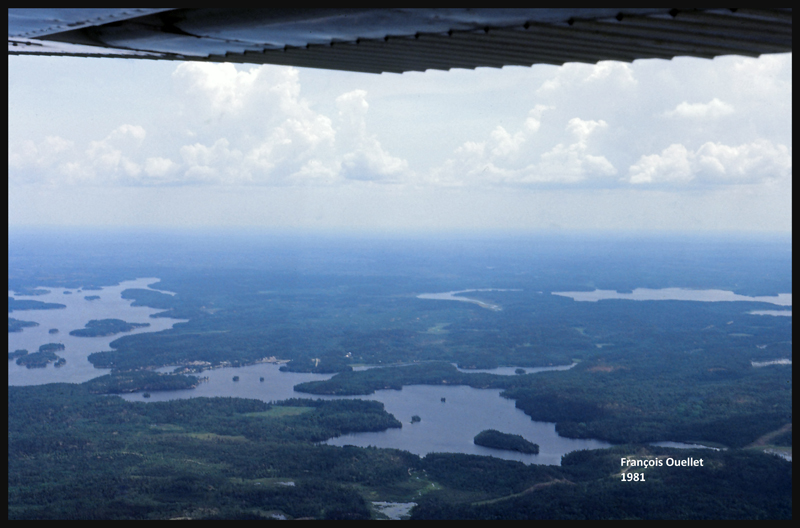
We fly around Lake Superior to our next stopovers, Thunder Bay and Fort Frances. Over large forested areas, with no major landmarks, the gyroscopic precession must be corrected frequently so as not to stray too far from the intended track. Sometimes when it facilitates navigation, we either follow a railway or main roads. There are some instances where the westerly winds are so strong that our ground speed is slower than a car on a highway.
From Fort Frances to Kenora in 1981, with a Cessna C170B
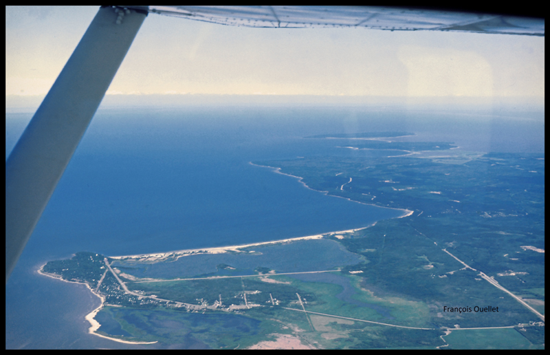
Our flight path follows a line that keeps us away from areas of high air traffic. I choose to fly north of Winnipeg terminal control area, thus avoiding frequent radio exchanges with air traffic control in a language I do not master. The underperforming radio would not be of any help at any rate. This option eventually means that we must fly over Lake Winnipeg, in its southern portion. We have enough altitude to be able to glide to the other side in case of an engine failure. Nonetheless, we realize that we are gradually loosing several thousand feet due to the cold air mass above the lake. This with maximum power applied. The unexpected descent eventually ends, but it is now impossible to have an engine failure without ditching in the lake…
The crossing of Lake Winnipeg with a Cessna C170B in 1981
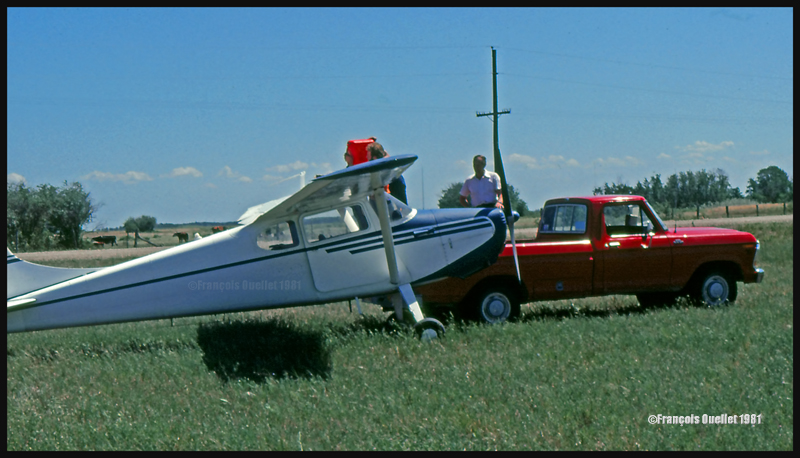
Near Lundar, Manitoba, the aircraft’s old gauges indicate a significant loss of fuel. It is surprising since we refueled an hour ago. We must land the plane on the nearest runway, but the strong crosswinds exceed the capabilities of the aircraft. Nonetheless, an attempt is made with the result that only the left wheel accepts the contact with the runway. As soon as the right wheel also touches the ground, the aircraft becomes airborne again. A nearby field is selected to make a precautionary landing so that the fuel status can be verified. We fly at low altitude over the electrical wires and the cows in the adjacent field, and touch smoothly at a ground speed not exceeding 15 knots. A farmer witnesses the landing and arrives in his red pick-up to offer some help. The tanks are almost full, so the plane only needs few liters of gasoline. Once this is done, we take off westward. It appears that the old fuel gauges of this 1952 Cessna are now totally unreliable…
Landing in a field with a Cessna C170B in Lundar, Manitoba in 1981.
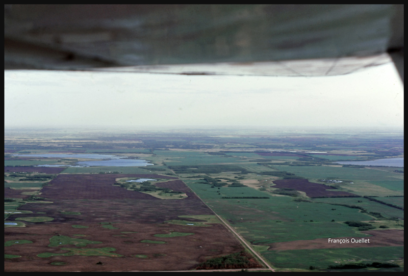
We leave Manitoba through Dauphin and enter Saskatchewan. If we were to experience an engine failure above such uniform fields, the risk of serious problems at landing would be virtually nonexistent.
Near Yorkton, Saskatchewan, in flight with a Cessna C170B in 1981
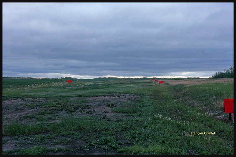
The weather is slowly deteriorating. We choose to land in Watson, Saskatchewan, on the nearest runway.
The runway surface consists of muddy earth and grass, and it’s delimited by small red wooden panels. As we touch the ground, the tires splash mud everywhere, including under the wings.
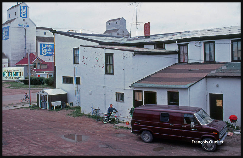
The Watson runway, Saskatchewan, in 1981
The King George motel in Watson, Saskatchewan in 1981
Finally, the weather improves and a takeoff is made toward North Battleford, the last stop before Edmonton. The sloping terrain forces us to fly lower and lower near Edmonton, under an overcast stratocumulus, limiting our ability to see a long time in advance the correct airport from the three available (international, civil , military ). Luckily, everything goes well in choosing the right airport and approach, but we cannot say the same with radio communications. The sound quality coming from the old speaker is awful and the English spoken by the air traffic controller too fast for us. The combination of these two factors causes the controller to repeat more than once his instructions until he finally decides to slow down and we can officially say: « Roger! »
After spending few days in Edmonton it is now time for the return flight to St-Jean. This proves to be much easier and faster because the westerly winds push the aircraft. Our ground speed is sometimes double what we had managed to get on our trip to Edmonton. The journey took us twenty-five hours to go and eighteen hours to come back.
Cessna C170B in flight over Canada, summer 1981.
Climbing to 9,500 feet on the return leg to St-Jean-sur-Richelieu, in 1981.
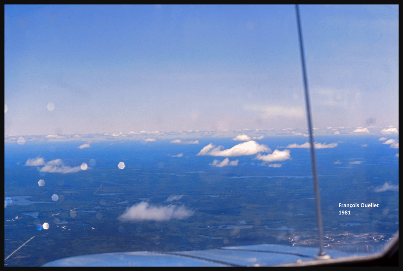
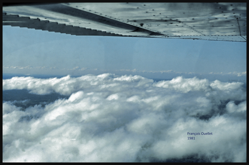
VFR “on top” with a Cessna C170B in 1981 over Canada
Over North Bay, Ontario, the weather is ideal. But we will have to land in Ottawa while waiting for thunderstorms to move away from Montreal and St-Jean-sur-Richelieu. After a total of forty- three-hours of flying time, the old Cessna 170B is landing back to St- Jean -sur- Richelieu.