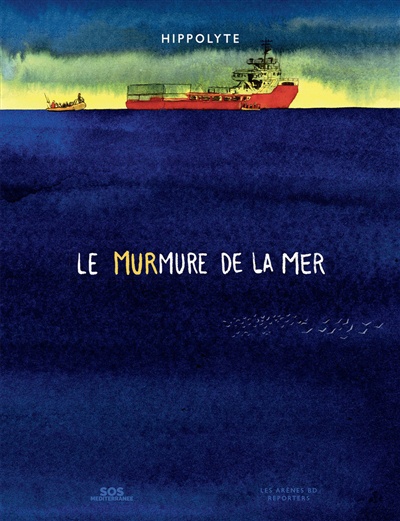
The graphic novel “Le murmure de la mer”, by Hippolyte.
The graphic novel “Le murmure de la mer” is a tribute to the work of the Ocean Viking’s crew, the rescue ship belonging to the SOS Méditerranée group. Its mission is to rescue migrants leaving North Africa, particularly the Libyan inferno.
Those refugees find themselves overcrowded on makeshift boats, drifting endlessly in the middle of the sometimes raging Mediterranean Sea. Often, the rafts brush up against Libyan oil platforms. Day and night, the coast guards pursue the migrants and brutally drag them back to Libya.
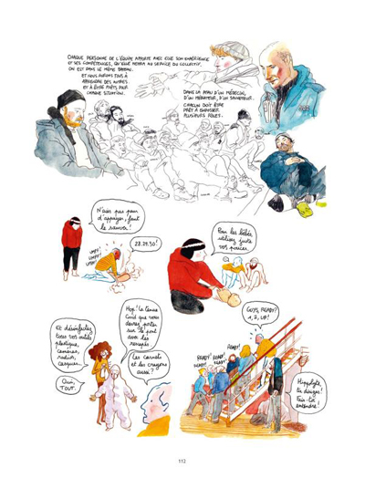
After a first blocked attempt to participate in a rescue, the author climbs aboard the Ocean Viking in 2020 as a journalist, cartoonist and crew member. He’s directly involved in the salvage operations, and recounts his experience in a series of beautiful sketches and touching photos.
Readers appreciate the great discipline and preparation required to carry out salvage missions in an orderly and safe manner for all concerned. Sentimentality has no place when rescuing migrants in crisis. Not following procedures can result in further deaths, including those of crew members.
A page from the graphic novel “Le murmure de la mer”.
We bear witness to the crew’s successes and failures in their attempts to rescue as many people as possible. The sailors of the Ocean Viking face administrative blockades from Italy, which seeks to limit the considerable arrival of refugees.
First among these attempts to hinder rescue operations is the obligation for the ship to remain docked for long periods for different reasons.
Next is the requirement to transfer the new migrants to ports far from the Ocean Viking’s position. These ports are deliberately chosen by the Italian government to generate fuel costs and lengthy delays between each recovery mission. This drag prevents thousands of refugees from being salvaged.
We must, however, question the involvement of other states when it comes to admitting migrants. The misfortune of people living in countries disadvantaged by ruthless dictatorships, climate change or poverty accelerated by the plundering of wealth is everyone’s responsibility.
Once the refugees are on the boat, the crew still has to secure them, care for them and prepare them for transfer to their next land of welcome. We all know the story of those vessels which have picked up hundreds of Africans in difficulty, and which remain immobilized for weeks while awaiting clearance to transfer the survivors to a new territory. Yet the law of the sea states that any ship’s captain who learns that human beings are in peril on a body of water must render assistance.
In short, a fascinating and informative read. It increases our understanding of the challenges faced by crews helping humans in danger on the Mediterranean Sea.
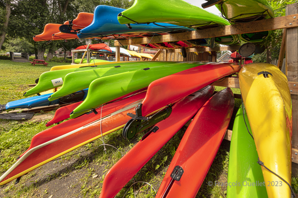
Sea kayaks at Saint-Laurent-de-l’Île d’Orléans 2023
On Sunday, September 24, 2023, the company Quatre Natures organized a certified level 1 sea kayaking course the St. Lawrence River, starting from Île d’Orléans. As registration was done well in advance, we had to be a bit lucky during the activity, as it would take place as much in good weather as in bad.
So, I take a chance. Fortunately, an incredible day awaits the six students: full sun and twenty degrees Celsius. How should we dress for the circumstances? We know that the human body temperature is 37 degrees Celsius. The kayaker adds up the water and air temperatures and compares the total to the temperature of the human body. With the river that day at 18 degrees and the air around 20 degrees, this gives a total of 38. As this figure is slightly higher than normal body temperature, we can wear normal clothing for water activities, rather than a wetsuit.
The morning is used to cover theory. No one sets foot in the water. The instructor discusses what the kayaker must have on board, the relative quality of different equipment, preparation, communications and radio frequencies, safety and hypothermia prevention, and so on.
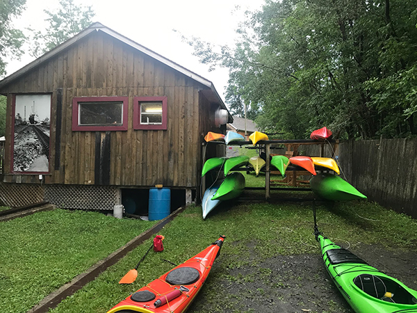
Sea kayaking activity at l’île d’Orléans (photo Vadym Kravchenko)
After lunch, the kayaks are placed on the lawn and the vocabulary related to each part of the kayak is learned. The student then settles into the kayak and learns how to adjust the footbraces, hold the paddle, install the spray skirt, and so on. The boats are then brought to shore and kayaking begins.
First, we learn the basic maneuvers. How to embark and disembark, the trajectory the paddle should follow in the water depending on whether you want to go forward, backward or turn. We discuss the correct position of the body, arms and wrists on the paddle, and the importance of rotating the pelvis to force the paddle properly. We quickly realize the influence of side winds on the kayak, especially when it has no centerboard or rudder.
The river is considered level 2 for kayaking. The current is strong, and we have to deal with three-metre tides. The wind around the island is also stronger than in Quebec City. Level 1 kayakers are encouraged to seek out Level 1 locations to gain experience, and never to set off alone at this stage of their learning process.
During the exercises, you can see the container ships and the various pleasure boats offshore. The larger vessels generate waves that take between five and ten minutes to reach the shore. When these approach, the instructor warns novice kayakers to turn to face the wave, so as to limit the effects on the boat.
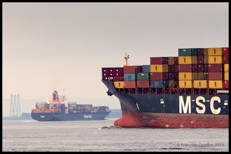
The container ship Hapag_Lloyd Quebec Express and the container ship MSC Paola are sailing around Île d’Orléans near Quebec City.
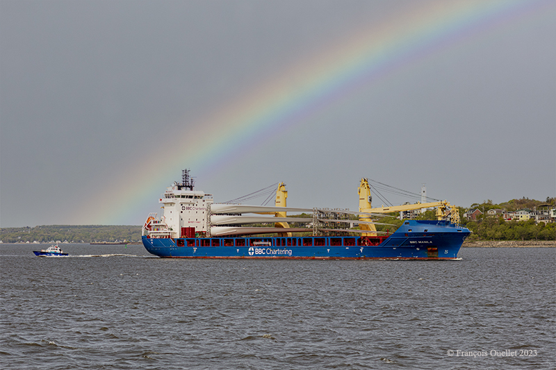
The BBC Manila carries wind turbine blades on the St.Lawrence Seaway near Quebec City.
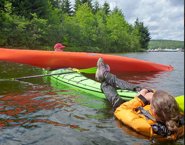
Then come the emergency maneuvers: what’s the procedure for getting out of a kayak that’s just capsized? How do you help someone who has capsized?
I didn’t have time to get to this stage of the course. I capsized before. I don’t remember how I managed to extricate myself from the kayak and get back to the surface, but we’re not talking about an approved method here. The brain immediately detects the danger and organizes itself so that the body gets out of the kayak and the head doesn’t stay underwater for too long.
In the minutes that follow, the instructor teaches us how to perform the classic exit from a capsized kayak. We work in pairs. At Level 1, there’s no question of using the paddle to force the kayak to turn.
To obtain KDM 1 certification, everyone must lean sideways so that the kayak tips over. Once submerged, the student leans forward, unhooks the spray skirt attached to the kayak, and slowly taps the kayak’s hull three times to signal that he is in control of what he is doing. The instructor wants to avoid unpredictable reactions. We then push ourself out of the kayak by placing our hands at hip height on the coaming. As soon as we are out of the water, it’s imperative that we hold on to our kayak, thanks to the lifeline. It only takes a few seconds. Here and there, you can hear a little coughing as the student surfaces, but nothing more. A good sip of St. Lawrence River boosts the immune system.
Next comes the recovery of the person in the water. As we work as a team, the kayaker in difficulty clings to the front of our kayak and stays there until we catch up with his or her kayak, lift it onto our boat, empty it of water, turn it over and position it correctly.
Sea kayaking course level 1 with Quatre Natures (photo Quatre Natures)
The person clinging to the kayak then releases his or her grip, and depending on the method taught, climbs back into the boat while the latter is being held securely. The important thing here is to keep the center of gravity as low as possible. If the person doesn’t hurry and proceed step by step, the operation is a success every time.
A few more exercises follow, and it’s back to the beach on Île d’Orléans a few hours later. Once all participants have dried off and put on their warm clothes, the course concludes with a few weather notions, including the need to consult weather forecasts and radars, and to return quickly to shore when storm cells are present.
We also cover tide calculation (rule of 12) and how to attach a kayak to a car roof. How many attachment points? What equipment is available to make the job easier? Where should harnesses go to avoid breaking the kayak? Etc.
The KDM 1 certificate is awarded approximately eight to nine hours after the start of the course, depending on the instructor’s assessment. I noticed that on the way home, in the heat of the car, I really didn’t feel like rushing on the road. But you quickly come back to reality when you see how fast the cars are coming up behind you.
I appreciate Erik Orsenna for his erudition, his Cartesian thinking, his poetry and his ability to find the detail that will amuse the reader while informing him. In his book, the author tackles with equal comfort a wide variety of themes relating to history, religion, philosophy, the environment, climate change, renewable energy, pure science, politics and economics.
Being first and foremost a man of the field, he quickly recognized the need to develop and maintain political contacts in many countries in order to facilitate his travels in areas often considered problematic. The reader benefits from this privileged access.
In “La Terre a soif”, he presents us with portraits of thirty-three rivers around the world. The list is not exhaustive, of course, because after years of travel and observation, he was pressed by the publisher to produce his book. I know that if it were up to him, he would still be on the road accumulating information, each more interesting than the other.
Here are some of the rivers discussed in this book: Mississippi, St. Lawrence, Loire, Nil, Congo, Ganges, Mekong, Colorado and even Panama’s two rivers. The smallest of the rivers mentions in the book flows in Brittany, France and is called Trieux, while the largest is the Amazon in Brazil.
With some of the more powerful countries like China, or Israel and a few others, negotiating for the equitable administration of a river is difficult. The dams built by a powerful country reduce the flow downstream and the smaller surrounding countries make do with what is left. Water harvesting also dries up land over long distances, affecting agricultural production.
Navigation on waterways must also adapt to the reduced flow. One example is the Panama Canal: [DeepL translation]: “ The lack of water is the great fear of Panama. We remember that the heart of the canal is the great Gatún Lake. If it were to dry up, the ships would run into rocks and sand: they would no longer be able to transport their cargo from one sea to the other. Trucks would have to take over”. (p.252)
In contrast, the author shows that there are ways to administrate a major river so that it benefits the riparian countries. He cites the management of the St. Lawrence River by the United States and Canada as an example.
Contrary to what one might think when it comes to the environment and water scarcity, not everything in this book is negative. On the contrary, Erik Orsenna has understood that the reader is tired of alarmist statements. The author has therefore designed a very well-balanced book where it is possible to make the reader’s thoughts evolve without the latter feeling the need to take an antidepressant at each chapter.
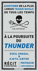
French version of Chasing the Thunder: “À la poursuite du Thunder”.
This book is sure to please fans who can understand French and true stories. “In pursuit of the Thunder – the story of the longest naval chase of all time” quickly hooks us, especially since it is a first in maritime history. The authors of this investigative story are two experienced journalists by the name of Eskil Engdal and Kjetil Saeter.
The information they were able to collect through multiple interviews around the world allows the reader to better understand what hides behind the theft of fishery resources in Antarctica.
This illegal fishing is a big business where the mafia, especially Spanish, does not hesitate to order the cutting of fishing nets or simply to sink a trawler to prevent the obtaining of evidence. Click on the link for a video of this maritime accident.
The chase takes place in inhospitable waters and spans several months and over 15,000 kilometers as we follow the stories of several members of the chase team as well as the illegal fishermen.
The authors discuss the squandering of resources, the lax legislation regarding illegal fishing in international waters, the methods that criminals use to remove a boat’s registration from the registers, the lack of political courage at the international level, the omerta that reigns in the villages where illegal fishermen operate, money laundering and modern slavery.
The Thunder’s captain does everything in his power to escape the pursuers. This escape leads him to sail in very risky areas through passages almost blocked by ice, hoping that the smaller pursuing ship will not dare to venture on the same route. He also steers his trawler into areas where strong waves risk sinking the pursuing ship.
Captain Peter Hammerstedt of the pursuit ship Bob Barker does not back down from any obstacle that stands in his way during the chase. He shows a determination that infuriates the Thunder’s crew and lead them to make mistakes.
The ecological thriller Chasing the Thunder was screened in 2019 at the World Biodiversity Conference.
In March 2023, more than 100 countries signed a treaty on high seas diversity, after 15 years of effort. Greenpeace welcomed the treaty, but demands that it be translated into action…
Reading this book alone will awaken the reader to many previously under-reported aspects of illegal fishing on the high seas, all in the context of a hunt unique in the history of maritime shipping.
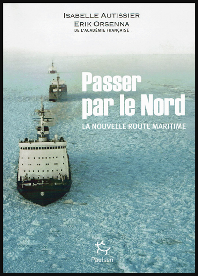
« Passer par le Nord » (Northern Sea Route), by Isabelle Autissier and Érik Orsenna, is an essential book for the reader who wishes to learn more about the profound transformations brought on by global warming, with regards to geopolitical, economic and ecological issues in the Arctic.
The book is at the same time a lesson in geography, history, politics, ecology and economy. It will certainly captivate those who are interested in maritime traffic and the development of new maritime routes, as well as the race towards the appropriation and exploitation of the immense oil and gas resources of the North.
Book cover of “Passer par le Nord” by Isabelle Autissier and Érik Orsenna
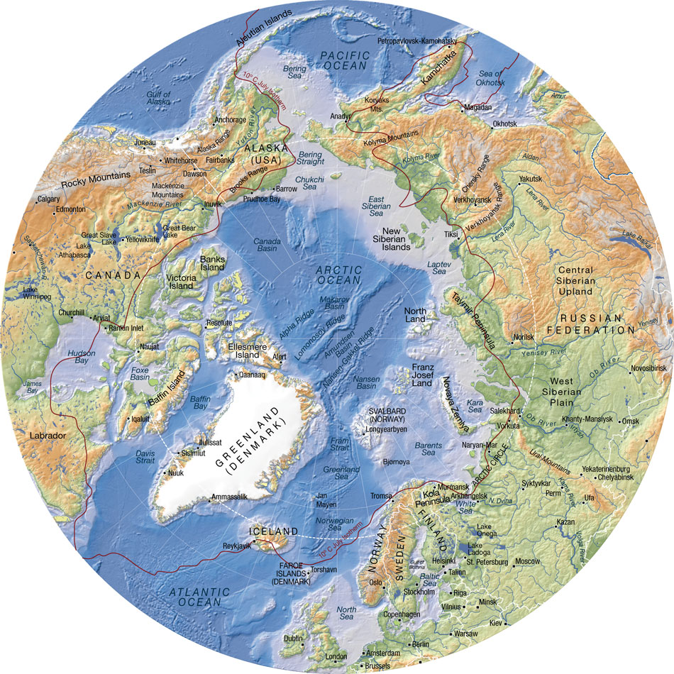
In order to sustain the reader’s interest, several maps are included in the book. They are very useful when comes the time to better understand the history and different uses, past and present, of the seas, islands and territories like: Kara Sea, Barents Sea, Laptev Sea, Franz Josef Land, Novaya Zemlya, Aleutian Islands, New Siberian Islands, North Land, Wrangel, Bering Strait, Svalbard, Spitzberg, Oslo, Tromsö, Kirkenes, Murmansk, etc.
Some of the seaways of Russia, which are among the longest in the world, are equally presented: Ob, Yenisei, Lena and Kolyma.
The numbers talk for themselves: to go from Rotterdam to Yokohama, a ship must travel 20,600 kilometers when passing through the Suez Canal. Only 12,800 kilometers are needed when using the northeast passage along the Siberian coast and 11,800 kilometers when traveling across the pole in the absence of ice during summer (this new transpolar route could be usable as soon as 2025). The need of resources by China and India, associated with melting ice in the poles, are rapidly taking Siberia out of its isolation.
Important people
The reader will certainly be interested by the information on the people who played a significant role in the discovery and exploitation of seas, islands and lands bordering the Northeast maritime route. Here are few of those names: the Viking Otar, Willem Barents, Simon Dejnev, Vitus Bering, Peter the Great, Alexander Baranov, Ivan Veniaminov, Adolf Erik Nordenskjöld, Ada Blackjack, etc.
The first northern crossing from the Atlantic to the Pacific belongs to a Swedish named Adolf Erik Nordenskjöld in 1879. Thirty-six years (1915) were needed to witness the second complete crossing, this time by Russian icebreakers under the command of Boris Vilkitski.
The importance of icebreakers
Icebreakers are extremely important for Russia, so much for protecting its recognized sovereignty and defending its new territorial claims than for economic reasons (insure the usability of the Northeast Passage and the continuous exploitation of the oil and gas resources along the Siberian coast).
The United States must also build icebreakers, so much for geopolitical and economic reasons than to insure the protection of a growing number of cruise ships that are about to use the narrow and risky channels of the Arctic.
An obvious collaboration exists between Russia and Norway with regards to fishing in the Barents Sea and in the south of Svalbard, a sector rapidly becoming more strategic with the northern migration of several fish species caused by the climatic changes. Ecosystems are nonetheless in danger due to the rapidly warming waters and insufficient time to adapt.
What are the obstacles presented by the Barents Sea towards tankers, ships and platforms? First the fog, which can last for weeks, than the “lows” which destroy vessels and twist superstructures. Finally,freezing spray adds excessive weight and freezes every crank on ships and platforms. In the event of an accident caused by oil or gas exploitation, the extreme meteorological conditions will present very important challenges.
One note on Siberia
The exploitation of mineral resources in Siberia was initially made possible, under Lenin, through work camps (gulags), since there were no volunteers ready to exile themselves in that hostile region.
The authors suggest, for whoever is interested in Siberia, the soon to be published book by Éric Hoesli. He has already published, in 2006, a very well documented book on the Caucasus: À la conquête du Caucase.
Oslo: Tschudi and Aker Solutions
The authors present two Norwegian companies based in Oslo which deal with logistics at sea: TSCHUDI and Aker Solutions.
Back cover of the book ” Passer par le Nord ” by Isabelle Autissier and Érik Orsenna
Shtokman and Yuzhno-Tambeyskoye natural gas reserves
The reader will certainly appreciate the chapter on the “eldorados glacés” (iced eldorados) which develops on the Shtockman and Yuzhno-Tambeyskoyenatural gas reserves fields (the latter holds 25% of the world reserve of natural gas). There are numerous challenges with regards to the exploitation of those fields: investments of twenty billion dollars, a necessary alliance between Russia, France (TOTAL) and China (CNPC), gigantic infrastructures to be built, the stabilization of all installations using thousands of posts, a constant fight against ice, the construction of thirty tankers (among them sixteen icebreakers), and the obligation to use the Northern maritime route.
Global warming
The book covers at length the accumulated effects of military, industrial and commercial activities on animal life and the environment. The fragility of the Arctic is well demonstrated. The reader will be surprised by the extent of nuclear wastes spread around the Novaya Zemlya.
The global warming favors the migration of species northward, an increase in the number of fishing vessels in the Arctic and political tensions between nations related to the ownership of the zone located between 12 and 200 miles along the different coasts. The native species are losing ground to the profit of the invasive species.
“[My translation] The diminishing polar ice will favor an increase in the number of ships in the Arctic with the added risk of collisions and the emission of all kind of noises that disrupt animals and prevent them from feeding correctly and communicate properly between them or with their offspring. Seismic tests or low-frequency sonars used by fishermen and militaries are particularly devastating.” (p.203)
“With few exceptions (Norway, Japan, Iceland), the moratorium on whale hunting is respected. The official predation by Inuit and the Russian poaching are limited.” (p.203)
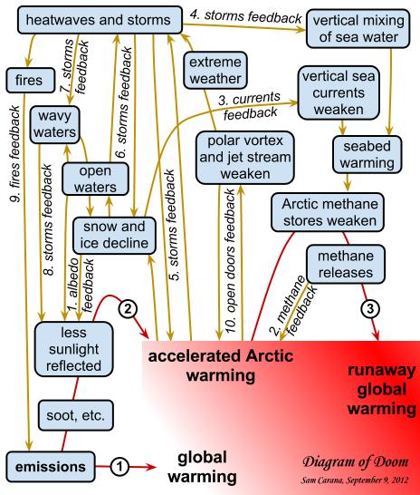
Map showing the links behind the accelerated warming of the Arctic (Source: http://arctic-news.blogspot.ca/2012/09/storm-enters-arctic-region.html)
Increase in extreme weather events
“[My translation] The diminishing pack ice will act on the oceanic currents, but also on the atmosphere by slowing down the higher jet streams. This phenomenon will favor an increase in extreme [weather] events (cold spells or heat waves, droughts or floods) at our mid-latitudes.”(p.219)
Response time when faced with an ecological disaster in the Arctic
The Bureau of Ocean Energy Management (USA) “[my translation] estimates that 61 000 barrels [of oil] would spill in the sea every day if a well exploded. The Shell Company indicates that it would need thirty-eight days to drill a relief well while it needed eighty-five in the Gulf of Mexico, infinitely more accessible and less dangerous. Admitting that it would show the same celerity as for Deepwater Horizon , which in itself would be a feat, more than 800 000 tons of oil would spill in the Arctic.
More likely, operating conditions in ice, fog and storms would prevent the realization of the work within only one summer. Once the polar night would set, a decision to let the well spill all winter would have to be taken, if not for many years in a row.” (p.229)
Methane
“[My translation] Methane has a greenhouse effect that is twenty-three time superior to that of the CO2, that is already presented as our worst enemy” (p.216)
“In the Laptev Sea, what looks like real fountains of several hundred of meters in diameter spew out methane. One can see the sea boil like if it was in a gigantic cauldron. 80% of surface waters and 50% of deep waters present methane concentrations varying from 8 to … 1 400 times the oceanic average!”(p.216)
Mammoth’s tusks poaching
There is a short passage in the book on the poaching of mammoth’s tusks buried in the ground on Liakhov Island. The operation is financed by Mafiosi. The tusks are carved then resold to Chinese collectors for a very good profit.
Global warming, and the thaw it provokes in Siberia, would indirectly protect the African elephant by allowing access to mammoth’s tusks. The new and important stock of ivory in Siberia drives the price down by increasing the offer, thus making the African elephant’s tusks less interesting financially.
Some names to remember
The Port of Kirkenes, in Norway, is one of the main ports of the new northern sea route. It has an ideal geographical position and its harbour is protected against storms. The city favors the development of the port. The efficiency of Norwegian employees is recognized. The Norwegians are used to deal with Russians, their immediate neighbours.
Murmansk, in Russia, is also expected to benefit from global warming. There are already dozens of mines in exploitation, with several of those mines producing rare earths which are vital for modern technology applications.
In the Arctic, the disappearance of the summer ice pack is expected between 2020 and 2030. The Northeast Passage could be accessible beyond the EEZ 200 miles, “which will favor Iceland “which could become a transport hub between America and Europe.”(p.218). “And it is said that some Beijing investors would be ready to offer 5 billion dollars to take control of the future Port of Reykjavik, the one that aims to be the hub of the North.” (p.245)
The Arctic Council
For a long time now, the Arctic has been a strategic area where numerous countries, among them few superpowers, claim an important part of the territory and resources. With the acceleration of the melting process, things get even more complicated.
In 1996, the Arctic Council was created to ease communications and reduce political tensions between the countries pretending to part of the Arctic territory and resources. These countries include Canada, Denmark, United States, Finland, Iceland, Norway, Sweden and Russia. Associations of indigenous population are also part of the group, but as “permanent members”.
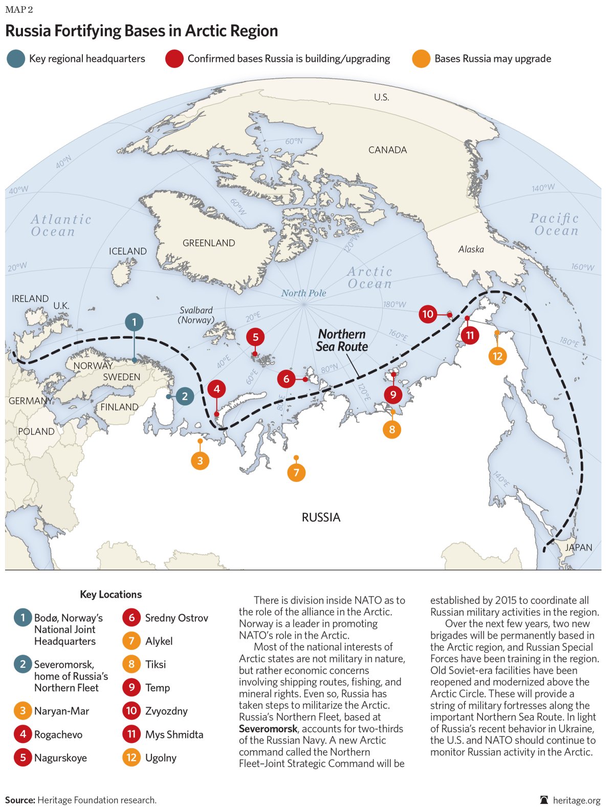
Militarization of the North
The Cold War between Russia and United States forced the construction of the DEW line by Americans and Canadians, a line that was eventually replaced by the North Warning System.
Today, the militarization of the area still goes on: “[my translation] Russia multiplies the signs and acts of militarization in the zone. Military exercises (parachuting, air patrols), reconstruction of installations in all of the islands (Wrangel, New Siberian, Novaya Zemlya, Franz Josef Land), orders of numerous ships among them new generation submarines (attack submarines and missile launchers), a complete program for the upgrading of the Boulava missiles … The [Northern Fleet] underwater base, near Murmansk (Severomorsk), seems to be in a state of complete reactivation.”(p.238)
Russia fortifying bases in Arctic region (Source: Heritage.org)
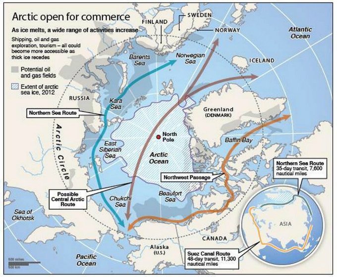
The transpolar maritime route
Geographic map showing the potential northern maritime routes (Source: www.businessinsider.com)
The Northeast Passage maritime route along the Siberian coast will be favored until the ice pack has melted at the pole (expected for 2025 instead of 2060 initially forecasted). So, in 2025, a new transpolar maritime route will be available to ship-owners. They will then be able to decide if they avoid the Siberian coast and the associated administrative hassle while they save an additional one thousand kilometers for a route from Rotterdam to Yokohama.
For more articles on geopolitics on my web site, click on the following link : Geopolitics
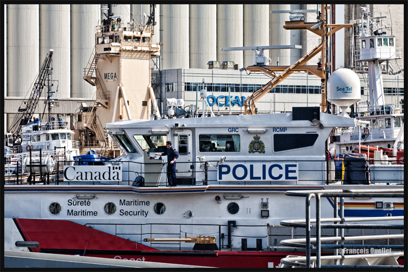
In order to give an impression of a very busy day in the Port of Quebec, during Spring 2015, I used a Canon 70-200 f2.8L IS II USM. A zoom is very useful to achieve some special effect in photography.
The apparent chaos in the photo is created by numerous details: first of all, the viewer has to read numerous words that have very different impacts on him: POLICE, CANADA, OCEAN, Sécurité Maritime, Maritime Security, GRC, RCMP, MEGA, Sea Tel, and part of the word Coast.
Secondly, there are numerous vertical lines of all sizes that interfere with multiple horizontal lines. The BUNGE silos, in the background, are themselves vertical lines, but much larger than the others.
The compressed perspective obtained through the use of a zoom gives the viewer a feeling that all the objects are close to each other. We are left wondering how the captain can manoeuver his boat with such little space available.
What is really happening in the scene: it is a very quiet day, where almost everything is immobile. There is only one boat that has started to move and the captain has all the space needed to leave the Bassin Louise and head toward the St-Lawrence Seaway without being concerned with any serious obstacle.
For other boat or ship photos posted on my website, click on the following link:
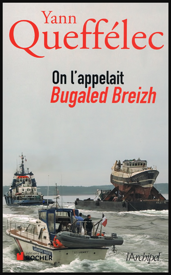
Bilingual readers who appreciate real life stories about the sea will love: “On l’appelait Bugaled Breizh”. This is the story of a trawler that sinks with all crew and equipment, while fishing in the Cornouailles region. Experienced sailors were on board and the weather was fair. Other trawlers were present in the area and their captains were maintaining contact with each other by radio. Suddenly, the Bugaled Breizh’s captain mayday call was received. Just a few words, not even enough time to complete his sentence.
Yann Queffélec – On l’appelait Bugaled Breizh
We soon discover that the trawlers were not alone in the area. There were alsonuclear submarines on an exercise in shallow waters. And there is a possibility that a submarine from an uninvited country could have also been watching the manoeuvers, well protected in the obscurity and silence.
The book raises the possibility that a fast moving submarine could have been entangled in the Bugaled Breizh’s fishing net, thus destabilizing the trawler and sinking it, without giving the captain any time to react. As for keeping the truth hidden about the accident,it is believed that if the facts were openly revealed to the general public, it would create strong political tensions due to admitting that an undetectedsubmarine was closely watching the military exercise. The book enumerates possible reasons explaining the presence of the foreign submarine in the area.
Theenquiry, or shall I say inquiries, have been stalled for over ten years now. But as questions have been asked over the years to a vast network of interested parties, a better idea of what could have been the causes behind that drama has emerged.
This is a really interesting book, signed by the reknowned writer Yann Queffélec (Goncourt prize 1985 for Les Noces barbares) also helped by Pascal Bodéré, a journalist known as one of the best connaisseur of the Bugaled Breizh affair.