Of the 55 aircraft of this model built in the 1980s, only 26 remain in service worldwide. The Antonov 124 can carry a load 17% greater than that of the C-5A Galaxy.
I took the first photo in close-up to emphasize the enormity of the aircraft compared to a human. Note also the “Be brave like Kharkiv” logo on the nose of the aircraft, in reference to the war between Ukraine and Russia.
Antonov AN 124-100M departing the Québec Jean-Lesage international airport (CYQB) for Harrisburg (KMDT) in the United States.
Tips in photography
The aircraft took off from runway 24 bound for Harrisburg (KMDT) in Pennsylvania. As the runway was wet, a photographer positioned at the threshold of runway 24 to observe the takeoff would have seen only water being lifted by the engines.
The thresholds of runways 06 and 29 were therefore an excellent choice. Runway 29 provided a nice side-on shot with no visual contaminants. Curiously, while many photography enthusiasts were massed near the thresholds of 06 and 24, I was alone near 29. This made it possible to get a shot from an original angle.
As the cargo plane was quite a distance from my position, I used a Canon 70-200mm f2.8L IS II USM telephoto lens. An acceptable shutter speed to avoid motion blur meant sacrificing depth of field.
The full-frame sensor’s 50.6 megapixels then made it possible to crop the subject sufficiently without compromising photo quality.
Photography technique
A good photography session goes hand in hand with proper planning. Listen to ground frequency 121.9, control tower 118.65 and terminal 127.85 to improve your chances of success.
A cell phone allows you to use the Flightradar24 application (for scheduled arrivals and departures and current trajectories). Flightaware is also an excellent choice. The cell phone can also be used to find out if there are any road closures around the airport that would prevent us from getting to our desired destination. It also provides information on current weather conditions and forecasts. In Canada, the AWWS site is a mine of information for aviation enthusiasts.
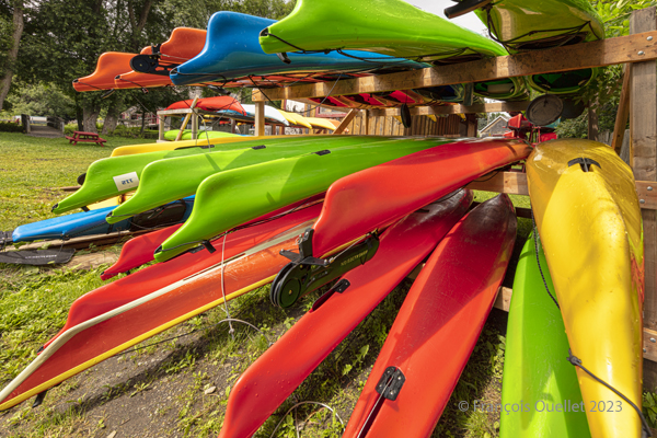
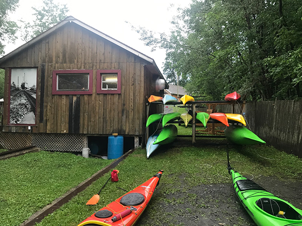
Sea kayaks at Saint-Laurent-de-l’Île d’Orléans 2023
On Sunday, September 24, 2023, the company Quatre Natures organized a certified level 1 sea kayaking course the St. Lawrence River, starting from Île d’Orléans. As registration was done well in advance, we had to be a bit lucky during the activity, as it would take place as much in good weather as in bad.
So, I take a chance. Fortunately, an incredible day awaits the six students: full sun and twenty degrees Celsius. How should we dress for the circumstances? We know that the human body temperature is 37 degrees Celsius. The kayaker adds up the water and air temperatures and compares the total to the temperature of the human body. With the river that day at 18 degrees and the air around 20 degrees, this gives a total of 38. As this figure is slightly higher than normal body temperature, we can wear normal clothing for water activities, rather than a wetsuit.
The morning is used to cover theory. No one sets foot in the water. The instructor discusses what the kayaker must have on board, the relative quality of different equipment, preparation, communications and radio frequencies, safety and hypothermia prevention, and so on.
Sea kayaking activity at l’île d’Orléans (photo Vadym Kravchenko)
After lunch, the kayaks are placed on the lawn and the vocabulary related to each part of the kayak is learned. The student then settles into the kayak and learns how to adjust the footbraces, hold the paddle, install the spray skirt, and so on. The boats are then brought to shore and kayaking begins.
First, we learn the basic maneuvers. How to embark and disembark, the trajectory the paddle should follow in the water depending on whether you want to go forward, backward or turn. We discuss the correct position of the body, arms and wrists on the paddle, and the importance of rotating the pelvis to force the paddle properly. We quickly realize the influence of side winds on the kayak, especially when it has no centerboard or rudder.
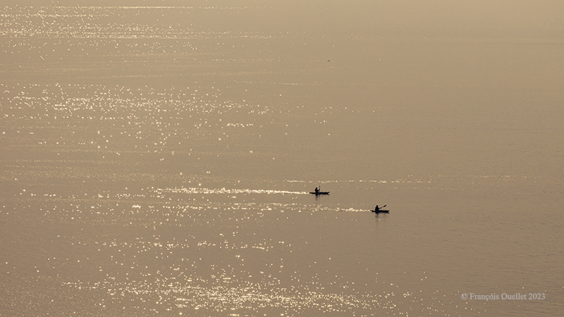
The river is considered level 2 for kayaking. The current is strong, and we have to deal with three-metre tides. The wind around the island is also stronger than in Quebec City. Level 1 kayakers are encouraged to seek out Level 1 locations to gain experience, and never to set off alone at this stage of their learning process.
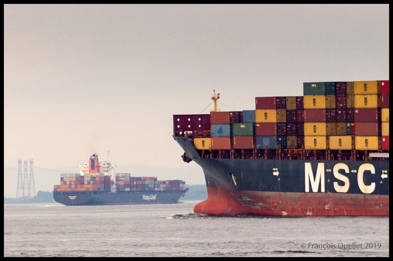
During the exercises, you can see the container ships and the various pleasure boats offshore. The larger vessels generate waves that take between five and ten minutes to reach the shore. When these approach, the instructor warns novice kayakers to turn to face the wave, so as to limit the effects on the boat.
The container ship Hapag_Lloyd Quebec Express and the container ship MSC Paola are sailing around Île d’Orléans near Quebec City.
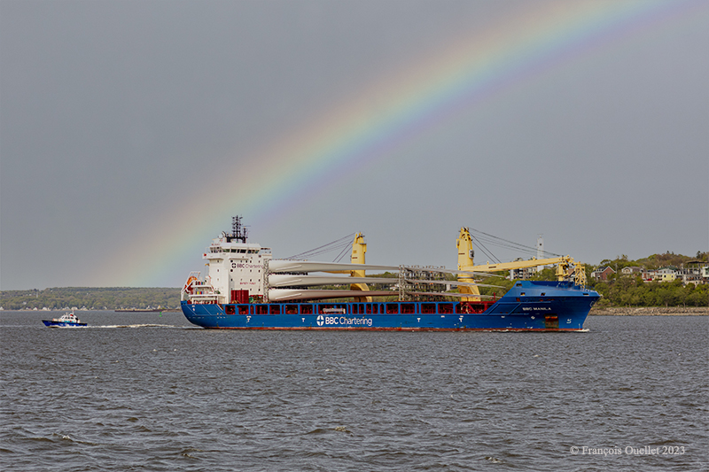
The BBC Manila carries wind turbine blades on the St.Lawrence Seaway near Quebec City.
Then come the emergency maneuvers: what’s the procedure for getting out of a kayak that’s just capsized? How do you help someone who has capsized?
I didn’t have time to get to this stage of the course. I capsized before. I don’t remember how I managed to extricate myself from the kayak and get back to the surface, but we’re not talking about an approved method here. The brain immediately detects the danger and organizes itself so that the body gets out of the kayak and the head doesn’t stay underwater for too long.
In the minutes that follow, the instructor teaches us how to perform the classic exit from a capsized kayak. We work in pairs. At Level 1, there’s no question of using the paddle to force the kayak to turn.
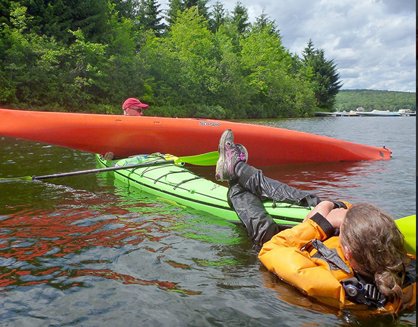
To obtain KDM 1 certification, everyone must lean sideways so that the kayak tips over. Once submerged, the student leans forward, unhooks the spray skirt attached to the kayak, and slowly taps the kayak’s hull three times to signal that he is in control of what he is doing. The instructor wants to avoid unpredictable reactions. We then push ourself out of the kayak by placing our hands at hip height on the coaming. As soon as we are out of the water, it’s imperative that we hold on to our kayak, thanks to the lifeline. It only takes a few seconds. Here and there, you can hear a little coughing as the student surfaces, but nothing more. A good sip of St. Lawrence River boosts the immune system.
Next comes the recovery of the person in the water. As we work as a team, the kayaker in difficulty clings to the front of our kayak and stays there until we catch up with his or her kayak, lift it onto our boat, empty it of water, turn it over and position it correctly.
Sea kayaking course level 1 with Quatre Natures (photo Quatre Natures)
The person clinging to the kayak then releases his or her grip, and depending on the method taught, climbs back into the boat while the latter is being held securely. The important thing here is to keep the center of gravity as low as possible. If the person doesn’t hurry and proceed step by step, the operation is a success every time.
A few more exercises follow, and it’s back to the beach on Île d’Orléans a few hours later. Once all participants have dried off and put on their warm clothes, the course concludes with a few weather notions, including the need to consult weather forecasts and radars, and to return quickly to shore when storm cells are present.
We also cover tide calculation (rule of 12) and how to attach a kayak to a car roof. How many attachment points? What equipment is available to make the job easier? Where should harnesses go to avoid breaking the kayak? Etc.
The KDM 1 certificate is awarded approximately eight to nine hours after the start of the course, depending on the instructor’s assessment. I noticed that on the way home, in the heat of the car, I really didn’t feel like rushing on the road. But you quickly come back to reality when you see how fast the cars are coming up behind you.
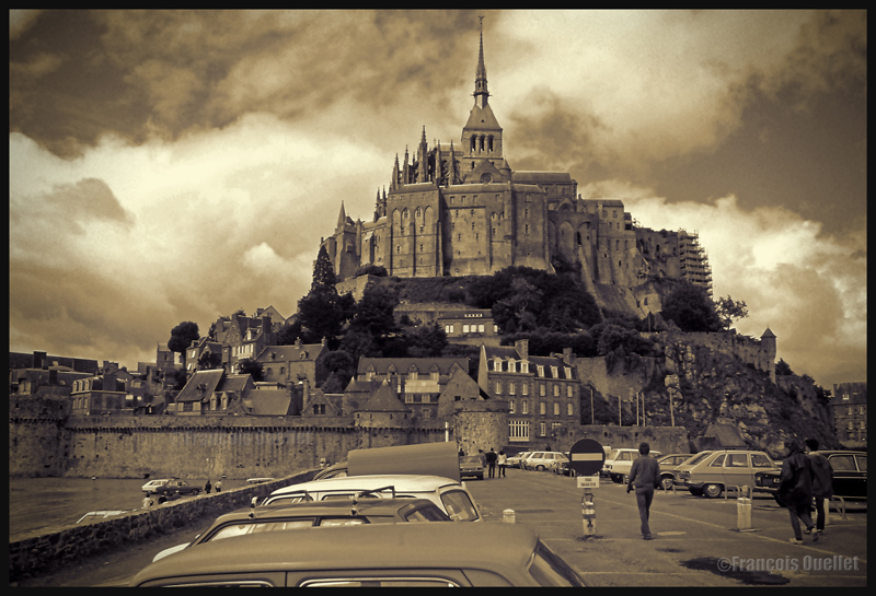
Cumuliform clouds add energy to any photo. Even photos in black and white benefit from them largely, whether it is for a normal or an HDR photo.
Cumuliform clouds add dynamism to this Abbaye du Mont St-Michel scenery. France (1978)
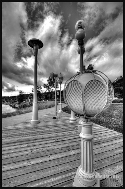
Black and white HDR picture of lamp posts installed along the St-Lawrence, Quebec City 2012.
The stratiform clouds add to the tranquillity and the stability of a photo.
Daytona Beach under stratus clouds in 2011. The end of the afternoon allows the fresh air from the sea to move over the heated land, which helps create few cumulus fractus, visible near the buildings.
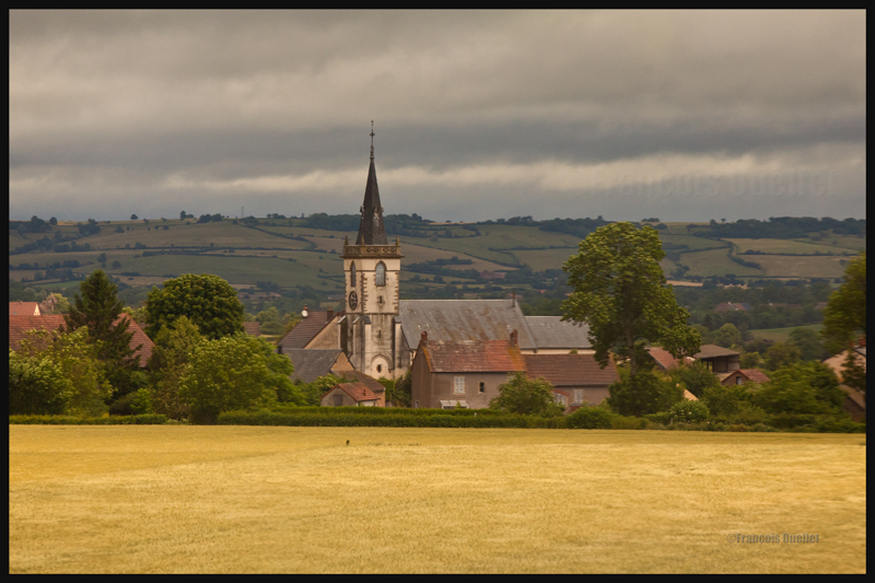
Clouds including a stratiform and cumuliform components (stratocumulus) produce an effect that is more energizing than the simple stratus, while avoiding the explosion of energy of the cumuliform clouds.
A stratocumulus adds to this otherwise peaceful scenery captured on board the Lyria train between Paris and Geneva in 2013.
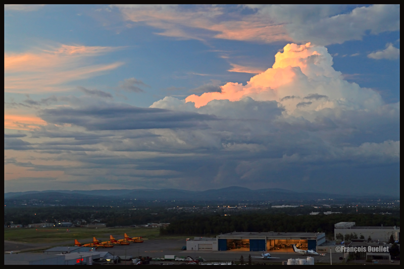
The cold front
The approach of a cold front enhances the possibility of interesting photos. If it is a fast moving cold front of moist and unstable air, the photos will probably be more spectacular, as some thunderstorms will be associated with the system. A dew point of more than 15 C indicates the presence of a lot of water vapor which can be transformed into precipitation, thus releasing a lot of energy. When these conditions are combined with a really strong contrast between the new air mass which approaches and the one which goes away, the produced meteorological phenomena will certainly be intense.
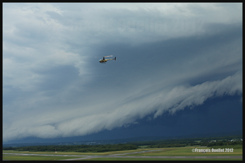
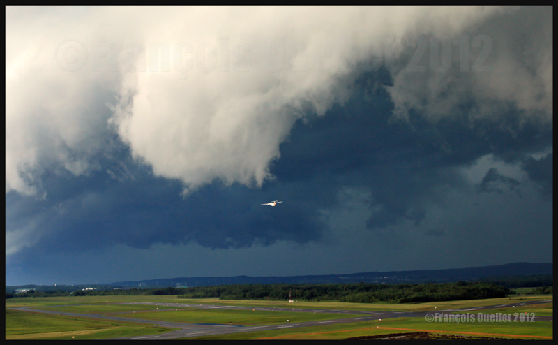
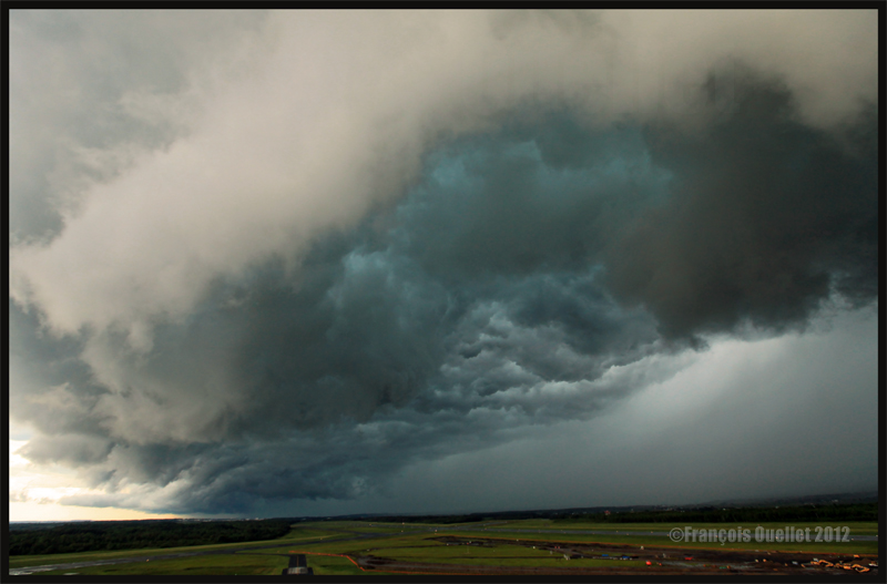
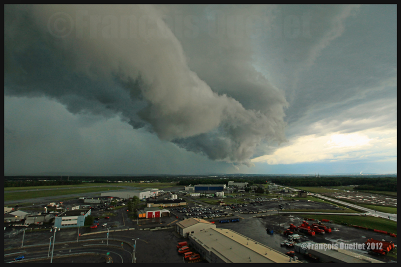
In the photos below, the meteorological system approaching the Quebec Jean-Lesage international airport also had to cross a small mountain range.
A roll arcus cloud in development ahead of a thunderstorm approaching the Quebec Jean-Lesage airport in 2012.
A roll arcus cloud in development ahead of a thunderstorm approaching the Quebec Jean-Lesage airport in 2012.
View under a developing arcus cloud at the Quebec Jean-Lesage international airport (2012)
An arcus cloud ahead of a thunderstorm approaching the Quebec Jean-Lesage airport in 2012
A roll arcus cloud ahead of a thunderstorm heading for Quebec City in 2012
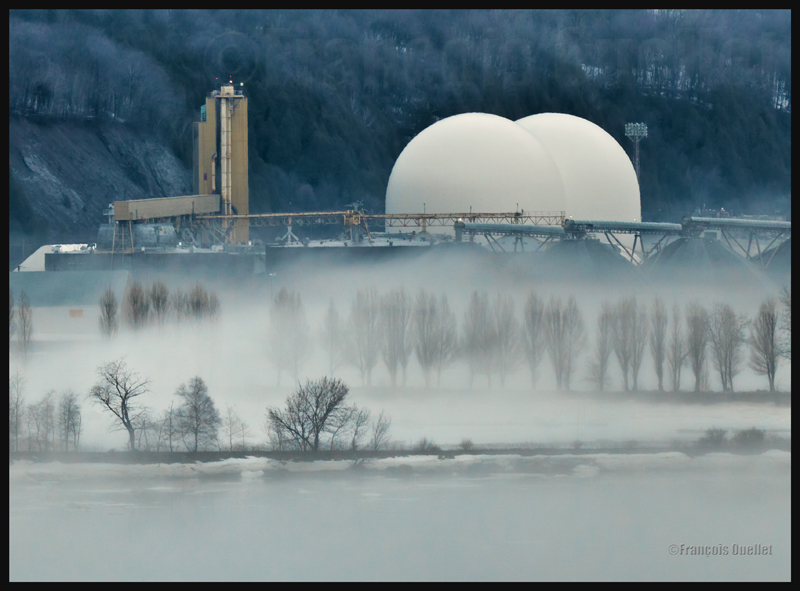
The morning fog
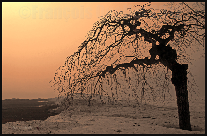
The morning fog offers many opportunities for interesting photos. You can choose an isolated tree and capture the combined effects of the morning sun and fog. Or you may choose a cluster of trees, for a completely different effect. Both photos below were taken in Domaine Cataraqui, Quebec City.
Trees in fog at Domaine Cataraqui, Quebec City 2009
Sun and fog provide for a special atmosphere at the Domaine Cataraqui, Quebec City 2009
A morning fog resulting from a cold cloudless night will persist for hours if there is no wind. The cold morning air, motionless over a slightly hotter stretch of water, creates a fog that will finally disappear just before noon, when the atmosphere has been heated enough. If there had been an overcast sky during the night, chances are that the air over the water would have remained at a higher temperature, preventing the formation of fog.
The opportunities for more interesting photos arise when you witness the first holes in the fog layer.
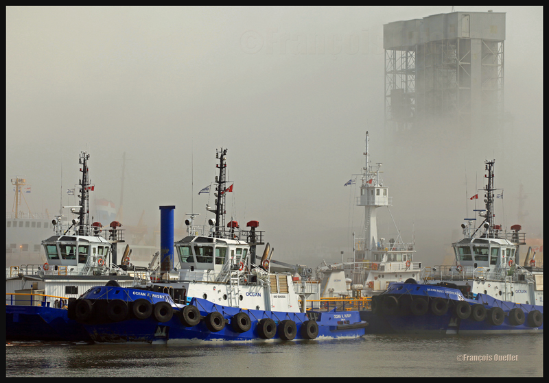
The Ocean tugboats during a dense fog in the Bassin Louise in Quebec (2012).
We can take into account the season to estimate the speed of the diurnal reheating of the lower atmosphere. A morning fog will need more time to dissipate from late autumn to early spring: that leaves more time for the photographer to prepare. The forecasts can announce the disappearance of fog while it will not be the case if, over your sector, there is an invading layer of stratocumulus preventing the morning sun from reaching the ground.
To determine if the fog is going to dissipate as expected or will remain and possibly intensify, watch the difference between the temperature and the dew point on the hourly meteorological observations issued by weather stations near your place of residence. If the temperature and dew point spread increases, the fog is going to lift. If the difference between those two decreases, the fog is going to persist and possibly intensify.
The mist
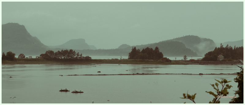
The mist can be qualified as such when the visibility is superior to ½ mile, but do not exceed 6 miles for an observer on the ground. If the visibility is of ½ mile or less, it is called fog. This photo of the Bic National Park, near Rimouski, shows the interesting effect that the mist adds to a beautiful landscape.
Mist in the Bic National Park, Province of Quebec (2009)
Hot and unstable air in winter
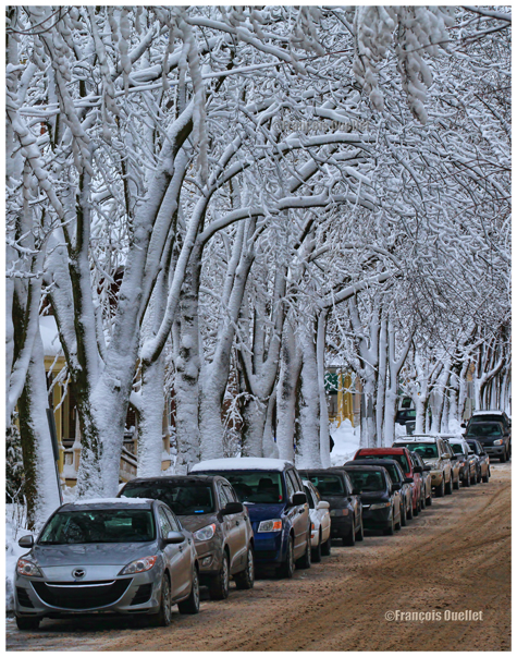
When there is a warm and unstable air advection (about 0 degrees) while winter has already settled, there are good opportunities for photos. A moderately developed cumulus produces significant snow showers and this snow sticks on all the surrounding objects. All that snow would have begun to melt on contact of objects if the latter had had a temperature superior to zero degree. But, the winter being already settled, the snow persists. It gives enough time to capture some souvenirs.
A Quebec City street after a snow shower
The local effects
A photographer might benefit from learning about the meteorological local effects influencing the regions he intends to visit. The local effects are often simple to understand and they repeat themselves regularly, according to wind and season changes. The knowledge of these effects allows the photographer to be ready and position himself even before the phenomenon occurs. It limits the comments like: “If I had known that it would occur, I would have settled down here one hour earlier!“
The local terrain as well as large size bodies of water produce predictable meteorological phenomenon that can be used by a well prepared photographer. It can consist of persistent fog, repetitive snowstorms over a small sector, strong winds, cumuliform clouds alongside the mountain summits, etc. By being positioned at the right place, at the right time, the desired photo can be realized.
A change in the wind direction
A change in the wind direction suddenly increases the opportunities of interesting photos. It might announce the approach of a cold front, a warm front, a sea or land breeze, etc. In the photo below, a bit of fresher air suddenly began crossing the St-Lawrence seaway at the end of the day, thanks to the approach of a weak cold front. The water was still relatively warm and the moisture which was present over the surface became visible due to the cool air supply. The conditions were now ideal for a short-term thin fog, as long as the wind speed would not increase. Just in time for a photo.
The new wood pellets silos in Anse au Foulon in Quebec City en 2014
Familiarization with weather radars
It can be useful to get acquainted with weather radars which, for the needs of photography, remain simple to interpret. Multiple echoes of small dimension with a steep gradient of various colors indicate precipitation resulting from cumuliform clouds. The showers associated with these clouds are often moderated or strong and will be the result of approaching towering cumulus or cumulonimbus (thunderstorms). A towering cumulus presents a dark base and a white summit to the photographer. At sunset, their vertical development can be used to emphasize the last rays of light.
The side of a towering cumulus (TCU) is benefiting from the remaining sunlight over Quebec
Large echo areas of similar colors of low intensity indicate a relatively stable air generally producing steady light rain or drizzle. This should be understood as a possibility of increased humidity limiting the visibility through mist or fog.
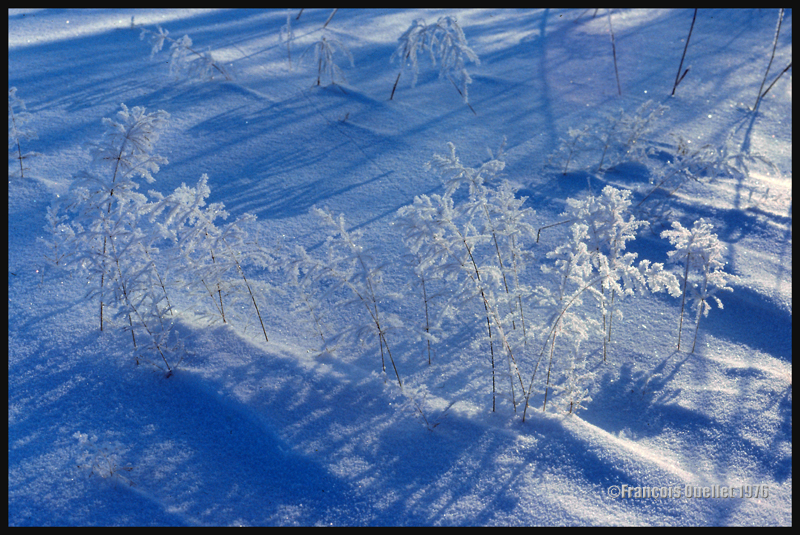
Hoar frost
Hoar frost is a short-term phenomenon. It is thus necessary to capture the scene before the sun melts everything. The photo below shows some small twigs on which hoar frost has settled. It was taken at the beginning of the seventies. Although the quality of the photo is not exceptional, the meteorological phenomenon is well demonstrated.
A combination of snow and hoar frost observed on a Quebec field in 1976.
Forest fires
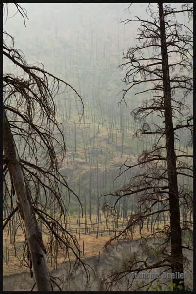
Wishing to make photos of western Canada during summer 2014, I came up against a season where hundreds of forest fires were raging. The smoke was covering some parts of Alberta and British Columbia. Some fires were important enough to require the closure of the sole highway connecting Lake Louise to Jasper. I thus decided to include the effects of those fires in the holiday souvenirs.
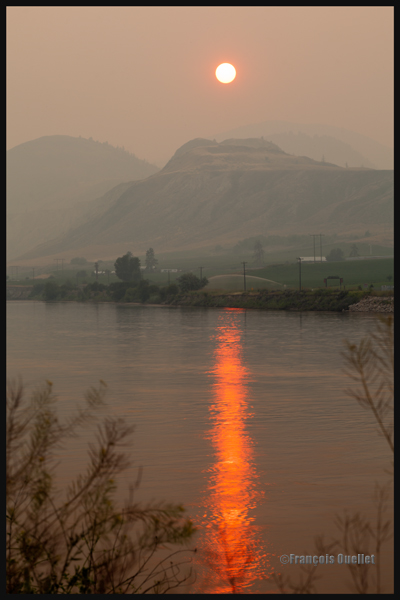
A visibility reduced in forest fire smoke allows a photographer to obtain, without special editing, sunsets with interesting colors.
Sunset and smoke from forest fires in Kamloops in 2014
The smoke also produces an effect similar as fog, but a fog which would be impossible to obtain at the end of a summer afternoon while the sun shines and there is a 38 degrees Celsius temperature.
An area near Kamloops, Canada, that was touched by forest fires in 2014
At dusk, the residual smoke is visible near tree tops while the setting sun strikes the mountain side. The effect is of two horizontal lines of complementary colors, blue and orange.
Forest fire smoke and sunset combined in Lake Louise, Alberta en 2014