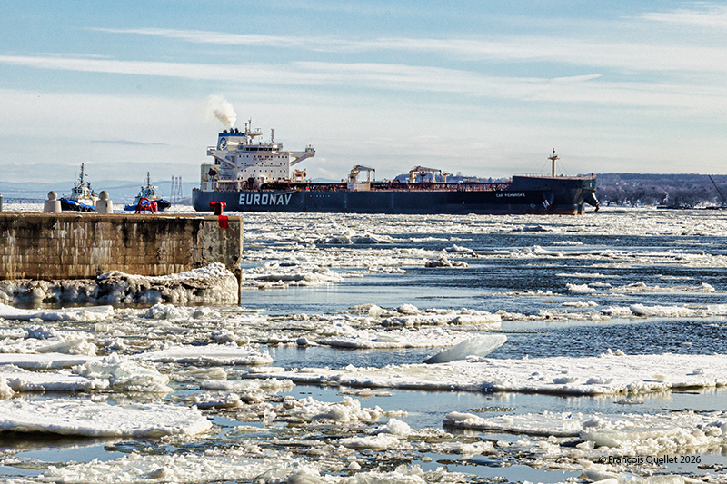
Oil tanker Cap Pembroke near Quebec City April 2026
Sailing from Ingleside (US YIG) in the Gulf of Mexico, the Greek-flagged oil tanker Cap Pembroke is heading toward the Valero Energy facilities in Lévis (CA QUE). The crew leaves the Gulf of Mexico in T-shirts and arrives in the icy waters of the St. Lawrence River a few days later.
The tanker can be seen as it rounds Île d’Orléans at high tide, assisted by two tugboats from the Ocean Group.
At very low speeds, the steering efficiency of a ship like the Cap Pembroke is greatly reduced. Measuring 277 meters long and 48 meters wide, it relies on tugboats to avoid obstacles and navigate the tides and winds of the river near Quebec City.
Federal Trident sailing through the ice in front of Quebec City 2026
Days with temperatures of -25 °C and below are becoming increasingly rare in Quebec City. With the wind chill factor, the temperature today feels like -36 °C. This is a golden opportunity to try to capture the sea smoke on the St. Lawrence River.
Photography technique
Sea mist between Île d’Orléans and Quebec City, winter 2026
Night photography in these weather conditions remains difficult. The low light requires a tripod, which itself vibrates in the gusty wind. This means increasing the ISO and decreasing the depth of field to achieve a faster shutter speed, which slightly reduces image quality. In addition, using a 300 mm telephoto lens increases the risk of blurry photos. Photography is all about compromise!
Canadian Coastguard icebreaker Des Groseillers at work near Quebec City winter 2026
Above is a photo of the Canadian Coast Guard icebreaker Des Groseillers at work. It is not surprising to see this type of vessel in the area, as the Seaway must remain ice-free in its centre to allow ships to navigate year-round. And this year, there is ice!
Snow blower at work on Île d’Orléans in the winter of 2026
On Île d’Orléans, snow blowers don’t stop clearing snow when a vehicle approaches from the opposite direction. They blow the snow across the road with enough force that you can quickly pass under the spray without getting too much debris on your car.
House on Île d’Orléans with Mont St. Anne in the background
The sun hits the trees sideways in the late afternoon on Île d’Orléans. From the Sainte-Famille parish, you can capture the island’s houses with an interesting backdrop: the ski slopes of Mont St-Anne.
Protest in Quebec City against Iran’s mullahs
Even in freezing temperatures, citizens of Iranian origin are demonstrating in Old Quebec against the dictatorial regime of the mullahs in Iran. All this at a time when an American fleet is positioning itself for a military intervention in Iran.
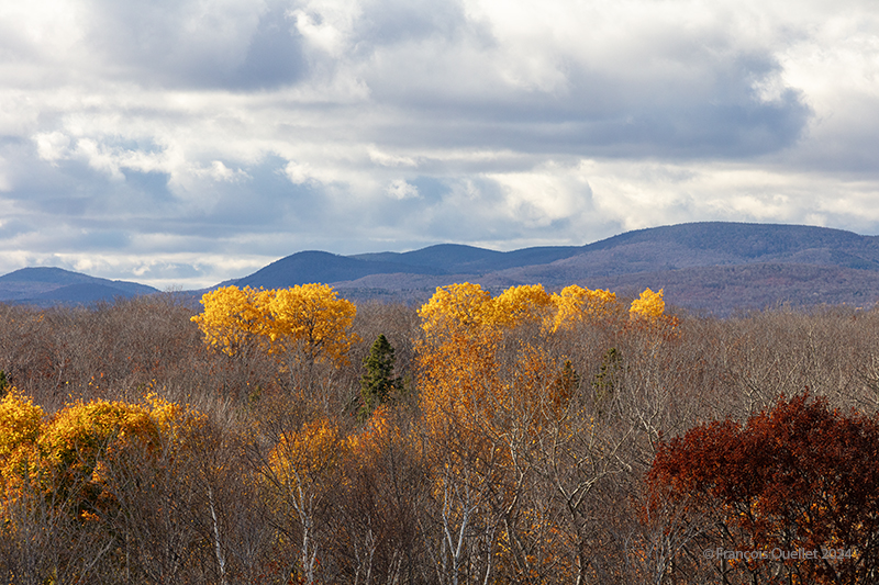
Here’s a photo taken late autumn on Île d’Orléans. The sun shines through the cumuliform clouds, helping to create interesting contrasts of light and shadow on the mountains in the background. Towards noon, the more direct sunshine dissipates these clouds, and late in the afternoon, the new-found coolness helps to form a uniform stratocumulus ceiling over the region. The photo was taken around 10 am, at a time when there is still a mixture of clear skies and clouds, making the photo more dynamic.
This photo was taken in autumn from the wooden tower at the eastern end of Île d’Orléans. Late in the season, there are fewer leaves left on the trees, but the sun hitting the vegetation from the side breathes new life into the landscape.
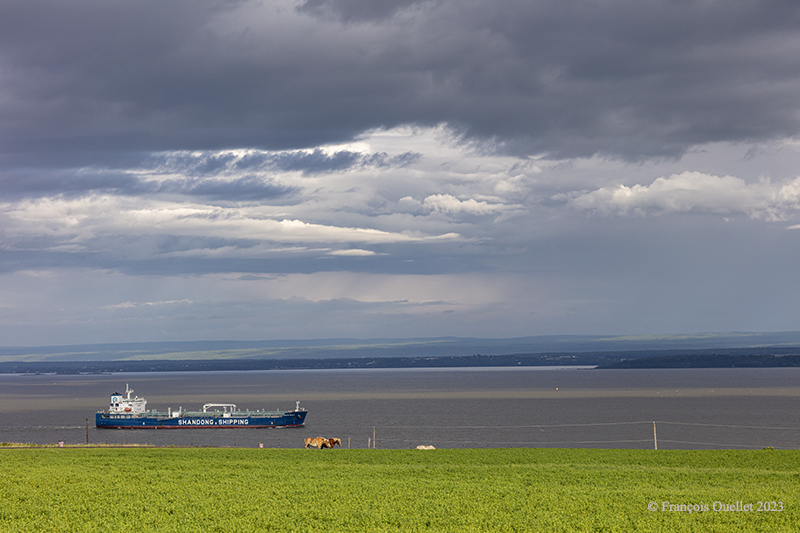
The Solar Sally from Shandong Shipping sailing south of Île d’Orléans. Summer 2023.
Above, Shandong Shipping’s Solar Sally photographed south of Île d’Orléans. I positioned the horizon according to the rule of thirds and gave plenty of room to the sky, filled with beautiful contrasts. The clouds let the sun filter through for a brief moment, bringing out the vegetation and horses. All that remained was to wait for the ship to enter the field of vision before taking the shot.
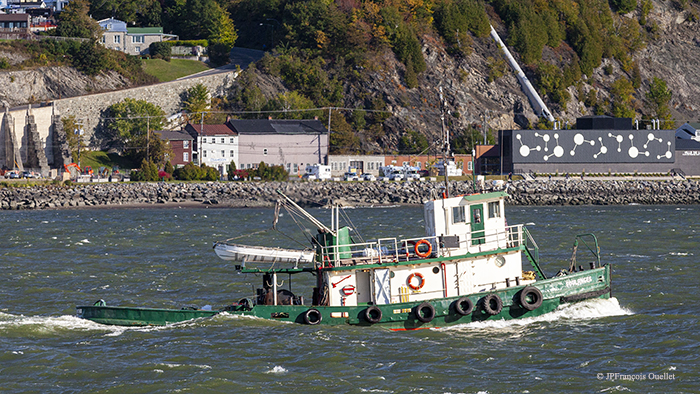
The Soulanges in front of Lévis in 2015.
The photo above shows the Soulanges, a tug built in 1905, on the St. Lawrence River in front of the city of Lévis. Seen from a distance, this type of vessel always looks like it’s sinking. The water seems to be overtaking the stern of the boat, but there are very few waves.
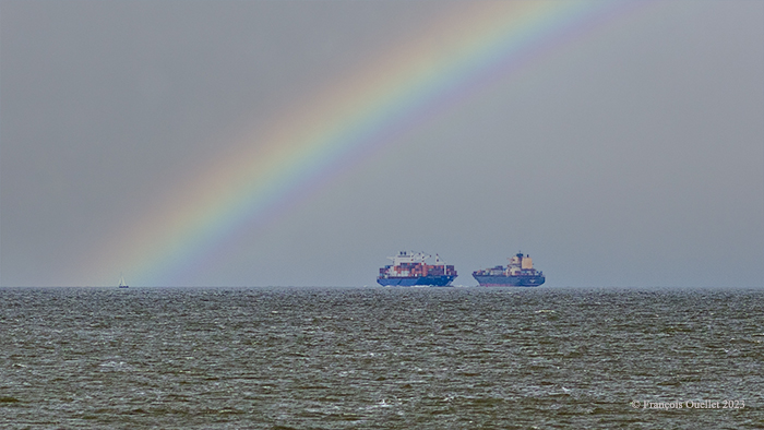
The Barcelona Express and the MSC Tuxpan on the St.Lawrence Seaway 2023
The Barcelona Express and the MSC Tuxpan meet in the middle of the St. Lawrence River, off Île d’Orléans. Lacking a telephoto lens on hand, I captured the scene with a Canon Ef 85mm f/1.2L II USM lens and enlarged the photo. The boats were at a much greater distance than they appear here. I used an image processing software with artificial intelligence to improve the focus after cropping.
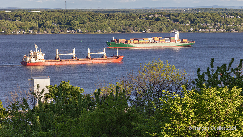
The Federal Skye and Mona Lisa ships on the St. Lawrence seaway near Quebec City
Above, the Mona Lisa (green hull) sails from Montreal to the port of Tanger Med in Morocco. The container ship sails under the Liberian flag. The port of Tanger Med boasts an exceptional geographical location when it comes to transshipping goods to Europe, the Mediterranean and Africa. Also visible in the photo, the Federal Skye arrives from Vila do Conde Brazil (BR VDC) and heads for Les Escoumins in Quebec, Canada (CA QLE). This port has a dry dock where major repairs can be carried out. The Federal Skye sails under the flag of the Marshall Islands.
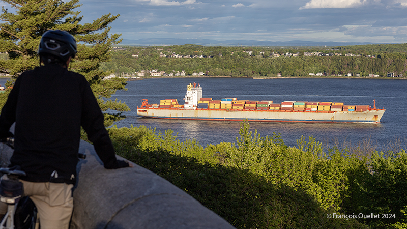
The MSC Tampa vessel by Quebec City in 2024.
A final photo shows the MSC Tampa sailing between Liverpool, Great Britain (GB LIV) and Montreal, Canada (CA MTR). This 294.12-meter-long container ship sails under the Liberian flag. The photo was taken from the Grey Terrace in Quebec City’s Parc des Champs-de-Bataille.
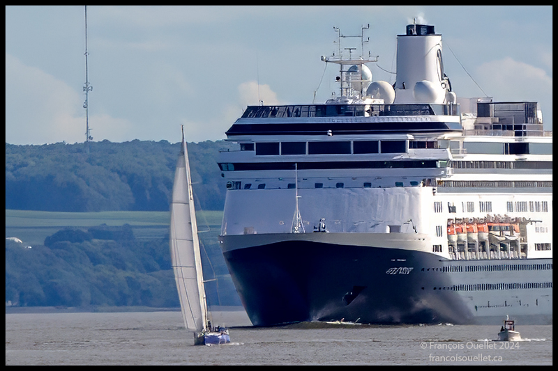
Sailboat and cruise ship Volendam on the St.Lawrence Seaway near Île d’Orléans during the Transat Québec St-Malo 2024.
Marine traffic off Quebec City was blocked in anticipation of the departure of the Transat Québec Saint-Malo 2024. As soon as the sailboats got a head start, cargo and cruise ships summarized their operations on the St. Lawrence River. Pictured above is the Volendam rounding Île d’Orléans near Quebec City. It is heading for Charlottetown, capital of Prince Edward Island in Canada.
Its captain appears to put a little pressure on the captain of the sailing vessel ahead, but this is in fact an optical illusion caused by compressed perspective. In fact, I took the photo when the ship was still a long way off. I brought the subject closer using a Canon 70-200 f2.8L IS II USM lens, followed by a major crop from a 50.6 megapixel photo.
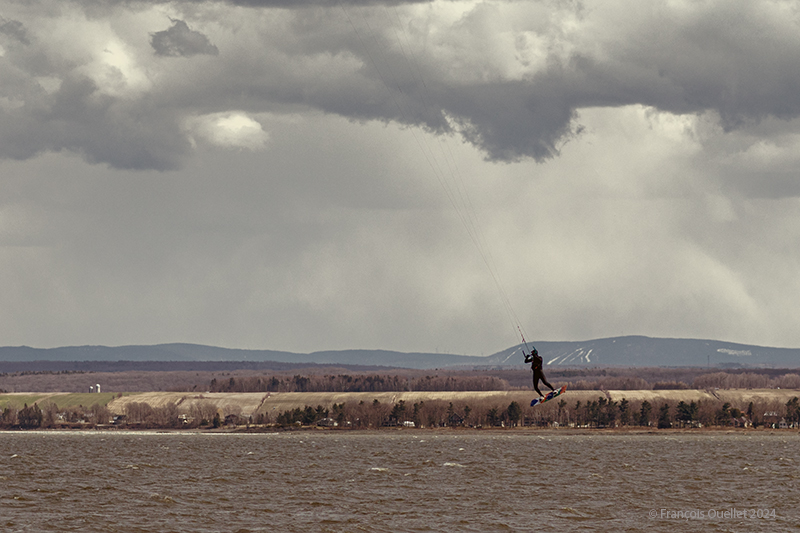
Profiting from the strong winds at île d’Orléans 2024
A single-day visit to Île d’Orléans for a photography session was enough to capture a wide variety of cloudy conditions in April 2024. In spring, when unstable, humid air crosses the mountain range north of the St. Lawrence River, you can expect anything on the island. Above, a kitesurfing enthusiast practises his art between localized showers. All he cares about is strong winds.
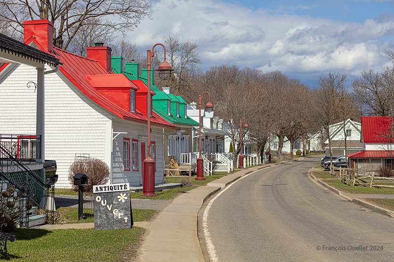
Coloured houses of Île d’Orléans. Spring 2024.
A few kilometers from route du Mitan, colourful houses and a bit of blue-sky contrast with the showers elsewhere on the island. You can see that the cloud layer in the distance is not very thick.
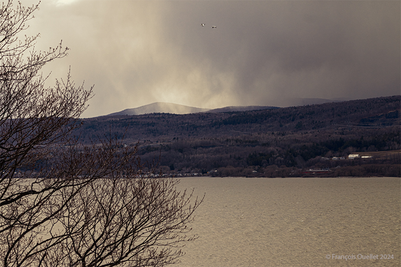
Looking north from île d’Orléans, Spring 2024.
Above, a towering cumulus (TCU) approaches the St. Lawrence River in the late afternoon from the north. It is likely to cross the river towards the island, if it has not lost some of its strength, in the meantime, due to subsidence, the phenomenon that forces air to compress and warm as it is forced down a mountain range.
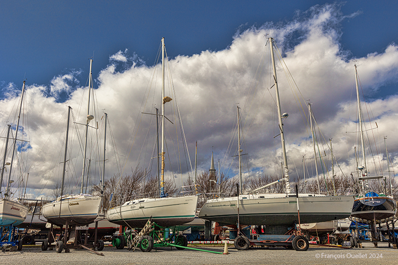
Sailboats on île d’Orléans. Spring 2024.
The shape of the clouds in the photo above gives a good indication of the strength of today’s winds. You can hear it whistling through the ropes and between the masts of the sailboats at the marina in the municipality of St-Jean, île d’Orléans. At the time of my visit, some owners were preparing their boats for the warmer periods of May.
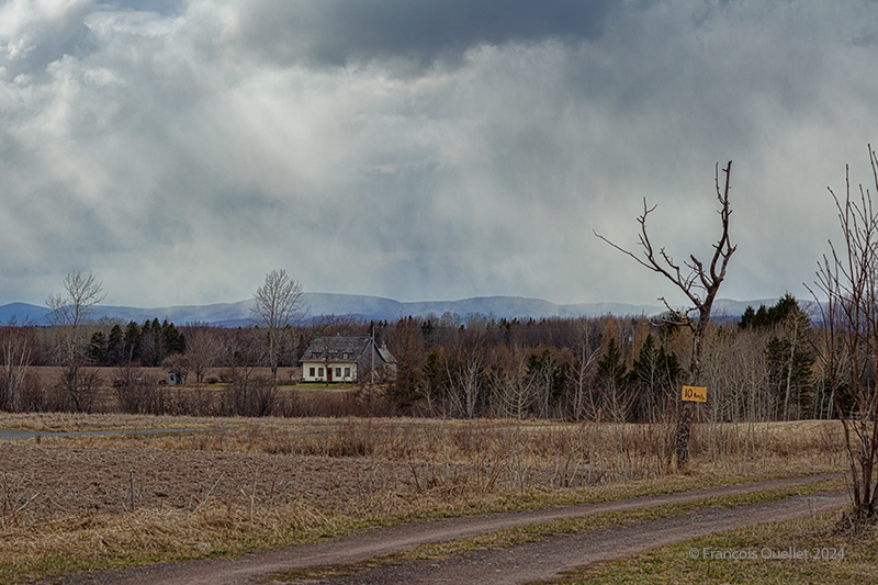
A house on île d’Orléans, Spring 2024.
I really like the scene above, but I admit that some might find it dark, if not sinister. It was this slightly disturbing aspect that caught my attention and that I tried to capture.
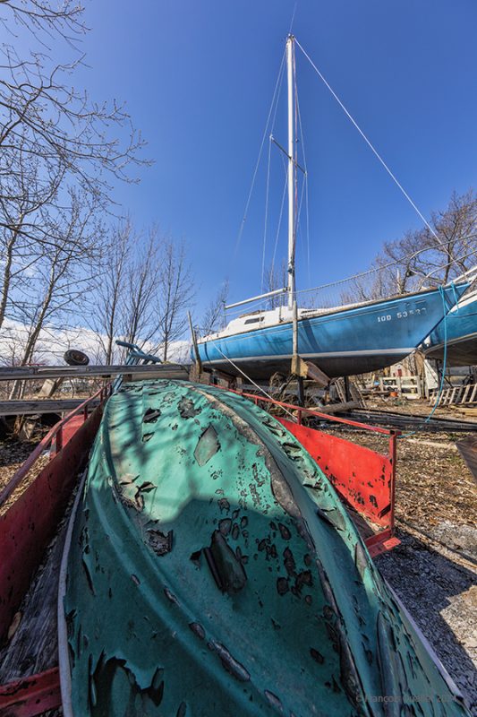
A boat requires repainting on île d’Orléans, Spring 2024.
In this last photo, the sky is practically clear. It is then easier to obtain better contrasts. A pseudo-HDR treatment brings out the paintwork on a boat that has seen better years.
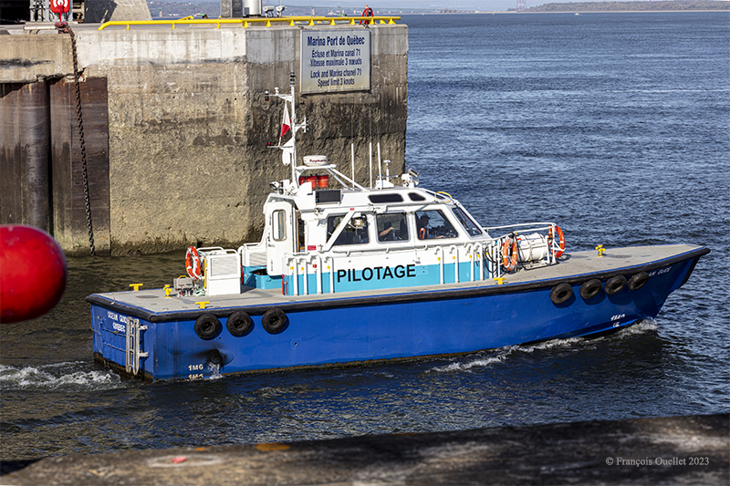
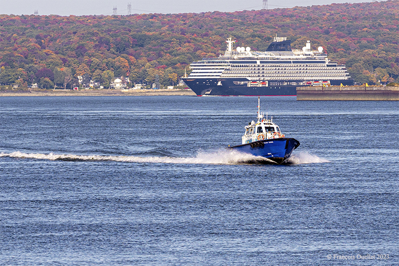
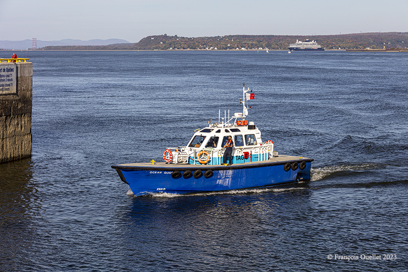
A “pilote du St-Laurent” leaves the Quebec harbour and heads towards the Explora 1 cruise ship in 2023.
As the St. Lawrence River is a fairly difficult waterway to navigate, Canadian law obliges the captains of certain large vessels to accept local pilots, who are fully conversant with the particularities of the seaway, on board for the riskiest journeys.
Once the Quebec pilot has helped the Explora 1 captain, the ship continues on its way to Quebec City, rounding the Île d’Orléans, as shown in the photo below. After playing its role as a sea cab, the little boat belonging to the St. Lawrence Pilots pulls away from the ship and returns to the Bassin Louise in the Port of Québec.
The Explora 1 cruise ship sails around île d’Orléans and a “pilote du Saint-Laurent” comes back to the Québec harbour in 2023.
Returning to Quebec harbour after a change of pilot in the Explora 1 cruise ship. 2023.
Serena Melani, “the first woman in the world to steer a cruise ship out of a shipyard“, ensures a smooth approach for the Explora 1 to Pier 30 in the Port of Québec. This brand-new vessel completed its sea trials in April 2023, and Quebec City is among the first destinations scheduled for 2023.
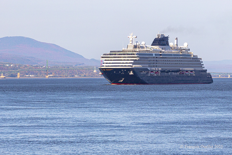
The Explora 1 approaching Quebec City with Mont St-Anne in the background 2023
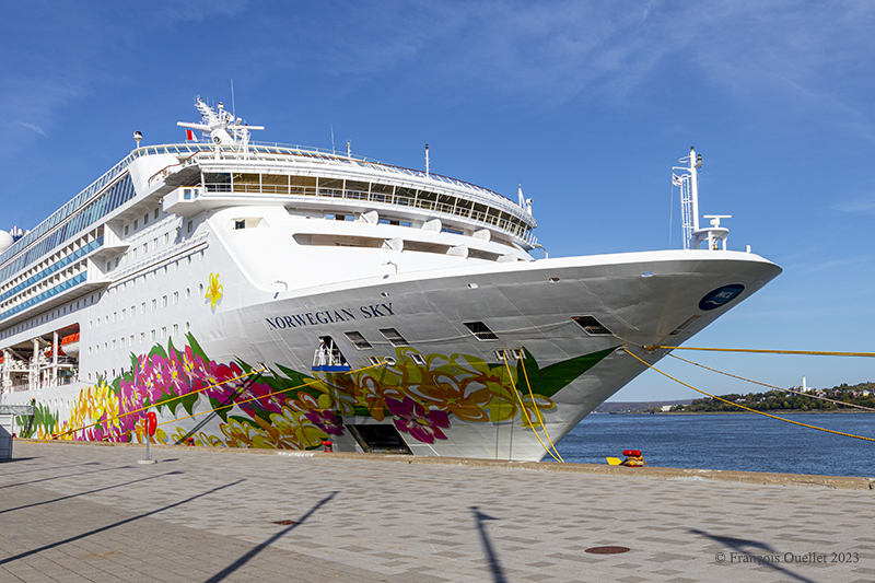
Every captain would love to dock at the popular Pier 22, as it offers a perfect view of the Château Frontenac. But on this fine October day, the Norwegian Sky is already occupying the spot.
The Norwegian Sky cruise ship docked in Quebec City.
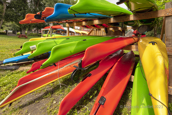
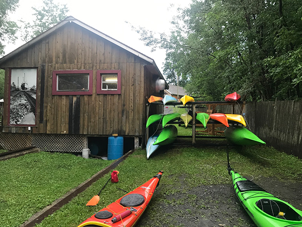
Sea kayaks at Saint-Laurent-de-l’Île d’Orléans 2023
On Sunday, September 24, 2023, the company Quatre Natures organized a certified level 1 sea kayaking course the St. Lawrence River, starting from Île d’Orléans. As registration was done well in advance, we had to be a bit lucky during the activity, as it would take place as much in good weather as in bad.
So, I take a chance. Fortunately, an incredible day awaits the six students: full sun and twenty degrees Celsius. How should we dress for the circumstances? We know that the human body temperature is 37 degrees Celsius. The kayaker adds up the water and air temperatures and compares the total to the temperature of the human body. With the river that day at 18 degrees and the air around 20 degrees, this gives a total of 38. As this figure is slightly higher than normal body temperature, we can wear normal clothing for water activities, rather than a wetsuit.
The morning is used to cover theory. No one sets foot in the water. The instructor discusses what the kayaker must have on board, the relative quality of different equipment, preparation, communications and radio frequencies, safety and hypothermia prevention, and so on.
Sea kayaking activity at l’île d’Orléans (photo Vadym Kravchenko)
After lunch, the kayaks are placed on the lawn and the vocabulary related to each part of the kayak is learned. The student then settles into the kayak and learns how to adjust the footbraces, hold the paddle, install the spray skirt, and so on. The boats are then brought to shore and kayaking begins.
First, we learn the basic maneuvers. How to embark and disembark, the trajectory the paddle should follow in the water depending on whether you want to go forward, backward or turn. We discuss the correct position of the body, arms and wrists on the paddle, and the importance of rotating the pelvis to force the paddle properly. We quickly realize the influence of side winds on the kayak, especially when it has no centerboard or rudder.
The river is considered level 2 for kayaking. The current is strong, and we have to deal with three-metre tides. The wind around the island is also stronger than in Quebec City. Level 1 kayakers are encouraged to seek out Level 1 locations to gain experience, and never to set off alone at this stage of their learning process.
During the exercises, you can see the container ships and the various pleasure boats offshore. The larger vessels generate waves that take between five and ten minutes to reach the shore. When these approach, the instructor warns novice kayakers to turn to face the wave, so as to limit the effects on the boat.
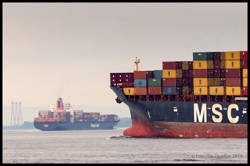
The container ship Hapag_Lloyd Quebec Express and the container ship MSC Paola are sailing around Île d’Orléans near Quebec City.
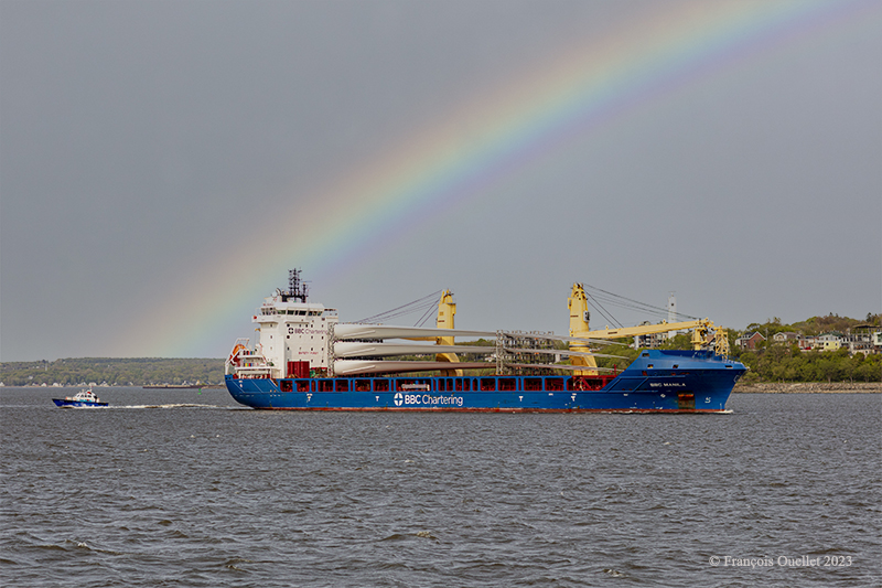
The BBC Manila carries wind turbine blades on the St.Lawrence Seaway near Quebec City.
Then come the emergency maneuvers: what’s the procedure for getting out of a kayak that’s just capsized? How do you help someone who has capsized?
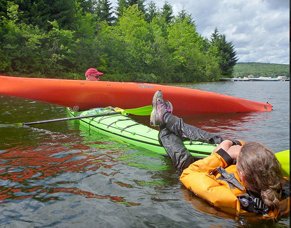
I didn’t have time to get to this stage of the course. I capsized before. I don’t remember how I managed to extricate myself from the kayak and get back to the surface, but we’re not talking about an approved method here. The brain immediately detects the danger and organizes itself so that the body gets out of the kayak and the head doesn’t stay underwater for too long.
In the minutes that follow, the instructor teaches us how to perform the classic exit from a capsized kayak. We work in pairs. At Level 1, there’s no question of using the paddle to force the kayak to turn.
To obtain KDM 1 certification, everyone must lean sideways so that the kayak tips over. Once submerged, the student leans forward, unhooks the spray skirt attached to the kayak, and slowly taps the kayak’s hull three times to signal that he is in control of what he is doing. The instructor wants to avoid unpredictable reactions. We then push ourself out of the kayak by placing our hands at hip height on the coaming. As soon as we are out of the water, it’s imperative that we hold on to our kayak, thanks to the lifeline. It only takes a few seconds. Here and there, you can hear a little coughing as the student surfaces, but nothing more. A good sip of St. Lawrence River boosts the immune system.
Next comes the recovery of the person in the water. As we work as a team, the kayaker in difficulty clings to the front of our kayak and stays there until we catch up with his or her kayak, lift it onto our boat, empty it of water, turn it over and position it correctly.
Sea kayaking course level 1 with Quatre Natures (photo Quatre Natures)
The person clinging to the kayak then releases his or her grip, and depending on the method taught, climbs back into the boat while the latter is being held securely. The important thing here is to keep the center of gravity as low as possible. If the person doesn’t hurry and proceed step by step, the operation is a success every time.
A few more exercises follow, and it’s back to the beach on Île d’Orléans a few hours later. Once all participants have dried off and put on their warm clothes, the course concludes with a few weather notions, including the need to consult weather forecasts and radars, and to return quickly to shore when storm cells are present.
We also cover tide calculation (rule of 12) and how to attach a kayak to a car roof. How many attachment points? What equipment is available to make the job easier? Where should harnesses go to avoid breaking the kayak? Etc.
The KDM 1 certificate is awarded approximately eight to nine hours after the start of the course, depending on the instructor’s assessment. I noticed that on the way home, in the heat of the car, I really didn’t feel like rushing on the road. But you quickly come back to reality when you see how fast the cars are coming up behind you.