Categories
Geopolitics

Books : “Passer par le Nord” – La nouvelle route maritime

« Passer par le Nord » (Northern Sea Route), by Isabelle Autissier and Érik Orsenna, is an essential book for the reader who wishes to learn more about the profound transformations brought on by global warming, with regards to geopolitical, economic and ecological issues in the Arctic.

The book is at the same time a lesson in geography, history, politics, ecology and economy. It will certainly captivate those who are interested in maritime traffic and the development of new maritime routes, as well as the race towards the appropriation and exploitation of the immense oil and gas resources of the North.

Book cover of "Passer par le Nord" by Isabelle Autissier and Érik Orsenna
Book cover of “Passer par le Nord” by Isabelle Autissier and Érik Orsenna

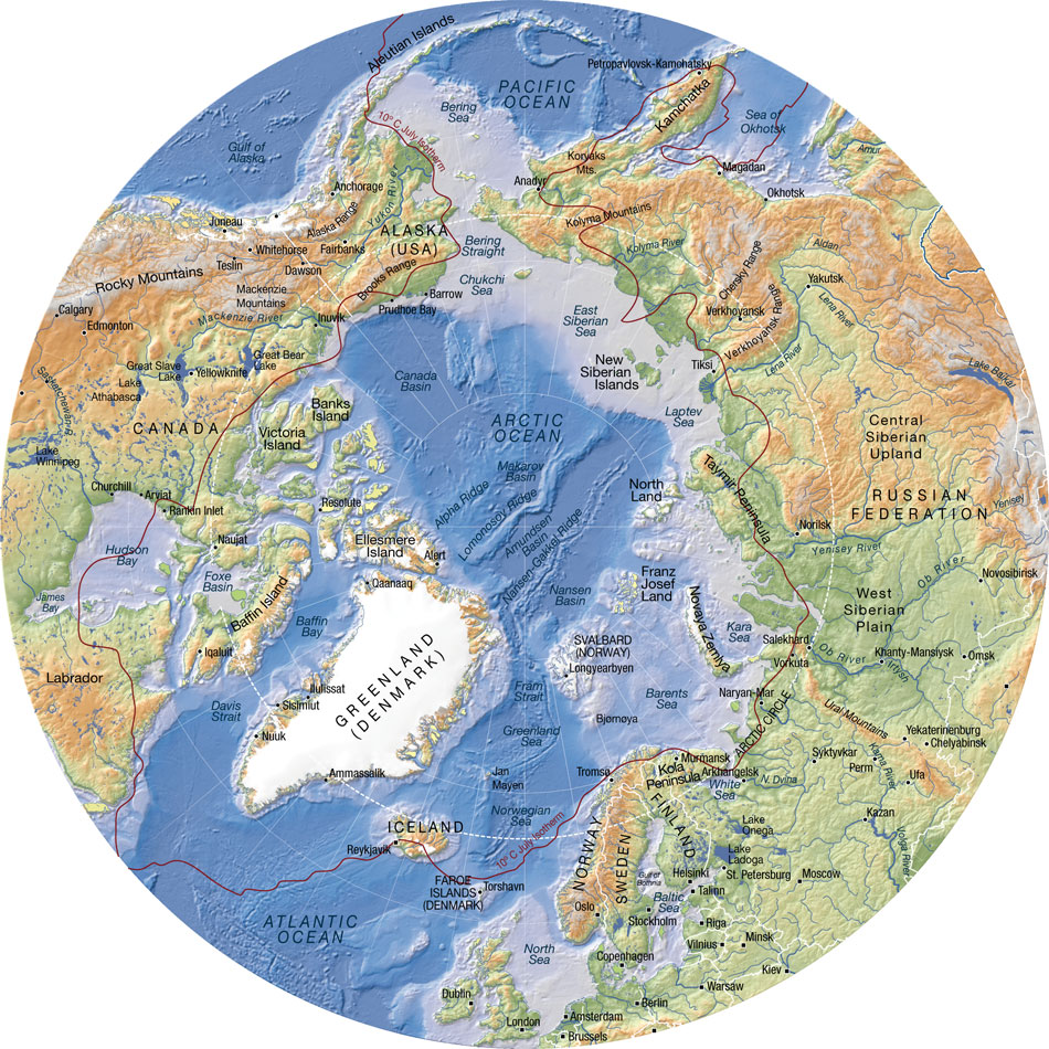
In order to sustain the reader’s interest, several maps are included in the book. They are very useful when comes the time to better understand the history and different uses, past and present, of the seas, islands and territories like: Kara Sea, Barents Sea, Laptev Sea, Franz Josef Land, Novaya Zemlya, Aleutian Islands, New Siberian Islands, North Land, Wrangel, Bering Strait, Svalbard, Spitzberg, Oslo, Tromsö, Kirkenes, Murmansk, etc.

Some of the seaways of Russia, which are among the longest in the world, are equally presented: Ob, Yenisei, Lena and Kolyma.

Numerous geographical maps are available at the following site : http://www.lib.utexas.edu/maps/polar.html

The numbers talk for themselves:  to go from Rotterdam to Yokohama, a ship must travel 20,600 kilometers when passing through the Suez Canal. Only 12,800 kilometers are needed when using the northeast passage along the Siberian coast and 11,800 kilometers when traveling across the pole in the absence of ice during summer (this new transpolar route could be usable as soon as 2025). The need of resources by China and India, associated with melting ice in the poles, are rapidly taking Siberia out of its isolation.

Important people

The reader will certainly be interested by the information on the people who played a significant role in the discovery and exploitation of seas, islands and lands bordering the Northeast maritime route. Here are few of those names: the Viking Otar, Willem Barents, Simon Dejnev, Vitus Bering, Peter the Great, Alexander Baranov, Ivan Veniaminov, Adolf Erik Nordenskjöld, Ada Blackjack, etc.

The first northern crossing from the Atlantic to the Pacific belongs to a Swedish named Adolf Erik Nordenskjöld in 1879. Thirty-six years (1915) were needed to witness the second complete crossing, this time by Russian icebreakers under the command of Boris Vilkitski.

The importance of icebreakers

Icebreakers are extremely important for Russia, so much for protecting its recognized sovereignty and defending its new territorial claims than for economic reasons (insure the usability of the Northeast Passage and the continuous exploitation of the oil and gas resources along the Siberian coast).

The United States must also build icebreakers, so much for geopolitical and economic reasons than to insure the protection of a growing number of cruise ships that are about to use the narrow and risky channels of the Arctic.

Arctic geographic map (Source: www.arcticcenter.org)

Collaboration and obstacles in the Barents Sea

An obvious collaboration exists between Russia and Norway with regards to fishing in the Barents Sea and in the south of Svalbard, a sector rapidly becoming more strategic with the northern migration of several fish species caused by the climatic changes. Ecosystems are nonetheless in danger due to the rapidly warming waters and insufficient time to adapt.

What are the obstacles presented by the Barents Sea towards tankers, ships and platforms? First the fog, which can last for weeks, than the “lows” which destroy vessels and twist superstructures. Finally, freezing spray adds excessive weight and freezes every crank on ships and platforms. In the event of an accident caused by oil or gas exploitation, the extreme meteorological conditions will present very important challenges.

One note on Siberia

The exploitation of mineral resources in Siberia was initially made possible, under Lenin, through work camps (gulags), since there were no volunteers ready to exile themselves in that hostile region.

The authors suggest, for whoever is interested in Siberia, the soon to be published book by Éric Hoesli. He has already published, in 2006, a very well documented book on the Caucasus: À la conquête du Caucase.

Oslo: Tschudi and Aker Solutions

The authors present two Norwegian companies based in Oslo which deal with logistics at sea: TSCHUDI and Aker Solutions.

Back cover of the book " Passer par le Nord " by Isabelle Autissier and Érik Orsenna
Back cover of the book ” Passer par le Nord ” by Isabelle Autissier and Érik Orsenna

Shtokman and Yuzhno-Tambeyskoye natural gas reserves

The reader will certainly appreciate the chapter on the “eldorados glacés” (iced eldorados) which develops on the Shtockman and Yuzhno-Tambeyskoyenatural gas reserves fields (the latter holds 25% of the world reserve of natural gas). There are numerous challenges with regards to the exploitation of those fields: investments of twenty billion dollars, a necessary alliance between Russia, France (TOTAL) and China (CNPC), gigantic infrastructures to be built, the stabilization of all installations using thousands of posts, a constant fight against ice, the construction of thirty tankers (among them sixteen icebreakers), and the obligation to use the Northern maritime route.

Global warming

The book covers at length the accumulated effects of military, industrial and commercial activities on animal life and the environment. The fragility of the Arctic is well demonstrated. The reader will be surprised by the extent of nuclear wastes spread around the Novaya Zemlya.

The global warming favors the migration of species northward, an increase in the number of fishing vessels in the Arctic and political tensions between nations related to the ownership of the zone located between 12 and 200 miles along the different coasts. The native species are losing ground to the profit of the invasive species.

“[My translation] The diminishing polar ice will favor an increase in the number of ships in the Arctic with the added risk of collisions and the emission of all kind of noises that disrupt animals and prevent them from feeding correctly and communicate properly between them or with their offspring. Seismic tests or low-frequency sonars used by fishermen and militaries are particularly devastating.” (p.203)

With few exceptions (Norway, Japan, Iceland), the moratorium on whale hunting is respected. The official predation by Inuit and the Russian poaching are limited.” (p.203)

Map showing the links behind the accelerated warming of the Arctic (Source: http://arctic-news.blogspot.ca/2012/09/storm-enters-arctic-region.html)

Increase in extreme weather events

“[My translation] The diminishing pack ice will act on the oceanic currents, but also on the atmosphere by slowing down the higher jet streams. This phenomenon will favor an increase in extreme [weather] events (cold spells or heat waves, droughts or floods) at our mid-latitudes.”(p.219)

Response time when faced with an ecological disaster in the Arctic

The Bureau of Ocean Energy Management (USA) “[my translation] estimates that 61 000 barrels [of oil] would spill in the sea every day if a well exploded. The Shell Company indicates that it would need thirty-eight days to drill a relief well while it needed eighty-five in the Gulf of Mexico, infinitely more accessible and less dangerous. Admitting that it would show the same celerity as for Deepwater Horizon , which in itself would be a feat, more than 800 000 tons of oil would spill in the Arctic.

More likely, operating conditions in ice, fog and storms would prevent the realization of the work within only one summer. Once the polar night would set, a decision to let the well spill all winter would have to be taken, if not for many years in a row.” (p.229)

Methane

“[My translation] Methane has a greenhouse effect that is twenty-three time superior to that of the CO2, that is already presented as our worst enemy” (p.216)

In the Laptev Sea, what looks like real fountains of several hundred of meters in diameter spew out methane. One can see the sea boil like if it was in a gigantic cauldron. 80% of surface waters and 50% of deep waters present methane concentrations varying from 8 to … 1 400 times the oceanic average!”(p.216)

Mammoth’s tusks poaching

There is a short passage in the book on the poaching of mammoth’s tusks buried in the ground on Liakhov Island. The operation is financed by Mafiosi. The tusks are carved then resold to Chinese collectors for a very good profit.

Global warming, and the thaw it provokes in Siberia, would indirectly protect the African elephant by allowing access to mammoth’s tusks. The new and important stock of ivory in Siberia drives the price down by increasing the offer, thus making the African elephant’s tusks less interesting financially.

Some names to remember

The Port of Kirkenes, in Norway, is one of the main ports of the new northern sea route. It has an ideal geographical position and its harbour is protected against storms. The city favors the development of the port. The efficiency of Norwegian employees is recognized. The Norwegians are used to deal with Russians, their immediate neighbours.

Murmansk, in Russia, is also expected to benefit from global warming. There are already dozens of mines in exploitation, with several of those mines producing rare earths which are vital for modern technology applications.

In the Arctic, the disappearance of the summer ice pack is expected between 2020 and 2030. The Northeast Passage could be accessible beyond the EEZ 200 miles, “which will favor Iceland “which could become a transport hub between America and Europe.”(p.218). “And it is said that some Beijing investors would be ready to offer 5 billion dollars to take control of the future Port of Reykjavik, the one that aims to be the hub of the North.” (p.245)

The Arctic Council

For a long time now, the Arctic has been a strategic area where numerous countries, among them few superpowers, claim an important part of the territory and resources. With the acceleration of the melting process, things get even more complicated.

In 1996, the Arctic Council was created to ease communications and reduce political tensions between the countries pretending to part of the Arctic territory and resources. These countries include Canada, Denmark, United States, Finland, Iceland, Norway, Sweden and Russia. Associations of indigenous population are also part of the group, but as “permanent members”.

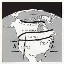
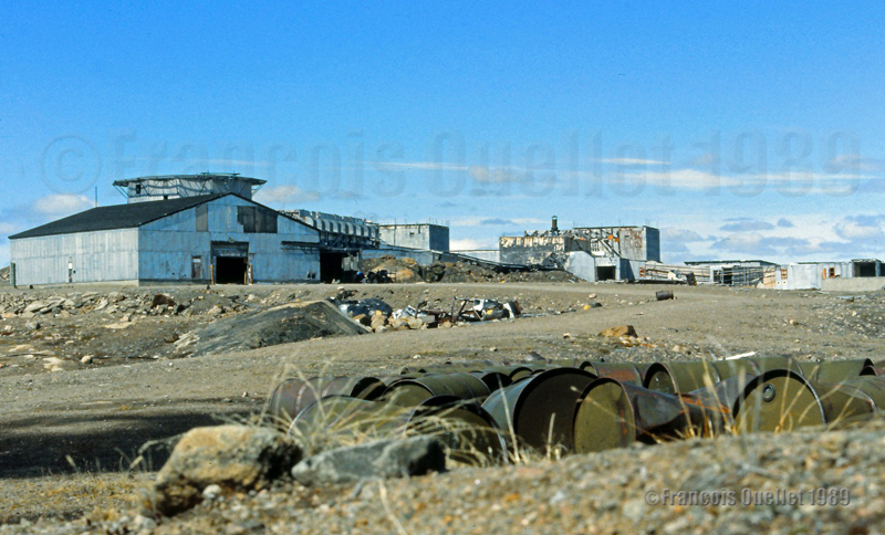
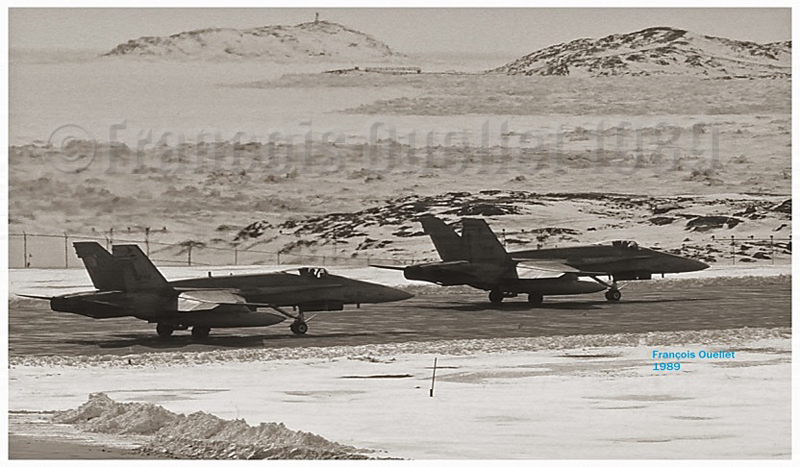
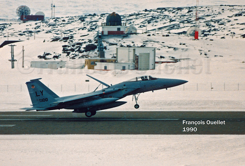
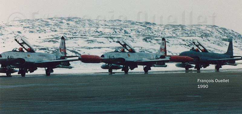
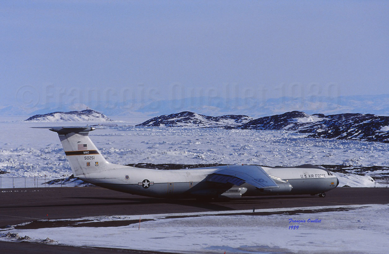
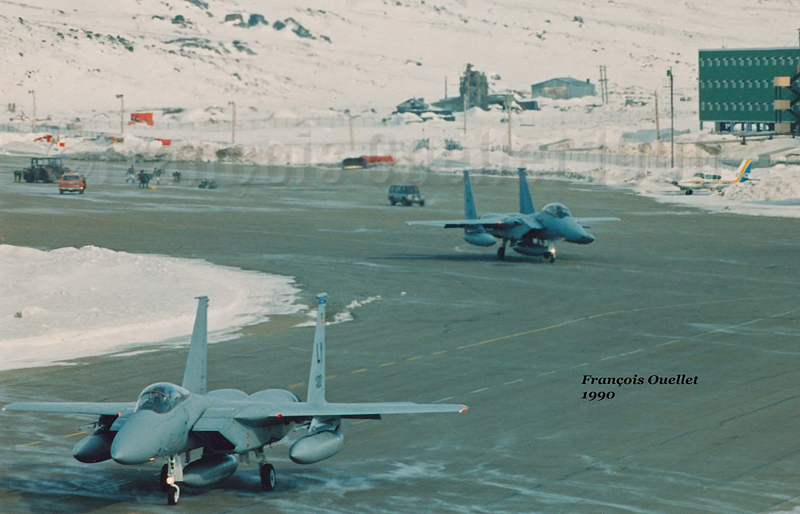
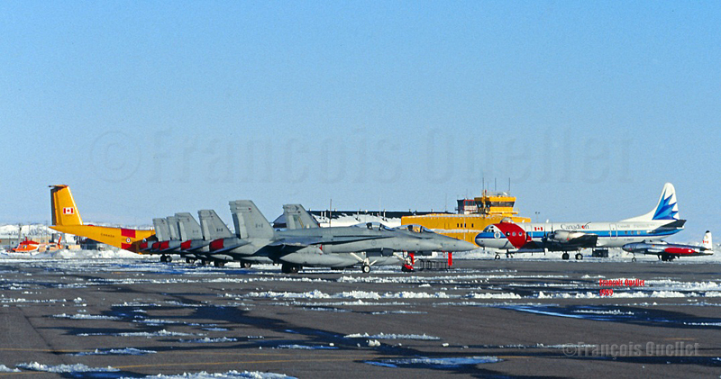
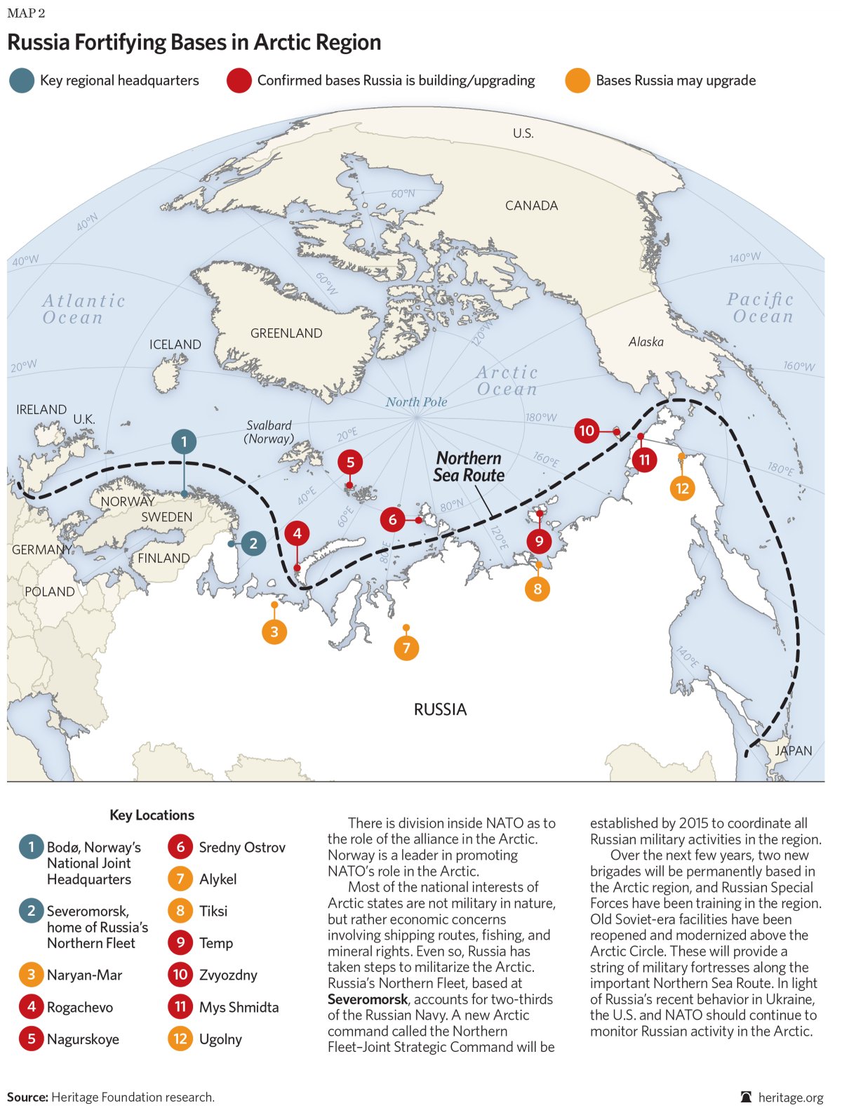
Militarization of the North

The Cold War between Russia and United States forced the construction of the DEW line by Americans and Canadians, a line that was eventually replaced by the North Warning System.

Today, the militarization of the area still goes on: “[my translation] Russia multiplies the signs and acts of militarization in the zone. Military exercises (parachuting, air patrols), reconstruction of installations in all of the islands (Wrangel, New Siberian, Novaya Zemlya, Franz Josef Land), orders of numerous ships among them new generation submarines (attack submarines and missile launchers), a complete program for the upgrading of the Boulava missiles … The [Northern Fleet] underwater base, near Murmansk (Severomorsk), seems to be in a state of complete reactivation.”(p.238)

Russia fortifying bases in Arctic region (Source: Heritage.org)

The transpolar maritime route

Geographic map showing the potential northern maritime routes (Source: www.businessinsider.com)

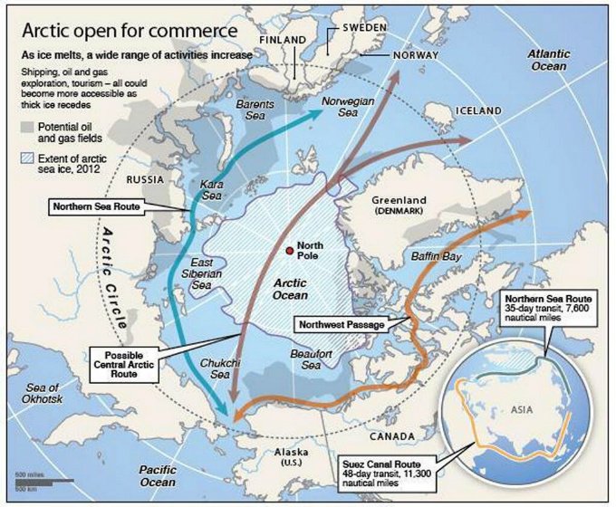
The Northeast Passage maritime route along the Siberian coast will be favored until the ice pack has melted at the pole (expected for 2025 instead of 2060 initially forecasted). So, in 2025, a new transpolar maritime route will be available to ship-owners. They will then be able to decide if they avoid the Siberian coast and the associated administrative hassle while they save an additional one thousand kilometers for a route from Rotterdam to Yokohama.

For more articles on geopolitics on my web site, click on the following link : Geopolitics

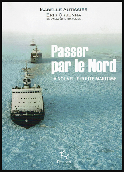
Title: Passer par le Nord – La nouvelle route maritime
Authors: Isabelle Autissier and Érik Orsenna
Editions: Paulsen
©2014
ISBN: 978-2-916-552-35-4

Categories
Real life stories as a flight service specialist (FSS): Iqaluit FSS

Iqaluit and the old American military base (Frobisher Bay)

(Precedent story: carrying a .357 Magnum to Iqaluit)

An American Trans Air Lockheed L-1011being refueled in Iqaluit, Canada, in 1989. I had the opportunity to leave the flight service station (the yellow tower) for few minutes to take this picture.

Before retelling some of the events that happened while I was working at the Transport Canada flight service station in Iqaluit, in the Nunavut (1989-1991), it is mandatory to present few important dates that will allow the reader to understand why the airport was initially an American military base.

1938. Hitler’s ambitions are such that Roosevelt deemed necessary to announce the following: “I give you assurance that the people of the United States will not stand idly by if domination of Canadian soil is threatened by any other empire ».

1939. Beginning of discussions between Canada and United States with regards to joint defense of the North American continent.

1940. Great-Britain was at risk of losing the war against a Germany that was progressing rapidly in its conquest of the European soil. When Denmark was defeated in autumn 1940, fear grew that the Germans would progress westward and establish operational military bases on the newly acquired territories.

Greenland belonging to a defeated Denmark, Germans would be using it to get closer to Canada. At the time, Greenland was the sole commercial source of cryolite, an essential component of aluminum used in aircraft production.

There was also a province which was not part of Canada in 1940 and which presented a strategic interest for an enemy in its war against Canada and United States: Newfoundland and Labrador.

In order for the war not to be fought directly on the North American territory, one had to keep the Germans busy in Europe. It therefore meant that Great-Britain must not be defeated.

1941. Ships carrying short range fighting aircrafts from America to Europe were regularly attacked and sunk by U-boats. It was imperative to change the route. Canadians and Americans were looking for the best sites that could accommodate the construction of runways allowing short range military aircrafts to fly up to Prestwick, Scotland.

This new route was called “Crimson Route” and the stopovers were Goose Bay in Labrador, Fort Chimo (Kuujjuaq) in Quebec, Frobisher Bay (Iqaluit), on Baffin Island in the Nunavut as well as three sites in Greenland (Narsarsuaq, Angmagssalik and Sondre Stromfjord (Kangerlussuaq). The Frobisher Bay coded name became “Crystal Two” base.

1941-42. Germans established the first inhabited weather bases on the Greenland coast in order to facilitate U-Boats operations across the North Atlantic. When those sites were discovered, they were destroyed by American commandos.

1942. U-Boats entered the St-Lawrence seaway and sank Canadian ships.

1942. The site initially chosen to establish the Frobisher Bay airport (the Crystal Two base) was Cromwell Island, located 20 miles south-west of today’s actual site for Iqaluit. This was until a new site was discovered (today’s site) that favored the construction of longer runways and allowed the beaching of flatboats loaded with cargo during the summer period.

A McAllister flat-bottomed barge will soon be unloaded in Iqaluit, during low tide.

A ships convoy carrying thousands of tons of cargo planned for the construction of the Frobisher Bay base arrived at destination. This convoy was nonetheless attacked by the U-517 U-Boat and the cargo-ship Chatham, carrying 6000 tons of material destined for Crystal One and Crystal Two bases was sank.

1943. An German automated weather station was built at Martin Bay, in Labrador, to facilitate the U-Boats operations. This weather station is now in permanent exhibition at the war museum in Ottawa. Pictures have been found were we can see smiling but armed German soldiers taking the pose near the automated weather station. Canada accidently learned about the existence of that weather station in 1980.

German automated weather station in exibit at the War Museum in Ottawa

Many German officers and soldiers who were captured in Europe were sent abroad while waiting for the end of the war. My grandparents, who owned a farm in St-Ignace, Quebec, became responsible, over time, for one German officer and two soldiers. They had only good comments on the behavior and desire of the prisoners to help on the farm.

1943. Both Frobisher Bay runways were now operational, although without being totally completed. The engineers did not have the knowledge of the Russians when it came to maintaining airport runways in the Arctic. Damages caused by permafrost were significant and the runways necessitated a lot of maintenance. The water present under the runways would sometimes surface suddenly and create five meter deep holes. Those runways needed a constant effort to remain usable.

The first runway to be built was eventually abandoned due to a wrong evaluation of the prevailing winds and the dangers associated with the surrounding elevated terrain. Today only remains the runway that we know in Iqaluit, although extended to 9000 feet. The year 1943 recorded 323 aircraft arrivals, of which only a small number made the complete trip to Europe.

1944. War took a new turn. The newly developed long range radars, allied to advanced technology in the detection and attack of submarines, radically diminished the U-Boats threat in North Atlantic. The “Crimson Route” airports were suddenly losing their pertinence. The Canadian government, worried about the massive presence of Americans in the Canadian Arctic, bought the airports from the American government.

1950. Canadians officially took control of the Frobisher Bay airport, but authorized an American presence since this airport had a new strategic importance in the cold war that followed Second World War. The weather station and runway maintenance were taken care of by American forces.

1951-53. A radar station was built on a hill northeast of runway 17-35. This station completed what was then known as the Pinetree line. This line was made of several long range surveillance radar stations; it covered all of southern Canada and gradually curved towards the north to end up in Frobisher Bay. All those stations were inhabited and could order interceptions at all times against potential enemy forces, by means of jet aircrafts.

What is left of the old American military base in Frobisher Bay (Iqaluit), Canada. I took the picture in 1989.

1955. Americans received the authorization from Canada to build a SAC [Strategic Air Command] military base where numerous KC-97 tankers were stationed in support of B-47 bombers operations carrying nuclear armament. The base was built in 1958 and, until the end of its operations in 1963, parking space was occupied by at least seven KC-97. The SAC base was not needed anymore after the new Boeing B-52 bombers and KC-135 tankers were developed.

A French-Canadian military from Quebec at work in Frobisher Bay

Gaston Gagnon during the period where he served as a Canadian military in the communication field, at the Frobisher Bay station of the Pinetree Line in Canada in 1955. He died in 2016.

My uncle Gaston Gagnon was part of the French-Canadian military staff who was in service in Frobisher Bay. He volunteered for service during the Second World War (1939-1945).

War medals (volontary service and honorable service during the Second World War (1939-1945) belonging to the French Canadian Gaston Gagnon who died in 2016
Frobisher Bay, N.W.T., Canada crest

He worked in the communication field during the Cold War and, after he died in 2016, I received some pictures that were taken in 1955 in Frobisher Bay. Those photos also witness of the American presence in Frobisher Bay.

Radar dish at the Frobisher Bay, NWT, Canada Pinetree Line Station in 1955
American soldier posted at the Frobisher Bay NWT Canada Pinetree Line site in 1955
Globe Master C-124 aircraft of the Military Transport Air Service (U.S. Air Force) in Frobisher Bay, NWT, Canada in 1955 serving the Pinetree Line stations during the Cold War.
C-124 Globemaster. Military Air Transport Service in United States (around 1957)
Frobisher Bay, N.W.T., Canada crest

1960. The runway was extended from 6000 to 9000 feet.

1961. The Frobisher Bay radar station, part of the Pinetree line, was closed but the Polevault station remained in activity.

DEW and Pinetree lines over Northern Canada

1963. Americans left Frobisher Bay and gave control of the Polevault station to the DOT [Department of Transport], an older designation of Transport Canada.

Old American military base in Frobisher Bay (Iqaluit)

1964. The radio operator, and later flight service specialist (FSS) Georges McDougall, arrived in Frobisher Bay. All the village inhabitants eventually got to know Georges since he provided air traffic services there for at least thirty-seven years, seven days a week, on shifts work. He progressively became a privileged witness of all the unusual events to happen in the village and at the airport.

Below is a picture of the old DOT hangar and tower.

People and DOT Canada in Frobisher Bay NWT aviation postcard

1987. Frobisher Bay was renamed Iqaluit.

Two Canadian CF-18s holding short of runway in Iqaluit (1989)

1989. Stacey Campbell wrote an article in News North that she titled: “Military Jets Fill the Arctic Skies”. She explained that NORAD (North American Air Defence) regularly held exercises aimed at testing the capacity of Canada’s new radar defense system to detect potential enemies approaching from the north.

The interviewed military officer told Stacey that CF-18 fighter jets, tankers and B-52 bombers, among other types, would be part of the operation. The CF-18’s would temporarily be stationed in Iqaluit, on Baffin Island, and Inuvik for the duration of the exercise. Other types of aircrafts were also involved in that annual test, like the F-15, T-33 and possibly the AWAC although the latter did not land in Iqaluit.

American F-15 landing in Iqaluit

The local Transport Canada flight service specialists (FSS) had to deal with the tight operating schedule provided by a military officer as well as integrate the daily arrivals and departures of private and commercial aircrafts.

At the time, the most useful taxiway, one which was located near the end of runway 35, could not be used since the terrain was too soft. All the aircrafts using runway 35 were forced to backtrack that runway before it could be cleared for other incoming or departing aircrafts. The additional time required for that procedure sometimes gave headaches to the military officer sitting by our side.

American F-15 Eagle airborne from Iqaluit
Canadian T-33s in Iqaluit (1990)
American Starlifter cargo aircraft ready for take-off in Iqaluit (1989)

I remember that the military officer in charge of the mission told us: “If the jets cannot takeoff within the next minute, the mission will be aborted”. It just happened that during the tight window within which the CF-18’s had to be airborne that day, there were many commercial aircrafts like the Avro 748, Twin Otter, Boeing 727 and 737 and other executive aircrafts operating around Iqaluit. There was always a way to please everybody and the military exercise ended the way it was initially planned.

Two Canadian CF-18s in Iqaluit (1989)
Two American F-15 Eagle taxiing for departure in Iqaluit (1990)

This was a period much appreciated by the flight service specialists (FSS) since, for one week during the year, our operations changed radically: we had to respect the imperative needs related to the military exercise as well as continue to provide regular air traffic services.

Six Canadian CF-18s, one Lockheed Electra Ice Patrol aircraft, a Dash-7 and a T-33 in Iqaluit

It was brought to our attention, for having discussed with many pilots involved in the exercise that military forces were kind enough to offer, through our Transport Canada manager, few posters signed by pilots of squadrons involved in the “Amalgam Chief” exercise. Although the manager never deemed necessary to show his staff even one of those posters, I appreciated the gesture from the pilots.

Canadian Armed Forces Boeing B-707 in Iqaluit, in front of the flight service station tower

1993. In order to replace a DEW line that had become obsolete, Canadians and Americans jointly built a new base that would now be used for logistical support for the new North Warning System.

Two Canadian fighter aircrafts CF-18 leaving the runway in Iqaluit.

2006. Extreme cold tests were held in Iqaluit by Airbus for the A-380, the biggest passenger aircraft in the world.

Airbus A380-841 in Iqaluit, Canada, during cold weather testing

2014. Extreme cold tests were held by Airbus for its new A-350 XWB.

2015. Canada was the host of the Arctic Council Ministerial Meeting in Iqaluit. The Council is composed of the following countries: Canada, Sweden, Denmark, Finland, Iceland, Norway, Russia and United States. Joining the meeting were senior representatives of indigenous organisations holding the status of permanent participants.

  1. Dassault completes several cold-soak trials in Iqaluit for its Falcon 6X
  2. Pope Francis visits Iqaluit during his Canadian trip aimed at healing and reconciliation with Indegenous groups and residential school survivors.

(Next story: The military exercise “Amalgam Chief”: B-52 bombers in northern Canada)

For more real life stories as a FSS in Iqaluit, click on the following link: Flight service specialist (FSS) in Iqaluit