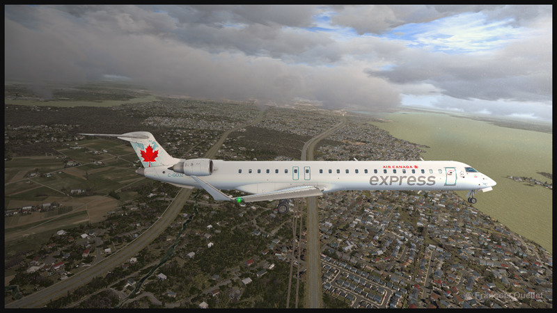
KLM MD-11 airborne from Rotterdam The Hague virtual airport in Microsoft Flight Simulation
After Holland, France is stage 22 of the flight simulation tour of the world. The first airport of interest will be Paris-Le Bourget (LFPB), more specifically the Musée de l’Air et de l’Espace du Bourget. Since this is a historical visit, we choose the aircraft accordingly.
So, departing from Rotterdam, passengers board an MD-11 in KLM colors. The last flight of KLM’s MD-11 passenger aircraft in the real world took place in 2014, departing from Montreal to Amsterdam.
Today, several MD-11s are still flying, but only in cargo versions. Airlines are progressively replacing them by more modern aircrafts.
TFDI produced this high-quality virtual aircraft. An updated version has further improved the aircraft. It can be seen below flying at 13,000 feet.
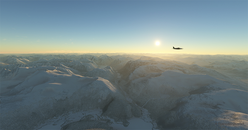
A KLM MD-11 climbs for FL210 towards Paris-Le Bourget (LFPB) with MSFS
Below, the MD-11 reaches flight level FL210. The virtual weather based on METAR reports from Rotterdam and Paris indicates no serious problems for the approach and landing.
Virtual TFDI KLM MD-11 about to reach FL210 enroute to (LFPB) Paris Le Bourget airport
For this flight, the MD-11 is carrying only about 100 passengers. The runway at Le Bourget offers plenty of room for maneuvering when landing such an aircraft. Thirty-five degrees of flaps will therefore be sufficient for the final approach to runway 25.
The approach axis is unusual in that it is offset by 26 degrees from the center of the runway. As Jean-Pierre Otelli so aptly puts it in his book, ” Piloter en sécurité ” : “If the localizer were in line with the runway, the final approaches at Le Bourget would pass 1,000 feet above Terminal 1 at Roissy” […]. Aircraft landing on 25 must make a final 26-degree turn after following the localizer.”
Le Bourget is not the only airport where a serious turn is necessary on final approach. We obviously remember the Hong Kong Checker Board Approach for runway 13 at the former Kai Tak Airport in Hong Kong. At that airport, the final turn was not 26 degrees, but 47 degrees.
Finally, we can also mention Ronald Reagan Airport, where the approach for runway 19 requires a final turn of 36 degrees to avoid the area surrounding the White House.
KLM MD-11 on final for the virtual airport Paris Le Bourget (LFPB) with Microsoft Flight Simulator
The MD-11 taxis down the runway after a smooth landing. After switching off the autopilot for the final approach, an alarm sounds in the cockpit. Even after the plane has touched down, no matter what I do to silence the alarm, nothing works. I still have several hours of study ahead of me to master this aircraft.
Virtual KLM MD-11 taxiing on rwy 27 Paris Le Bourget airport after landing with MSFS
The MD-11 taxis to a makeshift parking area near the museum after crossing the disused runway.
A KLM MD-11 de KLM arrives at the Paris Le Bourget (LFPB) airport with Microsoft Flight Simulator
Le Musée de l’Air et de l’Espace du Bourget (The Air and Space Museum in Le Bourget).
Virtual Musée de l’Air et de l’Espace du Bourget with Microsoft Flight Simulator MSFS
The next stage of our flight around the world with Microsoft Flight Simulator will also take place in France. The current weather conditions will once again dictate the choice of aircraft and destination.
Through the videos on Youtube, I see that a runway called Out Skerries (EG78 or OUK) in the Shetland Islands attracts interest for its challenging landing. It is only 1195 feet long.
The tiny airstrip will therefore be the destination for leg #15 of our round-the-world flight simulation tour with the MSFS flight simulator.
To increase the fun, we choose a twin-engine aircraft, which is heavier and requires a longer breaking distance.
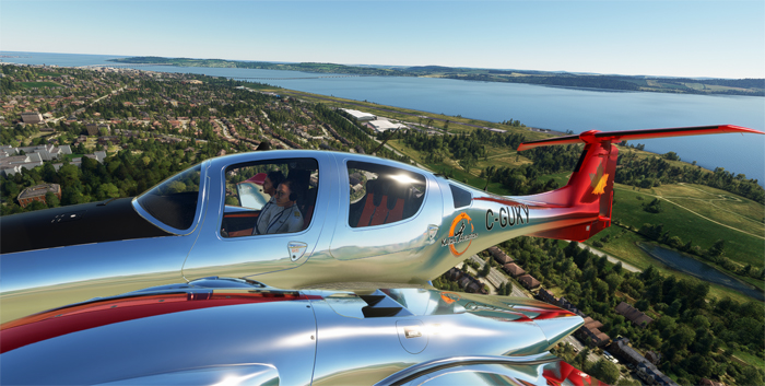
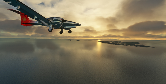
We take off from Dundee (EGPN) with a virtual Diamond DA-62 and arrive at dusk. It’s probably a bit tight for a short, unlit runway, but we’ll give it a go.
DA-62 aircraft taking off from Dundee airport, Scotland, with Microsoft Flight Simulator
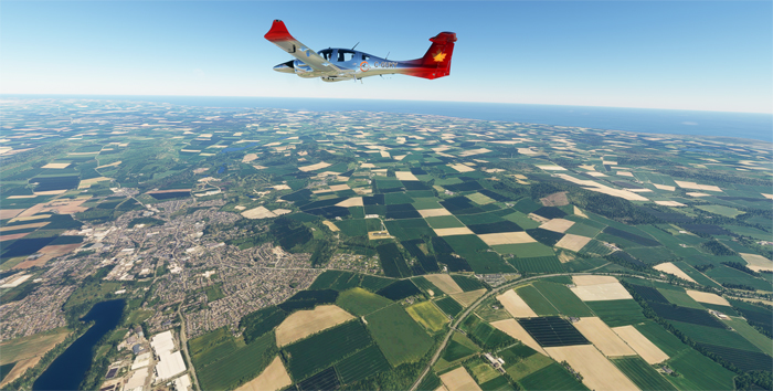
The stall speed of the DA-62 in landing configuration is 68 knots, which will help us to succeed in our undertaking. We take a 018-degree northerly course to reach the islands from Dundee. Ground speed is around 155 knots for this 250 nautical mile journey.
Virtual DA-62 over Scotland enroute to the Shetland Islands
DA-62 aircraft near Fair Isle in the Shetland Islands with Microsoft Flight Simulator
We have to fly off Fair Isle on the way to our destination. I learn from some research that Fair Isle knitwear remains one of Shetland’s most famous products. I imagine that fish products are also very popular.
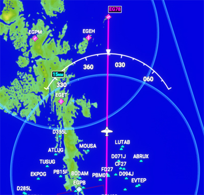
Flight trajectory towards Out Skerries (EG78) on the Shetland Islands, Scotland
Approaching Out Skerries (EG78) airport in Scotland with the DA62 virtual aircraft
Here we are, approaching Out Skerries. The absence of runway lights makes the operation tricky.
The surrounding hills block the pilot’s view at low altitude, and what is considered a landing strip is not visible until fairly late in the approach. There are no other aids to help locate the facilities.
The omnipresent winds complicate the task, as does the turn on approach. One of the runway thresholds ends in a cliff ready to receive ill-prepared aviators.
After landing at Out Skerries airport (EG78) with Microsoft Flight Simulator
We see the runway threshold at the last moment. Since the DA-62 weighs more than a single-engine model, the aircraft requires a longer braking distance.
Ground contact is harder than usual, but without bouncing. If there’s a bounce, the pilot has to climb back up and repeat the approach.
You really have to glue the aircraft to the ground at the runway threshold, immediately raise the flaps while pulling back on the stick to maximize braking efficiency. In real life, we’d add that braking must be performed without locking the wheels.
I classify this exercise as a challenging virtual flight.
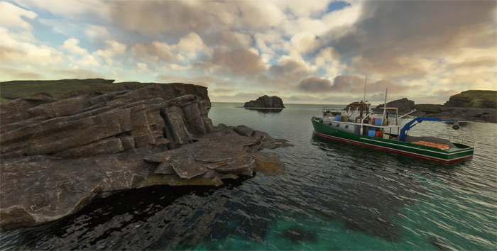
Fishing boat around the Shetland Islands with Microsoft Flight Simulator
Once the flight is over, the crew visits the surroundings. Many fishing boats come and go around the islands.
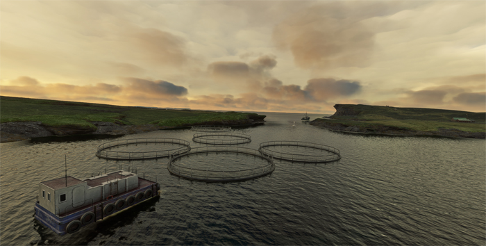
Mussel farming around the Shetland islands in Scotland, with Microsoft Flight Simulator.
On our next flight, we head for Barra Airfield (EGPR). It’s located in Scotland’s Outer Hebrides and is the only airport in the world “where scheduled services land on a beach”. We’ll be sure to check the tide before take-off…
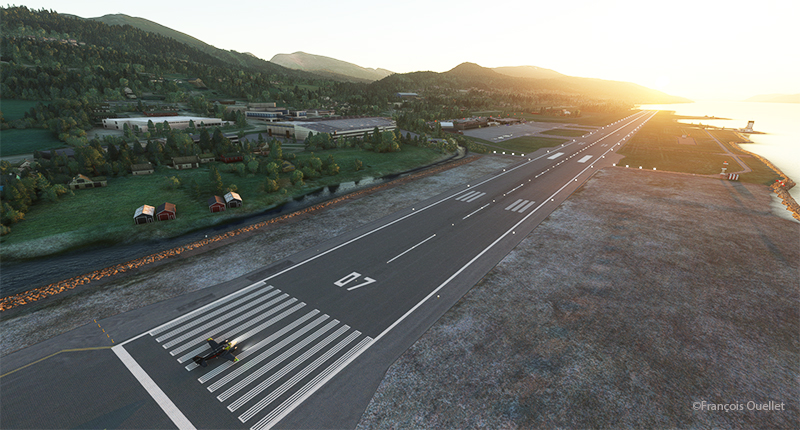
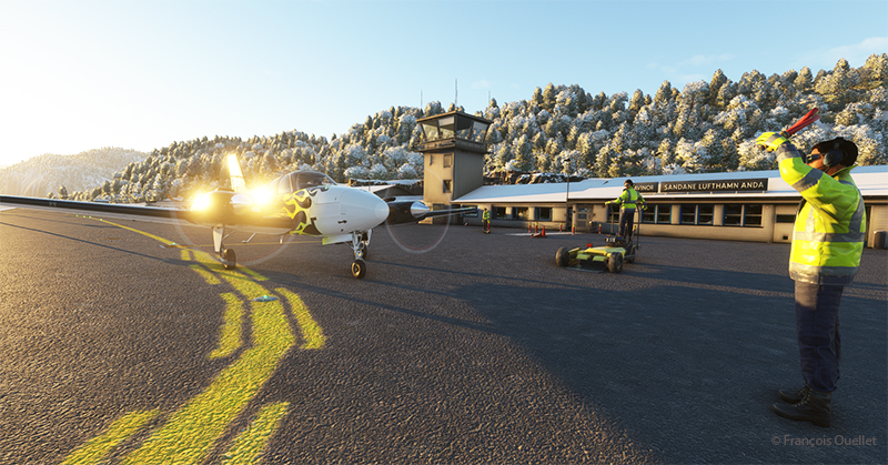
The sixth leg of this world tour of flight simulation continues with a journey from the Molde (ENML) airport to the Sandane/Anda (ENSD) airport in southern Norway.
Ready for departure from Molde (ENML) virtual airport to Sandane (ENSD) airport.
The destination can’t accommodate a private jet like the Cessna Citation Longitude, as runway 08/26 is only 3182 feet long. A good old light twin-engine plane, repainted a hundred times over, will have to be rented for the trip, and we’ll just have to hope the engines hold out.
Enroute to the virtual Sandane airport (ENSD) in Norway with Microsoft Flight Simulator
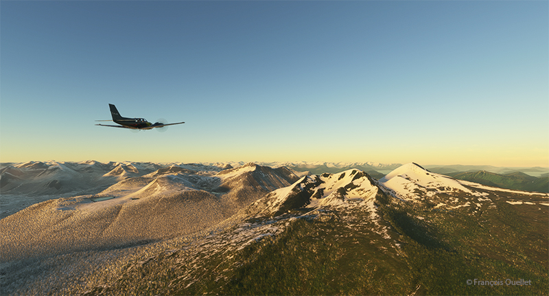
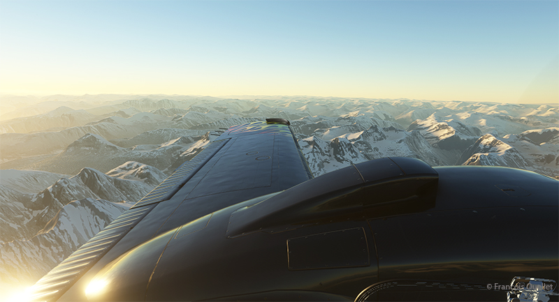
The mountains of Norway come into view, and the ascent continues gradually to ensure that the highest peaks along the route pose no problems.
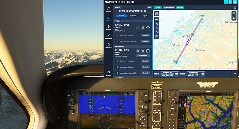
The navigraph tool for flight simulation and the VFR map from ENML to ENSD.
Above, a view of the aircraft’s instrument panel as it climbs, with a Navigraph map showing the route flown in visual flight. Virtual weather is integrated in real time whenever a new weather report is issued by a ground observation station around the world.
View of the Norwegian mountains from the pilot seat
Morning sun over the Norwegian mountains with Microsoft Flight Simulator.
Another sunrise view that brings Norway’s magnificent mountain landscape to life.
Approaching the Sandane virtual airport in flight simulation.
We are now almost at our destination. The plane is in left base for runway 08 at Sandane/Alda airport.
Turning final for runway 08 at Sandane (ENSD) virtual airport in Norway.
Over the still-frozen Innvikfjorden, the final turn is made to stabilize the aircraft on final runway 08. On short final, there’s a cliff just short of threshold 08, and a difference in runway height to take into account for the landing.
View of the Sandane (ENSD) virtual airport with Microsoft Flight Simulator.
Above, a view of the Sandane/Alda virtual airport (ENSD) using Microsoft Flight Simulator. There is no margin for error, as the two runway thresholds are bordered by a cliff and a stretch of water.
Help for parking is offered at the Sandane (ENSD) virtual airport in Norway.
Service at the airport is excellent. Two employees are waiting to help us park our aircraft.
Sandane is known for its magnificent panoramas, waterfalls, Briksdalsbreen glacier and horseback riding. The village is nestled inland from the Gloppe Fjord. If you’re traveling there in summer, you’ll need to be prepared for a fair amount of precipitation.
The next flight is from Sandane to Stockholm-Bromma in Sweden with a Beechcraft King Air 350I which has not flown for a long time. We’ll have to fly over the high mountains of the Jostedalsbreen Nasjonalpark before reaching our destination.
Decades ago, Canadian authorities used this island in the middle of the St. Lawrence River as a quarantine site for immigrants arriving in Canada. Many Irish people, among others, made an obligatory stop on this strip of land before being allowed to continue their journey to Canada.
At one time, a section of the island was reserved for Canadian and American researchers for their top secret research on Anthrax.The most amazing thing about reading the article is realizing that the entire production of this bacteriological weapon (439 liters) was mixed with formaldehyde and put in barrels that were dumped somewhere in the St. Lawrence River when it was decided that it would no longer be useful, as the Second World War took a turn in favor of the Allies. It seems to me that formaldehyde does not prevent barrels from rusting, but hey… back to the point.
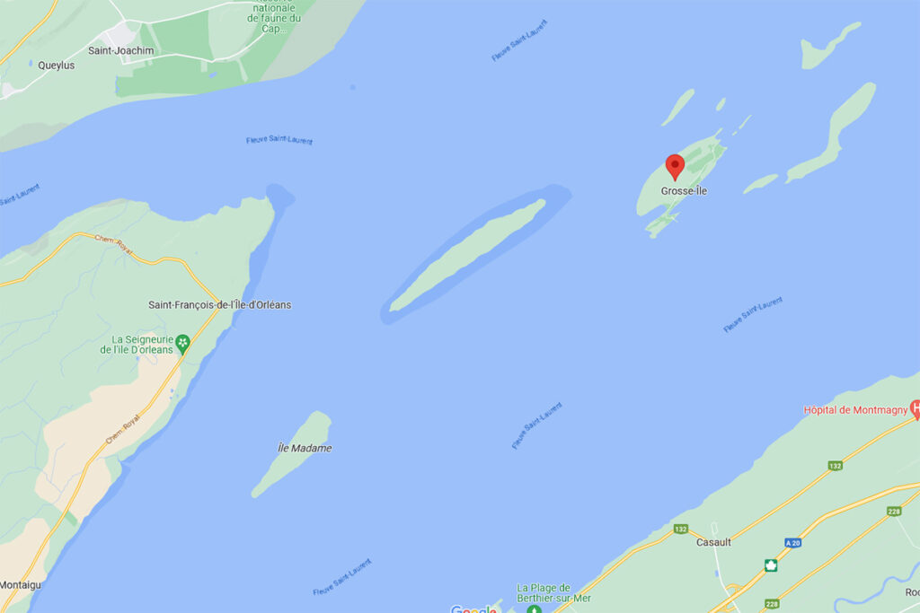
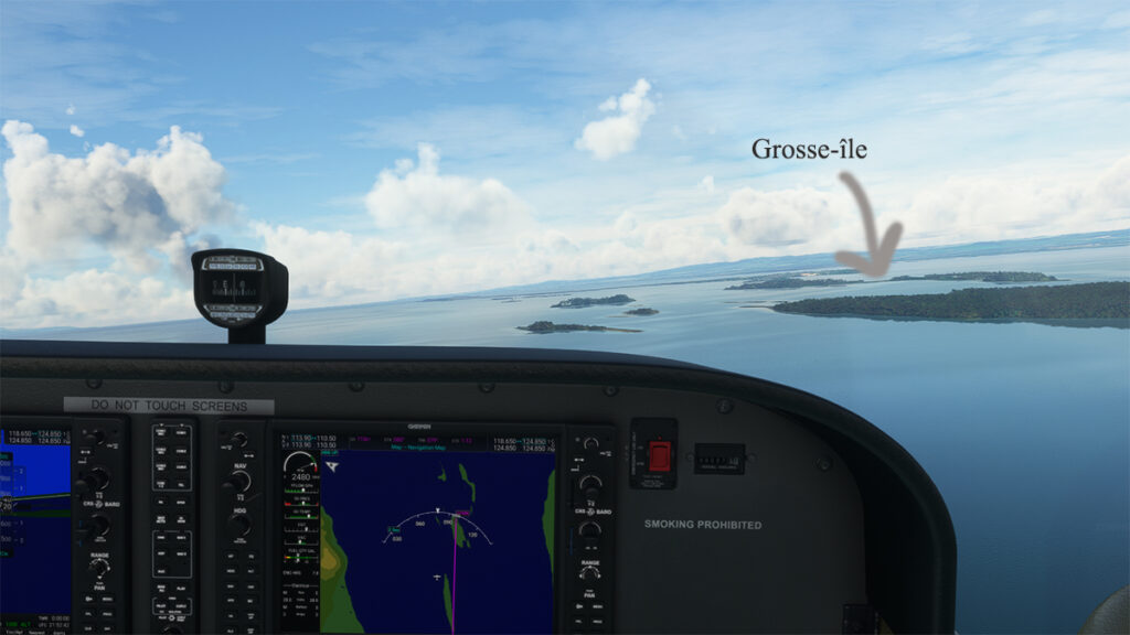
Where is Grosse-Île located? In the province of Quebec, a little east of Quebec City. It is one of the many islands that you can fly over once you have left Île d’Orléans behind. Below, a screenshot from Google Maps.
Grosse-Île in Quebec on Google Maps.
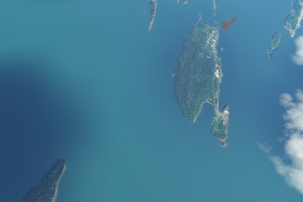
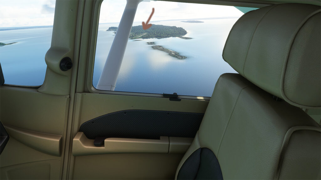
The satellite image below clearly shows that this is not an invention. Microsoft designates this runway as CYMN Montmagny: a mistake that one can easily live with, since by giving an official code to this Grosse-Île runway, the pilot can use it as a navigation point in his GPS.
Satellite view of Grosse-Île and its runway.
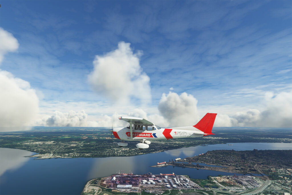
So, let’s use a small Cessna in US Coast Guard colors to make a virtual flight from Quebec City airport (CYQB) to Grosse-Île (CYMN). It was a bit chilly on this February day in Quebec City, so I decided to transport us to July for this flight, adding a few cumuliform clouds in the process.
Leaving Quebec City for Grosse-Île with MSFS 2020.
This short flight will allow us to fly over Île d’Orléans, Île Madame (owned by Laurent Beaudoin, former major shareholder of Bombardier), Île au Ruau (purchased in 2019 by the rich owner of the Gildan empire) to finally arrive at Grosse-Île.
Approaching Grosse-Île over the St Lawrence Seaway with the MSFS 2020 flight simulator.
The picture below shows the aircraft on a right base for the Grosse-Île runway. I do not know the official dimensions of this dirt airstrip, but it can easily accept a Cessna aircraft such as ours.
Cessna in base for the Grosse-Île runway with the MSFS 2020 flight simulator.
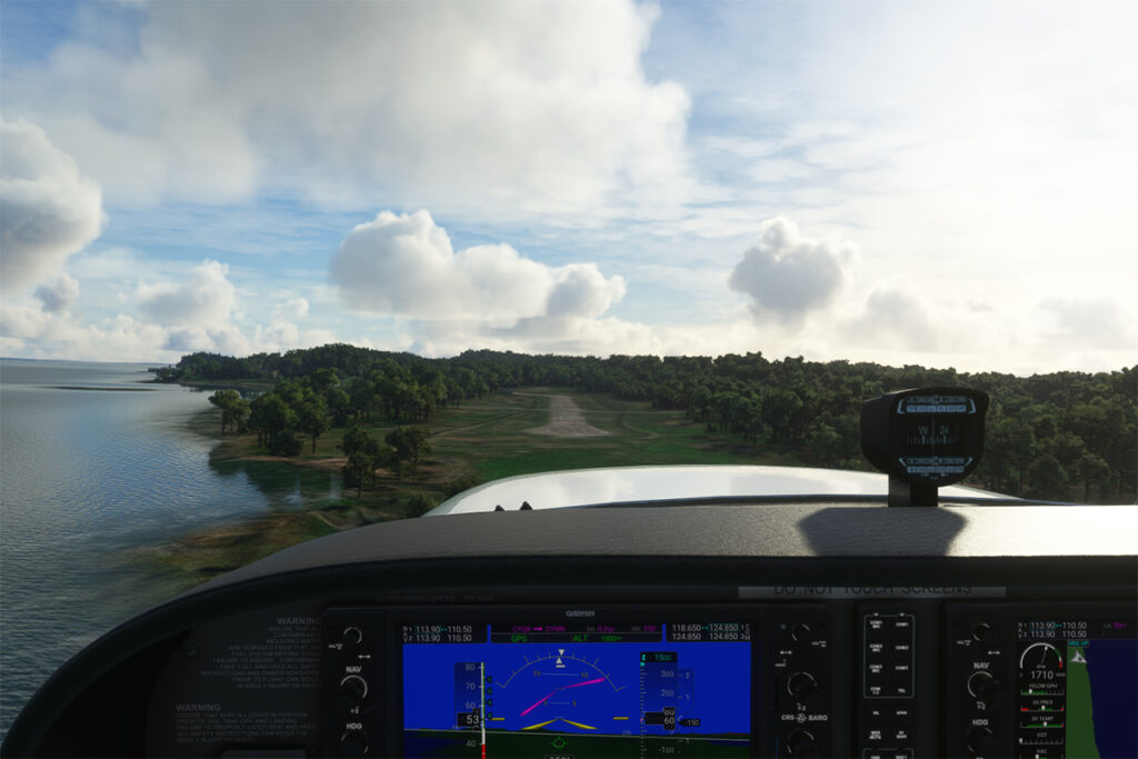
Below, the aircraft is on final for the runway.
On final for the Grosse-Île runway.
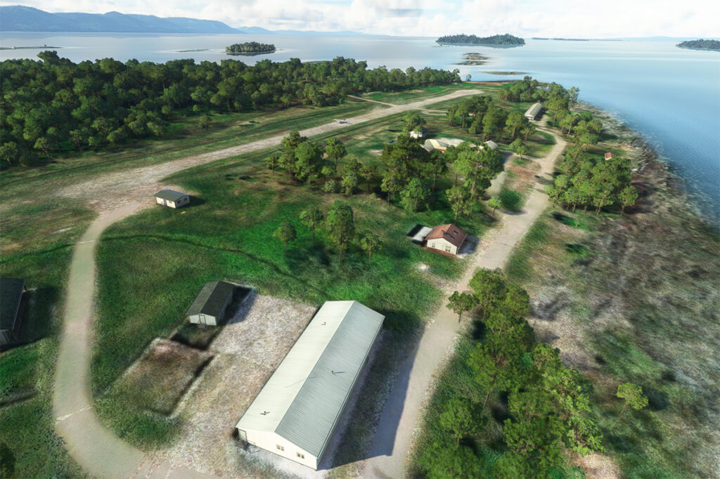
A final screenshot shows the Cessna taxiing down the runway after landing. As you can see, the runway can accommodate much larger aircraft. If you want to make a real flight to this island, find out beforehand about the condition of the runway and the restrictions surrounding its use by visiting pilots.
Cessna aircraft on Grosse-Île after the landing.
Click on the link for more flight simulation experiences on my blog.
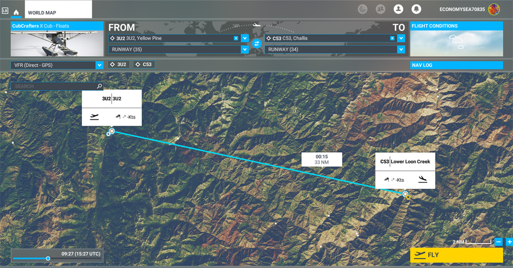
MSFS 2020 map for the flight 3U2 to C53 in United States
The challenging virtual flight is from Johnson Creek Airport (3U2) to the Lower Loon Creek Airstrip (C53) in the United States, using the MSFS 2020 flight simulator. The software map shows the type of aircraft chosen, a CubCrafters X Cub on floats, as well as the trajectory over the Idaho mountains.
The idea of using an amphibious aircraft for this flight is a bit far-fetched, but the goal is to make the pilot’s job a little more difficult by adding weight to the aircraft.
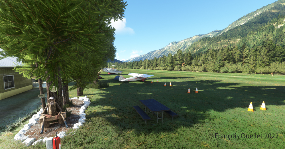
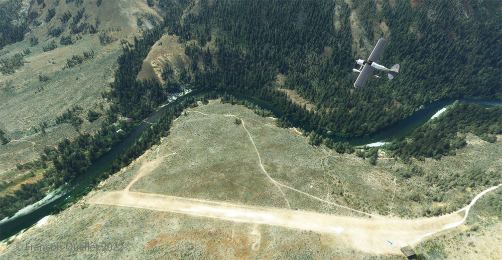
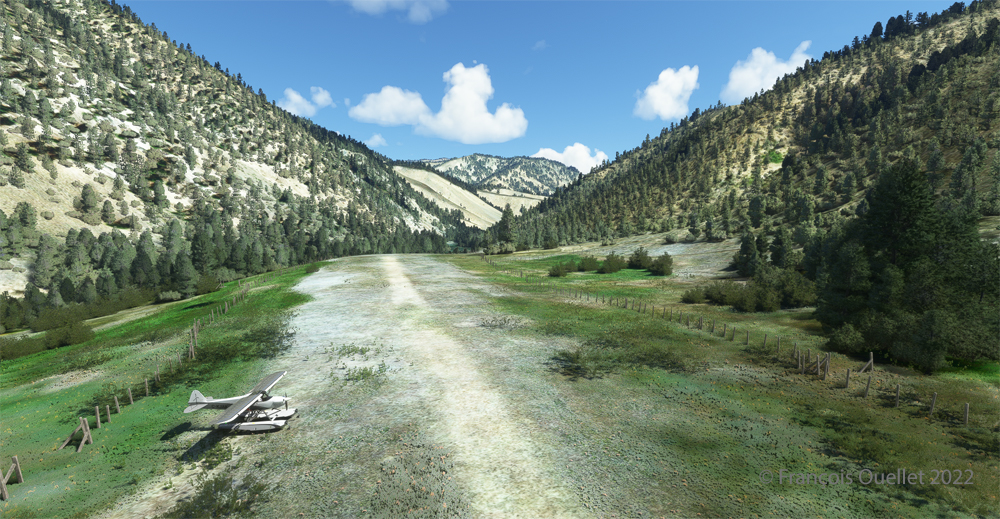
Johnson Creek (Yellow Pine) airport 3U2 with MSFS 2020
Johnson Creek Airport (3U2) is a creation of Creative Mesh. It is charming, with tents here and there planted near the planes. The runway is 3480 feet long by 150 feet wide. It is oriented on a 17/35 axis and still quite high at 4960 feet above sea level (MSL).
Amphibian CubCrafters X Cub ready for departure at the Johnson Creek 3U2 virtual airport with MSFS 2020.
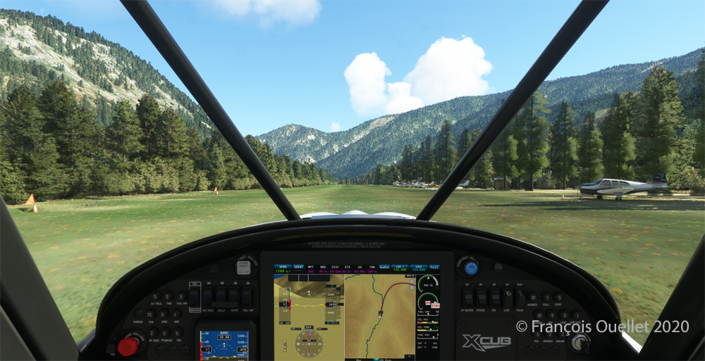
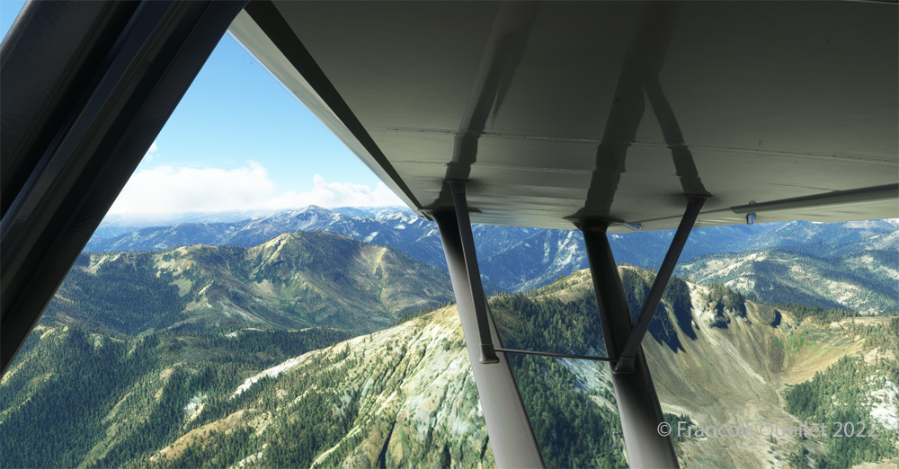
Given the departure altitude, one must not forget to adjust the air/fuel mixture so as not to lose power on takeoff, especially since there is a mountain at the end of the runway and the floats increase the weight of this small aircraft. The air is also thinner as the flight takes place in summer and at a high altitude; this represents another obstacle to the aircraft’s performance.
Avoiding obstacles after take-off from the 3U2 Johnson Creek virtual airport using MSFS 2020.
The mountains near the runway present a significant obstacle. The virtual pilot must use the best possible angle of climb without worrying about the route recommended by the GPS. The flaps are kept slightly extended during the initial climb.
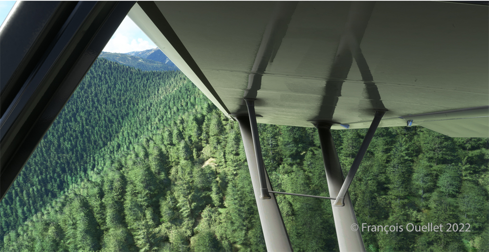
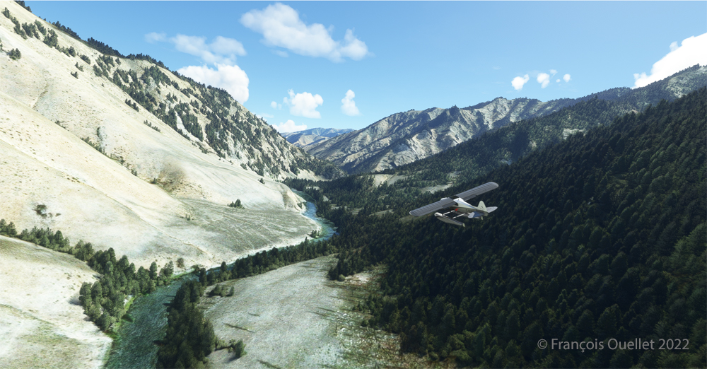
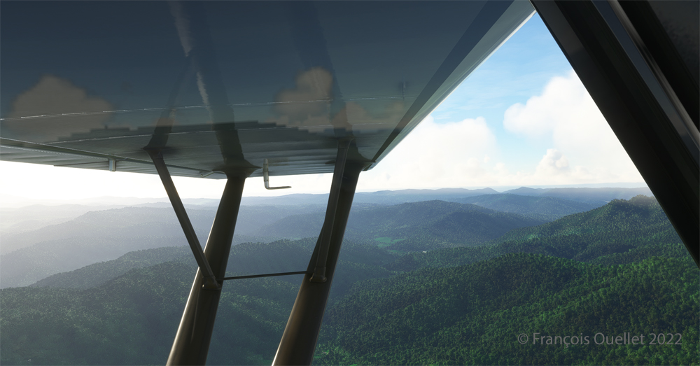
Flying over the Idaho mountains in flight simulation with MSFS 2020.
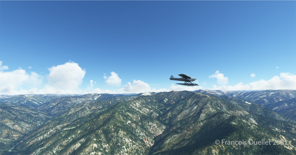
Once at a safe altitude and back on the GPS suggested route, the view of Idaho’s spectacular mountains is more enjoyable. Throughout the climb, the air-fuel mixture and altimeter (“B” on MSFS 2020) have to be adjusted.
CubCrafters X Cub floatplane over the Idaho mountains in flight simulation MSFS 2020
An altitude of almost 10,000 feet ASL makes it possible to fly over the mountains without risk of collision.
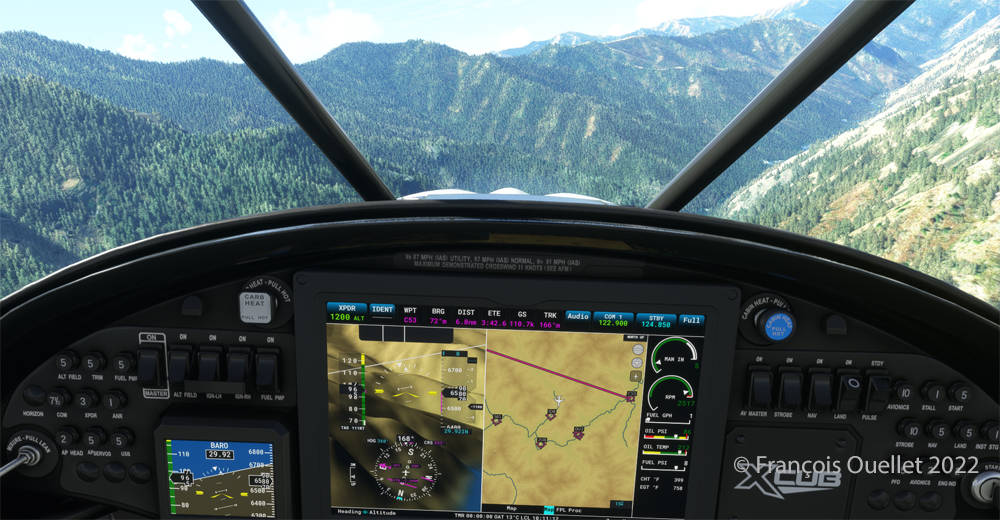
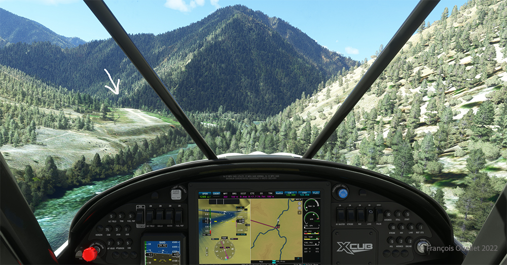
Descending in the valley towards the ID8 Marble Creek airport in Idaho in fligh simulation.
At the right moment, when the small surrounding airports and the river appear on the GPS, we leave our GPS road, until now in straight line, and we align in the valley to fly over the river until our destination, avoiding the surrounding mountains. In the photo above, the descent has already begun, with a necessary gradual adjustment of the air-fuel mixture.
Flying over the (ID8) Marble Creek airport in Idaho using the MSFS 2020 flight simulator.
We fly over a first small airport. The picture above shows the planes parked on the runway of Marble Creek airport (ID8), which dimension is 1160 x 20 feet. For those which would be interested in trying a landing there, the orientation of the runway is 03/21 and the altitude of 4662 feet MSL.
Flying over the 2U8 Thomas Creek Airport in Idaho using the MSFS 2020 flight simulator.
On the way towards our final destination, we also fly at low altitude over the Thomas Creek (2U8).
Following the river towards the C53 Lower Loon Creek airstrip using the MSFS 2020 flight simulator.
The mountains on either side of the river require close attention, as the poor performance of a small aircraft equipped with floats does not allow for easy correction of navigational errors.
By the time the runway suddenly becomes visible, the plane will not be on course but 90 degrees off the ideal course. It will be necessary to quickly turn left into the valley, make a fairly sharp 180-degree turn to the right to avoid the mountains, and then get back on course to land. It is only at this point that the landing gear will be extended.
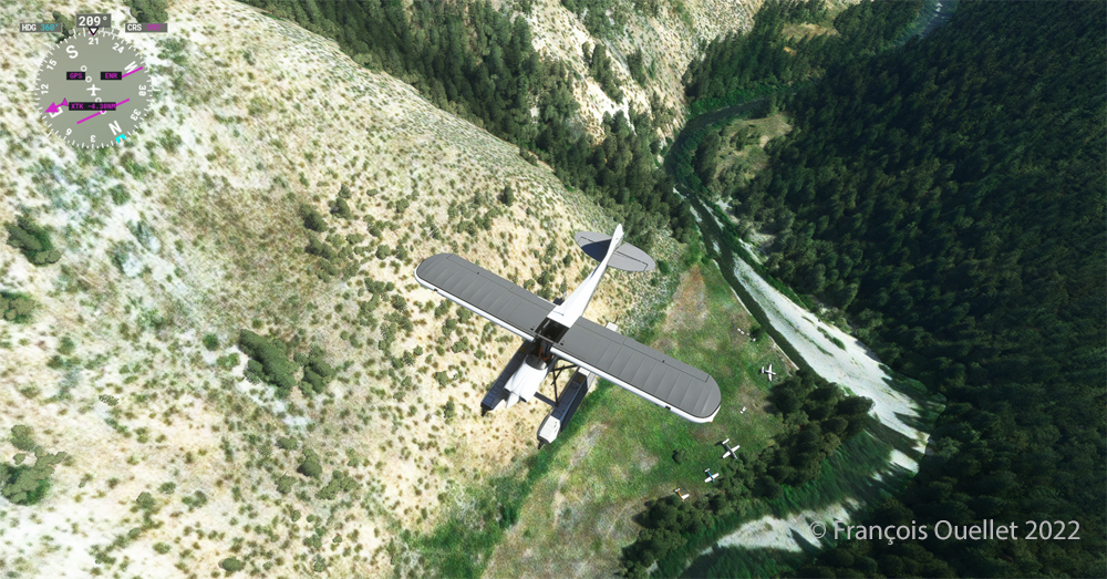
On final for Lower Loon Creek airstrip with MSFS 2020
The photo above shows the aircraft on final for the Lower Loon Creek dirt and grass runway (C53). It is located at 4084 feet MSL and is only 1200 feet long by 25 feet wide. Note that the approach should be made on runway 16 when possible.
Amphibian CubCrafters X Cub rolling down the C53 Lower Loon Creek airstrip in Idaho after landing.
As always, a stabilized aircraft on final makes landing easier, regardless of the conditions.
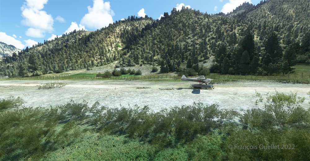
Amphibian CubCrafters X Cub parked at the C53 Lower Loon Creek airstrip using MSFS 2020 flight simulator.
We park the plane and rest a bit. Today, there is no one else here. But that’s not always the case in real life, as this video of a landing at Lower Loon Creek shows it.
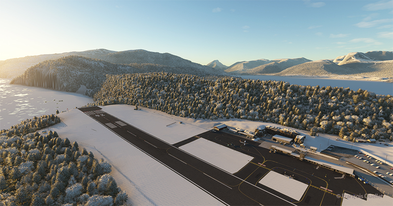
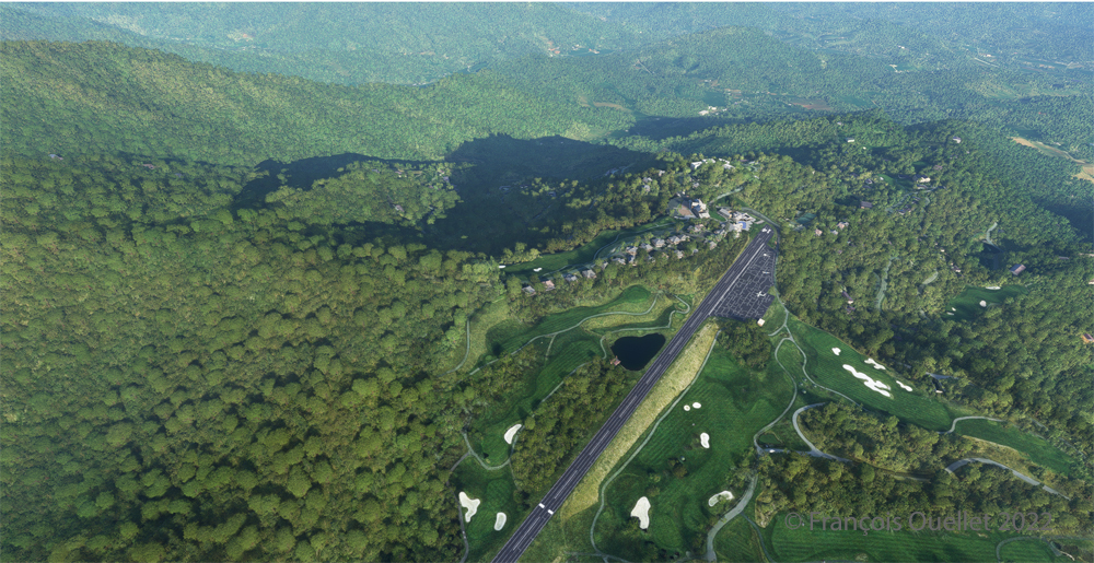
Ready for departure at the Elk River airport (NC06) created by Cloud Studio.
Today’s twenty-minute virtual flight is conducted using Microsoft MSFS 2020 flight simulation software. The virtual airport at Elk River (NC06) in the United States, modeled here by Pilot’s, is located at approximately 3468 feet (ft) above sea level (MSL). Its sloped 12/30 runway can accommodate many types of aircraft as its dimensions are still 4600 feet long by 75 feet wide. A golf course is located near the airport facilities.
The sloped runway of the Elk River airport (NC06) with the MSFS 2020 flight simulator.
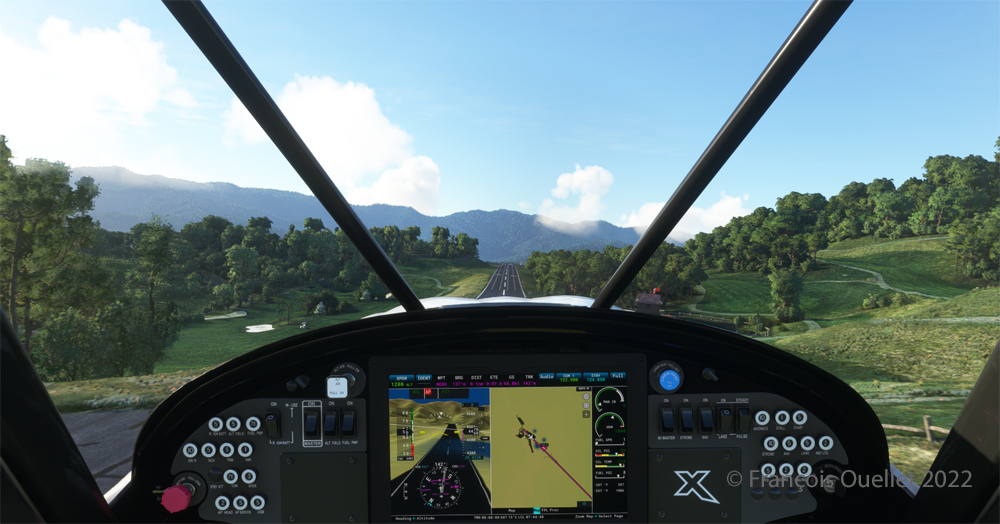
In the distance, the end of runway 30 can be seen rising rapidly. The trip to Mountain Air County Club Airport (2NC0), modeled by Cloud Studio, is made with a single engine Cubcrafters NX Cub.
Enroute towards the Mountain Air County Club (2NC0) airport from Elk River (NC06) with MSFS 2020.
In direct flight with GPS, the virtual pilot will have to climb at around 7000 feet msl to avoid the surrounding mountains. It is therefore important to adjust the air/fuel mixture during climb and descent for the destination. Also, don’t forget to adjust the altimeter (press “B”) as you move away from the point of departure. Near the summits, you will experience mechanical turbulence, which is normal.
Aerial view of the Mountain Air County Club (2NC0) airport created by Pilot’s.
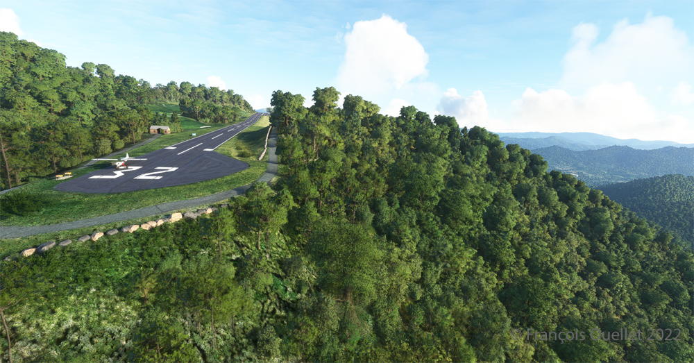
The photo above shows the virtual airport of Mountain Air County Club (2NC0) with the MSFS 2020 flight simulator. The sloped runway is 2900 feet long and only 50 feet wide. A golf course surrounds this airport located at 4432 feet MSL. Since the winds are light, the approach will be on runway 14.
On final for the sloped runway of the Mountain Air County Club (2NC0) airport using MSFS 2020.
On final approach, it is easy to see the uphill angle of this airstrip, which is slightly more damaged than the one at Elk River.
A view of the cliff at the threshold of runway 32 at the 2NC0 Mountain County Air Club airport created by Pilot’s pour MSFS 2020.
As we continue to taxi to the end of runway 14, we notice the cliff that awaits the pilot who has not properly prepared his landing. No forgiveness!
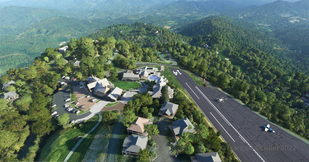
View from above of the Mountain Air County Club airport 2NC0 with the MSFS 2020 flight simulator.
An elevated view shows the threshold of runway 14 and the buildings associated with the golf club. A few golf loving pilots have already parked their aircraft to the left of runway 14. For this screenshot, I used the excellent X-BOX drone.
Buildings and flowers at the Mountain Air County Club airport (2NC0) created by Pilot’s for MSFS 2020.
A final photo shows the buildings and flowers associated with the golf club. The bird recordings are easily heard, which enhance the scene. Flight simulation enthusiasts wishing to repeat the experience should do so under VFR conditions to keep an eye on the mountain tops during the approach.
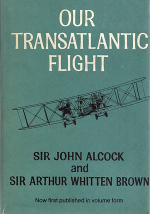
Our transatlantic flight, by Sir John Alcock and Sir Arthur Whitten Brown
Newfoundland
Before 1949, Newfoundland was called Dominion of Newfoundland and was part of the British Commonwealth . In 1949, it became a Canadian province.
The first non-stop flight eastward across the Atlantic.
The book « Our transatlantic flight » tells the story of the historic flight that was made in 1919, just after the First World War, from Newfoundland to Ireland. There was a 10,000 £ prize offered by Lord Northcliffe from Great Britain for whoever would succeed on the first non-stop flight eastward across the Atlantic.
A triumph for British aviation
Sir John Alcock and Sir Arthur Whitten Brown , respectively pilot and navigator, wrote the story of their successful flight in this book which was published in 1969. The followings are pilot quotes from the book : « For the first time in the history of aviation the Atlantic had been crossed in direct, non-stop flight in the record time of 15 hours, 57 minutes. » (p.13) « The flight was a triumph for British aviation; the pilot and navigator were both British, the aircraft was a Vickers-Vimy and the twin engines were made by Rolls-Royce. » (p.13)
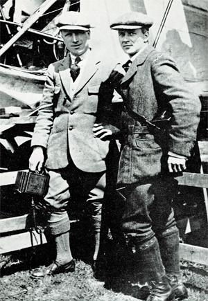
Sir John Alcock and Sir Arthur Whitten Brown
As with all great human achievements, a very good flight planning and some luck was needed to make this flight a success. If there was an engine failure during the flight, even if the planning was excellent, there was only one outcome : downward.
In order to make the flight, Alcock and Brown boarded a ship from England bound to Halifax. They then headed to Port aux Basques and finally arrived in St.John’s. There, they joined a small group of British aviators who had arrived a few days before and who were also preparing for the competition. « The evenings were mostly spent in playing cards with the other competitors at the Cochrane Hotel, or in visits to the neighbouring film theatres. St.John’s itself showed us every kindness. » (p.60)
Maritime transport was used to carry the Vickers-Vimy biplane to Newfoundland on May 4th. It was assembled in Newfoundland. « The reporters representing the Daily Mail, the New York Times, and the New York World were often of assistance when extra manpower was required. » (p.61).
While the aircraft was being built, there were more and more visiters coming to the site. Brown says : « Although we remained unworried so long as the crowd contented itself with just watching, we had to guard against petty damage. The testing of the fabric’s firmness with the point of an umbrella was a favourite pastime of the spectators […]. » (p.61)
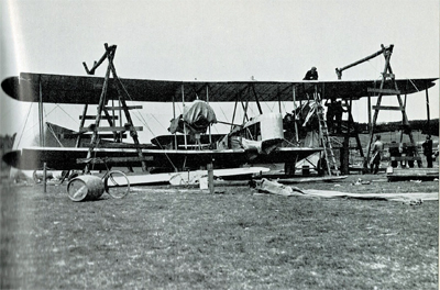
The Vickers-Vimy is being reassembled at Quidi Vidi in Newfoundland.
It was difficult to find a field that could be improvised into an aerodrome : « Newfoundland is a hospitable place, but its best friends cannot claim that it is ideal for aviation. The whole of the island has no ground that might be made into a first-class aerodrome. The district around St.John’s is especially difficult. Some of the country is wooded, but for the most part it shows a rolling, switchback surface, across which aeroplanes cannot taxi with any degree of smoothness. The soil is soft and dotted with boulders, as only a light layer covers the rock stratum. Another handicap is the prevalence of thick fogs, which roll westward from the sea. » (p.59)
They flight tested the airplane on June 9th at Quidi Vidi. During the short flight, the crew could see icebergs near the coast. They did a second trial on June 12th and found that the transmitter constantly caused problems. But, at least, the engines seemed to be reliable…
The departure
The two men left Newfoundland on June 14th 1919. In order to fight the cold air in flight, they wore electrically heated clothing. A battery located between two seats provided for the necessary energy.
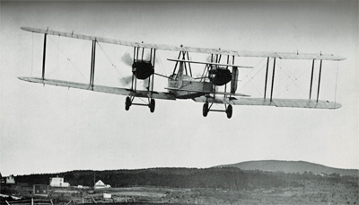
The Vickers-Vimy departs from Newfoundland in 1919
The short take-off was very difficult due to the wind and the rough surface of the aerodrome. Brown writes : « Several times I held my breath, from fear that our under-carriage would hit a roof or a tree-top. I am convinced that only Alcock’s clever piloting saved us from such an early disaster. » (p.73)
It took them 8 minutes to reach 1000 ft. Barely one hour after departure and once over the ocean, the generator broke and the flight crew was cut off from all means of communication.
As the airplane consumed petrol, the centre of gravity changed and since there was no trim on the machine, the pilot had to exert a permanent backward pressure on the joystick.
Flying in clouds, fog and turbulence.
During the flight with much clouds and fog, Brown, having almost no navigation aid, had real problems to estimate the aircraft’s position and limit the flying errors. He had to wait for a higher altitude and for the night to come to improve his calculations : « I waited impatiently for the first sight of the moon, the Pole Star and other old friends of every navigator. » (p.84). The fog and clouds were so thick that at times they « cut off from view parts of the Vickers-Vimy. » (p.95)
Without proper instruments to fly in clouds, they were relying on a « revolution-counter » to establish the climbing or the falling rate. That is pretty scary. « A sudden increase in revolutions would indicate that the plane was diving; a sudden loss of revs would show that she was climbing dangerously steeply. » (p.176)
But that was not enough. They also had to deal with turbulence that rocked the plane while they could not see anything outside. They became desoriented : « The airspeed indicator failed to register, and bad bumps prevented me from holding to our course. From side to side rocked the machine, and it was hard to know in what position we really were. A spin was the inevitable result. From an altitude of 4,000 feet we twirled rapidly downward.[…]. « Apart from the changing levels marked by aneroid, only the fact that our bodies were pressed tightly against the seats indicated that we were falling. How and at what angle we were falling, we knew not. Alcock tried to centralise the controls, but failed because we had lost all sense of what was central. I searched in every direction for an external sign, and saw nothing but opaque nebulousness. » (p.88)
« It was a tense moment for us, and when at last we emerged from the fog we were close down over the water at an extremely dangerous angle. The white-capped waves were rolling along too close to be comfortable, but a quick glimpse of the horizon enabled me to regain control of the machine. » (p.40).
De-icing a gauge installed outside of the cockpit.
Snow and sleet were falling. They didn’t realize how lucky they were to continue flying in such a weather. Nowadays, there are many ways to dislodge ice from a wing while the aircraft is in flight. Here is what Brown says about their situation : « […] The top sides of the plane were covered completely by a crusting of frozen sleet. The sleet imbedded itself in the hinges of the ailerons and jammed them, so that for about an hour the machine had scarcely any lateral control. Fortunately, the Vickers-Vimy possesses plenty of inherent lateral stability; and, as the rudder controls were never clogged by sleet, we were able to hold to the right direction. » (p.95)
After twelve hours of flying, the glass of a gauge outside the cockpit became obscured by clotted snow. Brown had to deal with it, while Alcock was flying. « The only way to reach it was by climbing out of the cockpit and kneeling on top of the fuselage, while holding a strut for the maintenance of balance. […] The violent rush of air, which tended to push me backward, was another discomfort. […] Until the storm ended, a repetition of this performance, at fairly frequent intervals, continued to be necessary. » (p.94)
In order to save themselves, they executed a descent from 11,000 to 1000 feet and in the warmer air the ailerons started to operate again. As they continued their descent below 1000 feet over the ocean, they were still surrounded by fog. They had to do some serious low altitude flying : « Alcock was feeling his way downward gently and alertly, not knowing whether the cloud extended to the ocean, nor at what moment the machine’s undercarriage might touch the waves. He had loosened his safety belt, and was ready to abandon ship if we hit the water […]. » (p.96)
The arrival.
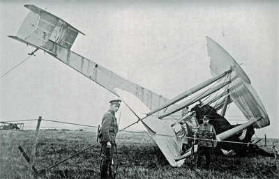
They saw Ireland at 8.15 am on June 15th and crossed the coast ten minutes later. They did not expect a very challenging landing as the field looked solid enough to support an aircraft. They landed at 8 :40 am at Clifden on top of what happened to be a bog; the aircraft rolled on its nose and suffered serious material damages. The first non-stop transatlantic flight ended in a crash. Both both crewmen were alive and well, although they were dealing with fatigue…
The transatlantic flight ends up in Ireland in a soft field
Initially, nobody in Ireland believed that the plane arrived from North America. But when they saw mail-bags from Newfoundland, there were « cheers and painful hand-shakes » (p.102).
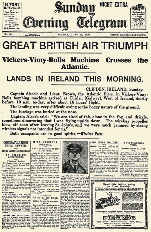
First page of the Sunday Evening Telegraph in 1919.
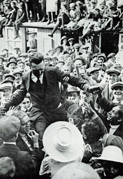
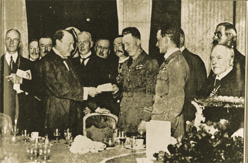
They were cheered by the crowds in Ireland and England and received their prize from Winston Churchill.
John Alcock chaired by the crowd
Winston Churchill is presenting the Daily Mail Check to the two pilots.
Their record stood unchallenged for eight years until Lindbergh’s flight in 1927.
The future of transatlantic flight.
Towards the end of the book, the authors risk a prediction on the future of transatlantic flight. But aviation made such a progress in a very short time that, inevitably, their thoughts on the subject was obsolete in a matter of a few years. Here are some examples :
« Nothwithstanding that the first two flights across the Atlantic were made respectively by a flying boat and an aeroplane, it is evident that the future of transatlantic flight belongs to the airship. » (p.121)
« […] The heavy type of aeroplane necessary to carry an economical load for long distances would not be capable of much more than 85 to 90 miles an hour. The difference between this and the present airship speed of 60 miles an hour would be reduced by the fact that an aeroplane must land at intermediate stations for fuel replenishment. » (p.123)
« It is undesirable to fly at great heights owing to the low temperature; but with suitable provision for heating there is no reason why flying at 10,000 feet should not be common. » (p.136)
The Air Age.
There is a short section in the book on the « Air Age ». I chose two small excerpts on Germany and Canada :
On Germany’s excellent Zeppelins : « The new type of Zeppelin – the Bodensee – is so efficient that no weather conditions, except a strong cross-hangar wind, prevents it from making its daily flight of 390 miles between Friedrichshafen and Staalsen, thirteen miles from Berlin. » (p.140)
On Canada’s use of aeroplanes : « Canada has found a highly successful use for aeroplanes in prospecting the Labrador timber country. A group of machines returned from an exploration with valuable photographs and maps of hundreds of thousands of pound’s worth of forest land. Aerial fire patrols, also, are sent out over forests.» (p.142) and « Already, the Canadian Northwest Mounted Police [today the RCMP] have captured criminals by means of aeroplane patrols. » (p.146)
Conclusion
The Manchester Guardian stated, on June 16th 1919 : « […] As far as can be foreseen, the future of air transport over the Atlantic is not for the aeroplane. It may be used many times for personal feats of daring. But to make the aeroplane safe enough for business use on such sea routes we should have to have all the cyclones of the Atlantic marked on the chart, and their progress marked in from hour to hour. »(p.169)
Title : Our Transatlantic Flight
Authors : Sir John Alcock and Sir Arthur Whitten Brown
The reason for the delays and the positive side for the consumers
A virtual Bombardier regional jet CRJ-900ER (Aerosoft) with the Alaska Airlines colors is climbing after its departure from the Valdez virtual airport in Alaska (ORBX).
Digital Aviation & Aerosoft have finally completed their long awaited project to make a virtual CRJ-900ER and CRJ-700ER Bombardier regional jets. Months later than expected, the flight simulation enthusiasts can now try those two new virtual aircrafts. The CRJ is mostly used to link smaller airports and remote areas to the main hubs. The aircraft can rapidly reach its cruising altitude and stay there a long time, but it is not intended to be a really fast aircraft.
The company explains that, since the beginning, it had underestimated the complexity of the project and, because of ongoing delays, ended up having to catch up with the competition. In order to offer a superior product than the competition, Digital Aviation and Aerosoft had to review what it initially considered as an almost completed project.
Virtual CRJ-700ER aircraft (Aerosoft) with the Alaska Airlines colors airborne from the Valdez virtual airport (ORBX)
The CRJ-900ER and CRJ-700ER had their exterior almost completely redone; the consumer now ends up with a much better looking aircraft. The project manager says that it is only due to the patience and kindness of potential customers that the project was saved. It pays to be nice!
The first flight with the CRJ
Virtual CRJ-900ER aircraft with the Air Nostrum colors departing the St. Maarten international airport (Fly Tampa St.Maarten)
For the first flight, the manual recommends to first choose and activate one of the default FSX aircraft with the engine running. The pilot then selects the CRJ of his choice. It seems that doing so will prevent a lot of problems.
The virtual 2D cockpit
The virtual 2D cockpit helps save a few FPS. An easy access to the different sections of the cockpit is available since it is divided in several logical panels numbered from 1 to 9.
Navigation
The virtual pilot has access to an updated NavDataPro (May 2017) database for air navigation. It is the world’s most used database in aircraft. The aircraft is also compatible with the popular Navigraph database.
How does a standard computer deals with the new CRJ?
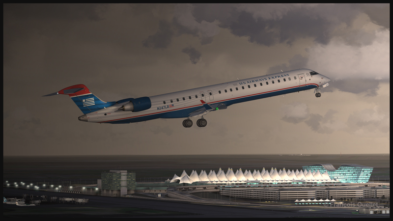
Virtual CRJ-900ER aircraft (Aerosoft) with the U.S. Airways colors airborne from the Denver International airport (Flightbeam Studios)
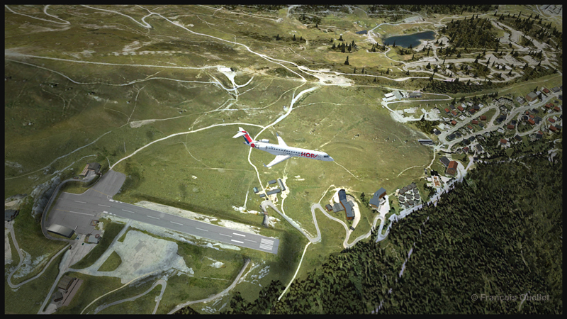
I have flown both aircrafts on several virtual airports like St. Maarten (Fly Tampa St. Maarten), Montreal international (Fly Tampa Montreal), Denver international (Flightbeam Studios) and Valdez (ORBX) without problems with regards to the computer’s processors and FPS. It was certainly out of question to try to land at the Courchevel airport (LLH Creations), with its short sloped runway, but a low pass at high speed caused no stutters.
A virtual CRJ-700ER aircraft (Aerosoft) with the Air France HOP colors is in flight over the Courchevel virtual airport in France (LLH Creations)
Flying the CRJ at low speed
The CRJ offers a good margin of manoeuver when it comes to flying at low speed. But due to the position of the engines, the aircraft’s nose will raise rapidly when the throttle is brought back to idle. In a constant and progressive descent, that does not cause a problem. But if the manoeuver is done on short final when the aircraft is still above 50 feet, the rapid change in the aircraft’s attitude could induce a stall.
The air brakes
One cannot rely too much on the air brakes to slow down the CRJ. They have limited efficiency, both for the virtual and the real aircraft.
Floating tendency
If the aircraft arrives over the threshold at a higher speed than recommended, it will float for a long distance before finally touching down.
Landing and take-off distances
A virtual CRJ-900ER aircraft with the Air Canada colours (Aerosoft) is approaching the Montreal Pierre-Elliott-Trudeau virtual airport (Fly Tampa Montreal)
The CRJ-900 and CRJ-700 operate on relatively short runways. The CRJ-700 needs 5040 feet for take-off (at maximum weight) and landing, under the standard ICAO conditions. The CRJ-900 requires 6060 feet for take-off and 5260 feet for landing. The maximum range has been established to be around 1300 and 1400 nm.
Managers that facilitate the use of the CRJ
For the CRJ, Digital Aviation & Aerosoft have created managers that allow choosing the number of passengers, cargo, as well as calculating the fuel weight, the center of gravity and the amount of trim required. There is even a FS2 Crew option if desired. Another manager facilitated the addition of liveries.
The flight simulation enthusiasts had been anticipating the arrival of that regional jet for a long time; some did not believe anymore that it would one day become a reality (that includes the company too!). The flight simmers now have access to a world class and high quality regional jet.
For more articles on flight simulation on my web site, click on the following link : Flight simulation
The flight simulator enthousiast will have fun trying this short flight ( 14 minutes) from the Eagle County virtual airport (KEGE) to the Telluride virtual airport (KTEX). The virtual flight, using FSX, was made during winter, on January 8th. The shots below represent an idea of what is visible while flying toTelluride. Use 14,000 feet, it should do it…
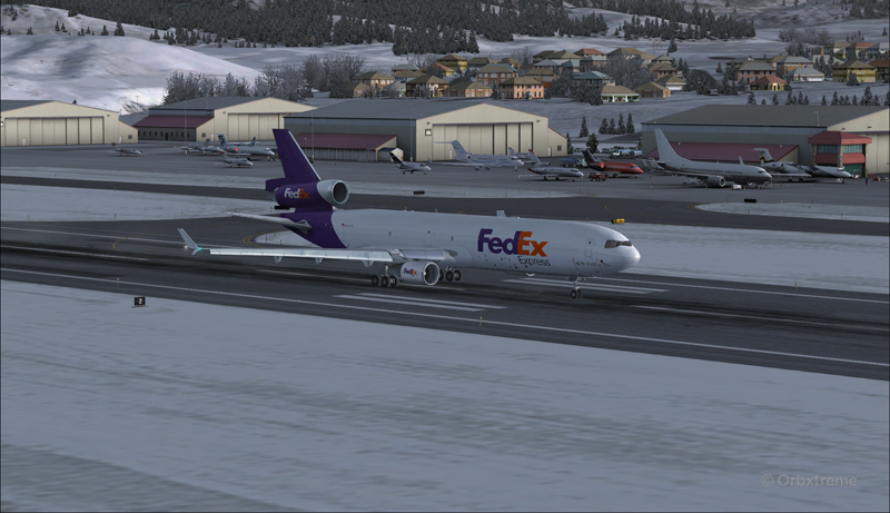
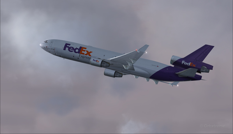
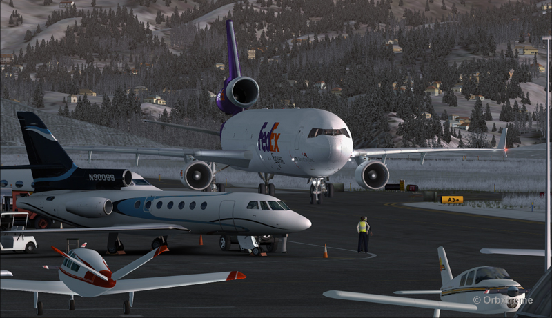
FedEx MD-11 on the take-off run at the Eagle County airport (KEGE) (FSX)
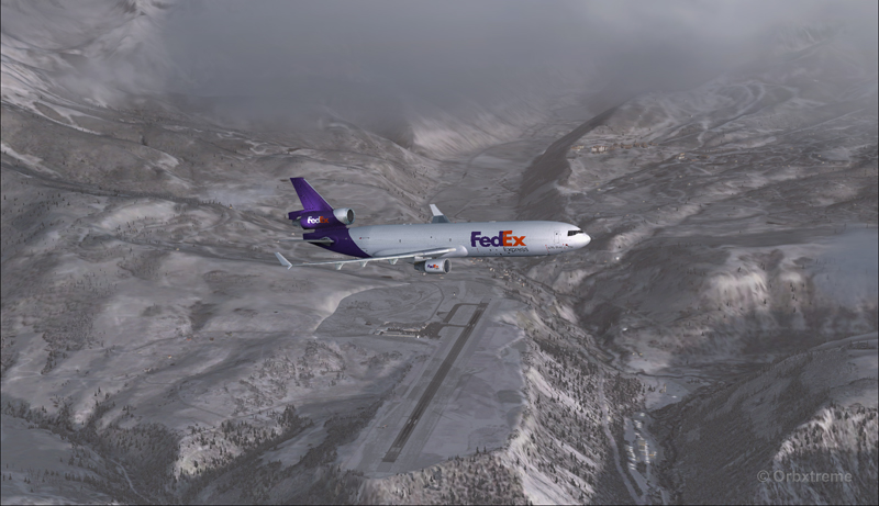
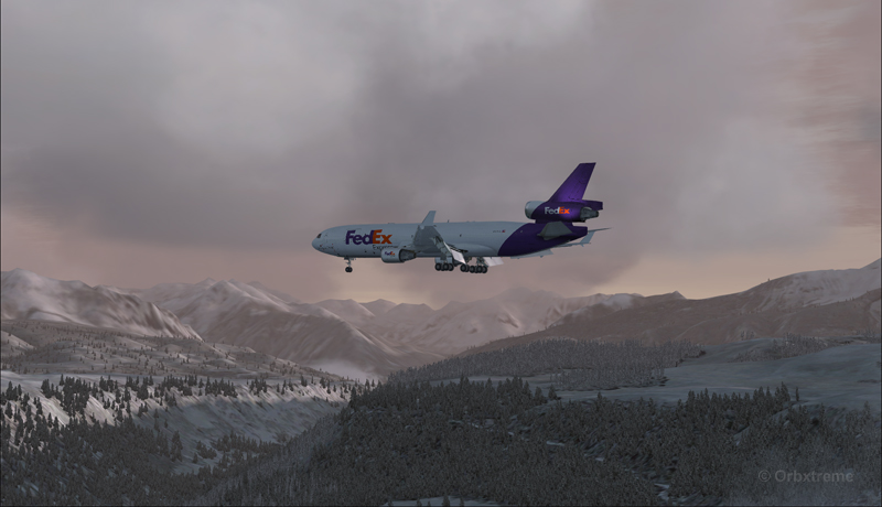
FedEx MD-11 airborne from the Eagle County airport (KEGE) (FSX)
FedEx MD-11 between Eagle County airport (KEGE) and Telluride airport (KTEX) (FSX)
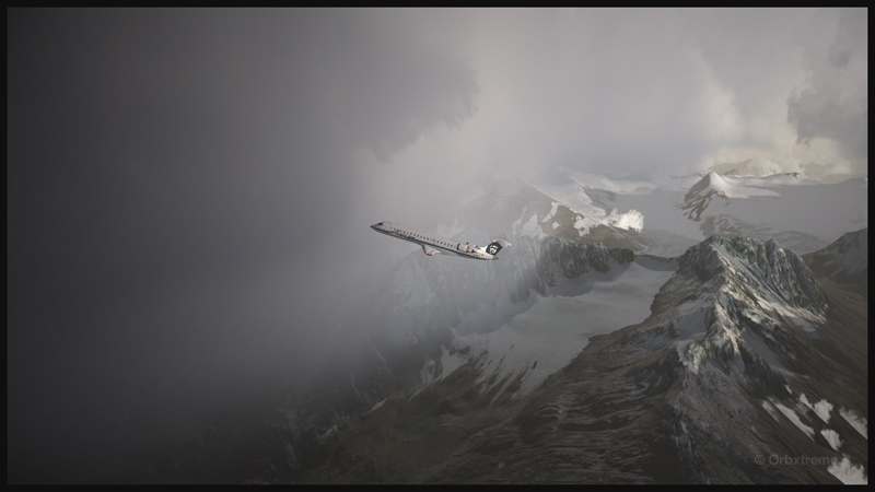
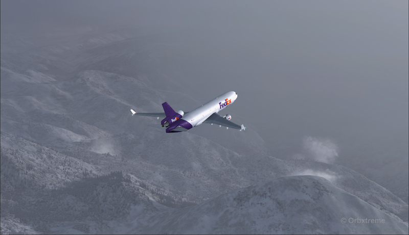
There are lots of beautiful mountains between KEGE and Telluride, and also some unpredictable weather…
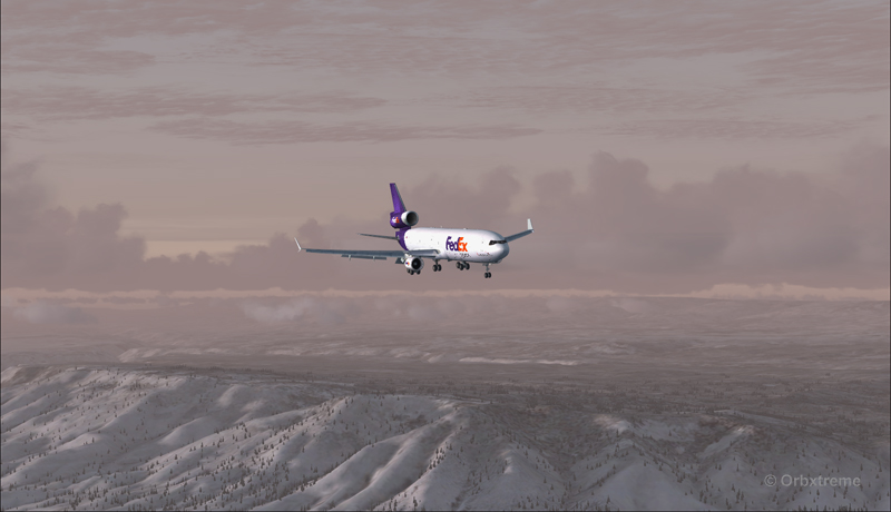
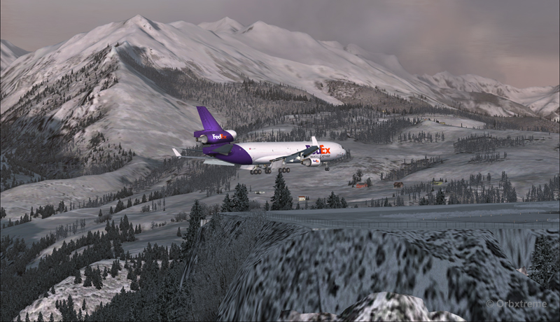
FedEX Md-11 entering bad weather
The expected ceiling at Telluride was 8500 ft. On the way to the airport, the clouds and visibility were sometimes obscuring the mountains.
A FedEx MD-11 on a flight Eagle County (KEGE) to Telluride (KTEX) (FSX)
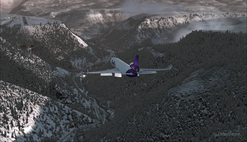
Telluride is a very inviting airport for a MD-11. The 7000 feet runway itself does not represent a big challenge, although its 100 feet are a bit narrow: this aircraft would normally require a 150 feet wide landing surface.
The virtual VFR approach made with the MD-11 was the most expensive way to do the trip, since it required a fly-by and a 270 degree turn to the right to align with runway 09.
FedEx MD-11 flies by the Telluride airport KTEX) (FSX)
The 270 degree turn at a 10-20 degree bank allowed to transit from 14,000 to 10,000 ft without doing anything radical. Just a turn while descending and gradually loosing speed to arrive at around 160 kts on final. The aircraft was now installed on long final, with flaps set at 50 degrees.
A FedEx MD-11 on long final runway 09 for the Telluride airport (KTEX) (FSX)
The high altitude runway’s 9078 feet msl elevation meant the pilots dealt with lower air density and heavy weight when approaching and, as such, the airspeed had to be adjusted accordingly to prevent stalling on final.
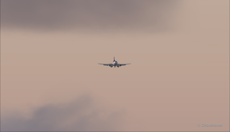
A FedEx MD-11 on final runway 09 for the Telluride airport (KTEX) (FSX)
Here is a view from the Telluride tower…
View from the Telluride airport (KTEX) (FSX) of a FedEx MD-11 on final for runway 09
Now with a view like that, you would not consider coming in IFR…!
A FedEx MD-11 inbound from KEGE on final for runway 09 at the Telluride airport (KTEX) (FSX)
To prevent an overshoot and some additional expenses in fuel (which are already skyrocketing), an optimal approach was required.
Most accidents with the MD-11 happen when the pilot pushes on the stick when there is a rebound with the nose wheel, thus creating an even stronger rebound. When there is a rebound, there is no need to push on the stick, just wait and the aircraft sets itself quickly.
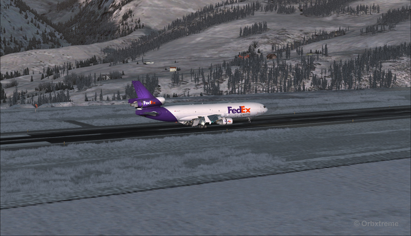
A FedEx MD-11 over the threshold runway 09 at the Telluride airport (KTEX) (FSX)
Now with max breaking and thrust reversers…
A FedEX MD-11 slowing down at the Telluride airport (KTEX) (FSX)
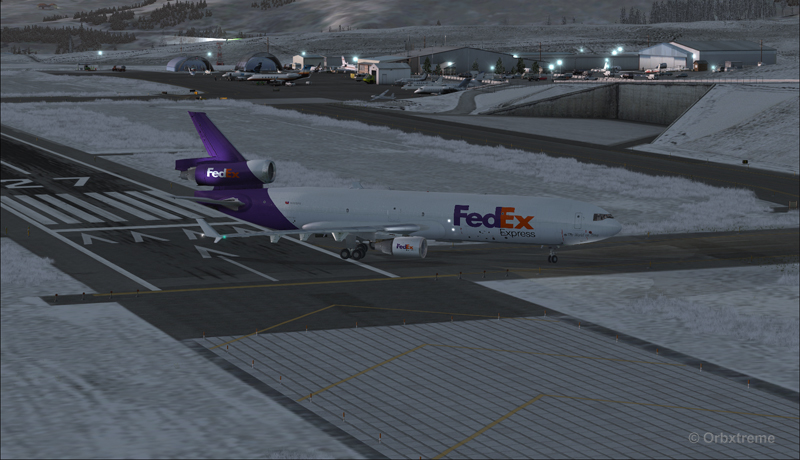
The MD-11 can easily turn at the first taxiway at Telluride. But in order to capture a wider view of the airport, I exited at the last taxiway (again adding to the already enormous expense in fuel…)
A FedEX Md-11 is exiting runway 09 at the Telluride airport (KTEX) (FSX)
The employee on the ramp was worried that the MD-11 lower winglet would scratch N900SS while taxiing. But there was plenty of space (11 inches)…
A FedEX Md-11 is taxiing on the ramp at the Telluride airport (KTEX) (FSX)
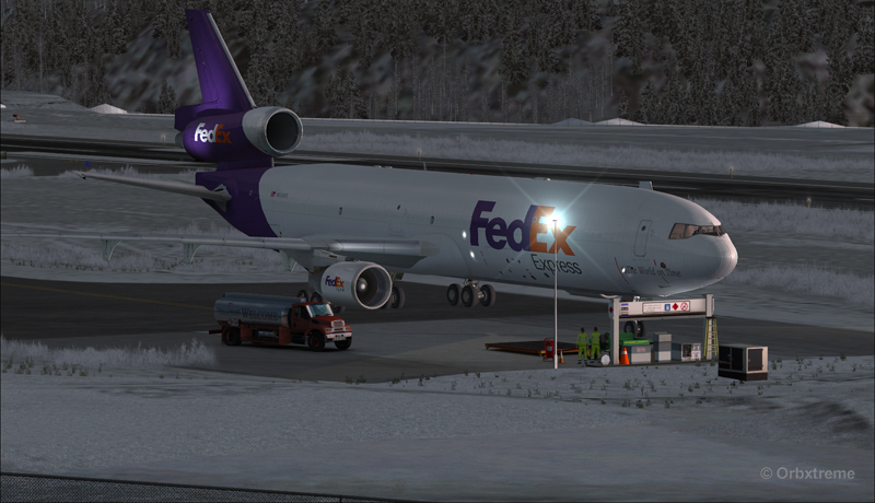
The MD-11 was parked temporarily in a spot needed by every aircraft. It was necessary to unload quickly the precious cargo and get out of the way.
Temporary parking for a FedEx MD-11 at the Telluride airport (KTEX) (FSX)
Some expert handling would be needed to help move back that MD-11 close to the runway. But that was the Telluride’s airport manager problem and he had promised he would have something ready!
FedEx Md-11 parked at the Telluride airport (KTEX) (FSX)
The virtual scenery from departure to destination is a creation of ORBX programmers and the virtual MD-11 is made by PMDG Simulations (I am not sure it works with P3D though). For the weather, I used REX Simulations as the weather engine and REX and Cumulus X for the cloud textures. (Edit: PMDG does not support it’s MD-11 anymore).
For other challenging virtual flights, head towards the flight simulation section of my web site, under “challenging virtual flights”: there is something for everyone!
For more articles on flight simulation on my web site, click on the following link : Flight simulation
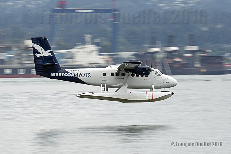
Westcoast Air Twin Otter floatplane C-FGQH arriving in Vancouver Harbour, in British-Columbia, during Summer 2016. The photo was taken with a Canon 5DSR camera.
The picture above was taken in British Columbia, during summer 2016, with a Canon 5DSR full-frame camera equipped with a Canon 70-200 f2.8L IS II USM telephoto lens.
A Westcoast Air (C-FGQH) Twin Otter floatplane (DHC-6) was about to land in the Vancouver Harbour. It is obvious that adjusting the shutter speed to 1/1200 would have given enough speed to obtain a clear image. But this would have taken away any movement sensation by freezing the propellers and background.
The shutter speed had to be slow enough to allow the rotation of propellers. It is clear that an aircraft’s propeller rotates more slowly on final for landing than during take-off. So the camera had to be adjusted for a shutter speed varying between 1/40 and 1/125.
A slower shutter speed increases the risk of getting a blurred photo, especially when the photograph must move with the camera to obtain the desired effect of movement. The fact that a telephoto lens is used also increases the possibility of a blurred picture. It is thus imperative to activate the stabilizer and horizontal panning function of the telephoto lens.
To obtain a background without any precise details, the camera is panning and follows exactly the aircraft’s movement. This requires a progressive acceleration of the panning, according to the aircraft’s position from the photographer.
When the Twin Otter gets closer, things get a bit more complicated as everything speeds up. It is necessary to already have positioned the feet in the appropriate direction in order to avoid a major switch in the body’s posture. The slightest useless or brisk movement would immediately be visible on the photo.
With a bit of practice, a photographer will achieve success by respecting the following elements: a shutter speed between 1/40 and 1/125, an appropriate position of the feet, no brisk movement while pivoting and a progressive acceleration of the body’s rotation aligned with the aircraft’s speed. A slower shutter speed will enhance the aircraft movement. But expect more blurred pictures when working with speeds between 1/40 and 1/60.
A last detail: as soon as the aircraft’s floats touch the water, the deceleration starts. The photographer’s pivoting speed must immediately slow down otherwise the photo will be blurred.