The flight simulator enthousiast will have fun trying this short flight ( 14 minutes) from the Eagle County virtual airport (KEGE) to the Telluride virtual airport (KTEX). The virtual flight, using FSX, was made during winter, on January 8th. The shots below represent an idea of what is visible while flying toTelluride. Use 14,000 feet, it should do it…
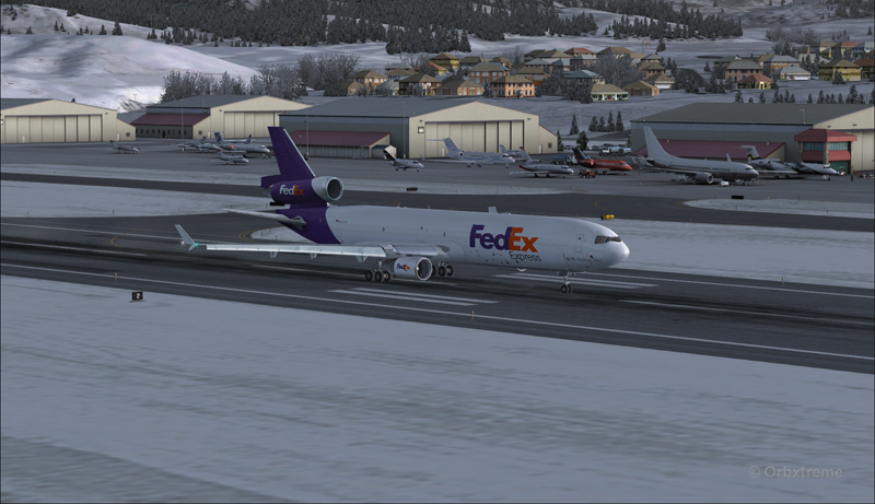
FedEx MD-11 on the take-off run at the Eagle County airport (KEGE) (FSX)
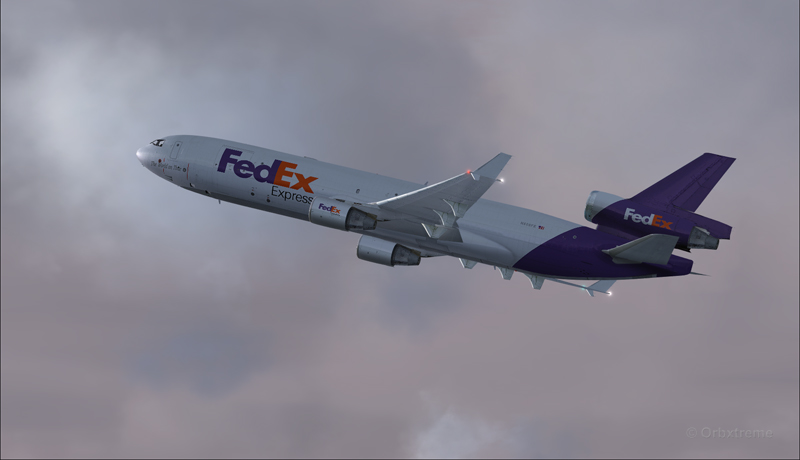
FedEx MD-11 airborne from the Eagle County airport (KEGE) (FSX)
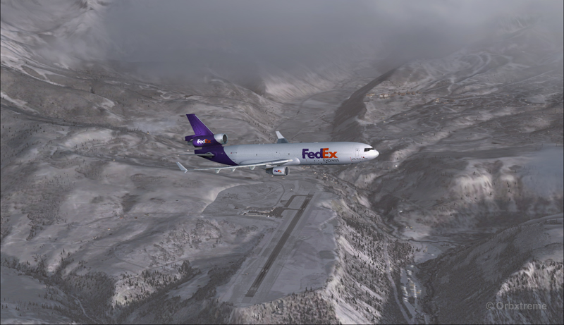
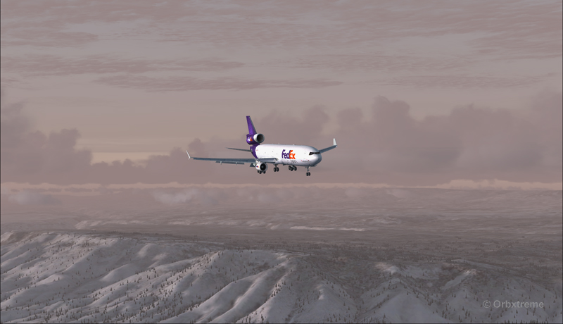
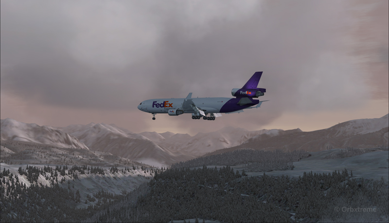
FedEx MD-11 between Eagle County airport (KEGE) and Telluride airport (KTEX) (FSX)
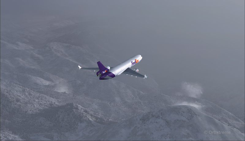
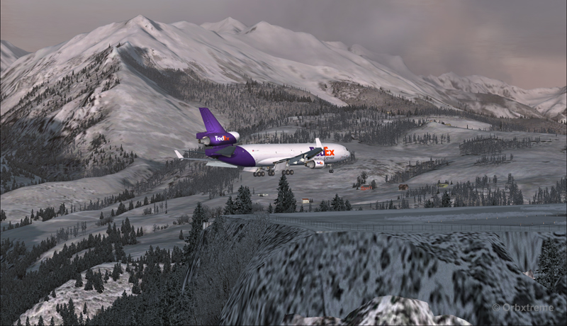
There are lots of beautiful mountains between KEGE and Telluride, and also some unpredictable weather…
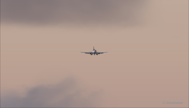
FedEX Md-11 entering bad weather
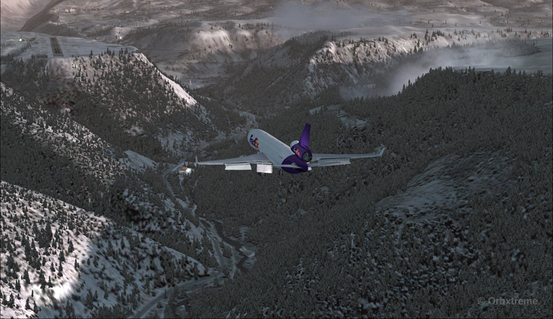
The expected ceiling at Telluride was 8500 ft. On the way to the airport, the clouds and visibility were sometimes obscuring the mountains.
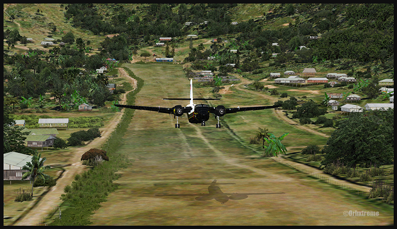
A FedEx MD-11 on a flight Eagle County (KEGE) to Telluride (KTEX) (FSX)
Telluride is a very inviting airport for a MD-11. The 7000 feet runway itself does not represent a big challenge, although its 100 feet are a bit narrow: this aircraft would normally require a 150 feet wide landing surface.
The virtual VFR approach made with the MD-11 was the most expensive way to do the trip, since it required a fly-by and a 270 degree turn to the right to align with runway 09.
FedEx MD-11 flies by the Telluride airport KTEX) (FSX)
The 270 degree turn at a 10-20 degree bank allowed to transit from 14,000 to 10,000 ft without doing anything radical. Just a turn while descending and gradually loosing speed to arrive at around 160 kts on final. The aircraft was now installed on long final, with flaps set at 50 degrees.
A FedEx MD-11 on long final runway 09 for the Telluride airport (KTEX) (FSX)
The high altitude runway’s 9078 feet msl elevation meant the pilots dealt with lower air density and heavy weight when approaching and, as such, the airspeed had to be adjusted accordingly to prevent stalling on final.
A FedEx MD-11 on final runway 09 for the Telluride airport (KTEX) (FSX)
Here is a view from the Telluride tower…
View from the Telluride airport (KTEX) (FSX) of a FedEx MD-11 on final for runway 09
Now with a view like that, you would not consider coming in IFR…!
A FedEx MD-11 inbound from KEGE on final for runway 09 at the Telluride airport (KTEX) (FSX)
To prevent an overshoot and some additional expenses in fuel (which are already skyrocketing), an optimal approach was required.
Most accidents with the MD-11 happen when the pilot pushes on the stick when there is a rebound with the nose wheel, thus creating an even stronger rebound. When there is a rebound, there is no need to push on the stick, just wait and the aircraft sets itself quickly.
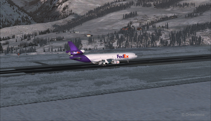
A FedEx MD-11 over the threshold runway 09 at the Telluride airport (KTEX) (FSX)
Now with max breaking and thrust reversers…
A FedEX MD-11 slowing down at the Telluride airport (KTEX) (FSX)
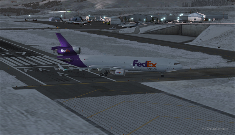
The MD-11 can easily turn at the first taxiway at Telluride. But in order to capture a wider view of the airport, I exited at the last taxiway (again adding to the already enormous expense in fuel…)
A FedEX Md-11 is exiting runway 09 at the Telluride airport (KTEX) (FSX)
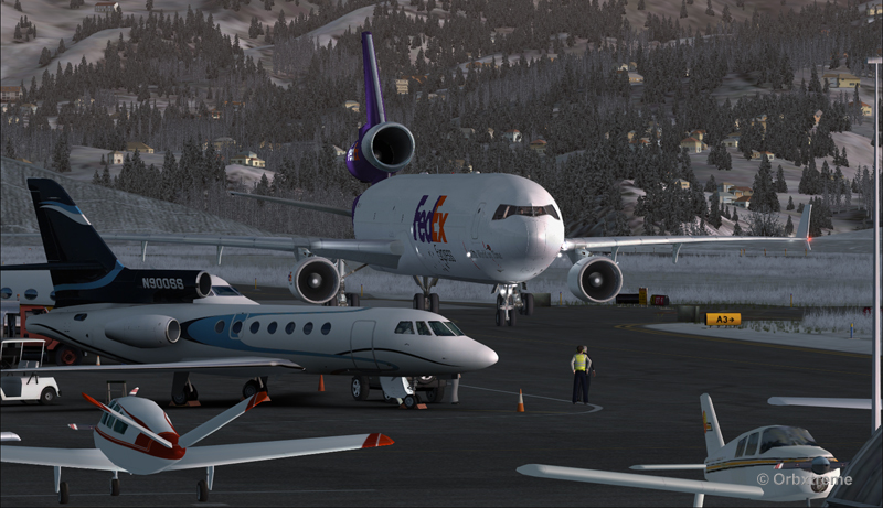
The employee on the ramp was worried that the MD-11 lower winglet would scratch N900SS while taxiing. But there was plenty of space (11 inches)…
A FedEX Md-11 is taxiing on the ramp at the Telluride airport (KTEX) (FSX)
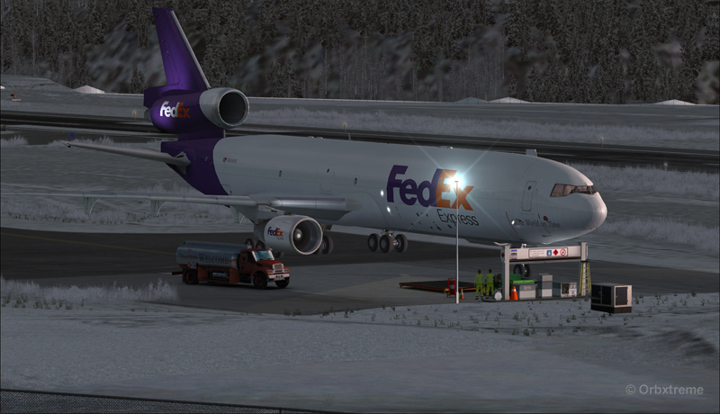
The MD-11 was parked temporarily in a spot needed by every aircraft. It was necessary to unload quickly the precious cargo and get out of the way.
Temporary parking for a FedEx MD-11 at the Telluride airport (KTEX) (FSX)
Some expert handling would be needed to help move back that MD-11 close to the runway. But that was the Telluride’s airport manager problem and he had promised he would have something ready!
FedEx Md-11 parked at the Telluride airport (KTEX) (FSX)
The virtual scenery from departure to destination is a creation of ORBX programmers and the virtual MD-11 is made by PMDG Simulations (I am not sure it works with P3D though). For the weather, I used REX Simulations as the weather engine and REX and Cumulus X for the cloud textures. (Edit: PMDG does not support it’s MD-11 anymore).
For other challenging virtual flights, head towards the flight simulation section of my web site, under “challenging virtual flights”: there is something for everyone!
For more articles on flight simulation on my web site, click on the following link : Flight simulation
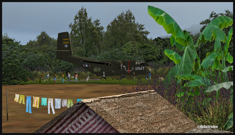
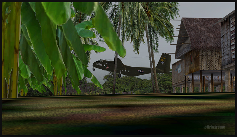
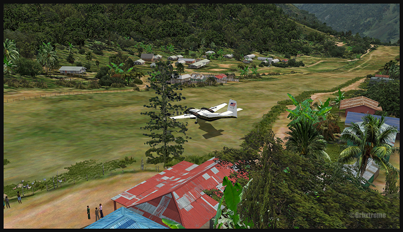
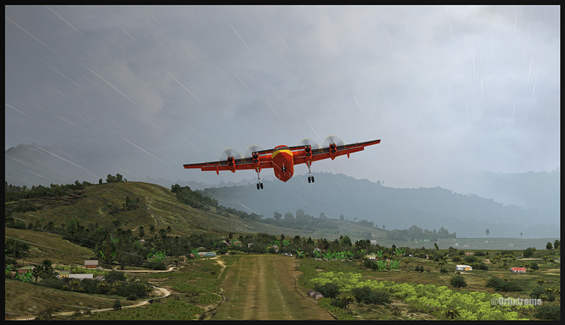
A virtual DHC-6 Twin Otter enroute for Kokoda after a fire on the right engine while departing Yongai (KGH) in Papua New Guinea PNG (FSX)
Ken Hall and Tim Harris have created a new virtual scenery for flight simulation enthousiasts. It is called “Tapini” and sold by ORBX. Their penultimate creation, AYPY Jackson’s International, allowed the virtual pilot to fly in very demanding virtual airports along the Kokoda Trail in Papua New Guinea. “Tapini” represents a whole new challenge and I have included several screen captures to show you how the different runways look in this new virtual scenery.
“Tapini”, still in Papua New Guinea, allows the virtual pilot to test his skills on seven new runways located in difficult areas of the Owen Stanley Range. Those airports also constitute a serious test for any aircraft, like in the picture above where damages to the right engine were sustained at Yongai.
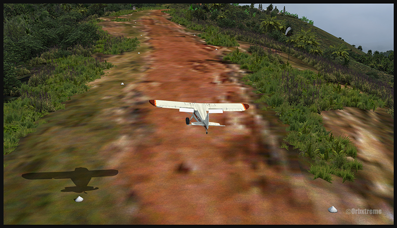
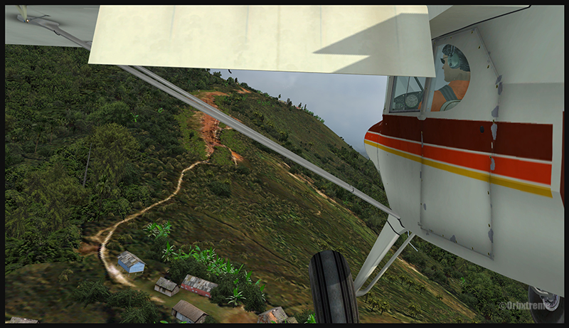
A virtual Piper Pacer virtuel is about to land on the Ononge (ONB) curved runway in Papua New Guinea PNG (FSX). (It is possible to see the curve starting on the top of the image)
To improve the virtual clouds while flying between the different airports, I used either REX or FSGRW weather engines. The cloud textures and weather effects were improved by one or many of the following products: Cumulus X, PrecipitFX, REX Texture Direct and REX Soft Clouds.
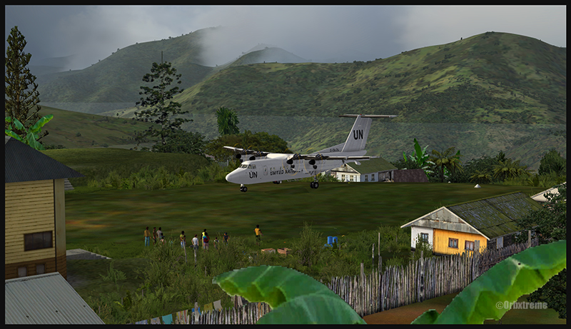
A virtual Dash 7 has just landed in Woitape (WTP) in Papua New Guinea PNG (FSX)
As variety is more fun, and also due to the different challenges created by those runways, the following virtual aircrafts were used: Carenado C-185F, Lionheart Creations PA-18, Virtavia DHC-4, Aerosoft DHC-6 Twin Otter and Milton Shupe DHC-7.
The “Tapini” scenery gives the pilot a choice between the seven following runways:
ASB (Asimba)
A tricky, very short runway near a river.
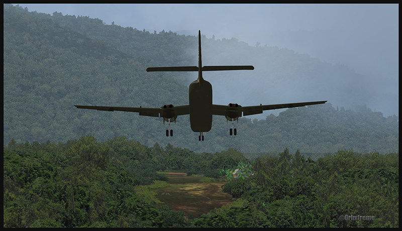
A DHC-4 Caribou virtual aircraft is on approach for Asimba’s sloped runway (ASB) in Papua New Guinea PNG (FSX)
This is a very interesting runway, best done with a STOL aircraft like the Caribou DHC-4. The inhabitants might have to help you clear out some branches along the runway, considering the size of the aircraft. The runway slopes down on take-off, which helps to build up speed.
A DHC-4 Caribou virtual aircraft is on a stopover at Asimba (ASB) in Papua New Guinea PNG (FSX)
A DHC-4 Caribou virtual aircraft is airborne from Asimba (ASB) in Papua New Guinea PNG (FSX)
FNE (Fane)
A one-way, really challenging 12 degree sloped runway, with unpredictable winds.
A De Havilland DHC-7 virtual aircraft on final for the Fane (FNE) airport’s sloped runway in Papua New Guinea PNG (FSX)
The runway sits on top of a hill. It is an amazing experience to land there. No wonder there are a lot of people watching the arrivals and departures.
If you slow down too quickly with an aircraft as big as the DHC-7 on that sloped runway, the twelve degree angle prevents you from moving forward. You must let the aircraft come down the runway very slowly, using the power to control the descent and the rudder to stay aligned on the runway, then apply take-off power for a few seconds to build just enough momentum to get above the hill.
A De Havilland DHC-7 virtual aircraft just finished taxiing uphill on the Fane (FNE) airport’s sloped runway in Papua New Guinea PNG (FSX)
To turn the aircraft around, it’s a combination of power and reverse thrust until you clear all the obstacles (any humans venturing behind the aircraft will also be cleared during the operation…).
A De Havilland DHC-7 virtual aircraft is airborne from the Fane (FNE) airport’s sloped runway in Papua New Guinea PNG (FSX)
There is a not so friendly man with a rifle watching the airport’s operations. Even the United Nations staff do not stay longer than necessary…
KGH (Yongai)
A very bumpy one-way sloped runway. A real bush aircraft is needed here!
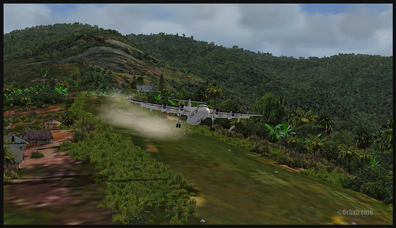
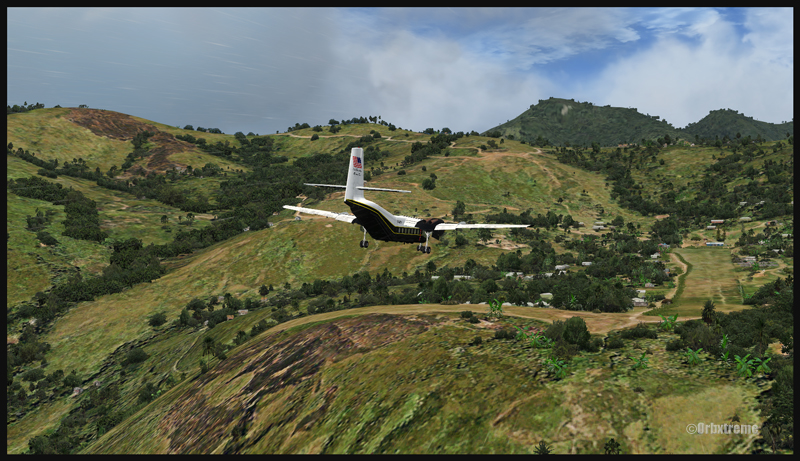
A virtual DHC-6 Twin Otter on approach for the Yongai (KGH) bumpy runway in Papua New Guinea PNG (FSX)
Even with a real bush aircraft, there is a possibility that one of the aircraft’s propellers hits the ground while taxiing on the runway. There are so many deep holes that are hard to see, I can only wish the best of lucks to everyone trying out this airport!
A virtual DHC-6 Twin Otter on the Yongai (KGH) bumpy runway in Papua New Guinea PNG (FSX)
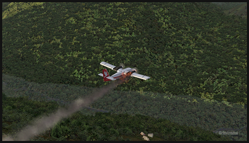
Keep a close watch on the area near the little house at the end of the runway. The DHC-6 was really shaken while turning around for take-off. One of the propellers hit the ground but no problems were detected…until the aircraft was airborne. The fire alarm then went off, just as the aircraft was passing the runway threshold, seconds before flying over a cliff.
A virtual DHC-6 Twin Otter with its right engine on fire is just airborne from the Yongai (KGH) bumpy runway in Papua New Guinea PNG (FSX)
So much for the planned trip… and it was out of the question to return to Yongai on one engine. I had to pull the handle to stop the fire, feather the prop, cut the fuel where it was not needed anymore then head to the Kokoda airport as it was a sure alternative, having a long runway and an elevation that did not require the use of extra power.
KSP (Kosipe)
A relatively short runway that requires good calculations from the pilot, since it is located high in the mountains.
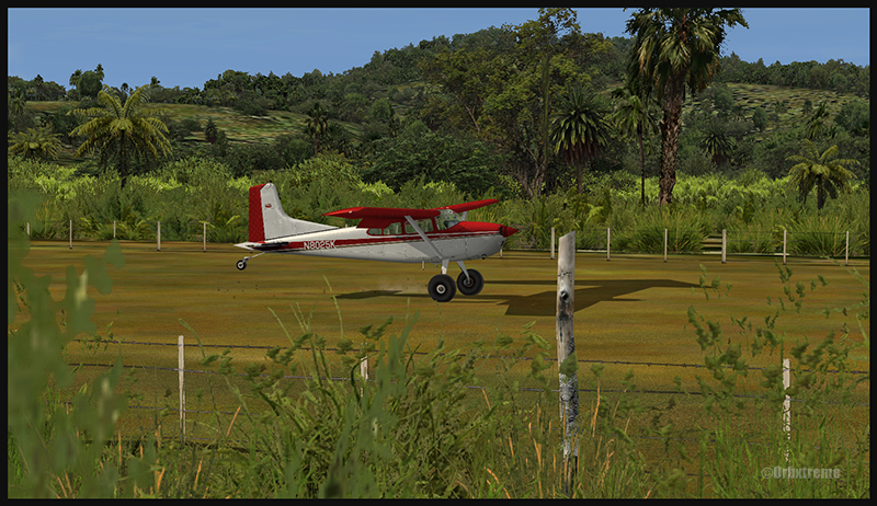
A virtual Cessna C-185F is enroute to the Kosipe (KSP) airport in Papua New Guinea PNG (FSX)
The Cessna C-185F is a very well suited aircraft for that runway. Make sure not to be too heavy on the brakes, as new C-185 propellers are hard to find in Kosipe. You can land in both directions. Ensure that the mixture is set properly as the airport is above 6300 feet.
A virtual Cessna C-185F is rolling after touching down on the Kosipe (KSP) runway in Papua New Guinea PNG (FSX)
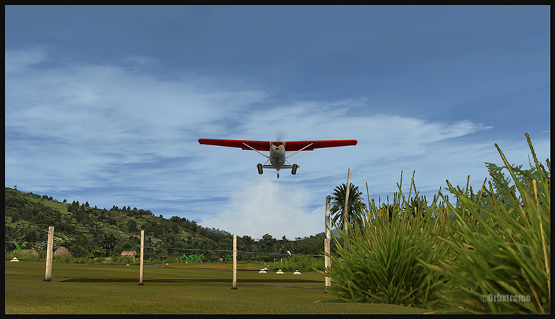
A virtual Cessna C-185F is airborne from the Kosipe (KSP) runway in Papua New Guinea PNG (FSX)
ONB (Ononge)
A curved and very bumpy runway! For those who like low flying. Make sure you choose the good aircraft here; there is not much manoeuvering area once on the ground.
A Virtual Piper Pacer on approach for the Ononge (ONB) curved runway in Papua New Guinea PNG (FSX)
Ononge looks really scary when you show up on final for the first time. You wonder if the little trail that you see can really be a runway. For that kind of situation, the little Piper Pacer is an excellent aircraft, approaching slowly and braking on a dime. The runway is curved in the middle so you will need a bit of right rudder to keep the aircraft aligned with the runway.
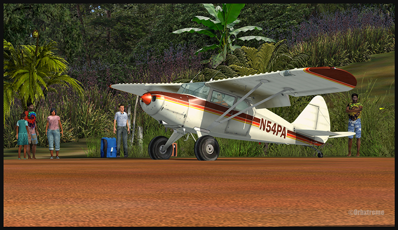
A Virtual Piper Pacer on the Ononge curved runway in Papua New Guinea PNG (FSX)
I guess all those people with their cargo are waiting for a bigger airplane than mine…
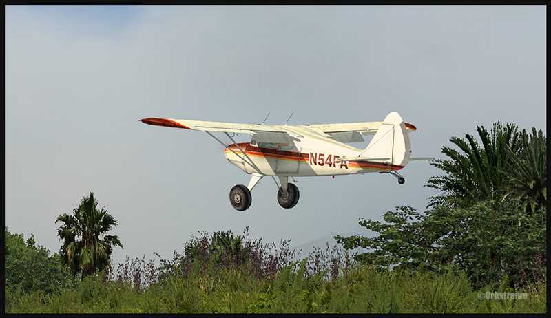
A Virtual Piper Pacer is airborne from the Ononge curved runway in Papua New Guinea PNG (FSX)
TAP (Tapini)
A challenging one-way sloped runway nestled in a tight valley. You can even use an ILS to arrive there!
A virtual DHC-4 Caribou on short final for the Tapini (TAP) sloped runway in Papua New Guinea PNG (FSX)
This is a superbly designed area and airport. I visited it with the DHC-4 Caribou but any other big STOL aircraft would have fitted there. There is enough room to manoeuver. It is not too bumpy. There is an interesting slope: it starts downward and ends upward: this helps to slow down the aircraft after landing.
A virtual DHC-4 Caribou on the ground at the Tapini (TAP) airport in Papua New Guinea PNG (FSX)
A virtual DHC-4 Caribou is airborne from the Tapini (TAP) airport in Papua New Guinea PNG (FSX)
WTP (Woitape)
Looks like a no brainer, but there is no margin of error on this one-way slightly sloped runway. Very precise calculations and settings are required if you want to land there with something else than a small aircraft.
A virtual De Havilland DHC-7 on final approach for the Woitape airport (WTP) virtual airport in Papua New Guinea (FSX)
I found the runway to be very slippery with the De Havilland DHC-7. I must say that there was a good crosswind, as I was flying with real life weather and winds. The DHC-7 behaves like a big boat while decelerating on such a runway.
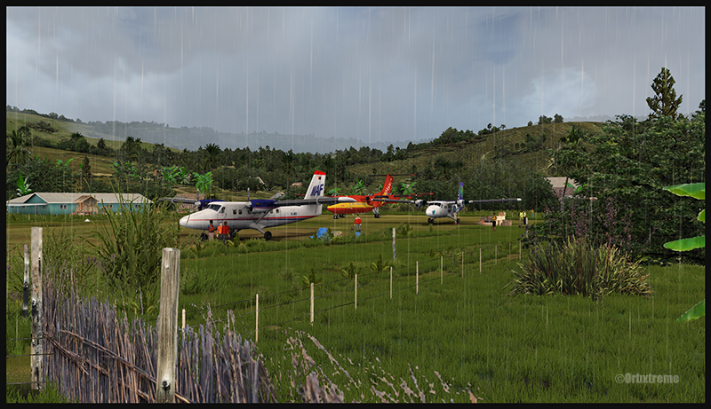
A virtual De Havilland DHC-7 on the ground with two Twin Otters at the Woitape airport (WTP) in Papua New Guinea (FSX)
The Woitape scenery is gorgeous. It is nice to have all those well designed virtual aircrafts, people and animals on site as this makes the scenery so much more realistic.
A De Havilland Virtual DHC-7 is airborne from the Woitape airport (WTP) in Papua New Guinea (FSX)
I love this new Orbx product. When you fly in such a realistic scenery, the brain does not make much difference between what is real and what is virtual. It really works! And if you use real life weather downloaded from the internet, it’s even better.
I tried the seven airports included in the “Tapini” virtual scenery and they are quite demanding. Yongai was the most challenging airport of them all. I had to do two missed approaches there since I ended up too high on the approach. I eventually got it right, like in real life!
I used the Microsoft flight simulator X (FSX) for all the virtual flights, but other platforms would have worked as well (Dovetail Games FSX Steam edition (FSX: SE) and all versions of P3D). The following products were also installed on my flight simulator: FTX Global, FTX Global Vector and Holgermesh, as well as Pilot’s FS Global 2010.
It is a totally immersive virtual experience and you have to forget everything else when undertaking those challenging virtual flights… if you want to make it “virtually” alive!
For more articles on flight simulation on my web site, click on the following link : Flight simulation
FSGRW is a weather generator and it uses downloaded data from the internet to simulate actual real weather all around the world (24,000 + airports).
The program simulates very well what is going on in the atmosphere up to FL520, including the depiction of hurricanes and tropical cyclones.
FSGRW does not come with its own cloud texture packages. Like for ASN(Active Sky Next) or OpusFSI, you must add a texture package from a third party (like REX for example). FSGRW will then use those beautiful textures to represent the downloaded weather from the internet, instead of the old cloud files that were created years ago by Microsoft.
FSGRW was not created to give you access to all kind of fancy options like automatic connections to the weather radar of big airliners. It is a simple but very efficient program that aims at representing the weather accurately.
FSGRW includes some well-known local weather effects.
Icefield in sight! A screen capture realized with the following products: FSX, FSGRW, REX, and a combination of Orbx creations. Final editing with a photo editing software (slight corrections only)
FSGRW is compatible with FS2004, FSX, ESP, P3D, Steam and X-Plane.
FSGRW gives you the possibility to use the actual weather present at one airport and transfer it to another airport. You have access to historic weather through a file-mode option. You may also choose to fly with dynamic or static weather. The weather updates are made every six minutes now that version 027 has been issued.
You can create your own flight plan and weather sequence.
FSGRW can be used through a network.
I own FSGRW and use it in combination with REX texture packages. I am very satisfied of the result. But I don’t doubt that ASN, OpusFSI or REX weather engines can provide excellent results as well. The only thing to remember is that you have to buy a weather engine AND cloud texture packages in order to improve the virtual weather’s visual aspect.
The weather engine ASN (Active Sky Next), like FSGRW, OpusFSI or REX updates the weather by downloading the latest information from the internet. There is also a possibility to use historical data (up to two years back).
ASN, FSGRW and OpusFSI use the default FSX cloud texture sets. So those weather engines can benefit from additional cloud texture sets (from REX for example) for a better visual depiction.
The cloud locations and coverage are accurate as well as realist. Thick overcast layers can be displayed. The cloud transitions are smooth, as well as the vertical variations in temperature, wind speed and wind direction.
Cloud-based effects include in-cloud reduced visibility, related turbulence (in cloud or when entering or exiting a cloud formation), accurate position of precipitation according to the type of clouds and to your position relative to the cloud formation.
Microbursts, wind shears, hail, turbulence as well as updrafts and downdrafts effects are modelled for thunderstorms. There are aural wind shear alerts when flying through a thunderstorm cell: That will nonetheless not be of great help if you attempt to cross a strong thunderstorm as, like in real life, you might not succeed…
You can use the radar to navigate through bad weather since radar and cloud positions are synchronized. The radar shows the intensity of precipitations as well as the echo tops.
Voiced warnings will be triggered when new Airmets and Sigmets are issued. They cover the world and can be viewed on a map. Associated icing and turbulence are added according to the warnings.
In flight, you can receive voiced weather updates through ATIS, FlightWatch or FSS.
ASN corrects the problems sometimes associated with low-level clouds, like inaccurate coverage and wrong position of the clouds, or layers that are really too thin.
Like with other weather engines, there is a flight planning mode. You can enter, import, or build a flight plan, as well as change the flight plan and waypoints at any time before or during a flight.
The weather, airports and navaids are displayed and can be edited, added or erased. The forecasts are available through graphics or text. If, along your route, there is no Metar issued for few hours, the engine will use the forecast to update the weather.
The thermals are modeled using the temperature and surface of terrain.
The wake turbulence trails are visible and, like in real life, are moving with the wind.
ASN does not rely only on interpolation to cover the oceanic areas and other territories where there are few weather stations.
The developers of ASN say that they have created a realistic hurricane simulation based on actual hurricane data. Their program would automatically disregard the ground data that seems incorrect. I cannot comment about the realism of that simulation since I have not tried it yet. But if it is correctly modelled, this function should interest whoever wants to experiment what it is to fly in or near a hurricane.
ASN is compatible with FSX, FSX: SE and the P3D versions up to P3DV4. It can support a multi-monitor setup.
I am not listing all the characteristics of this interesting software since there are always new options added. If you want more details, I provided the link below. Like with all the other weather engines, take the time to see what each has to offer since they have quite different features and spectrum of options.
REX offers two important elements through its different products: 1) A weather engine that downloads real weather in your computer while replicating the different weather phenomenon, through its REX Essential Plus program and 2) very realistic cloud textures (through its add-ons like Overdrive, Texture Direct, Soft Clouds).
A flight planning mode is also included, as well as numerous options to create specific weather themes that take care of the appearance of the clouds, the quality of the light in the sky, the definition of the sun effects, the different textures and colors of water.
You also have the possibility to choose different runway markings, the sounds associated with thunderstorms and the type of lightning that will illuminate your virtual sky.
REX is compatible with all platforms, including X-Plane.
Here are the REX products, which each play a very different role:
REX Essential Plus: a weather engine and a product that contains cloud textures and multiple options in order to simulate as much as possible the real outside weather for the area you have chosen. The weather engine will soon be renewed with a new addition: REX Weather Direct.
REX Overdrive: adds 12 GB of cloud textures.
REX4 Texture Direct: adds another 16 GB of cloud textures, and a possibility to create complete weather themes according to your preferences, while you still have access to other themes created by all the virtual pilots of the REX community.
REX Soft Clouds: adds volumetric clouds in the lower layer of the atmosphere for a more realistic effect.
REX4 Weather Architect: a program that allows you to create a precise weather system then position it anywhere on the planet. This is not a weather engine: It will not look for new data on internet and download it in your computer.
REX Weather Direct: a soon to be released improved weather engine that will be compatible with DX9, DX10 and DX11 as well as with FSX, FSX: SE (Steam Edition) and P3D.
On virtual flying forums, users seem to have a preference for the Active Sky Next (ASN) weather engine combined with REX cloud textures. This is a good combination, but it’s not the only one that deserves attention: FSGRW together with REX cloud textures do an excellent job (this is the duo that I am using for very precise results). There is also OpusFSI with REX, ASN with ASN2012 (ASN weather engine combined with ASN2012 cloud textures) or even a REX only set of programs (soon to be available REX Weather Direct and REX cloud textures).
This all depends on your priority: the FSGRW simplicity and absolute realism, the facility to use a cockpit camera and the dynamic head movements supported mode of OpusFSI, etc. It is best to read a lot and take the necessary time before jumping to quickly to a conclusion.
Some weather engines might need tweaking or modifications to be compatible with the most recent versions of P3D, if we believe what is written on specialized forums.
It used to be called OpusFSX, but that was before P3D arrived on the market. Now it is OpusFSI (a more generic name applicable to many platforms)
OpusFSI
OpusFSI is a weather engine which, like FSGRW, ASN or REX, downloads real live weather close to your route and integrates it in your computer so that your virtual flight is always done in actualized weather. All those programs will update the data more frequently if the weather deteriorates along your flight path.
OpusFSI does not add new cloud texture sets. If you wish to fly in more interesting clouds, you need to use OpusFSI in combination with REX.
Opus works well on a network, which is practical if you want to transfer some OpusFSI functions towards a second computer to limit the use of the main computer’s resources.
OpusFSI is compatible with FSX, FSX: SE and P3D and even with TrackIR real-time 3D view controls (some files will have to be deactivated in the Program Files if you were using TrackIR before buying Opus). You have access to multiple interactive maps to check the weather or SIDs/Stars and to adjust the many options according to your taste.
OpusFSI is quite an advanced program that is well adapted to the use of virtual cockpit cameras. It replicates head movements caused by vibrations or turbulence and allows views from left to right when taxiing or turning in flight. The effects are all adjustable by the user.
If you are using many computer screens for your virtual flight, you can program each screen to show a different view (like the left and right window, for example).
OpusFSI allows you to use historical weather. The program also offers the possibility to relocate the weather over an airport towards another one. As well, you can decide to make some low clouds disappear or eliminate any obstruction to visibility when you want to have a perfect view of the territory. You can even create your own Metar.
Like for other weather engines on the market, you have access to a “flight planning mode”.
An option allows you to include turbulence and wind shear caused by the surrounding terrain within 80 kilometers of an airport.
The data generated by OpusFSI can be used directly in the PMDG B737NGX. That means you can see the real weather on the aircraft’s radar.
OpusFSI is in continual development and new functions are frequently added. They are not all mentioned in the present article.
Like for other weather engines available on the market, it is necessary for you to visit the company’s web site in order to choose the most appropriate software that will be adapted to your type of virtual flying and to the equipment that you use or intend to use in the future.
Flying over the Eastern Townships in Quebec under MVFR always represents a problem due to the terrain. Here is a screen capture of a flight from the Quebec international airport to the Sherbrooke airport, to show what a virtual flight looks like during autumn. The terrain has been modelized by Orbx.
A2A Simulations C182T Skylane in the Eastern Townships region in Québec
Here are the first few hills visible but, rapidly, the top of mountains will be obscured in clouds. The downloaded weather is managed by the FSGRW weather engine and the cloud textures are the result of a combination between REX Texture Direct and REX Soft Clouds. A photo software has been used to enhance the contrasts.
The aircraft is a C182T Skylane from A2A Simulations. The similarities between a real aircraft and this virtual aircraft is really unbelievable. The pilot must take care of all corrections, even the gyroscopic precession, otherwise the ADF will indicate the road to follow while the compass sends you in a totally different direction!
C182T airborne from the Parry Sound airport in Ontario, Canada.
In order to celebrate autumnal colors, here is a screen capture of an A2A Simulations C182T Skylane airborne from the Parry Sound (CNK4) airport in Ontario, Canada.
The airport was created by Vlad Maly, for ORBX. FSGRW was the weather engine used to follow the actual weather around Georgian Bay. REX Texture Direct was used for the cloud textures.
The screen capture of this virtual flight was slightly retouched by means of a photo software in order to add a bit more intensity to the autumnal scene.
For more articles on flight simulation on my web site, click on the following link : Flight simulation
Icefield in sight! A screen capture realized with the following products: FSX, FSGRW, REX, and a combination of Orbx creations. Final editing with a photo editing software (slight corrections only)
The screen capture above, titled “Icefield in sight”, represents a virtual flight using the FSX platform. A combination of FSGRW and REX has been used to improve the cloud effects.
As the basic FSX program does not offer a very realistic representation of clouds, it is necessary to get better cloud sets from a third party provider. In the present screen capture, the clouds are a creation of REX, through their Texture Direct and Soft Clouds used in combination.
It is one thing to have access to realistic clouds but you also need a good weather engine. This engine will download real-weather data and, if you wish, will update it every few minutes when you fly.
Many weather engines are available. In the above picture, I used FSGRW (PILOT’S version 1.7, build 29).
To represent the mountains and the icefield, ORBX creations like SAK, Vector and Open LC Canada-Alaska were used. The DC-3 livery is available as a free download from major sites like FlightSim.com or AVSIM .
Last point: when you take a screen capture, it is possible to use a photo editing software (there are many good ones on the market) to slightly improve a particular aspect of the picture. It takes very little effort to learn how to use few basic functions that will enhance your captures.
For more articles on flight simulation on my web site, click on the following link : Flight simulation