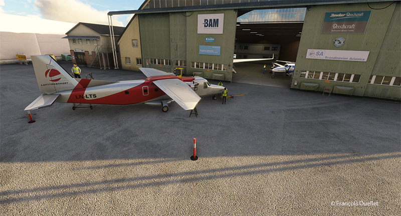
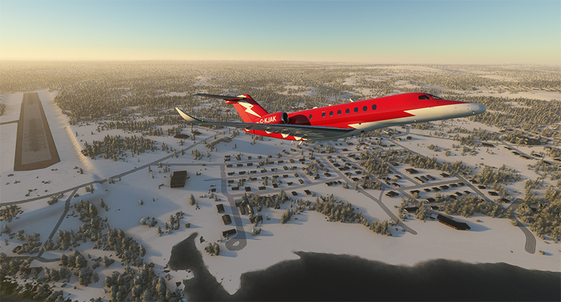
A surprise awaits us as we depart from the Sandane airport (ENSD) for Sweden, Stockholm-Bromma airport (ESSB).
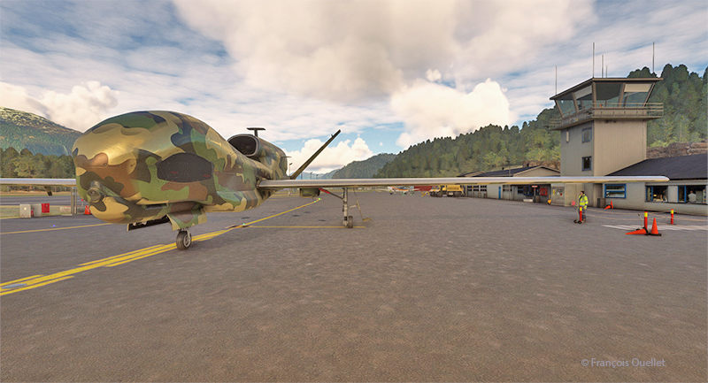
Drone on the ground at Sandane airport (ENSD) in Norway.
A Northrop Grumman RQ-4 Global Hawk drone is at the airport. This long-range surveillance aircraft has an autonomy of around 35 hours and a range of 22779 kilometers. It flies at altitudes of up to 60,000 feet (18288 meters). Its maximum speed is 635 km/h, and each hour of operation costs $24,000.
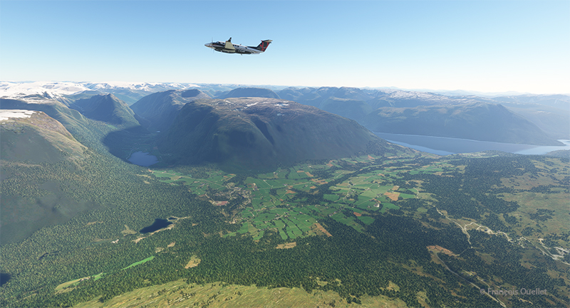
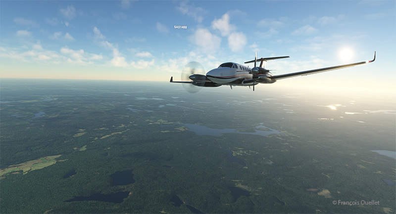
Beech 350I airborne from the Sandane Airport (ENSD) heading to Stockholm-Broma airport (ESSB)
Today, we’re repositioning a twin-engine Beechcraft King Air 350I that hasn’t flown in ages. The usual checks have been carried out to ensure that no birds have nested under the engine cowling. We also checked that there was no condensation water at the bottom of the fuel tanks. Finally, we ran the engines for a long time on the ground. The aircraft takes off from Sandane for a planned altitude of 18,000 feet.
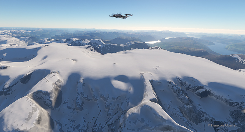
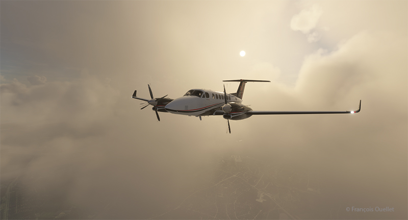
Over Norway snowcapped mountains heading to Sweden in flight simulation.
We fly over the mountains of Norway towards Sweden. Everything goes according to plan.
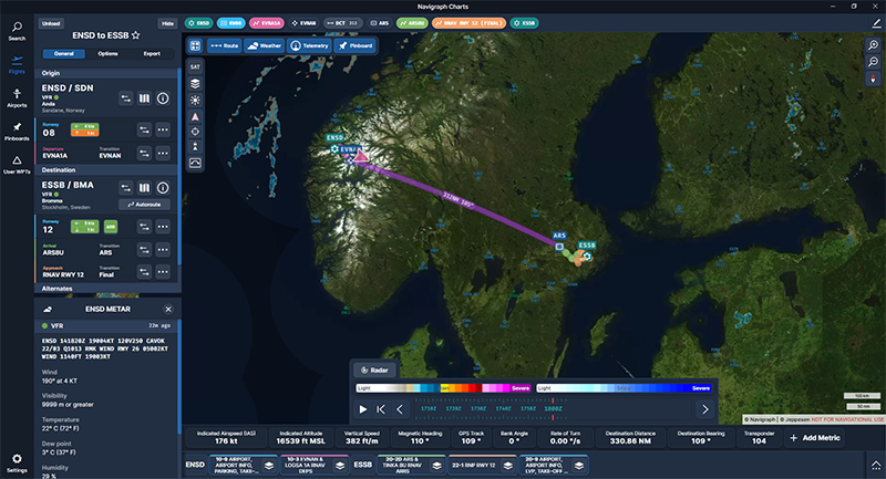
Navigraph chart showing a flight from Sandane (ENSD) to Stockholm-Bromma (ESSB)
The Navigraph map shows the planned route between the two countries.
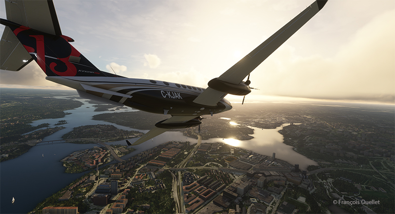
Engine failure on a twin engine aircraft with Microsoft Flight Simulator.
Suddenly, the left engine experiences problems. It stops and the propeller feathers to minimize drag. Since we’re approaching the runway at Stockholm-Bromma airport, we choose to continue on our way, as we benefit from a large airstrip and emergency response services. Now unsure about the reliability of the second engine, we keep a slightly higher altitude than a normal approach would generally dictate.
Double engine failure on a twin engine with Microsoft Flight Simulator.
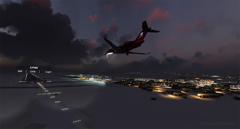
A few minutes later, the second engine stops. The plane becomes a large glider. The clouds prevent a good view of the surrounding area, but we feel our altitude is sufficient to attempt an approach to the airport when the runway is in sight.
On final for Stockholm-Bromma airport with a double engine failure
The flaps and landing gear will only be extended once we’re established on final and the aircraft is stabilized and certain of reaching the runway. Microsoft’s flight simulator doesn’t allow us to do just anything with an aircraft. If we exceed the aircraft’s structural capabilities when attempting to reach the airport, the flight will stop immediately.
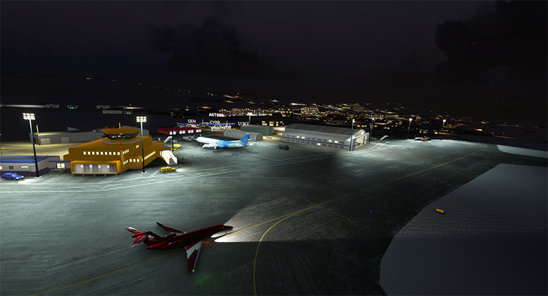
On the ground at Stockholm-Bromma with a double engine failure on a Beechcraft 350I in flight simulation.
The final approach and taxiing caused no problems. The aircraft gradually slows down until it comes to a complete stop on the runway. The poor air traffic controllers now have to apply Plan B to reorganize air traffic around the airport, with the main runway temporarily blocked.
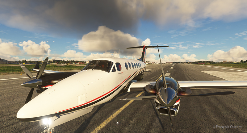
Beechcraft maintenance hangar at the Stockholm-Bromma virtual airport
Fortunately, Beechcraft offers maintenance services at Stockholm-Bromma airport. So, we’ll leave the aircraft for major repairs and find something faster for the next flight to Ukraine. Why not an F-14 Tomcat? It is not in military service anymore and thus its presence in the air should not worry too much.
P.S. This story is based on a real even that happened in Quebec several years ago. An acquaintance of mine (Paul B.) was scheduled to fly from the Val-d’Or airport (CYVO) to Rouyn-Noranda (CYUY) in a light twin-engine aircraft that hadn’t flown in a long time. Halfway between CYVO and CYUY, the first engine failed. The pilot decided to continue. With the runway in sight in the distance, the second engine stopped. The pilot hovered the aircraft and managed to land on route 117, just behind a large truck which accelerated to give way to the aircraft he could see descending in his rear-view mirror. The aircraft landed safely and without damages!
The flight simulation with Microsoft Flight Simulator lets you fly over the planet like never before from the comfort of your own home. As airports around the world transmit weather observations at all times, it’s possible to import this data into the flight simulator and fly virtually in the real weather conditions reported around the globe.
This data enhances the feeling of reality for the virtual pilot, but at the same time complicates his task, as he has to take into account the presence of thunderstorms and icing, surface and upper-level winds, changes in cloud cover, visibility, pressure, and so on.
Today’s virtual pilot must also anticipate that failures of all kinds may affect the flight, especially if he or she owns a high-quality virtual aircraft. The engine(s) may fail, a structural problem may affect the aircraft’s controls and navigation equipment may cease to function. Good planning is essential, just as in real life. And since the brain doesn’t differentiate too much between the real and the virtual, there’s plenty of fun to be had.
So, I’ve decided to fly around the world as a millionaire, at my own pace, i.e., using the types of aircraft that tempt me, and flying the routes that are of particular interest. All of this will be done in real weather, with all its joys and obstacles. I’ll be publishing one of these routes on my blog from time to time.
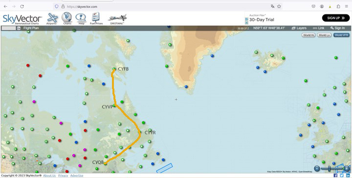
The initial route departs from Quebec’s Jean-Lesage airport (CYQB), passes through Goose Bay (CYYR), in the Canadian province of Newfoundland and Labrador, heads north to Kuujjuaq and ends in Iqaluit (CYFB).
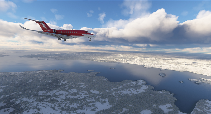
Virtual Flight 2 will present a few photos of the Atlantic crossing from Iqaluit to Kangerlussuaq (BGSF) in Greenland, to Isafjordur (BIIS) in Iceland .
Isafjordur airport has a challenging approach. I don’t know if the Cessna Citation Longitude will be able to land there in one piece, but I intend to give it a try.
Virtual flight 1.
Virtual flights CYQB CYYR CYVP CYFB
Enroute from Quebec City (CYQB) to Goose Bay (CYYR)
Above, the setting sun illuminates the clouds and the Cessna Citation Longitude en route from Quebec City to Goose Bay. At high altitude, the pilot sets the altimeter to the standard atmospheric pressure of 29.92 inches of mercury. Since all the other pilots are doing the same, a safe separation between the aircraft is ensured.
Approaching the Kuujjuaq airport (CYVP) in Quebec.
The next day, the aircraft is seen approaching Kuujjuaq (CYVP) in Nunavik. The altimeter is set to the airport’s atmospheric pressure to reflect the correct height of the runways in relation to the aircraft. Near the airport, the autopilot is disconnected, and the approach is made manually and visually. The desired speed is around 135 knots for the final.
Departing Kuujjuaq airport (CYVP) with the Cessna Citation Longitude
Above, the jet takes off from Kuujjuaq bound for Iqaluit (CYFB) on Baffin Island in Nunavut.
Enroute to Iqaluit airport (CYFB)
The setting sun illuminates the aircraft’s windows. The approach to Iqaluit has begun. The descent is gradual, so as not to cause discomfort to the virtual passengers…
On final for runway 34 of the Iqaluit airport (CYFB)
Above, the aircraft is on final for runway 34 at Iqaluit (CYFB).
The yellow Iqaluit flight service station (FSS) in Iqaluit (CYFB)
The first leg of our virtual flight around the world ends in Iqaluit, the airport where I worked for two and a half years as Flight Service Specialist (FSS) in the yellow tower on the left of the photo.
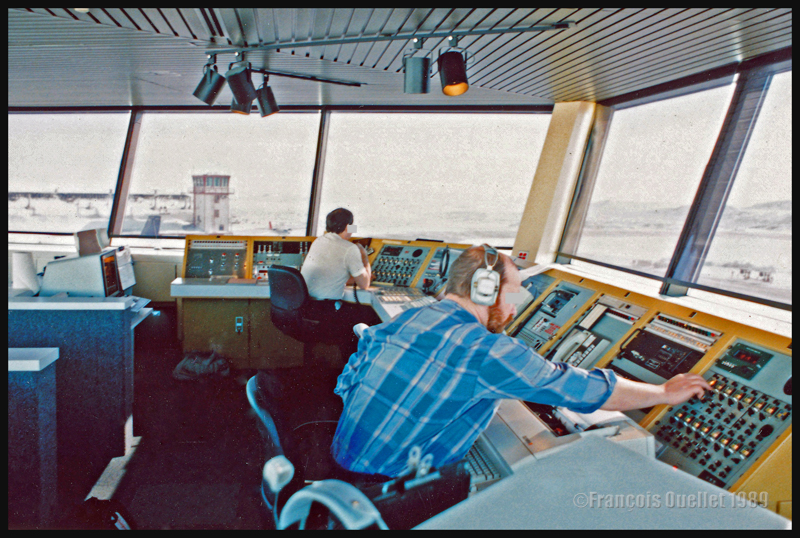
Flight service specialists at work at the Iqaluit flight service station in 1989
Above, a photo of the interior of the Flight Service Station at the time. One FSS worked on arrivals and departures at the airport, while the other handled transatlantic flights between Europe and mainly the western USA.
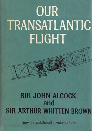
Our transatlantic flight, by Sir John Alcock and Sir Arthur Whitten Brown
Newfoundland
Before 1949, Newfoundland was called Dominion of Newfoundland and was part of the British Commonwealth . In 1949, it became a Canadian province.
The first non-stop flight eastward across the Atlantic.
The book « Our transatlantic flight » tells the story of the historic flight that was made in 1919, just after the First World War, from Newfoundland to Ireland. There was a 10,000 £ prize offered by Lord Northcliffe from Great Britain for whoever would succeed on the first non-stop flight eastward across the Atlantic.
A triumph for British aviation
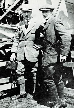
Sir John Alcock and Sir Arthur Whitten Brown , respectively pilot and navigator, wrote the story of their successful flight in this book which was published in 1969. The followings are pilot quotes from the book : « For the first time in the history of aviation the Atlantic had been crossed in direct, non-stop flight in the record time of 15 hours, 57 minutes. » (p.13) « The flight was a triumph for British aviation; the pilot and navigator were both British, the aircraft was a Vickers-Vimy and the twin engines were made by Rolls-Royce. » (p.13)
Sir John Alcock and Sir Arthur Whitten Brown
As with all great human achievements, a very good flight planning and some luck was needed to make this flight a success. If there was an engine failure during the flight, even if the planning was excellent, there was only one outcome : downward.
In order to make the flight, Alcock and Brown boarded a ship from England bound to Halifax. They then headed to Port aux Basques and finally arrived in St.John’s. There, they joined a small group of British aviators who had arrived a few days before and who were also preparing for the competition. « The evenings were mostly spent in playing cards with the other competitors at the Cochrane Hotel, or in visits to the neighbouring film theatres. St.John’s itself showed us every kindness. » (p.60)
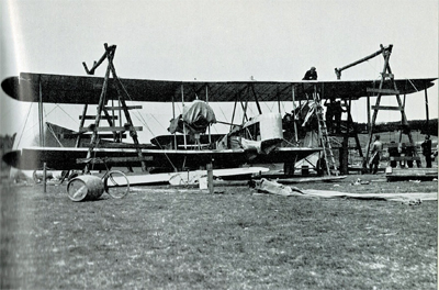
Maritime transport was used to carry the Vickers-Vimy biplane to Newfoundland on May 4th. It was assembled in Newfoundland. « The reporters representing the Daily Mail, the New York Times, and the New York World were often of assistance when extra manpower was required. » (p.61).
While the aircraft was being built, there were more and more visiters coming to the site. Brown says : « Although we remained unworried so long as the crowd contented itself with just watching, we had to guard against petty damage. The testing of the fabric’s firmness with the point of an umbrella was a favourite pastime of the spectators […]. » (p.61)
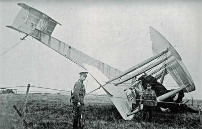
The Vickers-Vimy is being reassembled at Quidi Vidi in Newfoundland.
It was difficult to find a field that could be improvised into an aerodrome : « Newfoundland is a hospitable place, but its best friends cannot claim that it is ideal for aviation. The whole of the island has no ground that might be made into a first-class aerodrome. The district around St.John’s is especially difficult. Some of the country is wooded, but for the most part it shows a rolling, switchback surface, across which aeroplanes cannot taxi with any degree of smoothness. The soil is soft and dotted with boulders, as only a light layer covers the rock stratum. Another handicap is the prevalence of thick fogs, which roll westward from the sea. » (p.59)
They flight tested the airplane on June 9th at Quidi Vidi. During the short flight, the crew could see icebergs near the coast. They did a second trial on June 12th and found that the transmitter constantly caused problems. But, at least, the engines seemed to be reliable…
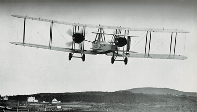
The departure
The two men left Newfoundland on June 14th 1919. In order to fight the cold air in flight, they wore electrically heated clothing. A battery located between two seats provided for the necessary energy.
The Vickers-Vimy departs from Newfoundland in 1919
The short take-off was very difficult due to the wind and the rough surface of the aerodrome. Brown writes : « Several times I held my breath, from fear that our under-carriage would hit a roof or a tree-top. I am convinced that only Alcock’s clever piloting saved us from such an early disaster. » (p.73)
It took them 8 minutes to reach 1000 ft. Barely one hour after departure and once over the ocean, the generator broke and the flight crew was cut off from all means of communication.
As the airplane consumed petrol, the centre of gravity changed and since there was no trim on the machine, the pilot had to exert a permanent backward pressure on the joystick.
Flying in clouds, fog and turbulence.
During the flight with much clouds and fog, Brown, having almost no navigation aid, had real problems to estimate the aircraft’s position and limit the flying errors. He had to wait for a higher altitude and for the night to come to improve his calculations : « I waited impatiently for the first sight of the moon, the Pole Star and other old friends of every navigator. » (p.84). The fog and clouds were so thick that at times they « cut off from view parts of the Vickers-Vimy. » (p.95)
Without proper instruments to fly in clouds, they were relying on a « revolution-counter » to establish the climbing or the falling rate. That is pretty scary. « A sudden increase in revolutions would indicate that the plane was diving; a sudden loss of revs would show that she was climbing dangerously steeply. » (p.176)
But that was not enough. They also had to deal with turbulence that rocked the plane while they could not see anything outside. They became desoriented : « The airspeed indicator failed to register, and bad bumps prevented me from holding to our course. From side to side rocked the machine, and it was hard to know in what position we really were. A spin was the inevitable result. From an altitude of 4,000 feet we twirled rapidly downward.[…]. « Apart from the changing levels marked by aneroid, only the fact that our bodies were pressed tightly against the seats indicated that we were falling. How and at what angle we were falling, we knew not. Alcock tried to centralise the controls, but failed because we had lost all sense of what was central. I searched in every direction for an external sign, and saw nothing but opaque nebulousness. » (p.88)
« It was a tense moment for us, and when at last we emerged from the fog we were close down over the water at an extremely dangerous angle. The white-capped waves were rolling along too close to be comfortable, but a quick glimpse of the horizon enabled me to regain control of the machine. » (p.40).
De-icing a gauge installed outside of the cockpit.
Snow and sleet were falling. They didn’t realize how lucky they were to continue flying in such a weather. Nowadays, there are many ways to dislodge ice from a wing while the aircraft is in flight. Here is what Brown says about their situation : « […] The top sides of the plane were covered completely by a crusting of frozen sleet. The sleet imbedded itself in the hinges of the ailerons and jammed them, so that for about an hour the machine had scarcely any lateral control. Fortunately, the Vickers-Vimy possesses plenty of inherent lateral stability; and, as the rudder controls were never clogged by sleet, we were able to hold to the right direction. » (p.95)
After twelve hours of flying, the glass of a gauge outside the cockpit became obscured by clotted snow. Brown had to deal with it, while Alcock was flying. « The only way to reach it was by climbing out of the cockpit and kneeling on top of the fuselage, while holding a strut for the maintenance of balance. […] The violent rush of air, which tended to push me backward, was another discomfort. […] Until the storm ended, a repetition of this performance, at fairly frequent intervals, continued to be necessary. » (p.94)
In order to save themselves, they executed a descent from 11,000 to 1000 feet and in the warmer air the ailerons started to operate again. As they continued their descent below 1000 feet over the ocean, they were still surrounded by fog. They had to do some serious low altitude flying : « Alcock was feeling his way downward gently and alertly, not knowing whether the cloud extended to the ocean, nor at what moment the machine’s undercarriage might touch the waves. He had loosened his safety belt, and was ready to abandon ship if we hit the water […]. » (p.96)
The arrival.
They saw Ireland at 8.15 am on June 15th and crossed the coast ten minutes later. They did not expect a very challenging landing as the field looked solid enough to support an aircraft. They landed at 8 :40 am at Clifden on top of what happened to be a bog; the aircraft rolled on its nose and suffered serious material damages. The first non-stop transatlantic flight ended in a crash. Both both crewmen were alive and well, although they were dealing with fatigue…
The transatlantic flight ends up in Ireland in a soft field
Initially, nobody in Ireland believed that the plane arrived from North America. But when they saw mail-bags from Newfoundland, there were « cheers and painful hand-shakes » (p.102).
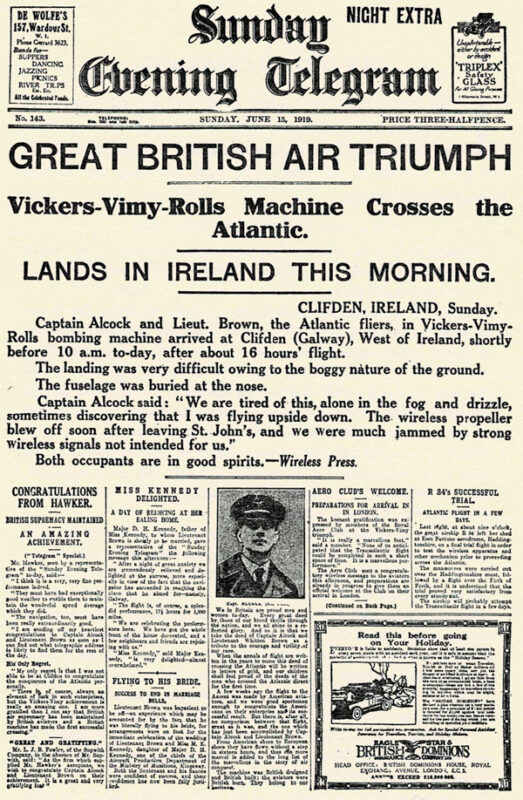
First page of the Sunday Evening Telegraph in 1919.
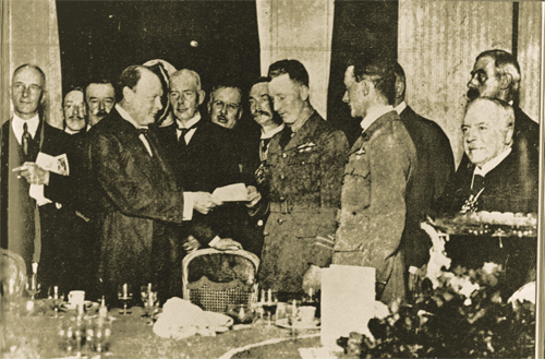
They were cheered by the crowds in Ireland and England and received their prize from Winston Churchill.
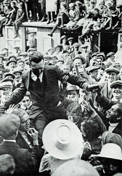
John Alcock chaired by the crowd
Winston Churchill is presenting the Daily Mail Check to the two pilots.
Their record stood unchallenged for eight years until Lindbergh’s flight in 1927.
The future of transatlantic flight.
Towards the end of the book, the authors risk a prediction on the future of transatlantic flight. But aviation made such a progress in a very short time that, inevitably, their thoughts on the subject was obsolete in a matter of a few years. Here are some examples :
« Nothwithstanding that the first two flights across the Atlantic were made respectively by a flying boat and an aeroplane, it is evident that the future of transatlantic flight belongs to the airship. » (p.121)
« […] The heavy type of aeroplane necessary to carry an economical load for long distances would not be capable of much more than 85 to 90 miles an hour. The difference between this and the present airship speed of 60 miles an hour would be reduced by the fact that an aeroplane must land at intermediate stations for fuel replenishment. » (p.123)
« It is undesirable to fly at great heights owing to the low temperature; but with suitable provision for heating there is no reason why flying at 10,000 feet should not be common. » (p.136)
The Air Age.
There is a short section in the book on the « Air Age ». I chose two small excerpts on Germany and Canada :
On Germany’s excellent Zeppelins : « The new type of Zeppelin – the Bodensee – is so efficient that no weather conditions, except a strong cross-hangar wind, prevents it from making its daily flight of 390 miles between Friedrichshafen and Staalsen, thirteen miles from Berlin. » (p.140)
On Canada’s use of aeroplanes : « Canada has found a highly successful use for aeroplanes in prospecting the Labrador timber country. A group of machines returned from an exploration with valuable photographs and maps of hundreds of thousands of pound’s worth of forest land. Aerial fire patrols, also, are sent out over forests.» (p.142) and « Already, the Canadian Northwest Mounted Police [today the RCMP] have captured criminals by means of aeroplane patrols. » (p.146)
Conclusion
The Manchester Guardian stated, on June 16th 1919 : « […] As far as can be foreseen, the future of air transport over the Atlantic is not for the aeroplane. It may be used many times for personal feats of daring. But to make the aeroplane safe enough for business use on such sea routes we should have to have all the cyclones of the Atlantic marked on the chart, and their progress marked in from hour to hour. »(p.169)
Title : Our Transatlantic Flight
Authors : Sir John Alcock and Sir Arthur Whitten Brown
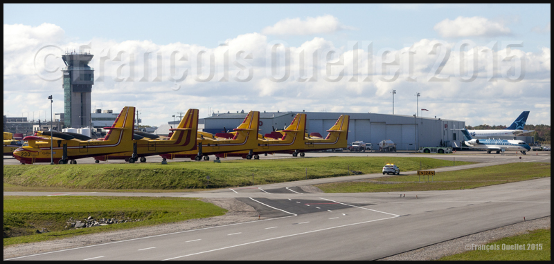
Nav Canada control tower with, in the foreground, several CL-215 and Cl-415, a Nav Canada Challenger, and an Air Transat Airbus at the Quebec Jean-Lesage international airport (CYQB).
On a stormy summer day, Air Canada called the Nav Canada flight information center (FIC) at the Quebec Jean-Lesage international airport (CYQB) on the Montreal frequency. The pilot was flying an Airbus and was about to take-off from the Montreal Pierre-Elliott-Trudeau international airport to Halifax, but there was violent weather that had to be avoided.
Normally, big airlines have their own briefing and flight planning services. However, rapidly changing weather sometimes requires last minute adjustments. In the case of the Air Canada flight, severe thunderstorms forbid a direct path from Montreal to Halifax. The pilot was looking for the best option: go around the thunderstorms by flying north over Mont-Joli then eastward to Halifax or fly southward to United States then head east to Halifax.
Both solutions were possible but the objective was to pick the route that would diminish the pilot’s chances to have to divert to an alternate airport.
Radar imagery became the essential tool to propose a solution. Knowing the time lapse between two images, it was possible to evaluate the weather system’s speed. By calculating what was the distance left for the system to arrive in Halifax, and knowing the system’s speed, the flight service specialist (FSS) was able to estimate as precisely as possible the time when the thunderstorms would move over the destination airport.
The pilot having calculated the estimated time of arrival to Halifax for both the south and north routes, and now knowing at what time the weather system would be over Halifax, he understood that the best option was the southern route through United States. If there was no last minute modification in the system’s speed, he would be able to land in Halifax between twenty and thirty minutes before the first thunderstorm cells arrive over the airport.
It is fairly uncommon to receive an official feedback from the pilot of a big company like Air Canada. But the next day, surprising the flight service specialist (FSS), the pilot called back, presenting himself as the one who had made a flight from Montreal to Halifax the precedent day. He wanted to thank the FSS who had helped him in his decision making since, as he said it, the route via the United States had been a success and he was able to land his Airbus thirty minutes before the arrival of the thunderstorms. That kind of call certainly helps any employee to start a working day on the good foot…!
The weather engine ASN (Active Sky Next), like FSGRW, OpusFSI or REX updates the weather by downloading the latest information from the internet. There is also a possibility to use historical data (up to two years back).
ASN, FSGRW and OpusFSI use the default FSX cloud texture sets. So those weather engines can benefit from additional cloud texture sets (from REX for example) for a better visual depiction.
The cloud locations and coverage are accurate as well as realist. Thick overcast layers can be displayed. The cloud transitions are smooth, as well as the vertical variations in temperature, wind speed and wind direction.
Cloud-based effects include in-cloud reduced visibility, related turbulence (in cloud or when entering or exiting a cloud formation), accurate position of precipitation according to the type of clouds and to your position relative to the cloud formation.
Microbursts, wind shears, hail, turbulence as well as updrafts and downdrafts effects are modelled for thunderstorms. There are aural wind shear alerts when flying through a thunderstorm cell: That will nonetheless not be of great help if you attempt to cross a strong thunderstorm as, like in real life, you might not succeed…
You can use the radar to navigate through bad weather since radar and cloud positions are synchronized. The radar shows the intensity of precipitations as well as the echo tops.
Voiced warnings will be triggered when new Airmets and Sigmets are issued. They cover the world and can be viewed on a map. Associated icing and turbulence are added according to the warnings.
In flight, you can receive voiced weather updates through ATIS, FlightWatch or FSS.
ASN corrects the problems sometimes associated with low-level clouds, like inaccurate coverage and wrong position of the clouds, or layers that are really too thin.
Like with other weather engines, there is a flight planning mode. You can enter, import, or build a flight plan, as well as change the flight plan and waypoints at any time before or during a flight.
The weather, airports and navaids are displayed and can be edited, added or erased. The forecasts are available through graphics or text. If, along your route, there is no Metar issued for few hours, the engine will use the forecast to update the weather.
The thermals are modeled using the temperature and surface of terrain.
The wake turbulence trails are visible and, like in real life, are moving with the wind.
ASN does not rely only on interpolation to cover the oceanic areas and other territories where there are few weather stations.
The developers of ASN say that they have created a realistic hurricane simulation based on actual hurricane data. Their program would automatically disregard the ground data that seems incorrect. I cannot comment about the realism of that simulation since I have not tried it yet. But if it is correctly modelled, this function should interest whoever wants to experiment what it is to fly in or near a hurricane.
ASN is compatible with FSX, FSX: SE and the P3D versions up to P3DV4. It can support a multi-monitor setup.
I am not listing all the characteristics of this interesting software since there are always new options added. If you want more details, I provided the link below. Like with all the other weather engines, take the time to see what each has to offer since they have quite different features and spectrum of options.
REX offers two important elements through its different products: 1) A weather engine that downloads real weather in your computer while replicating the different weather phenomenon, through its REX Essential Plus program and 2) very realistic cloud textures (through its add-ons like Overdrive, Texture Direct, Soft Clouds).
A flight planning mode is also included, as well as numerous options to create specific weather themes that take care of the appearance of the clouds, the quality of the light in the sky, the definition of the sun effects, the different textures and colors of water.
You also have the possibility to choose different runway markings, the sounds associated with thunderstorms and the type of lightning that will illuminate your virtual sky.
REX is compatible with all platforms, including X-Plane.
Here are the REX products, which each play a very different role:
REX Essential Plus: a weather engine and a product that contains cloud textures and multiple options in order to simulate as much as possible the real outside weather for the area you have chosen. The weather engine will soon be renewed with a new addition: REX Weather Direct.
REX Overdrive: adds 12 GB of cloud textures.
REX4 Texture Direct: adds another 16 GB of cloud textures, and a possibility to create complete weather themes according to your preferences, while you still have access to other themes created by all the virtual pilots of the REX community.
REX Soft Clouds: adds volumetric clouds in the lower layer of the atmosphere for a more realistic effect.
REX4 Weather Architect: a program that allows you to create a precise weather system then position it anywhere on the planet. This is not a weather engine: It will not look for new data on internet and download it in your computer.
REX Weather Direct: a soon to be released improved weather engine that will be compatible with DX9, DX10 and DX11 as well as with FSX, FSX: SE (Steam Edition) and P3D.
On virtual flying forums, users seem to have a preference for the Active Sky Next (ASN) weather engine combined with REX cloud textures. This is a good combination, but it’s not the only one that deserves attention: FSGRW together with REX cloud textures do an excellent job (this is the duo that I am using for very precise results). There is also OpusFSI with REX, ASN with ASN2012 (ASN weather engine combined with ASN2012 cloud textures) or even a REX only set of programs (soon to be available REX Weather Direct and REX cloud textures).
This all depends on your priority: the FSGRW simplicity and absolute realism, the facility to use a cockpit camera and the dynamic head movements supported mode of OpusFSI, etc. It is best to read a lot and take the necessary time before jumping to quickly to a conclusion.
Some weather engines might need tweaking or modifications to be compatible with the most recent versions of P3D, if we believe what is written on specialized forums.