Categories
Flight Simulation

Around the world in flight simulation (3)

Airborne from the Isafjordur airport (BIIS) In Iceland with Microsoft Flight Simulator.

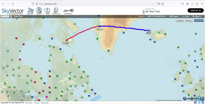
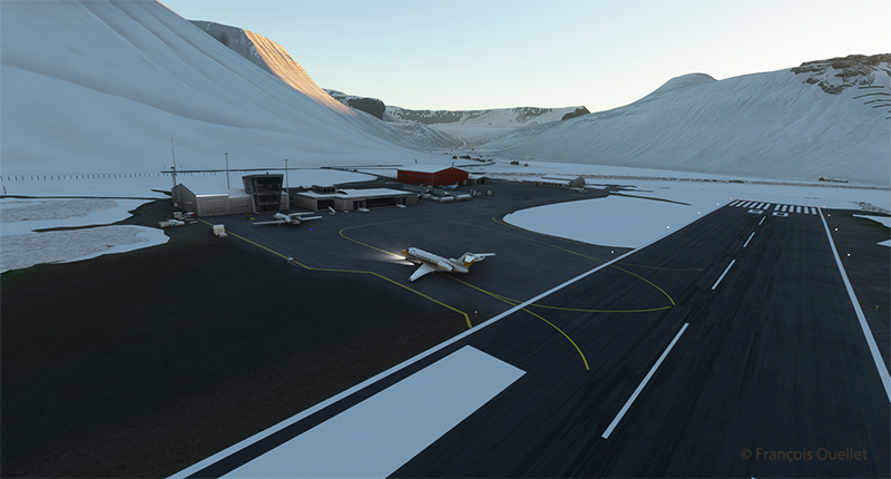
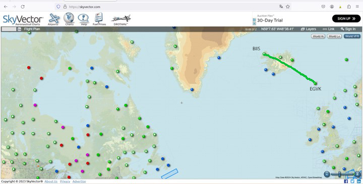
The third leg of the round-the-world flight simulation begins with a departure from Isafjordur (BIIS) in Iceland and ends at Vagar airport (EKVG) in the Faroe Islands, an autonomous archipelago belonging to the Kingdom of Denmark.

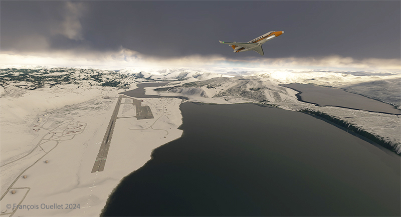
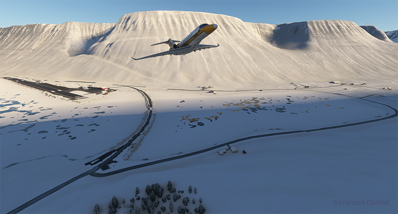
The departure from Isafjordur faces a mountain. You can see the shadows on the ground. But as visibility is perfect, this is no problem at all, as long as the rate of climb is sufficient.

Virtual flight BIIS EGVK
The Cessna Citation Longitude is airborne from the Isafjordur airport (BIIS) in Iceland with Microsoft Flight Simulator.

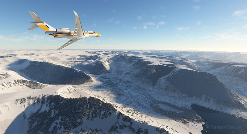
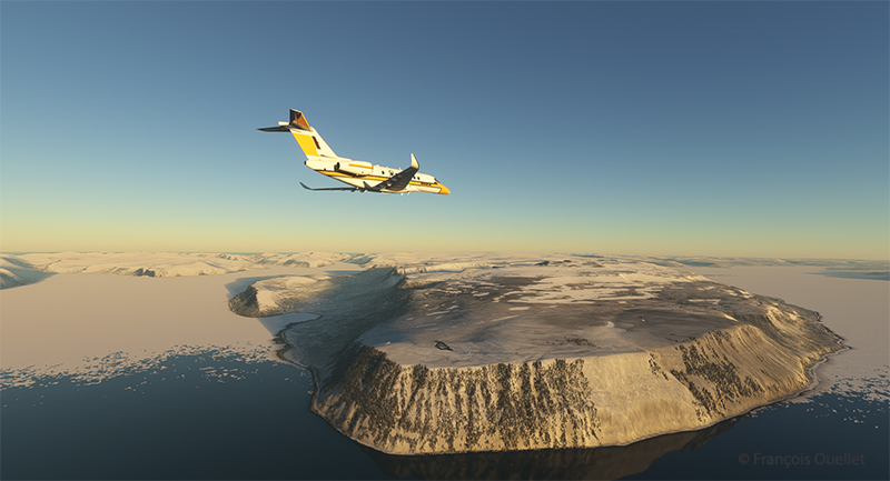
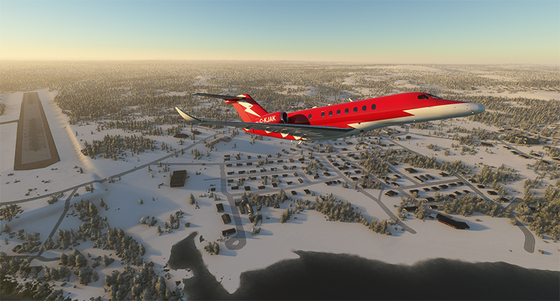
A left turn over the superb Icelandic landscape establishes the Cessna Citation Longitude on course for the Faroe Islands. The FMS ensures that the aircraft will stay on course. But it’s important to remain vigilant: there’s a lot of other equipment that can cause surprises along the way.

The Cessna Citation is climbing slowly over Iceland.

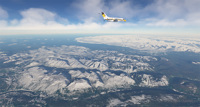
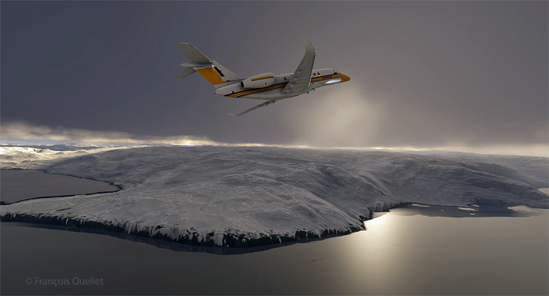
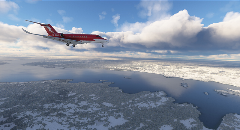
The climb continues over a magnificent landscape. There’s no turbulence today; if there were, the flight simulator would make sure the plane was harder to control, even for the autopilot. I set the virtual flight to observe real air traffic during the flight, but the route between Iceland and the Faroe Islands is off the most popular routes, so it’s normal not to encounter too many aircrafts.

The Cessna Citation Longitude is heading to the Vagar airport (EKVG) in Feroe Islands

We are now established at our cruising altitude, leaving Iceland’s eastern border to fly over the Atlantic Ocean.

Visual approach for runway 12 at the Vagar airport (EKVG) Feroe Islands

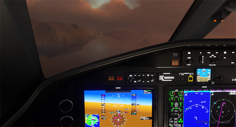
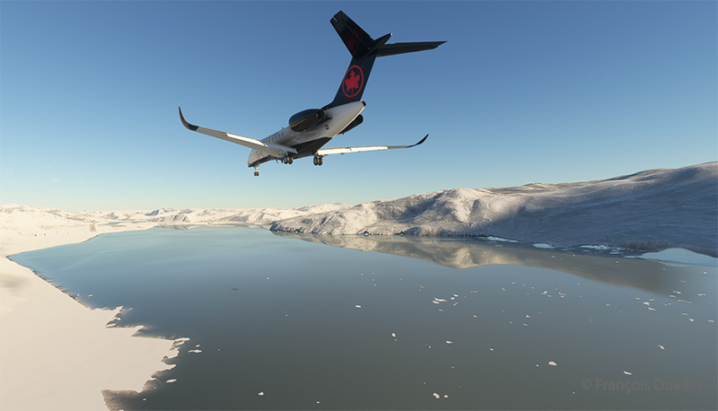
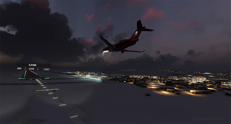
We disconnect the autopilot to give us a free hand on the visual approach to Vagar (EKVG) airport. A small white dot, the lights of runway 12, can be seen straight ahead in the distance.  The landing gear is down, as are the flaps, and the speed has stabilized at around 140 knots for the moment.

The Cessna Citation is on long final for runway 12 of the Vagar airport (EKVG) Faroe Islands

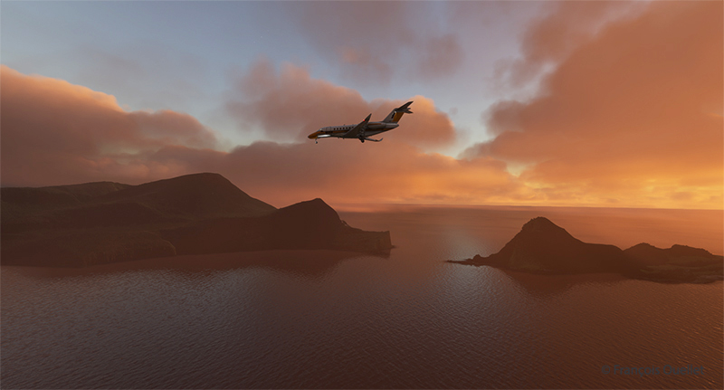
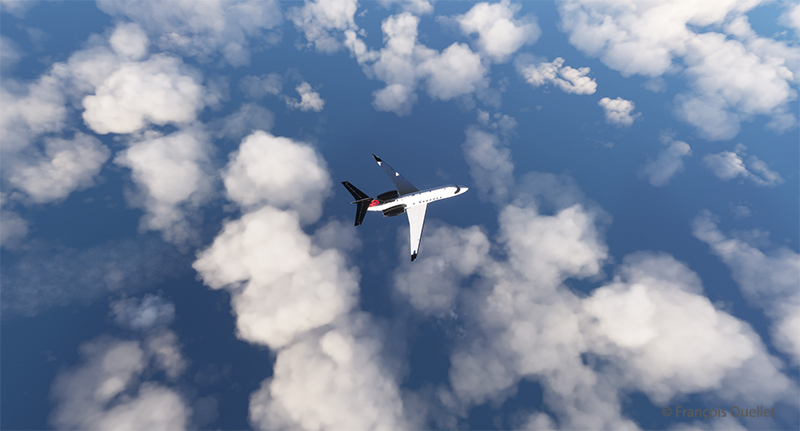
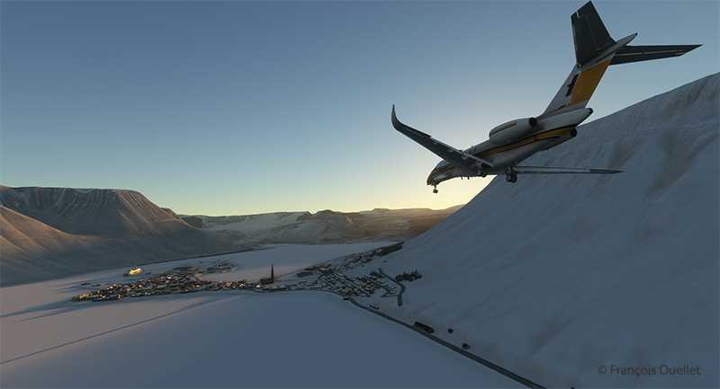
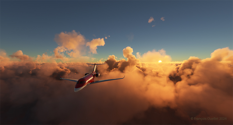
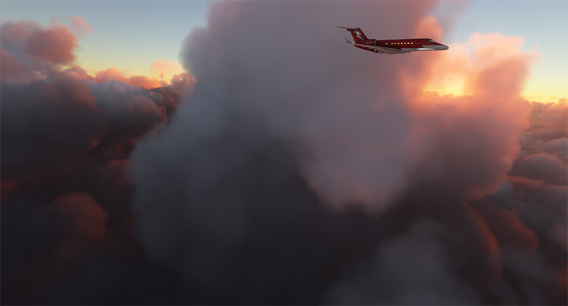
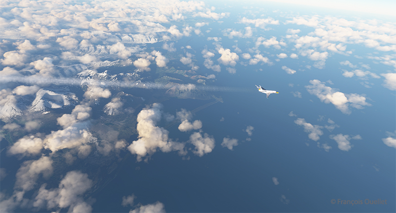
It’s an ideal time to arrive in the Faroe Islands, with the setting sun coloring all the surrounding clouds.

The Citation Longitude on visual approach to runway 12 at the Vagar airport (EKVG)

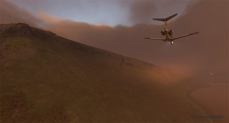
Runway 12 is visible on the far right in the photo above. The uneven cloud cover sometimes blocks the view of the airport for a few seconds, but the wind quickly blows the clouds away, preventing a missed approach. Virtual weather ensures a constant renewal of weather conditions.

The Cessna Citation exits runway 12 at the Vagar airport (EKVG) in Faroe Islands with Microsoft Flight Simulator

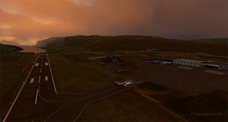
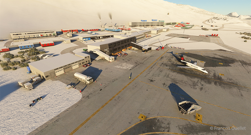
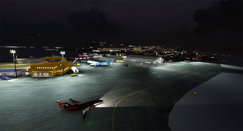
Landing is trouble-free, as the Vagar runway is long enough (5902 x 98 feet) to accommodate such a private jet.

Some 53,000 people lived in the Faroe Islands as of 2021. One of the most popular activities is bird and plant watching. To make it easier for residents and tourists to get around, tunnels have been built between some of the archipelago’s 18 islands.

The fourth leg of the round-the-world virtual flight will take place between Vagar and Ivalo (EFIV) in Finland. This is Finland’s northernmost airport.

Click on the link for more flights around the world in flight simulation on my blog.

Categories
Flight Simulation

Around the world in flight simulation (2)

Climbing from Iqaluit (CYFB) to Kangerlussuaq (BGSF)

For this second leg of the round-the-world flight simulation, the aircraft departs from Iqaluit (CYFB) in appalling weather conditions, but soon find itself above cloud and approaching an area of high pressure. The sky becomes increasingly clear as I approach runway 09 Kangerlussuaq (BGSF) in Greenland.

Virtual flights CYFB BGSF BIIS

The map shows the planned itinerary: departure from Iqaluit (CYFB), stopover in Kangerlussuaq (BGSF) and arrival at destination in Iceland, at Isafjordur airport (BIIS).

Cessna Citation Longitude on the final approach for the Kangerlussuaq virtual airport (BGSF)

Above, the approach to runway 09. You really need to be well prepared for a destination like BGSF. If the pilot arrives after the tower is closed, the fines are very steep. You can generally expect a little mechanical turbulence on the approach to Runway 09, as the mountains on either side of the aircraft change the airflow.

When I worked at the Iqaluit Flight Service Station (CYFB), many pilots would come up to the tower to plan their flight to BGSF. The most frequent problem was the closing time of the control tower in Kangerlussuaq. They knew that a hefty fine awaited them if they arrived late, often due to stronger-than-expected winds or a departure time that was too tight from Iqaluit. Most of the time, they chose to sleep in Iqaluit and leave the next day, rather than force the issue and end up with a $1500.00 bill to pay.

We also had pilots ferrying single-engine planes over the ocean from Europe to America. In this case, the weather had to be excellent, and the captain had to have the necessary equipment on board to attempt (and I do mean attempt) to survive in the ocean in the event of engine failure.

Cessna Longitude parked at Kangerlussuaq (BGSF)

Above, a partial view of Kangerlussuaq’s virtual airport (BGSF), with the Cessna Citation Longitude at a standstill. On the other side of the runway (invisible here), the airport receives military aircraft.

Climbing from (BGSF) Kangerlussuaq to (BIIS) Isafjordur

The next day, after a stopover in Kangerlussuaq, it’s time to continue on to Isafjordur. Take-off is on runway 27. The pitot tube heating system and icing protection are activated before entering the cloud layer.

Airborne from the Kangerlussuaq (BGSF) airport

Flying in real weather makes for unexpected screenshots.

The Cessna Longitude arrives over Iceland in flight simulation

Above, the relief of Iceland shortly before arrival at Isafjordur airport (BIIS). As expected, the sky is clear.

Approaching Isafjordur (BIIS) with the Asobo Cessna Citation Longitude

The approach to Isafjordur is demanding, especially when flying a jet like the Cessna Citation Longitude. You have to save extra speed in the sharp left turn to avoid stalling. I made the turn downhill at 160 knots to get to the runway threshold at the right height. Towards the end of the approach, as the angle of the turn decreases, you immediately reduce speed to around 135 knots.

The Cessna Citation Longitude exits the runway at the Isafjordur virtual airport (BIIS)

Contrary to real life, it is difficult to have a constant view on a runway when doing a virtual approach in a steep turn. A flight simmer would need 3D glasses to quickly look at the runway and then check the instruments. After two unsuccessful attempts where I found myself a little too high above the runway threshold, I nonetheless managed to land. The instrument panel indicated, however, that the brakes worked pretty hard to slow down the plane, which didn’t really surprise me. There are more relaxing approaches…

The next leg on this trip around the world will be a departure from Isafjordur to Vagar (EKVG) in the Feroe Islands.

Click on the link for more flights around the world in flight simulation on my blog.

Categories
Flight Simulation

Around the world in flight simulation (1)

F-14 Tomcat at work over the sea

The flight simulation with Microsoft Flight Simulator lets you fly over the planet like never before from the comfort of your own home. As airports around the world transmit weather observations at all times, it’s possible to import this data into the flight simulator and fly virtually in the real weather conditions reported around the globe.

This data enhances the feeling of reality for the virtual pilot, but at the same time complicates his task, as he has to take into account the presence of thunderstorms and icing, surface and upper-level winds, changes in cloud cover, visibility, pressure, and so on.

Today’s virtual pilot must also anticipate that failures of all kinds may affect the flight, especially if he or she owns a high-quality virtual aircraft. The engine(s) may fail, a structural problem may affect the aircraft’s controls and navigation equipment may cease to function. Good planning is essential, just as in real life. And since the brain doesn’t differentiate too much between the real and the virtual, there’s plenty of fun to be had.

So, I’ve decided to fly around the world as a millionaire, at my own pace, i.e., using the types of aircraft that tempt me, and flying the routes that are of particular interest. All of this will be done in real weather, with all its joys and obstacles. I’ll be publishing one of these routes on my blog from time to time.

The initial route departs from Quebec’s Jean-Lesage airport (CYQB), passes through Goose Bay (CYYR), in the Canadian province of Newfoundland and Labrador, heads north to Kuujjuaq and ends in Iqaluit (CYFB).

Virtual Flight 2 will present a few photos of the Atlantic crossing from Iqaluit to Kangerlussuaq (BGSF) in Greenland, to Isafjordur (BIIS) in Iceland .

Isafjordur airport has a challenging approach. I don’t know if the Cessna Citation Longitude will be able to land there in one piece, but I intend to give it a try.

Virtual flight 1.

Virtual flights CYQB CYYR CYVP CYFB
Enroute from Quebec City (CYQB) to Goose Bay (CYYR)

Above, the setting sun illuminates the clouds and the Cessna Citation Longitude en route from Quebec City to Goose Bay. At high altitude, the pilot sets the altimeter to the standard atmospheric pressure of 29.92 inches of mercury. Since all the other pilots are doing the same, a safe separation between the aircraft is ensured.

Approaching the Kuujjuaq airport (CYVP) in Quebec.

The next day, the aircraft is seen approaching Kuujjuaq (CYVP) in Nunavik. The altimeter is set to the airport’s atmospheric pressure to reflect the correct height of the runways in relation to the aircraft. Near the airport, the autopilot is disconnected, and the approach is made manually and visually. The desired speed is around 135 knots for the final.

Departing Kuujjuaq airport (CYVP) with the Cessna Citation Longitude

Above, the jet takes off from Kuujjuaq bound for Iqaluit (CYFB) on Baffin Island in Nunavut.

Enroute to Iqaluit airport (CYFB)

The setting sun illuminates the aircraft’s windows. The approach to Iqaluit has begun. The descent is gradual, so as not to cause discomfort to the virtual passengers…

On final for runway 34 of the Iqaluit airport (CYFB)

Above, the aircraft is on final for runway 34 at Iqaluit (CYFB).

The yellow Iqaluit flight service station (FSS) in Iqaluit (CYFB)

The first leg of our virtual flight around the world ends in Iqaluit, the airport where I worked for two and a half years as Flight Service Specialist (FSS) in the yellow tower on the left of the photo.

Flight service specialists at work at the Iqaluit flight service station in 1989

Above, a photo of the interior of the Flight Service Station at the time. One FSS worked on arrivals and departures at the airport, while the other handled transatlantic flights between Europe and mainly the western USA.

Click on the link for more flights around the world in flight simulation on my blog.