Leg 10 of this round-the-world flight simulation trip takes place between Poland and Germany. Two very different aircraft will be used to complete the journey during this day of VFR flying: an old Junkers Ju 52/3m and a modern business helicopter, the Airbus H160.
Junkers JU 52 airborne from the Lublin airport (EPLB) in Poland.
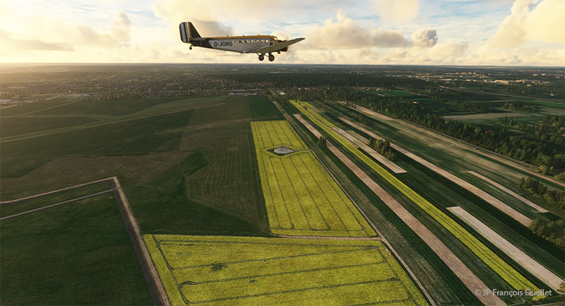
Departure is from Lublin airport (EPLB) in Poland. The Junkers Ju 52/3m takes off without a hitch over a short distance. The big three-engine tailwheel is as predictable as the Cessna C-170B I used in real life to cross Canada in 1981. Above, one can see the cultivated fields of Poland.
Junkers JU 52 and the Moritzburg Castle in Germany in flight simulation
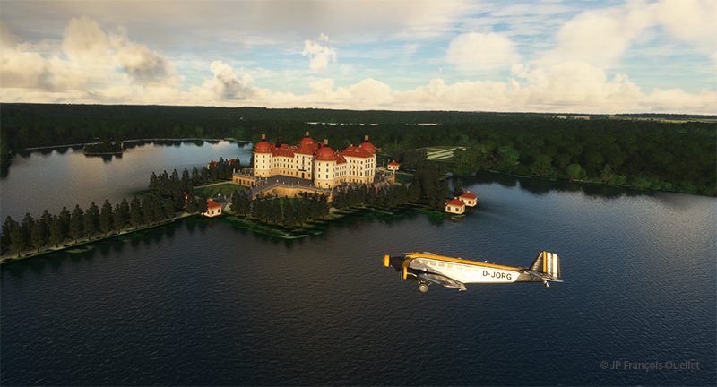
It’s shaping up to be a beautiful morning, weather-wise. The first leg of the trip takes us over Moritzburg Castle (Schloss Moritzburg), northwest of Dresden. Built in 1542, it was originally the hunting lodge of the Duke of Saxony.
Junkers JU 52 enroute to the Landesmuseum für Vorgeschichte Halle in Germany
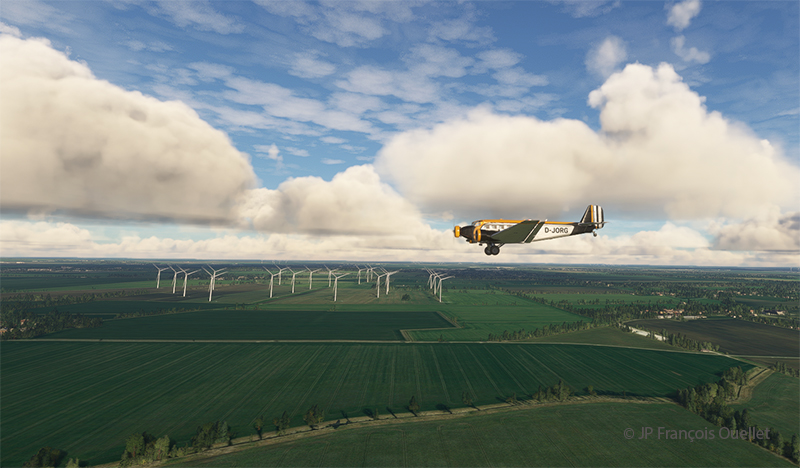
On the way to Halle is a large wind farm. Germany, like Europe, is rapidly developing its green energy. Russia’s recent attitude to Europe’s natural gas supply has drastically changed energy planning in neighboring countries.
A Junkers JU 52 flying over the State Museum of Prehistory Halle in Germany in flight simulation
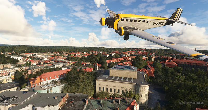
Above, in the center of the photo, is a partial view of the National Museum of Prehistory in Halle (Landesmuseum für Vorgeschichte Halle), not far from Leipzig. It is one of Central Europe’s leading archaeological museums.
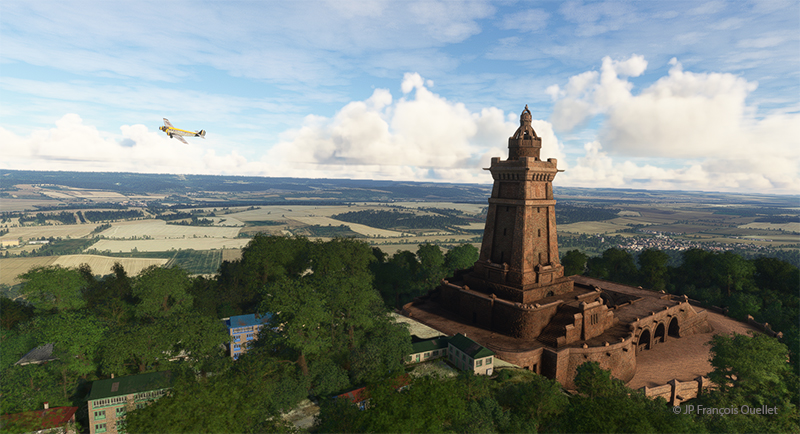
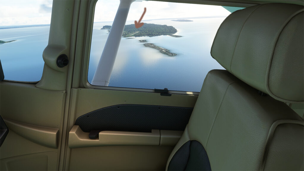
Fly-by of the Kyffhaüser-Denkmal in Germany by a Junkers Ju 52 in flight simulation
Before reaching Calden airport to change aircraft, we gaze at the Kyffhaüser monument (Kyffhaüser Denkmal). Once in Calden, we jump into a modern Airbus-built H160 helicopter and head for Göttingen, more precisely over the Münchhausenstrasse.
We’ve obtained permission to fly over this thoroughfare at very low altitude, just long enough to say hello to an old acquaintance. This dubious authorization will probably cost Germany’s Minister of Transport his job.
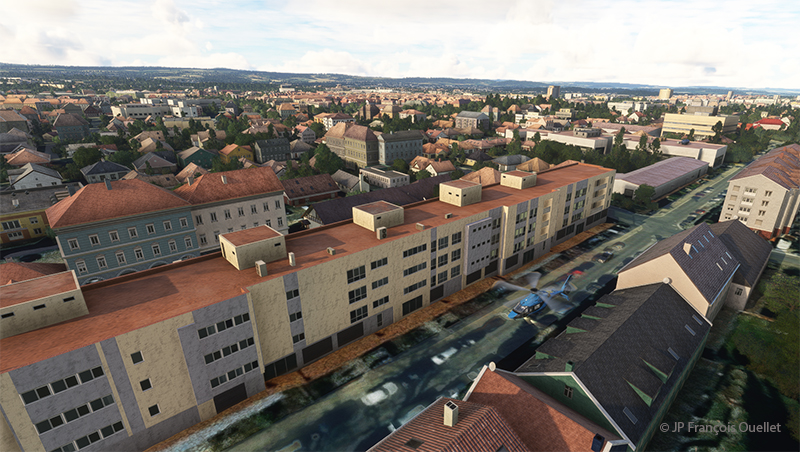
Streets of Göttingen, Germany, in flight simulation
A flyover of this Göttingen street is necessary to verify the extent of the traffic.
Helicopter descending on Münchhausenstrasse, Göttingen, Germany, in flight simulation.
The descent is gradual between the buildings. We hover just above the cars. Pedestrians seem to wave at us, but we may misinterpret the gesture. Our friend is at the window and takes the time to stop his reading of an excellent comic strip to wave at us. We then continue on our way to Padderborn Lippstadt Airport (EDLP), our destination for today.
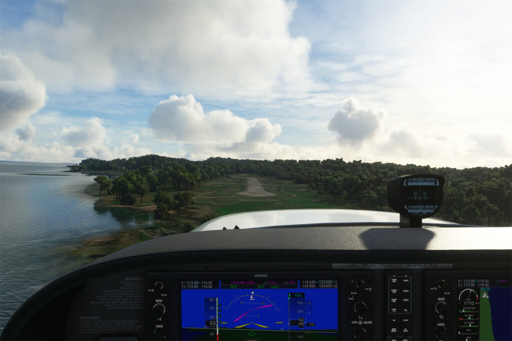
Helicopter H160 landing at the Padderborn Lippstadt (EDLP) in Germany in flight simulation.
Still, there’s a fair amount of activity at the airport. Immediately after landing, we’ll start planning leg 11 of this round-the-world flight simulation and real weather trip.
The flight simulation with Microsoft Flight Simulator lets you fly over the planet like never before from the comfort of your own home. As airports around the world transmit weather observations at all times, it’s possible to import this data into the flight simulator and fly virtually in the real weather conditions reported around the globe.
This data enhances the feeling of reality for the virtual pilot, but at the same time complicates his task, as he has to take into account the presence of thunderstorms and icing, surface and upper-level winds, changes in cloud cover, visibility, pressure, and so on.
Today’s virtual pilot must also anticipate that failures of all kinds may affect the flight, especially if he or she owns a high-quality virtual aircraft. The engine(s) may fail, a structural problem may affect the aircraft’s controls and navigation equipment may cease to function. Good planning is essential, just as in real life. And since the brain doesn’t differentiate too much between the real and the virtual, there’s plenty of fun to be had.
So, I’ve decided to fly around the world as a millionaire, at my own pace, i.e., using the types of aircraft that tempt me, and flying the routes that are of particular interest. All of this will be done in real weather, with all its joys and obstacles. I’ll be publishing one of these routes on my blog from time to time.
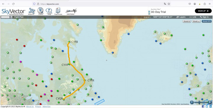
The initial route departs from Quebec’s Jean-Lesage airport (CYQB), passes through Goose Bay (CYYR), in the Canadian province of Newfoundland and Labrador, heads north to Kuujjuaq and ends in Iqaluit (CYFB).
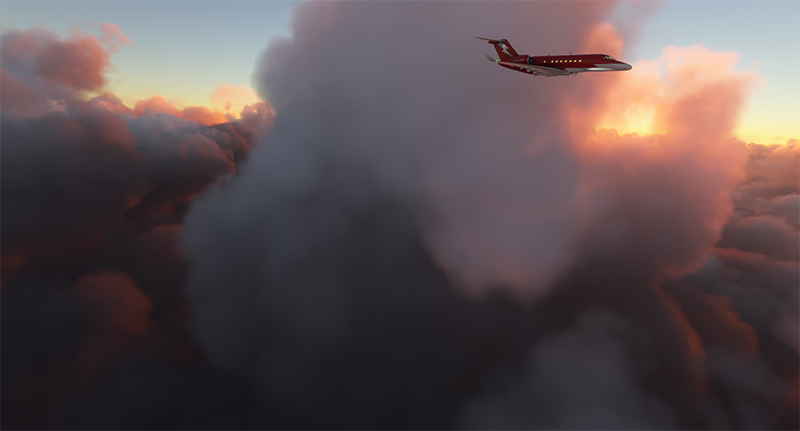
Virtual Flight 2 will present a few photos of the Atlantic crossing from Iqaluit to Kangerlussuaq (BGSF) in Greenland, to Isafjordur (BIIS) in Iceland .
Isafjordur airport has a challenging approach. I don’t know if the Cessna Citation Longitude will be able to land there in one piece, but I intend to give it a try.
Virtual flight 1.
Virtual flights CYQB CYYR CYVP CYFB
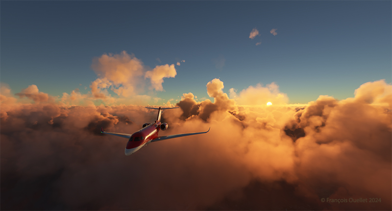
Enroute from Quebec City (CYQB) to Goose Bay (CYYR)
Above, the setting sun illuminates the clouds and the Cessna Citation Longitude en route from Quebec City to Goose Bay. At high altitude, the pilot sets the altimeter to the standard atmospheric pressure of 29.92 inches of mercury. Since all the other pilots are doing the same, a safe separation between the aircraft is ensured.
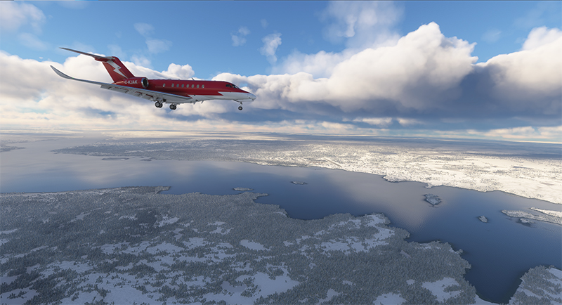
Approaching the Kuujjuaq airport (CYVP) in Quebec.
The next day, the aircraft is seen approaching Kuujjuaq (CYVP) in Nunavik. The altimeter is set to the airport’s atmospheric pressure to reflect the correct height of the runways in relation to the aircraft. Near the airport, the autopilot is disconnected, and the approach is made manually and visually. The desired speed is around 135 knots for the final.
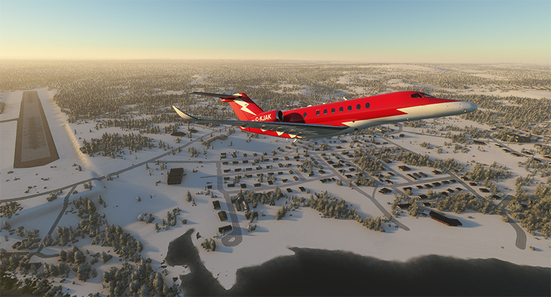
Departing Kuujjuaq airport (CYVP) with the Cessna Citation Longitude
Above, the jet takes off from Kuujjuaq bound for Iqaluit (CYFB) on Baffin Island in Nunavut.
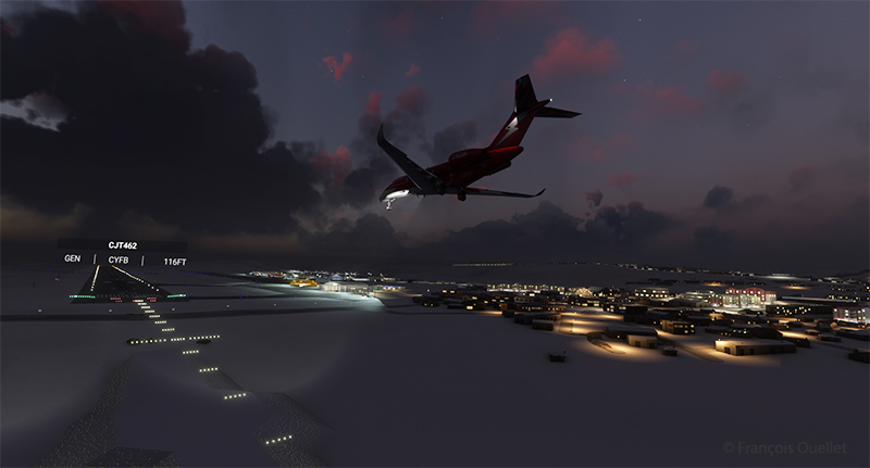
Enroute to Iqaluit airport (CYFB)
The setting sun illuminates the aircraft’s windows. The approach to Iqaluit has begun. The descent is gradual, so as not to cause discomfort to the virtual passengers…
On final for runway 34 of the Iqaluit airport (CYFB)
Above, the aircraft is on final for runway 34 at Iqaluit (CYFB).
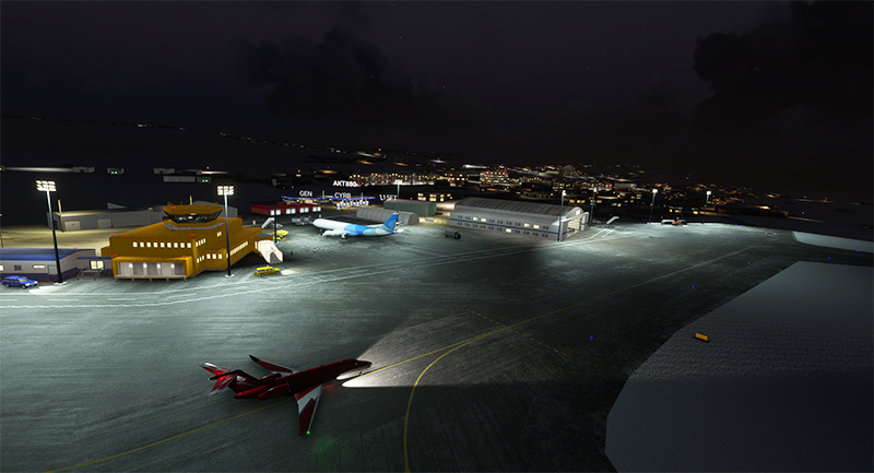
The yellow Iqaluit flight service station (FSS) in Iqaluit (CYFB)
The first leg of our virtual flight around the world ends in Iqaluit, the airport where I worked for two and a half years as Flight Service Specialist (FSS) in the yellow tower on the left of the photo.
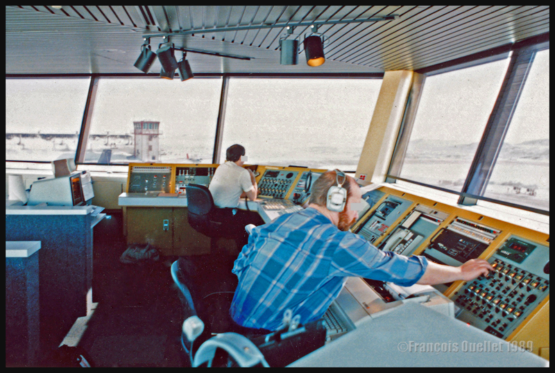
Flight service specialists at work at the Iqaluit flight service station in 1989
Above, a photo of the interior of the Flight Service Station at the time. One FSS worked on arrivals and departures at the airport, while the other handled transatlantic flights between Europe and mainly the western USA.
Decades ago, Canadian authorities used this island in the middle of the St. Lawrence River as a quarantine site for immigrants arriving in Canada. Many Irish people, among others, made an obligatory stop on this strip of land before being allowed to continue their journey to Canada.
At one time, a section of the island was reserved for Canadian and American researchers for their top secret research on Anthrax.The most amazing thing about reading the article is realizing that the entire production of this bacteriological weapon (439 liters) was mixed with formaldehyde and put in barrels that were dumped somewhere in the St. Lawrence River when it was decided that it would no longer be useful, as the Second World War took a turn in favor of the Allies. It seems to me that formaldehyde does not prevent barrels from rusting, but hey… back to the point.
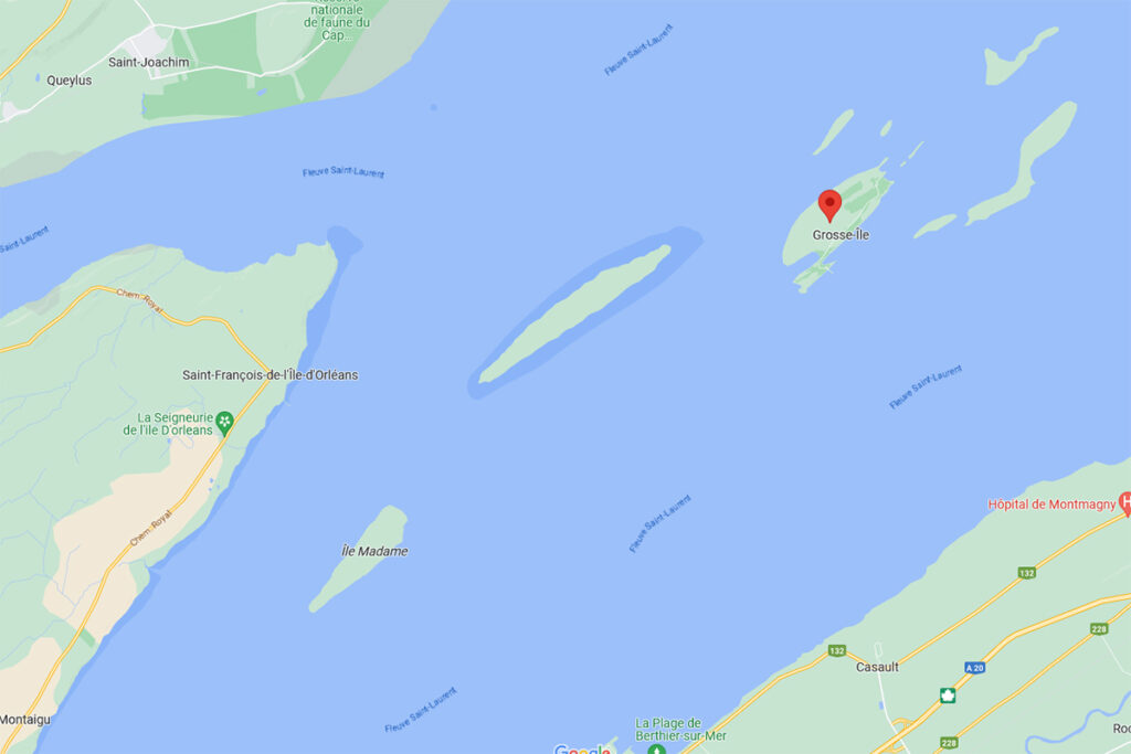
Where is Grosse-Île located? In the province of Quebec, a little east of Quebec City. It is one of the many islands that you can fly over once you have left Île d’Orléans behind. Below, a screenshot from Google Maps.
Grosse-Île in Quebec on Google Maps.
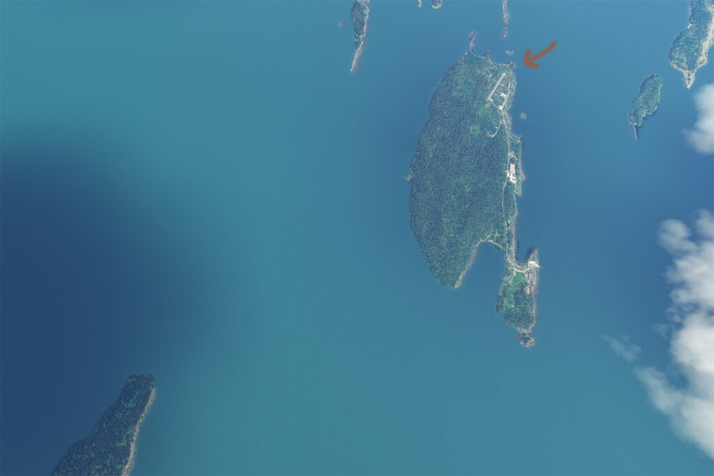
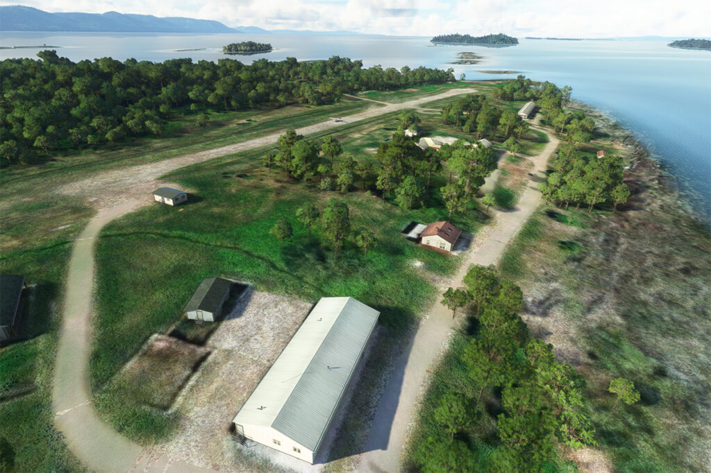
The satellite image below clearly shows that this is not an invention. Microsoft designates this runway as CYMN Montmagny: a mistake that one can easily live with, since by giving an official code to this Grosse-Île runway, the pilot can use it as a navigation point in his GPS.
Satellite view of Grosse-Île and its runway.
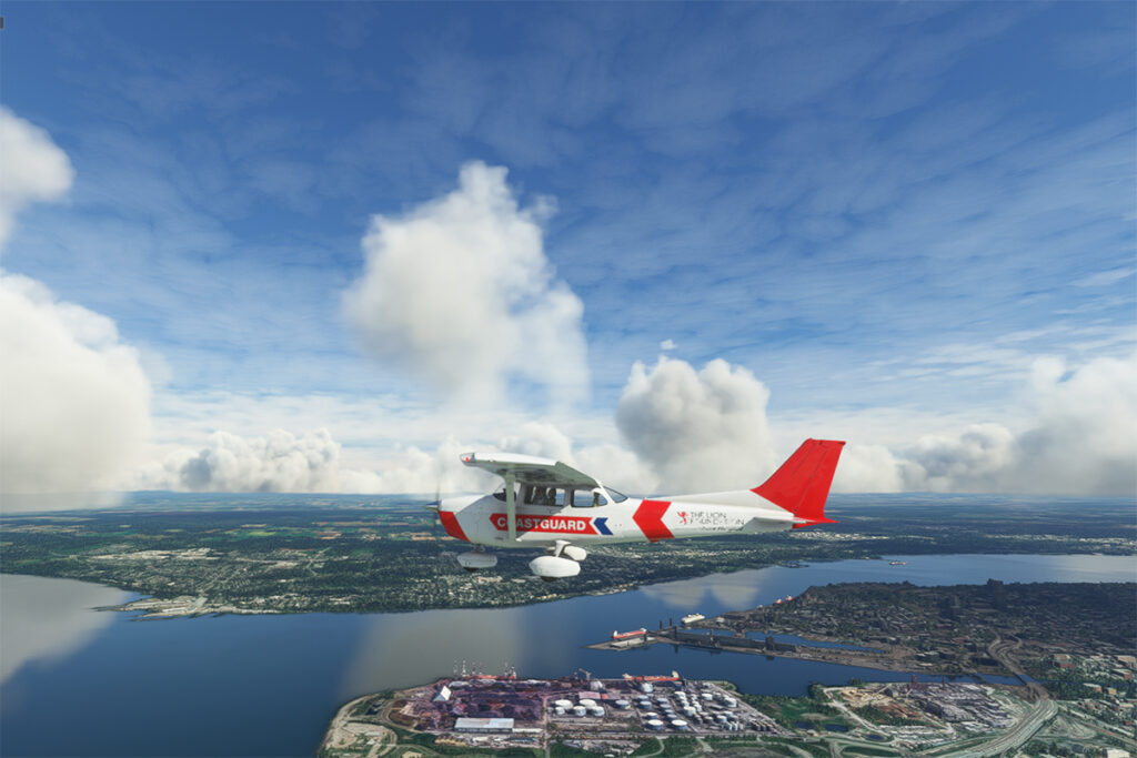
So, let’s use a small Cessna in US Coast Guard colors to make a virtual flight from Quebec City airport (CYQB) to Grosse-Île (CYMN). It was a bit chilly on this February day in Quebec City, so I decided to transport us to July for this flight, adding a few cumuliform clouds in the process.
Leaving Quebec City for Grosse-Île with MSFS 2020.
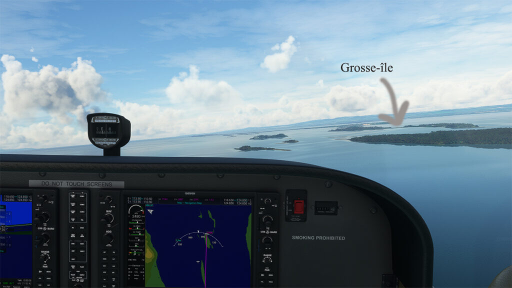
This short flight will allow us to fly over Île d’Orléans, Île Madame (owned by Laurent Beaudoin, former major shareholder of Bombardier), Île au Ruau (purchased in 2019 by the rich owner of the Gildan empire) to finally arrive at Grosse-Île.
Approaching Grosse-Île over the St Lawrence Seaway with the MSFS 2020 flight simulator.
The picture below shows the aircraft on a right base for the Grosse-Île runway. I do not know the official dimensions of this dirt airstrip, but it can easily accept a Cessna aircraft such as ours.
Cessna in base for the Grosse-Île runway with the MSFS 2020 flight simulator.
Below, the aircraft is on final for the runway.
On final for the Grosse-Île runway.
A final screenshot shows the Cessna taxiing down the runway after landing. As you can see, the runway can accommodate much larger aircraft. If you want to make a real flight to this island, find out beforehand about the condition of the runway and the restrictions surrounding its use by visiting pilots.
Cessna aircraft on Grosse-Île after the landing.
Click on the link for more flight simulation experiences on my blog.
Enlarging the Blake and Mortimer album: La vallée des immortels tome 1
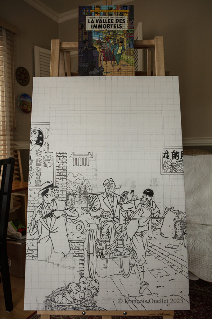
In February 2023, I began transferring the cover of the Blake and Mortimer album “The Valley of the Immortals – Part 1” to a 24 x 36 inch canvas.
The photo above shows the original album sitting on top of the canvas and the work in progress. There is still a lot of work to do before the drawing and lettering are finished.
Then comes the coloring stage, to get the tones as close as possible to the original album. The cover has a lot of colors, which is not the case with many other Blake and Mortimer albums.
This particular album resonates with me for several reasons. First of all, the authors use in the scenario a Cessna C-170B type plane, which brings back memories of flying. Indeed, by a happy coincidence, in 1981 I flew across Canada in this small aircraft dating from 1952. The plane was not equipped with any air navigation instruments, except for an old compass. We were not yet in the GPS era! I published the story of this flight from St-Jean to Edmonton on my blog.
Another reason that increases my interest in the album is also related to a memory. On the cover, Mortimer is in Wan Chai District, a district I visited in 1990 during a trip to Hong Kong and the New Territories. At that time, the Cathay Pacific Boeing B-747 used the legendary Kai Tak airport and flew the approach over a huge demonstration of more than 100,000 people commemorating the anniversary of the Tiananmen Square massacre.
I will be posting more photos of “The valley of the immortals” painting over the next few months, numbering the title of each article so that those interested in the subject can find their way around.
Tales of a Dakota Pilot – The way it was 1929 – 1937
This is a simple and charming little book retelling the life stories of the pilot Fred Max Roberts Jr when he was flying his airplanes in the Bismark region, North Dakota, between 1929 and 1937. The book was written by his son, Fred Marke Roberts, so that some of his father’s stories do not fall in oblivion. You will find here a good idea of how things were done in the early years of aviation.
An original and easy way of refueling
When came the time to refuel, the pilots would regularly land on a farmer’s field. They knew that somebody had noticed the landing and, most of the time, a fuel truck would be sent without any previous arrangements. The pilot had nonetheless the duty to make sure he landed close to an easy access for the fuel truck. Sometimes, to simplify the refueling process a bit, the pilot landed directly on the road, outside of the city.
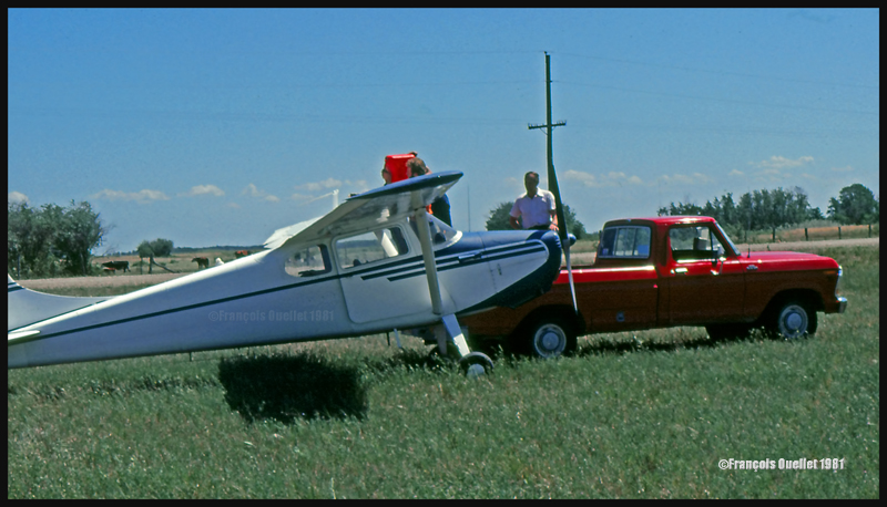
This habit did not seem to have change fifty years later when I did a 2650 kilometers cross-country flight with a Cessna 170B, between St-Jean-sur-Richelieu, Quebec, and Edmonton, Alberta. During the trip, I had to land in a field near Lundar, Manitoba, a Canadian province which is bounded to the south by North Dakota and Minnesota. Soon after the landing, a pick-up truck carrying fuel approached the plane. I had not made any arrangements for fuel. In my case, a precautionary landing was needed as the fuel gauges had started to give false indications. Since fuel was readily available, the tanks were topped before the next takeoff.
Landing in a field with a Cessna C170B in Lundar, Manitoba in 1981.
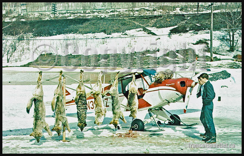
Killing coyotes against the county bounty
Coyotes where frequently attacking farmer’s livestock. When the situation was getting out of control, the farmers would phone Fred Max. The latter would take off with his Curtiss Junior Pusher, accompanied by an experienced shooter and they would spot and kill coyotes. Winter was the best season for hunting from the air since the coyote’s dark colored fur contrasted against the white snow.
The farmers, on their horses, were following the aircraft’s manoeuvers to spot where the coyotes had been shot. They then brought the dead animals back to their farm. Few minutes later, the aircraft would land as close to the farm as possible and the pilots picked up the coyotes, bringing them back to the county’s bureau in order to receive the published bounty for each killed coyote.
Super Cub and wolves shot from the air in Northern Ontario, Canada, on an aviation postcard dating from the sixties.
The American Midwest farmer’s hospitality
When a pilot landed in a farmer’s field, as a stopover on a long cross-country flight, he would often be offered a meal with the farmer’s family. If darkness was an obstacle for the continuation of the flight, the pilot was often offered a bed for the night. The next morning, after breakfast, and as a thank you gesture, the pilot would offer the farmer a courtesy flight.
A practical way to lower the costs associated with a long cross-country flight
An easy way to reduce the costs associated with a long cross-country flight was to offer airplane rides to villagers who had come to meet the pilot once at the destination. The pilot landed, waited a bit and knew that, soon, few people would come to him to ask for a ride.
The pilot Fred Max Roberts Jr hanging to the wing of his monoplane
A major concern for any pilot landing in a field was to find a fence to tie the plane as soon as possible to protect it from the strong winds blowing over the Midwest plains. But really strong gusts would sometimes break the ropes.
The pilot tells the reader that he was once immobilized in the middle of a field while a storm was quickly approaching. He got under the wing of his monoplane and hanged to it in order to add some weight. But that was not enough. A strong gust lifted the plane, broke the two tie-downs and sent pilot and plane flying at about ten feet in the air. Fearing that his plane would continue to climb without him at the controls, the pilot let go. The plane maintained a level flight while backing until it suddenly rolled and crashed.
Pilot and passengers are caught in flight by a tornado
Flying and meteorology manuals teach every pilot the necessity to avoid thunderstorms because, among other reasons, of the extreme ascending and descending air currents that are present in a well-developed cell. The pilot Fred Max Roberts Jr not only went through a thunderstorm but survived a tornado while he was in flight. His story was published in many newspapers at the time. Some of the articles are reproduced in the book.
As the pilot tells it, meteorological forecasts and weather observations were not as easily accessible as they are today. During a flight with passengers in his Waco 90 biplane, the sky suddenly darkened and the weather degraded rapidly. The pilot tried his best to fly between two important cloud formations. He could hardly see his instruments due to the lack of light, even if the flight was made during the day. He was fighting to avoid being disoriented.
Suddenly, the plane started to gain altitude rapidly by itself. The pilot nosed his ship downward and applied full power. This was useless. The aircraft was still rapidly climbing, tail first. Then the ascent abruptly stopped and a dive ensued. He pulled on the stick to bring his Waco to a level flight, but the rapid descent continued. Having no other choice, he applied full throttle and set his plane for a normal climb. Again, the descent continued until the Waco was at about 500 feet above ground level.
Eventually, they got out of the storm and landed at White Rock. Fred Max then realized that his passengers, sitting in the open cockpit Waco during the storm, had not fasten their seat belts and were hanging for dear life to a brace running across the front of the passenger cockpit.
Those are some of the tales a reader can find in “Tales of a Dakota Pilot”, an unpretentious book but nonetheless a publication that might very well surprise many young pilots, as the 1930’s way of flying so differed from what a young pilot lives when he integrates today’s world of aviation.
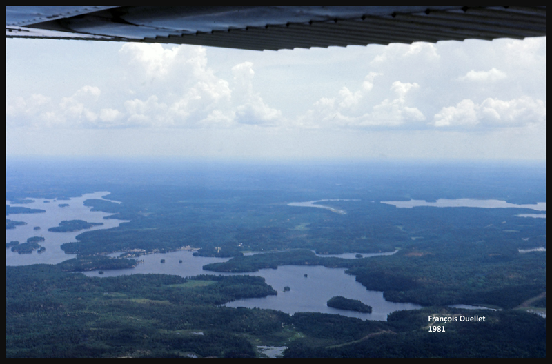
After a proficiency check, I soon find myself flying a Cessna 170B (tail wheel) on a flight across Canada, from St -Jean-sur- Richelieu, Quebec, to Edmonton, Alberta. I am accompanied by the aircraft’s owner who has not yet completed his private pilot course. The 1952 Cessna flies well, but has absolutely no instruments for air navigation, not even a VOR nor ADF. And the era of the portable GPS is not yet upon us.
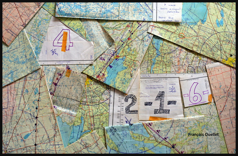
Fourteen 1:500,000 VFR charts, covering the planned flight, are folded, glued and numbered. I trace the expected flight path on each chart, with 10 miles landmarks. This will facilitate the monitoring of our progress, considering the absence of navigation equipment. The preparation now completed, the take off is done on a beautiful summer day of 1981.
1:500,000 VFR charts used for a flight toward Edmonton, Canada, in 1981
We do stopovers at Gatineau, North Bay, Sudbury and then fly along Lake Superior to Wawa.
Small break in Sudbury on a VFR flight to Edmonton in 1981
We fly around Lake Superior to our next stopovers, Thunder Bay and Fort Frances. Over large forested areas, with no major landmarks, the gyroscopic precession must be corrected frequently so as not to stray too far from the intended track. Sometimes when it facilitates navigation, we either follow a railway or main roads. There are some instances where the westerly winds are so strong that our ground speed is slower than a car on a highway.
From Fort Frances to Kenora in 1981, with a Cessna C170B
Our flight path follows a line that keeps us away from areas of high air traffic. I choose to fly north of Winnipeg terminal control area, thus avoiding frequent radio exchanges with air traffic control in a language I do not master. The underperforming radio would not be of any help at any rate. This option eventually means that we must fly over Lake Winnipeg, in its southern portion. We have enough altitude to be able to glide to the other side in case of an engine failure. Nonetheless, we realize that we are gradually loosing several thousand feet due to the cold air mass above the lake. This with maximum power applied. The unexpected descent eventually ends, but it is now impossible to have an engine failure without ditching in the lake…
The crossing of Lake Winnipeg with a Cessna C170B in 1981
Near Lundar, Manitoba, the aircraft’s old gauges indicate a significant loss of fuel. It is surprising since we refueled an hour ago. We must land the plane on the nearest runway, but the strong crosswinds exceed the capabilities of the aircraft. Nonetheless, an attempt is made with the result that only the left wheel accepts the contact with the runway. As soon as the right wheel also touches the ground, the aircraft becomes airborne again. A nearby field is selected to make a precautionary landing so that the fuel status can be verified. We fly at low altitude over the electrical wires and the cows in the adjacent field, and touch smoothly at a ground speed not exceeding 15 knots. A farmer witnesses the landing and arrives in his red pick-up to offer some help. The tanks are almost full, so the plane only needs few liters of gasoline. Once this is done, we take off westward. It appears that the old fuel gauges of this 1952 Cessna are now totally unreliable…
Landing in a field with a Cessna C170B in Lundar, Manitoba in 1981.
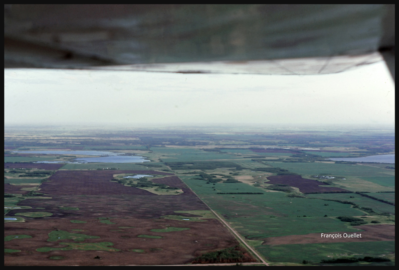
We leave Manitoba through Dauphin and enter Saskatchewan. If we were to experience an engine failure above such uniform fields, the risk of serious problems at landing would be virtually nonexistent.
Near Yorkton, Saskatchewan, in flight with a Cessna C170B in 1981
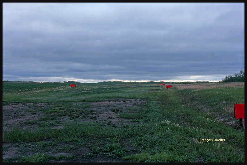
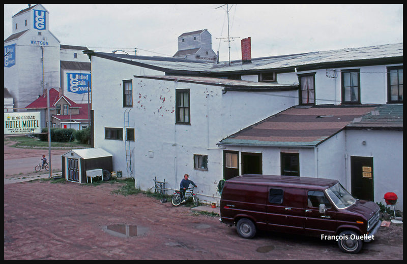
The weather is slowly deteriorating. We choose to land in Watson, Saskatchewan, on the nearest runway.
The runway surface consists of muddy earth and grass, and it’s delimited by small red wooden panels. As we touch the ground, the tires splash mud everywhere, including under the wings.
The Watson runway, Saskatchewan, in 1981
The King George motel in Watson, Saskatchewan in 1981
Finally, the weather improves and a takeoff is made toward North Battleford, the last stop before Edmonton. The sloping terrain forces us to fly lower and lower near Edmonton, under an overcast stratocumulus, limiting our ability to see a long time in advance the correct airport from the three available (international, civil , military ). Luckily, everything goes well in choosing the right airport and approach, but we cannot say the same with radio communications. The sound quality coming from the old speaker is awful and the English spoken by the air traffic controller too fast for us. The combination of these two factors causes the controller to repeat more than once his instructions until he finally decides to slow down and we can officially say: « Roger! »
After spending few days in Edmonton it is now time for the return flight to St-Jean. This proves to be much easier and faster because the westerly winds push the aircraft. Our ground speed is sometimes double what we had managed to get on our trip to Edmonton. The journey took us twenty-five hours to go and eighteen hours to come back.
Cessna C170B in flight over Canada, summer 1981.
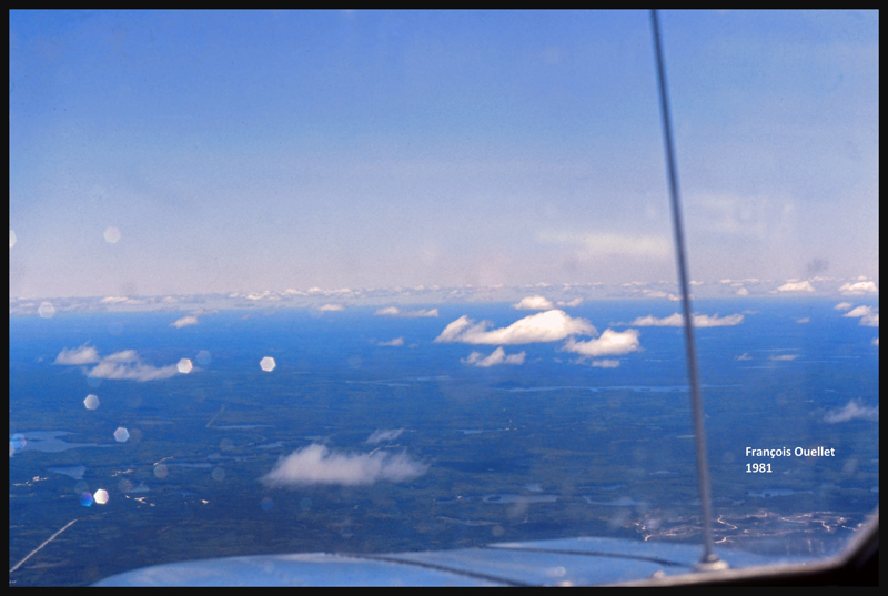
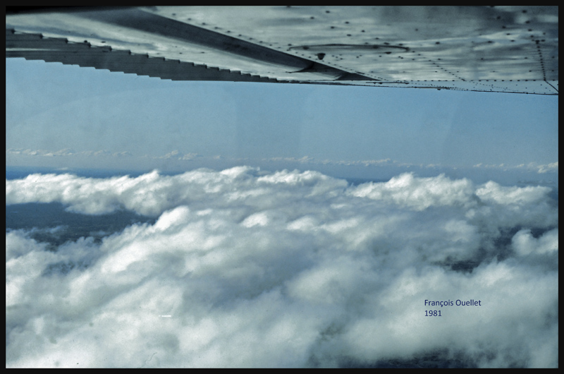
Climbing to 9,500 feet on the return leg to St-Jean-sur-Richelieu, in 1981.
VFR “on top” with a Cessna C170B in 1981 over Canada
Over North Bay, Ontario, the weather is ideal. But we will have to land in Ottawa while waiting for thunderstorms to move away from Montreal and St-Jean-sur-Richelieu. After a total of forty- three-hours of flying time, the old Cessna 170B is landing back to St- Jean -sur- Richelieu.
A few months later, I got my commercial pilot license. It was now time, as for all pilots, to accumulate flying hours in order to gain experience as captain.
I chose to accumulate hours by making short cross-country trips and offering first flights to people of all ages. The evenings were particularly popular because there was little convection and most passengers appreciated a smooth ride for their first flight in a small aircraft.
A Tire Bursts on Landing.
Despite my best intentions, there has still been an occasion where I had to perform an unusual landing. It was during a busy time for air traffic control. Many aircrafts were in the St-Jean-sur-Richelieu (CYJN) airport’s circuit pattern and the controller asked me if I could make a short landing with my Grumman Cheetah (AA-5A). He was counting on a minimal roll after the landing so that the aircraft could exit the runway as soon as possible.
All pilots know how to make a short landing. This is part of the basic training and I accepted this restriction. This can, however, be complicated by the fact that sometimes we had to fly an aircraft with particularly worn out tires. I remember (and I should not be the only one) having had to use an aircraft on which we could see the rope under what was left of the rubber sole. School aircrafts are generally safe. You just don’t want to be the one using the plane the day before the tires have to be changed…
So I began the approach toward runway 29 on a particularly hot summer day. Touchdown was smooth. I applied the brakes without blocking the wheels, while pulling on the control column at the same time that the flaps were returning to their initial position. A pilot does not block the wheels when breaking as the friction decreases and the length necessary to stop the aircraft increases.
At the same time, blocking the wheels increases the risk of loss of control of the aircraft. With these manoeuvers, my aircraft was supposed to stop quickly. However, a few seconds after landing, it started to vibrate and move to the right. I had no other choice but to apply a lot of pressure on the left brake and use full deflection on the left rudder trying to keep the aircraft centered on the runway. Nevertheless, the aircraft slowly headed toward the right side of the runway while slowing down. The landing ended with the left wheel on the runway and the right wheel in the grass.
During the last few seconds, it became obvious that I was dealing with a flat tire. The passengers were not too bothered by the incident because they only started to realize what was happening when we were almost immobilized on the grass. The tire was completely twisted but still on the wheel. Equipment failure is something a pilot knows he will have to deal with from time to time. So considering that it was part of the job, I continued to accumulate flying hours during the following weeks and months.