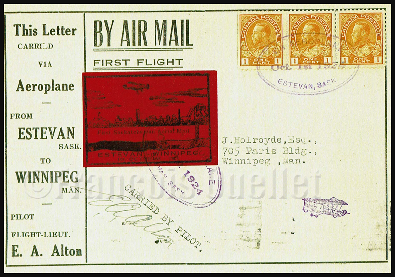
Airmail Estevan Winnipeg CLP5 semi official stamp front cover
The CLP5 semi-official stamp was issued on October 1st,1924 and put on airmail covers for the first airmail flight planned from Estevan, Saskatchewan to Winnipeg, Manitoba. What initially seemed to be a publicity stunt toward the use of airmail was instead a marketing operation planned by two promoters of a local industry, coal mining.
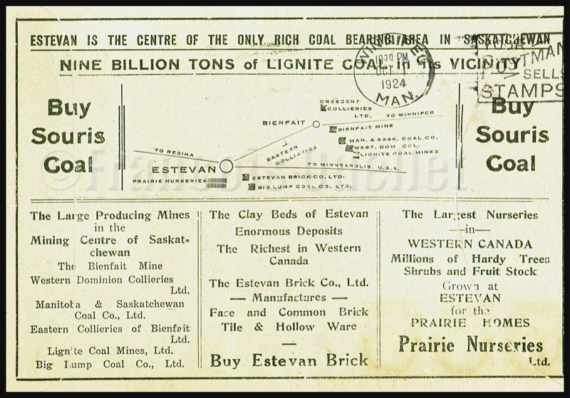
The Estevan to Winnipeg flight promoter and his associate had personal interests in the Eureka Coal and Brick mining company. On the back cover, we even have a commercial invitation: « Buy Estevan Brick ».
Airmail Estevan Winnipeg CLP5 semi official stamp. Back of cover.
The pilot, E.A.Alton took-off from Estevan under nice weather on the morning of October 1st,1924 and headed east toward Winnipeg. He was supposed to do a stopover in Brandon, to refuel, but engine problems forced him to land in a field in Bienfait. During the landing, the wheels hit hidden rocks and the aircraft was wrecked.
The pilot quickly transferred the mail to the Bienfait Post Office where it was put on the Souris train to Winnipeg. The mail arrived late but on the same day at destination.
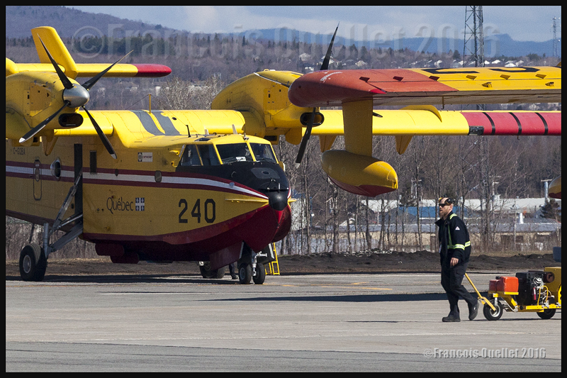
A Bombardier CL-415 water bomber, property of the Government of Quebec, is being prepared for its flight towards Fort McMurray, May 2016
Quebec’s CL-415s helping out in Fort McMurray
On May 5th, 2016, according to what had been announced by the Government of Quebec, four CL-415s took off from the Quebec Jean-Lesage international airport (CYQB) heading to Fort McMurray, Alberta, to help in the fight against widespread forest fires in that province. It is the worst natural disaster that Canada has known in its history.
Preparing flight crews and aircrafts for such a long cross-country trip naturally demands much coordination from the SOPFEU (Society for the protection of forests against fires). Once they will have landed at the Fort McMurray airport, the pilots of those CL-415s will be under the direct command of the Albertan authorities in charge of fighting the wildfires, since the latter are best positioned to know exactly what the local needs are.
I figure that the flight service specialists (FSS) of the Nav Canada flight information center (FIC) in Edmonton must have quite busy days with the increased aerial activity associated with the numerous fires…
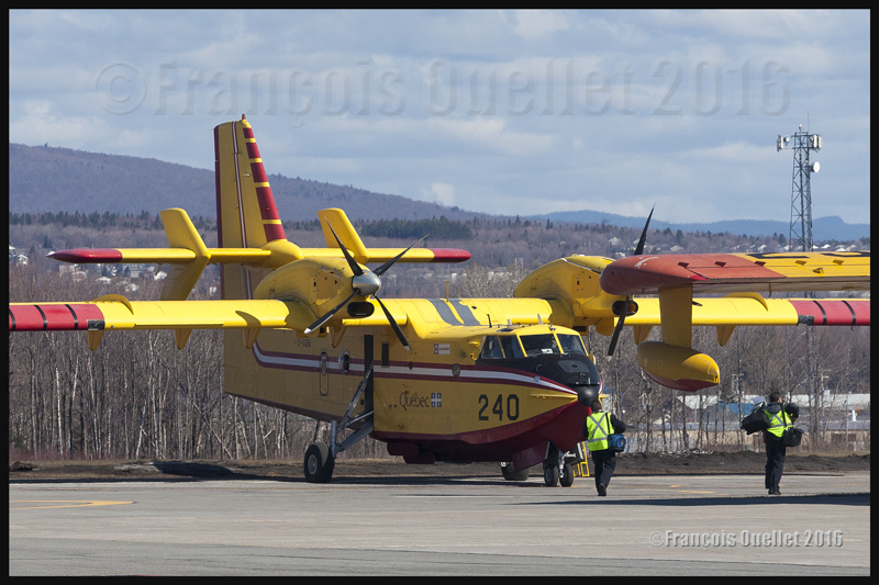
Crew members are walking towards the Government of Quebec CL-415; they will soon be airborne and heading to Fort McMurray in Alberta, to fight the forest fires (2016)
The picture above shows crew members heading towards their assigned aircraft. Once they start working in the Fort McMurray region, they will not only have to directly fight the forest fires but also head to sectors that have not yet been touched by fire and water the area thoroughly to prevent new wildfires.
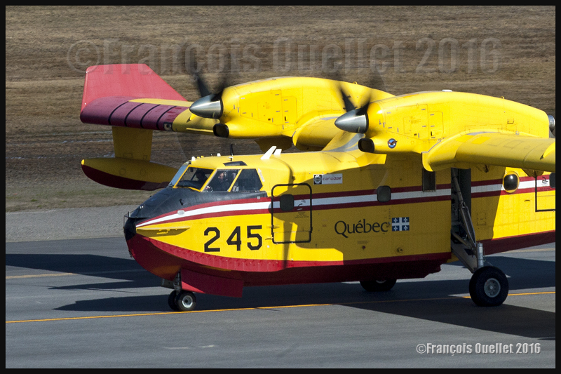
A Government of Quebec CL-415 number 245 is taxiing at the Quebec Jean-Lesage international airport to take-off towards Fort McMurray, in Alberta, to help fight the out of control forest fires in that province during May 2016.
Taking pictures of propeller-driven aircrafts
A Bombardier CL-415 water bomber takes off from the Quebec Jean-Lesage international airport heading to Fort McMurray, in Alberta, to help fight the forest fires (2016)
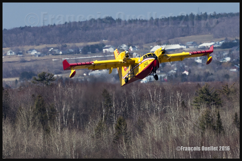
It is a bit touchy to photograph propeller-driven aircrafts while making sure that there is a sensation of movement. In a natural reflex to want to avoid blurred pictures, the photographer uses a shutter speed that corresponds to the focal used for the shot. In the case of the picture above, the focal was 400mm. But if a shutter speed of 1/400 had been used, the propellers would have been totally immobilized and the aircraft would have looked like its climbing while not using its engines.
It was necessary to reduce the speed to 1/160, thus increasing the risk of obtaining a blurred picture. In order to get both image sharpness and moving propellers visual effect, the photographer has to follow exactly the movement of the aircraft with the camera so that it looks totally immobile in the viewfinder. This asks for a bit of practice but allows for more realistic photos.
The CL-415 in a black and white photo
Black and white photo of a Bombardier CL-415 (C-GQBG) flying over Quebec City in 2015
The government of Canada helping out Alberta’s citizens
The government of Canada, under Justin Trudeau, has promised to match the amounts of money offered by all Canadians to the Red Cross society toward helping the Fort McMurray population.
Obviously, its contribution will not stop there (in fact, far from it), but the message is for the whole Canadian population to contribute generously to support the efforts of the Red Cross. It is already estimated that the material damages will reach at least nine billion dollars and that numerous years will be required to rebuild everything. The Liberal Party of Canada had built its political campaign around the need to invest for the renewal of infrastructures. With the Fort McMurray fires, there will be plenty of new unplanned expenses ahead.
More than 1,400 firemen are fighting the wildfires. So few, there has been very few lives lost, although “very few” is always too much. The crisis is, according to everyone, well managed by the government of Alberta.
At the time of writing, there was still no rain forecasted for days to come and the drought was also extending to the southern half of Saskatchewan and part of Manitoba. The winds were expected to increase, which would mean that even more resources would be needed in the near future to bring those wildfires under control.
It seems to me that the government of many Canadian provinces would benefit in acquiring new water bombers like the CL-415 to give them an increased margin of manoeuver that would allow them to react more quickly, if we take into account the tendency for the ever growing number and size of forest fires. In the picture below, the government of Quebec CL-415 number 247 is just airborne from Quebec to Fort McMurray.
A Bombardier CL-415 C-GQBK airborne from the Quebec Jean-Lesage international airport heading to Fort McMurray, Alberta, in May 2016
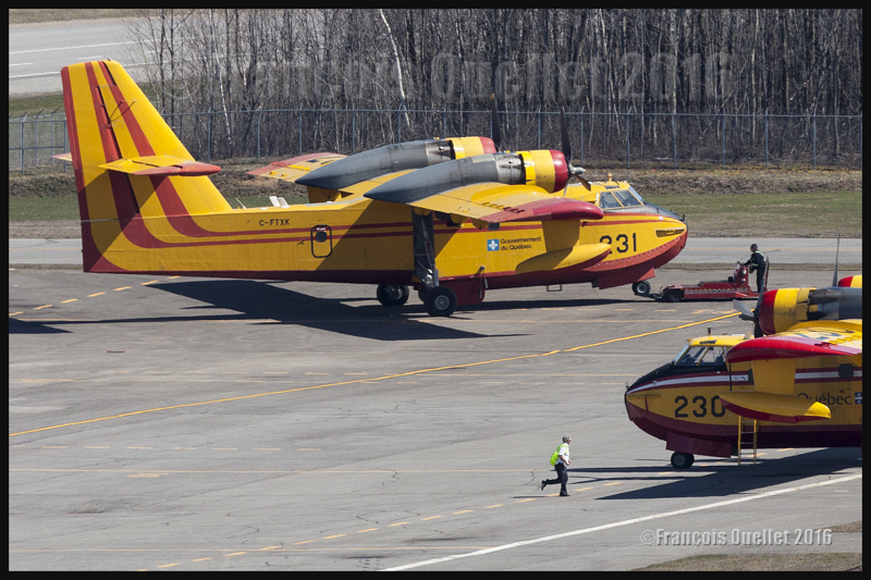
The CL-215s will not head to Fort McMurray
While several CL-415s are leaving for Alberta, few water bombers, like the two Canadair CL-215s shown below, stay at the Quebec Jean-Lesage international airport in case of forest fires in the province and also to be used for the seasonal rehearsal needed for every pilot before they are dispatched across the province of Quebec.
Two Canadair CL-215 water bombers parked at the Quebec Jean-Lesage international airport in May 2016.
Global warming
Some people can say that global warming is not responsible for the increasing number of extended wildfires. They might be right, but I prefer to adopt a wider view than only what is going on in Alberta. Heat transfer between the north and south are now more extreme in order to equalize the temperatures around the globe. All means to reduce the difference in temperatures between the equator and the poles are at work and this causes increasing problems to particular regions.
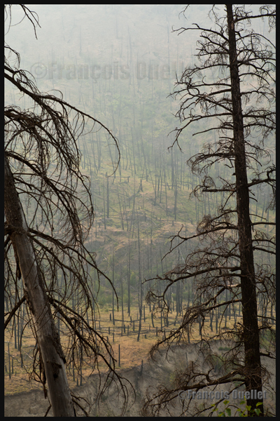
The Kamloops region in British-Columbia, when numerous forest fires were raging 2014.
A powerful El Nino phenomenon, repetitive Omega blocks, the air circulation in different cells (Hadley, Ferrell, polar, Walker) all participate in the heat exchange. At a more reduced scale, we also regularly hear of cold and warm fronts in the meteorological forecasts.
It is certainly not local warm fronts that are responsible for the fact that a thinner layer of permafrost is unable to ensure the stability of Arctic runways anymore. Nor are fronts responsible for the fact that houses on stilts do not have a stable foundation anymore. Many heat records have been established these past years in northern Canada. There will certainly be large amounts of money to spend to rebuild the Nordic infrastructures.
Brush fires as soon as April in Alberta
This year, as soon as April, there were widespread brush fires in a region as north as Fort McMurray in Alberta because winter has not brought much snow to humidify the land during Spring. I thus wondered what would happen once in July. Albertans did not need to wait that long to get the answer.
Western Canada forest after a fire (2014)
The modelization of climatic changes indicates that, in the Fort McMurray region, the forest fire season is already fifteen days longer that it used to be. More heat might favor more droughts. But an increase in temperature also favors the development of thunderstorms and with them comes lighting that will start up new fires.
One thing is sure: insurance companies will not lose time with the different theories on global warming. The reinsurers (those who insure the insurance companies) have the obligation to limit their losses to stay afloat and premiums will quickly increase to answer to the thousands of claims following an increasing number of natural disasters.
Photos of the local air traffic in Quebec, just after the CL-415s departed to Fort McMurray
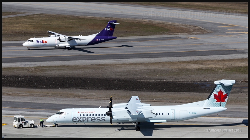
FedEx ATR 72-202F C-FTAR and Air Canada Express Bombardier DHC-8-Q-402NG (C-GIJZ) at the Quebec Jean-Lesage international airport in May 2016
At the Quebec airport, between the take offs of the four Bombardier CL-415 towards Fort McMurray, I was able to take few pictures of the local air traffic. In the photo above, it is possible to see a FedEx ATR 72 (C-FTAR) taxiing toward the ramp after a landing runway 06. An Air Canada Express Bombardier DHC-8-402 (Q-400) (C-GIJZ) was also being towed for is imminent departure.
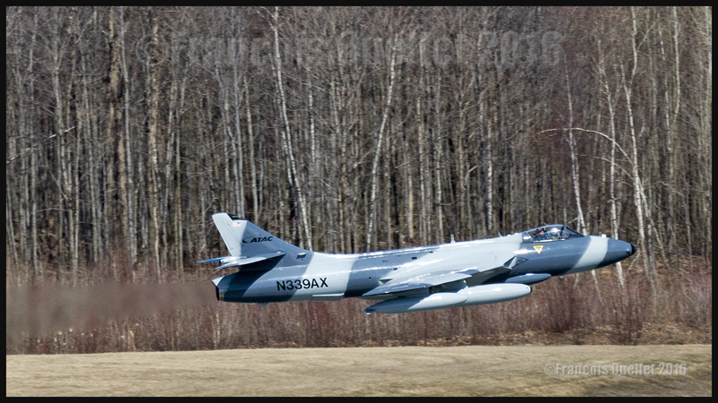
ATAC’s Hawker Hunter N339AX
Being in luck, I was able to capture a Hawker Hunter (N339AX) belonging to the American company ATAC, just airborne from Quebec. As for any military jet, it is difficult to ignore them on take-off: the reactor’s noise is there to remind you of their presence…
A Hawker Hunter belonging to the american company ATAC is airborne from the Quebec Jean-Lesage international airport (CYQB), May 2016
A Hawker Hunter, from the american company ATAC, is airborne from the Quebec Jean-Lesage international airport (CYQB) in May 2016
The pictures above have been taken with a Canon 5D MKII camera, equipped with a telephoto lens Canon 70-200 f2.8L IS II USM with a polarizing filter and a Canon Extender EF 2X III which brought the focal length to 400 mm. Even then, more cropping was necessary to enlarge the aircraft since I was quite far away from the runway.
Wishing to ensure that the image was sharp (a blurred picture is more probable with a 400 mm focal length while the photographer attempts to follow a fast flying jet), I adjusted the shutter speed to 1/1600 and made sure that the automatic focus was set on AI servo.
I now realized that a slower speed could have worked a bit better since it would have allowed showing a blurred forest in the background while keeping the aircraft sharp. But it is not often that you have the opportunity to see a Hawker Hunter in flight these days and I played safe with the shutter speed. The ideal shot will be for another day…
CL-415s and CL-215s together in Quebec (2012 photo)
CL-415 and CL-215 water bombers belonging to the Gouvernment of Quebec. Quebec Jean-Lesage international airport (CYQB) 2012
A last picture, taken few years ago, during autumn 2012, shows numerous water bombers CL-415 and CL-215 parked at the Quebec Jean-Lesage international airport (CYQB). During the off- season, the water bombers are brought back to Quebec City from the different bases were they have been in operation during summertime.
For other articles on aviation and photography, click on the following link: Aviation photography
Tales of a Dakota Pilot – The way it was 1929 – 1937
This is a simple and charming little book retelling the life stories of the pilot Fred Max Roberts Jr when he was flying his airplanes in the Bismark region, North Dakota, between 1929 and 1937. The book was written by his son, Fred Marke Roberts, so that some of his father’s stories do not fall in oblivion. You will find here a good idea of how things were done in the early years of aviation.
An original and easy way of refueling
When came the time to refuel, the pilots would regularly land on a farmer’s field. They knew that somebody had noticed the landing and, most of the time, a fuel truck would be sent without any previous arrangements. The pilot had nonetheless the duty to make sure he landed close to an easy access for the fuel truck. Sometimes, to simplify the refueling process a bit, the pilot landed directly on the road, outside of the city.
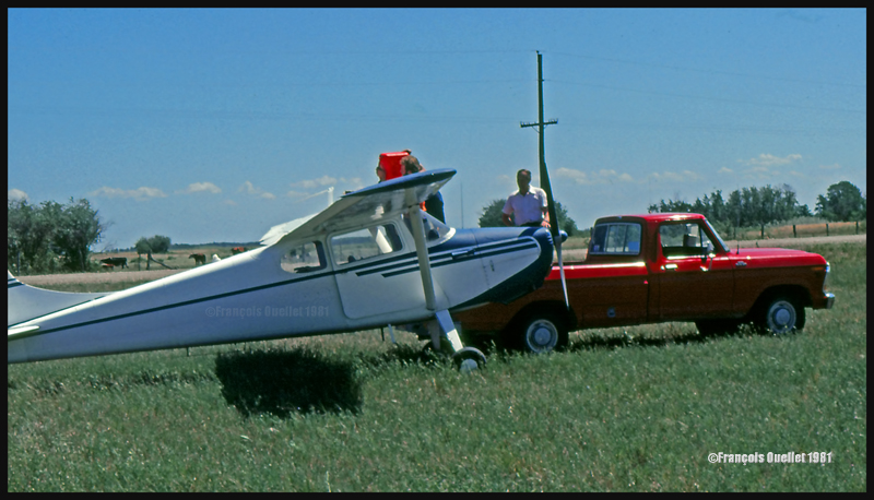
This habit did not seem to have change fifty years later when I did a 2650 kilometers cross-country flight with a Cessna 170B, between St-Jean-sur-Richelieu, Quebec, and Edmonton, Alberta. During the trip, I had to land in a field near Lundar, Manitoba, a Canadian province which is bounded to the south by North Dakota and Minnesota. Soon after the landing, a pick-up truck carrying fuel approached the plane. I had not made any arrangements for fuel. In my case, a precautionary landing was needed as the fuel gauges had started to give false indications. Since fuel was readily available, the tanks were topped before the next takeoff.
Landing in a field with a Cessna C170B in Lundar, Manitoba in 1981.
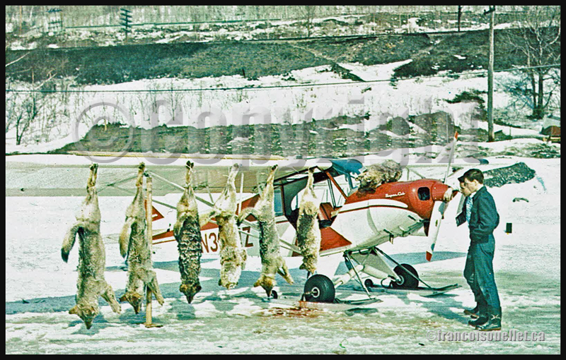
Killing coyotes against the county bounty
Coyotes where frequently attacking farmer’s livestock. When the situation was getting out of control, the farmers would phone Fred Max. The latter would take off with his Curtiss Junior Pusher, accompanied by an experienced shooter and they would spot and kill coyotes. Winter was the best season for hunting from the air since the coyote’s dark colored fur contrasted against the white snow.
The farmers, on their horses, were following the aircraft’s manoeuvers to spot where the coyotes had been shot. They then brought the dead animals back to their farm. Few minutes later, the aircraft would land as close to the farm as possible and the pilots picked up the coyotes, bringing them back to the county’s bureau in order to receive the published bounty for each killed coyote.
Super Cub and wolves shot from the air in Northern Ontario, Canada, on an aviation postcard dating from the sixties.
The American Midwest farmer’s hospitality
When a pilot landed in a farmer’s field, as a stopover on a long cross-country flight, he would often be offered a meal with the farmer’s family. If darkness was an obstacle for the continuation of the flight, the pilot was often offered a bed for the night. The next morning, after breakfast, and as a thank you gesture, the pilot would offer the farmer a courtesy flight.
A practical way to lower the costs associated with a long cross-country flight
An easy way to reduce the costs associated with a long cross-country flight was to offer airplane rides to villagers who had come to meet the pilot once at the destination. The pilot landed, waited a bit and knew that, soon, few people would come to him to ask for a ride.
The pilot Fred Max Roberts Jr hanging to the wing of his monoplane
A major concern for any pilot landing in a field was to find a fence to tie the plane as soon as possible to protect it from the strong winds blowing over the Midwest plains. But really strong gusts would sometimes break the ropes.
The pilot tells the reader that he was once immobilized in the middle of a field while a storm was quickly approaching. He got under the wing of his monoplane and hanged to it in order to add some weight. But that was not enough. A strong gust lifted the plane, broke the two tie-downs and sent pilot and plane flying at about ten feet in the air. Fearing that his plane would continue to climb without him at the controls, the pilot let go. The plane maintained a level flight while backing until it suddenly rolled and crashed.
Pilot and passengers are caught in flight by a tornado
Flying and meteorology manuals teach every pilot the necessity to avoid thunderstorms because, among other reasons, of the extreme ascending and descending air currents that are present in a well-developed cell. The pilot Fred Max Roberts Jr not only went through a thunderstorm but survived a tornado while he was in flight. His story was published in many newspapers at the time. Some of the articles are reproduced in the book.
As the pilot tells it, meteorological forecasts and weather observations were not as easily accessible as they are today. During a flight with passengers in his Waco 90 biplane, the sky suddenly darkened and the weather degraded rapidly. The pilot tried his best to fly between two important cloud formations. He could hardly see his instruments due to the lack of light, even if the flight was made during the day. He was fighting to avoid being disoriented.
Suddenly, the plane started to gain altitude rapidly by itself. The pilot nosed his ship downward and applied full power. This was useless. The aircraft was still rapidly climbing, tail first. Then the ascent abruptly stopped and a dive ensued. He pulled on the stick to bring his Waco to a level flight, but the rapid descent continued. Having no other choice, he applied full throttle and set his plane for a normal climb. Again, the descent continued until the Waco was at about 500 feet above ground level.
Eventually, they got out of the storm and landed at White Rock. Fred Max then realized that his passengers, sitting in the open cockpit Waco during the storm, had not fasten their seat belts and were hanging for dear life to a brace running across the front of the passenger cockpit.
Those are some of the tales a reader can find in “Tales of a Dakota Pilot”, an unpretentious book but nonetheless a publication that might very well surprise many young pilots, as the 1930’s way of flying so differed from what a young pilot lives when he integrates today’s world of aviation.
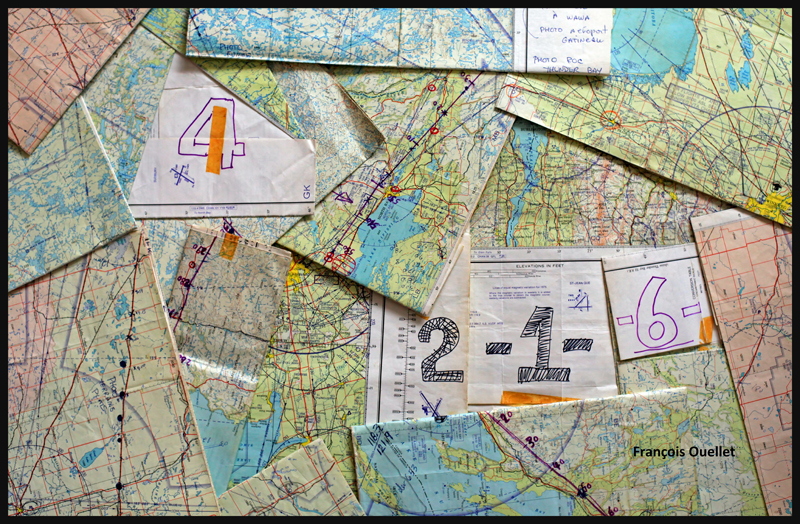
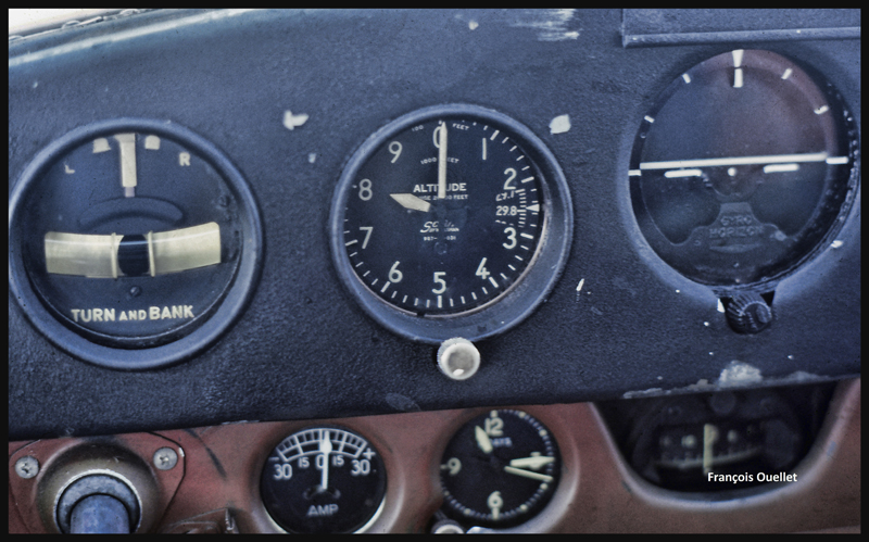
After a proficiency check, I soon find myself flying a Cessna 170B (tail wheel) on a flight across Canada, from St -Jean-sur- Richelieu, Quebec, to Edmonton, Alberta. I am accompanied by the aircraft’s owner who has not yet completed his private pilot course. The 1952 Cessna flies well, but has absolutely no instruments for air navigation, not even a VOR nor ADF. And the era of the portable GPS is not yet upon us.
Fourteen 1:500,000 VFR charts, covering the planned flight, are folded, glued and numbered. I trace the expected flight path on each chart, with 10 miles landmarks. This will facilitate the monitoring of our progress, considering the absence of navigation equipment. The preparation now completed, the take off is done on a beautiful summer day of 1981.
1:500,000 VFR charts used for a flight toward Edmonton, Canada, in 1981
We do stopovers at Gatineau, North Bay, Sudbury and then fly along Lake Superior to Wawa.
Small break in Sudbury on a VFR flight to Edmonton in 1981
We fly around Lake Superior to our next stopovers, Thunder Bay and Fort Frances. Over large forested areas, with no major landmarks, the gyroscopic precession must be corrected frequently so as not to stray too far from the intended track. Sometimes when it facilitates navigation, we either follow a railway or main roads. There are some instances where the westerly winds are so strong that our ground speed is slower than a car on a highway.
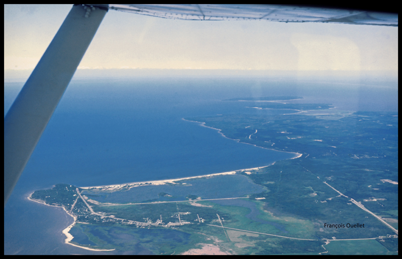
From Fort Frances to Kenora in 1981, with a Cessna C170B
Our flight path follows a line that keeps us away from areas of high air traffic. I choose to fly north of Winnipeg terminal control area, thus avoiding frequent radio exchanges with air traffic control in a language I do not master. The underperforming radio would not be of any help at any rate. This option eventually means that we must fly over Lake Winnipeg, in its southern portion. We have enough altitude to be able to glide to the other side in case of an engine failure. Nonetheless, we realize that we are gradually loosing several thousand feet due to the cold air mass above the lake. This with maximum power applied. The unexpected descent eventually ends, but it is now impossible to have an engine failure without ditching in the lake…
The crossing of Lake Winnipeg with a Cessna C170B in 1981
Near Lundar, Manitoba, the aircraft’s old gauges indicate a significant loss of fuel. It is surprising since we refueled an hour ago. We must land the plane on the nearest runway, but the strong crosswinds exceed the capabilities of the aircraft. Nonetheless, an attempt is made with the result that only the left wheel accepts the contact with the runway. As soon as the right wheel also touches the ground, the aircraft becomes airborne again. A nearby field is selected to make a precautionary landing so that the fuel status can be verified. We fly at low altitude over the electrical wires and the cows in the adjacent field, and touch smoothly at a ground speed not exceeding 15 knots. A farmer witnesses the landing and arrives in his red pick-up to offer some help. The tanks are almost full, so the plane only needs few liters of gasoline. Once this is done, we take off westward. It appears that the old fuel gauges of this 1952 Cessna are now totally unreliable…
Landing in a field with a Cessna C170B in Lundar, Manitoba in 1981.
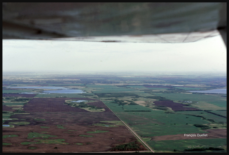
We leave Manitoba through Dauphin and enter Saskatchewan. If we were to experience an engine failure above such uniform fields, the risk of serious problems at landing would be virtually nonexistent.
Near Yorkton, Saskatchewan, in flight with a Cessna C170B in 1981
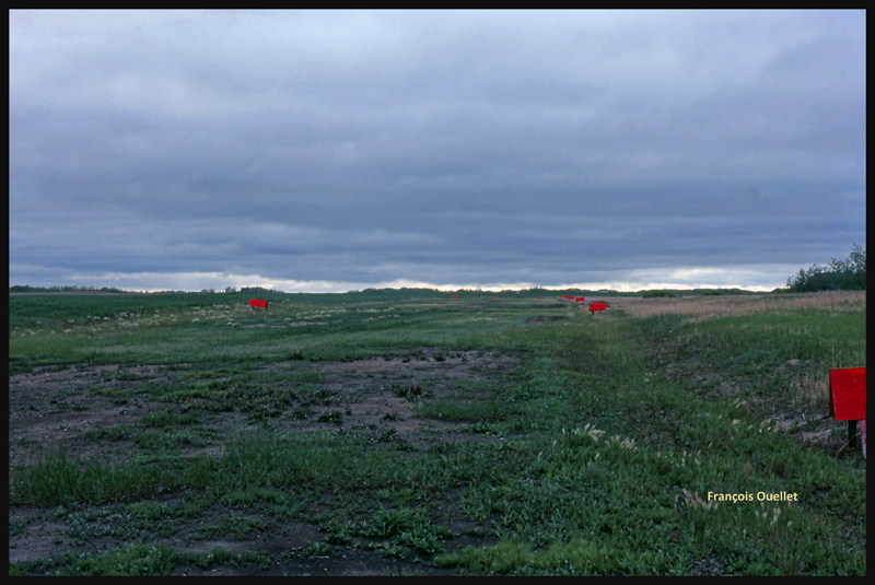
The weather is slowly deteriorating. We choose to land in Watson, Saskatchewan, on the nearest runway.
The runway surface consists of muddy earth and grass, and it’s delimited by small red wooden panels. As we touch the ground, the tires splash mud everywhere, including under the wings.
The Watson runway, Saskatchewan, in 1981
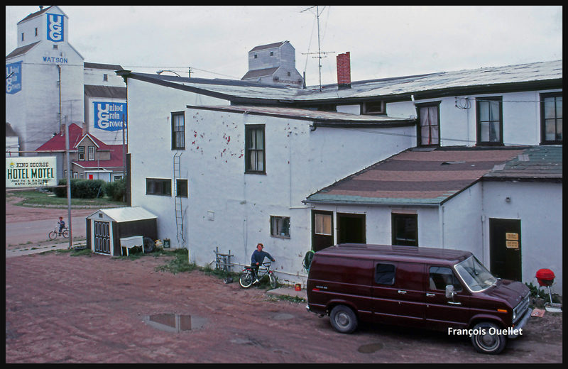
The King George motel in Watson, Saskatchewan in 1981
Finally, the weather improves and a takeoff is made toward North Battleford, the last stop before Edmonton. The sloping terrain forces us to fly lower and lower near Edmonton, under an overcast stratocumulus, limiting our ability to see a long time in advance the correct airport from the three available (international, civil , military ). Luckily, everything goes well in choosing the right airport and approach, but we cannot say the same with radio communications. The sound quality coming from the old speaker is awful and the English spoken by the air traffic controller too fast for us. The combination of these two factors causes the controller to repeat more than once his instructions until he finally decides to slow down and we can officially say: « Roger! »
After spending few days in Edmonton it is now time for the return flight to St-Jean. This proves to be much easier and faster because the westerly winds push the aircraft. Our ground speed is sometimes double what we had managed to get on our trip to Edmonton. The journey took us twenty-five hours to go and eighteen hours to come back.
Cessna C170B in flight over Canada, summer 1981.
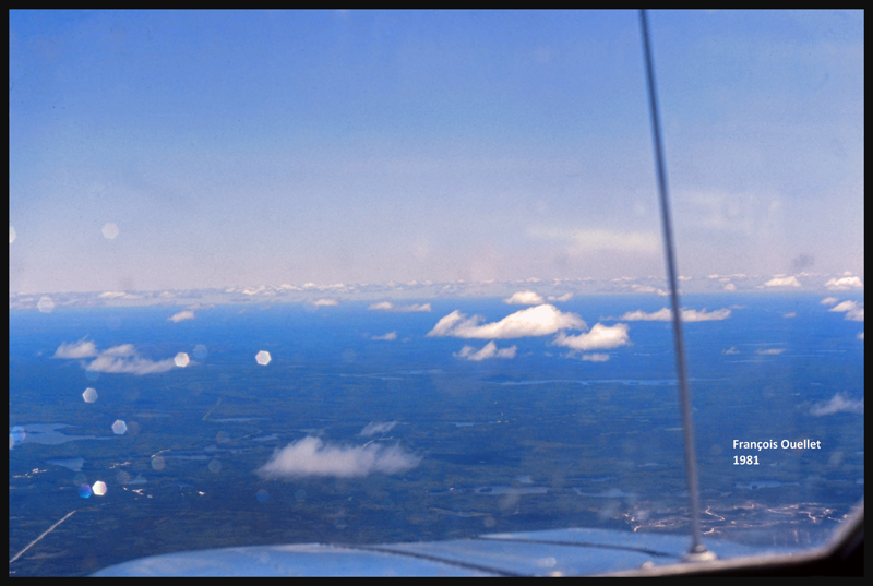
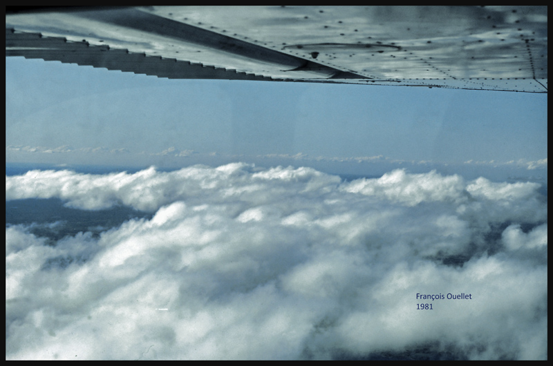
Climbing to 9,500 feet on the return leg to St-Jean-sur-Richelieu, in 1981.
VFR “on top” with a Cessna C170B in 1981 over Canada
Over North Bay, Ontario, the weather is ideal. But we will have to land in Ottawa while waiting for thunderstorms to move away from Montreal and St-Jean-sur-Richelieu. After a total of forty- three-hours of flying time, the old Cessna 170B is landing back to St- Jean -sur- Richelieu.