Enlarging the Blake and Mortimer album: La vallée des immortels tome 1
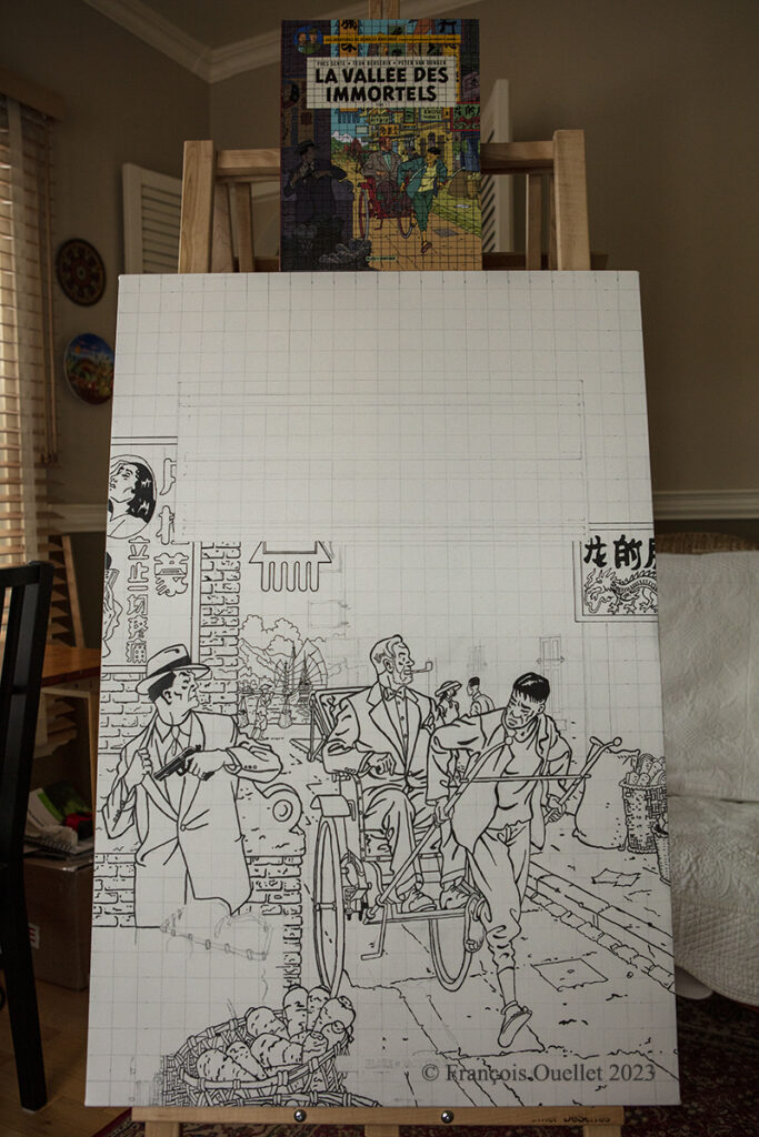
In February 2023, I began transferring the cover of the Blake and Mortimer album “The Valley of the Immortals – Part 1” to a 24 x 36 inch canvas.
The photo above shows the original album sitting on top of the canvas and the work in progress. There is still a lot of work to do before the drawing and lettering are finished.
Then comes the coloring stage, to get the tones as close as possible to the original album. The cover has a lot of colors, which is not the case with many other Blake and Mortimer albums.
This particular album resonates with me for several reasons. First of all, the authors use in the scenario a Cessna C-170B type plane, which brings back memories of flying. Indeed, by a happy coincidence, in 1981 I flew across Canada in this small aircraft dating from 1952. The plane was not equipped with any air navigation instruments, except for an old compass. We were not yet in the GPS era! I published the story of this flight from St-Jean to Edmonton on my blog.
Another reason that increases my interest in the album is also related to a memory. On the cover, Mortimer is in Wan Chai District, a district I visited in 1990 during a trip to Hong Kong and the New Territories. At that time, the Cathay Pacific Boeing B-747 used the legendary Kai Tak airport and flew the approach over a huge demonstration of more than 100,000 people commemorating the anniversary of the Tiananmen Square massacre.
I will be posting more photos of “The valley of the immortals” painting over the next few months, numbering the title of each article so that those interested in the subject can find their way around.
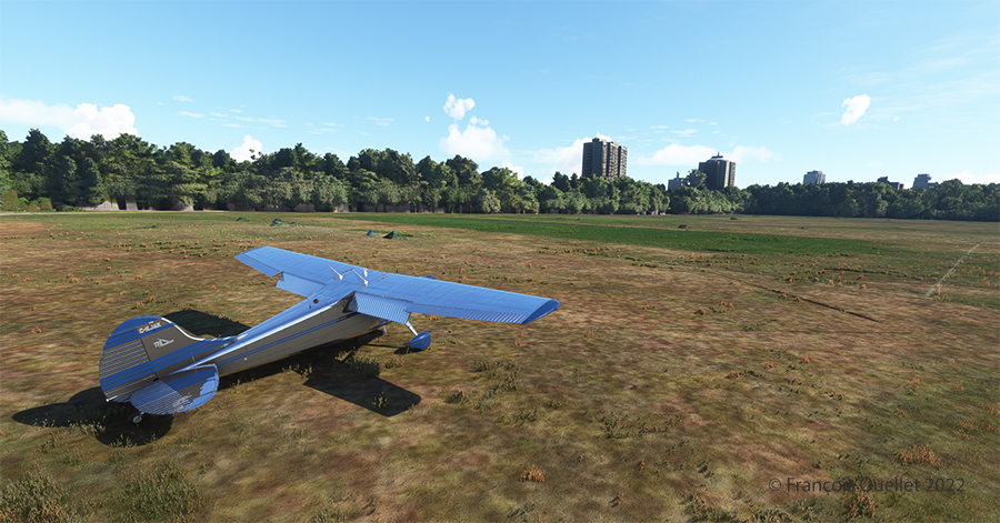
First of all, I admit that the Cessna 170B’s windows are dirty. For realism, the designer Carenado left a little dirt here and there to show the wear and tear of this very old aircraft.
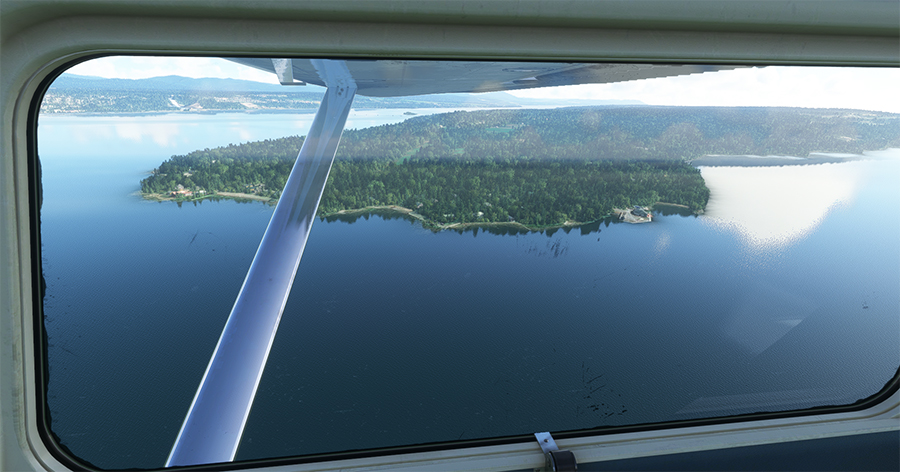
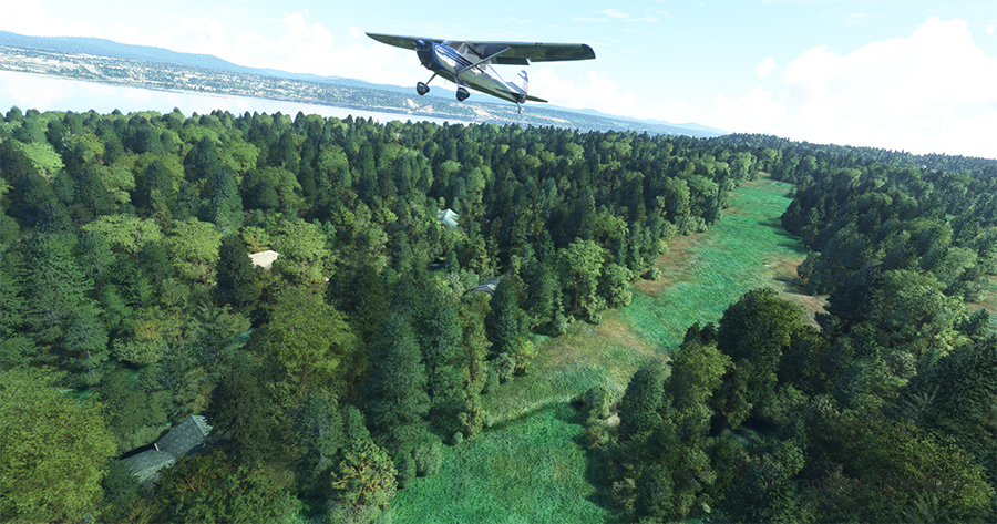
The picture above shows Île d’Orléans as seen from the Cessna. Since there is no landing strip but a golf club in the area, we will use the open fairways to land the aircraft. If there is a golfer on the course, I will open the window and yell, as is customary, “Fore!” (Falling Object Returning to Earth).
On final for Île d’Orléans
We are established on final for the small portion of open ground ahead. With 40 degrees of flaps, the stall speed is particularly low and the landing should not be too difficult.
On Île d’Orléans ready for take-off.
Although the available strip was not very wide, it was long enough for the landing, the taxiing and the maneuvering to turn the aircraft 180 degrees for its take-off to Quebec City.
Airborne from Île d’Orléans with a Cessna 170B
Back in the air, direction Quebec City. The take-off on soft ground requires about 20 degrees of flaps.
Enroute towards Quebec City.
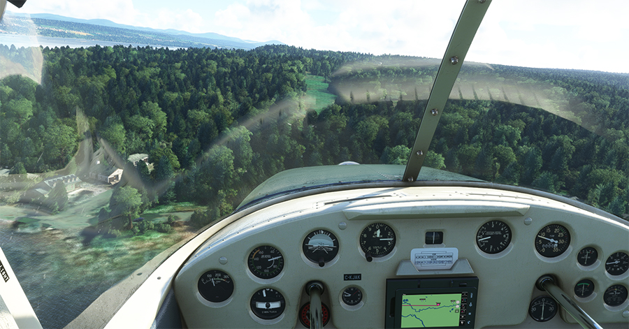
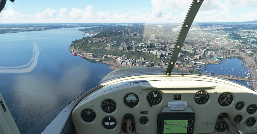
Quebec City is in sight. In the Cessna C-170B I flew in 1981 across Canada from St-Jean-sur-Richelieu to Edmonton, Alberta, there was no modern navigation aid installed on board as in the photo above, where the GPS helps the pilot find his way. The flight was flown using 14 VFR charts and nothing more. (If you are interested, click to read more about real-life flying stories on my blog).
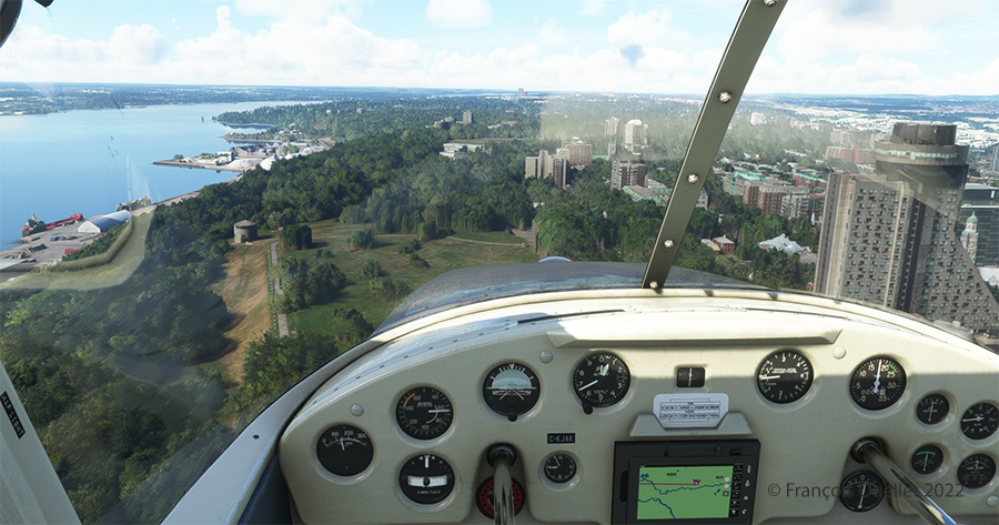
Hôtel le Concorde and its revolving restaurant, visible on the right.
We are now above the Plains of Abraham. On the picture above, on the right, you can see the Hotel le Concorde and its revolving restaurant. We will possibly disturb the quiet atmosphere of the meal as we fly by…
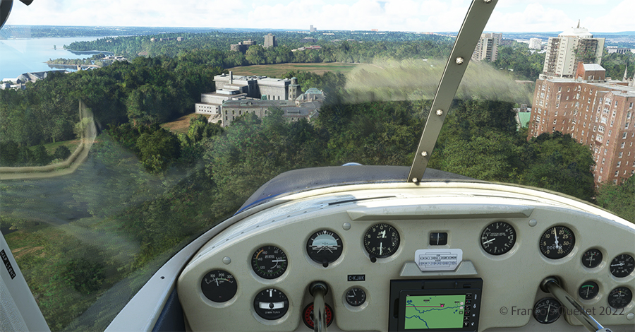
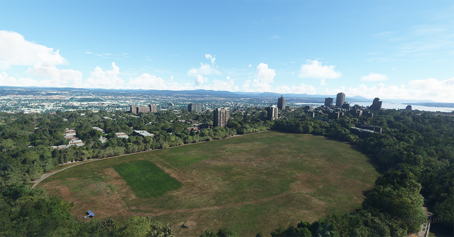
The MNBAQ and the Battlefields Park are in sight.
Above, straight ahead, the gray buildings represent a portion of the Musée National des Beaux-Arts de Québec (MNBAQ). A little further on is the open area of the Battlefields Park. In 1928, Lindbergh landed on that field to bring badly needed medicine for his friend Floyd Bennett. Can we normally land on the Battlefields Park, in the heart of Quebec City? Of course not. But that’s the beauty of a flight simulation; you can do whatever you want!
Cessna 170B on the Battlefields Park in Québec City.
Once landed, the aircraft is allowed to decelerate gradually and then turned 180 degrees for the next takeoff. When winds are light, there is no need to worry about the direction of the takeoff.
Aerial view of Battlefield Parks with the Cessna 170B under MSFS 2020.
Above, an aerial view of the Battlefields Park, with the virtual Cessna C-170B ready to take off again.
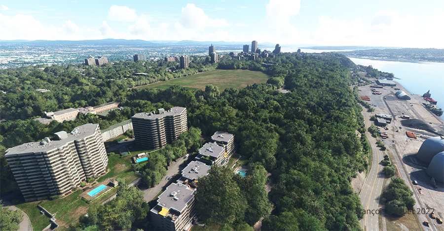
Partial view of Quebec City in flight simulation with MSFS 2020
One last picture, this time with some additional buildings. The realism of the virtual scene with FS2020 is amazing!
I hope you enjoyed these two short flights. Whether you use the short landing technique for the Battlefields Park is really up to you, as there is enough space for a normal landing. But it is good to practice landing in the shortest distance possible. You never know when your engine will quit!
Tales of a Dakota Pilot – The way it was 1929 – 1937
This is a simple and charming little book retelling the life stories of the pilot Fred Max Roberts Jr when he was flying his airplanes in the Bismark region, North Dakota, between 1929 and 1937. The book was written by his son, Fred Marke Roberts, so that some of his father’s stories do not fall in oblivion. You will find here a good idea of how things were done in the early years of aviation.
An original and easy way of refueling
When came the time to refuel, the pilots would regularly land on a farmer’s field. They knew that somebody had noticed the landing and, most of the time, a fuel truck would be sent without any previous arrangements. The pilot had nonetheless the duty to make sure he landed close to an easy access for the fuel truck. Sometimes, to simplify the refueling process a bit, the pilot landed directly on the road, outside of the city.
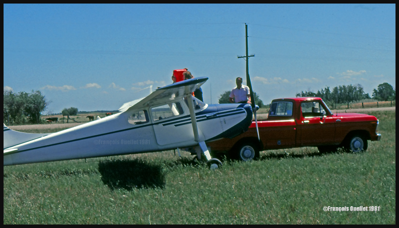
This habit did not seem to have change fifty years later when I did a 2650 kilometers cross-country flight with a Cessna 170B, between St-Jean-sur-Richelieu, Quebec, and Edmonton, Alberta. During the trip, I had to land in a field near Lundar, Manitoba, a Canadian province which is bounded to the south by North Dakota and Minnesota. Soon after the landing, a pick-up truck carrying fuel approached the plane. I had not made any arrangements for fuel. In my case, a precautionary landing was needed as the fuel gauges had started to give false indications. Since fuel was readily available, the tanks were topped before the next takeoff.
Landing in a field with a Cessna C170B in Lundar, Manitoba in 1981.
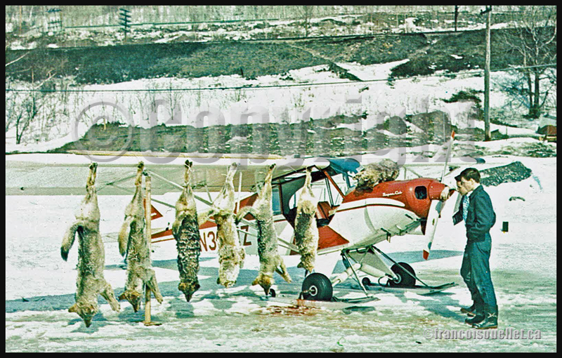
Killing coyotes against the county bounty
Coyotes where frequently attacking farmer’s livestock. When the situation was getting out of control, the farmers would phone Fred Max. The latter would take off with his Curtiss Junior Pusher, accompanied by an experienced shooter and they would spot and kill coyotes. Winter was the best season for hunting from the air since the coyote’s dark colored fur contrasted against the white snow.
The farmers, on their horses, were following the aircraft’s manoeuvers to spot where the coyotes had been shot. They then brought the dead animals back to their farm. Few minutes later, the aircraft would land as close to the farm as possible and the pilots picked up the coyotes, bringing them back to the county’s bureau in order to receive the published bounty for each killed coyote.
Super Cub and wolves shot from the air in Northern Ontario, Canada, on an aviation postcard dating from the sixties.
The American Midwest farmer’s hospitality
When a pilot landed in a farmer’s field, as a stopover on a long cross-country flight, he would often be offered a meal with the farmer’s family. If darkness was an obstacle for the continuation of the flight, the pilot was often offered a bed for the night. The next morning, after breakfast, and as a thank you gesture, the pilot would offer the farmer a courtesy flight.
A practical way to lower the costs associated with a long cross-country flight
An easy way to reduce the costs associated with a long cross-country flight was to offer airplane rides to villagers who had come to meet the pilot once at the destination. The pilot landed, waited a bit and knew that, soon, few people would come to him to ask for a ride.
The pilot Fred Max Roberts Jr hanging to the wing of his monoplane
A major concern for any pilot landing in a field was to find a fence to tie the plane as soon as possible to protect it from the strong winds blowing over the Midwest plains. But really strong gusts would sometimes break the ropes.
The pilot tells the reader that he was once immobilized in the middle of a field while a storm was quickly approaching. He got under the wing of his monoplane and hanged to it in order to add some weight. But that was not enough. A strong gust lifted the plane, broke the two tie-downs and sent pilot and plane flying at about ten feet in the air. Fearing that his plane would continue to climb without him at the controls, the pilot let go. The plane maintained a level flight while backing until it suddenly rolled and crashed.
Pilot and passengers are caught in flight by a tornado
Flying and meteorology manuals teach every pilot the necessity to avoid thunderstorms because, among other reasons, of the extreme ascending and descending air currents that are present in a well-developed cell. The pilot Fred Max Roberts Jr not only went through a thunderstorm but survived a tornado while he was in flight. His story was published in many newspapers at the time. Some of the articles are reproduced in the book.
As the pilot tells it, meteorological forecasts and weather observations were not as easily accessible as they are today. During a flight with passengers in his Waco 90 biplane, the sky suddenly darkened and the weather degraded rapidly. The pilot tried his best to fly between two important cloud formations. He could hardly see his instruments due to the lack of light, even if the flight was made during the day. He was fighting to avoid being disoriented.
Suddenly, the plane started to gain altitude rapidly by itself. The pilot nosed his ship downward and applied full power. This was useless. The aircraft was still rapidly climbing, tail first. Then the ascent abruptly stopped and a dive ensued. He pulled on the stick to bring his Waco to a level flight, but the rapid descent continued. Having no other choice, he applied full throttle and set his plane for a normal climb. Again, the descent continued until the Waco was at about 500 feet above ground level.
Eventually, they got out of the storm and landed at White Rock. Fred Max then realized that his passengers, sitting in the open cockpit Waco during the storm, had not fasten their seat belts and were hanging for dear life to a brace running across the front of the passenger cockpit.
Those are some of the tales a reader can find in “Tales of a Dakota Pilot”, an unpretentious book but nonetheless a publication that might very well surprise many young pilots, as the 1930’s way of flying so differed from what a young pilot lives when he integrates today’s world of aviation.
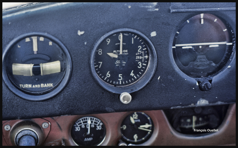
After a proficiency check, I soon find myself flying a Cessna 170B (tail wheel) on a flight across Canada, from St -Jean-sur- Richelieu, Quebec, to Edmonton, Alberta. I am accompanied by the aircraft’s owner who has not yet completed his private pilot course. The 1952 Cessna flies well, but has absolutely no instruments for air navigation, not even a VOR nor ADF. And the era of the portable GPS is not yet upon us.
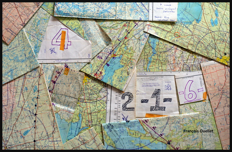
Fourteen 1:500,000 VFR charts, covering the planned flight, are folded, glued and numbered. I trace the expected flight path on each chart, with 10 miles landmarks. This will facilitate the monitoring of our progress, considering the absence of navigation equipment. The preparation now completed, the take off is done on a beautiful summer day of 1981.
1:500,000 VFR charts used for a flight toward Edmonton, Canada, in 1981
We do stopovers at Gatineau, North Bay, Sudbury and then fly along Lake Superior to Wawa.
Small break in Sudbury on a VFR flight to Edmonton in 1981
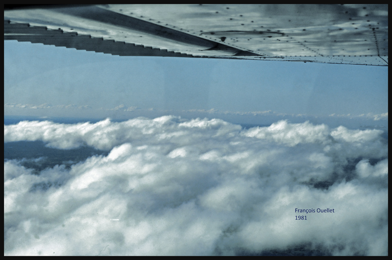
We fly around Lake Superior to our next stopovers, Thunder Bay and Fort Frances. Over large forested areas, with no major landmarks, the gyroscopic precession must be corrected frequently so as not to stray too far from the intended track. Sometimes when it facilitates navigation, we either follow a railway or main roads. There are some instances where the westerly winds are so strong that our ground speed is slower than a car on a highway.
From Fort Frances to Kenora in 1981, with a Cessna C170B
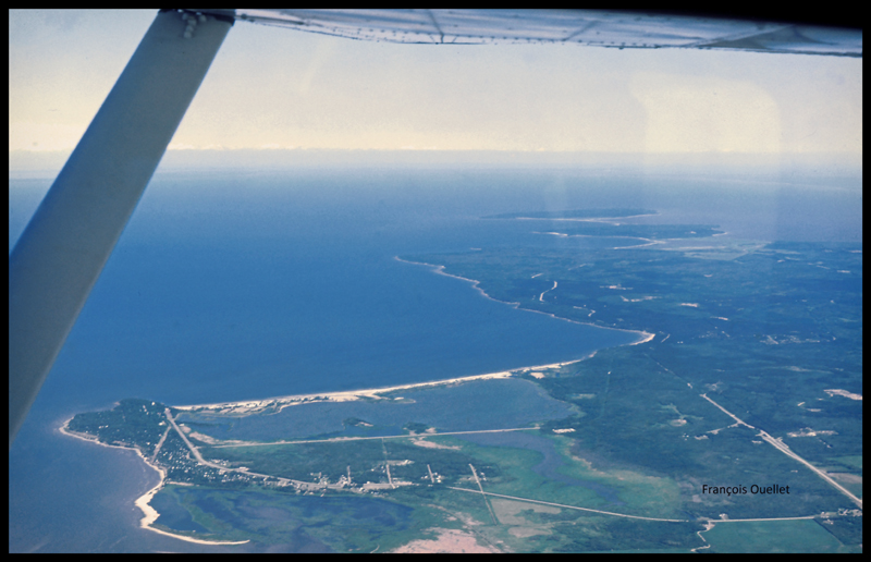
Our flight path follows a line that keeps us away from areas of high air traffic. I choose to fly north of Winnipeg terminal control area, thus avoiding frequent radio exchanges with air traffic control in a language I do not master. The underperforming radio would not be of any help at any rate. This option eventually means that we must fly over Lake Winnipeg, in its southern portion. We have enough altitude to be able to glide to the other side in case of an engine failure. Nonetheless, we realize that we are gradually loosing several thousand feet due to the cold air mass above the lake. This with maximum power applied. The unexpected descent eventually ends, but it is now impossible to have an engine failure without ditching in the lake…
The crossing of Lake Winnipeg with a Cessna C170B in 1981
Near Lundar, Manitoba, the aircraft’s old gauges indicate a significant loss of fuel. It is surprising since we refueled an hour ago. We must land the plane on the nearest runway, but the strong crosswinds exceed the capabilities of the aircraft. Nonetheless, an attempt is made with the result that only the left wheel accepts the contact with the runway. As soon as the right wheel also touches the ground, the aircraft becomes airborne again. A nearby field is selected to make a precautionary landing so that the fuel status can be verified. We fly at low altitude over the electrical wires and the cows in the adjacent field, and touch smoothly at a ground speed not exceeding 15 knots. A farmer witnesses the landing and arrives in his red pick-up to offer some help. The tanks are almost full, so the plane only needs few liters of gasoline. Once this is done, we take off westward. It appears that the old fuel gauges of this 1952 Cessna are now totally unreliable…
Landing in a field with a Cessna C170B in Lundar, Manitoba in 1981.
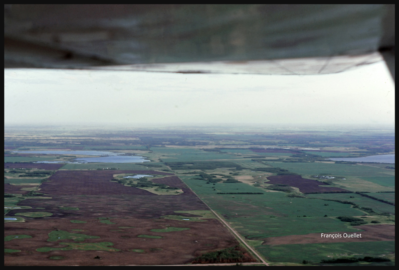
We leave Manitoba through Dauphin and enter Saskatchewan. If we were to experience an engine failure above such uniform fields, the risk of serious problems at landing would be virtually nonexistent.
Near Yorkton, Saskatchewan, in flight with a Cessna C170B in 1981
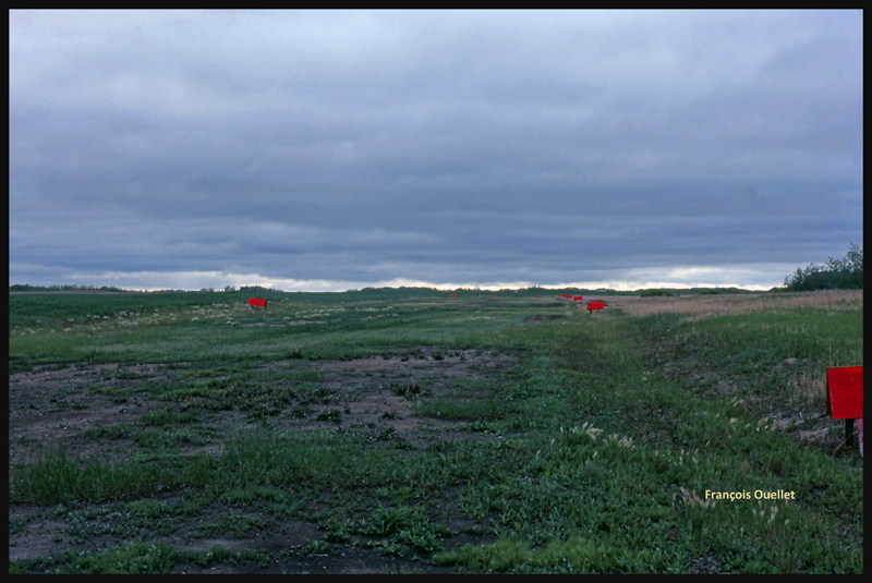
The weather is slowly deteriorating. We choose to land in Watson, Saskatchewan, on the nearest runway.
The runway surface consists of muddy earth and grass, and it’s delimited by small red wooden panels. As we touch the ground, the tires splash mud everywhere, including under the wings.
The Watson runway, Saskatchewan, in 1981
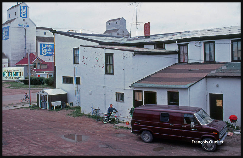
The King George motel in Watson, Saskatchewan in 1981
Finally, the weather improves and a takeoff is made toward North Battleford, the last stop before Edmonton. The sloping terrain forces us to fly lower and lower near Edmonton, under an overcast stratocumulus, limiting our ability to see a long time in advance the correct airport from the three available (international, civil , military ). Luckily, everything goes well in choosing the right airport and approach, but we cannot say the same with radio communications. The sound quality coming from the old speaker is awful and the English spoken by the air traffic controller too fast for us. The combination of these two factors causes the controller to repeat more than once his instructions until he finally decides to slow down and we can officially say: « Roger! »
After spending few days in Edmonton it is now time for the return flight to St-Jean. This proves to be much easier and faster because the westerly winds push the aircraft. Our ground speed is sometimes double what we had managed to get on our trip to Edmonton. The journey took us twenty-five hours to go and eighteen hours to come back.
Cessna C170B in flight over Canada, summer 1981.
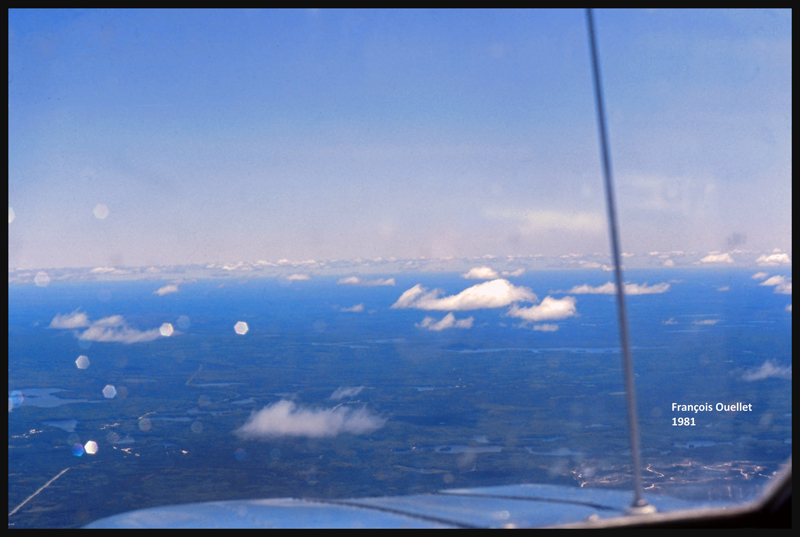
Climbing to 9,500 feet on the return leg to St-Jean-sur-Richelieu, in 1981.
VFR “on top” with a Cessna C170B in 1981 over Canada
Over North Bay, Ontario, the weather is ideal. But we will have to land in Ottawa while waiting for thunderstorms to move away from Montreal and St-Jean-sur-Richelieu. After a total of forty- three-hours of flying time, the old Cessna 170B is landing back to St- Jean -sur- Richelieu.
here is a picture and an edited screen capture recently added on the site (among about ten new pictures). During the next few days, two articles will be published on 1) Bletchley Park and 2) the trip (with pictures) of a VFR flight from St-Jean-sur-Richelieu, Quebec, to Edmonton, Alberta, trip that was done in 1981 with an old Cessna 170B.
Have a good visit,
François
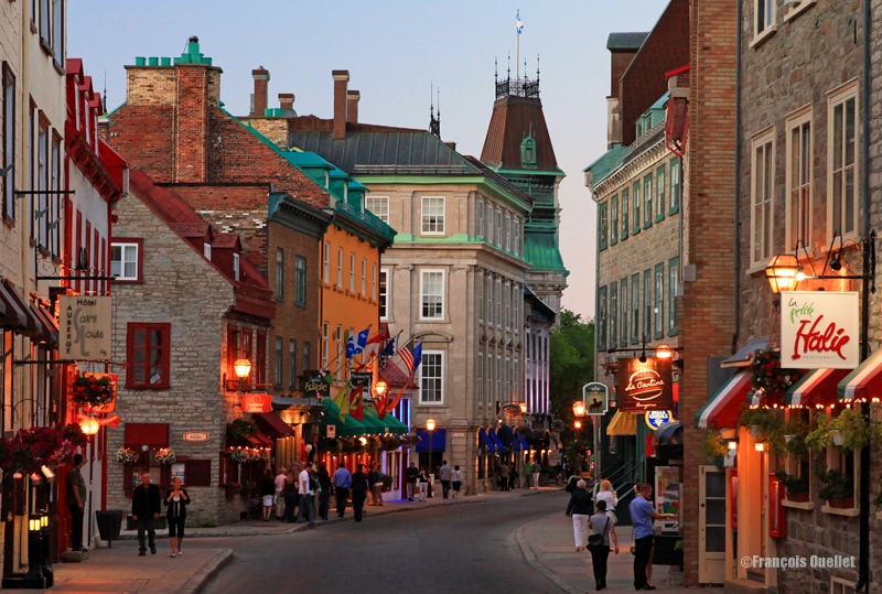
Old Quebec scene during a summer night.
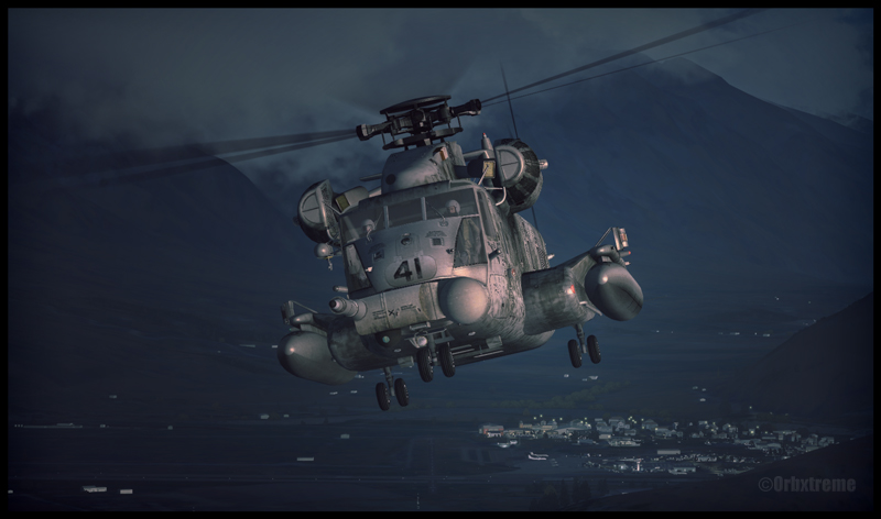
Sikorsky MH-53 airborne from Queenstown, New Zealand.
The nice problem with the flight simulator is that there are lots of interesting planes and sceneries available from around the world. Virtual pilots benefit from a huge variety of products. In general, flights made either at dusk or dawn benefit from a special light. For the actual flight with the Sikorsky, I went for a cool light so that the military helicopter would not look too inviting.