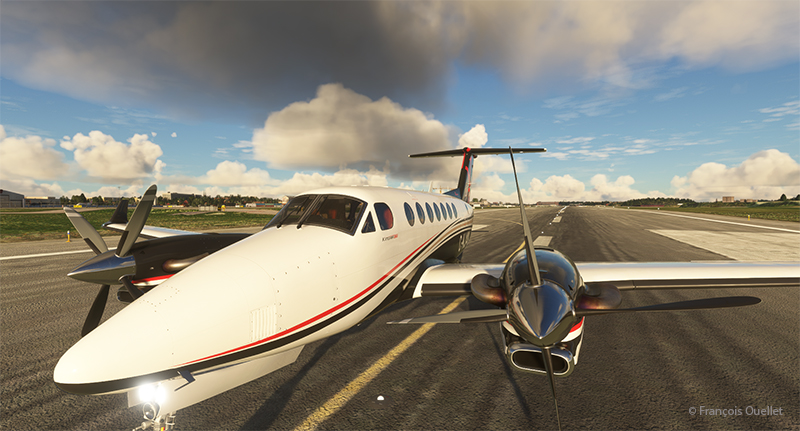
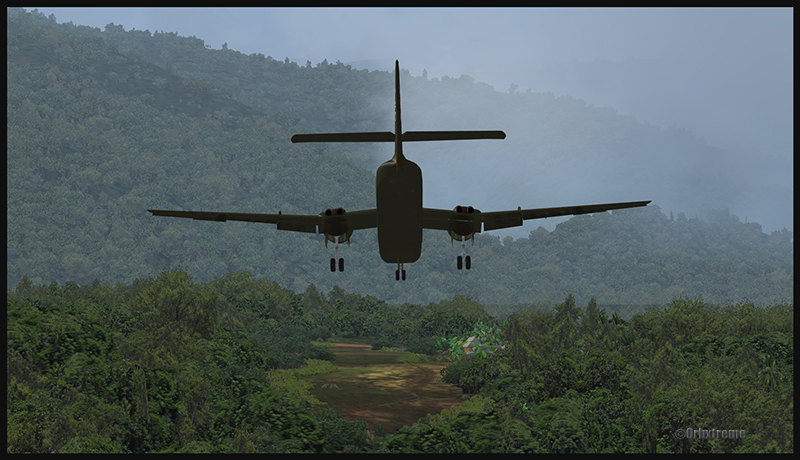
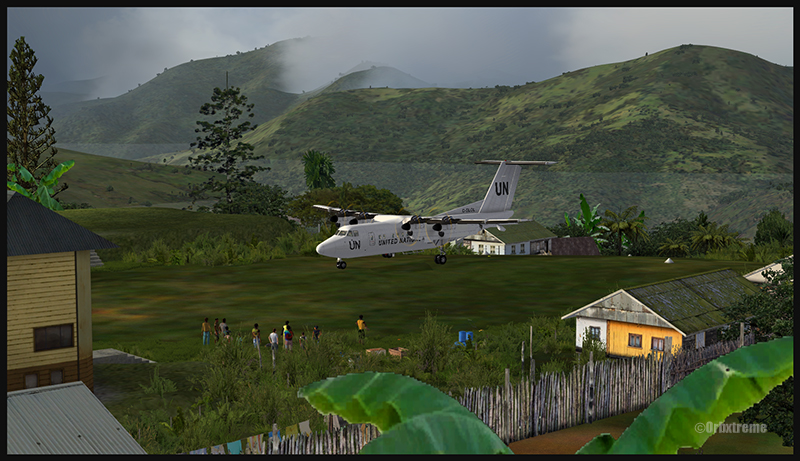
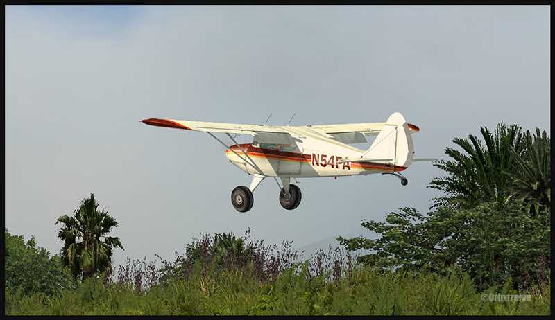
Cessna 310R airborne from Isle of Man airport with MSFS
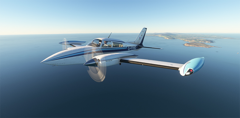
The crew got their hands on a Cessna 310R for the next stage of their round-the-world flight simulation. The virtual aircraft is manufactured by Blackbird Simulations and scores highly with users. Departure is from the Isle of Man Airport (EGNS), with Dublin as the destination. This will be the only stopover in the Republic of Ireland before proceeding on to London, UK.
Blackbird Simulations twin engine Cessna 310R is crossing the Irish Sea towards the Dublin airport (EIDW)
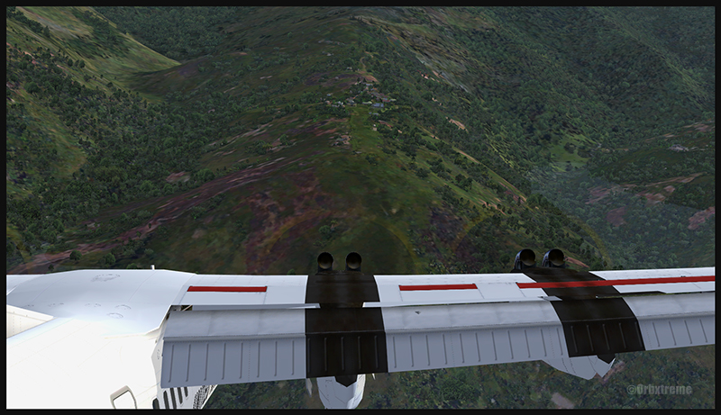
The good weather continues in this part of the world known for its rather cloudy conditions. Flying the Cessna 310R is a real pleasure. With its cruising speed of 188 knots, we reach Dublin quickly.
The left engine is considered critical in the event of engine failure. Vmc is 80 knots. Stall occurs immediately below this speed when only the right engine is running.
Car ferries on the Irish Sea with Microsoft Flight Simulator
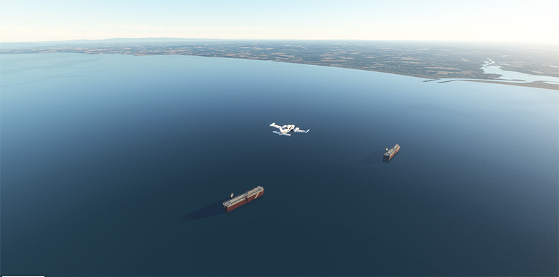
The aircraft approaches the Republic of Ireland as it flies over two ships carrying cars.
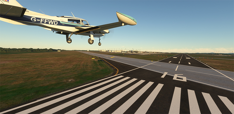
The Blackbird Simulations Cessna 310R turns on final for the Dublin airport (EIDW)
Dublin airport (EIDW) is in sight. A last turn to runway 16 takes us onto long final. Winds are not a problem for the approach.
The virtual pilot extends the landing gear and flaps. Even though this is a flight simulation, you have to keep to the required speeds with flaps and gear, otherwise the flight will come to a halt.
Virtual Cessna 310R on short final for Dublin airport in flight simulation
The UK-registered aircraft arrives on short final after an uneventful flight.
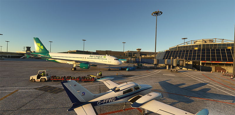
Blackbird C310R taxiing at Dublin after arrival from Isle of Man
We make our way through the airport to the agreed disembarkation point. Along the route, we can observe several parked aircraft, including those of British Airways, WestJet and Aer Lingus.
FSLTL software works effectively to furnish most airports with virtual aircraft.
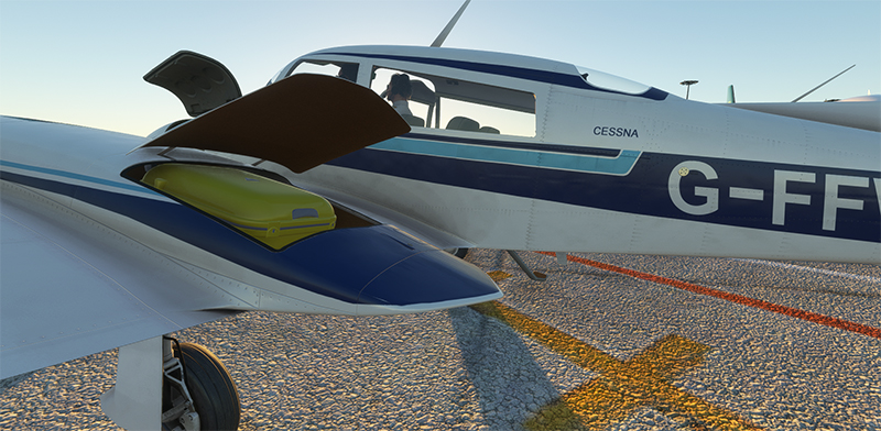
Blackbird Simulations Cessna C310R on the ground at Dublin with MSFS 2020
At last, a passenger who had the idea of getting a yellow suitcase instead of the eternal black ones that everyone confuses on luggage straps.
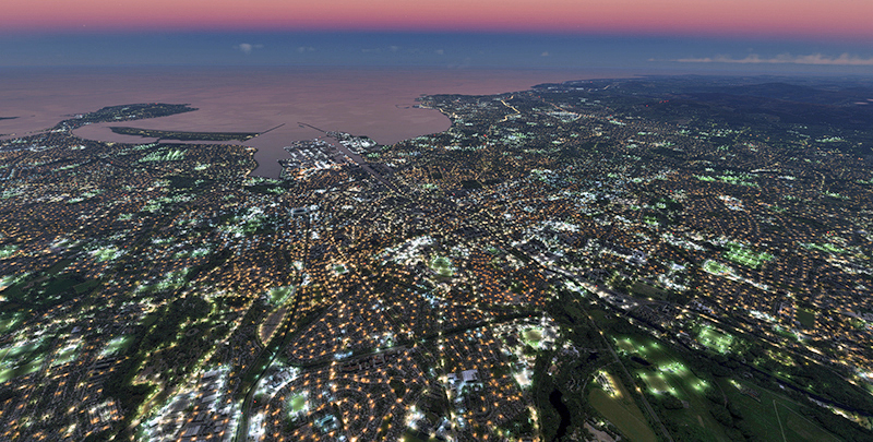
Dublin in the evening with Microsoft Flight Simulator
A flight with the virtual drone gives an idea of Dublin illuminated just before nightfall. This is the version offered by Microsoft’s MSFS 2020 flight simulator. The light is superb.
The next leg of our round-the-world trip will soon take us from Dublin to London City Airport (EGLC) in a Black Square Beechcraft B60 Duke.
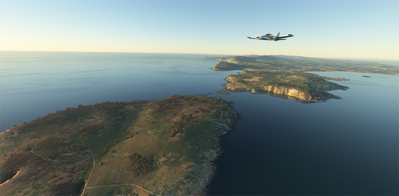
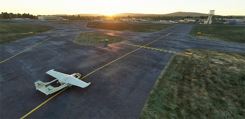
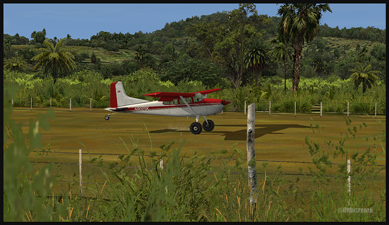
Stage 18 of the round-the-world flight simulation takes place between Donegal Airport (EIDL) and Isle of Man Airport (EGNS), also known as Douglas Ronaldsway. This island is renowned as a tax haven and for its online gaming. It has a more “advantageous” financial regime than the UK. Its role also came to light in the “Paradise Papers”.
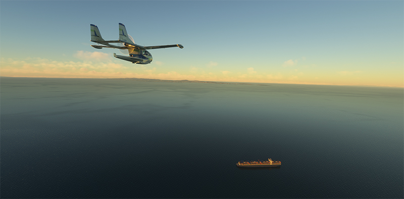
Since we fly over the Irish Sea in a single-engine aircraft, the Nardi FN-333 is an excellent choice in the event of engine failure. What’s more, it offers an attractive range (490 nmi) and a respectable cruising speed (143 knots at 8,000 feet).
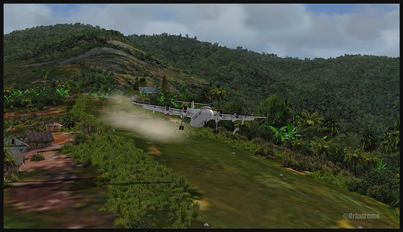
Virtual Nardi FN-333 Riviera at the Donegal (EIDL) with MSFS
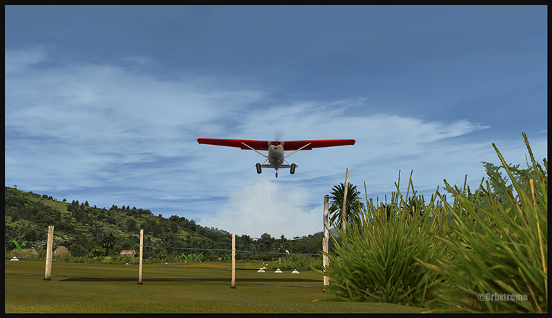
Capable of an ascent of 1280 feet/minute, it flies smoothly over the terrain after taking off from Donegal.
Virtual Nardi FN-333 Riviera airborne from the Donegal airport (EIDL) in the Republic of Ireland with MSFS
To the left of the flight path is Northern Ireland’s Strangford and Lecale Area of Outstanding Natural Beauty, https://strangfordlough.org/ a tourist attraction rated 4.8/5 by Google users.
Nardi FN-333 Riviera flying by the Strangford and Lecale area of outstanding natural beauty in Northern Ireland with MSFS
Once over the Irish Sea, you can see the first container ship, which will be followed by many other vessels with a variety of functions (Irish Ferries, car carriers, tankers, LNG carriers, etc.).
Nardi FN-333 Riviera overflying a container ship in the Irish Sea with Microsoft Flight Simulator
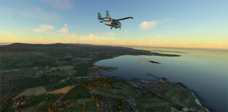
At the end of the day, the Isle of Man becomes visible. It’s always nice to arrive before dark when landing for the first time at an unfamiliar airport. This allows the pilot to get a good look at the surroundings.
Nardi FN-333 Riviera on final for the Isle of Man airport with MSFS
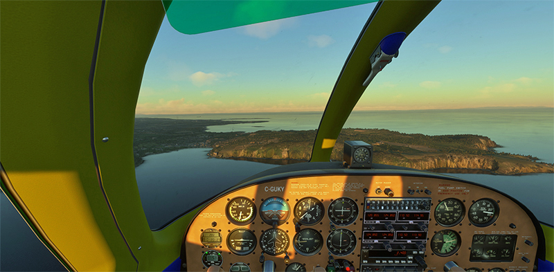
The sun illuminates the cockpit in a very realistic way with the new flight simulators. In the past, shadows didn’t move in the cockpit.
Isle of Man in sight in the evening with Microsoft Flight Simulator 2020
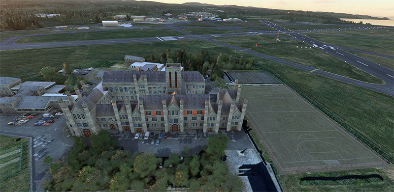
Very close to the Isle of Man Airport (EGNS) is a huge building, King William’s College. It offers private education to young people between the ages of 3 and 18. I wonder if the staff have ever had a scare because of a missed approach by one of the many aircraft that land on the island every day. After all, there is no shortage of accidents.
King William’s College near the Isle of Man airport with Microsoft Flight Simulator 2020
Fortunately, the landing did not frighten the students at the nearby college.
The Nardi FN-333 Riviera just landed at the Isle of Man (EGNS) airport in the evening.
A few days’ stopover will be necessary before embarking on the rest of the trip. We’ll then reach the Republic of Ireland, landing at Dublin airport (EIDW) with the MSFS 2020 flight simulator and the Cessna 310R from Blackbird Simulations.
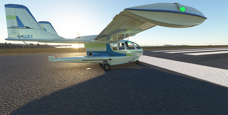
A surprise awaits us as we depart from the Sandane airport (ENSD) for Sweden, Stockholm-Bromma airport (ESSB).
Drone on the ground at Sandane airport (ENSD) in Norway.
A Northrop Grumman RQ-4 Global Hawk drone is at the airport. This long-range surveillance aircraft has an autonomy of around 35 hours and a range of 22779 kilometers. It flies at altitudes of up to 60,000 feet (18288 meters). Its maximum speed is 635 km/h, and each hour of operation costs $24,000.
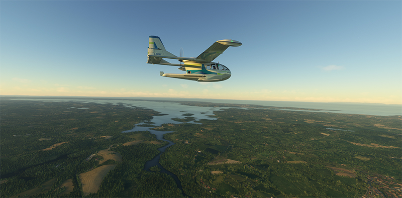
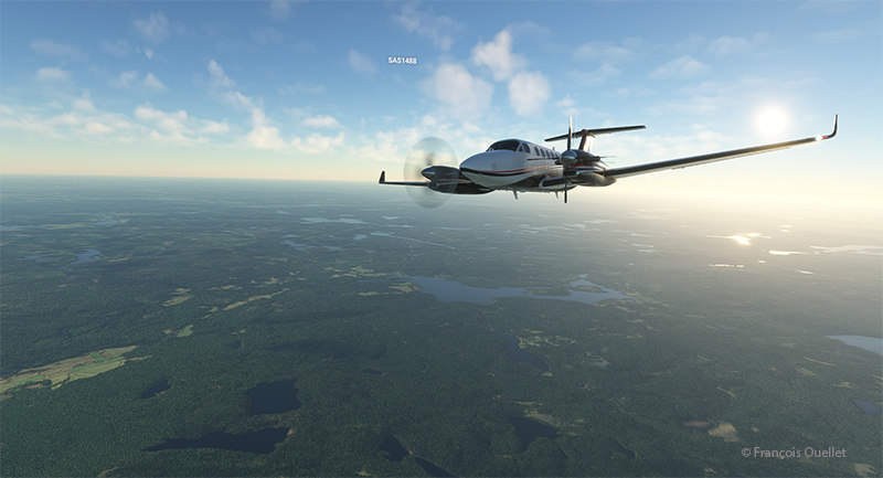
Beech 350I airborne from the Sandane Airport (ENSD) heading to Stockholm-Broma airport (ESSB)
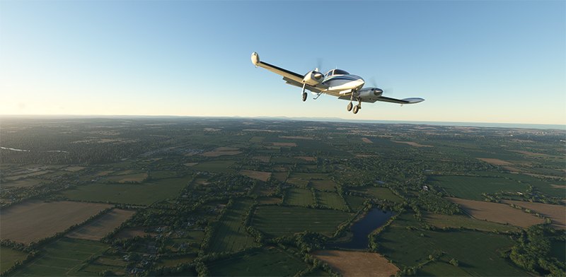
Today, we’re repositioning a twin-engine Beechcraft King Air 350I that hasn’t flown in ages. The usual checks have been carried out to ensure that no birds have nested under the engine cowling. We also checked that there was no condensation water at the bottom of the fuel tanks. Finally, we ran the engines for a long time on the ground. The aircraft takes off from Sandane for a planned altitude of 18,000 feet.
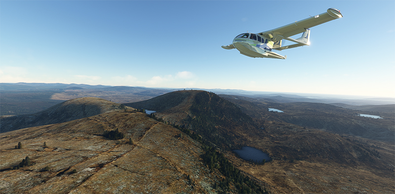
Over Norway snowcapped mountains heading to Sweden in flight simulation.
We fly over the mountains of Norway towards Sweden. Everything goes according to plan.
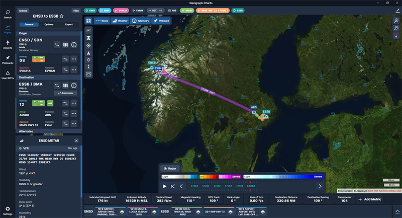
Navigraph chart showing a flight from Sandane (ENSD) to Stockholm-Bromma (ESSB)
The Navigraph map shows the planned route between the two countries.
Engine failure on a twin engine aircraft with Microsoft Flight Simulator.
Suddenly, the left engine experiences problems. It stops and the propeller feathers to minimize drag. Since we’re approaching the runway at Stockholm-Bromma airport, we choose to continue on our way, as we benefit from a large airstrip and emergency response services. Now unsure about the reliability of the second engine, we keep a slightly higher altitude than a normal approach would generally dictate.
Double engine failure on a twin engine with Microsoft Flight Simulator.
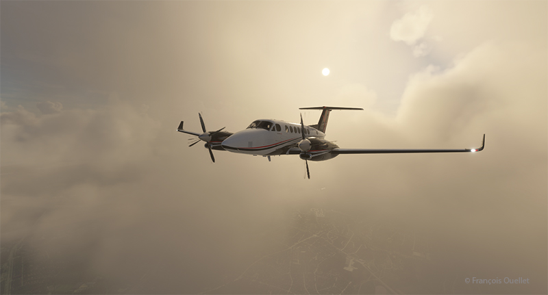
A few minutes later, the second engine stops. The plane becomes a large glider. The clouds prevent a good view of the surrounding area, but we feel our altitude is sufficient to attempt an approach to the airport when the runway is in sight.
On final for Stockholm-Bromma airport with a double engine failure
The flaps and landing gear will only be extended once we’re established on final and the aircraft is stabilized and certain of reaching the runway. Microsoft’s flight simulator doesn’t allow us to do just anything with an aircraft. If we exceed the aircraft’s structural capabilities when attempting to reach the airport, the flight will stop immediately.
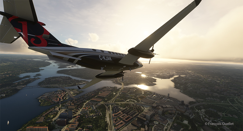
On the ground at Stockholm-Bromma with a double engine failure on a Beechcraft 350I in flight simulation.
The final approach and taxiing caused no problems. The aircraft gradually slows down until it comes to a complete stop on the runway. The poor air traffic controllers now have to apply Plan B to reorganize air traffic around the airport, with the main runway temporarily blocked.
Beechcraft maintenance hangar at the Stockholm-Bromma virtual airport
Fortunately, Beechcraft offers maintenance services at Stockholm-Bromma airport. So, we’ll leave the aircraft for major repairs and find something faster for the next flight to Ukraine. Why not an F-14 Tomcat? It is not in military service anymore and thus its presence in the air should not worry too much.
P.S. This story is based on a real even that happened in Quebec several years ago. An acquaintance of mine (Paul B.) was scheduled to fly from the Val-d’Or airport (CYVO) to Rouyn-Noranda (CYUY) in a light twin-engine aircraft that hadn’t flown in a long time. Halfway between CYVO and CYUY, the first engine failed. The pilot decided to continue. With the runway in sight in the distance, the second engine stopped. The pilot hovered the aircraft and managed to land on route 117, just behind a large truck which accelerated to give way to the aircraft he could see descending in his rear-view mirror. The aircraft landed safely and without damages!
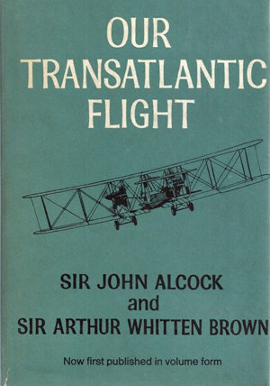
Our transatlantic flight, by Sir John Alcock and Sir Arthur Whitten Brown
Newfoundland
Before 1949, Newfoundland was called Dominion of Newfoundland and was part of the British Commonwealth . In 1949, it became a Canadian province.
The first non-stop flight eastward across the Atlantic.
The book « Our transatlantic flight » tells the story of the historic flight that was made in 1919, just after the First World War, from Newfoundland to Ireland. There was a 10,000 £ prize offered by Lord Northcliffe from Great Britain for whoever would succeed on the first non-stop flight eastward across the Atlantic.
A triumph for British aviation
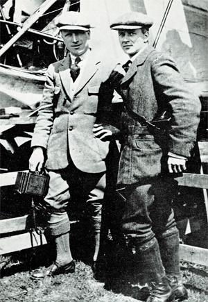
Sir John Alcock and Sir Arthur Whitten Brown , respectively pilot and navigator, wrote the story of their successful flight in this book which was published in 1969. The followings are pilot quotes from the book : « For the first time in the history of aviation the Atlantic had been crossed in direct, non-stop flight in the record time of 15 hours, 57 minutes. » (p.13) « The flight was a triumph for British aviation; the pilot and navigator were both British, the aircraft was a Vickers-Vimy and the twin engines were made by Rolls-Royce. » (p.13)
Sir John Alcock and Sir Arthur Whitten Brown
As with all great human achievements, a very good flight planning and some luck was needed to make this flight a success. If there was an engine failure during the flight, even if the planning was excellent, there was only one outcome : downward.
In order to make the flight, Alcock and Brown boarded a ship from England bound to Halifax. They then headed to Port aux Basques and finally arrived in St.John’s. There, they joined a small group of British aviators who had arrived a few days before and who were also preparing for the competition. « The evenings were mostly spent in playing cards with the other competitors at the Cochrane Hotel, or in visits to the neighbouring film theatres. St.John’s itself showed us every kindness. » (p.60)
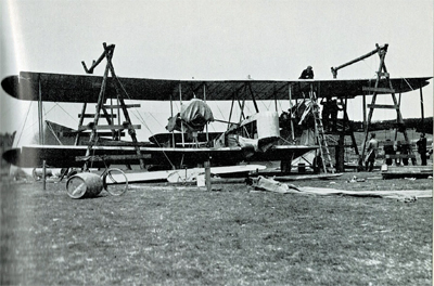
Maritime transport was used to carry the Vickers-Vimy biplane to Newfoundland on May 4th. It was assembled in Newfoundland. « The reporters representing the Daily Mail, the New York Times, and the New York World were often of assistance when extra manpower was required. » (p.61).
While the aircraft was being built, there were more and more visiters coming to the site. Brown says : « Although we remained unworried so long as the crowd contented itself with just watching, we had to guard against petty damage. The testing of the fabric’s firmness with the point of an umbrella was a favourite pastime of the spectators […]. » (p.61)
The Vickers-Vimy is being reassembled at Quidi Vidi in Newfoundland.
It was difficult to find a field that could be improvised into an aerodrome : « Newfoundland is a hospitable place, but its best friends cannot claim that it is ideal for aviation. The whole of the island has no ground that might be made into a first-class aerodrome. The district around St.John’s is especially difficult. Some of the country is wooded, but for the most part it shows a rolling, switchback surface, across which aeroplanes cannot taxi with any degree of smoothness. The soil is soft and dotted with boulders, as only a light layer covers the rock stratum. Another handicap is the prevalence of thick fogs, which roll westward from the sea. » (p.59)
They flight tested the airplane on June 9th at Quidi Vidi. During the short flight, the crew could see icebergs near the coast. They did a second trial on June 12th and found that the transmitter constantly caused problems. But, at least, the engines seemed to be reliable…
The departure
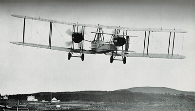
The two men left Newfoundland on June 14th 1919. In order to fight the cold air in flight, they wore electrically heated clothing. A battery located between two seats provided for the necessary energy.
The Vickers-Vimy departs from Newfoundland in 1919
The short take-off was very difficult due to the wind and the rough surface of the aerodrome. Brown writes : « Several times I held my breath, from fear that our under-carriage would hit a roof or a tree-top. I am convinced that only Alcock’s clever piloting saved us from such an early disaster. » (p.73)
It took them 8 minutes to reach 1000 ft. Barely one hour after departure and once over the ocean, the generator broke and the flight crew was cut off from all means of communication.
As the airplane consumed petrol, the centre of gravity changed and since there was no trim on the machine, the pilot had to exert a permanent backward pressure on the joystick.
Flying in clouds, fog and turbulence.
During the flight with much clouds and fog, Brown, having almost no navigation aid, had real problems to estimate the aircraft’s position and limit the flying errors. He had to wait for a higher altitude and for the night to come to improve his calculations : « I waited impatiently for the first sight of the moon, the Pole Star and other old friends of every navigator. » (p.84). The fog and clouds were so thick that at times they « cut off from view parts of the Vickers-Vimy. » (p.95)
Without proper instruments to fly in clouds, they were relying on a « revolution-counter » to establish the climbing or the falling rate. That is pretty scary. « A sudden increase in revolutions would indicate that the plane was diving; a sudden loss of revs would show that she was climbing dangerously steeply. » (p.176)
But that was not enough. They also had to deal with turbulence that rocked the plane while they could not see anything outside. They became desoriented : « The airspeed indicator failed to register, and bad bumps prevented me from holding to our course. From side to side rocked the machine, and it was hard to know in what position we really were. A spin was the inevitable result. From an altitude of 4,000 feet we twirled rapidly downward.[…]. « Apart from the changing levels marked by aneroid, only the fact that our bodies were pressed tightly against the seats indicated that we were falling. How and at what angle we were falling, we knew not. Alcock tried to centralise the controls, but failed because we had lost all sense of what was central. I searched in every direction for an external sign, and saw nothing but opaque nebulousness. » (p.88)
« It was a tense moment for us, and when at last we emerged from the fog we were close down over the water at an extremely dangerous angle. The white-capped waves were rolling along too close to be comfortable, but a quick glimpse of the horizon enabled me to regain control of the machine. » (p.40).
De-icing a gauge installed outside of the cockpit.
Snow and sleet were falling. They didn’t realize how lucky they were to continue flying in such a weather. Nowadays, there are many ways to dislodge ice from a wing while the aircraft is in flight. Here is what Brown says about their situation : « […] The top sides of the plane were covered completely by a crusting of frozen sleet. The sleet imbedded itself in the hinges of the ailerons and jammed them, so that for about an hour the machine had scarcely any lateral control. Fortunately, the Vickers-Vimy possesses plenty of inherent lateral stability; and, as the rudder controls were never clogged by sleet, we were able to hold to the right direction. » (p.95)
After twelve hours of flying, the glass of a gauge outside the cockpit became obscured by clotted snow. Brown had to deal with it, while Alcock was flying. « The only way to reach it was by climbing out of the cockpit and kneeling on top of the fuselage, while holding a strut for the maintenance of balance. […] The violent rush of air, which tended to push me backward, was another discomfort. […] Until the storm ended, a repetition of this performance, at fairly frequent intervals, continued to be necessary. » (p.94)
In order to save themselves, they executed a descent from 11,000 to 1000 feet and in the warmer air the ailerons started to operate again. As they continued their descent below 1000 feet over the ocean, they were still surrounded by fog. They had to do some serious low altitude flying : « Alcock was feeling his way downward gently and alertly, not knowing whether the cloud extended to the ocean, nor at what moment the machine’s undercarriage might touch the waves. He had loosened his safety belt, and was ready to abandon ship if we hit the water […]. » (p.96)
The arrival.
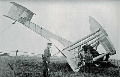
They saw Ireland at 8.15 am on June 15th and crossed the coast ten minutes later. They did not expect a very challenging landing as the field looked solid enough to support an aircraft. They landed at 8 :40 am at Clifden on top of what happened to be a bog; the aircraft rolled on its nose and suffered serious material damages. The first non-stop transatlantic flight ended in a crash. Both both crewmen were alive and well, although they were dealing with fatigue…
The transatlantic flight ends up in Ireland in a soft field
Initially, nobody in Ireland believed that the plane arrived from North America. But when they saw mail-bags from Newfoundland, there were « cheers and painful hand-shakes » (p.102).
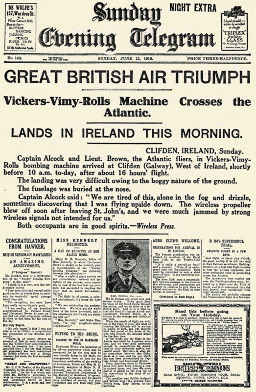
First page of the Sunday Evening Telegraph in 1919.
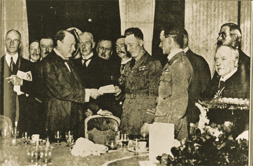
They were cheered by the crowds in Ireland and England and received their prize from Winston Churchill.
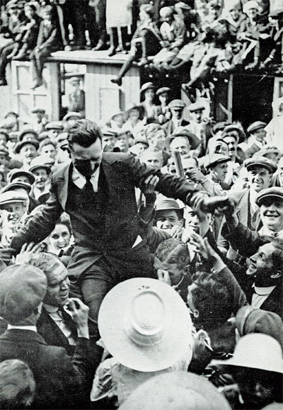
John Alcock chaired by the crowd
Winston Churchill is presenting the Daily Mail Check to the two pilots.
Their record stood unchallenged for eight years until Lindbergh’s flight in 1927.
The future of transatlantic flight.
Towards the end of the book, the authors risk a prediction on the future of transatlantic flight. But aviation made such a progress in a very short time that, inevitably, their thoughts on the subject was obsolete in a matter of a few years. Here are some examples :
« Nothwithstanding that the first two flights across the Atlantic were made respectively by a flying boat and an aeroplane, it is evident that the future of transatlantic flight belongs to the airship. » (p.121)
« […] The heavy type of aeroplane necessary to carry an economical load for long distances would not be capable of much more than 85 to 90 miles an hour. The difference between this and the present airship speed of 60 miles an hour would be reduced by the fact that an aeroplane must land at intermediate stations for fuel replenishment. » (p.123)
« It is undesirable to fly at great heights owing to the low temperature; but with suitable provision for heating there is no reason why flying at 10,000 feet should not be common. » (p.136)
The Air Age.
There is a short section in the book on the « Air Age ». I chose two small excerpts on Germany and Canada :
On Germany’s excellent Zeppelins : « The new type of Zeppelin – the Bodensee – is so efficient that no weather conditions, except a strong cross-hangar wind, prevents it from making its daily flight of 390 miles between Friedrichshafen and Staalsen, thirteen miles from Berlin. » (p.140)
On Canada’s use of aeroplanes : « Canada has found a highly successful use for aeroplanes in prospecting the Labrador timber country. A group of machines returned from an exploration with valuable photographs and maps of hundreds of thousands of pound’s worth of forest land. Aerial fire patrols, also, are sent out over forests.» (p.142) and « Already, the Canadian Northwest Mounted Police [today the RCMP] have captured criminals by means of aeroplane patrols. » (p.146)
Conclusion
The Manchester Guardian stated, on June 16th 1919 : « […] As far as can be foreseen, the future of air transport over the Atlantic is not for the aeroplane. It may be used many times for personal feats of daring. But to make the aeroplane safe enough for business use on such sea routes we should have to have all the cyclones of the Atlantic marked on the chart, and their progress marked in from hour to hour. »(p.169)
Title : Our Transatlantic Flight
Authors : Sir John Alcock and Sir Arthur Whitten Brown
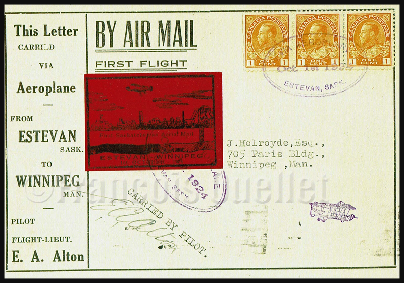
Airmail Estevan Winnipeg CLP5 semi official stamp front cover
The CLP5 semi-official stamp was issued on October 1st,1924 and put on airmail covers for the first airmail flight planned from Estevan, Saskatchewan to Winnipeg, Manitoba. What initially seemed to be a publicity stunt toward the use of airmail was instead a marketing operation planned by two promoters of a local industry, coal mining.
The Estevan to Winnipeg flight promoter and his associate had personal interests in the Eureka Coal and Brick mining company. On the back cover, we even have a commercial invitation: « Buy Estevan Brick ».
Airmail Estevan Winnipeg CLP5 semi official stamp. Back of cover.
The pilot, E.A.Alton took-off from Estevan under nice weather on the morning of October 1st,1924 and headed east toward Winnipeg. He was supposed to do a stopover in Brandon, to refuel, but engine problems forced him to land in a field in Bienfait. During the landing, the wheels hit hidden rocks and the aircraft was wrecked.
The pilot quickly transferred the mail to the Bienfait Post Office where it was put on the Souris train to Winnipeg. The mail arrived late but on the same day at destination.
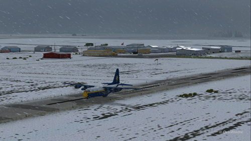
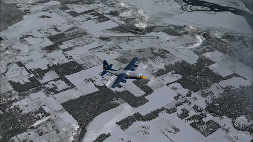
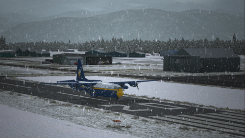
A virtual C-130 belonging to the Blue Angels is taxiing at the High River airport, in Alberta.
Wanting to add an almost impossible flight in the “unhinged virtual flights” section of my web site, I tried a flight with the Blue Angels C-130 Hercules (Captain Sim) where the aircraft gradually lost all of its engines.
The Blue Angels C-130 Hercules waiting in line behind a single engine aircraft at the High River airport.
I am aware that the Blue Angels mechanics are real professionals, so I assumed that the engine failures were caused by an unknown reason.
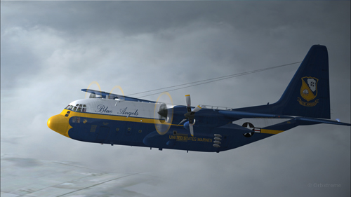
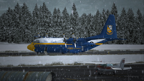
A virtual Blue Angels Lockheed C-130 Hercules takes-off from the High River (CEN4) Canadian airport in Alberta.
The take-off was made without problem from the Canadian High River (CEN4) airport. This free airport was designed by Vlad Maly and is available through ORBX. The aircraft leaves the 4150 feet runway heading to the Coeur d’Alène airport (KCOE) in United States.
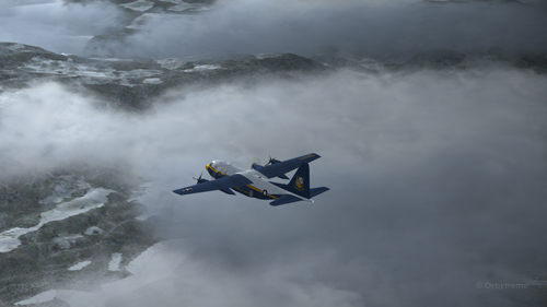
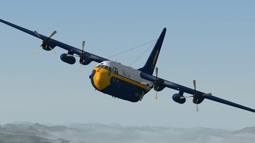
Eventually, the first engine stops. This does not cause a problem. The propeller is feathered and the gradual climbing continues.
The C-130 Hercules loses its first engine.
The second engine stops. The pilot must forget the initial destination. Bonners Ferry (65S) becomes the alternate airport since the 4000×75 feet runway is good enough for the C-130.
The second engine has just stopped on this C-130 Hercules.
Double engine failure for this virtual Blue Angles C-130 Hercules.
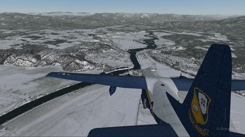
The third engines gives way. A slow descent starts. Bonners Ferry is not very far. The airport is at an altitude of 2337 ft asl.
The aircraft is volontarily flown at a higher altitude than what would normally be requested for a normal approach, just in case the fourth engine stops. When three engines stop after the same refueling, the pilot has the right to think that what feeds the fourth engine can also cause problems.
Three engine failures on this virtual Blue Angels C-130 Hercules.
The highest mountains are now behind the aircraft.
Virtual C-130 Hercules aircraft with three engine failures enroute to the Bonners Ferry airport.
The Bonners Ferry (65S) runway is in sight.
Virtual C-130 Hercules aircraft with three engine failures, by the Bonners Ferry’s runway.
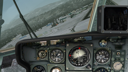
The fourth engine stops. The flaps will not be functional for the landing.
From now on, the pilot should save the virtual flight a few times since it is possible that several trials will be necessary to glide sucessfully to the airport. This is the fun of virtual flight.
The four engines have now failed on that virtual C-130 aircraft.
The C-130 Hercules has become a big glider. When the speed is maintained, the aircraft loses more 1000 feet per minute. It is easier to feel the aircraft’s inertia.
The wheels will be brought out only when necessary since the gear adds a lot of drag.
From the position indicated in the picture below, it is impossible to arrive to the airport in a straight line: the aircraft will glide over the airport. In the picture, the aircraft seems to be on a good path for landing, but it is an illusion caused by the wide-angle format chosen for the screen capture.
The aircraft is definitely too high. It is impossible to use the flaps to increase the rate of descent.
Lockheed C-130 Hercules virtual aircraft with four engine failures on the approach to the Bonners Ferry’s virtual airport (65S).
One must choose between 1) sideslips 2) a 360 degree turn to lose altitude or 3) multiple steep turns perpendicular to the runway to increase to distance to the airport.
What would you choose?
There is no universal method. The 360 degree turn is riskier but can prove efficient. An Airbus A330-200 flown by Quebecer Robert Piché that had lost all of its engines landed successfully in the Açores in 2001 after attempting a last minute 360 degree turn to lose altitude. But here, I did not believe there was enough altitude to safely complete the turn and reach the runway.
A few steep turns were made to extend to ride to the airport. Why steep turns? In order to avoid getting closer to the airport before an acceptable altitude was reached. This method helped keep an eye on the runway at all times to verify if the slope to the airport was still acceptable.
Fourty degree turn to the right on the approach to the Bonners Ferry’s airport.
Steep turn to the left to extend the distance to the Bonners Ferry airport.
I tried the three methods, always starting from the same saved flight (photo 10). After several sideslips, the aircraft was always approaching the airport too quickly. There was not enough time to lose altitude. The final speed always happened to be too high to stop a C-130 without flaps or thrust reversers.
The 360 degree turn, be it right or left, with different angles and a reasonable speed, always incurred a loss of altitude that brought the aircraft 200 to 300 feet short of the threshold.
Finally, after a few steep turns, the aircraft was positioned on final with the appropriate speed and altitude.
View of the Lockheed C-130 Hercules with four engine failures, on the approach for Bonners Ferry (65S).
A few last seconds adjustments, to reposition the aircraft in the center of the runway.
Speed 150 knots. End of the turn for the Bonners Ferry’s airport.
At 140 kts, but without any reverse thrust, the whole runway should be necessary to stop the aircraft.
Speed 140 knots, aligned with the Bonners Ferry’s runway.
The landing was smooth and the aircraft stopped short of the threshold.
For an unknown reason, the anemometer was still indicating a 10 kts airspeed, even when the aircraft had stopped.
C-130 cargo aircraft on the Bonners Ferry’s runway.
Lockheed C-130 Hercules virtual aircraft after landing at the Bonners Ferry (65S) airport.
C-130 Hercules aircraft in Bonners Ferry.
Try such a flight in the virtual mode. The worst that can happen is that you have fun!
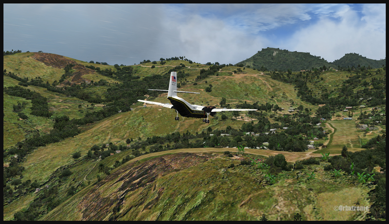
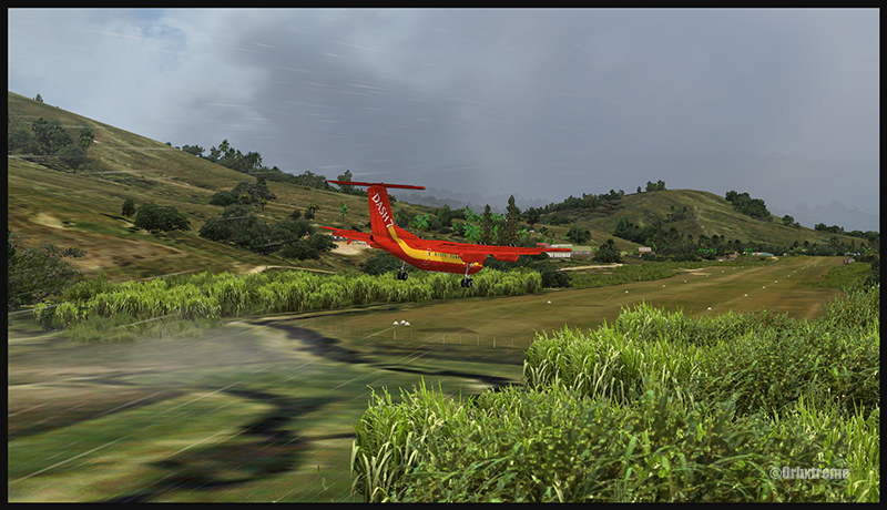
A virtual DHC-6 Twin Otter enroute for Kokoda after a fire on the right engine while departing Yongai (KGH) in Papua New Guinea PNG (FSX)
Ken Hall and Tim Harris have created a new virtual scenery for flight simulation enthousiasts. It is called “Tapini” and sold by ORBX. Their penultimate creation, AYPY Jackson’s International, allowed the virtual pilot to fly in very demanding virtual airports along the Kokoda Trail in Papua New Guinea. “Tapini” represents a whole new challenge and I have included several screen captures to show you how the different runways look in this new virtual scenery.
“Tapini”, still in Papua New Guinea, allows the virtual pilot to test his skills on seven new runways located in difficult areas of the Owen Stanley Range. Those airports also constitute a serious test for any aircraft, like in the picture above where damages to the right engine were sustained at Yongai.
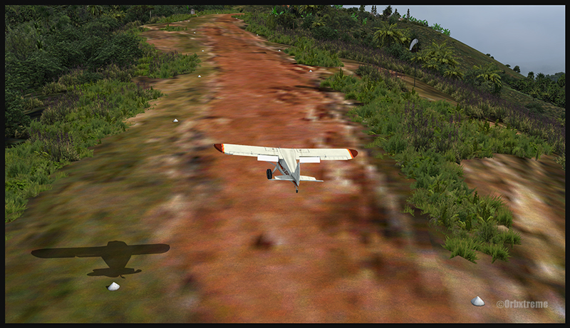
A virtual Piper Pacer virtuel is about to land on the Ononge (ONB) curved runway in Papua New Guinea PNG (FSX). (It is possible to see the curve starting on the top of the image)
To improve the virtual clouds while flying between the different airports, I used either REX or FSGRW weather engines. The cloud textures and weather effects were improved by one or many of the following products: Cumulus X, PrecipitFX, REX Texture Direct and REX Soft Clouds.
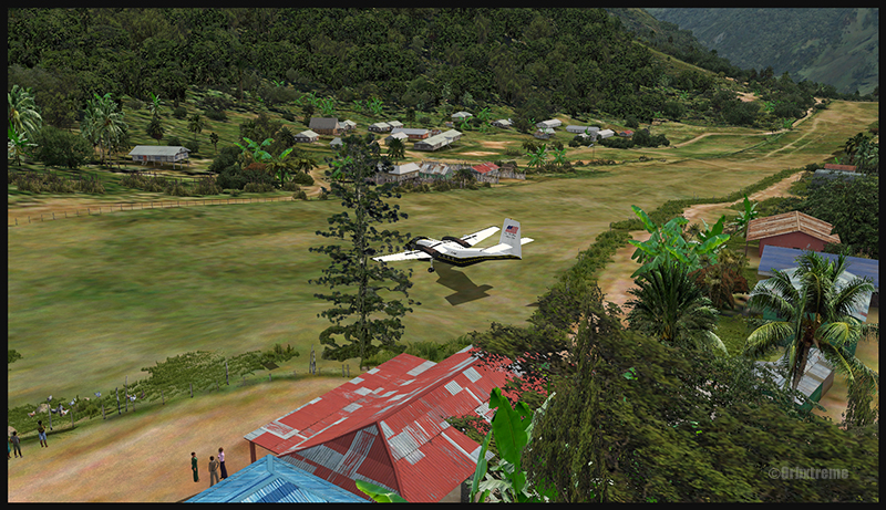
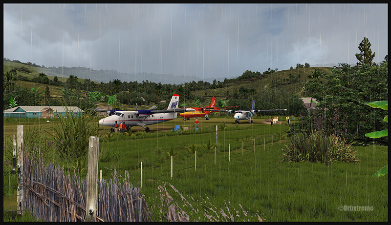
A virtual Dash 7 has just landed in Woitape (WTP) in Papua New Guinea PNG (FSX)
As variety is more fun, and also due to the different challenges created by those runways, the following virtual aircrafts were used: Carenado C-185F, Lionheart Creations PA-18, Virtavia DHC-4, Aerosoft DHC-6 Twin Otter and Milton Shupe DHC-7.
The “Tapini” scenery gives the pilot a choice between the seven following runways:
ASB (Asimba)
A tricky, very short runway near a river.
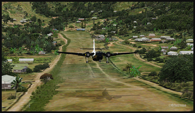
A DHC-4 Caribou virtual aircraft is on approach for Asimba’s sloped runway (ASB) in Papua New Guinea PNG (FSX)
This is a very interesting runway, best done with a STOL aircraft like the Caribou DHC-4. The inhabitants might have to help you clear out some branches along the runway, considering the size of the aircraft. The runway slopes down on take-off, which helps to build up speed.
A DHC-4 Caribou virtual aircraft is on a stopover at Asimba (ASB) in Papua New Guinea PNG (FSX)
A DHC-4 Caribou virtual aircraft is airborne from Asimba (ASB) in Papua New Guinea PNG (FSX)
FNE (Fane)
A one-way, really challenging 12 degree sloped runway, with unpredictable winds.
A De Havilland DHC-7 virtual aircraft on final for the Fane (FNE) airport’s sloped runway in Papua New Guinea PNG (FSX)
The runway sits on top of a hill. It is an amazing experience to land there. No wonder there are a lot of people watching the arrivals and departures.
If you slow down too quickly with an aircraft as big as the DHC-7 on that sloped runway, the twelve degree angle prevents you from moving forward. You must let the aircraft come down the runway very slowly, using the power to control the descent and the rudder to stay aligned on the runway, then apply take-off power for a few seconds to build just enough momentum to get above the hill.
A De Havilland DHC-7 virtual aircraft just finished taxiing uphill on the Fane (FNE) airport’s sloped runway in Papua New Guinea PNG (FSX)
To turn the aircraft around, it’s a combination of power and reverse thrust until you clear all the obstacles (any humans venturing behind the aircraft will also be cleared during the operation…).
A De Havilland DHC-7 virtual aircraft is airborne from the Fane (FNE) airport’s sloped runway in Papua New Guinea PNG (FSX)
There is a not so friendly man with a rifle watching the airport’s operations. Even the United Nations staff do not stay longer than necessary…
KGH (Yongai)
A very bumpy one-way sloped runway. A real bush aircraft is needed here!
A virtual DHC-6 Twin Otter on approach for the Yongai (KGH) bumpy runway in Papua New Guinea PNG (FSX)
Even with a real bush aircraft, there is a possibility that one of the aircraft’s propellers hits the ground while taxiing on the runway. There are so many deep holes that are hard to see, I can only wish the best of lucks to everyone trying out this airport!
A virtual DHC-6 Twin Otter on the Yongai (KGH) bumpy runway in Papua New Guinea PNG (FSX)
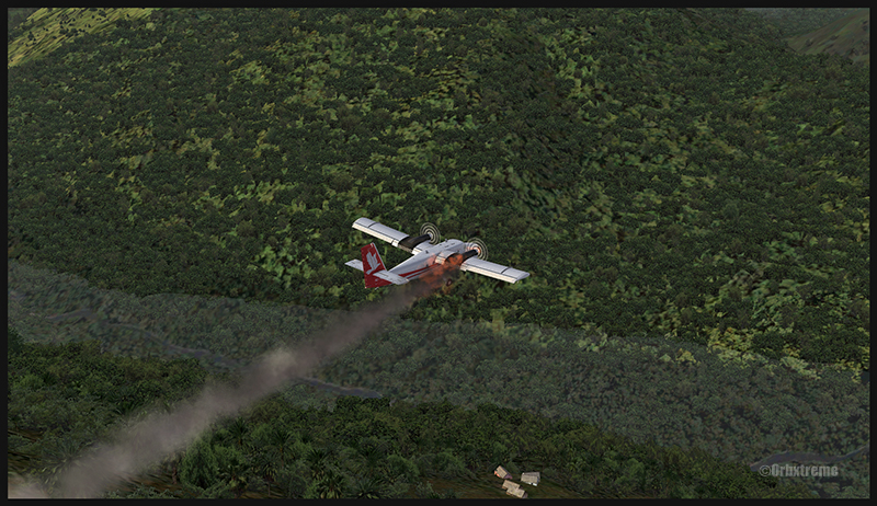
Keep a close watch on the area near the little house at the end of the runway. The DHC-6 was really shaken while turning around for take-off. One of the propellers hit the ground but no problems were detected…until the aircraft was airborne. The fire alarm then went off, just as the aircraft was passing the runway threshold, seconds before flying over a cliff.
A virtual DHC-6 Twin Otter with its right engine on fire is just airborne from the Yongai (KGH) bumpy runway in Papua New Guinea PNG (FSX)
So much for the planned trip… and it was out of the question to return to Yongai on one engine. I had to pull the handle to stop the fire, feather the prop, cut the fuel where it was not needed anymore then head to the Kokoda airport as it was a sure alternative, having a long runway and an elevation that did not require the use of extra power.
KSP (Kosipe)
A relatively short runway that requires good calculations from the pilot, since it is located high in the mountains.
A virtual Cessna C-185F is enroute to the Kosipe (KSP) airport in Papua New Guinea PNG (FSX)
The Cessna C-185F is a very well suited aircraft for that runway. Make sure not to be too heavy on the brakes, as new C-185 propellers are hard to find in Kosipe. You can land in both directions. Ensure that the mixture is set properly as the airport is above 6300 feet.
A virtual Cessna C-185F is rolling after touching down on the Kosipe (KSP) runway in Papua New Guinea PNG (FSX)
A virtual Cessna C-185F is airborne from the Kosipe (KSP) runway in Papua New Guinea PNG (FSX)
ONB (Ononge)
A curved and very bumpy runway! For those who like low flying. Make sure you choose the good aircraft here; there is not much manoeuvering area once on the ground.
A Virtual Piper Pacer on approach for the Ononge (ONB) curved runway in Papua New Guinea PNG (FSX)
Ononge looks really scary when you show up on final for the first time. You wonder if the little trail that you see can really be a runway. For that kind of situation, the little Piper Pacer is an excellent aircraft, approaching slowly and braking on a dime. The runway is curved in the middle so you will need a bit of right rudder to keep the aircraft aligned with the runway.
A Virtual Piper Pacer on the Ononge curved runway in Papua New Guinea PNG (FSX)
I guess all those people with their cargo are waiting for a bigger airplane than mine…
A Virtual Piper Pacer is airborne from the Ononge curved runway in Papua New Guinea PNG (FSX)
TAP (Tapini)
A challenging one-way sloped runway nestled in a tight valley. You can even use an ILS to arrive there!
A virtual DHC-4 Caribou on short final for the Tapini (TAP) sloped runway in Papua New Guinea PNG (FSX)
This is a superbly designed area and airport. I visited it with the DHC-4 Caribou but any other big STOL aircraft would have fitted there. There is enough room to manoeuver. It is not too bumpy. There is an interesting slope: it starts downward and ends upward: this helps to slow down the aircraft after landing.
A virtual DHC-4 Caribou on the ground at the Tapini (TAP) airport in Papua New Guinea PNG (FSX)
A virtual DHC-4 Caribou is airborne from the Tapini (TAP) airport in Papua New Guinea PNG (FSX)
WTP (Woitape)
Looks like a no brainer, but there is no margin of error on this one-way slightly sloped runway. Very precise calculations and settings are required if you want to land there with something else than a small aircraft.
A virtual De Havilland DHC-7 on final approach for the Woitape airport (WTP) virtual airport in Papua New Guinea (FSX)
I found the runway to be very slippery with the De Havilland DHC-7. I must say that there was a good crosswind, as I was flying with real life weather and winds. The DHC-7 behaves like a big boat while decelerating on such a runway.
A virtual De Havilland DHC-7 on the ground with two Twin Otters at the Woitape airport (WTP) in Papua New Guinea (FSX)
The Woitape scenery is gorgeous. It is nice to have all those well designed virtual aircrafts, people and animals on site as this makes the scenery so much more realistic.
A De Havilland Virtual DHC-7 is airborne from the Woitape airport (WTP) in Papua New Guinea (FSX)
I love this new Orbx product. When you fly in such a realistic scenery, the brain does not make much difference between what is real and what is virtual. It really works! And if you use real life weather downloaded from the internet, it’s even better.
I tried the seven airports included in the “Tapini” virtual scenery and they are quite demanding. Yongai was the most challenging airport of them all. I had to do two missed approaches there since I ended up too high on the approach. I eventually got it right, like in real life!
I used the Microsoft flight simulator X (FSX) for all the virtual flights, but other platforms would have worked as well (Dovetail Games FSX Steam edition (FSX: SE) and all versions of P3D). The following products were also installed on my flight simulator: FTX Global, FTX Global Vector and Holgermesh, as well as Pilot’s FS Global 2010.
It is a totally immersive virtual experience and you have to forget everything else when undertaking those challenging virtual flights… if you want to make it “virtually” alive!
For more articles on flight simulation on my web site, click on the following link : Flight simulation
(Precedent story: the « Amalgam Chief » military exercise: B-52 bombers in northern Canada).
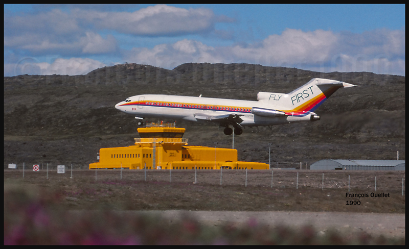
Aer Lingus Boeing B-737 on final for Iqaluit (1989)
This story is about a 1990 winter day where very bad weather conditions prevailed in Iqaluit, on Baffin Island, Canada. Bad as it was, the weather still allowed for takeoffs. Two airline companies, respectively owning a Boeing 727 and 737 had completed the boarding and expected to be airborne shortly. The weather deteriorating even more, the Transport Canada flight service specialists (FSS) had to tell the pilots that they could not proceed with the takeoff as the airport was now under the minimum visibility criteria.
The aircrafts were ready, the engines running and the pilots could not takeoff. There was a bit of tension in the air and the pilots finally decided that they would take a chance and takeoff under unacceptable conditions. The two captains were reminded by the FSS that if they tried to takeoff in the prevailing visibility, which was under legal minimums, an occurrence report would be filed against them.
The flight service specialist naturally received a reply in line with the pilot’s impatience. Nevertheless, the pilots took a second look at the weather and, thinking of a possible occurrence report, decided to delay both takeoffs.
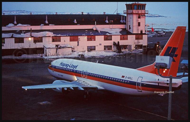
A view from the Iqaluit flight service tower: a First Air Boeing B-727 and a Canadian Airlines Boeing B-737A new Hapag-LLoyd (D-AHLL) Boeing B-737 has just arrived from Boeing Field in Seattle. Next destination: Germany.
In being so impatient to complete their flight, those captains were neglecting that there is always the possibility of an engine failure or other major emergency on takeoff. If they had lost an engine just after being airborne, it would have been impossible to return back to Iqaluit due to the extremely low visibility; they would have been forced to fly a very long distance with one less engine to get to their alternate airport, increasing the risks for the safety of the passengers.
The threat of a potential occurrence report, which has always been the prerogative of air traffic services, forced the pilots to wait for appropriate weather conditions.
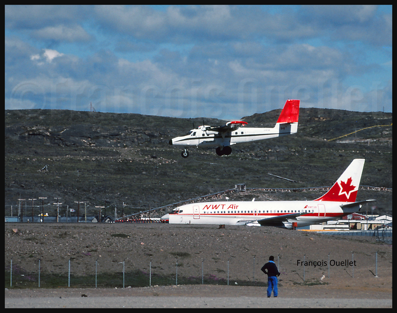
The Iqaluit flight service station tower and a First Air Boeing B-727 landing on runway 36 (1990)View from the Iqaluit flight service station tower of an Evergreen International Boeing B-727 (1989)A NWT Air B-737 on the taxiway and a Bradley Air Services Twin Otter about to land in Iqaluit (1989)An AirUK G-UKLB Boeing B737 is arriving in Iqaluit (around 1989)
(Next story: the lady who was robbed before my eyes)
In 1986, the Propair Company’s hangar was located very close from our flight service station in Rouyn-Noranda. There were frequent exchanges between their staff and our FSS’s. One day, one of their employees told us that two American pilots had just come to the airport to take delivery of a Caribou DHC-4 cargo aircraft that had been sold by Propair.
The aircraft would be exported. The DHC-4 is known to be a very practical aircraft as it can carry heavy loads and manage to takeoff or land on an extremely short distance.The pilots took-off with their used Caribou and we did not hear any more from them until the world Medias started to talk about the Irangate affair. I can talk about it today as it is a public affair: details can be found on the internet.
The Rouyn-Noranda Propair Company had in fact sold not one but two used DHC-4 Caribous to a consultant working for a panamean company. One of the DHC-4 was later registered in El Salvador. One of the two Caribous experienced an engine failure over the mountains, enroute towards El Salvador. In order to stay in the air, and considering the extreme outside moisture and air temperature, the crew had no other choice than to get rid of some weight. Spare parts in the cargo bay, including a brand new engine still in its crate, were pushed outside the plane, falling in the jungle below. But the plane had eventually no other choice than to land before arriving to its initially planned destination, Ilopango.
All this was linked to the Contras who were engaged in warfare operations against the Nicaraguan leftist government of Daniel Ortega. In order to finance the covert operations, a secret budget was necessary: some Americans were selling arms to Iran, even if there was an official ban, and the money received was financing warfare operations. A journalist who had followed this story closely and made important discoveries was found dead. He had apparently committed suicide by shooting himself twice in the head…
One of the pilots who departed Rouyn-Noranda with a DHC-4 was named Sawyer. This man would later fly, covert operations organized by the CIA, a C123 cargo type aircraft that was shot down in southern Nicaragua. The pilot and co-pilot were killed but a passenger, Eugene Hasenfus, parachuted out knowing the aircraft would soon crash. He was interrogated and revealed the details that allowed the discovery of the secret deal with Iran.
The Oliver North’s testimony in front of the Congress kept that story alive for a long time. Eventually, like everything, this story was progressively forgotten. Thirty years later, I still remember the numerous phone calls that the flight service station received from the Medias about this affair.
A book published in 2013 and titled “Raymond Boulanger, le pilote mercenaire” adds several details to this story, since Mr Boulanger was himself a pilot hired by the CIA.
For more real life stories on the Rouyn-Noranda flight service station and flight service specialists, click here:
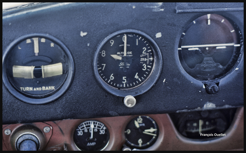
After a proficiency check, I soon find myself flying a Cessna 170B (tail wheel) on a flight across Canada, from St -Jean-sur- Richelieu, Quebec, to Edmonton, Alberta. I am accompanied by the aircraft’s owner who has not yet completed his private pilot course. The 1952 Cessna flies well, but has absolutely no instruments for air navigation, not even a VOR nor ADF. And the era of the portable GPS is not yet upon us.
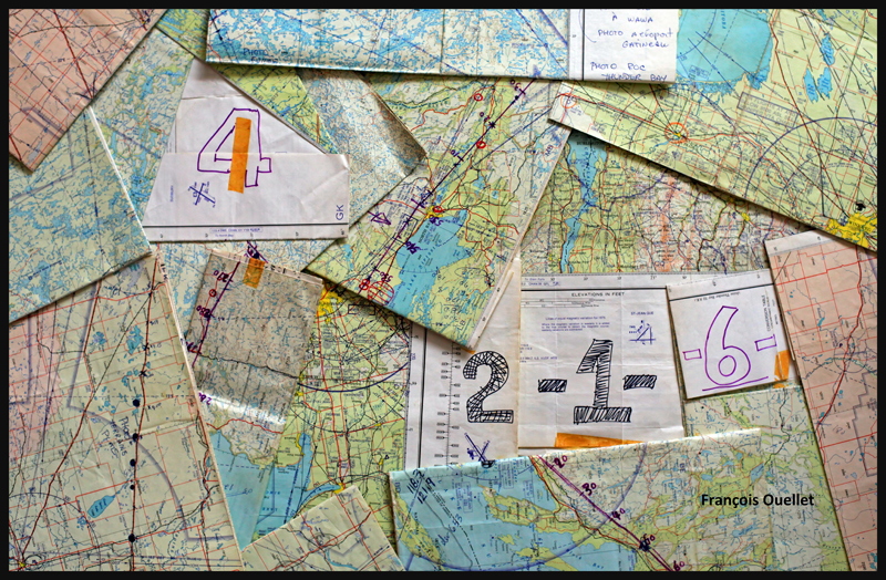
Fourteen 1:500,000 VFR charts, covering the planned flight, are folded, glued and numbered. I trace the expected flight path on each chart, with 10 miles landmarks. This will facilitate the monitoring of our progress, considering the absence of navigation equipment. The preparation now completed, the take off is done on a beautiful summer day of 1981.
1:500,000 VFR charts used for a flight toward Edmonton, Canada, in 1981
We do stopovers at Gatineau, North Bay, Sudbury and then fly along Lake Superior to Wawa.
Small break in Sudbury on a VFR flight to Edmonton in 1981
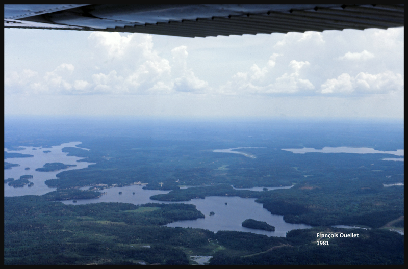
We fly around Lake Superior to our next stopovers, Thunder Bay and Fort Frances. Over large forested areas, with no major landmarks, the gyroscopic precession must be corrected frequently so as not to stray too far from the intended track. Sometimes when it facilitates navigation, we either follow a railway or main roads. There are some instances where the westerly winds are so strong that our ground speed is slower than a car on a highway.
From Fort Frances to Kenora in 1981, with a Cessna C170B
Our flight path follows a line that keeps us away from areas of high air traffic. I choose to fly north of Winnipeg terminal control area, thus avoiding frequent radio exchanges with air traffic control in a language I do not master. The underperforming radio would not be of any help at any rate. This option eventually means that we must fly over Lake Winnipeg, in its southern portion. We have enough altitude to be able to glide to the other side in case of an engine failure. Nonetheless, we realize that we are gradually loosing several thousand feet due to the cold air mass above the lake. This with maximum power applied. The unexpected descent eventually ends, but it is now impossible to have an engine failure without ditching in the lake…
The crossing of Lake Winnipeg with a Cessna C170B in 1981
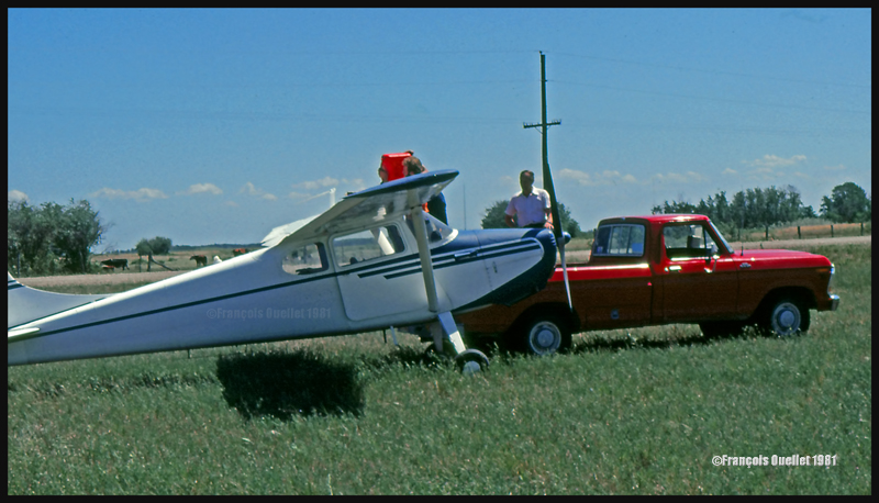
Near Lundar, Manitoba, the aircraft’s old gauges indicate a significant loss of fuel. It is surprising since we refueled an hour ago. We must land the plane on the nearest runway, but the strong crosswinds exceed the capabilities of the aircraft. Nonetheless, an attempt is made with the result that only the left wheel accepts the contact with the runway. As soon as the right wheel also touches the ground, the aircraft becomes airborne again. A nearby field is selected to make a precautionary landing so that the fuel status can be verified. We fly at low altitude over the electrical wires and the cows in the adjacent field, and touch smoothly at a ground speed not exceeding 15 knots. A farmer witnesses the landing and arrives in his red pick-up to offer some help. The tanks are almost full, so the plane only needs few liters of gasoline. Once this is done, we take off westward. It appears that the old fuel gauges of this 1952 Cessna are now totally unreliable…
Landing in a field with a Cessna C170B in Lundar, Manitoba in 1981.
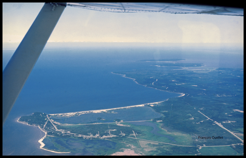
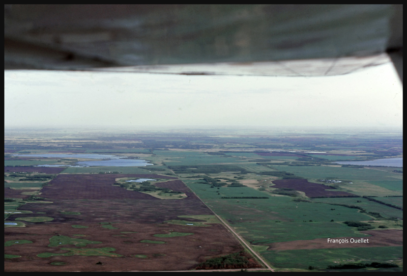
We leave Manitoba through Dauphin and enter Saskatchewan. If we were to experience an engine failure above such uniform fields, the risk of serious problems at landing would be virtually nonexistent.
Near Yorkton, Saskatchewan, in flight with a Cessna C170B in 1981
The weather is slowly deteriorating. We choose to land in Watson, Saskatchewan, on the nearest runway.
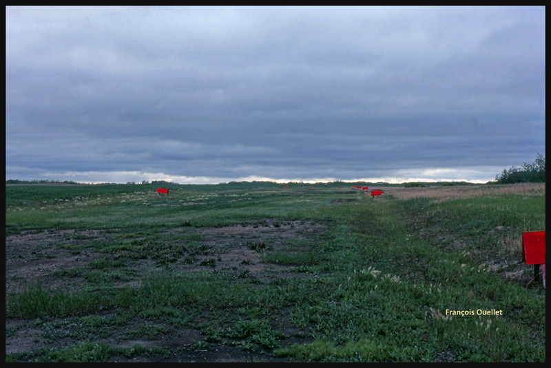
The runway surface consists of muddy earth and grass, and it’s delimited by small red wooden panels. As we touch the ground, the tires splash mud everywhere, including under the wings.
The Watson runway, Saskatchewan, in 1981
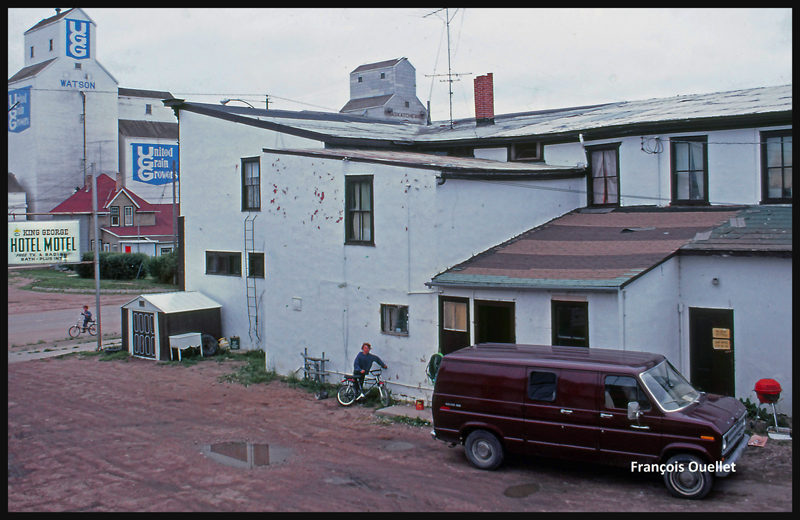
The King George motel in Watson, Saskatchewan in 1981
Finally, the weather improves and a takeoff is made toward North Battleford, the last stop before Edmonton. The sloping terrain forces us to fly lower and lower near Edmonton, under an overcast stratocumulus, limiting our ability to see a long time in advance the correct airport from the three available (international, civil , military ). Luckily, everything goes well in choosing the right airport and approach, but we cannot say the same with radio communications. The sound quality coming from the old speaker is awful and the English spoken by the air traffic controller too fast for us. The combination of these two factors causes the controller to repeat more than once his instructions until he finally decides to slow down and we can officially say: « Roger! »
After spending few days in Edmonton it is now time for the return flight to St-Jean. This proves to be much easier and faster because the westerly winds push the aircraft. Our ground speed is sometimes double what we had managed to get on our trip to Edmonton. The journey took us twenty-five hours to go and eighteen hours to come back.
Cessna C170B in flight over Canada, summer 1981.
Climbing to 9,500 feet on the return leg to St-Jean-sur-Richelieu, in 1981.
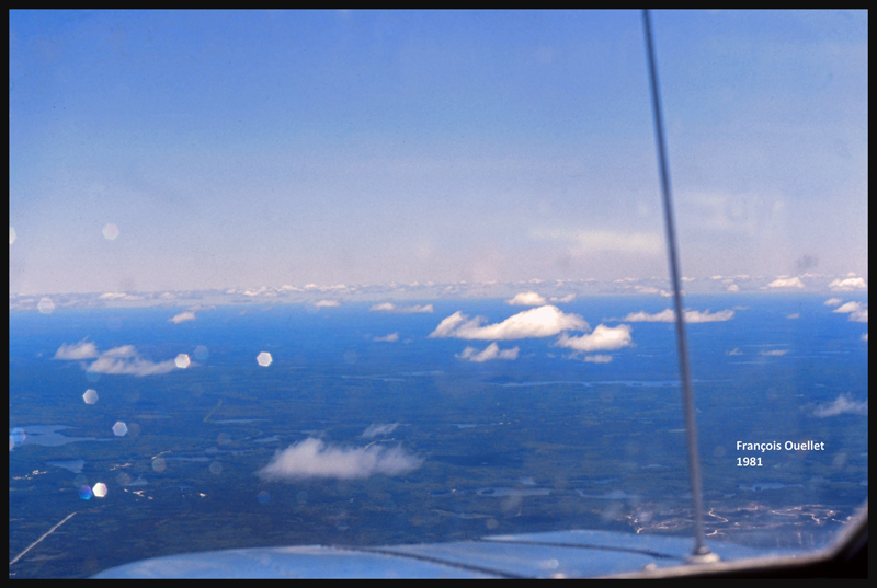
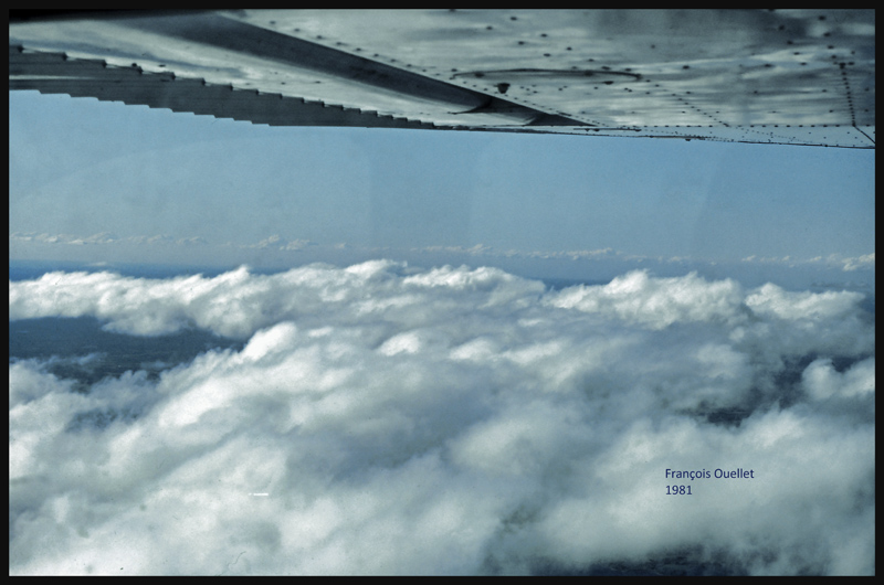
VFR “on top” with a Cessna C170B in 1981 over Canada
Over North Bay, Ontario, the weather is ideal. But we will have to land in Ottawa while waiting for thunderstorms to move away from Montreal and St-Jean-sur-Richelieu. After a total of forty- three-hours of flying time, the old Cessna 170B is landing back to St- Jean -sur- Richelieu.