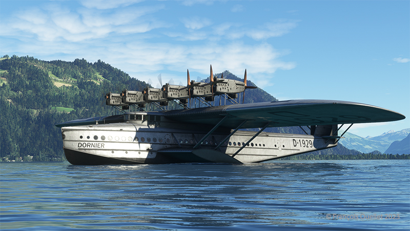
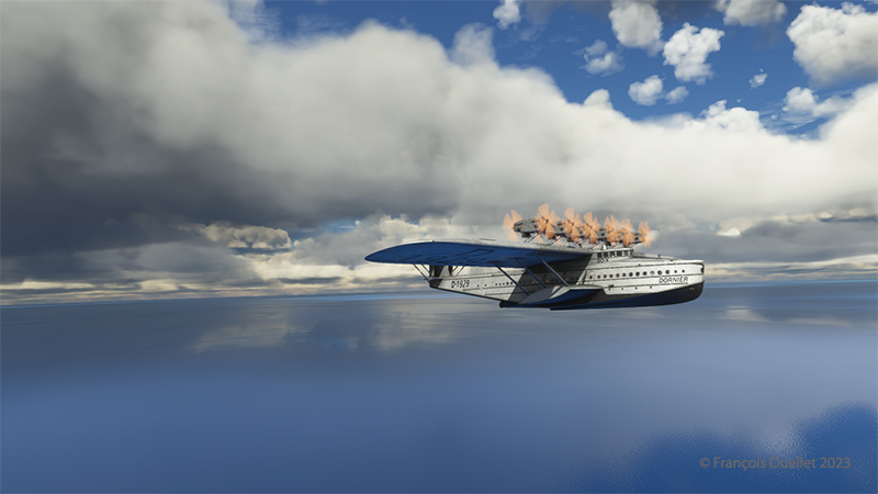
Dornier DO X stops its engines on a Swiss lake with Microsoft’s flight simulator
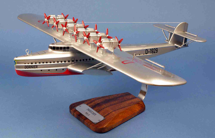
Microsoft has made the famous German Dornier DO X seaplane available to flight simulation enthusiasts. Designed in 1929 by Claude Dornier, this seaplane far surpassed anything else on the market at the time, in terms of weight, length and power.
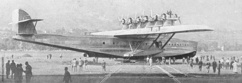
Flyingboat Dornier DO X.
Unfortunately, the Germans couldn’t make a commercial success of it, as the aircraft was really too heavy to cover long distances at high altitude in an economical way. What’s more, bad experiences were piling up during the various stopovers: the left-wing canvas caught fire in Portugal, there was some problems with tropical weather, the tail was torn off during a poorly-planned ditching in Passau. What remains of the empennage after the accident can now be seen in the Dornier Museum in Friedrichshafen.
The Germans built the three DO X models at Altenheim, on the Swiss side of Lake Constance, to get round the restrictions imposed by the Treaty of Versailles.
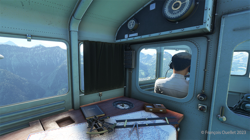
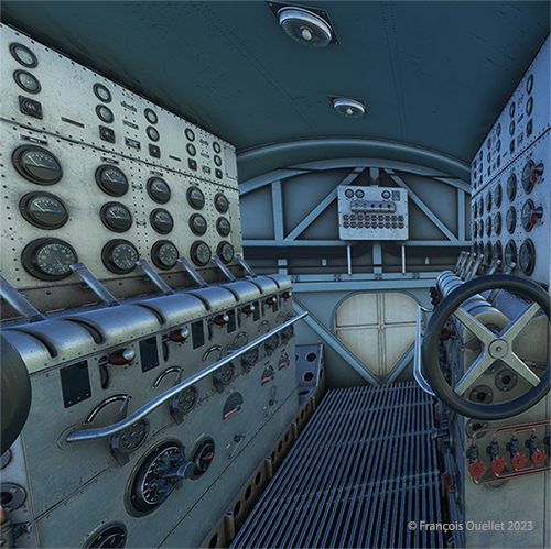
Inside the flyingboat Dornier DO X with Microsoft flight simulator
One crew member was in charge of controlling and monitoring the engines. He obeyed the captain’s instructions.
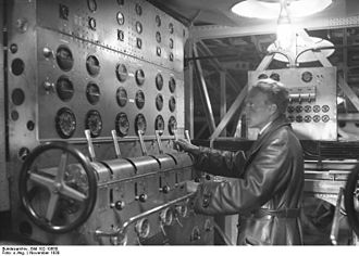
Dornier DO X engine control
Dornier DO X engine room with Microsoft flight simulator
The layout of the engines caused headaches for the mechanics. Six propellers pulled the aircraft forward, while another six pushed the DO X. The engines driving the rear propellers received less air than those in front of the aircraft. This led to cooling problems, which reduced reliability on long-distance flights.
Dornier DO-X flyingboat over the Atlantic ocean with MSFS 2020 flight simulator.
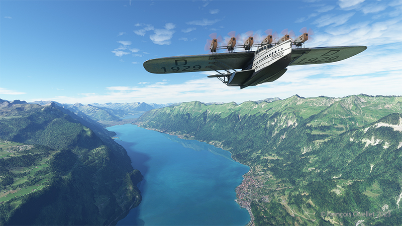
The seaplane made its first test flight from Lake Constance (Bodensee) in 1929. Below, a screenshot of the flight near Lake Brienz in Switzerland.
Dornier DO X flyingboat over Lake Brienz in Switzerland with Microsoft flight simulator.
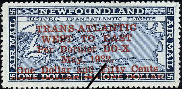
On its international routes, the DO X made stopovers in several European countries, Africa, South America, Miami, New York and Newfoundland. At the time, Newfoundland was not yet part of Canada. Newfoundlanders issued a stamp to commemorate the plane’s passage through Hollyrod. Naturally, those who kept a copy of the stamp have seen its value rise sharply over the years.
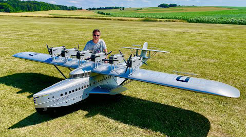
This legendary seaplane is still admired by aviation enthusiasts today. It’s available as a glue-on model, a desktop model and even as a remote-controlled model.
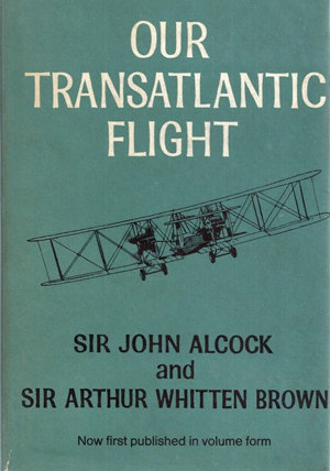
Our transatlantic flight, by Sir John Alcock and Sir Arthur Whitten Brown
Newfoundland
Before 1949, Newfoundland was called Dominion of Newfoundland and was part of the British Commonwealth . In 1949, it became a Canadian province.
The first non-stop flight eastward across the Atlantic.
The book « Our transatlantic flight » tells the story of the historic flight that was made in 1919, just after the First World War, from Newfoundland to Ireland. There was a 10,000 £ prize offered by Lord Northcliffe from Great Britain for whoever would succeed on the first non-stop flight eastward across the Atlantic.
A triumph for British aviation
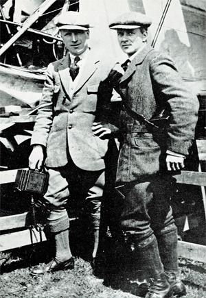
Sir John Alcock and Sir Arthur Whitten Brown , respectively pilot and navigator, wrote the story of their successful flight in this book which was published in 1969. The followings are pilot quotes from the book : « For the first time in the history of aviation the Atlantic had been crossed in direct, non-stop flight in the record time of 15 hours, 57 minutes. » (p.13) « The flight was a triumph for British aviation; the pilot and navigator were both British, the aircraft was a Vickers-Vimy and the twin engines were made by Rolls-Royce. » (p.13)
Sir John Alcock and Sir Arthur Whitten Brown
As with all great human achievements, a very good flight planning and some luck was needed to make this flight a success. If there was an engine failure during the flight, even if the planning was excellent, there was only one outcome : downward.
In order to make the flight, Alcock and Brown boarded a ship from England bound to Halifax. They then headed to Port aux Basques and finally arrived in St.John’s. There, they joined a small group of British aviators who had arrived a few days before and who were also preparing for the competition. « The evenings were mostly spent in playing cards with the other competitors at the Cochrane Hotel, or in visits to the neighbouring film theatres. St.John’s itself showed us every kindness. » (p.60)
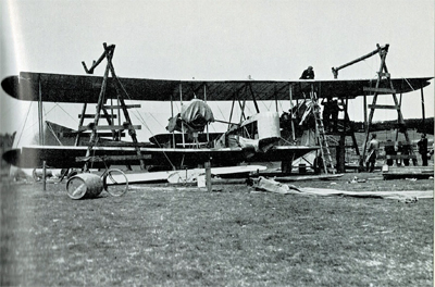
Maritime transport was used to carry the Vickers-Vimy biplane to Newfoundland on May 4th. It was assembled in Newfoundland. « The reporters representing the Daily Mail, the New York Times, and the New York World were often of assistance when extra manpower was required. » (p.61).
While the aircraft was being built, there were more and more visiters coming to the site. Brown says : « Although we remained unworried so long as the crowd contented itself with just watching, we had to guard against petty damage. The testing of the fabric’s firmness with the point of an umbrella was a favourite pastime of the spectators […]. » (p.61)
The Vickers-Vimy is being reassembled at Quidi Vidi in Newfoundland.
It was difficult to find a field that could be improvised into an aerodrome : « Newfoundland is a hospitable place, but its best friends cannot claim that it is ideal for aviation. The whole of the island has no ground that might be made into a first-class aerodrome. The district around St.John’s is especially difficult. Some of the country is wooded, but for the most part it shows a rolling, switchback surface, across which aeroplanes cannot taxi with any degree of smoothness. The soil is soft and dotted with boulders, as only a light layer covers the rock stratum. Another handicap is the prevalence of thick fogs, which roll westward from the sea. » (p.59)
They flight tested the airplane on June 9th at Quidi Vidi. During the short flight, the crew could see icebergs near the coast. They did a second trial on June 12th and found that the transmitter constantly caused problems. But, at least, the engines seemed to be reliable…
The departure
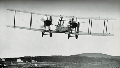
The two men left Newfoundland on June 14th 1919. In order to fight the cold air in flight, they wore electrically heated clothing. A battery located between two seats provided for the necessary energy.
The Vickers-Vimy departs from Newfoundland in 1919
The short take-off was very difficult due to the wind and the rough surface of the aerodrome. Brown writes : « Several times I held my breath, from fear that our under-carriage would hit a roof or a tree-top. I am convinced that only Alcock’s clever piloting saved us from such an early disaster. » (p.73)
It took them 8 minutes to reach 1000 ft. Barely one hour after departure and once over the ocean, the generator broke and the flight crew was cut off from all means of communication.
As the airplane consumed petrol, the centre of gravity changed and since there was no trim on the machine, the pilot had to exert a permanent backward pressure on the joystick.
Flying in clouds, fog and turbulence.
During the flight with much clouds and fog, Brown, having almost no navigation aid, had real problems to estimate the aircraft’s position and limit the flying errors. He had to wait for a higher altitude and for the night to come to improve his calculations : « I waited impatiently for the first sight of the moon, the Pole Star and other old friends of every navigator. » (p.84). The fog and clouds were so thick that at times they « cut off from view parts of the Vickers-Vimy. » (p.95)
Without proper instruments to fly in clouds, they were relying on a « revolution-counter » to establish the climbing or the falling rate. That is pretty scary. « A sudden increase in revolutions would indicate that the plane was diving; a sudden loss of revs would show that she was climbing dangerously steeply. » (p.176)
But that was not enough. They also had to deal with turbulence that rocked the plane while they could not see anything outside. They became desoriented : « The airspeed indicator failed to register, and bad bumps prevented me from holding to our course. From side to side rocked the machine, and it was hard to know in what position we really were. A spin was the inevitable result. From an altitude of 4,000 feet we twirled rapidly downward.[…]. « Apart from the changing levels marked by aneroid, only the fact that our bodies were pressed tightly against the seats indicated that we were falling. How and at what angle we were falling, we knew not. Alcock tried to centralise the controls, but failed because we had lost all sense of what was central. I searched in every direction for an external sign, and saw nothing but opaque nebulousness. » (p.88)
« It was a tense moment for us, and when at last we emerged from the fog we were close down over the water at an extremely dangerous angle. The white-capped waves were rolling along too close to be comfortable, but a quick glimpse of the horizon enabled me to regain control of the machine. » (p.40).
De-icing a gauge installed outside of the cockpit.
Snow and sleet were falling. They didn’t realize how lucky they were to continue flying in such a weather. Nowadays, there are many ways to dislodge ice from a wing while the aircraft is in flight. Here is what Brown says about their situation : « […] The top sides of the plane were covered completely by a crusting of frozen sleet. The sleet imbedded itself in the hinges of the ailerons and jammed them, so that for about an hour the machine had scarcely any lateral control. Fortunately, the Vickers-Vimy possesses plenty of inherent lateral stability; and, as the rudder controls were never clogged by sleet, we were able to hold to the right direction. » (p.95)
After twelve hours of flying, the glass of a gauge outside the cockpit became obscured by clotted snow. Brown had to deal with it, while Alcock was flying. « The only way to reach it was by climbing out of the cockpit and kneeling on top of the fuselage, while holding a strut for the maintenance of balance. […] The violent rush of air, which tended to push me backward, was another discomfort. […] Until the storm ended, a repetition of this performance, at fairly frequent intervals, continued to be necessary. » (p.94)
In order to save themselves, they executed a descent from 11,000 to 1000 feet and in the warmer air the ailerons started to operate again. As they continued their descent below 1000 feet over the ocean, they were still surrounded by fog. They had to do some serious low altitude flying : « Alcock was feeling his way downward gently and alertly, not knowing whether the cloud extended to the ocean, nor at what moment the machine’s undercarriage might touch the waves. He had loosened his safety belt, and was ready to abandon ship if we hit the water […]. » (p.96)
The arrival.
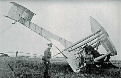
They saw Ireland at 8.15 am on June 15th and crossed the coast ten minutes later. They did not expect a very challenging landing as the field looked solid enough to support an aircraft. They landed at 8 :40 am at Clifden on top of what happened to be a bog; the aircraft rolled on its nose and suffered serious material damages. The first non-stop transatlantic flight ended in a crash. Both both crewmen were alive and well, although they were dealing with fatigue…
The transatlantic flight ends up in Ireland in a soft field
Initially, nobody in Ireland believed that the plane arrived from North America. But when they saw mail-bags from Newfoundland, there were « cheers and painful hand-shakes » (p.102).
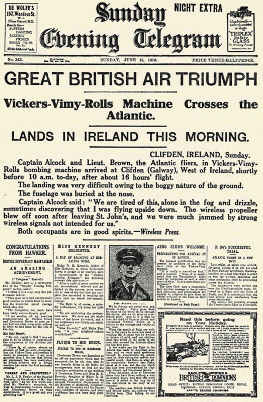
First page of the Sunday Evening Telegraph in 1919.
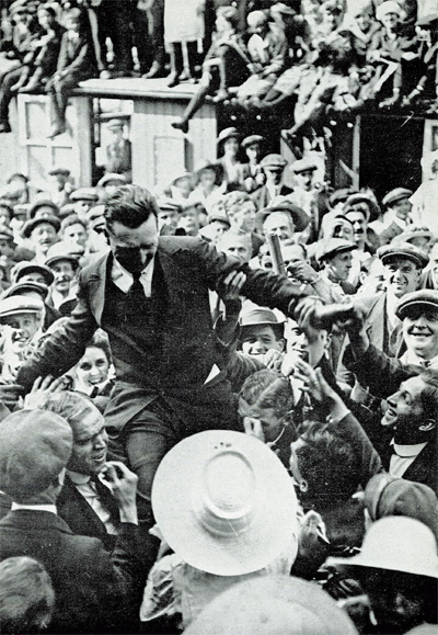
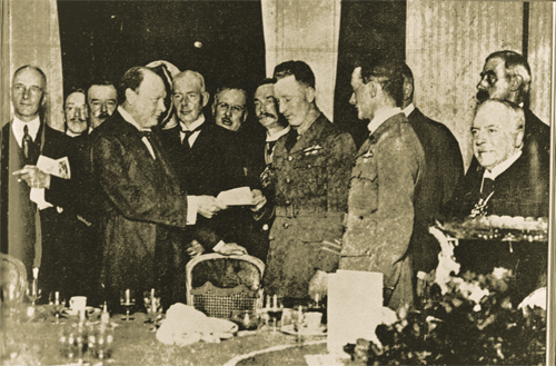
They were cheered by the crowds in Ireland and England and received their prize from Winston Churchill.
John Alcock chaired by the crowd
Winston Churchill is presenting the Daily Mail Check to the two pilots.
Their record stood unchallenged for eight years until Lindbergh’s flight in 1927.
The future of transatlantic flight.
Towards the end of the book, the authors risk a prediction on the future of transatlantic flight. But aviation made such a progress in a very short time that, inevitably, their thoughts on the subject was obsolete in a matter of a few years. Here are some examples :
« Nothwithstanding that the first two flights across the Atlantic were made respectively by a flying boat and an aeroplane, it is evident that the future of transatlantic flight belongs to the airship. » (p.121)
« […] The heavy type of aeroplane necessary to carry an economical load for long distances would not be capable of much more than 85 to 90 miles an hour. The difference between this and the present airship speed of 60 miles an hour would be reduced by the fact that an aeroplane must land at intermediate stations for fuel replenishment. » (p.123)
« It is undesirable to fly at great heights owing to the low temperature; but with suitable provision for heating there is no reason why flying at 10,000 feet should not be common. » (p.136)
The Air Age.
There is a short section in the book on the « Air Age ». I chose two small excerpts on Germany and Canada :
On Germany’s excellent Zeppelins : « The new type of Zeppelin – the Bodensee – is so efficient that no weather conditions, except a strong cross-hangar wind, prevents it from making its daily flight of 390 miles between Friedrichshafen and Staalsen, thirteen miles from Berlin. » (p.140)
On Canada’s use of aeroplanes : « Canada has found a highly successful use for aeroplanes in prospecting the Labrador timber country. A group of machines returned from an exploration with valuable photographs and maps of hundreds of thousands of pound’s worth of forest land. Aerial fire patrols, also, are sent out over forests.» (p.142) and « Already, the Canadian Northwest Mounted Police [today the RCMP] have captured criminals by means of aeroplane patrols. » (p.146)
Conclusion
The Manchester Guardian stated, on June 16th 1919 : « […] As far as can be foreseen, the future of air transport over the Atlantic is not for the aeroplane. It may be used many times for personal feats of daring. But to make the aeroplane safe enough for business use on such sea routes we should have to have all the cyclones of the Atlantic marked on the chart, and their progress marked in from hour to hour. »(p.169)
Title : Our Transatlantic Flight
Authors : Sir John Alcock and Sir Arthur Whitten Brown
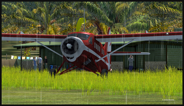
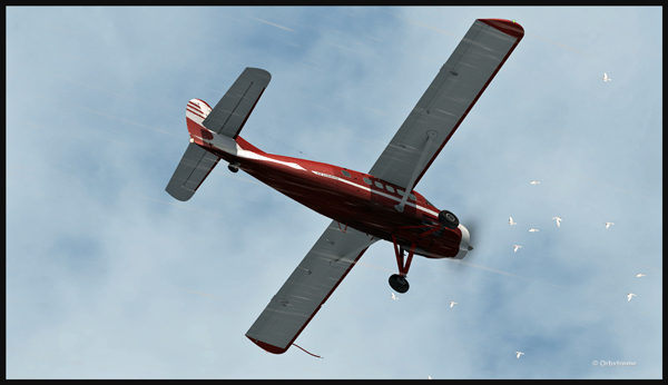
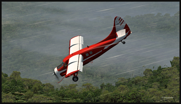
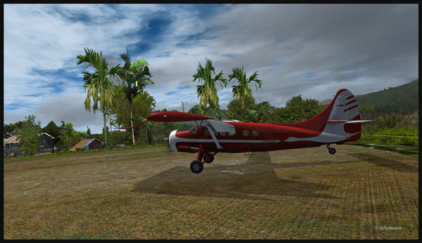
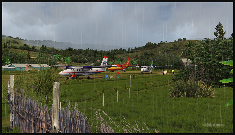
An Air Saguenay DHC-3 Otter has made it from Québec to Kokoda, in Papua New Guinea. It is expected to work around the remote mountain airfields for a while.
The Air Saguenay Otter is taxiing for the Kokoda runway towards Launumu in Papua New Guinea.
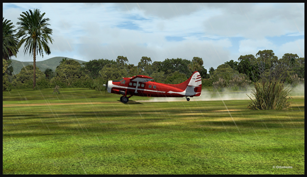
Today, the Otter heads for Launumu, a mountain airfield that is at an elevation of 5082 ft asl and 1200 feet long.
The Air Saguenay Otter departing Kokoda.
The pilot has to watch for the birds in order to avoid any collision in flight…
Otter aircraft and birds.
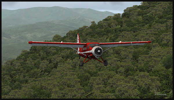
Following the Kokoda trail is a good way to reach Launumu.
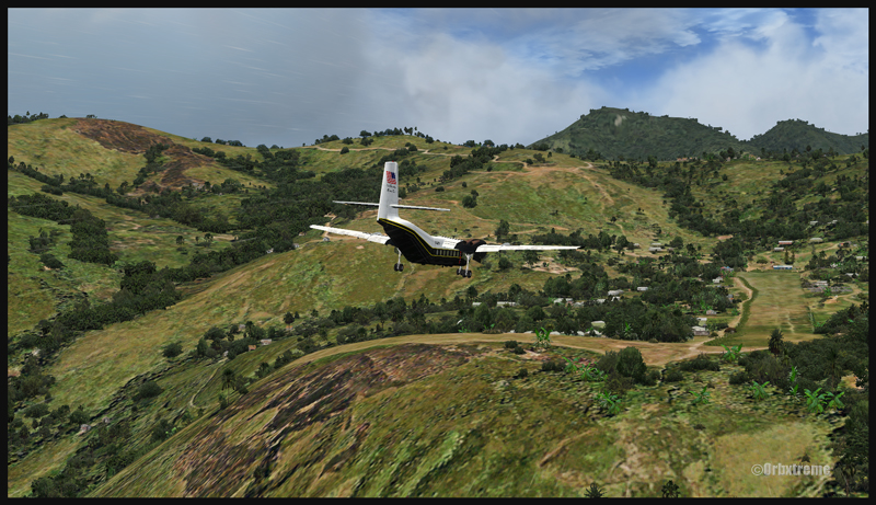
The Otter in the Papua New Guinea mountains, following the Kokoda Trail.
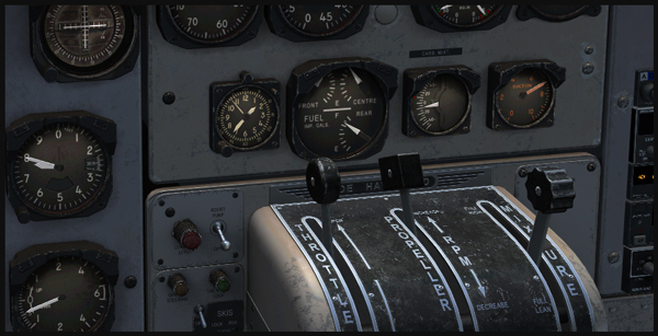
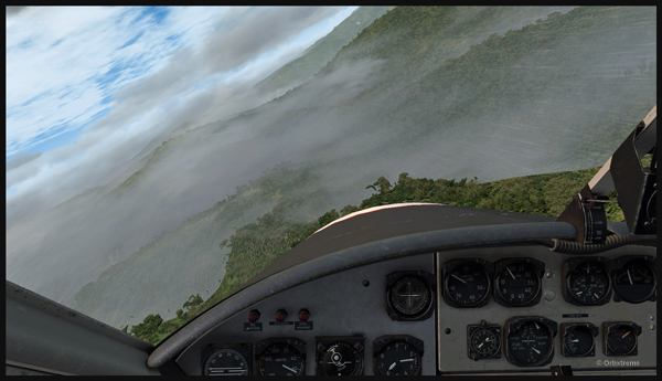
If the mixture is not adjusted, the Otter will lose a lot of steam trying to climb up to 7,500 feet to cross the first line of mountains.
Inside the Otter cockpit, with the mixture adjusted.
Anybody landing and departing from Launumu deals with high density altitude. This is not only due to the elevation of the airfield but also to the very warm and moist air present in the region. Consequently, some additional airspeed is required on the approach and on the departure.
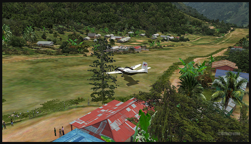
The Launumu runway is in sight.
When a pilot lands southwestward in Launumu coming from Kokoda, he must dive in a valley to lose altitude, which will increase the aircraft’s airspeed. The Launumu runway is in sight.
If the airspeed is not promptly corrected, the approach to the Launumu runway will be too fast. Any airspeed above 60 knots forces the pilot to overshoot (unless you are ready to virtually die a few times while trying).
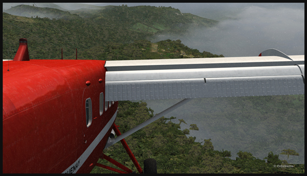
Losing altitude while respecting the flaps speed limit.
So, once the higher mountains are crossed, a good way of losing altitude without gaining airspeed is to use flaps (at the corresponding airspeed) and do a tight 360 degree coordinated turn while descending. That way, the pilot will end up in line with the runway and at the speed you want, which is around 50 knots.
Turning and descending in the valley during an approach for Launumu.
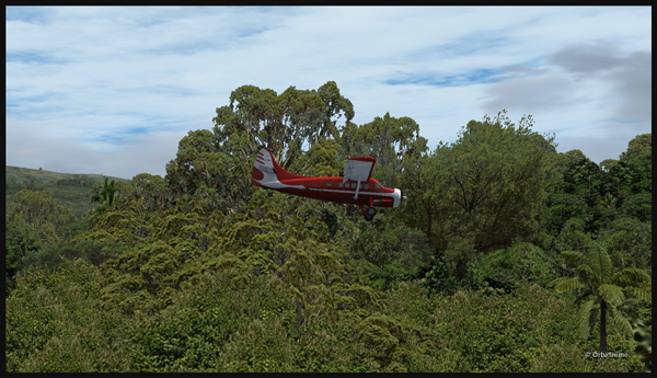
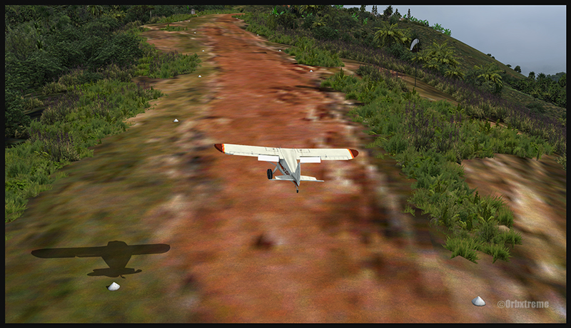
The Otter floats endlessly because of its huge wings.
The Air Saguenay Otter is on approach for the Launumu short runway in Papua New Guinea.
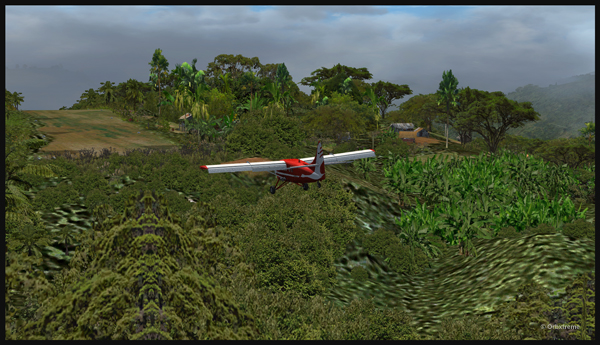
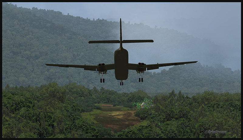
On final for Launumu, the pilot might end up having to deal with the bushes that are close to the runway. It is not unusual for the Otter or the Beaver to complete a difficult approach with bushes wrapped around the landing gear.
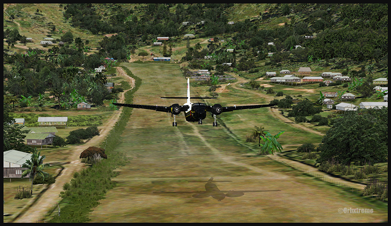
A Air Saguenay Otter is on final for the Launumu mountain runway.
A Otter aircraft is arriving on the Launumu high altitude runway.
Launumu has a surprise for the newcomers. If the pilot lands southwestward, like it was just done here, and the aircraft is not stopped within approximately 600 feet, it starts accelerating since there is a pronounced slope downward in the second half of the runway. This slope leads to a cliff. In case of a missed approach, the pilot can use the slope downwards and dive in the valley at the end of the runway to build up airspeed and start a new approach.
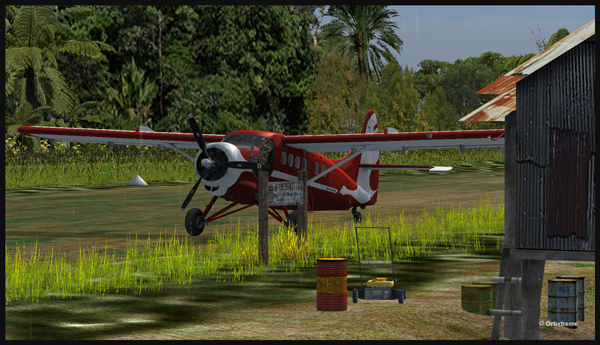
Now that the hard work is done, it is time to wait for the passengers and cargo, and plan the next leg…
A Otter aircraft is backtracking the Launumu runway after landing.
A Otter aircraft is parked on the Launumu runway in Papua New Guinea.
The virtual scenery and clouds required softwares like REX, REX Texture Direct, Cumulus X, FTX Global, FTX Global Vector and Pilot’s FS Global 2010.
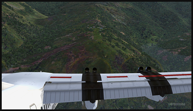
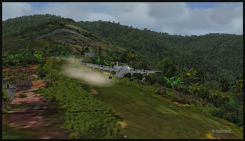
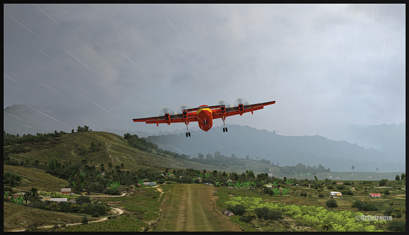
A virtual DHC-6 Twin Otter enroute for Kokoda after a fire on the right engine while departing Yongai (KGH) in Papua New Guinea PNG (FSX)
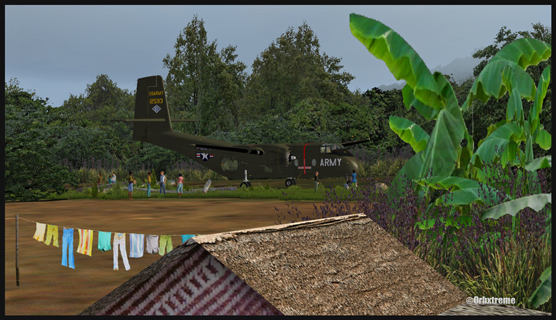
Ken Hall and Tim Harris have created a new virtual scenery for flight simulation enthousiasts. It is called “Tapini” and sold by ORBX. Their penultimate creation, AYPY Jackson’s International, allowed the virtual pilot to fly in very demanding virtual airports along the Kokoda Trail in Papua New Guinea. “Tapini” represents a whole new challenge and I have included several screen captures to show you how the different runways look in this new virtual scenery.
“Tapini”, still in Papua New Guinea, allows the virtual pilot to test his skills on seven new runways located in difficult areas of the Owen Stanley Range. Those airports also constitute a serious test for any aircraft, like in the picture above where damages to the right engine were sustained at Yongai.
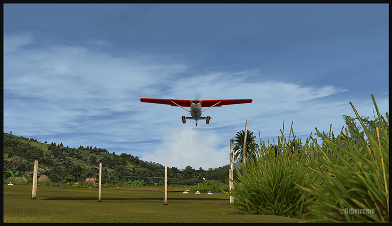
A virtual Piper Pacer virtuel is about to land on the Ononge (ONB) curved runway in Papua New Guinea PNG (FSX). (It is possible to see the curve starting on the top of the image)
To improve the virtual clouds while flying between the different airports, I used either REX or FSGRW weather engines. The cloud textures and weather effects were improved by one or many of the following products: Cumulus X, PrecipitFX, REX Texture Direct and REX Soft Clouds.
A virtual Dash 7 has just landed in Woitape (WTP) in Papua New Guinea PNG (FSX)
As variety is more fun, and also due to the different challenges created by those runways, the following virtual aircrafts were used: Carenado C-185F, Lionheart Creations PA-18, Virtavia DHC-4, Aerosoft DHC-6 Twin Otter and Milton Shupe DHC-7.
The “Tapini” scenery gives the pilot a choice between the seven following runways:
ASB (Asimba)
A tricky, very short runway near a river.
A DHC-4 Caribou virtual aircraft is on approach for Asimba’s sloped runway (ASB) in Papua New Guinea PNG (FSX)
This is a very interesting runway, best done with a STOL aircraft like the Caribou DHC-4. The inhabitants might have to help you clear out some branches along the runway, considering the size of the aircraft. The runway slopes down on take-off, which helps to build up speed.
A DHC-4 Caribou virtual aircraft is on a stopover at Asimba (ASB) in Papua New Guinea PNG (FSX)
A DHC-4 Caribou virtual aircraft is airborne from Asimba (ASB) in Papua New Guinea PNG (FSX)
FNE (Fane)
A one-way, really challenging 12 degree sloped runway, with unpredictable winds.
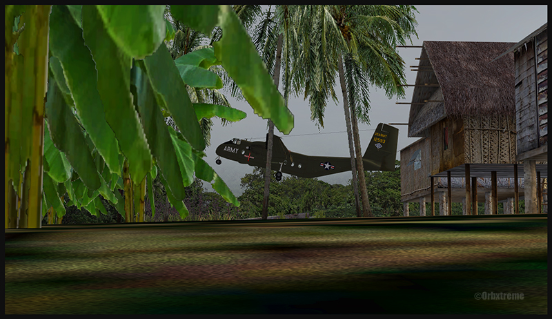
A De Havilland DHC-7 virtual aircraft on final for the Fane (FNE) airport’s sloped runway in Papua New Guinea PNG (FSX)
The runway sits on top of a hill. It is an amazing experience to land there. No wonder there are a lot of people watching the arrivals and departures.
If you slow down too quickly with an aircraft as big as the DHC-7 on that sloped runway, the twelve degree angle prevents you from moving forward. You must let the aircraft come down the runway very slowly, using the power to control the descent and the rudder to stay aligned on the runway, then apply take-off power for a few seconds to build just enough momentum to get above the hill.
A De Havilland DHC-7 virtual aircraft just finished taxiing uphill on the Fane (FNE) airport’s sloped runway in Papua New Guinea PNG (FSX)
To turn the aircraft around, it’s a combination of power and reverse thrust until you clear all the obstacles (any humans venturing behind the aircraft will also be cleared during the operation…).
A De Havilland DHC-7 virtual aircraft is airborne from the Fane (FNE) airport’s sloped runway in Papua New Guinea PNG (FSX)
There is a not so friendly man with a rifle watching the airport’s operations. Even the United Nations staff do not stay longer than necessary…
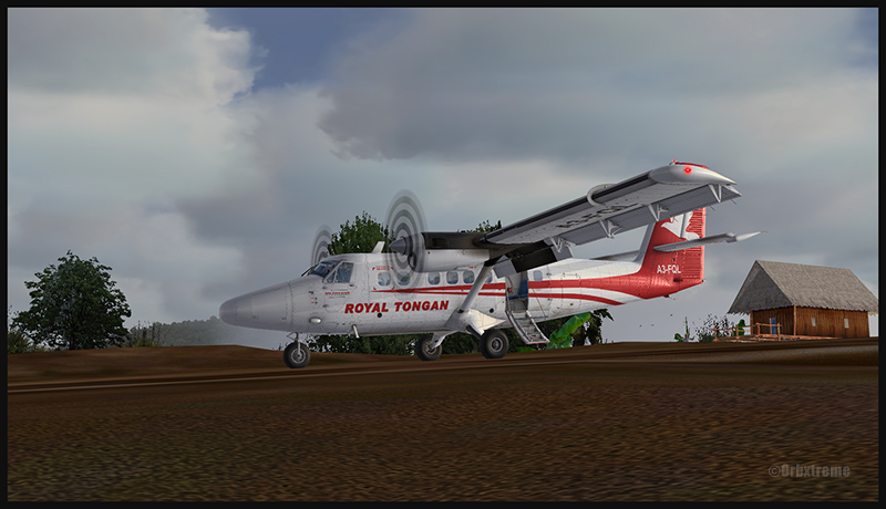
KGH (Yongai)
A very bumpy one-way sloped runway. A real bush aircraft is needed here!
A virtual DHC-6 Twin Otter on approach for the Yongai (KGH) bumpy runway in Papua New Guinea PNG (FSX)
Even with a real bush aircraft, there is a possibility that one of the aircraft’s propellers hits the ground while taxiing on the runway. There are so many deep holes that are hard to see, I can only wish the best of lucks to everyone trying out this airport!
A virtual DHC-6 Twin Otter on the Yongai (KGH) bumpy runway in Papua New Guinea PNG (FSX)
Keep a close watch on the area near the little house at the end of the runway. The DHC-6 was really shaken while turning around for take-off. One of the propellers hit the ground but no problems were detected…until the aircraft was airborne. The fire alarm then went off, just as the aircraft was passing the runway threshold, seconds before flying over a cliff.
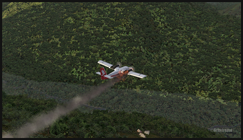
A virtual DHC-6 Twin Otter with its right engine on fire is just airborne from the Yongai (KGH) bumpy runway in Papua New Guinea PNG (FSX)
So much for the planned trip… and it was out of the question to return to Yongai on one engine. I had to pull the handle to stop the fire, feather the prop, cut the fuel where it was not needed anymore then head to the Kokoda airport as it was a sure alternative, having a long runway and an elevation that did not require the use of extra power.
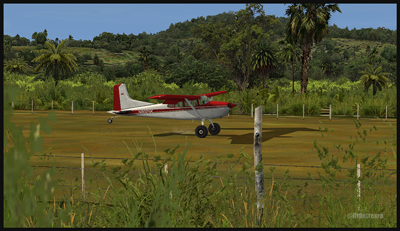
KSP (Kosipe)
A relatively short runway that requires good calculations from the pilot, since it is located high in the mountains.
A virtual Cessna C-185F is enroute to the Kosipe (KSP) airport in Papua New Guinea PNG (FSX)
The Cessna C-185F is a very well suited aircraft for that runway. Make sure not to be too heavy on the brakes, as new C-185 propellers are hard to find in Kosipe. You can land in both directions. Ensure that the mixture is set properly as the airport is above 6300 feet.
A virtual Cessna C-185F is rolling after touching down on the Kosipe (KSP) runway in Papua New Guinea PNG (FSX)
A virtual Cessna C-185F is airborne from the Kosipe (KSP) runway in Papua New Guinea PNG (FSX)
ONB (Ononge)
A curved and very bumpy runway! For those who like low flying. Make sure you choose the good aircraft here; there is not much manoeuvering area once on the ground.
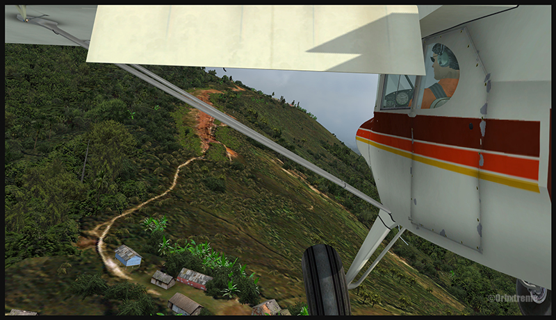
A Virtual Piper Pacer on approach for the Ononge (ONB) curved runway in Papua New Guinea PNG (FSX)
Ononge looks really scary when you show up on final for the first time. You wonder if the little trail that you see can really be a runway. For that kind of situation, the little Piper Pacer is an excellent aircraft, approaching slowly and braking on a dime. The runway is curved in the middle so you will need a bit of right rudder to keep the aircraft aligned with the runway.
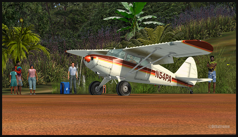
A Virtual Piper Pacer on the Ononge curved runway in Papua New Guinea PNG (FSX)
I guess all those people with their cargo are waiting for a bigger airplane than mine…
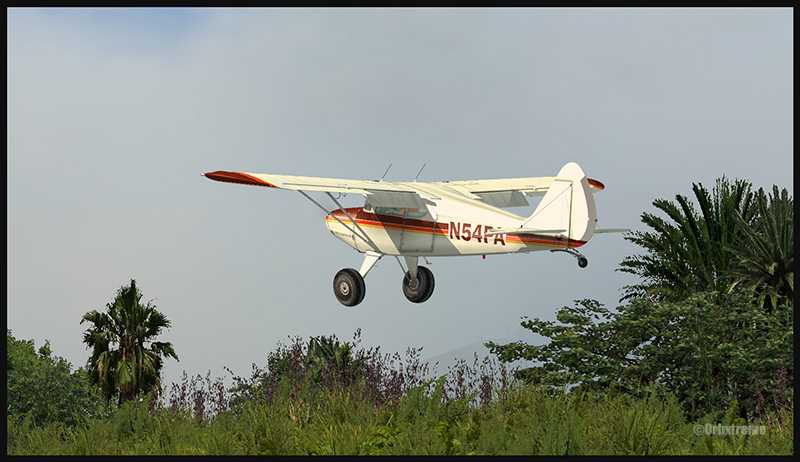
A Virtual Piper Pacer is airborne from the Ononge curved runway in Papua New Guinea PNG (FSX)
TAP (Tapini)
A challenging one-way sloped runway nestled in a tight valley. You can even use an ILS to arrive there!
A virtual DHC-4 Caribou on short final for the Tapini (TAP) sloped runway in Papua New Guinea PNG (FSX)
This is a superbly designed area and airport. I visited it with the DHC-4 Caribou but any other big STOL aircraft would have fitted there. There is enough room to manoeuver. It is not too bumpy. There is an interesting slope: it starts downward and ends upward: this helps to slow down the aircraft after landing.
A virtual DHC-4 Caribou on the ground at the Tapini (TAP) airport in Papua New Guinea PNG (FSX)
A virtual DHC-4 Caribou is airborne from the Tapini (TAP) airport in Papua New Guinea PNG (FSX)
WTP (Woitape)
Looks like a no brainer, but there is no margin of error on this one-way slightly sloped runway. Very precise calculations and settings are required if you want to land there with something else than a small aircraft.
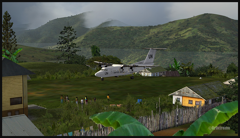
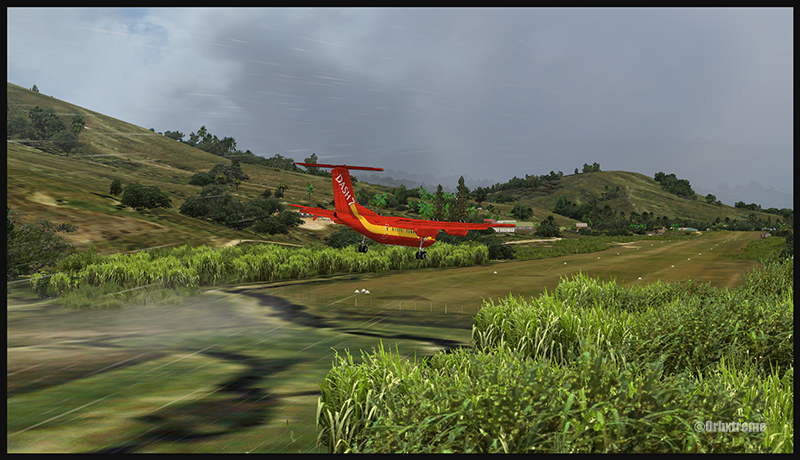
A virtual De Havilland DHC-7 on final approach for the Woitape airport (WTP) virtual airport in Papua New Guinea (FSX)
I found the runway to be very slippery with the De Havilland DHC-7. I must say that there was a good crosswind, as I was flying with real life weather and winds. The DHC-7 behaves like a big boat while decelerating on such a runway.
A virtual De Havilland DHC-7 on the ground with two Twin Otters at the Woitape airport (WTP) in Papua New Guinea (FSX)
The Woitape scenery is gorgeous. It is nice to have all those well designed virtual aircrafts, people and animals on site as this makes the scenery so much more realistic.
A De Havilland Virtual DHC-7 is airborne from the Woitape airport (WTP) in Papua New Guinea (FSX)
I love this new Orbx product. When you fly in such a realistic scenery, the brain does not make much difference between what is real and what is virtual. It really works! And if you use real life weather downloaded from the internet, it’s even better.
I tried the seven airports included in the “Tapini” virtual scenery and they are quite demanding. Yongai was the most challenging airport of them all. I had to do two missed approaches there since I ended up too high on the approach. I eventually got it right, like in real life!
I used the Microsoft flight simulator X (FSX) for all the virtual flights, but other platforms would have worked as well (Dovetail Games FSX Steam edition (FSX: SE) and all versions of P3D). The following products were also installed on my flight simulator: FTX Global, FTX Global Vector and Holgermesh, as well as Pilot’s FS Global 2010.
It is a totally immersive virtual experience and you have to forget everything else when undertaking those challenging virtual flights… if you want to make it “virtually” alive!
For more articles on flight simulation on my web site, click on the following link : Flight simulation
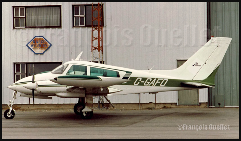
Cessna 310 C-GAFO parked on the ramp at Rouyn-Noranda (around 1986-88)
During the summer season, air surveillance is needed to watch for new forest fires in the center and north of the Quebec Province. There are periods, sometimes many days in a row, where the pilots do not observe anything significant. They accumulate hours of flying, quietly waiting to see a new fire or expecting to be directed by a dispatcher to a new problematic area. Those pilots also act as spotters for the Canadair CL215’s and CL415’s.
During the eighties, in the Abitibi region, a Cessna 310 had been in flight for few hours and the pilot had not spotted anything worth a call. Wishing to add a bit of action to his flight, he decided to descend and follow the meanders of a river at an extremely low altitude. As he exited a bend, the pilot faced a standing fisherman in its boat, angling in open water. Imitating the gestures of the fisherman, the pilot later told the Transport Canada flight service specialist (FSS) in Rouyn-Noranda (CYUY) that he was not the only one surprised…
It might be hard to believe that an aircraft could fly that low, especially when exiting a bend in a river. But after many decades in the aviation world, I can say that almost everything is possible. I imagine the fisherman’s reaction, quietly angling during a beautiful summer morning. While the fisherman lowers his head, the pilot pulls on the controls…
The expression in the pilot’s face showed clearly that he had had enough action for the day…I would like to swear that it was his last daring move, but it would be to ignore that this need for extreme flying is always present in some pilots.
For more real life stories on the Rouyn-Noranda flight service station and flight service specialists, click here: