Cover page of the manga “Les montagnes hallucinées”, by Gou Tanabe.
Gou Tanabe presents H.P. Lovecraft’s masterpiece “Les montagnes hallucinées” (the French version of “At the Mountains of Madness”) as a two-volume manga. Leafing through Lovecraft is in itself a journey into the strange, but to do so by starting at the end of a book and reading from right to left adds to the weirdness of the experience.
This transposition of Lovecraft into manga is a success. And the statistics prove it. The 382 reviews left on Amazon show clear customer satisfaction, with a total of 4.9/5 stars at the time of writing.
I normally prefer color comics and graphic novels, but the black-and-white interpretation of Lovecraft’s work is a perfect match for the fantasy world into which Tanabe plunges us.
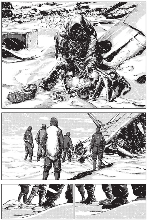
A page from the manga “Les montagnes hallucinées” from Lovecraft, by Gou Tanabe.
Lovecraft makes a phantasmagorical work credible by integrating a well-balanced mix of real and fictional elements into the plot. Unless you’re an archaeologist and paleontologist yourself, it’s hard to tell which data really belong to science. This helps to frame the reader. You recognize moments of pure imagination, but you’re still hooked.
I put myself in the shoes of someone who lived in Lovecraft’s time, when Antarctica was still a mysterious continent, unexplored in its entirety. A story filled with elements of fiction would gain in credibility, while no one could really confirm or deny some of the author’s statements.
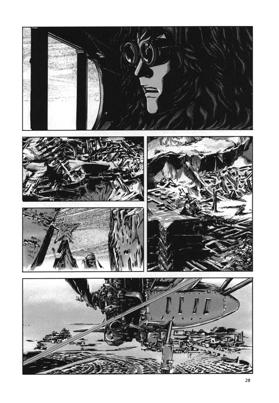
A page from the graphic novel “Les montagnes hallucinées”.
In “Les montagnes hallucinées”, we read about sailing, aviation, extreme weather and survival in icy, isolated spaces. Readers witness the problems experienced by the various crews exploring Antarctica. The scientists’ increasingly startling discoveries force them to make risky decisions that plunge them into an unknown world. In short, themes that still appeal to most people today.
The two volumes total around 650 pages, which can be flipped through with interest in a single day, since many plates include no text at all.
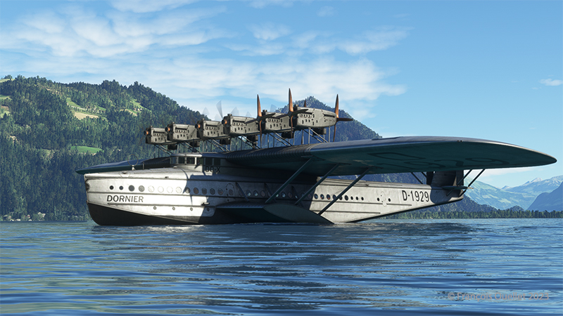
Dornier DO X stops its engines on a Swiss lake with Microsoft’s flight simulator
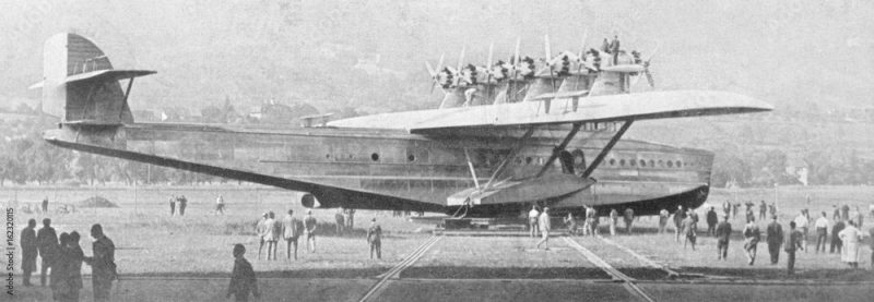
Microsoft has made the famous German Dornier DO X seaplane available to flight simulation enthusiasts. Designed in 1929 by Claude Dornier, this seaplane far surpassed anything else on the market at the time, in terms of weight, length and power.
Flyingboat Dornier DO X.
Unfortunately, the Germans couldn’t make a commercial success of it, as the aircraft was really too heavy to cover long distances at high altitude in an economical way. What’s more, bad experiences were piling up during the various stopovers: the left-wing canvas caught fire in Portugal, there was some problems with tropical weather, the tail was torn off during a poorly-planned ditching in Passau. What remains of the empennage after the accident can now be seen in the Dornier Museum in Friedrichshafen.
The Germans built the three DO X models at Altenheim, on the Swiss side of Lake Constance, to get round the restrictions imposed by the Treaty of Versailles.
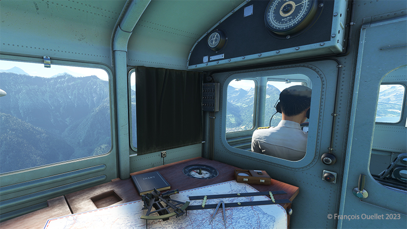
Inside the flyingboat Dornier DO X with Microsoft flight simulator
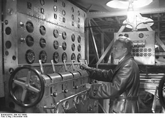
One crew member was in charge of controlling and monitoring the engines. He obeyed the captain’s instructions.
Dornier DO X engine control
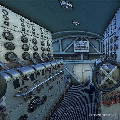
Dornier DO X engine room with Microsoft flight simulator
The layout of the engines caused headaches for the mechanics. Six propellers pulled the aircraft forward, while another six pushed the DO X. The engines driving the rear propellers received less air than those in front of the aircraft. This led to cooling problems, which reduced reliability on long-distance flights.
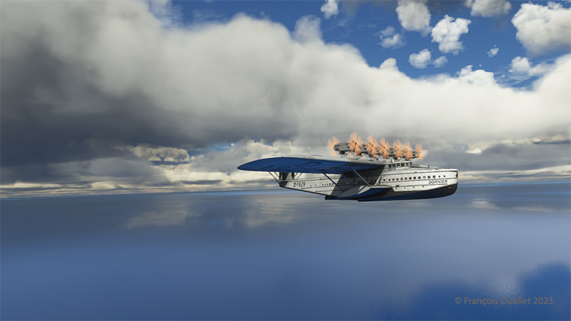
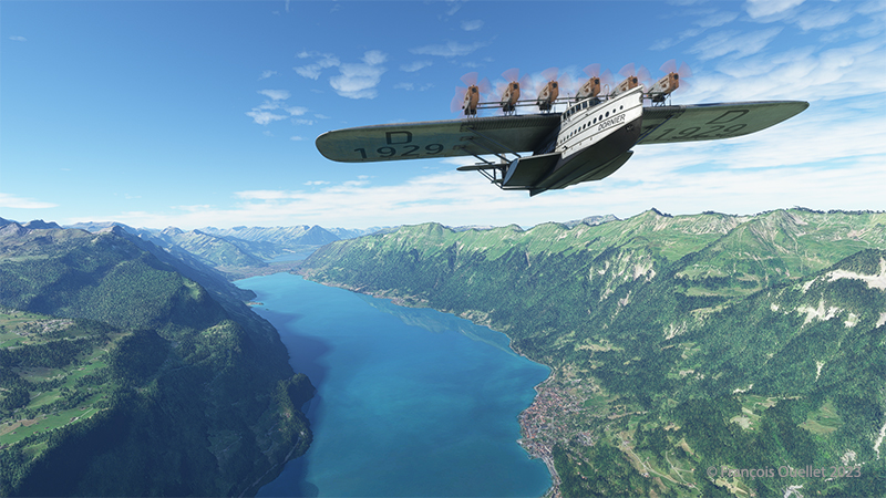
Dornier DO-X flyingboat over the Atlantic ocean with MSFS 2020 flight simulator.
The seaplane made its first test flight from Lake Constance (Bodensee) in 1929. Below, a screenshot of the flight near Lake Brienz in Switzerland.
Dornier DO X flyingboat over Lake Brienz in Switzerland with Microsoft flight simulator.
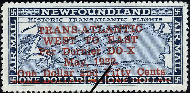
On its international routes, the DO X made stopovers in several European countries, Africa, South America, Miami, New York and Newfoundland. At the time, Newfoundland was not yet part of Canada. Newfoundlanders issued a stamp to commemorate the plane’s passage through Hollyrod. Naturally, those who kept a copy of the stamp have seen its value rise sharply over the years.
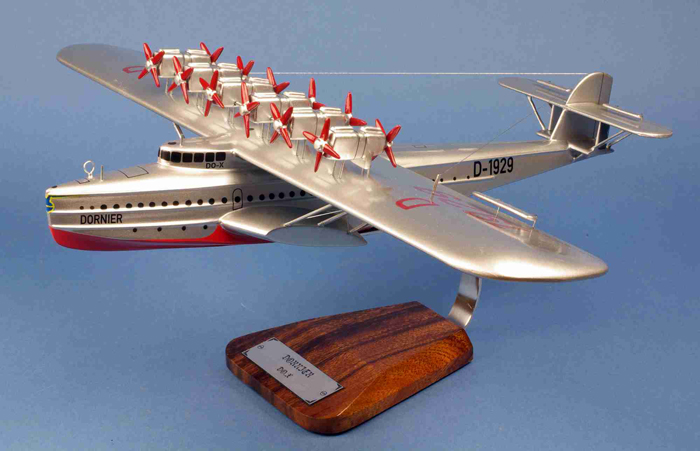
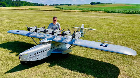
This legendary seaplane is still admired by aviation enthusiasts today. It’s available as a glue-on model, a desktop model and even as a remote-controlled model.
These machines, which were not designed to operate from an aircraft carrier, would not be able to reach their targets and return safely to port for lack of sufficient fuel. All the pilots were well aware of this, and volunteered.
The fleet of sixteen aircraft, commanded by Jimmy Doolittle, successfully achieved its objective of confusing the enemy and showing that Japan remained vulnerable to surprise attacks. The Japanese wondered how it was possible that American bombers could have reached and hit their country. Where did they take off from? They know that the B-25 Mitchells were not designed to take off from an aircraft carrier, and that they were incapable of landing on one.
The genius of the operation laid in the combination of a number of highly risky decisions which, taken together, took the enemy by surprise. Firstly, as it was impossible to land the planes on the Hornet, they were installed with a crane, knowing full well that they would never return to the ship.
In addition, the captains were trained to take off over distances unthinkable for them, using a technique pushed to the extreme. The ship sailed at high speed into the wind, improving the headwind component so essential for such perilous maneuvers.
The pilots had to be extremely skilful to keep to the departure trajectory on a platform that moved from left to right in the middle of a storm. Buildings on the Hornet’s side had to be avoided at all costs, and the available gap between the wing tip and the ship’s tower was no more than two meters. Despite all the obstacles, all the B-25s managed to take off. It was to be a one-way mission to Japan.
Doolittle piloted the first B-25 to take off from the carrier. He had only a very small portion of the deck to work with, as there were still fifteen other bombers waiting their turn to take off. The second pilot to leave the deck narrowly avoided a water landing, as the aircraft sank slightly and a landing gear wheel touched the water. But the plane gained just enough speed to stay airborne.
Bombers and crews suffered different fates once the bombing raids on Japanese targets had been completed. The authors conclude: “The raid destroyed 112 buildings and killed 87 people, in about 6 minutes. […] The destruction of 15 of the 16 B-25s, unable to reach Chinese airfields for landing, was nevertheless to be deplored, the 16th B-25 having landed safely in the USSR. Also to be deplored was the accidental death of three airmen (planes 3 and 6) and the capture of 8 others (planes 6 and 16) by the Japanese, 4 of whom never returned home, 3 having been executed as “war criminals” and the 4th having died in captivity. Worse still, the Japanese took revenge on the Chinese, who had helped all the surviving airmen, by organizing the massacre of some 250,000 civilians in the Zhejiang and Jiangxi provinces then under their control. This was to leave its mark…”.
Landing and takeoff tests on an aircraft carrier, the Forrestal, were also made decades later for a C-130 Hercules. I tried to repeat the experience in flight simulation. The flight can be found in the “challenging virtual flights” section of my blog. As the Forrestal is not available in virtual mode, I used the aircraft carrier USS Enterprise.
Decades ago, Canadian authorities used this island in the middle of the St. Lawrence River as a quarantine site for immigrants arriving in Canada. Many Irish people, among others, made an obligatory stop on this strip of land before being allowed to continue their journey to Canada.
At one time, a section of the island was reserved for Canadian and American researchers for their top secret research on Anthrax.The most amazing thing about reading the article is realizing that the entire production of this bacteriological weapon (439 liters) was mixed with formaldehyde and put in barrels that were dumped somewhere in the St. Lawrence River when it was decided that it would no longer be useful, as the Second World War took a turn in favor of the Allies. It seems to me that formaldehyde does not prevent barrels from rusting, but hey… back to the point.
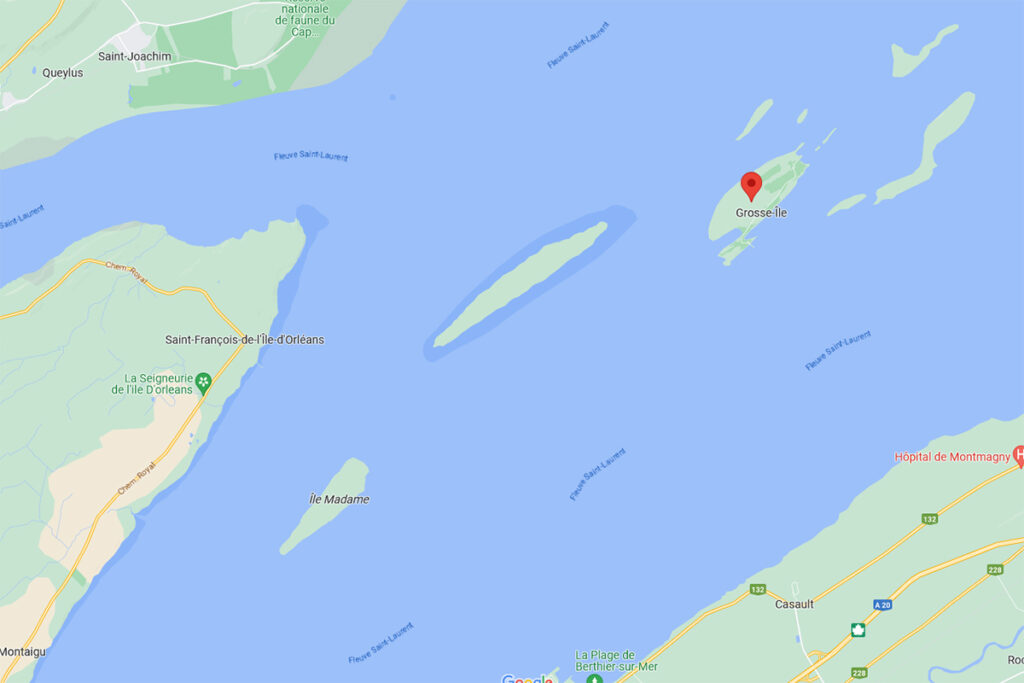
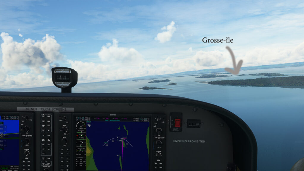
Where is Grosse-Île located? In the province of Quebec, a little east of Quebec City. It is one of the many islands that you can fly over once you have left Île d’Orléans behind. Below, a screenshot from Google Maps.
Grosse-Île in Quebec on Google Maps.
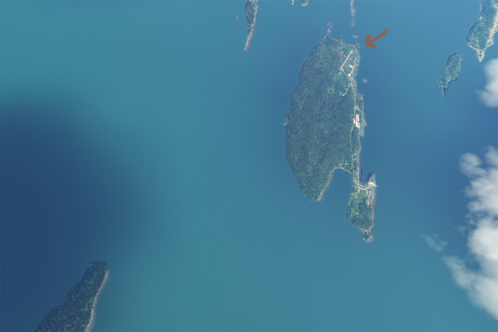
The satellite image below clearly shows that this is not an invention. Microsoft designates this runway as CYMN Montmagny: a mistake that one can easily live with, since by giving an official code to this Grosse-Île runway, the pilot can use it as a navigation point in his GPS.
Satellite view of Grosse-Île and its runway.
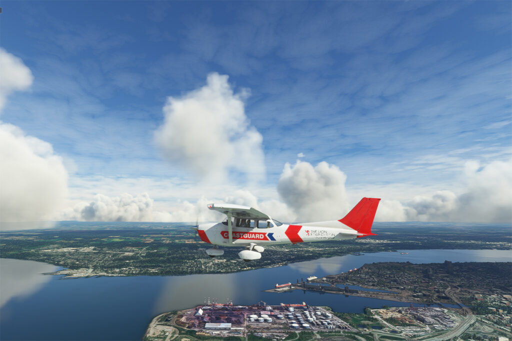
So, let’s use a small Cessna in US Coast Guard colors to make a virtual flight from Quebec City airport (CYQB) to Grosse-Île (CYMN). It was a bit chilly on this February day in Quebec City, so I decided to transport us to July for this flight, adding a few cumuliform clouds in the process.
Leaving Quebec City for Grosse-Île with MSFS 2020.
This short flight will allow us to fly over Île d’Orléans, Île Madame (owned by Laurent Beaudoin, former major shareholder of Bombardier), Île au Ruau (purchased in 2019 by the rich owner of the Gildan empire) to finally arrive at Grosse-Île.
Approaching Grosse-Île over the St Lawrence Seaway with the MSFS 2020 flight simulator.
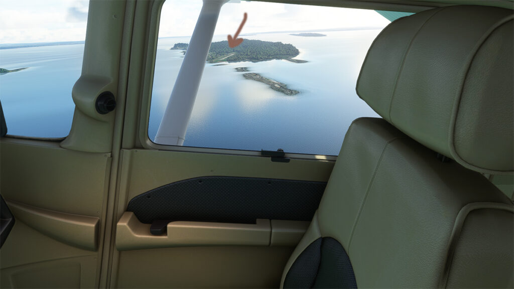
The picture below shows the aircraft on a right base for the Grosse-Île runway. I do not know the official dimensions of this dirt airstrip, but it can easily accept a Cessna aircraft such as ours.
Cessna in base for the Grosse-Île runway with the MSFS 2020 flight simulator.
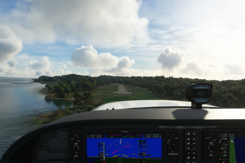
Below, the aircraft is on final for the runway.
On final for the Grosse-Île runway.
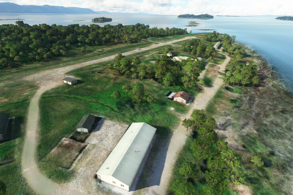
A final screenshot shows the Cessna taxiing down the runway after landing. As you can see, the runway can accommodate much larger aircraft. If you want to make a real flight to this island, find out beforehand about the condition of the runway and the restrictions surrounding its use by visiting pilots.
Cessna aircraft on Grosse-Île after the landing.
Click on the link for more flight simulation experiences on my blog.
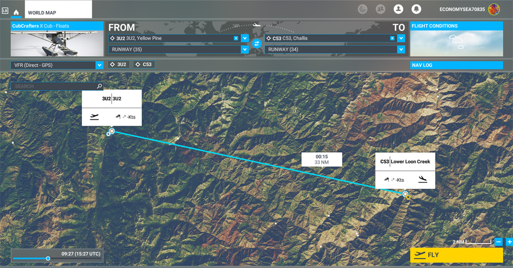
MSFS 2020 map for the flight 3U2 to C53 in United States
The challenging virtual flight is from Johnson Creek Airport (3U2) to the Lower Loon Creek Airstrip (C53) in the United States, using the MSFS 2020 flight simulator. The software map shows the type of aircraft chosen, a CubCrafters X Cub on floats, as well as the trajectory over the Idaho mountains.
The idea of using an amphibious aircraft for this flight is a bit far-fetched, but the goal is to make the pilot’s job a little more difficult by adding weight to the aircraft.
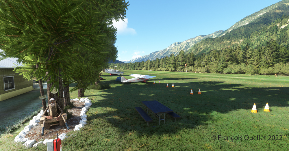
Johnson Creek (Yellow Pine) airport 3U2 with MSFS 2020
Johnson Creek Airport (3U2) is a creation of Creative Mesh. It is charming, with tents here and there planted near the planes. The runway is 3480 feet long by 150 feet wide. It is oriented on a 17/35 axis and still quite high at 4960 feet above sea level (MSL).
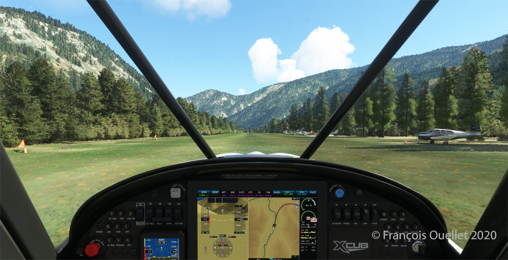
Amphibian CubCrafters X Cub ready for departure at the Johnson Creek 3U2 virtual airport with MSFS 2020.
Given the departure altitude, one must not forget to adjust the air/fuel mixture so as not to lose power on takeoff, especially since there is a mountain at the end of the runway and the floats increase the weight of this small aircraft. The air is also thinner as the flight takes place in summer and at a high altitude; this represents another obstacle to the aircraft’s performance.
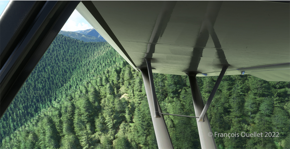
Avoiding obstacles after take-off from the 3U2 Johnson Creek virtual airport using MSFS 2020.
The mountains near the runway present a significant obstacle. The virtual pilot must use the best possible angle of climb without worrying about the route recommended by the GPS. The flaps are kept slightly extended during the initial climb.
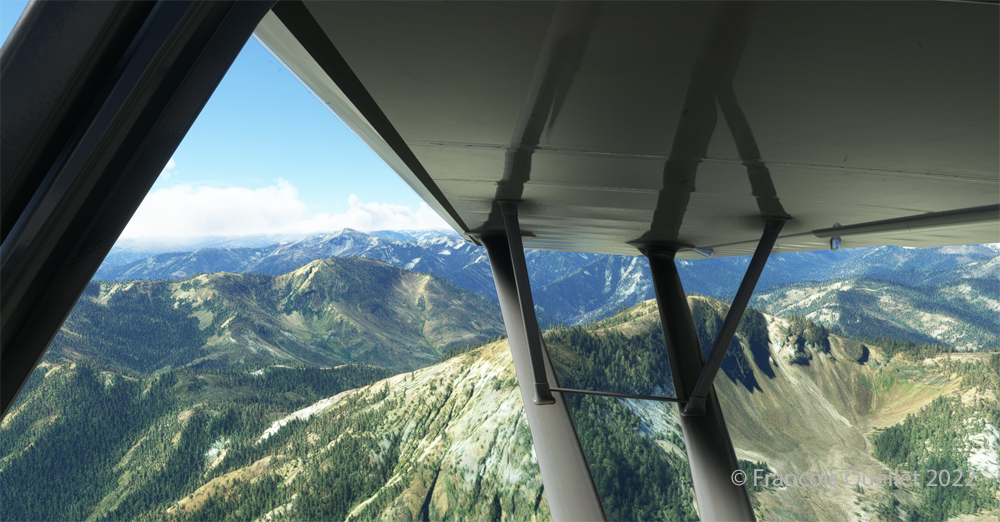
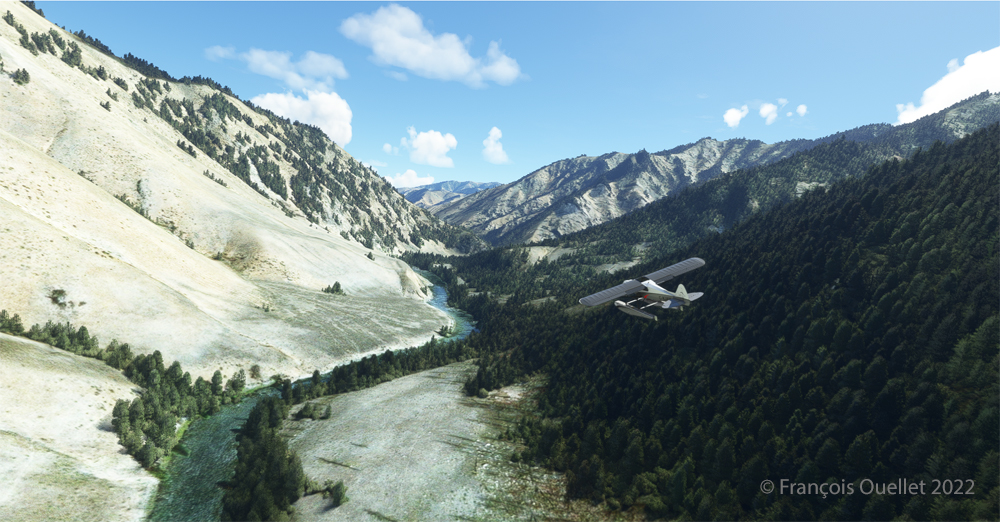
Flying over the Idaho mountains in flight simulation with MSFS 2020.
Once at a safe altitude and back on the GPS suggested route, the view of Idaho’s spectacular mountains is more enjoyable. Throughout the climb, the air-fuel mixture and altimeter (“B” on MSFS 2020) have to be adjusted.
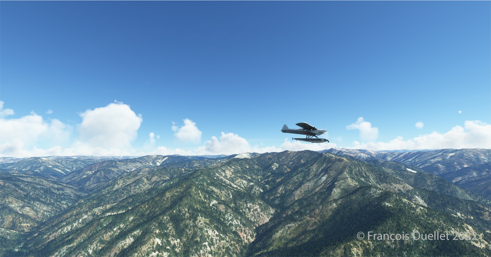
CubCrafters X Cub floatplane over the Idaho mountains in flight simulation MSFS 2020
An altitude of almost 10,000 feet ASL makes it possible to fly over the mountains without risk of collision.
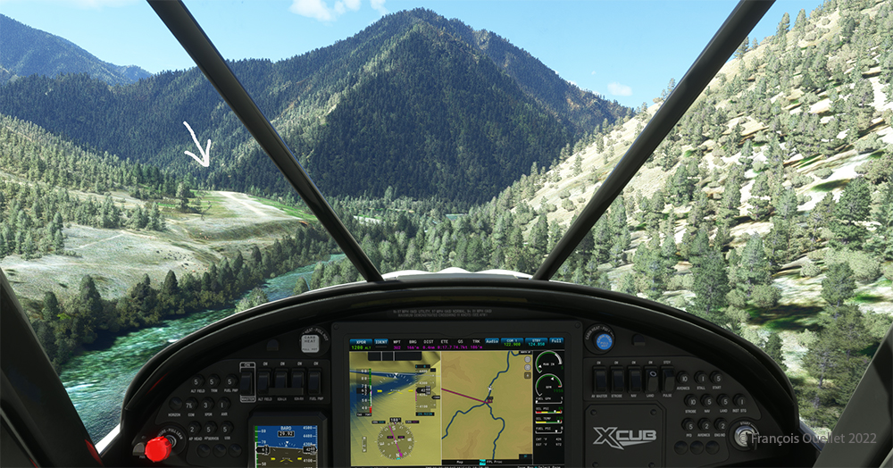
Descending in the valley towards the ID8 Marble Creek airport in Idaho in fligh simulation.
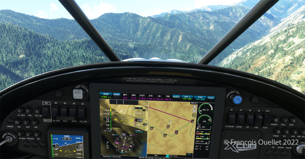
At the right moment, when the small surrounding airports and the river appear on the GPS, we leave our GPS road, until now in straight line, and we align in the valley to fly over the river until our destination, avoiding the surrounding mountains. In the photo above, the descent has already begun, with a necessary gradual adjustment of the air-fuel mixture.
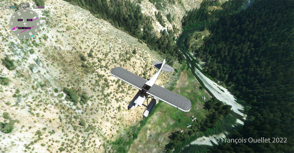
Flying over the (ID8) Marble Creek airport in Idaho using the MSFS 2020 flight simulator.
We fly over a first small airport. The picture above shows the planes parked on the runway of Marble Creek airport (ID8), which dimension is 1160 x 20 feet. For those which would be interested in trying a landing there, the orientation of the runway is 03/21 and the altitude of 4662 feet MSL.
Flying over the 2U8 Thomas Creek Airport in Idaho using the MSFS 2020 flight simulator.
On the way towards our final destination, we also fly at low altitude over the Thomas Creek (2U8).
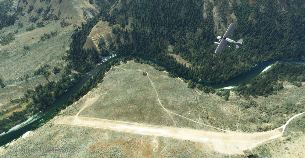
Following the river towards the C53 Lower Loon Creek airstrip using the MSFS 2020 flight simulator.
The mountains on either side of the river require close attention, as the poor performance of a small aircraft equipped with floats does not allow for easy correction of navigational errors.
By the time the runway suddenly becomes visible, the plane will not be on course but 90 degrees off the ideal course. It will be necessary to quickly turn left into the valley, make a fairly sharp 180-degree turn to the right to avoid the mountains, and then get back on course to land. It is only at this point that the landing gear will be extended.
On final for Lower Loon Creek airstrip with MSFS 2020
The photo above shows the aircraft on final for the Lower Loon Creek dirt and grass runway (C53). It is located at 4084 feet MSL and is only 1200 feet long by 25 feet wide. Note that the approach should be made on runway 16 when possible.
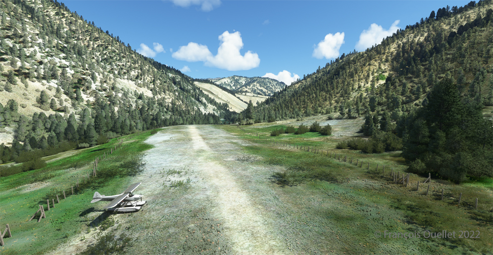
Amphibian CubCrafters X Cub rolling down the C53 Lower Loon Creek airstrip in Idaho after landing.
As always, a stabilized aircraft on final makes landing easier, regardless of the conditions.
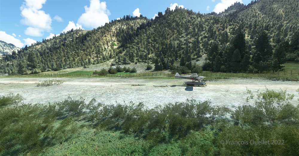
Amphibian CubCrafters X Cub parked at the C53 Lower Loon Creek airstrip using MSFS 2020 flight simulator.
We park the plane and rest a bit. Today, there is no one else here. But that’s not always the case in real life, as this video of a landing at Lower Loon Creek shows it.