Here are some screen captures taken shortly after I bought FlyTampa Toronto. I am using FSX for those pictures.
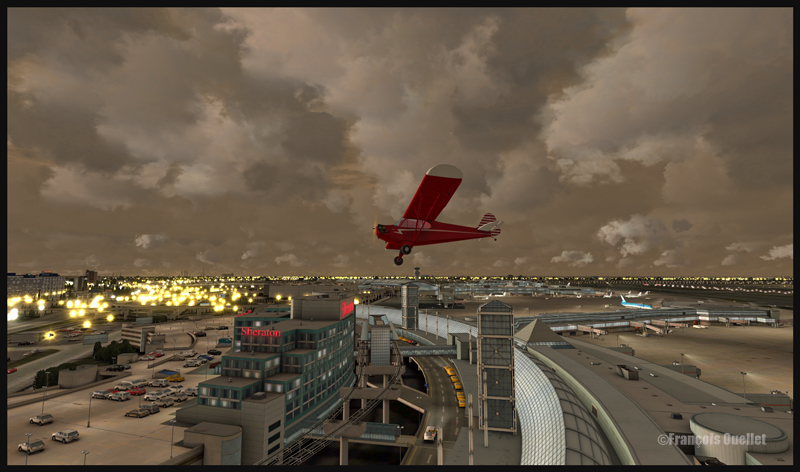
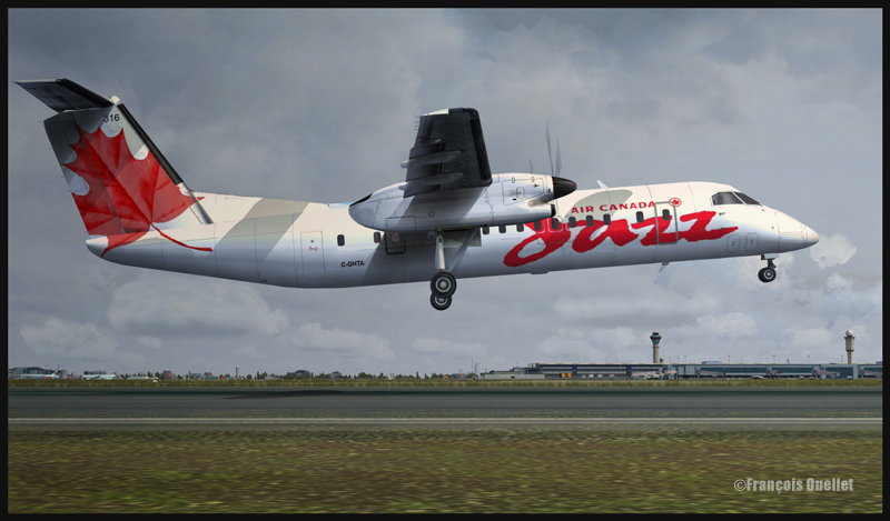
A Piper over the Toronto international airport. The scenery is FlyTampa Toronto and the clouds are generated by REXFlyTampa Toronto et Air Canada JazzFlyTampa Toronto avec REX et Cumulus X
In order to increase the virtual flight realism, the CumulusX program was used, in addition with REX, a software that generates clouds. Cumulus X is mostly used by virtual gliding enthousiasts but one of its strong side is that it creates shadows on the ground, like in the picture above.
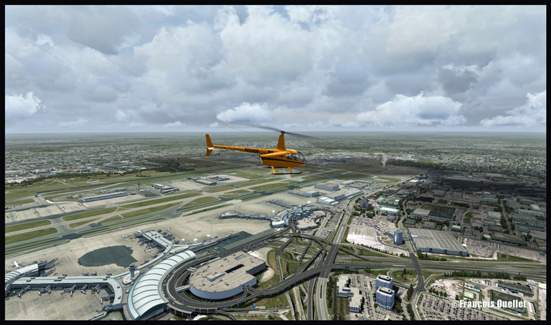
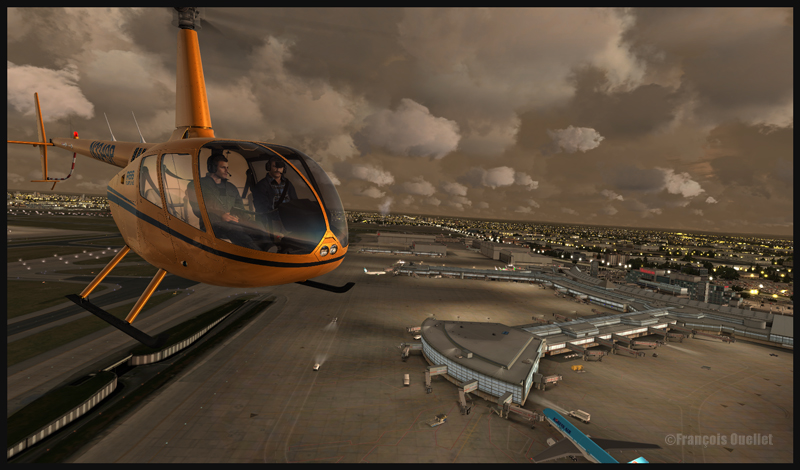
Fly Tampa Toronto et Alabeo R66
FlyTampa is the company which, up to now, has done the best work representing virtually the Toronto international airport (CYYZ). There are high quality 3D objects, moving people, smoke that comes out of the surrounding buildings. Even the roof’s fan blades can be activated through a control panel that allows the modification of settings according to the configuration of your computer. Three seasons are modelized in order to enhance the virtual flight experience.
For more articles on flight simulation on my web site, click on the following link : Flight simulation
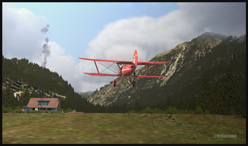
I’ve just added a new VFR flight in the “flight simulation” section, under “standard virtual flights”. An Alabeo WACO takes off from Cushman Meadows, heads south-east towards the Skokomish Reservation, then flies over the Bremerton airport to the north-east and ends up landing at the Bear Gulch aerodrome, just in time for a BBQ. This was done using FSX. The first part of the cross country is for a starting virtual pilot but the last part requires a bit more experience.
Waco on short final for Bear Gulch WA38 (fsx)
WACO landing in Bear Gulch WA38 (FSX)
It is a more demanding experience than what is normally found in the “standard flights” section, since it involves a final landing at Bear Gulch. The runway at that airport is only 1411 ft long, and quite narrow. So you have to plan your approach carefully. A little wooden bridge is part of the runway! Since the flight is done in nice VFR conditions and does not involve engine failures or using a really fast aircraft arriving on a short runway, I decided that the “standard virtual flights” section was more appropriate. Still, it is not an easy approach.
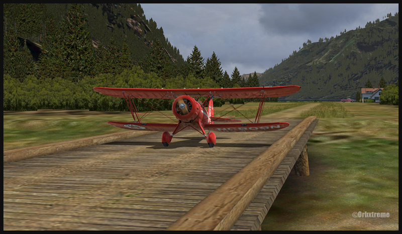
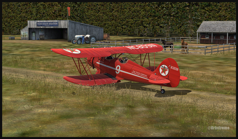
A Texaco WACO aircraft is taxiing on a wooden bridge at Bear Gulch, WA38
A Waco aircraft belonging to Texaco is taxiing in Bear Gulch, WA38
Cushman Meadows (KCMW) and the Bear Gulch (WA38) runways do not exist in real life but am I ever glad Bill Womack took the time to create them. His site can be found under Iblueyonder. The screen captures show both airports and the PNW region sold by ORBX. If you want nice shadows on the ground while not using P3D, just get CumulusX and set the season to summer, with scattered clouds in mid afternoon.
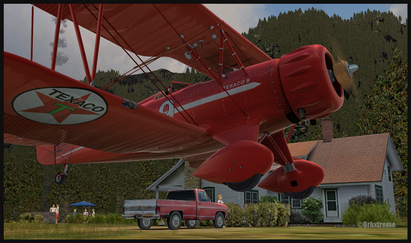
A Waco aircraft with a tractor in the foreground is parked at Bear Gulch, WA38
Some guests have already arrived in Bear Gulch. You will see the smoke rising from the BBQ being prepared while you are on short final. The guests will certainly be taking pictures of your approach, as you are flying a vintage aircraft. So, if there was ever a time to do things correctly, now it is!
For more articles on flight simulation on my web site, click on the following link : Flight simulation
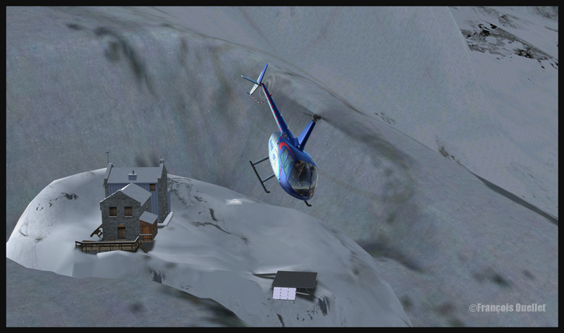
R66 helicopter on the Refuge du Requin helipad in the Alps (DZRR) FSX
In the “flight simulation” section, under “challenging virtual flights”, I have added screen captures (also visible here for now) that show a flight that can be quite demanding and which consists of doing a VFR ride with an helicopter between two helipads situated high in the Alps. The flight is made using FSX. In real weather conditions, the winds can really complicate things when you are on short final for your destination.
R66 helicopter airborne from the Refuge du Requin (DZRR) FSX
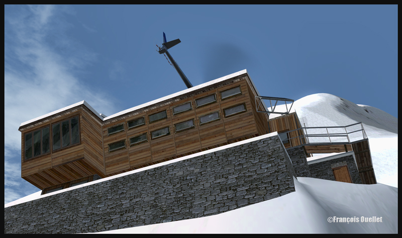
R66 helicopter approaching the Refuge de l’Argentière DZRA FSX
For this exercice, the ALABEO R66 has been chosen. You could add another degree of difficulty by using a DODOSIM helicopter. The helipads are made by LLH Créations. The virtual flight that you can see in the screen captures set above shows a takeoff from the Refuge du Requin sur la Mer de glace (DZRR), which is at an altitude of 2510 meters, towards the Refuge de l’Argentière (DZRA), located at 2778 meters MSL. Two other mountain chalets could have been chosen: Chamonix (DZ des Bois , DZDB), at 1075 meters, and Promontoire (DZPR), near the Alpe d’Huez mountain airfield and Grenoble airport, at 3055 mètres in the mountains.
R66 on final for the Refuge de l’Argentière helipad DZRA FSX
Before doing a flight, you can select one of the following three options: winter, summer and photographic scenery. The documents provided help you out with the best settings as to the autogen, the complexity, the resolution, etc.
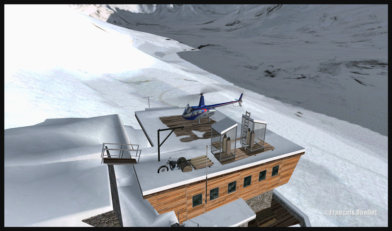
R66 helicopter on the Refuge de l’Argentière helipad DZRA FSX
R66 on the roof of the Refuge de l’Argentière DZRA FSX
I am convinced that you will enjoy the experience. By using real weather, each flight becomes an adventure. With moderate winds, on an approach to the Refuge de l’Argentière, you will realize that there is not much margin of manoeuver!
Have a good flight!
For more articles on flight simulation on my web site, click on the following link : Flight simulation
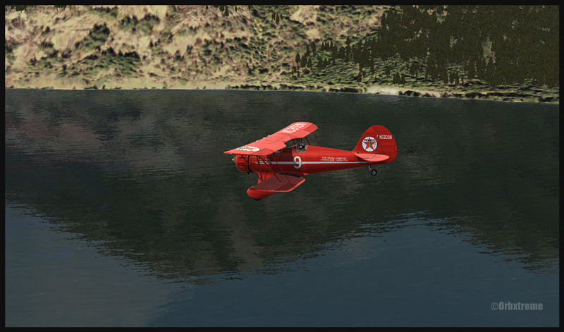
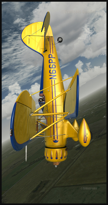
A WACO YMF5 practicing aerobatic figures over Airdrie, Alberta.
The screen capture shows an Alabeo company Waco YMF5 in action. The background scene is a creation of ORBX. FSX has been used for this virtual flight over Alberta. The Waco is easy to fly and Alabao has programmed many point of views from which the virtual pilot can take pictures in flight. ( V on the keyboard). Airdrie Airpark, Claresholm Industrial Park and High River, all created by Vlad Maly, can be found near the training area. They are all quality products. The first airport must be bought but the two others are offered as freewares by Orbx. It is an interesting point of departure for a virtual pilot who would like to cross the Rockies towards Vancouver or Victoria.