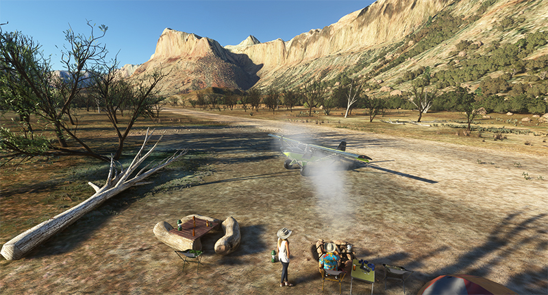
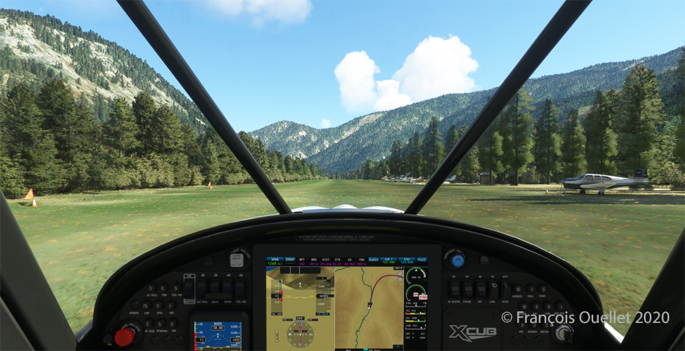
The Mexican Mountain Virtual Landing Strip (42MX) under Microsoft Flight Simulator 2020 (MSFS) is located in the United States, in Utah. It is a 1800 x 40 feet dirt runway, sloping slightly to the west.
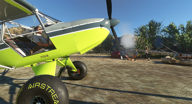
The MX42 Mexican Mountain airstrip with visitors (MSFS)
The surrounding landscape is characterized by large cliffs and mountains whose peaks reach 6900 feet.
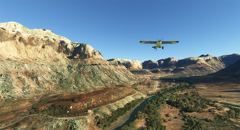
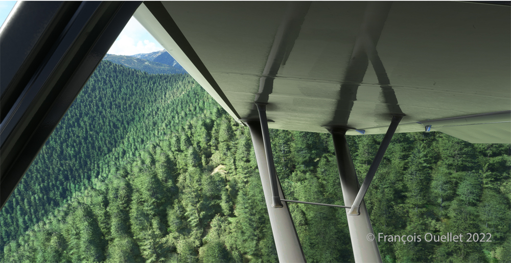
Airborne from the 42MX Mexican Mountain airstrip in MSFS flight simulation
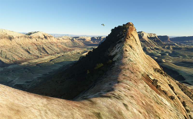
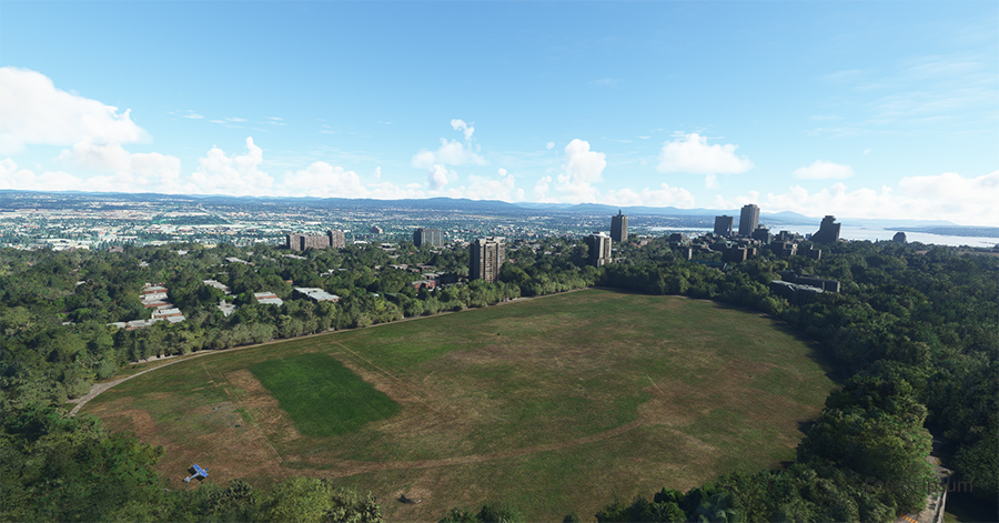
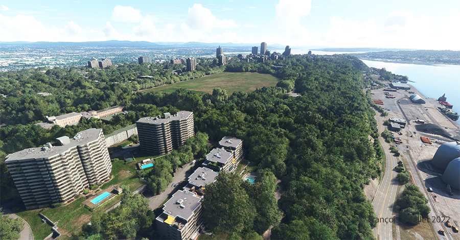
Virtual scenery around the 42MX Mexican Mountain airstrip (MSFS)
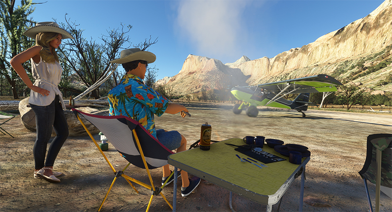
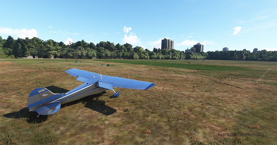
Once on the ground and near the campfire, we can hear the fire crackling and the RC Plane activities through the walkie-talkie left on the table. We can’t tell if anyone will be there when we arrive. This time, a young couple was enjoying the good weather and had taken the time to light a fire in my absence…
42MX Mexican Mountain visitors taking a break in MSFS
One final note from the company: pineapples on pizza are not allowed on the site.
If you have purchased the Bushplane Campout 42BC, the simulation will be all the more realistic.
First of all, I admit that the Cessna 170B’s windows are dirty. For realism, the designer Carenado left a little dirt here and there to show the wear and tear of this very old aircraft.
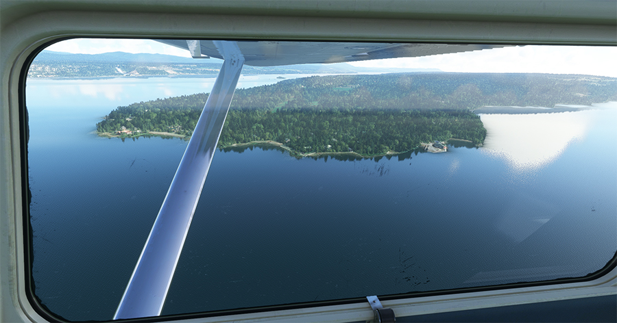
The picture above shows Île d’Orléans as seen from the Cessna. Since there is no landing strip but a golf club in the area, we will use the open fairways to land the aircraft. If there is a golfer on the course, I will open the window and yell, as is customary, “Fore!” (Falling Object Returning to Earth).
On final for Île d’Orléans
We are established on final for the small portion of open ground ahead. With 40 degrees of flaps, the stall speed is particularly low and the landing should not be too difficult.
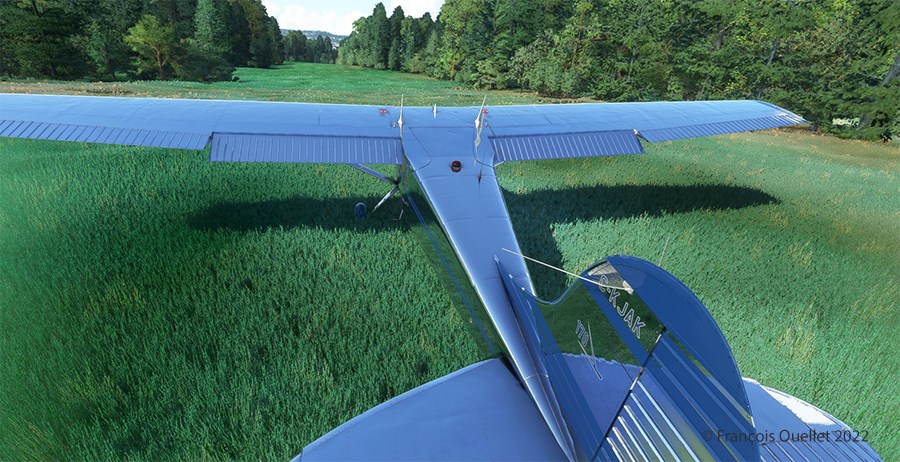
On Île d’Orléans ready for take-off.
Although the available strip was not very wide, it was long enough for the landing, the taxiing and the maneuvering to turn the aircraft 180 degrees for its take-off to Quebec City.
Airborne from Île d’Orléans with a Cessna 170B
Back in the air, direction Quebec City. The take-off on soft ground requires about 20 degrees of flaps.
Enroute towards Quebec City.
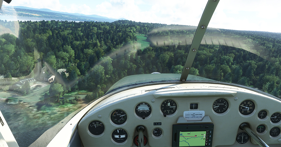
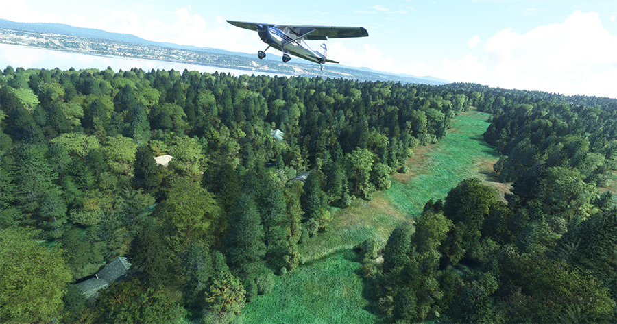
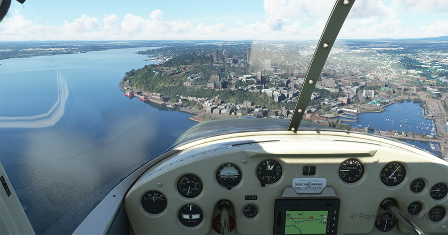
Quebec City is in sight. In the Cessna C-170B I flew in 1981 across Canada from St-Jean-sur-Richelieu to Edmonton, Alberta, there was no modern navigation aid installed on board as in the photo above, where the GPS helps the pilot find his way. The flight was flown using 14 VFR charts and nothing more. (If you are interested, click to read more about real-life flying stories on my blog).
Hôtel le Concorde and its revolving restaurant, visible on the right.
We are now above the Plains of Abraham. On the picture above, on the right, you can see the Hotel le Concorde and its revolving restaurant. We will possibly disturb the quiet atmosphere of the meal as we fly by…
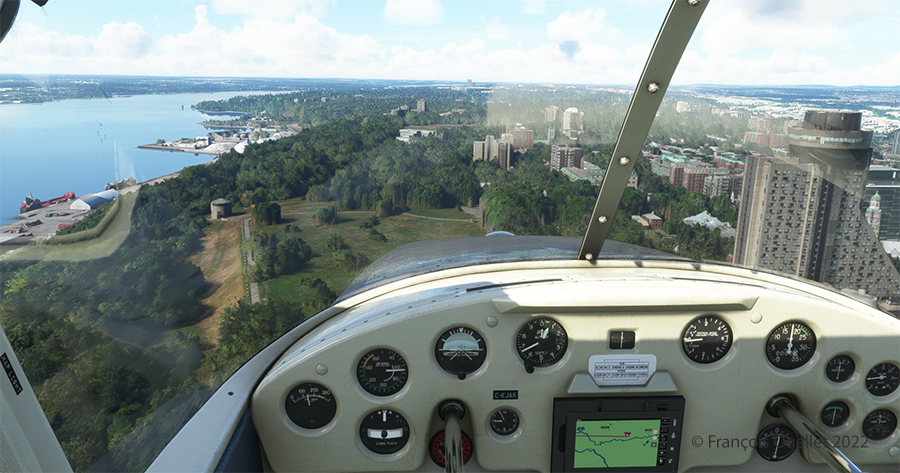
The MNBAQ and the Battlefields Park are in sight.
Above, straight ahead, the gray buildings represent a portion of the Musée National des Beaux-Arts de Québec (MNBAQ). A little further on is the open area of the Battlefields Park. In 1928, Lindbergh landed on that field to bring badly needed medicine for his friend Floyd Bennett. Can we normally land on the Battlefields Park, in the heart of Quebec City? Of course not. But that’s the beauty of a flight simulation; you can do whatever you want!
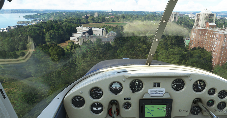
Cessna 170B on the Battlefields Park in Québec City.
Once landed, the aircraft is allowed to decelerate gradually and then turned 180 degrees for the next takeoff. When winds are light, there is no need to worry about the direction of the takeoff.
Aerial view of Battlefield Parks with the Cessna 170B under MSFS 2020.
Above, an aerial view of the Battlefields Park, with the virtual Cessna C-170B ready to take off again.
Partial view of Quebec City in flight simulation with MSFS 2020
One last picture, this time with some additional buildings. The realism of the virtual scene with FS2020 is amazing!
I hope you enjoyed these two short flights. Whether you use the short landing technique for the Battlefields Park is really up to you, as there is enough space for a normal landing. But it is good to practice landing in the shortest distance possible. You never know when your engine will quit!
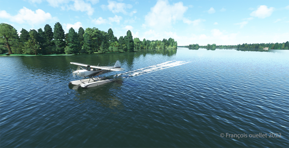
Taking of from Rivière des Mille-Îles near Marina Venise
Today’s flight is part of my blog’s standard virtual flight category. The take-off is from the Mille-Îles River in Quebec. There will be a touch and go at Mirabel (CYMX) and a flight over Quebec and Ontario to the Cascades hydrobase (CTY3).
Towards the Mirabel international airport (CYMX) with the MSFS 2020 flight simulator.
Flying at low altitude towards Mirabel airport, for a touch and go.
The Mirabel (CYMX) runway is in sight.
One of the CYMX runways can be seen straight ahead. If a virtual pilot does not find the runway long enough to do a touch and go, then a refresher course is in order.
Touch and go at the Mirabel airport with MSFS 2020
Takeoff from Mirabel. This is the advantage of an amphibious aircraft; you can land anywhere.
The virtual weather shows the difference between the snow in the north and the green vegetation in the south.
The Lachute airport (CSE4) is visible (buildings in red in the foreground). Flying in April in Quebec allows to notice the demarcation between the still white landscapes (the snow persists) in the north and the areas where everything has already melted.
Over Hawksbury, Ontario, with the MSFS 2020 flight simulator.
The flight continues to the Cascades waterbase (CTY3). The Ottawa River separates Quebec from Ontario. The aircraft is currently over the town of , Ontario, with Hamilton Island on the left.
Realism of the flight simulation under MSFS 2020
The screenshot above shows the very realistic effect of the virtual landscape, both in terms of the virtual weather, the multiple color tones of the ground and the shading on the ground and on the aircraft caused by the breaks between the clouds.
Overflying the Plaisance National Park in Quebec with MSFS 2020
Descending for 1500 feet. Near Gatineau, the weather conditions deteriorate slightly. But it will be short-lived.
Turning towards the Gatineau river with the MSFS 2020 flight simulator.
Right turn for a water landing on the Gatineau River. The destination is in sight.
Water landing of the Gatineau river near the Wakefield hydrobase (CTY3)
The plane progresses slowly towards the hydrobase.
Aerial view of the Wakefield hydrobase (CTY3) with MSFS 2020
There is not yet a virtual waterbase worthy of the name for Cascades under Microsoft. At low altitude, the virtual pilot notes that he is only flying over a photo with aircraft footprints. An aerial view shows the CTY3 hydrobase.
Those who wish to repeat the experience will find the ride quite interesting.
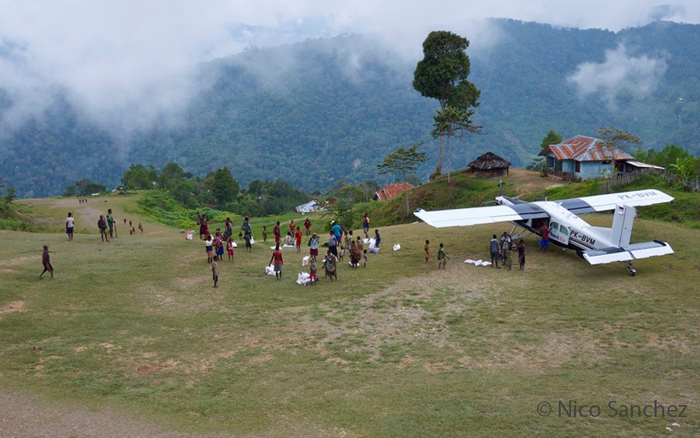
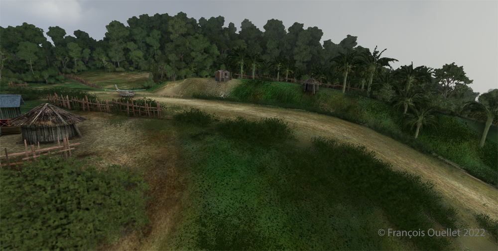
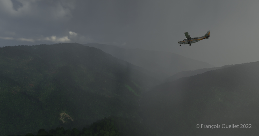
Bugalaga airstrip in Indonesia photographed by Nico Sanchez
Takeoffs and landings on the Bugalaga runway (WX53) in Indonesia can be classified as being in the challenging virtual flight category. The runway is not extraordinarily demanding, due to its comfortable size of 1478 feet by 75 feet. But the approach still requires more skill than a standard approach, especially with the trees on final and the steep slope.
Today’s flight with the MSFS 2020 flight simulator consists of taking off and landing on this sloping runway. To add to the fun, the flight must be done during adverse weather conditions. Indeed, the thunderstorms programmed in the virtual weather system complicate the task of the virtual pilot, as he has to deal with gusty winds and mechanical turbulence. And to add to the fun, the Pilatus normally used is replaced by a Cessna Grand Caravan 208B. The photo above represents the Bugalaga runway in reality.
View of the Bugalaga (WX53) sloped airstrip using MSFS 2020 flight simulator.
Above is the virtual graphic interpretation of this runway located at 6233 feet above sea level (MSL) with the Cessna ready to take off. Asobo (Microsoft) did a good job.
Cessna Grand Caravan 208B ready for departure at Bugalaga airstrip with MSFS 2020
The visibility could be better, but it does not prevent the aircraft from taking off on runway 06.
Cessna Grand Caravan 208B airborne from the Bugalaga sloped airstrip (WX53) using MSFS 2020 flight simulator
As you can see, the margin of error is pretty small for this aircraft that is less efficient than the Pilatus normally used in reality.
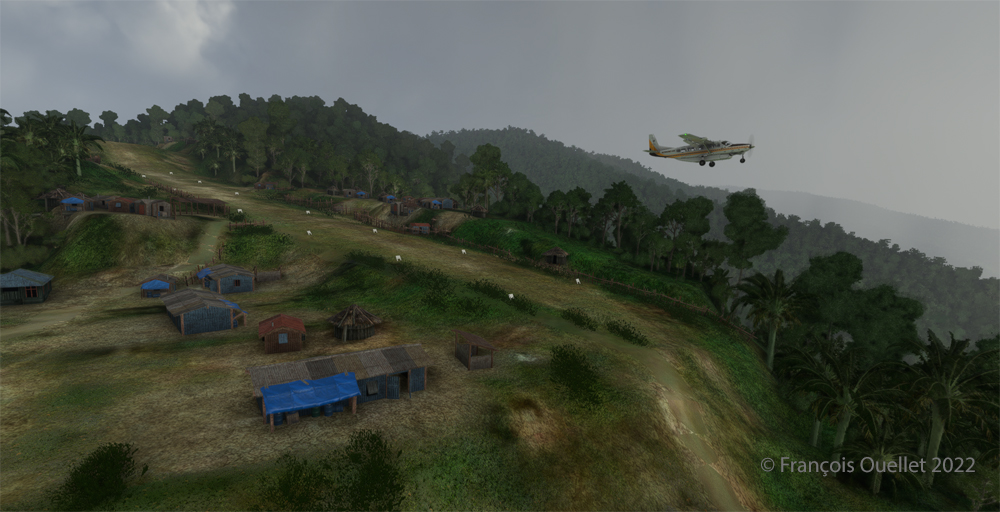
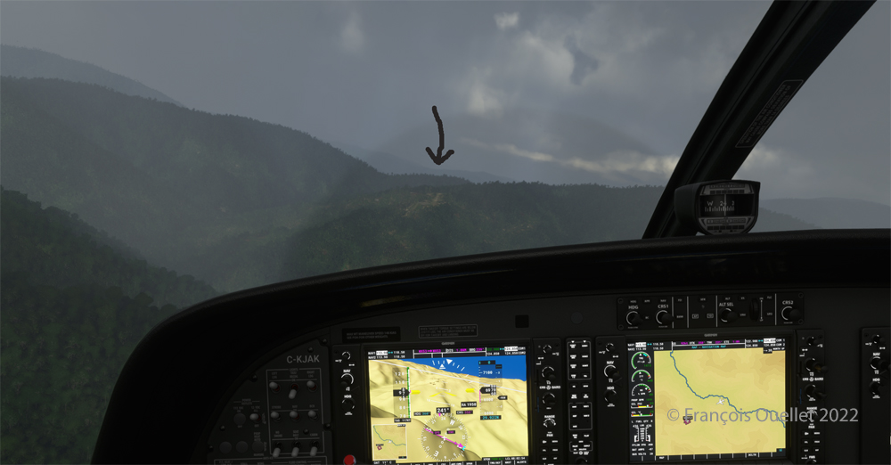
Mountains around the Bugalaga airstrip during a thunderstorm using MSFS 2020.
Immediately after takeoff, preparation begins for the outbound procedure and the 180 degrees turn that will put the aircraft on final for runway 24. The surrounding mountains require the pilot’s full attention.
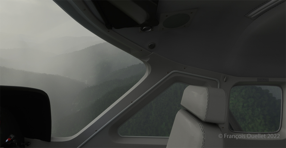
Cessna Grand Caravan 208B approaching the Bugalaga airstrip in flight simulation.
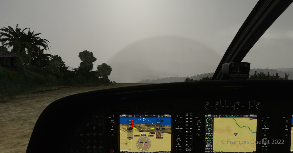
Acceptable visibility but strong winds characterize the approach to Bugalaga.
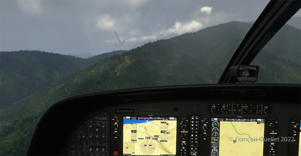
The Bugalaga virtual sloped airstrip is visible in the distance in the mountains.
Runway 24 is now visible in the mountains.
On final at 82 kts for the Bugalaga sloped airstrip (WX53) using MSFS 2020
The approach speed with flaps out is about 82 knots.
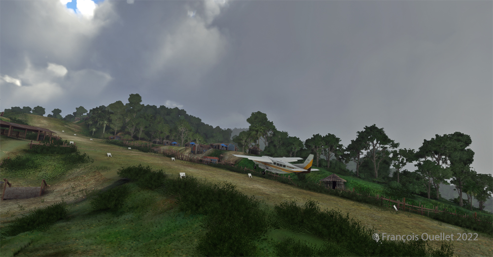
Touching down on rwy 24 on the Bugalaga sloped airstrip using MSFS 2020
The Cessna Grand Caravan C208B is about to touch down. You can see the steepness of the runway, which gets even steeper towards the end.
Cessna Grand Caravan 208B keeping enough speed to climb the sloped airstrip at Bugalaga in Indonesia (MSFS 2020)
Once the aircraft has touched down, the virtual pilot must maintain enough speed to climb the hill at the end of the strip.
Cessna Grand Caravan 208B after landing in Bugalaga in flight simulation.
A last screen capture shows the aircraft having crossed the last hillock at the end of runway 24. The flight is short, but requires your full attention. Good luck to those who will try the experience!
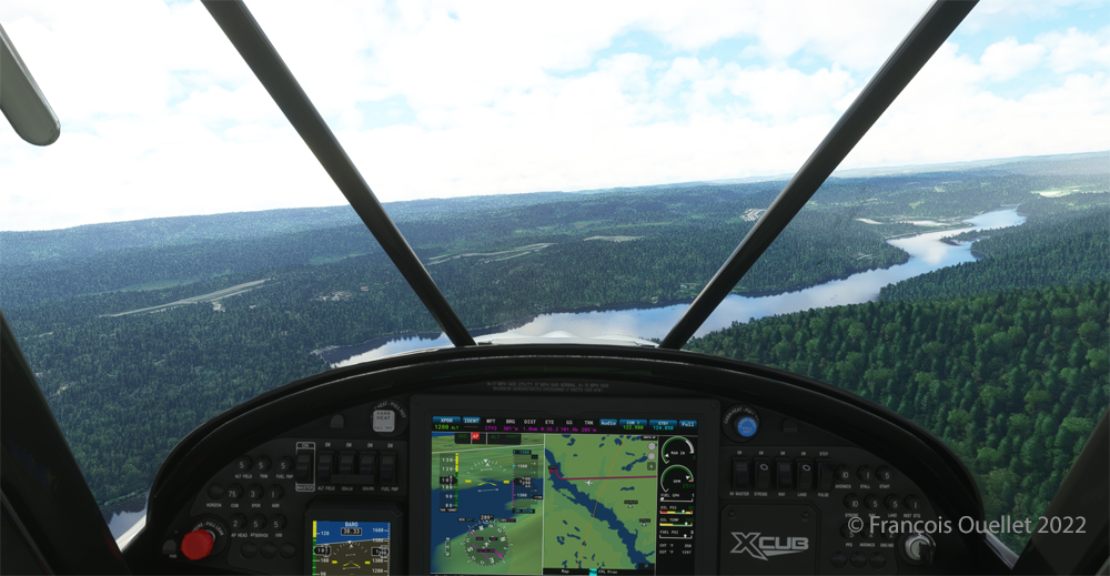
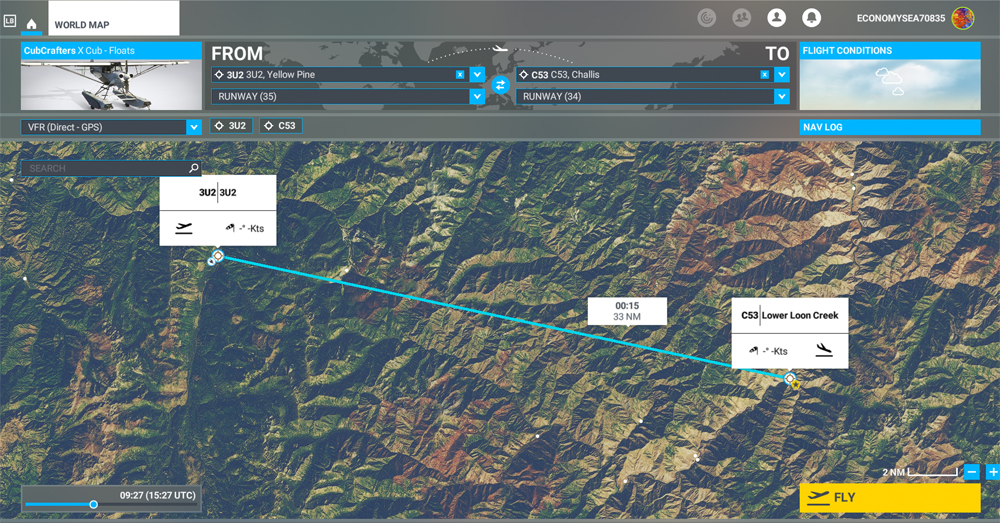
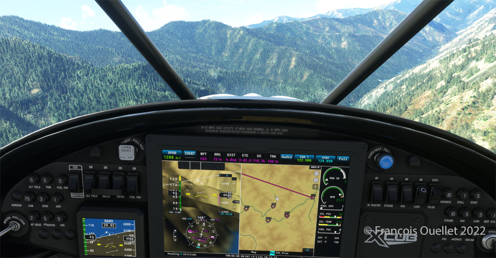
MSFS 2020 map for the flight 3U2 to C53 in United States
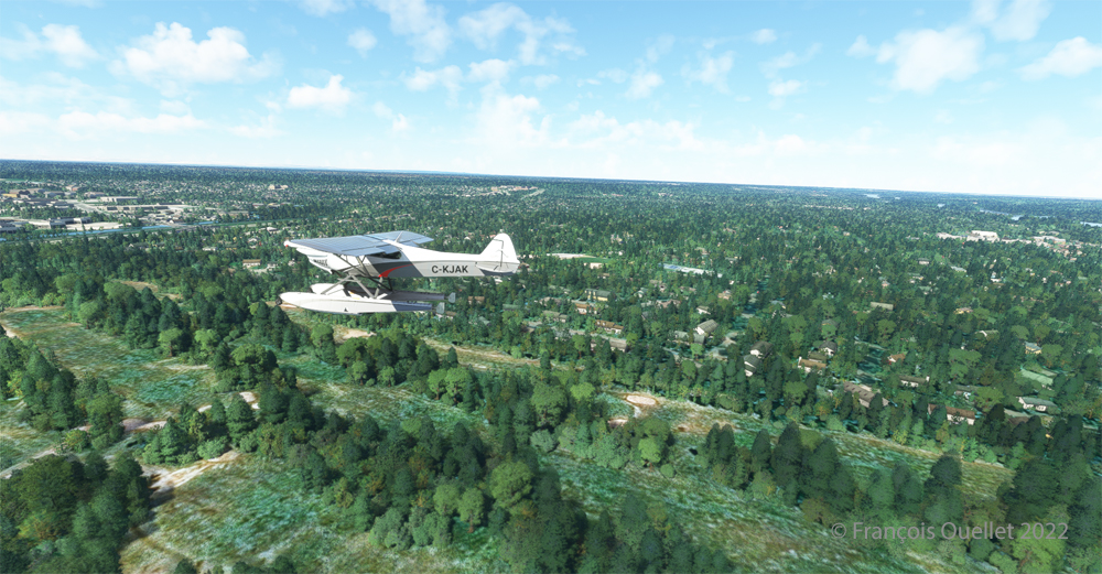
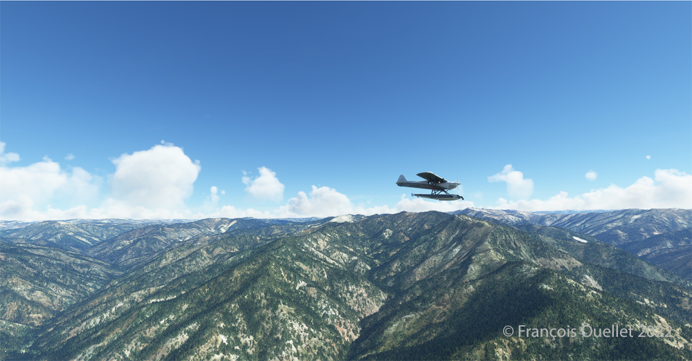
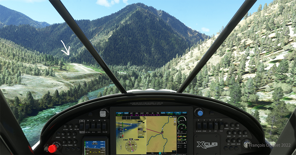
The challenging virtual flight is from Johnson Creek Airport (3U2) to the Lower Loon Creek Airstrip (C53) in the United States, using the MSFS 2020 flight simulator. The software map shows the type of aircraft chosen, a CubCrafters X Cub on floats, as well as the trajectory over the Idaho mountains.
The idea of using an amphibious aircraft for this flight is a bit far-fetched, but the goal is to make the pilot’s job a little more difficult by adding weight to the aircraft.
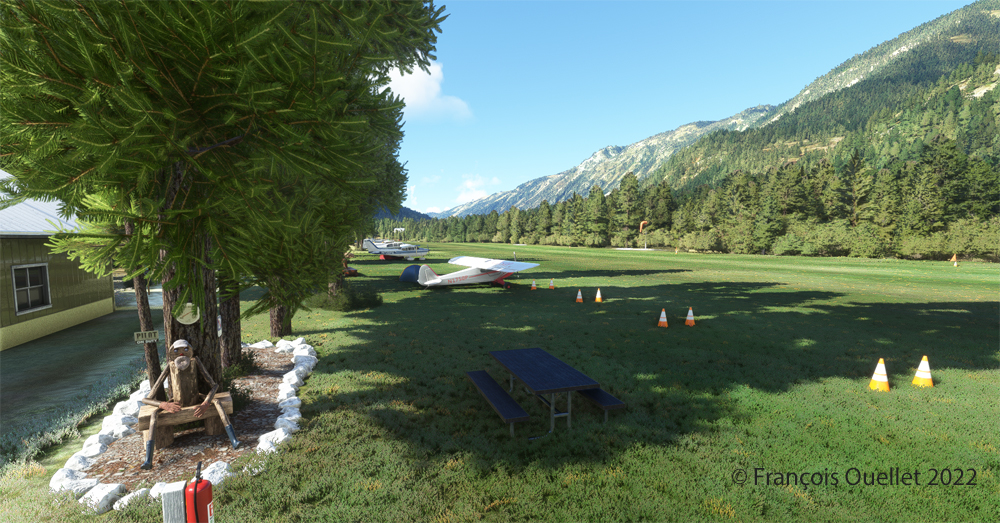
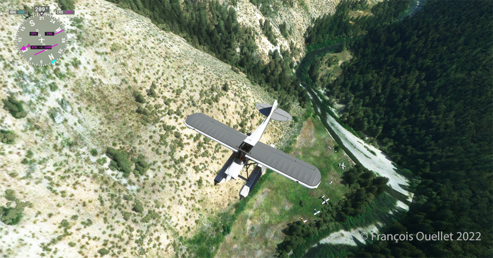
Johnson Creek (Yellow Pine) airport 3U2 with MSFS 2020
Johnson Creek Airport (3U2) is a creation of Creative Mesh. It is charming, with tents here and there planted near the planes. The runway is 3480 feet long by 150 feet wide. It is oriented on a 17/35 axis and still quite high at 4960 feet above sea level (MSL).
Amphibian CubCrafters X Cub ready for departure at the Johnson Creek 3U2 virtual airport with MSFS 2020.
Given the departure altitude, one must not forget to adjust the air/fuel mixture so as not to lose power on takeoff, especially since there is a mountain at the end of the runway and the floats increase the weight of this small aircraft. The air is also thinner as the flight takes place in summer and at a high altitude; this represents another obstacle to the aircraft’s performance.
Avoiding obstacles after take-off from the 3U2 Johnson Creek virtual airport using MSFS 2020.
The mountains near the runway present a significant obstacle. The virtual pilot must use the best possible angle of climb without worrying about the route recommended by the GPS. The flaps are kept slightly extended during the initial climb.
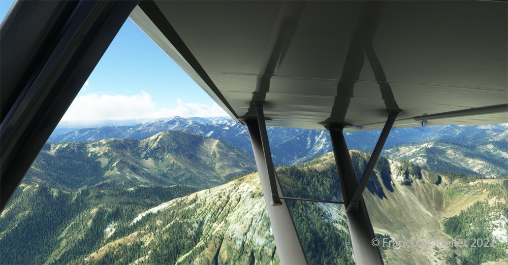
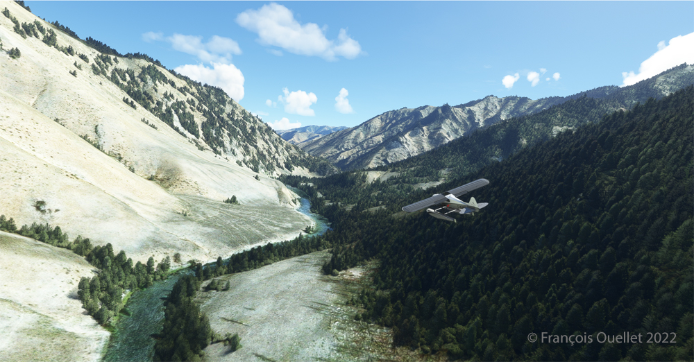
Flying over the Idaho mountains in flight simulation with MSFS 2020.
Once at a safe altitude and back on the GPS suggested route, the view of Idaho’s spectacular mountains is more enjoyable. Throughout the climb, the air-fuel mixture and altimeter (“B” on MSFS 2020) have to be adjusted.
CubCrafters X Cub floatplane over the Idaho mountains in flight simulation MSFS 2020
An altitude of almost 10,000 feet ASL makes it possible to fly over the mountains without risk of collision.
Descending in the valley towards the ID8 Marble Creek airport in Idaho in fligh simulation.
At the right moment, when the small surrounding airports and the river appear on the GPS, we leave our GPS road, until now in straight line, and we align in the valley to fly over the river until our destination, avoiding the surrounding mountains. In the photo above, the descent has already begun, with a necessary gradual adjustment of the air-fuel mixture.
Flying over the (ID8) Marble Creek airport in Idaho using the MSFS 2020 flight simulator.
We fly over a first small airport. The picture above shows the planes parked on the runway of Marble Creek airport (ID8), which dimension is 1160 x 20 feet. For those which would be interested in trying a landing there, the orientation of the runway is 03/21 and the altitude of 4662 feet MSL.
Flying over the 2U8 Thomas Creek Airport in Idaho using the MSFS 2020 flight simulator.
On the way towards our final destination, we also fly at low altitude over the Thomas Creek (2U8).
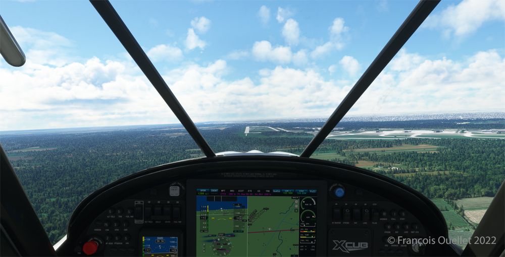
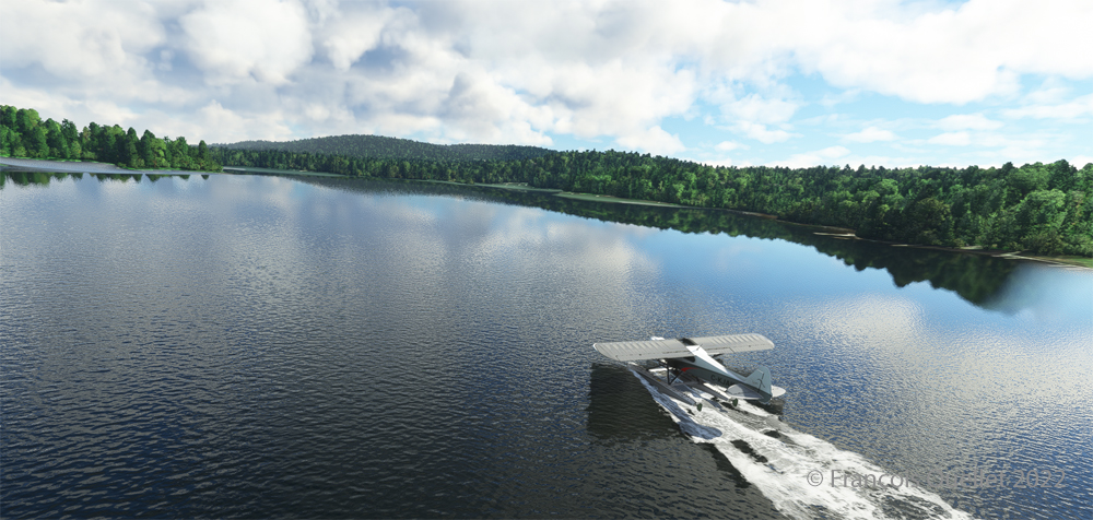
Following the river towards the C53 Lower Loon Creek airstrip using the MSFS 2020 flight simulator.
The mountains on either side of the river require close attention, as the poor performance of a small aircraft equipped with floats does not allow for easy correction of navigational errors.
By the time the runway suddenly becomes visible, the plane will not be on course but 90 degrees off the ideal course. It will be necessary to quickly turn left into the valley, make a fairly sharp 180-degree turn to the right to avoid the mountains, and then get back on course to land. It is only at this point that the landing gear will be extended.
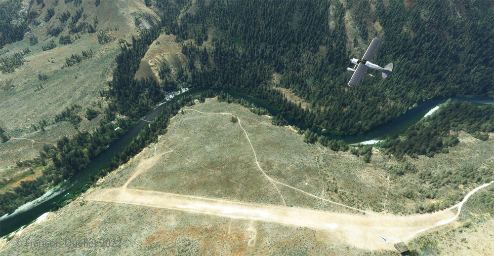
On final for Lower Loon Creek airstrip with MSFS 2020
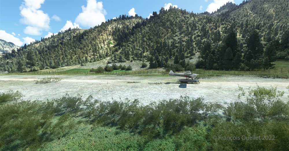
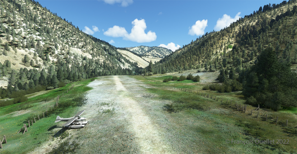
The photo above shows the aircraft on final for the Lower Loon Creek dirt and grass runway (C53). It is located at 4084 feet MSL and is only 1200 feet long by 25 feet wide. Note that the approach should be made on runway 16 when possible.
Amphibian CubCrafters X Cub rolling down the C53 Lower Loon Creek airstrip in Idaho after landing.
As always, a stabilized aircraft on final makes landing easier, regardless of the conditions.
Amphibian CubCrafters X Cub parked at the C53 Lower Loon Creek airstrip using MSFS 2020 flight simulator.
We park the plane and rest a bit. Today, there is no one else here. But that’s not always the case in real life, as this video of a landing at Lower Loon Creek shows it.
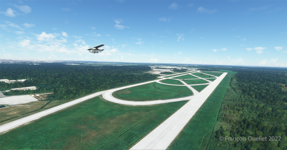
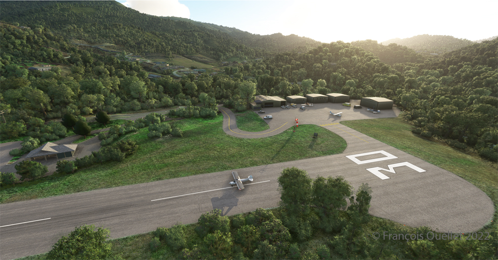
Ready for departure at the Elk River airport (NC06) created by Cloud Studio.
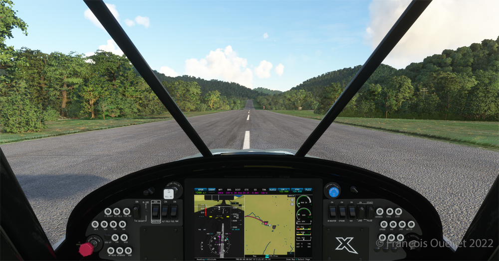
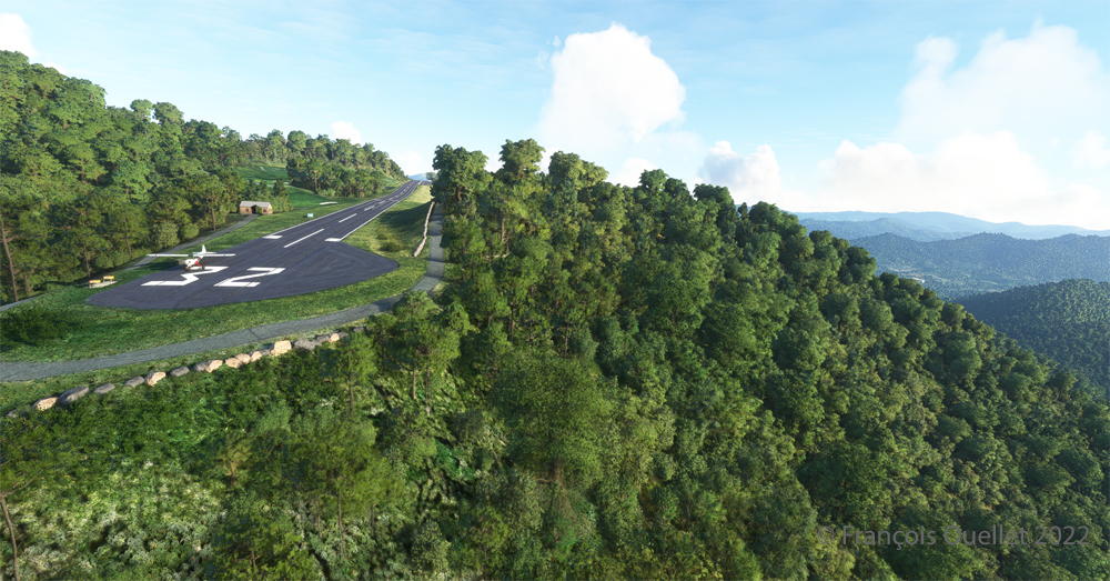
Today’s twenty-minute virtual flight is conducted using Microsoft MSFS 2020 flight simulation software. The virtual airport at Elk River (NC06) in the United States, modeled here by Pilot’s, is located at approximately 3468 feet (ft) above sea level (MSL). Its sloped 12/30 runway can accommodate many types of aircraft as its dimensions are still 4600 feet long by 75 feet wide. A golf course is located near the airport facilities.
The sloped runway of the Elk River airport (NC06) with the MSFS 2020 flight simulator.
In the distance, the end of runway 30 can be seen rising rapidly. The trip to Mountain Air County Club Airport (2NC0), modeled by Cloud Studio, is made with a single engine Cubcrafters NX Cub.
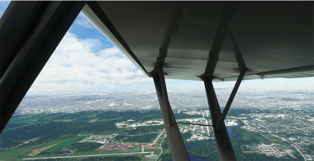
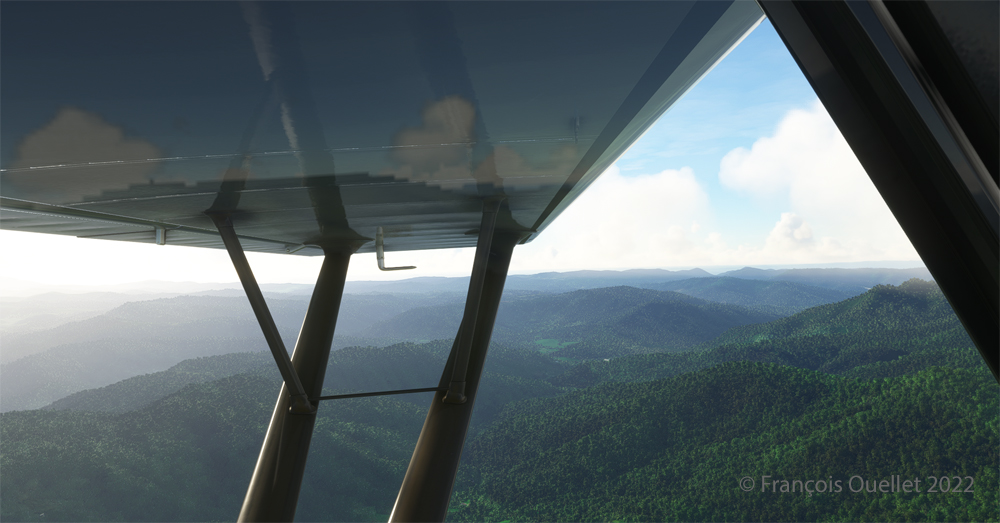
Enroute towards the Mountain Air County Club (2NC0) airport from Elk River (NC06) with MSFS 2020.
In direct flight with GPS, the virtual pilot will have to climb at around 7000 feet msl to avoid the surrounding mountains. It is therefore important to adjust the air/fuel mixture during climb and descent for the destination. Also, don’t forget to adjust the altimeter (press “B”) as you move away from the point of departure. Near the summits, you will experience mechanical turbulence, which is normal.
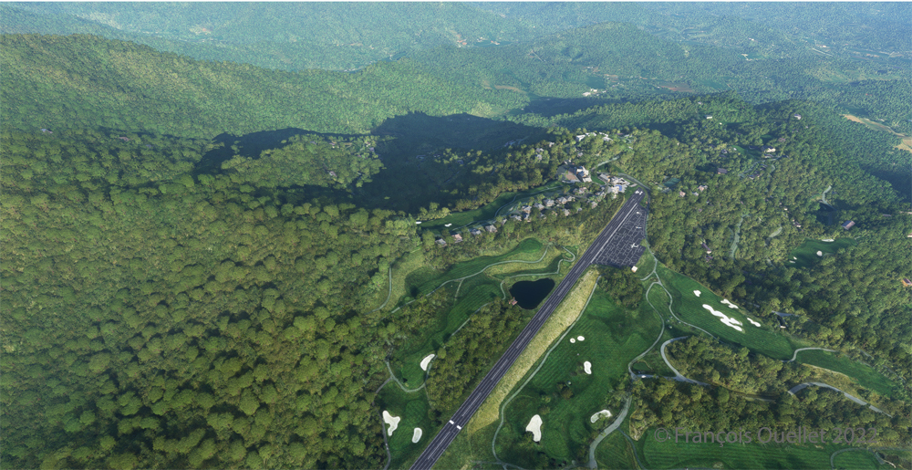
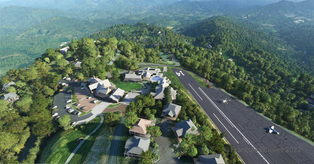
Aerial view of the Mountain Air County Club (2NC0) airport created by Pilot’s.
The photo above shows the virtual airport of Mountain Air County Club (2NC0) with the MSFS 2020 flight simulator. The sloped runway is 2900 feet long and only 50 feet wide. A golf course surrounds this airport located at 4432 feet MSL. Since the winds are light, the approach will be on runway 14.
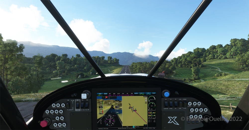
On final for the sloped runway of the Mountain Air County Club (2NC0) airport using MSFS 2020.
On final approach, it is easy to see the uphill angle of this airstrip, which is slightly more damaged than the one at Elk River.
A view of the cliff at the threshold of runway 32 at the 2NC0 Mountain County Air Club airport created by Pilot’s pour MSFS 2020.
As we continue to taxi to the end of runway 14, we notice the cliff that awaits the pilot who has not properly prepared his landing. No forgiveness!
View from above of the Mountain Air County Club airport 2NC0 with the MSFS 2020 flight simulator.
An elevated view shows the threshold of runway 14 and the buildings associated with the golf club. A few golf loving pilots have already parked their aircraft to the left of runway 14. For this screenshot, I used the excellent X-BOX drone.
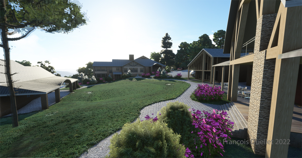
Buildings and flowers at the Mountain Air County Club airport (2NC0) created by Pilot’s for MSFS 2020.
A final photo shows the buildings and flowers associated with the golf club. The bird recordings are easily heard, which enhance the scene. Flight simulation enthusiasts wishing to repeat the experience should do so under VFR conditions to keep an eye on the mountain tops during the approach.
Approaching the Narita international airport, in Japan, with Microsoft Flight Simulator 2020.
The Microsoft Flight Simulator 2020 is an extremely interesting product. Microsoft is taking advantage of the satellite imagery offered by Bing, which allows the flight simulation enthusiast to fly over the world almost like in the real life. With the addition of live weather and air traffic in real time, the immersion is incredible.
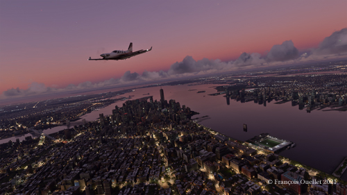
Flying over New York in the evening with Microsoft Flight Simulator 2020.
To download the game’s 128 gigabytes using my current internet plan, it took fourteen hours. I still remember when I bought a hard drive that could hold 30 megabytes of data: it was a computer revolution!
Of course, the game requires an adaptation. We are far from the old FSX platform. It goes without saying that you need a high-performance computer. But a new and very positive aspect of this simulator is that you can now use an X-Box controller as an in-flight camera, with the addition of a rudder and a steering wheel for more reality. This camera offers incredible possibilities and the additional X-Box controller becomes essential.
The Zlin Savage Cub flying over the United States using Microsoft Flight Simulator 2020.
As with anything new, there are some glitches. Personally, I have been using the CH company products for flight simulation for many years and the new MSFS 2020 has had problems recognizing the functions of CH products. Many virtual flight enthousiasts have had the same problems. So here are the links below that allowed a neophyte like me to solve the problems.
A first video of interest is also available. Its author uses a slightly different method, but it is super easy to understand and allows you to acquire additional knowledge if you want to map your CH rudder and control column correctly.
A second video gives you access to the CH company products. There you will find the links that allow you to print a representation of your CH flight controls. This will allow you to find which number is associated with a specific command control. You can then remap the controls to your taste and keep a record of all the modifications you made.
Here are two other practical links for answers to various questions about X-Box and other subjects and CH products.
Aerial view of Quebec City using Microsoft Flight Simulator 2020.
In the screenshot above, you might recognize Quebec City, with the restaurant Le Concorde in the distance on the left, followed by the Edifice Marie-Guyart, a part of the Plains of Abraham, the Château Frontenac, the Price building and the lower town.
The complete edition of the Orbx freeware and payware virtual airports, dated June 09 2019, is in the downloadable file below. The runway details and airport elevation is included. It will be updated regularly.
The information in the PDF file is in colour. The airports in black are part of the global pack freewares. The airports in green are freewares that are not part of the global packs. The airports in blue are payware airports.
When a runway is in orange, it means that the length of the runway is 2000 ft or below, and/or the width is 60 ft or below. The water aerodrome are defined by the word “water” in blue. Finally, the elevation of the airport is in red at the end of the runway details.
The fourth edition of the Orbx freeware and payware virtual airports, dated June 02 2019 is in the downloadable file below. The list of airports is complete. I still have to add runway details to several airports.
The information in the PDF file is in colour. The airports in black are part of the global pack freewares. The airports in green are freewares that are not part of the global packs. The airports in blue are payware airports.
When a runway is in orange, it means that the length of the runway is 2000 ft or below, and/or the width is 60 ft or below. The water aerodrome are defined by the word “water” in blue. Finally, the elevation of the airport is in red at the end of the runway details.
The virtual sceneries shown below were used for flight simulation exercises. They are all available online, for sale or free, at ORBX.
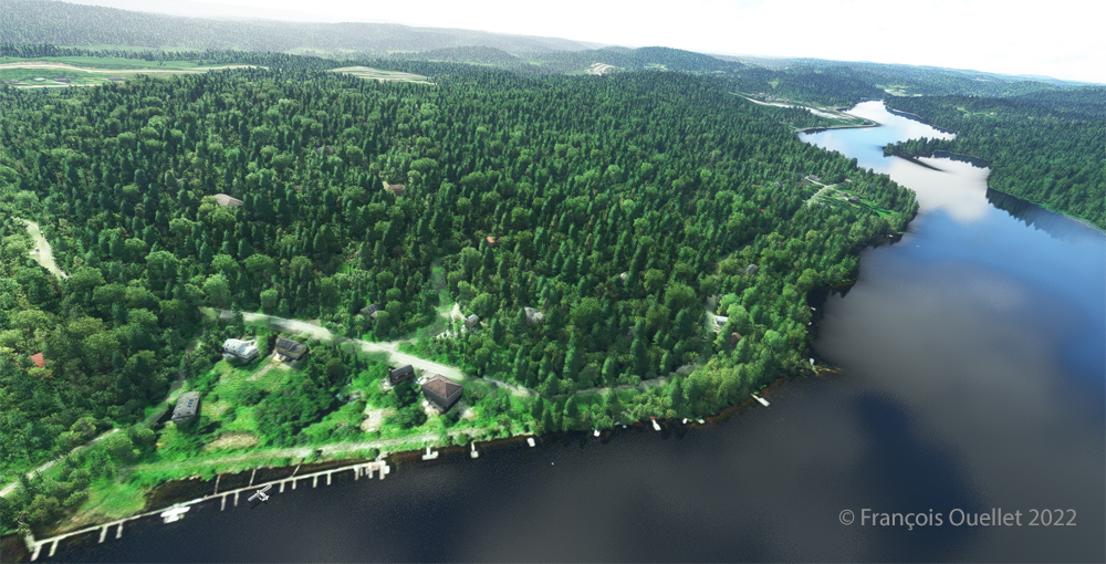
Piper Pacer approaching the dock at Robert’s Lake in Ontario, Canada.
In the scenery above, the red Piper Pacer, which is made by Lionheart Creations Ltd , arrives at a Pier at Robert’s Lake, in Canada. This lake was modelized jointly with the Parry Sound (CNK4) virtual scenery.
Virtual Cessna C188B Agtruck near Claresholm Industrial Park in Alberta, Canada.
In the picture above, a virtual Cessna C188B Agtruck created by the Alabeo company is parked near the Claresholm Industrial Park (CEJ4), in Canada. The virtual airport is available for free download at ORBX. Who said that nothing in life is free?!
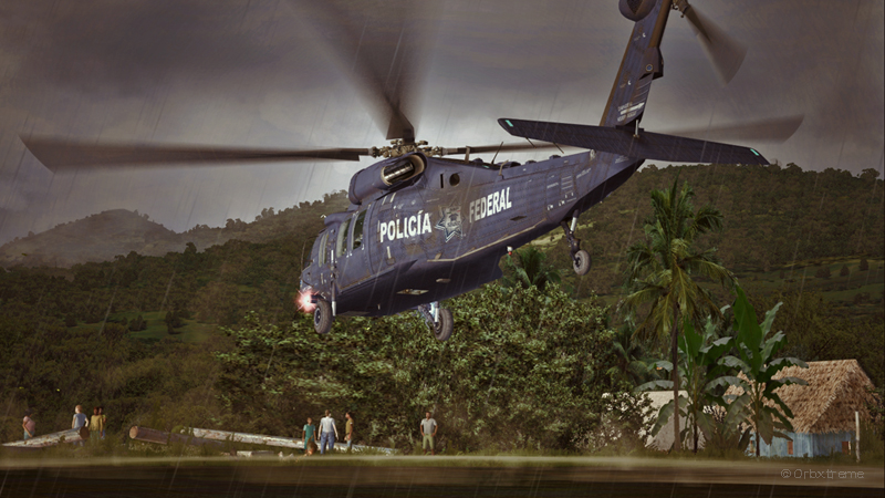
A virtual UH-60L Black Hawk belonging to the Columbian Police Force is hovering in the jungle.
Above, a UH-60L Black Hawk virtual helicopter created by the Cerasim company is flying over the Papua New Guinea territory. It should normally be hovering over Columbia, but the ORBX company has not yet developed very well defined airports for that country. It was more interesting to fly over an area that was already well modelized.
The three screen captures were slightly digitally improved following each virtual flight. The FSX flight simulation platform, although still interesting, is getting a bit old. The original screen captures often benefit from additional digital processing, especially when it comes to posting for the international contest held monthly by the ORBX company.