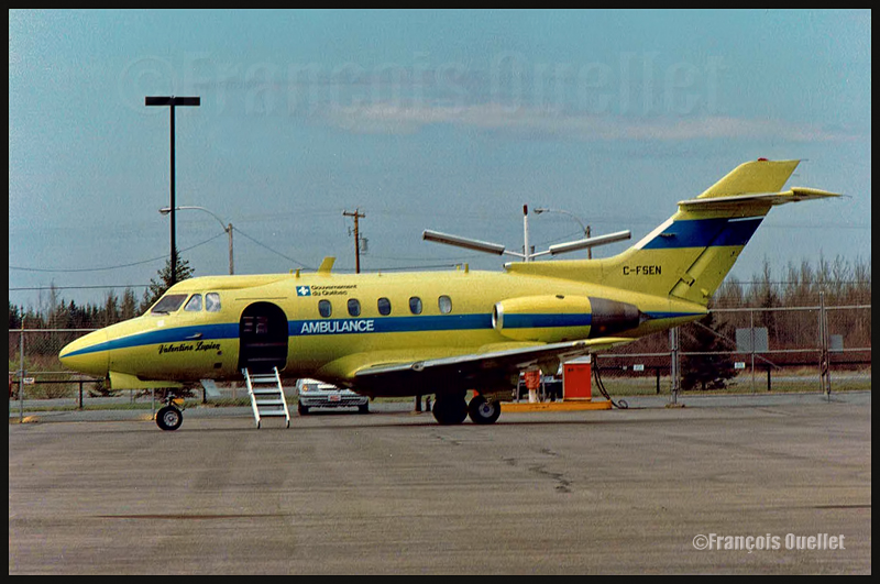
Medical evacuation aircraft HS-125 C-FSEN Valentine Lupien of the Quebec Government, around 1986.
During the eighties, while I was working as a flight service specialist (FSS) at the Transport Canada flight service station in Rouyn-Noranda (CYUY), I received a phone call from a Val-d’Or air traffic controller. He told me that there was a problem with the type K ARCAL. The ARCAL allows a pilot to remotely activate the runway lights.
Normally, the pilot can choose between three intensities: low, medium and high. But it now seemed that for an extended period, the ARCAL’s low intensity would not be serviceable. The controller told me to issue aNOTAM stating that nobody could use the ARCAL for an indefinite period.
I did not agree with that request. An ARCAL system that was left available would facilitate a pilot’s life by allowing him to choose between the remaining intensities during the approach, or on takeoff. The pilots of the Quebec Government HS125 in charge of medical evacuations during night time would certainly appreciate.
I told the controller that I did not know of any approved procedures relating to an ARCAL type K system failure and that I did not see why I would consider totally unserviceable a system in which only one intensity out of three was posing a problem.
He replied that those were the written procedures that could be found in the control tower and that I had to call his manager if I wanted to see them. How was it possible that official procedures pertinent to a system installed on many airports across Canada, with or without a control tower, could only be found in selected control towers? This was unthinkable.
Through my manager, I asked to receive a copy of those procedures. But it now seemed that those procedures were not in the Val-d’Or control tower but in the Montreal regional office. I tried to get them from that office, but nobody could find anything on the subject.
It was now obvious that those procedures never existed. The funny thing is that all the stakeholders were defending, one level at a time, the existence of those fictive procedures, for all kinds of reasons.
During those years, there was a program called “Incentive Award”, encouraging an employee to present new ideas that would improve the efficiency of the public service. If a proposition was accepted by the highest management levels, a certificate accompanied with a small amount of money would be sent to the employee by the Deputy Minister at Transport Canada. Realizing I would not obtain satisfaction from the regional management, I used the “Incentive Award” program to present my proposition.
One year later, I received a call from somebody who told me he was working at the national level, in Ottawa. He implied that my suggestion would not be accepted.
I told him that I paid, like other Canadians, to get the ARCAL system installed and that, as long as one intensity would remain serviceable, the ARCAL would have to be available to pilots. I made sure he understood that I could not care if he felt comfortable with the idea or not. He was advised that if he maintained his view on the subject, he would have to justify his action to the Canadian public and to the Minister of Transport, who, at the time, was Benoît Bouchard.
Two months later, I received a check and a letter from the Deputy Minister of Transport Canada thanking me for my suggestion that was improving the efficiency of public service. Fourteen months were needed to make the transition from fictive to official procedures that now apply to all Canadian airports equipped with this type of remote control of runway lights.
For more real life stories on the Rouyn-Noranda flight service station and flight service specialists, click here:
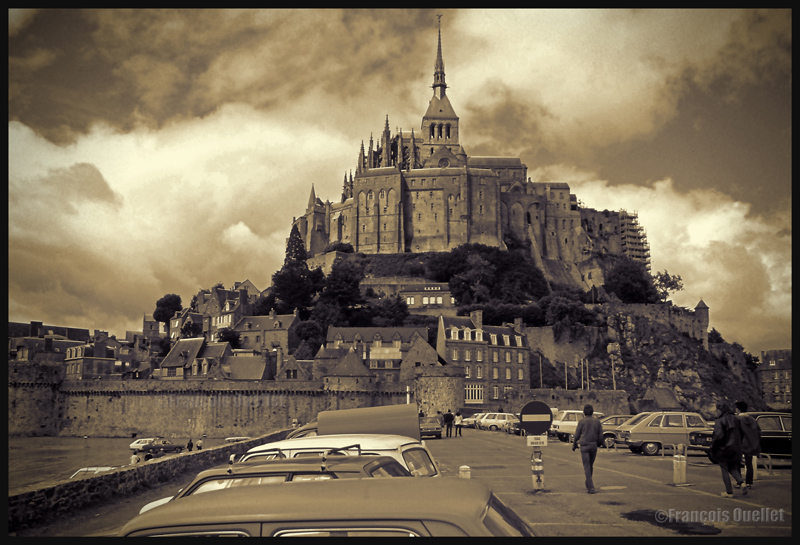
Cumuliform clouds add energy to any photo. Even photos in black and white benefit from them largely, whether it is for a normal or an HDR photo.
Cumuliform clouds add dynamism to this Abbaye du Mont St-Michel scenery. France (1978)
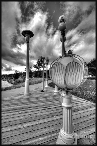
Black and white HDR picture of lamp posts installed along the St-Lawrence, Quebec City 2012.
The stratiform clouds add to the tranquillity and the stability of a photo.
Daytona Beach under stratus clouds in 2011. The end of the afternoon allows the fresh air from the sea to move over the heated land, which helps create few cumulus fractus, visible near the buildings.
Clouds including a stratiform and cumuliform components (stratocumulus) produce an effect that is more energizing than the simple stratus, while avoiding the explosion of energy of the cumuliform clouds.
A stratocumulus adds to this otherwise peaceful scenery captured on board the Lyria train between Paris and Geneva in 2013.
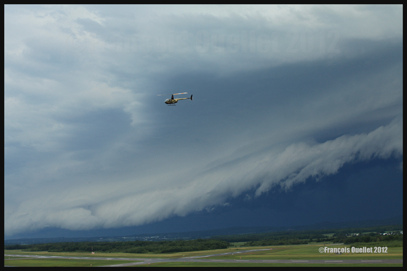
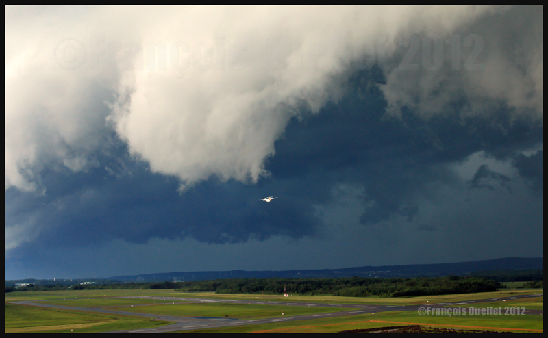
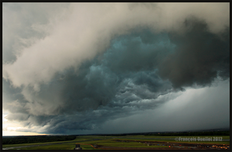
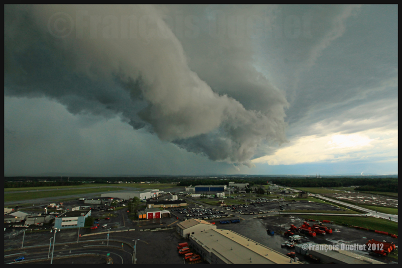
The cold front
The approach of a cold front enhances the possibility of interesting photos. If it is a fast moving cold front of moist and unstable air, the photos will probably be more spectacular, as some thunderstorms will be associated with the system. A dew point of more than 15 C indicates the presence of a lot of water vapor which can be transformed into precipitation, thus releasing a lot of energy. When these conditions are combined with a really strong contrast between the new air mass which approaches and the one which goes away, the produced meteorological phenomena will certainly be intense.
In the photos below, the meteorological system approaching the Quebec Jean-Lesage international airport also had to cross a small mountain range.
A roll arcus cloud in development ahead of a thunderstorm approaching the Quebec Jean-Lesage airport in 2012.
A roll arcus cloud in development ahead of a thunderstorm approaching the Quebec Jean-Lesage airport in 2012.
View under a developing arcus cloud at the Quebec Jean-Lesage international airport (2012)
An arcus cloud ahead of a thunderstorm approaching the Quebec Jean-Lesage airport in 2012
A roll arcus cloud ahead of a thunderstorm heading for Quebec City in 2012
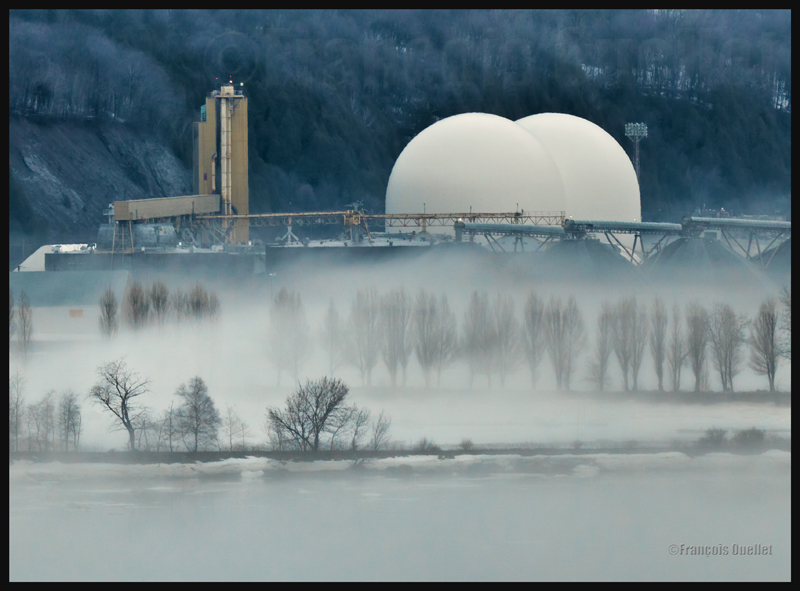
The morning fog
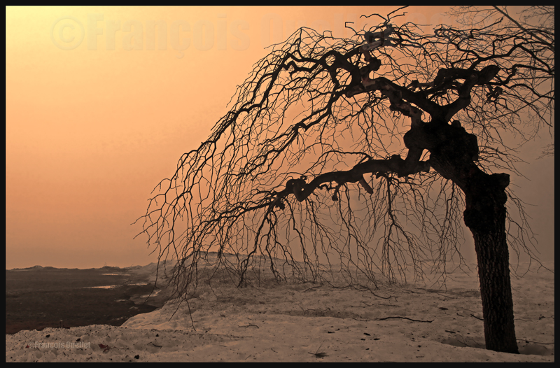
The morning fog offers many opportunities for interesting photos. You can choose an isolated tree and capture the combined effects of the morning sun and fog. Or you may choose a cluster of trees, for a completely different effect. Both photos below were taken in Domaine Cataraqui, Quebec City.
Trees in fog at Domaine Cataraqui, Quebec City 2009
Sun and fog provide for a special atmosphere at the Domaine Cataraqui, Quebec City 2009
A morning fog resulting from a cold cloudless night will persist for hours if there is no wind. The cold morning air, motionless over a slightly hotter stretch of water, creates a fog that will finally disappear just before noon, when the atmosphere has been heated enough. If there had been an overcast sky during the night, chances are that the air over the water would have remained at a higher temperature, preventing the formation of fog.
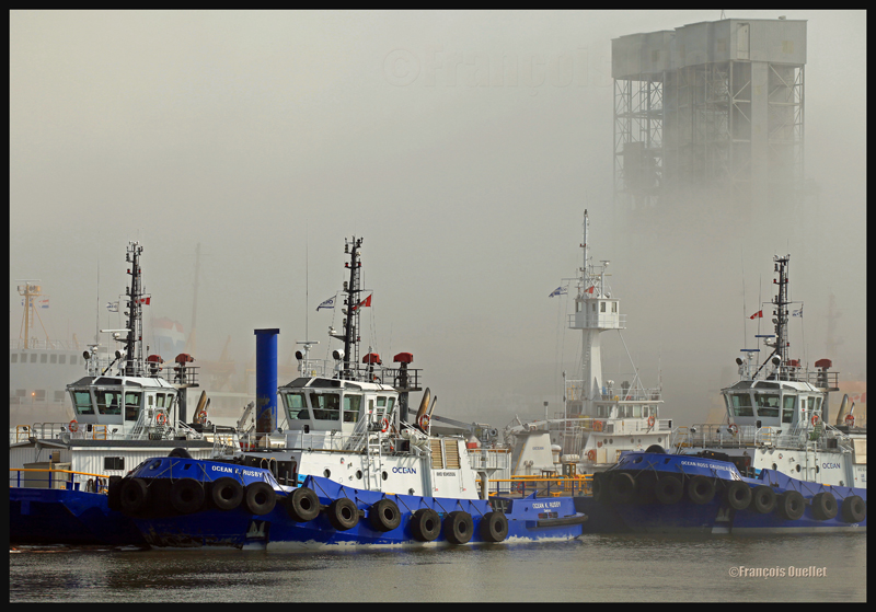
The opportunities for more interesting photos arise when you witness the first holes in the fog layer.
The Ocean tugboats during a dense fog in the Bassin Louise in Quebec (2012).
We can take into account the season to estimate the speed of the diurnal reheating of the lower atmosphere. A morning fog will need more time to dissipate from late autumn to early spring: that leaves more time for the photographer to prepare. The forecasts can announce the disappearance of fog while it will not be the case if, over your sector, there is an invading layer of stratocumulus preventing the morning sun from reaching the ground.
To determine if the fog is going to dissipate as expected or will remain and possibly intensify, watch the difference between the temperature and the dew point on the hourly meteorological observations issued by weather stations near your place of residence. If the temperature and dew point spread increases, the fog is going to lift. If the difference between those two decreases, the fog is going to persist and possibly intensify.
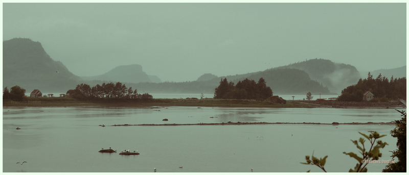
The mist
The mist can be qualified as such when the visibility is superior to ½ mile, but do not exceed 6 miles for an observer on the ground. If the visibility is of ½ mile or less, it is called fog. This photo of the Bic National Park, near Rimouski, shows the interesting effect that the mist adds to a beautiful landscape.
Mist in the Bic National Park, Province of Quebec (2009)
Hot and unstable air in winter
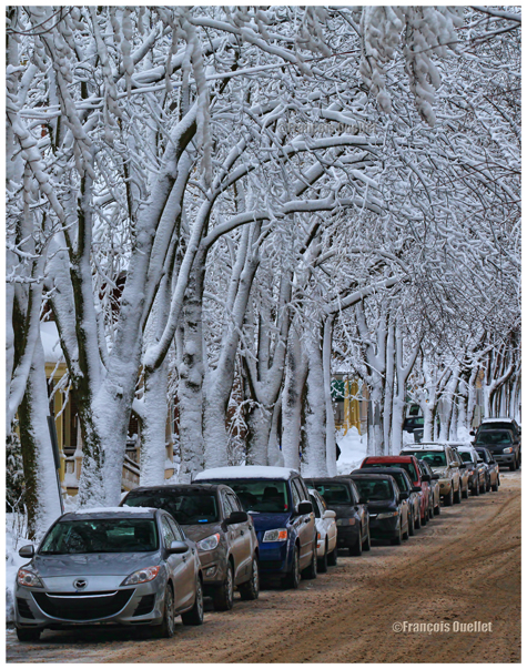
When there is a warm and unstable air advection (about 0 degrees) while winter has already settled, there are good opportunities for photos. A moderately developed cumulus produces significant snow showers and this snow sticks on all the surrounding objects. All that snow would have begun to melt on contact of objects if the latter had had a temperature superior to zero degree. But, the winter being already settled, the snow persists. It gives enough time to capture some souvenirs.
A Quebec City street after a snow shower
The local effects
A photographer might benefit from learning about the meteorological local effects influencing the regions he intends to visit. The local effects are often simple to understand and they repeat themselves regularly, according to wind and season changes. The knowledge of these effects allows the photographer to be ready and position himself even before the phenomenon occurs. It limits the comments like: “If I had known that it would occur, I would have settled down here one hour earlier!“
The local terrain as well as large size bodies of water produce predictable meteorological phenomenon that can be used by a well prepared photographer. It can consist of persistent fog, repetitive snowstorms over a small sector, strong winds, cumuliform clouds alongside the mountain summits, etc. By being positioned at the right place, at the right time, the desired photo can be realized.
A change in the wind direction
A change in the wind direction suddenly increases the opportunities of interesting photos. It might announce the approach of a cold front, a warm front, a sea or land breeze, etc. In the photo below, a bit of fresher air suddenly began crossing the St-Lawrence seaway at the end of the day, thanks to the approach of a weak cold front. The water was still relatively warm and the moisture which was present over the surface became visible due to the cool air supply. The conditions were now ideal for a short-term thin fog, as long as the wind speed would not increase. Just in time for a photo.
The new wood pellets silos in Anse au Foulon in Quebec City en 2014
Familiarization with weather radars
It can be useful to get acquainted with weather radars which, for the needs of photography, remain simple to interpret. Multiple echoes of small dimension with a steep gradient of various colors indicate precipitation resulting from cumuliform clouds. The showers associated with these clouds are often moderated or strong and will be the result of approaching towering cumulus or cumulonimbus (thunderstorms). A towering cumulus presents a dark base and a white summit to the photographer. At sunset, their vertical development can be used to emphasize the last rays of light.
The side of a towering cumulus (TCU) is benefiting from the remaining sunlight over Quebec
Large echo areas of similar colors of low intensity indicate a relatively stable air generally producing steady light rain or drizzle. This should be understood as a possibility of increased humidity limiting the visibility through mist or fog.
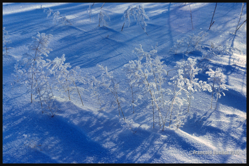
Hoar frost
Hoar frost is a short-term phenomenon. It is thus necessary to capture the scene before the sun melts everything. The photo below shows some small twigs on which hoar frost has settled. It was taken at the beginning of the seventies. Although the quality of the photo is not exceptional, the meteorological phenomenon is well demonstrated.
A combination of snow and hoar frost observed on a Quebec field in 1976.
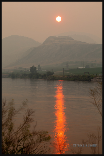
Forest fires
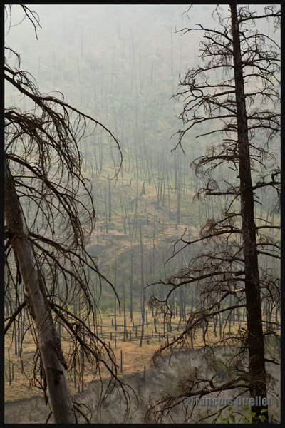
Wishing to make photos of western Canada during summer 2014, I came up against a season where hundreds of forest fires were raging. The smoke was covering some parts of Alberta and British Columbia. Some fires were important enough to require the closure of the sole highway connecting Lake Louise to Jasper. I thus decided to include the effects of those fires in the holiday souvenirs.
A visibility reduced in forest fire smoke allows a photographer to obtain, without special editing, sunsets with interesting colors.
Sunset and smoke from forest fires in Kamloops in 2014
The smoke also produces an effect similar as fog, but a fog which would be impossible to obtain at the end of a summer afternoon while the sun shines and there is a 38 degrees Celsius temperature.
An area near Kamloops, Canada, that was touched by forest fires in 2014
At dusk, the residual smoke is visible near tree tops while the setting sun strikes the mountain side. The effect is of two horizontal lines of complementary colors, blue and orange.
Forest fire smoke and sunset combined in Lake Louise, Alberta en 2014
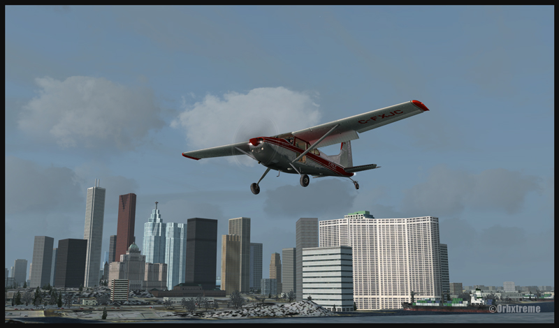
Flying over Toronto downtown shortly before the landing in Toronto Island (CYTZ)
I recently added, in the standard virtual flight section, a flight leaving Parry Sound for Toronto Billy Bishop.Here is an opportunity to learn a bit more about the Great Lakes region in Ontario. The Parry Sound airport, from ORBX, is a first creation by Vlad Maly for this province. The runway length is 4000 feet. Just beside the airport, there is a lake, Robert’s Lake (CRL8), with many cottages, floatplanes and sailboats that are visible when you select the appropriate season. The lake also offers 4000 feet for takeoffs and landings.
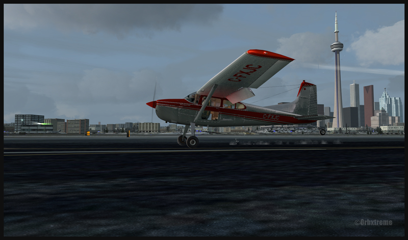
The actual flight has been made while the clouds were low enough that the flying altitude forbid the adequate reception of the Toronto Island (Billy Bishop) NDB (257khz) in the first half of the flight. A touch-and-go was made at Toronto International (CYYZ). MyTraffic2013 provided the airport with many AI aircrafts. Once over downtown Toronto, it was now time for Pilot’s FS Global 2010 to automatically install a maximum of buildings, for more realism.
On final for the Toronto Billy Bishop (Toronto Island) airport (CYTZ)
Landing at CYTZ with the CN tower in the background (FSX)
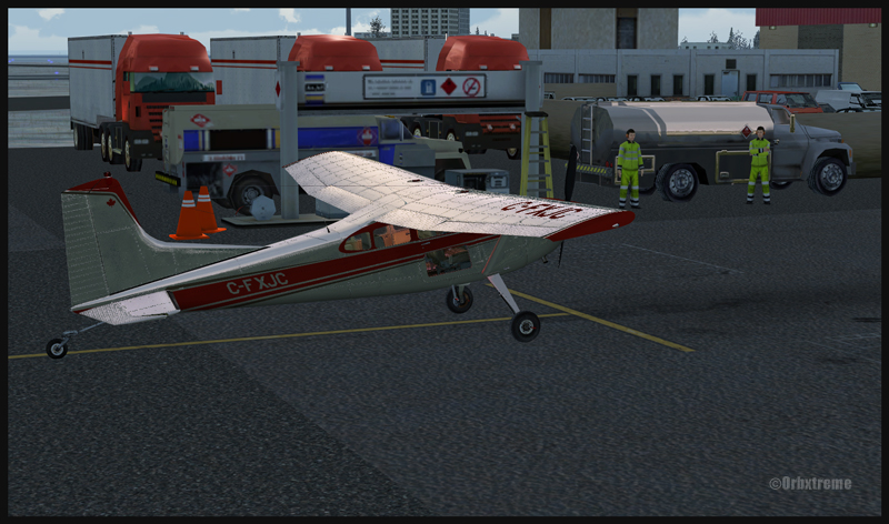
Finally, theToronto Billy Bishop (formerly Toronto Island) was modified by ORBX in order to make it more interesting and alive. You will thus find, on arrival, some staff to take care of the refueling process. Somes vehicules have also been added. Naturally, MyTraffic2013 took charge of AI aircrafts as CYTZ is quite a busy airport and needs some air traffic to enhance the realism.
Time to refuel at Toronto Billy Bishop (CYTZ)
I wish you a good flight, if you wish to try it out. I would suggest though, for a more interesting experience, that you install ORBX FTX Global Vector on your computer, as the Microsoft Flight Simulator (FSX)software does not do a good job when it comes to representing the Great Lakes area. ORBX Open LC for North America further improves the flying experience.
For more articles on flight simulation on my web site, click on the following link : Flight simulation
You must decide the ideal combination between the following: aperture, speed and ISO. All three are interrelated and choosing one has a direct influence on the other two.
You are facing a beautiful landscape in which you want everything to be in focus: you decide that the aperture is what matters the most. Choosing aperture as the priority is a very popular choice. Let’s consider that you choose F16, which should give you a very interesting depth-of-field but will demand a lot of light. You have to compensate somewhere. If there is not much movement in the scene, and you have access to a tripod, you might decide to choose a slow speed, which allows more time for the light to enter the camera. Doing so, you won’t need to crank the ISO and you will avoid adding useless noise to your picture.
In the picture below, aperture is set at F16. The vegetation in the left corner draws the viewer’s eye toward the pedestrians, and then progressively to the quai des Cageux. We finally see the Quebec bridge, the longest cantilever bridge in the world.
Quai des Cageux, Québec 2012.
If you decide that speed is a priority, you will have to compromise ISO or aperture. ISO will have to be increased to improve light sensibility, but doing so will increase the size of the grain in the picture. Depth-of-field will have to be adjusted as well since a higher speed does not let much light enter the camera. You won’t be able to pick F16 this time. So you will eventually find that there are some out of focus areas in your picture. With a bit of practice, you can be less demanding on the speed, providing you can follow the subject with your camera (it is like if you were slowing down the subject, so less speed is required).
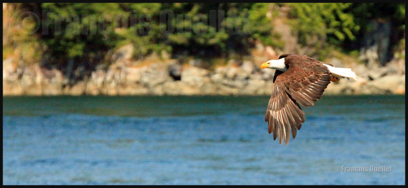
The picture below was a bit particular: it was taken when I was on a boat rocked by waves. The eagle was far away and was traveling in the opposite direction, thus increasing the relative speed of the subject. The Canon 5D MKII was hand held and 400mm focal was necessary. Speed was crancked at 1/1600 and the ISO required was set at 5000. Naturally, the grain in the picture being larger, slightly diminishes the quality. This was a necessary compromise if the eagle was to be taken in flight.
Eagle observed in the Campbell River region. Summer 2012.
It is getting dark and you want a photo with absolutely no noise and you decide that the aperture is what matters the most. You make no compromise and choose ISO 50. This setting requires a lot of light, because the lower the ISO, the higher the demand for light. In order to make sure that your picture will not be blurred, a tripod will be necessary, since there will be an extended exposition time. In the picture below, the shutter has been opened for ten seconds, with a 9.0 aperture, 200mm focal and 50 ISO. Only the small branches in the foreground are blurred.
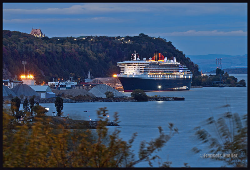
Note: in general, it is better to use a tripod as often as possible, even in daylight, in order to optimize quality. Choose a heavy enough tripod to prevent vibrations under windy conditions. A light tripod is easy to carry but does not allow for acceptable pictures in adverse weather. It’s obvious that this Queen Mary II photo would not have been as precise if a light tripod had been used. In this case, it would have meant that continual vibrations would have been recorded during 10 seconds. The boat would have been totally blurred.
(Precedent story: acquisition of an Inuit sculpture in Inukjuak in 1982)
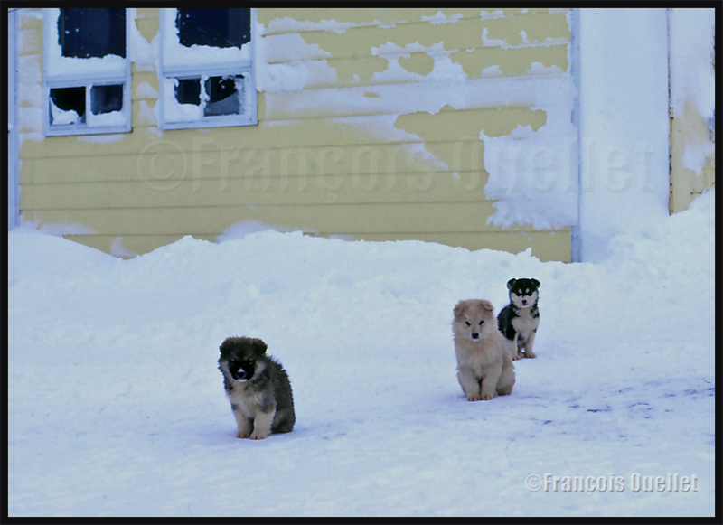
Canadian eskimo dogs in front of a house in Inukjuak in 1983
When I was working in Inukjuak (CYPH) in Northern Quebec as a flight service specialist (FSS) for Transport Canada, in 1982-1983, I liked walking along the Hudson Bay coast. One day, I got for company a big Canadian eskimo dog belonging to an Environment Canada employee. The dog had found a way to free itself from its leash and I took advantage of his company to explore the coast.
It was not and still isn’t frequent to witness unattended dogs on a territory inhabited by Inuits. During summer, the latter normally carry the dogs on nearby isolated islands along the Hudson Bay and Ungava coasts. Naturally, the Inuits come back at regular intervals to feed them. This was still going on in 2013 as it serves multiple useful purposes. According to an Inukjuak Inuit with whom I was discussing recently, the island allows the dogs some freedom of movement since they don’t need to be tied all day long to a short rope. Also, the dogs are more comfortable on the islands since there is far less mosquitoes.
In 1982, I heard rumors according to the fact that dogs left free might be brought down, but I did not witness such a thing. Local policy was such that stray dogs would not be tolerated because they presented a threat for the population. Of all that has been said concerning dogs that were brought down for the most diverse reasons, the recurrent story is the allegation of massacres of Eskimo dogs during the fifties and sixties. The documentation found in this respect states that about one thousand dogs were brought down during those two decades, most pointlessly, in the various villages along Hudson Bay, Ungava Bay and Davis Strait.
An interim report about the investigation on this subject was handed in 2009 to the Makivik Corporation and to the Government of Quebec by the retired judge Jean-Jacques Croteau from the Quebec Superior Court. We learn of this report that the RCMP as much as Sûreté du Québec police forces had participated in the elimination of sled dogs during those years, by interpreting in a personal and fairly restrictive way a law dating from 1941 and dealing with “The Agricultural Abuses Act“. When it was created, this text of law aimed at creating a system of non-responsibility for a person who would shoot down a stray dog according to specific conditions stipulated in the text of law. Reference was made here to actions taken against stray dogs attacking sheeps and farm animals.
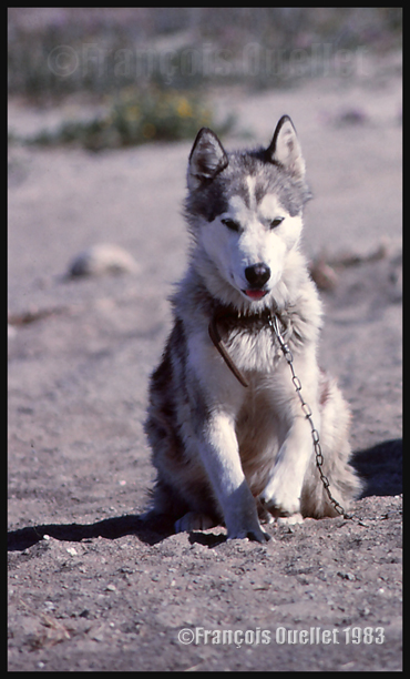
A Canadian eskimo dog (Jordan) in Inukjuak in 1983
The police quickly made excessive use of this section of the law to apply it on a territory which was not targeted by the law. I can make a mistake, but I believe that nobody ever observed an Inuit sheep farmer on a farm in the Arctic. The most important events occurred after the RCMP gave back the responsibility of the territory to the Sûreté du Québec. That police force showed a complete misunderstanding of the Inuit culture. According to the proofs presented in the report, policemen arrived in a village without warning and killed stray dogs, chasing them even under houses, without having taken care of verifying if the dog was sick or dangerous. We find in the report the testimony of two Kangiqsujuaq Inuits asserting having seen two policemen arriving by seaplane, and without saying a word to whoever it is, begin to chase stray dogs through the village. Thirty two animals were eliminated and the policemen left the village without giving explanations.
The report states that the Northern Quebec Inuits were never consulted as to the impact of the law on “The Agricultural Abuses Act”, a totally inappropriate law for them, not taking into account their ancestral rights. The Inuits depended completely on dogs for transportation, to go hunting and fishing. We can read the following passage, in the last sections of the report: “after 1960, the actions and the behavior of the police force went too far. Nothing was to be understood. The officers demonstrated a total lack of consciousness with regard to the fundamental rights of the Inuits, their culture and the importance of dogs for their subsistence. The behavior of the officers, which could not be ignored by the provincial and federal civil administrations, had a damaging effect on seventy-five dog owners and their family, compromising their capacity to meet their needs in food “. No help was offered by the authorities to compensate for the loss of dogs.
The judge finally noted that he had no other choice than to declare that Canada and Quebec did not respect their fiduciary obligations towards the Inuits. I imagine that monetary compensations have since been offered, unless this report was only the first step in the process aimed at establishing the responsibilities and some future compensation.
(Next story: the UFO invented in Inukjuak in 1983)
An American Trans Air Lockheed L-1011 is parked in front of the Iqaluit flight service station tower (Iqaluit FSS) in 1990.
The image above comes from a slide that was then digitalized 24 years later. Its quality is not optimal but the essential information is there: the presence in Iqaluit (CYFB), on Baffin Island, of a Lockheed L-1011 belonging to American Trans Air. During the refueling and customs procedures, the passengers were allowed to stretch their legs on the ramp. In the background is the Transport Canada flight service station (FSS) tower, where I used to provide air traffic services on VHF as well as HF frequencies to airliners crossing the atlantic ocean in the absence of satellite technology. Many heavy aircrafts were using Iqaluit on a regular basis as a stopover airport, like the extended DC8, Boeing B707, 727, 737. An Airbus A-380 even stayed for few days in order to be tested under extreme cold.
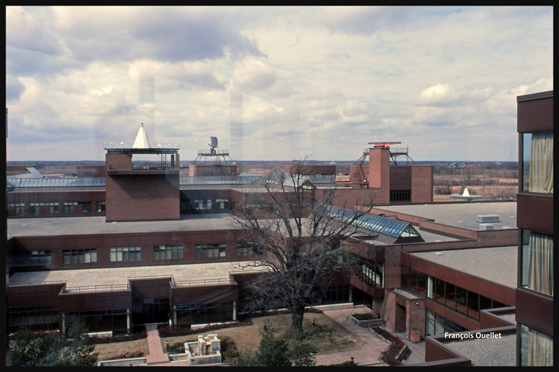
View of a small portion of the Transport Canada Training Institute in Cornwall, Ontario, in 1982
In the early 80s, the oil crisis forces airlines to greatly limit hiring. This was not the case during our pilot training course but becomes a reality when applying for a job a year later.
However, on the government side, the situation is quite different. The air traffic services branch of Transport Canada is looking for new employees to replace staff approaching retirement age. The only option immediately accessible to me is to apply as a flight service specialist (FSS). I have only a rough idea of what are the responsibilities, nothing more. But the pay and advantages are far better than what is otherwise available to a new flight instructor. It is time to send in an application.
For the Province of Quebec, two written examinations totally unrelated with aviation are held at the University of Quebec in Montreal. There are 1500 candidates (5 sessions of 300 applicants) who attempt these tests during the two days allotted for the first phase of the selection process. In the following weeks and months, those who have succeeded in the written tests must then undergo anything from personal interviews to language tests, medical examinations and security clearances.
We are now three candidates from Quebec heading towards the Transport Canada Training Institute in Cornwall. There will be thirty-five hours of theoretical and practical course per week, over a six months period. The pressure will be continuous and desired in order to eliminate candidates who may not react well to stress.
We will be paid to study. A candidate is guaranteed with a posting upon completion of training, providing he manages to obtain 80% and above on the written and practical evaluations. Because this 82-01 course is not dedicated to Quebecers only, it cannot be offered in French. So it is going to be in English only, and will include twenty-four students from almost all Canadian provinces.
The Transport Canada Training Institute in Cornwall is nothing short of exceptional for those who have decided to study and succeed.
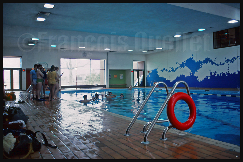
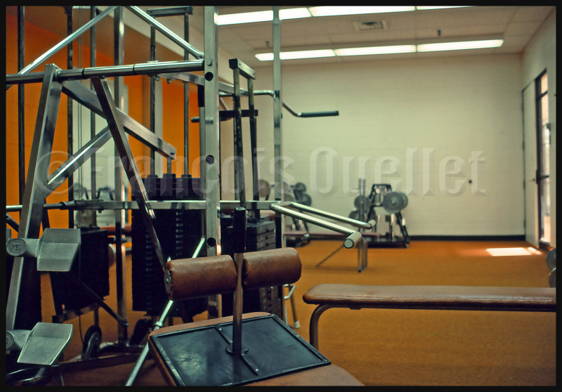
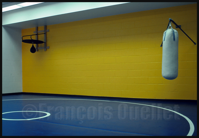
In order to help the student to deal with the weekly thirty-five hours of courses and examinations, the school provides interesting amenities.Each student has a private room with daily maid service. The cafeteria offers a good choice of meals. Calories can be burned at the pool, gym, weight room, on the tennis court or on the baseball field. A snack bar remains open for late-night cravings. A bank teller is made available to students, as well as a hairdressing salon, a bar, arcade games, pool tables, etc.
1982 Cornwall TCTI Pool
Transport Canada Training Institute weight room. Cornwall, Ontario 1982
1982 Cornwall TCTI combat room
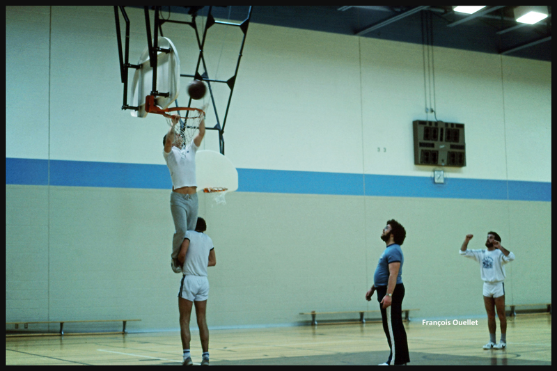
1982 TCTI, Cornwall. Students from the FSS 82-01 group are experimenting a new way to improve scoring at basketball.
1982 Cornwall TCTI games
So that we understand what lies ahead, we are told that there are traditionally many students in each class who will not keep pace and will be sent home, despite their efforts. For a francophone who wasn’t using a second language on a daily basis , it is clear that integrating new theory presented in English for seven and a half hours every day, five days a week, becomes demanding. I compensate for the times when my attention decreases by studying in the evening.
There is a library in the school as well as multiples rooms for flight simulators designed for every career considered by the students.
1982 Cornwall TCTI Flight Simulation Room
1982 TCTI Cornwall. Environment Canada upper air building.
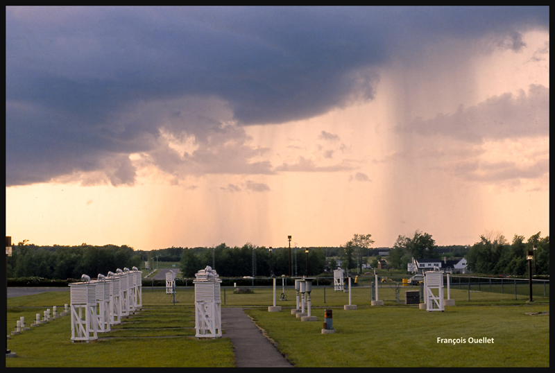
1982 TCTI Cornwall Stevenson screens
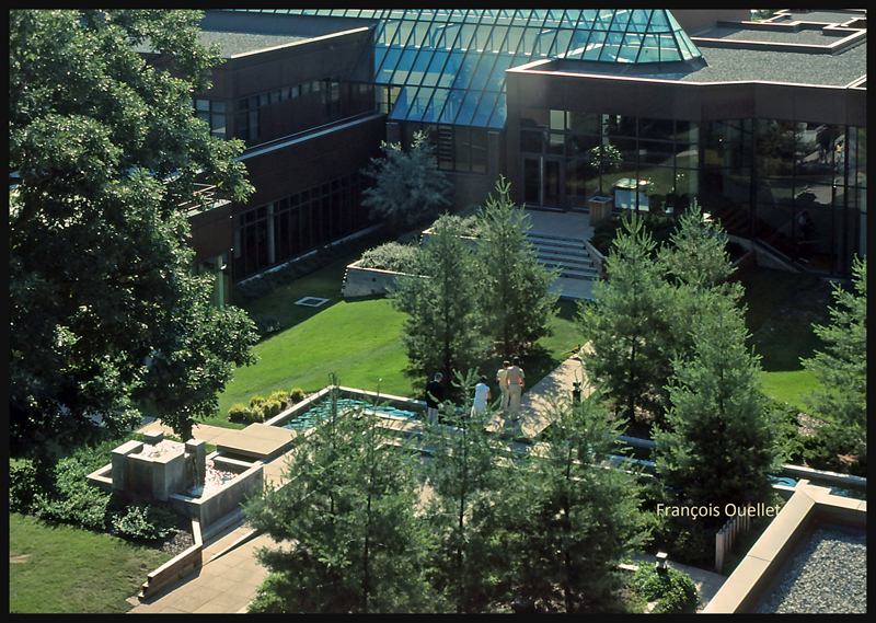
In the courtyard, there is a peacock and other small animals and a water source flows into a very well planned landscape.
1982 Cornwall TCTI courtyard
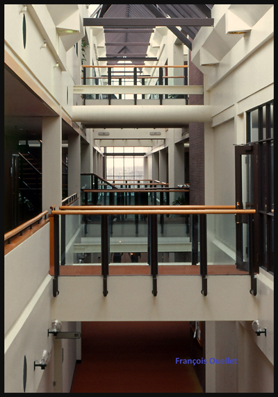
The amenities are simply stunning. The message is clear: “Transport Canada only ask you to study and succeed, it will take care of the rest.”
1982 Cornwall TCTI corridors to classrooms
Finally, the moment we were all waiting for as arrived. Students who managed to get through the course celebrate their graduation.
Assignments are distributed. Those who will be working in isolated postings, in northern Quebec, are well aware that the schedule does not include holidays. The FSS will be on duty every day. The new employee will be compensated for overtime and a more expensive cost of life. He will also benefit from subsidized rents.
My departure is planned shortly for Inukjuak (CYPH), along the east coast of Hudson Bay in the Nunavik. Life will soon change radically.
(Next story: enroute to the first posting: Inukjuak)
(Precedent story: the flight from St-Jean-sur-Richelieu to Edmonton)
In order to accumulate flying hours, I needed to become a flight instructor. The course was undertaken and my license obtained, after successful written and flying exams. Already having logged enough flying hours as pilot in command, I was able to receive a Class 3 license immediately. Technically, this meant that I did not have to receive permission from a chief instructor before I authorized a student to fly alone for the first time.
In order to study certain maneuvers with the greatest possible accuracy that I would have to teach, I sometimes practiced unusual flying exercises. This meant I needed to check the behavior of the aircraft if a student mishandled the controls before I could correct him. With enough altitude, you could afford a fair amount of improvisation.
So I decided, during one of these specific exercises, to simulate a student who had inverted the maneuvers required to stall an aircraft and bring it to a spin. The plane turned completely upside down and I heard noises indicating that the stress on the structure was possibly important. Needless to say, I decided to abandon some experiments, realizing that it was quite possible that certain leased aircraft had previously been engaged in similar exercises. We all want to end a flight with our aircraft intact…
A group of flight instructors working in St-Jean-sur-Richelieu in 1981
At the St-Jean-sur-Richelieu flying club, we were now eleven certified instructors. However, the number of new students was stagnating in the economic uncertainty of the late 70s to early 80s. A global recession was raging and unemployment soaring. Some airlines went bankrupt, others were freezing the hiring of new pilots. Eleven instructors in the same flying club was a lot for so few customers. The pay was meager.
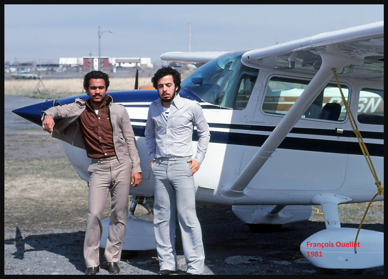
Among the students I trained during the period when I was a flight instructor, the first to successfully fly solo was an Egyptian. He arrived in Quebec with a group of a dozen compatriots. Their ambition was to receive all of their training in Quebec and return to Egypt as pilots for the national carrier EgyptAir.
Two Egyptian students at a St-Jean-sur-Richelieu flying school in 1981
My student had talent and learned quickly. But there was a student in the group that many instructors tried to train without success. Each of us thought that our own method might not have been appropriate so we encouraged him to try flying with other instructors. But it became clear that aviation would never be the field of activity in which he could progress and make a career. No instructor ever agreed to let him fly solo, and this, even after the student had spent months trying to understand the basics of flying: when came the time to execute the learned concepts, even after multiple demonstrations, he could not do it. He was simply not a safe pilot. I guess he changed his plan after the St-Jean experience.
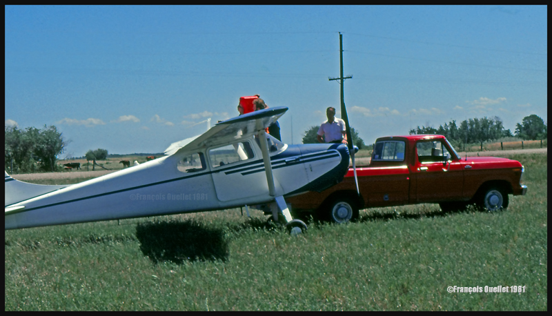
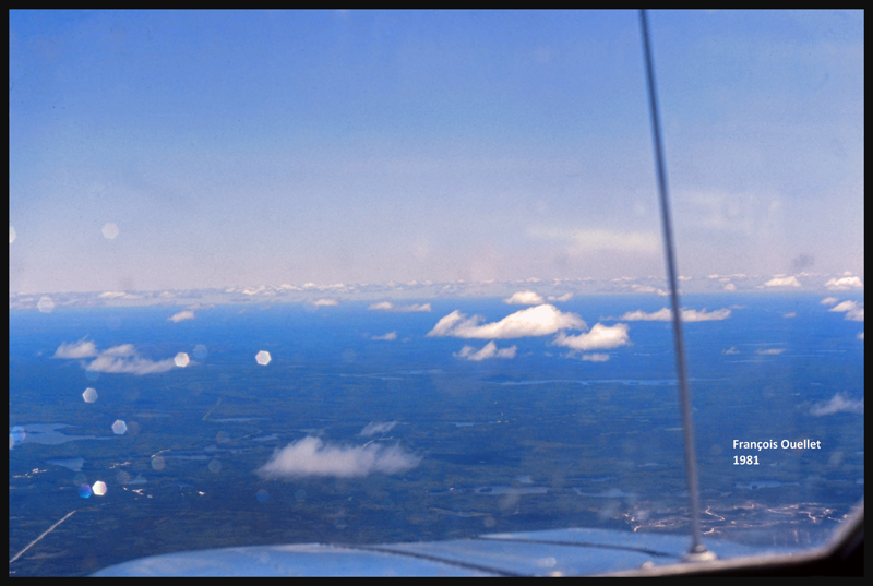
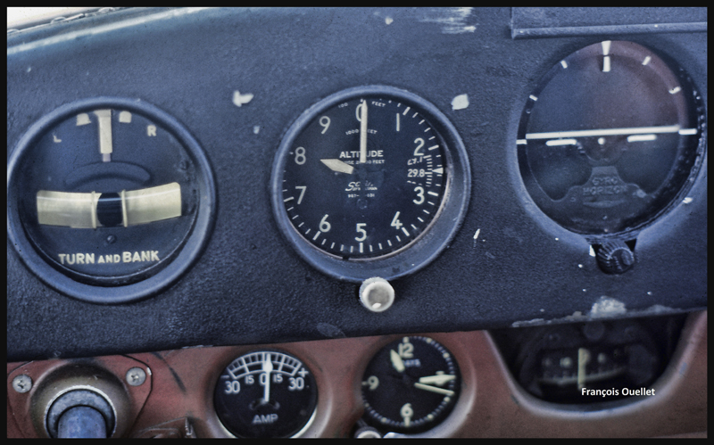
After a proficiency check, I soon find myself flying a Cessna 170B (tail wheel) on a flight across Canada, from St -Jean-sur- Richelieu, Quebec, to Edmonton, Alberta. I am accompanied by the aircraft’s owner who has not yet completed his private pilot course. The 1952 Cessna flies well, but has absolutely no instruments for air navigation, not even a VOR nor ADF. And the era of the portable GPS is not yet upon us.
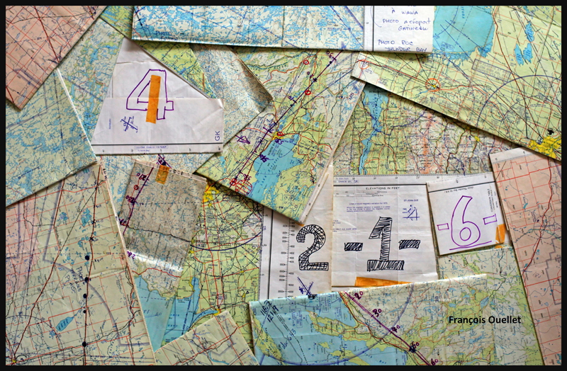
Fourteen 1:500,000 VFR charts, covering the planned flight, are folded, glued and numbered. I trace the expected flight path on each chart, with 10 miles landmarks. This will facilitate the monitoring of our progress, considering the absence of navigation equipment. The preparation now completed, the take off is done on a beautiful summer day of 1981.
1:500,000 VFR charts used for a flight toward Edmonton, Canada, in 1981
We do stopovers at Gatineau, North Bay, Sudbury and then fly along Lake Superior to Wawa.
Small break in Sudbury on a VFR flight to Edmonton in 1981
We fly around Lake Superior to our next stopovers, Thunder Bay and Fort Frances. Over large forested areas, with no major landmarks, the gyroscopic precession must be corrected frequently so as not to stray too far from the intended track. Sometimes when it facilitates navigation, we either follow a railway or main roads. There are some instances where the westerly winds are so strong that our ground speed is slower than a car on a highway.
From Fort Frances to Kenora in 1981, with a Cessna C170B
Our flight path follows a line that keeps us away from areas of high air traffic. I choose to fly north of Winnipeg terminal control area, thus avoiding frequent radio exchanges with air traffic control in a language I do not master. The underperforming radio would not be of any help at any rate. This option eventually means that we must fly over Lake Winnipeg, in its southern portion. We have enough altitude to be able to glide to the other side in case of an engine failure. Nonetheless, we realize that we are gradually loosing several thousand feet due to the cold air mass above the lake. This with maximum power applied. The unexpected descent eventually ends, but it is now impossible to have an engine failure without ditching in the lake…
The crossing of Lake Winnipeg with a Cessna C170B in 1981
Near Lundar, Manitoba, the aircraft’s old gauges indicate a significant loss of fuel. It is surprising since we refueled an hour ago. We must land the plane on the nearest runway, but the strong crosswinds exceed the capabilities of the aircraft. Nonetheless, an attempt is made with the result that only the left wheel accepts the contact with the runway. As soon as the right wheel also touches the ground, the aircraft becomes airborne again. A nearby field is selected to make a precautionary landing so that the fuel status can be verified. We fly at low altitude over the electrical wires and the cows in the adjacent field, and touch smoothly at a ground speed not exceeding 15 knots. A farmer witnesses the landing and arrives in his red pick-up to offer some help. The tanks are almost full, so the plane only needs few liters of gasoline. Once this is done, we take off westward. It appears that the old fuel gauges of this 1952 Cessna are now totally unreliable…
Landing in a field with a Cessna C170B in Lundar, Manitoba in 1981.
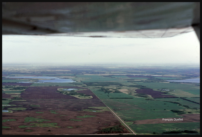
We leave Manitoba through Dauphin and enter Saskatchewan. If we were to experience an engine failure above such uniform fields, the risk of serious problems at landing would be virtually nonexistent.
Near Yorkton, Saskatchewan, in flight with a Cessna C170B in 1981
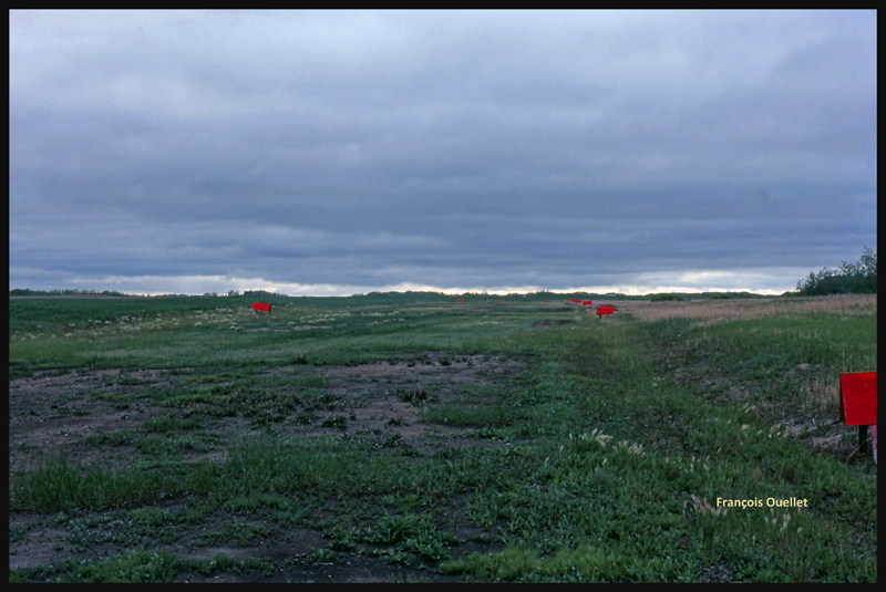
The weather is slowly deteriorating. We choose to land in Watson, Saskatchewan, on the nearest runway.
The runway surface consists of muddy earth and grass, and it’s delimited by small red wooden panels. As we touch the ground, the tires splash mud everywhere, including under the wings.
The Watson runway, Saskatchewan, in 1981
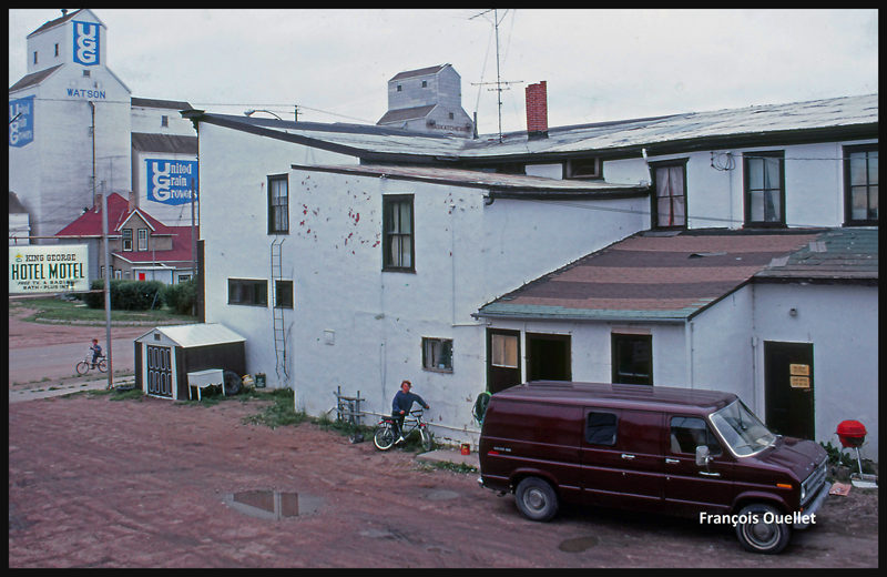
The King George motel in Watson, Saskatchewan in 1981
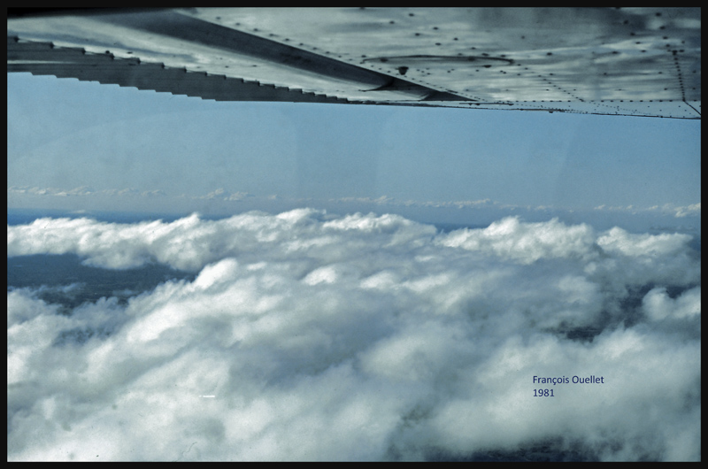
Finally, the weather improves and a takeoff is made toward North Battleford, the last stop before Edmonton. The sloping terrain forces us to fly lower and lower near Edmonton, under an overcast stratocumulus, limiting our ability to see a long time in advance the correct airport from the three available (international, civil , military ). Luckily, everything goes well in choosing the right airport and approach, but we cannot say the same with radio communications. The sound quality coming from the old speaker is awful and the English spoken by the air traffic controller too fast for us. The combination of these two factors causes the controller to repeat more than once his instructions until he finally decides to slow down and we can officially say: « Roger! »
After spending few days in Edmonton it is now time for the return flight to St-Jean. This proves to be much easier and faster because the westerly winds push the aircraft. Our ground speed is sometimes double what we had managed to get on our trip to Edmonton. The journey took us twenty-five hours to go and eighteen hours to come back.
Cessna C170B in flight over Canada, summer 1981.
Climbing to 9,500 feet on the return leg to St-Jean-sur-Richelieu, in 1981.
VFR “on top” with a Cessna C170B in 1981 over Canada
Over North Bay, Ontario, the weather is ideal. But we will have to land in Ottawa while waiting for thunderstorms to move away from Montreal and St-Jean-sur-Richelieu. After a total of forty- three-hours of flying time, the old Cessna 170B is landing back to St- Jean -sur- Richelieu.
(Precedent story: the commercial pilot license / a tire bursts on landing)
On a hot summer day of 1981, I was asked to fly a Cessna 150 to the Montreal Pierre-Elliott-Trudeau international airport to pick-up one of our flight instructors and bring him back to St-Jean-sur-Richelieu. The winds were blowing from the northwest, so runway 28 was being used. While I was in final for that runway, the air traffic controller realized that he did not have enough separation between my plane and a heavy one that was also in long final. He told me “Increase your speed, there is a Boeing 727 behind you”.
It is very easy to increase the speed of an airplane while maintaining an altitude. You just push the throttle and the speed increases. However, when the aircraft is above the threshold of the runway, it needs its specific speed to touch the ground otherwise it continues to fly until the appropriate speed for landing is reached. It seemed to me that the Cessna floated for an eternity before finally touching the runway. But it eventually worked out well and I exited the runway before an overshoot was required for the Boeing.
So I parked the aircraft near Transport Canada’s offices and waited for the instructor for about thirty minutes. Clouds were rapidly covering the sky in this late afternoon, with all the humidity and an already high temperature. When the instructor finally showed up and we proceeded with the taxiing procedure, the air traffic controller told us: “You must accept radar vectors for your departing route because of the weather.” What weather? A cold front was at work, but nothing serious was visible from our position. So close to the airport terminal, all we could see were towering cumulus, nothing else. We accepted his offer in order to be allowed to leave the airport.
The take-off was made from runway 28. I made a left turn toward St-Jean. We soon understood why radar vectors had to be followed. A storm had developed between Montreal and St-Jean. We observed what looked like five cylinders created by heavy rain. Lightning was also occasionally visible. We had to fly between the cylinders to avoid the most problematic areas. We tightened our seat belts just as the first bumps were being felt, making our altitude vary considerably. Knowing what I know today about flying in bad weather, I would not attempt another flight like this one, especially without an onboard weather radar.
The flight ended nicely with a smooth landing in St- Jean, outside of the problematic weather area. A few weeks later, I was asked if I would accept to be captain for a long flight across Canada. This unexpected offer represented a great opportunity, especially since it would allow me to log more than forty additional flying hours.
(Next story: a visual flight (VFR) from St-Jean-sur-Richelieu, Quebec, to Emonton, Alberta)