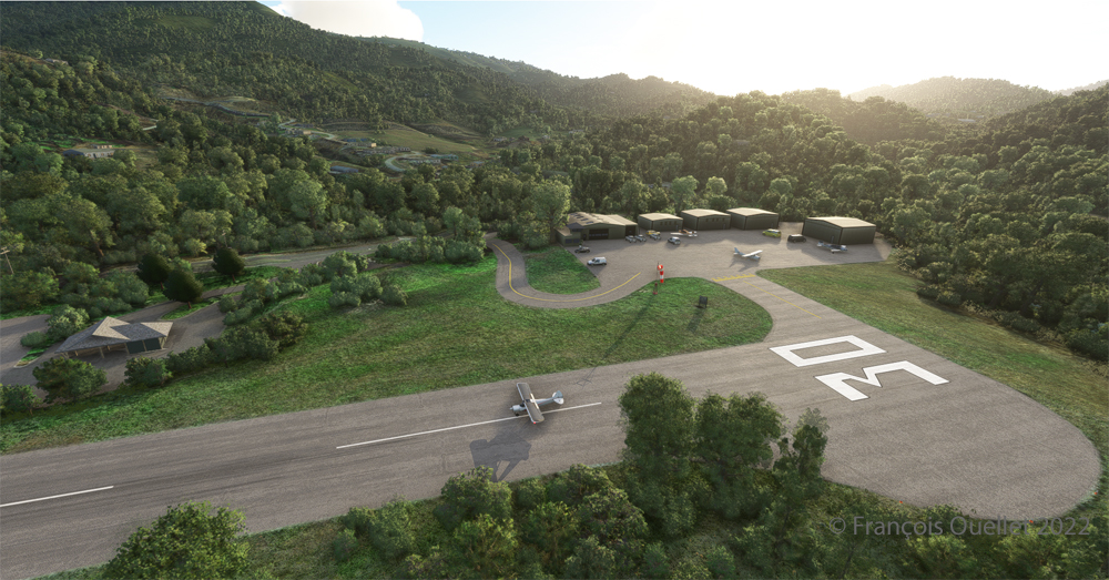
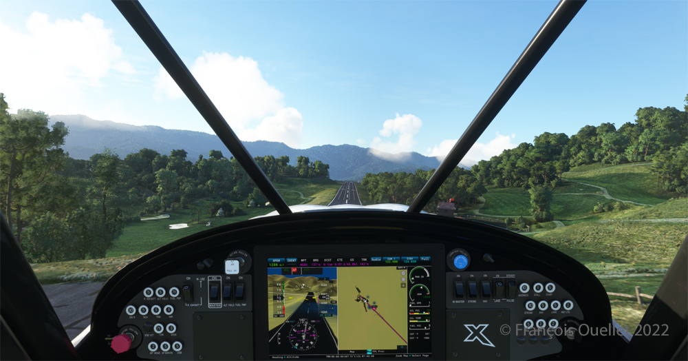
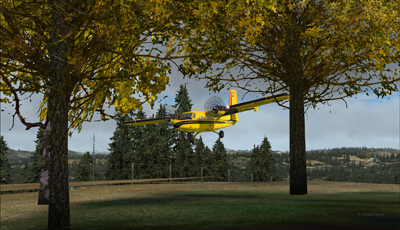
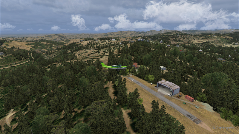
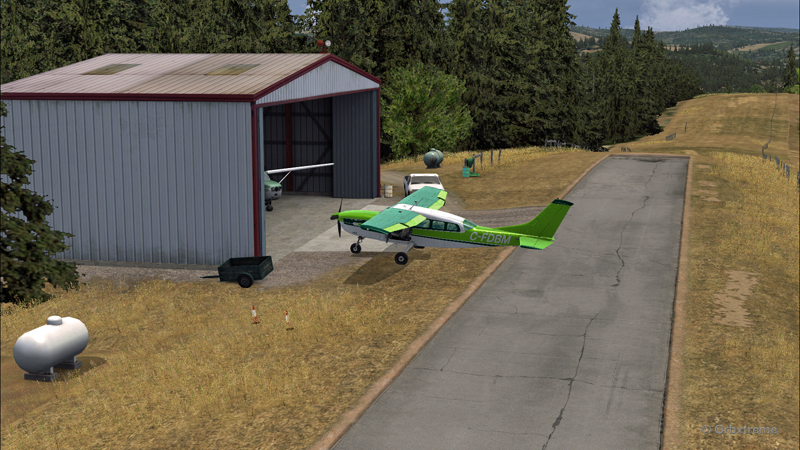
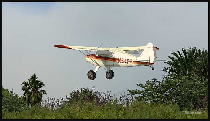
Ready for departure at the Elk River airport (NC06) created by Cloud Studio.
Today’s twenty-minute virtual flight is conducted using Microsoft MSFS 2020 flight simulation software. The virtual airport at Elk River (NC06) in the United States, modeled here by Pilot’s, is located at approximately 3468 feet (ft) above sea level (MSL). Its sloped 12/30 runway can accommodate many types of aircraft as its dimensions are still 4600 feet long by 75 feet wide. A golf course is located near the airport facilities.
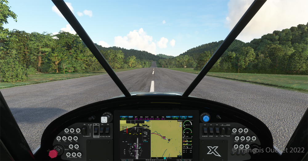
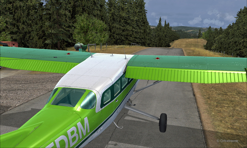
The sloped runway of the Elk River airport (NC06) with the MSFS 2020 flight simulator.
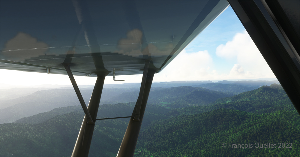
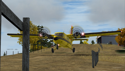
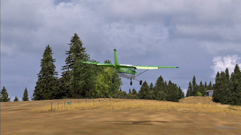
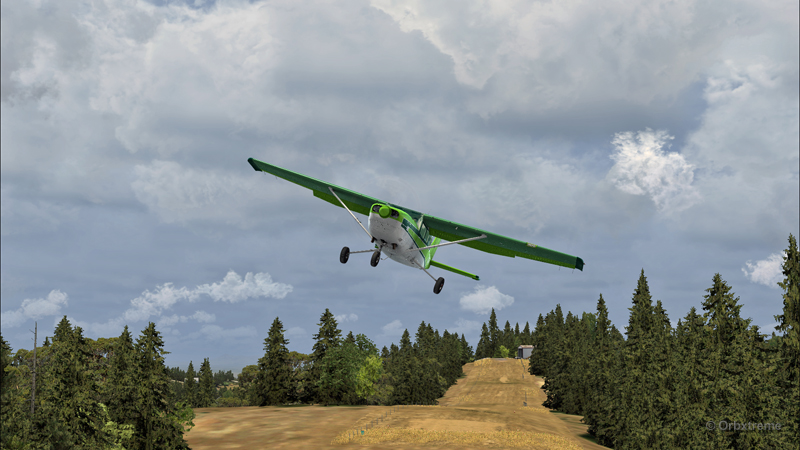
In the distance, the end of runway 30 can be seen rising rapidly. The trip to Mountain Air County Club Airport (2NC0), modeled by Cloud Studio, is made with a single engine Cubcrafters NX Cub.
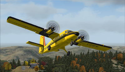
Enroute towards the Mountain Air County Club (2NC0) airport from Elk River (NC06) with MSFS 2020.
In direct flight with GPS, the virtual pilot will have to climb at around 7000 feet msl to avoid the surrounding mountains. It is therefore important to adjust the air/fuel mixture during climb and descent for the destination. Also, don’t forget to adjust the altimeter (press “B”) as you move away from the point of departure. Near the summits, you will experience mechanical turbulence, which is normal.
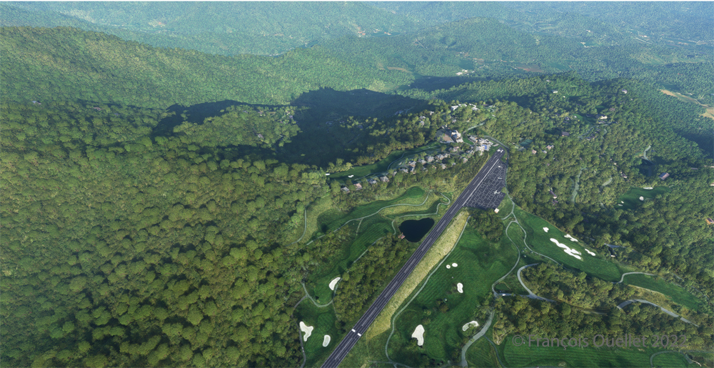
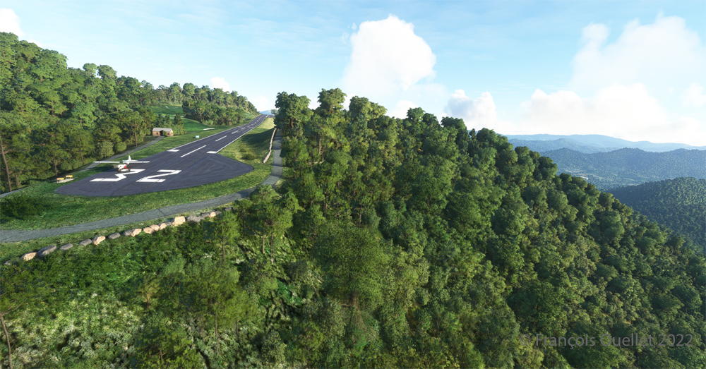
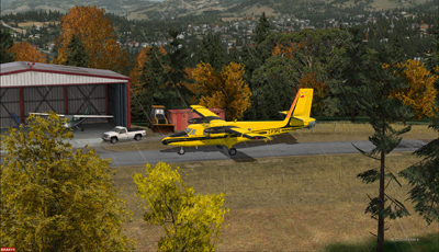
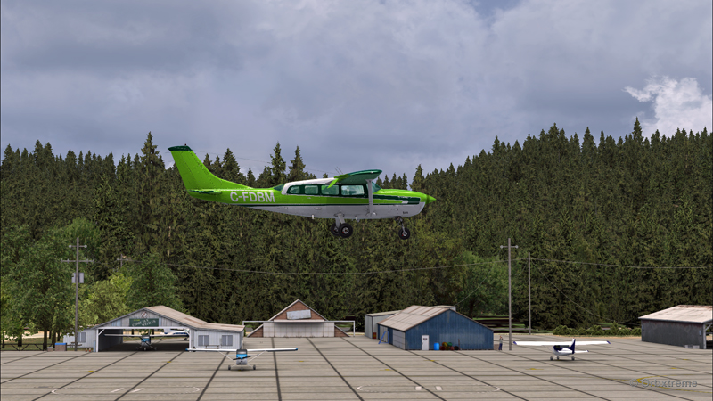
Aerial view of the Mountain Air County Club (2NC0) airport created by Pilot’s.
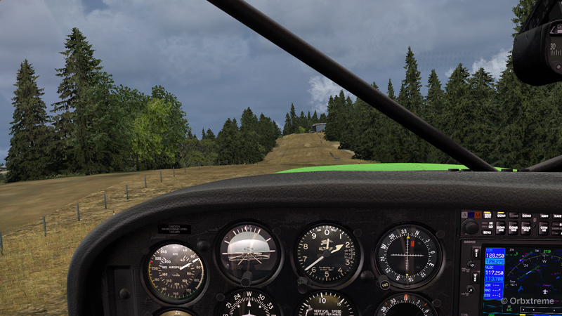
The photo above shows the virtual airport of Mountain Air County Club (2NC0) with the MSFS 2020 flight simulator. The sloped runway is 2900 feet long and only 50 feet wide. A golf course surrounds this airport located at 4432 feet MSL. Since the winds are light, the approach will be on runway 14.
On final for the sloped runway of the Mountain Air County Club (2NC0) airport using MSFS 2020.
On final approach, it is easy to see the uphill angle of this airstrip, which is slightly more damaged than the one at Elk River.
A view of the cliff at the threshold of runway 32 at the 2NC0 Mountain County Air Club airport created by Pilot’s pour MSFS 2020.
As we continue to taxi to the end of runway 14, we notice the cliff that awaits the pilot who has not properly prepared his landing. No forgiveness!
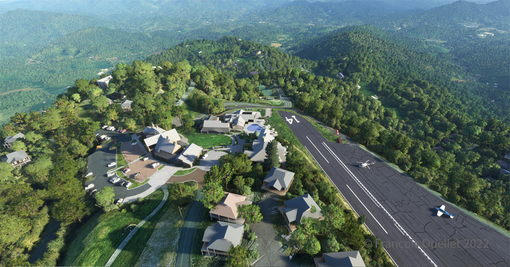
View from above of the Mountain Air County Club airport 2NC0 with the MSFS 2020 flight simulator.
An elevated view shows the threshold of runway 14 and the buildings associated with the golf club. A few golf loving pilots have already parked their aircraft to the left of runway 14. For this screenshot, I used the excellent X-BOX drone.
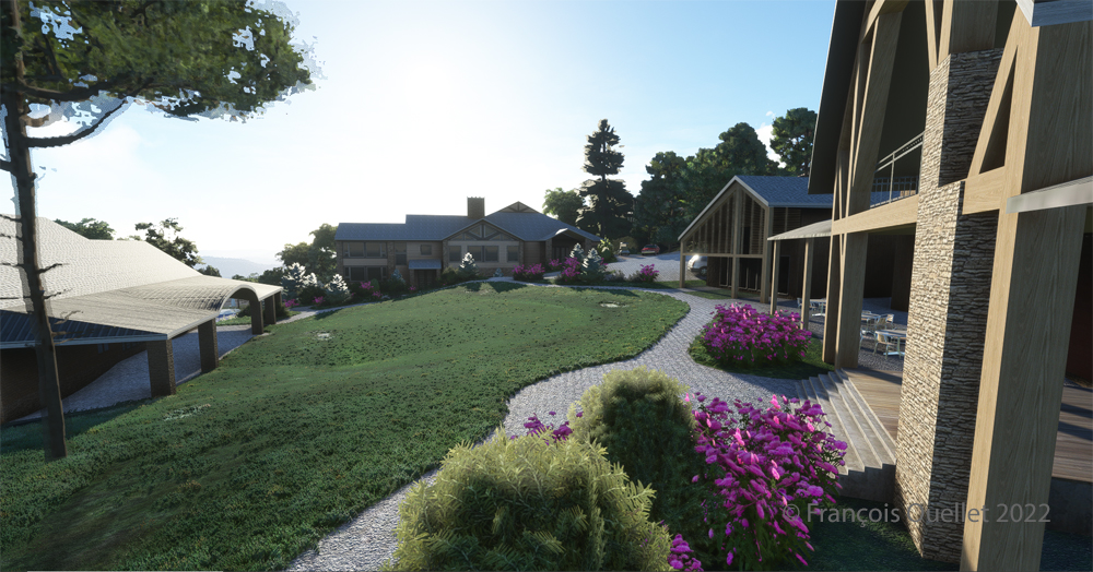
Buildings and flowers at the Mountain Air County Club airport (2NC0) created by Pilot’s for MSFS 2020.
A final photo shows the buildings and flowers associated with the golf club. The bird recordings are easily heard, which enhance the scene. Flight simulation enthusiasts wishing to repeat the experience should do so under VFR conditions to keep an eye on the mountain tops during the approach.
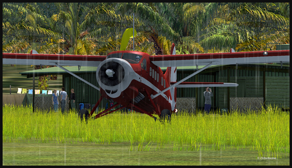
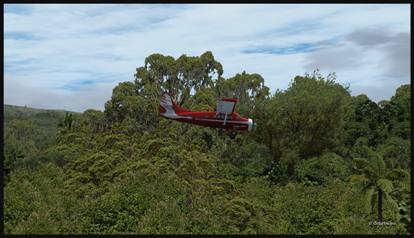
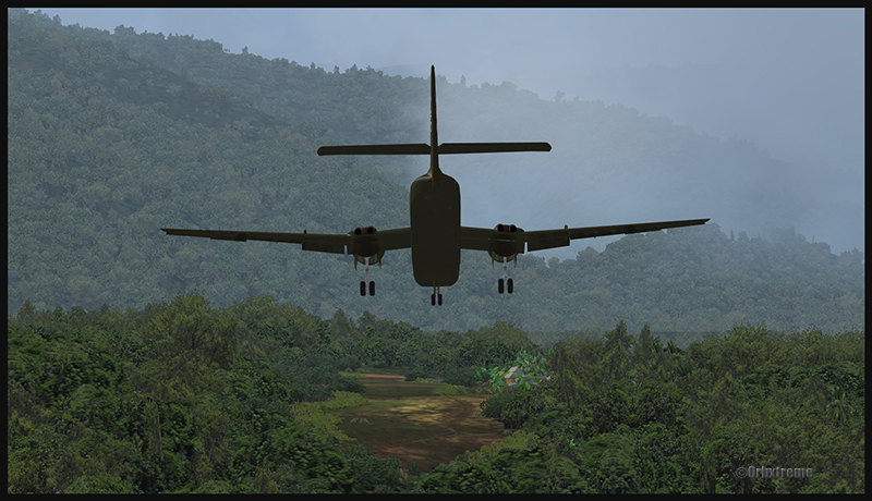
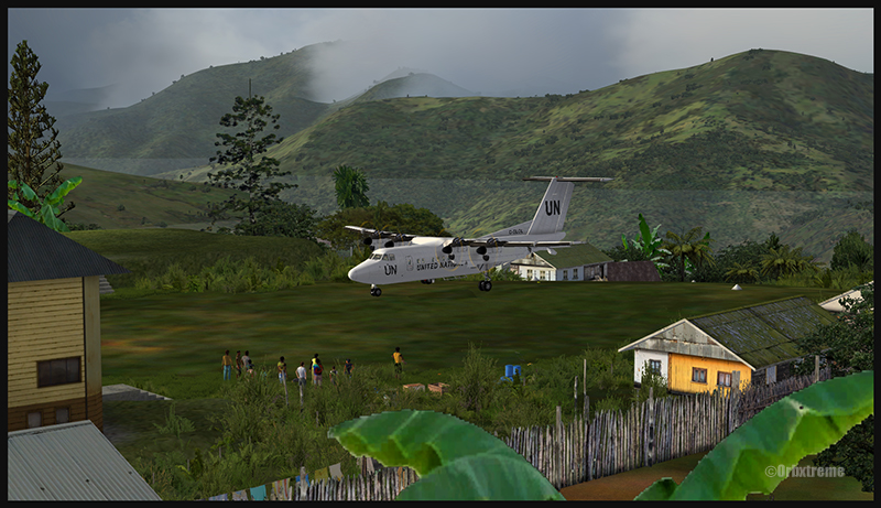
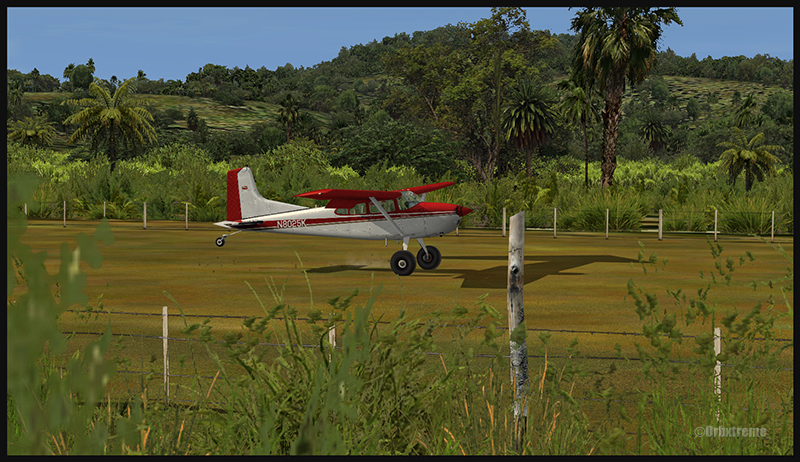
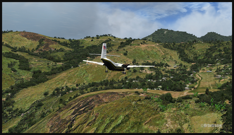
An Air Saguenay DHC-3 Otter has made it from Québec to Kokoda, in Papua New Guinea. It is expected to work around the remote mountain airfields for a while.
The Air Saguenay Otter is taxiing for the Kokoda runway towards Launumu in Papua New Guinea.
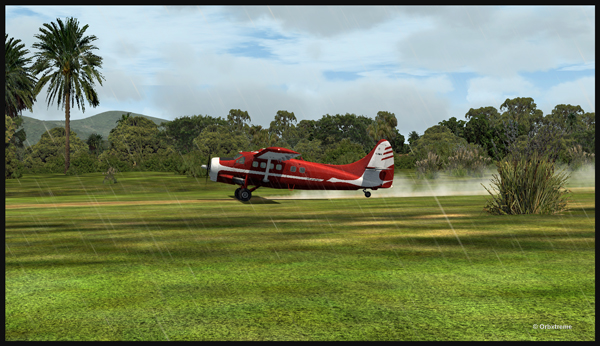
Today, the Otter heads for Launumu, a mountain airfield that is at an elevation of 5082 ft asl and 1200 feet long.
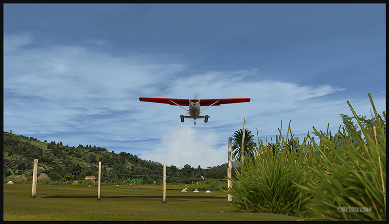
The Air Saguenay Otter departing Kokoda.
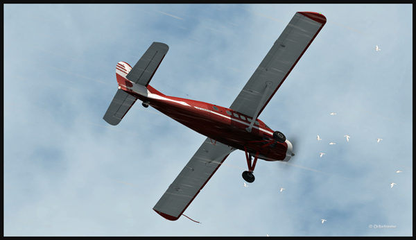
The pilot has to watch for the birds in order to avoid any collision in flight…
Otter aircraft and birds.
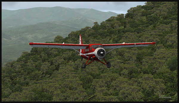
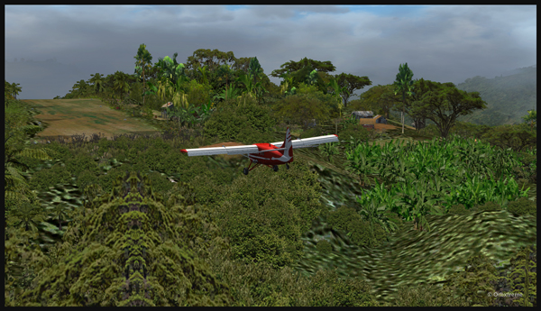
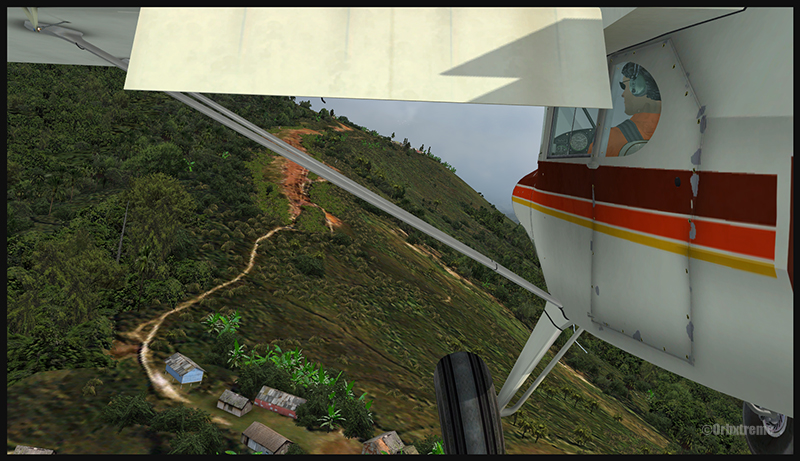
Following the Kokoda trail is a good way to reach Launumu.
The Otter in the Papua New Guinea mountains, following the Kokoda Trail.
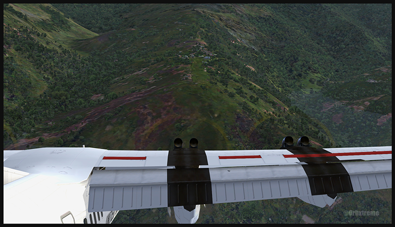
If the mixture is not adjusted, the Otter will lose a lot of steam trying to climb up to 7,500 feet to cross the first line of mountains.
Inside the Otter cockpit, with the mixture adjusted.
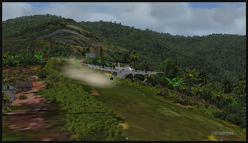
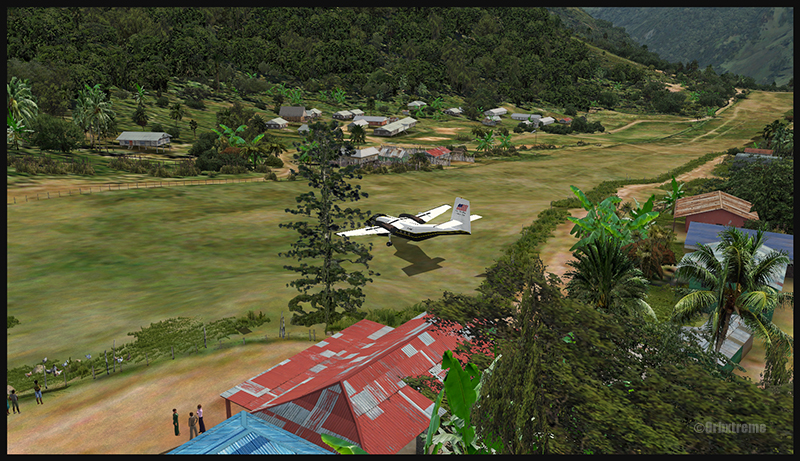
Anybody landing and departing from Launumu deals with high density altitude. This is not only due to the elevation of the airfield but also to the very warm and moist air present in the region. Consequently, some additional airspeed is required on the approach and on the departure.
The Launumu runway is in sight.
When a pilot lands southwestward in Launumu coming from Kokoda, he must dive in a valley to lose altitude, which will increase the aircraft’s airspeed. The Launumu runway is in sight.
If the airspeed is not promptly corrected, the approach to the Launumu runway will be too fast. Any airspeed above 60 knots forces the pilot to overshoot (unless you are ready to virtually die a few times while trying).
Losing altitude while respecting the flaps speed limit.
So, once the higher mountains are crossed, a good way of losing altitude without gaining airspeed is to use flaps (at the corresponding airspeed) and do a tight 360 degree coordinated turn while descending. That way, the pilot will end up in line with the runway and at the speed you want, which is around 50 knots.
Turning and descending in the valley during an approach for Launumu.
The Otter floats endlessly because of its huge wings.
The Air Saguenay Otter is on approach for the Launumu short runway in Papua New Guinea.
On final for Launumu, the pilot might end up having to deal with the bushes that are close to the runway. It is not unusual for the Otter or the Beaver to complete a difficult approach with bushes wrapped around the landing gear.
A Air Saguenay Otter is on final for the Launumu mountain runway.
A Otter aircraft is arriving on the Launumu high altitude runway.
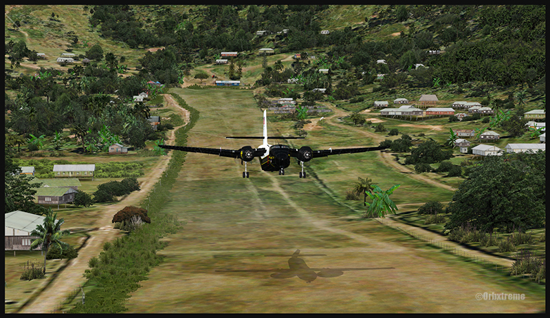
Launumu has a surprise for the newcomers. If the pilot lands southwestward, like it was just done here, and the aircraft is not stopped within approximately 600 feet, it starts accelerating since there is a pronounced slope downward in the second half of the runway. This slope leads to a cliff. In case of a missed approach, the pilot can use the slope downwards and dive in the valley at the end of the runway to build up airspeed and start a new approach.
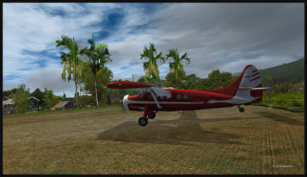
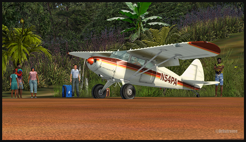
Now that the hard work is done, it is time to wait for the passengers and cargo, and plan the next leg…
A Otter aircraft is backtracking the Launumu runway after landing.
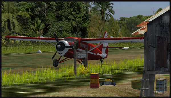
A Otter aircraft is parked on the Launumu runway in Papua New Guinea.
The virtual scenery and clouds required softwares like REX, REX Texture Direct, Cumulus X, FTX Global, FTX Global Vector and Pilot’s FS Global 2010.
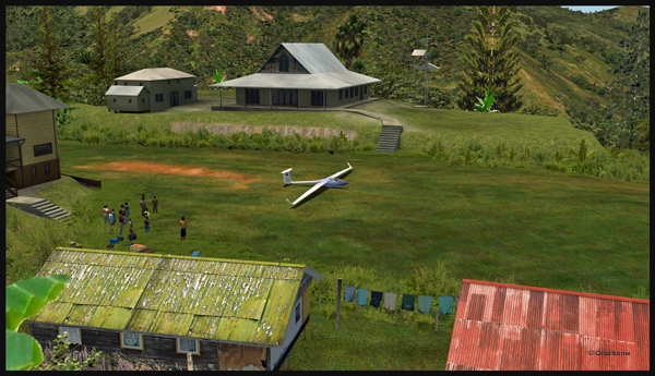
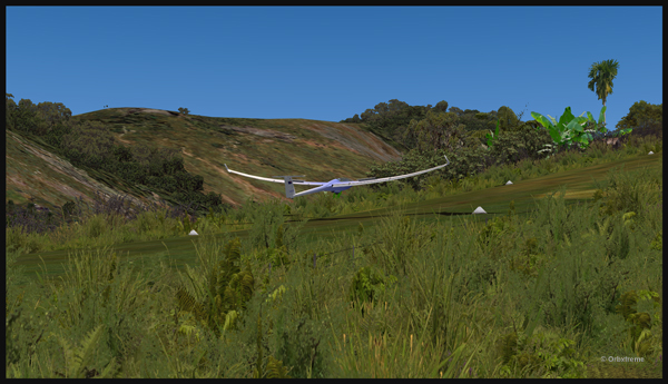
Well, that is it! The first glider just arrived at the Fane Parish airport in Papua New Guinea…
Glider on the Fane Parish short grass runway in Papua New Guinea.
Before it is officially offered as a tourist attraction for the region, some attempts at taking-off and landing must be done. The first trial attracts a few people!
Aircraft and glider on the Fane Parish mountain airfield.
The descent along the twelve degree sloped runway is a bit rough for the glider’s low wings, as there are some bushes that will have to be trimmed!
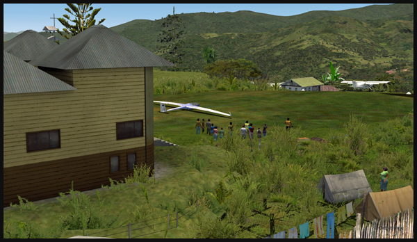
An aircraft pulls a glider after the take-off from the Fane Parish sloped runway in Papua New Guinea.
The weather is nice and very warm. The only potential problem is the mountain ahead.
Glider being towed by an aircraft after the take-off from the Fane Parish mountain airfield.
Finally, the pilot cuts the link. He is free to go!
The link is cut between the plane and the glider after the take-off from Fane Parish.
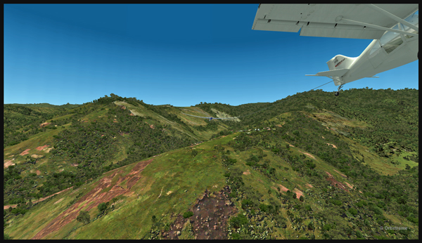
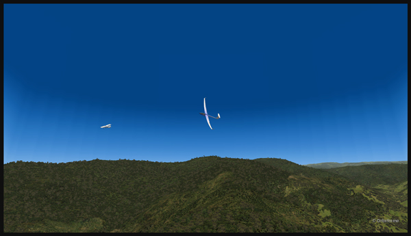
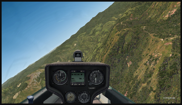
The glider flies silently over the lush area of Papua New Guinea.
Virtually gliding over the Papua New Guinea territory (FSX).
Using the rising warm air currents, the glider gains altitude.
The glider gains altitude.
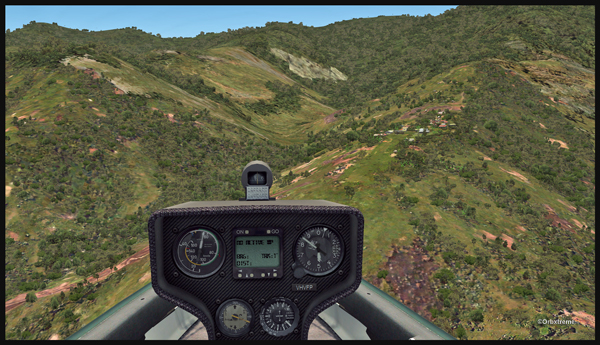
Why not a pass over Fane?
Gliding over the Fane Parish village.
Here is another isolated village alongside a mountain.
Flight with a virtual glider over an isolated village of Papua New Guinea.
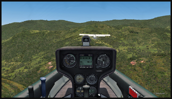
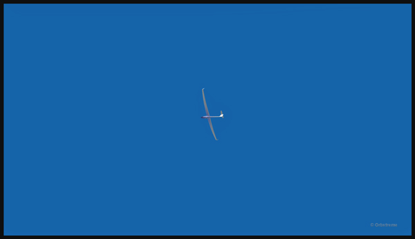
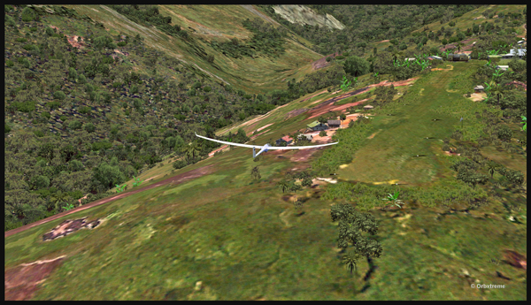
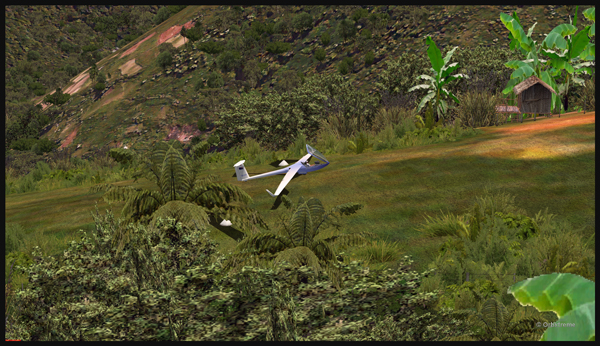
A last steep turn in order to realign for the approach at Fane Parish.
Last steep turn for a short landing on the Fane Parish mountain sloped runway.
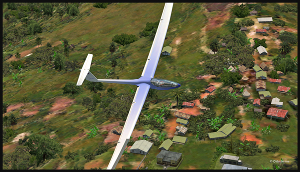
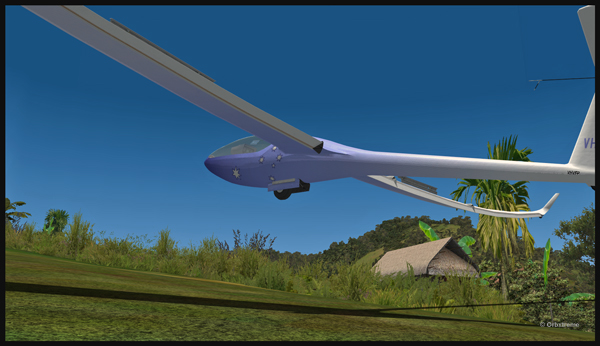
The airbrakes are out and the speed reasonable. The sloped runway is just ahead, on top of the mountain to the right.
Approach of a glider on the elevated airfield at Fane Parish in Papua New Guinea. The speed and angle of approach are right on target.
Keeping just enough altitude on the approach to be safe.
Glider approaching the 12 degree sloped runway of the Fane Parish aerodrome.
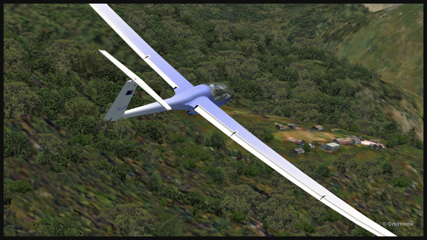
Now that the landing is a sure thing, it is time to use the airbrakes again to slow down as much as possible.
Virtual glider arriving over the Fane Parish runway in Papua New Guinea. The airbrakes are being used.
Keeping in mind that this mountain airfield as a good slope, it is better to have a bit of extra speed. Nobody likes to stall a few feet over a runway!
Virtual glider with airbrakes over the Fane Parish runway
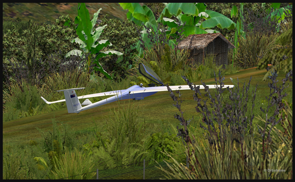
What an experience it was! But I’ll need some help to pull the glider up the slope!
Glider on the Fane Parish runway
The virtual flight was great, the view was worth every penny, and I think that this could become a new touristic attraction for the region and the more wealthy visitors…
The glider has landed on the runway at the Fane Parish airport in Papua New Guinea.
The virtual flight below was made with the FSX flight simulation platform. The last time I flew at Limberlost Ranch, I used a Cessna C-207 ( The Cessna C-207 in Limberlost Ranch ).
This time, I tried the sloped and laterally uneven runway with a Twin Otter. This one is painted with the real colours of the Province of Ontario Ministry of natural resources (C-FOPG). The only problem I expected was regarding the larger wings of the Twin Otter once close to the hangar.
On final for the Limberlost Ranch runway
Twin Otter C-FOPG approaching the Limberlost Ranch short runway
Finally, everything went well. The only difficulty was to manoeuver near the hangar to reposition the aircraft for take-off. With several ajustments to the propeller’s pitch, I was eventually able to turn around.
Arrival at Limberlost Ranch of the Twin Otter C-FOPG
Virtual aircraft belonging to the Ontario provincial government turning around on the Limberlost Ranch runway.
Since the fence is low enough, it is not a problem for the aircraft’s wings.
Virtual aircraft C-FOPG rolling on the Limberlost Ranch (CA21) runway.
Near the grass runway’s threshold are a few tall trees that require, for safety measures, a slight banking. Just in case…
Limberlost Ranch is a fun challenge. It is part of a package called Blue-Canyon Nyack and sold by Orbx. If this is not challenging enough for the flight simulation buff, it is always possible to add strong direct crosswinds and that should do it!
An interesting challenge for flight simulation enthousiasts consists in searching and intercepting virtual aircrafts that are flying randomly: those without any known flight plans.
The degree of difficulty varies accordingly with the intercepted aircraft and the interceptor.
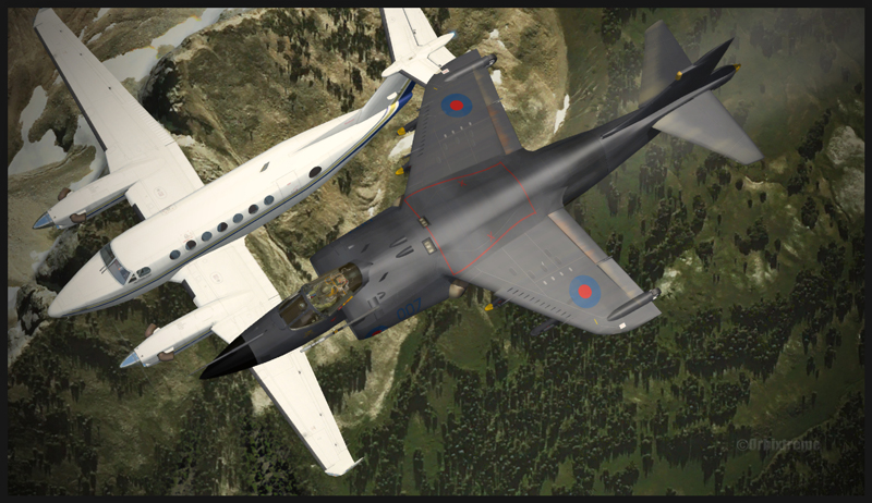
The screen capture below shows a relatively simple interception since it is not too difficult for the AV-8B Harrier to modify its speed according to the high cruising speed of a Beechcraft B350.
Virtual Beechcraft B350 aircraft intercepted by an AV-8B Harrier.
In order to increase the difficulty, the flight simmer could attempt the interception in flight of a relatively slow aircraft with a military jet.
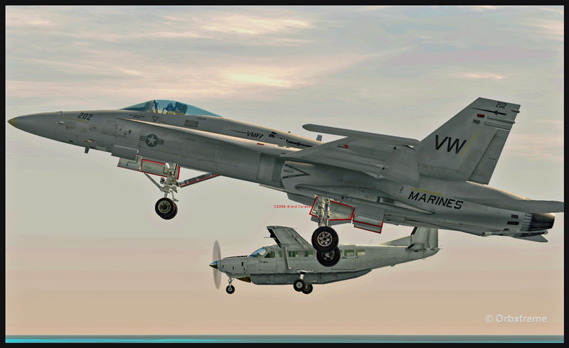
A challenging virtual flight can be executed by using a CF-18 and adapting its speed and altitude to that of the intercepted aircraft while flying in formation for one minute. In order to succeed, it will be necessary to set the CF-18 in a slow flight configuration with the wheels out.
Virtual Cessna C208 aircraft intercepted by a CF-18
This type of interception is sometimes done in real life when an aircraft accidentally (or not) enters a restricted zone. A military jet must then take-off, reach the unknown target, get very close and make the appropriate signals ordering it to follow him to the closest military base.
Once in flight, do not forget to take a screen capture! Good luck and have a good flight!
Manually flying a huge aircraft like the MD-11F to make a virtual landing in Innsbruck surely will be fun for most flight simulation enthusiasts. Since the Innsbruck airport and its surroundings have been redesigned under ORBX Innsbruck, the immersion feeling is total. The landscape is absolutely fantastic.
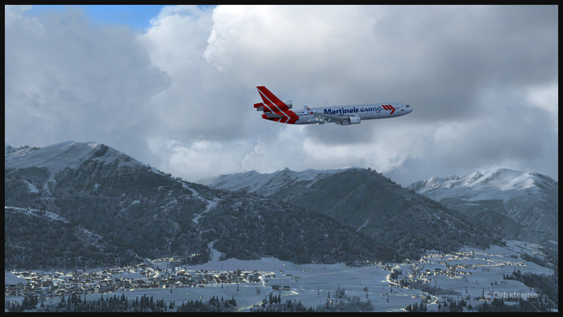
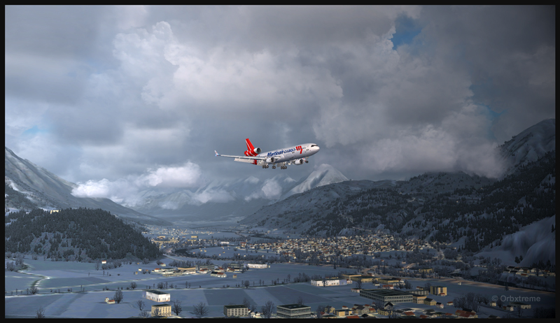
A virtual Martinair Cargo MD-11F is airborne from runway 26 at the Innsbruck airport (LOWI)
Start by taking-off from runway 08. Anybody standing near the fence at the end of the runway will feel the blast. Then, gain enough altitude to be able to do a 180 degree turn to realign the aircraft for runway 26.
A PMDG MD-11F preparing for a visual approach runway 08 at Innsbruck
Make sure to activate the “air turbulence” option on your virtual weather engine, since an approach near the mountains in Innsbruck generates enough turbulence to make your approach more difficult. The pilot must also, for this exercise, deal with the actual winds even if they do not favor runway 26.
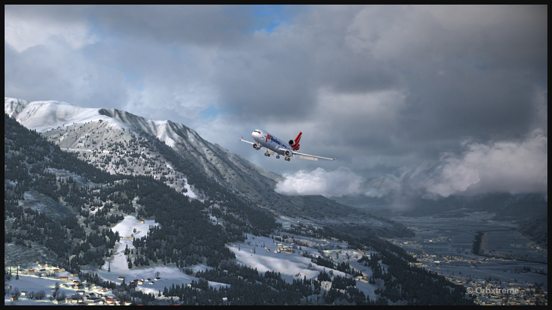
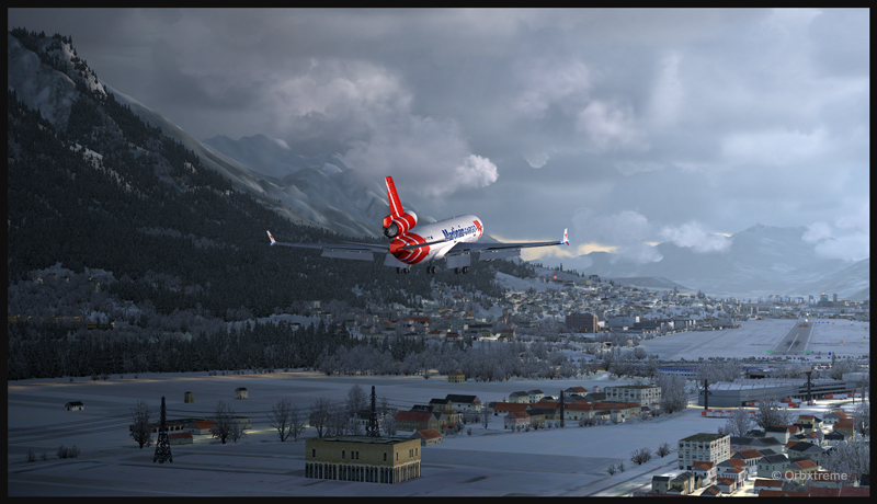
Virtual Martinair Cargo MD-11F approaching the Innsbruck airport (LOWI)
The flaps must be adjusted to 50 degrees for the MD-11F. Insure that the “Autopilot” function is set at “OFF”. The intensity of the automatic breaking is chosen according to the actual winds, the aircraft’s cargo load and the altitude of the airport. The margin of manoeuver with regards to the approach speed is not very large. I tried to maintain 150 kts.
A virtual PMDG MD-11F with full flaps (50 degrees) on final for runway 08 in Innsbruck
The Innsbruck runway is 2000 meters long. There is not much leeway for the MD-11F.
Virtual PMDG MD-11F arriving for runway 08 at Innsbruck
Virtual PMDG MD-11F breaking runway 08 in Innsbruck
Once on the ground, you must continue until the end of runway 26 in order to do a 180 degree turn. There is just enough space for the MD-11F.
Virtual Martinair Cargo MD-11F backtracking runway 08 at Innsbruck
As you can see in the image below, looking at the windsock, the landing was made with a good tailwind.
Virtual Martinair Cargo MD-11F exiting the runway at Innsbruck
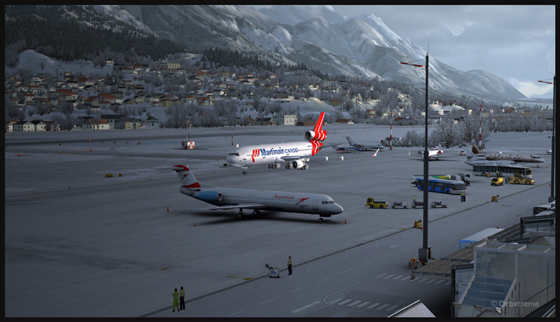
The airport is superbly represented and a parking space is already reserved for bigger aircrafts. Employees are waiting for your arrival.
Innsbruck virtual airport and the Martinair Cargo MD-11F
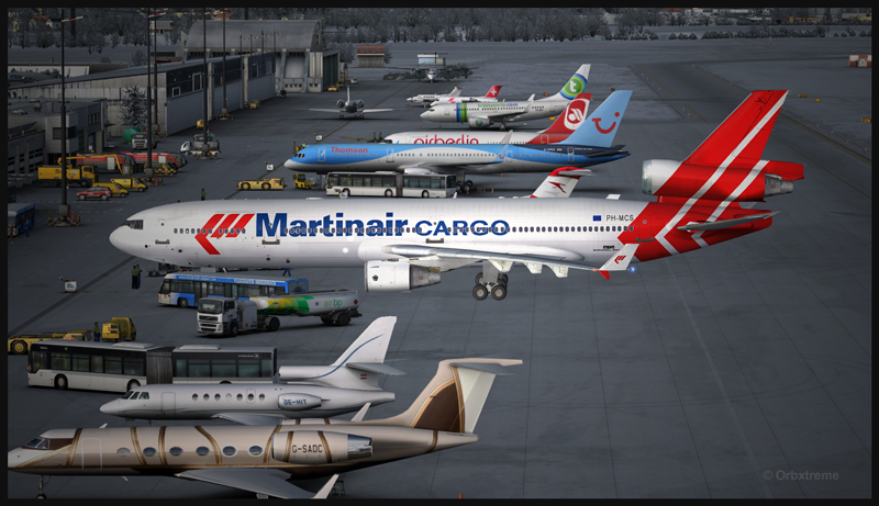
PMDG virtual MD-11F parked at the Innsbruck airport in Austria
Virtual Martinair Cargo MD-11F parked at the Innsbruck airport
You can try landing with any other big carrier if you do not already own a PMDG virtual MD-11. If you would like to acquire this aircraft, you will realize that it is no longer offered by PMDG, at least for now. Try to put some pressure on the company so that they restart offering the aircraft on which they have put in so much effort. A message on their Facebook site should show your interest: PMDG
If you would like to see an exceptional two hour aviation video on a real flight that lasted ten days across the world, there is none better than the one made by PilotsEYE.tv: Lufthansa Cargo MD-11F in Quito
PilotsEye DVD on a ten day worldwide trip with a Lufthansa Cargo MD-11F
You witness part of the crew’s planning for a landing on the old Quito runway, in Ecuador. The airport’s altitude is so high that the MD-11F margin of manoeuver is extremely limited. Make sure to own a player that can decode European videos.
The following pictures show a virtual flight in United States. The trip is from KBLU ( Blue Canyon-Nyack) to Limberlost Ranch (CA21) then to Gansner Field (201). Landing and taking-off from Limberlost Ranch is a nice challenge.
For this flight simulation, I used the FSX flight simulator, the Carenado Cessna C-207 equipped with bush tires and REX clouds.
Airborne from KBLU.
The Cessna C-207 is airborne from the Blue Canyon-Nyack airport runway
Enroute from KBLU (5284 ft ASL) to Limberlost Ranch and it’s 1700 ft grass runway (1650 ft ASL and about 23 NM east of KBLU), you pass by the Nevada County airport (O17) that has also received a special treatment from ORBX.
It might be necessary to fly over the Limberlost Ranch airport before starting an approach, so that you have an idea of what to expect on final.
Over the Limberlost Ranch short and sloped runway
Limberlost Ranch has a sloped runway (in fact, a multiple slope runway). Part of it is asphalted, but most of it is grass. You make the approach for the grass section. Note that there is a fence on the side at the beginning of the runway. The virtual aircraft should not touch the field before it has passed the fence (for more realism).
The Cessna C-207 is on final for the Limberlost Ranch sloped runway
Landing on the Limberlost Ranch short and sloped grass runway
The Cessna C-207 is parked at Limberlost Ranch for a few minutes
Ready for take-off from the Limberlost Ranch runway
With a bit of crosswind, taking-off from this short runway can be demanding. The aircraft feels really sloppy (and I mean it) and behaves more like a boat than a plane during the acceleration to get airborne. It is essential to avoid the line of trees on the left side of the runway. A bit of flaps is required as it is the norm for soft runway operations. Careful but essential use of the rudder will also make your take-off a success.
Aircraft airborne from the Limberlost Ranch runway
Enroute to Gansner Field.
Over the Gansner Field airport runway
Gansner Field is about 41 nm north of KBLU. The virtual airport is very well made and nestled in a valley. Coming in from KBLU, you need to pass 6000 ft mountains before diving for that 3419 ft asl asphalt runway.
The fully enjoy those virtual flights, it is suggested that you install the different layers of Orbx products (Global, Vector, Open LC) as well as the KBLU virtual scenery.
Have a good flight!
For more articles on flight simulation on my web site, click on the following link : Flight simulation
The flight simulator enthousiast will have fun trying this short flight ( 14 minutes) from the Eagle County virtual airport (KEGE) to the Telluride virtual airport (KTEX). The virtual flight, using FSX, was made during winter, on January 8th. The shots below represent an idea of what is visible while flying toTelluride. Use 14,000 feet, it should do it…
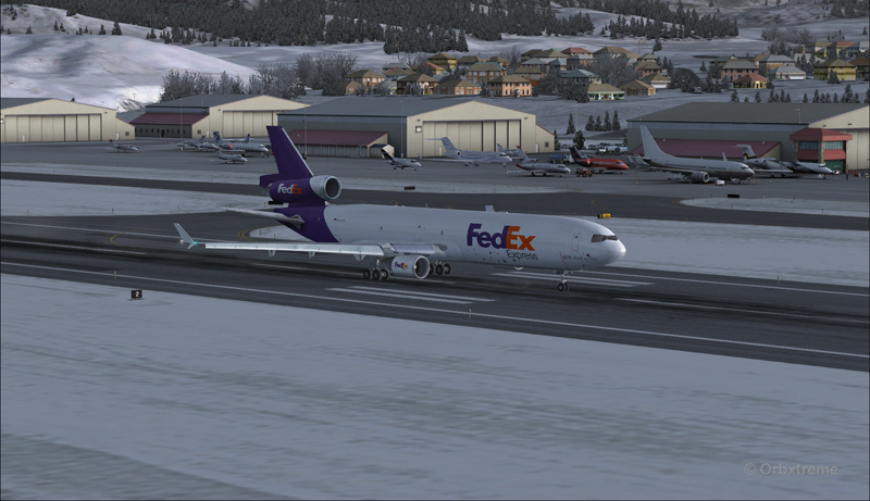
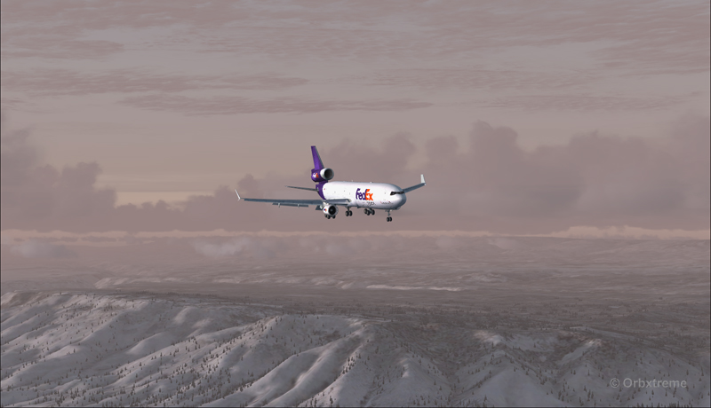
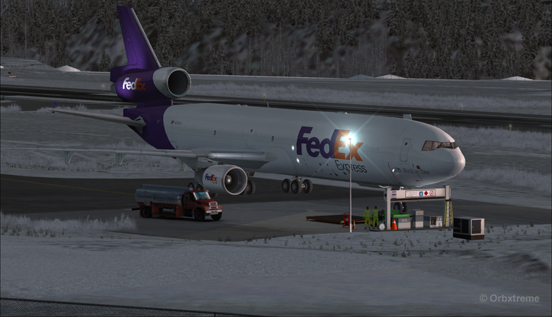
FedEx MD-11 on the take-off run at the Eagle County airport (KEGE) (FSX)
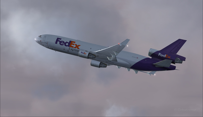
FedEx MD-11 airborne from the Eagle County airport (KEGE) (FSX)
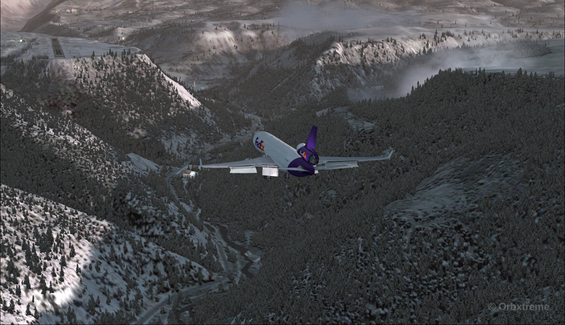
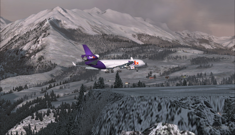
FedEx MD-11 between Eagle County airport (KEGE) and Telluride airport (KTEX) (FSX)
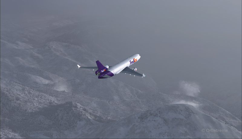
There are lots of beautiful mountains between KEGE and Telluride, and also some unpredictable weather…
FedEX Md-11 entering bad weather
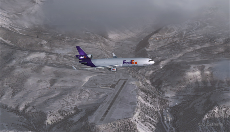
The expected ceiling at Telluride was 8500 ft. On the way to the airport, the clouds and visibility were sometimes obscuring the mountains.
A FedEx MD-11 on a flight Eagle County (KEGE) to Telluride (KTEX) (FSX)
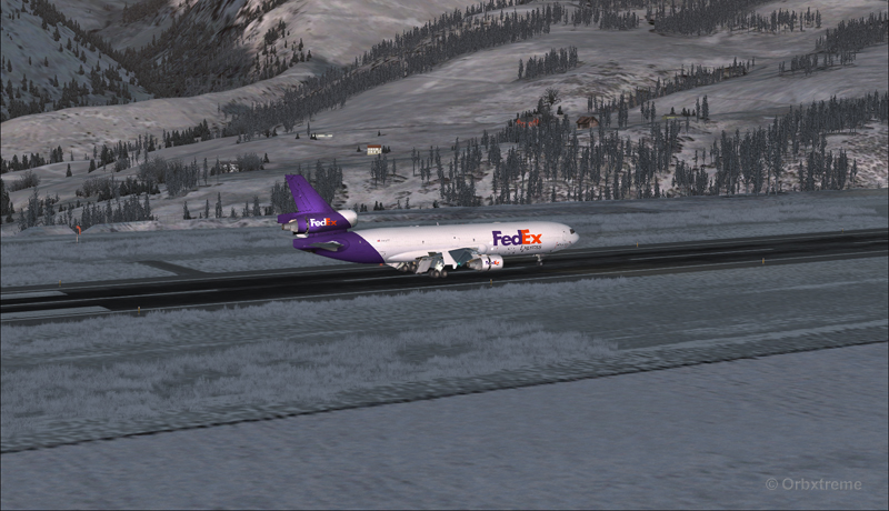
Telluride is a very inviting airport for a MD-11. The 7000 feet runway itself does not represent a big challenge, although its 100 feet are a bit narrow: this aircraft would normally require a 150 feet wide landing surface.
The virtual VFR approach made with the MD-11 was the most expensive way to do the trip, since it required a fly-by and a 270 degree turn to the right to align with runway 09.
FedEx MD-11 flies by the Telluride airport KTEX) (FSX)
The 270 degree turn at a 10-20 degree bank allowed to transit from 14,000 to 10,000 ft without doing anything radical. Just a turn while descending and gradually loosing speed to arrive at around 160 kts on final. The aircraft was now installed on long final, with flaps set at 50 degrees.
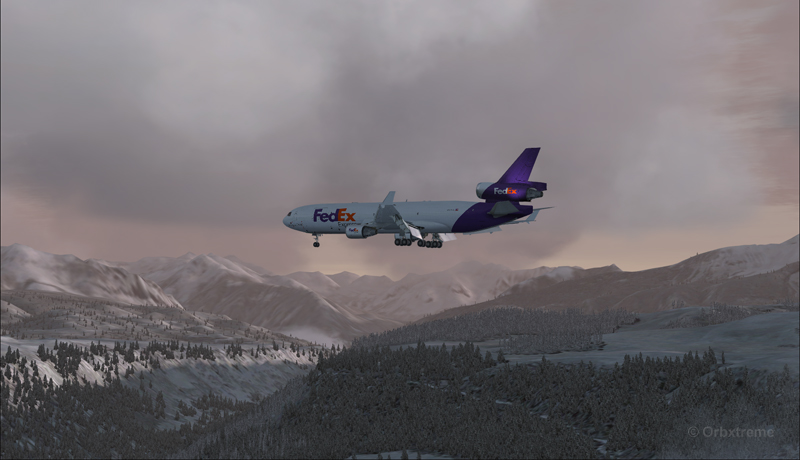
A FedEx MD-11 on long final runway 09 for the Telluride airport (KTEX) (FSX)
The high altitude runway’s 9078 feet msl elevation meant the pilots dealt with lower air density and heavy weight when approaching and, as such, the airspeed had to be adjusted accordingly to prevent stalling on final.
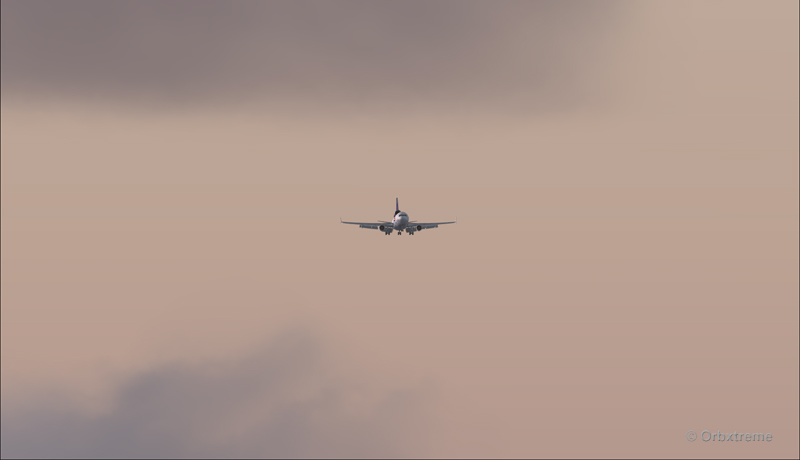
A FedEx MD-11 on final runway 09 for the Telluride airport (KTEX) (FSX)
Here is a view from the Telluride tower…
View from the Telluride airport (KTEX) (FSX) of a FedEx MD-11 on final for runway 09
Now with a view like that, you would not consider coming in IFR…!
A FedEx MD-11 inbound from KEGE on final for runway 09 at the Telluride airport (KTEX) (FSX)
To prevent an overshoot and some additional expenses in fuel (which are already skyrocketing), an optimal approach was required.
Most accidents with the MD-11 happen when the pilot pushes on the stick when there is a rebound with the nose wheel, thus creating an even stronger rebound. When there is a rebound, there is no need to push on the stick, just wait and the aircraft sets itself quickly.
A FedEx MD-11 over the threshold runway 09 at the Telluride airport (KTEX) (FSX)
Now with max breaking and thrust reversers…
A FedEX MD-11 slowing down at the Telluride airport (KTEX) (FSX)
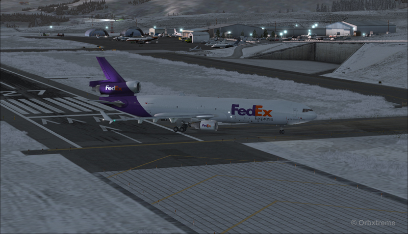
The MD-11 can easily turn at the first taxiway at Telluride. But in order to capture a wider view of the airport, I exited at the last taxiway (again adding to the already enormous expense in fuel…)
A FedEX Md-11 is exiting runway 09 at the Telluride airport (KTEX) (FSX)
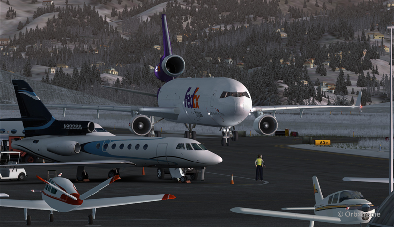
The employee on the ramp was worried that the MD-11 lower winglet would scratch N900SS while taxiing. But there was plenty of space (11 inches)…
A FedEX Md-11 is taxiing on the ramp at the Telluride airport (KTEX) (FSX)
The MD-11 was parked temporarily in a spot needed by every aircraft. It was necessary to unload quickly the precious cargo and get out of the way.
Temporary parking for a FedEx MD-11 at the Telluride airport (KTEX) (FSX)
Some expert handling would be needed to help move back that MD-11 close to the runway. But that was the Telluride’s airport manager problem and he had promised he would have something ready!
FedEx Md-11 parked at the Telluride airport (KTEX) (FSX)
The virtual scenery from departure to destination is a creation of ORBX programmers and the virtual MD-11 is made by PMDG Simulations (I am not sure it works with P3D though). For the weather, I used REX Simulations as the weather engine and REX and Cumulus X for the cloud textures. (Edit: PMDG does not support it’s MD-11 anymore).
For other challenging virtual flights, head towards the flight simulation section of my web site, under “challenging virtual flights”: there is something for everyone!
For more articles on flight simulation on my web site, click on the following link : Flight simulation
Alex Geoff, the ORBX Block Island (KBID) virtual airport designer, asked flight simulator enthousiasts to try to operate the biggest aircraft possible on that airport ‘s 2502 ft runway.
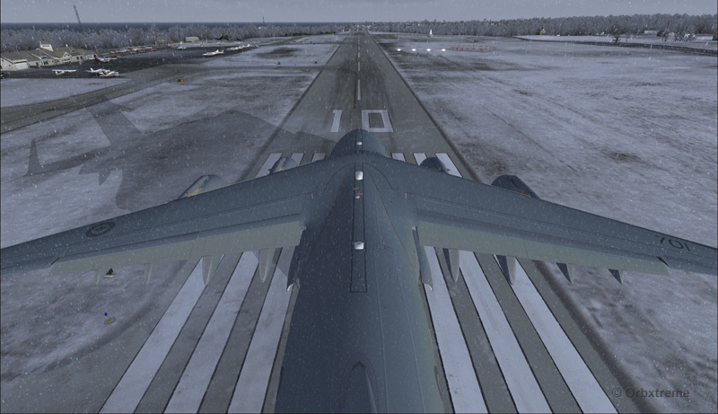
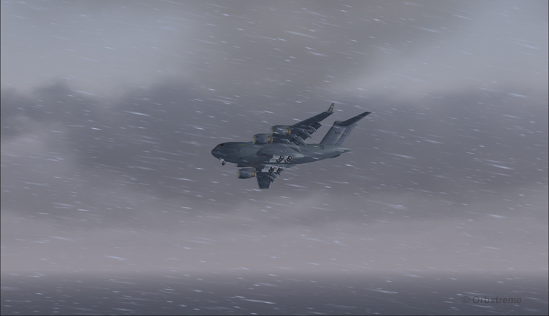
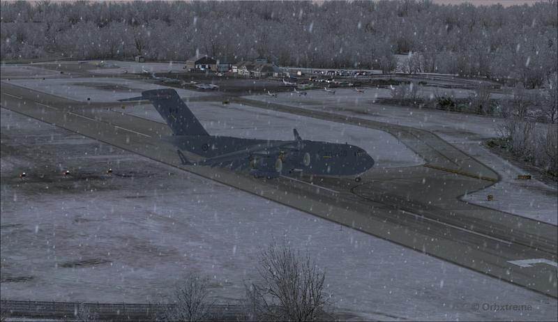
Canadian military aircraft C17-A ready for take-off runway 10 at the Block Island (KBID) virtual airport in United States (FSX)
Naturally, we are talking about a virtual flight. You must then forgive the landing of an aircraft which, in real life, would destroy the runway. You also have to disregard the fact that numerous trees would have to be chopped if the aircraft would elect to use the taxiway. I was almost forgetting the pilots and airport manager that would have to be fired following the authorized manoeuver.
The context of the flight having been presented, here is the data that will allow flight simulator enthousiasts to replicate the circuit around the Block Island airport with a Virtavia C-17A.
Contrary to the Cessna type aircrafts normally evolving around the airport, the total weight of the canadian military C-17A used for the flight was 405,000 pounds. The fuel was adjusted to 50% in all four tanks. Both pilots agreed to skip lunch in order to avoid adding any extra weight to the beast…
Flaps were adjusted to 2/3. I backed the aircraft to the beginning of the runway, applied the brakes, applied full throttle, waited for maximum regime, released the brakes and used ground effect to lift the aircraft before it was too late. The take-off was done on runway 10 with a 12 kts and 70 degree crosswind.
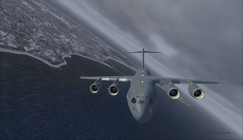
Canadian military aircraft C17-A airborne runway 10 at the Block Island (KBID) virtual airport in United States (FSX)
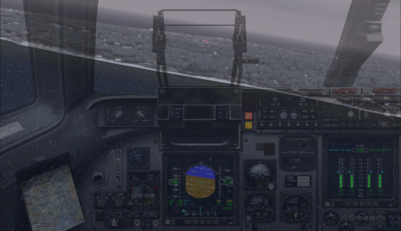
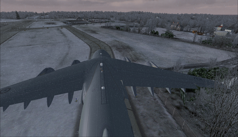
Then, four right turns were made : 190°, 280°, 010° and 100°. During the flight, the aircraft’s altitude never went above 2000 feet.
Canadian military aircraft C17-A turning downwind runway 10 at the Block Island (KBID) virtual airport in United States (FSX)
Wheels and flaps were brought down in base so that I did not have to make serious adjustments on final.
Canadian military aircraft C17-A turning base runway 10 at the Block Island (KBID) virtual airport in United States (FSX)
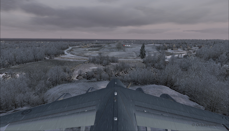
Canadian military aircraft C17-A on long final runway 10 at the Block Island (KBID) virtual airport in United States (FSX)
Canadian military aircraft C17-A short final runway 10 at the Block Island (KBID) virtual airport in United States (FSX)
The speed eventually went down to 128 kts and, while the aircraft was still about two feet in the air, I used the airbrakes. The thrust reversers were fully activated two feet before touch-down (continued pressure on F2) since they take time to rev up. That is not necessarily the proper way to do it and you can wait one more second, until the wheels touch the runway, to use the reversers. The main gear touched at the very beginning of the runway and maximum breaking was then applied.
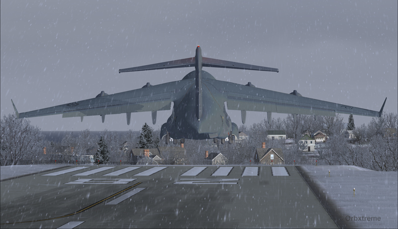
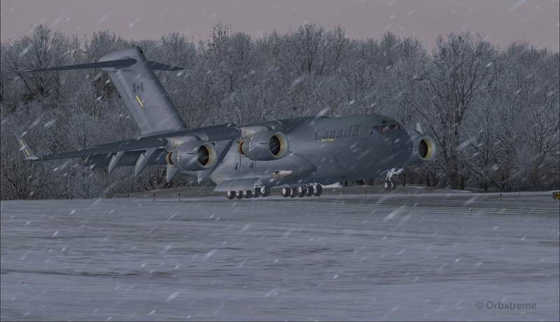
Canadian military aircraft C17-A landing at the Block Island (KBID) virtual airport in United States (FSX)
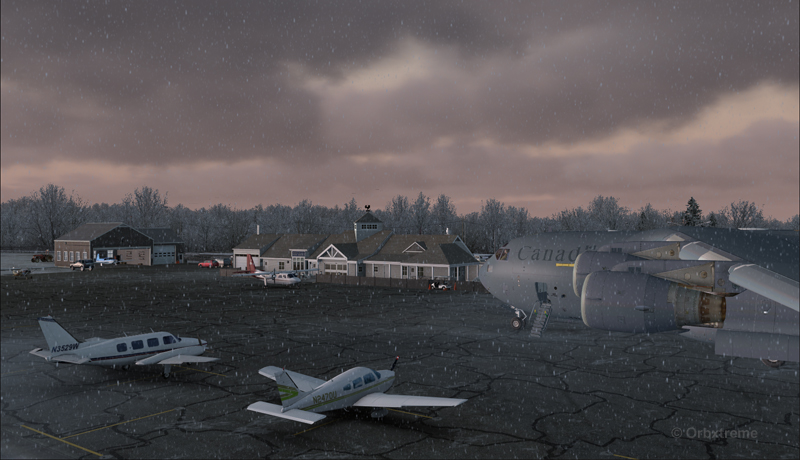
It was possible to exit on the taxiway without having to back-track on the runway. The environment always coming second, some trees were cut so that there were no contacts with the aircraft.
Canadian military aircraft C17-A exiting runway 10 at the Block Island (KBID) virtual airport (FSX) in United States
Canadian military aircraft C17-A taxiing at the Block Island (KBID) virtual airport (FSX) in United States
If you decide to try it out, think of saving the flight when you are on final, in case you are not satisfied with your performance during the landing (scrapped aircraft, destroyed houses and vehicles in the neighborhood, burned forest at the end of runway 10, collateral victims, etc.).
Canadian military aircraft C17-A at the Block Island (KBID) virtual airport (FSX) in United States
Good luck!
For other challenging virtual flights, head towards the flight simulation section of the present web site.
For more articles on flight simulation on my web site, click on the following link : Flight simulation
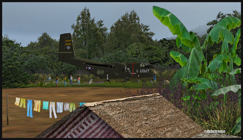
A virtual DHC-6 Twin Otter enroute for Kokoda after a fire on the right engine while departing Yongai (KGH) in Papua New Guinea PNG (FSX)
Ken Hall and Tim Harris have created a new virtual scenery for flight simulation enthousiasts. It is called “Tapini” and sold by ORBX. Their penultimate creation, AYPY Jackson’s International, allowed the virtual pilot to fly in very demanding virtual airports along the Kokoda Trail in Papua New Guinea. “Tapini” represents a whole new challenge and I have included several screen captures to show you how the different runways look in this new virtual scenery.
“Tapini”, still in Papua New Guinea, allows the virtual pilot to test his skills on seven new runways located in difficult areas of the Owen Stanley Range. Those airports also constitute a serious test for any aircraft, like in the picture above where damages to the right engine were sustained at Yongai.
A virtual Piper Pacer virtuel is about to land on the Ononge (ONB) curved runway in Papua New Guinea PNG (FSX). (It is possible to see the curve starting on the top of the image)
To improve the virtual clouds while flying between the different airports, I used either REX or FSGRW weather engines. The cloud textures and weather effects were improved by one or many of the following products: Cumulus X, PrecipitFX, REX Texture Direct and REX Soft Clouds.
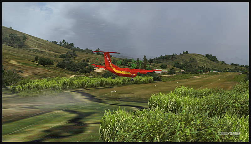
A virtual Dash 7 has just landed in Woitape (WTP) in Papua New Guinea PNG (FSX)
As variety is more fun, and also due to the different challenges created by those runways, the following virtual aircrafts were used: Carenado C-185F, Lionheart Creations PA-18, Virtavia DHC-4, Aerosoft DHC-6 Twin Otter and Milton Shupe DHC-7.
The “Tapini” scenery gives the pilot a choice between the seven following runways:
ASB (Asimba)
A tricky, very short runway near a river.
A DHC-4 Caribou virtual aircraft is on approach for Asimba’s sloped runway (ASB) in Papua New Guinea PNG (FSX)
This is a very interesting runway, best done with a STOL aircraft like the Caribou DHC-4. The inhabitants might have to help you clear out some branches along the runway, considering the size of the aircraft. The runway slopes down on take-off, which helps to build up speed.
A DHC-4 Caribou virtual aircraft is on a stopover at Asimba (ASB) in Papua New Guinea PNG (FSX)
A DHC-4 Caribou virtual aircraft is airborne from Asimba (ASB) in Papua New Guinea PNG (FSX)
FNE (Fane)
A one-way, really challenging 12 degree sloped runway, with unpredictable winds.
A De Havilland DHC-7 virtual aircraft on final for the Fane (FNE) airport’s sloped runway in Papua New Guinea PNG (FSX)
The runway sits on top of a hill. It is an amazing experience to land there. No wonder there are a lot of people watching the arrivals and departures.
If you slow down too quickly with an aircraft as big as the DHC-7 on that sloped runway, the twelve degree angle prevents you from moving forward. You must let the aircraft come down the runway very slowly, using the power to control the descent and the rudder to stay aligned on the runway, then apply take-off power for a few seconds to build just enough momentum to get above the hill.
A De Havilland DHC-7 virtual aircraft just finished taxiing uphill on the Fane (FNE) airport’s sloped runway in Papua New Guinea PNG (FSX)
To turn the aircraft around, it’s a combination of power and reverse thrust until you clear all the obstacles (any humans venturing behind the aircraft will also be cleared during the operation…).
A De Havilland DHC-7 virtual aircraft is airborne from the Fane (FNE) airport’s sloped runway in Papua New Guinea PNG (FSX)
There is a not so friendly man with a rifle watching the airport’s operations. Even the United Nations staff do not stay longer than necessary…
KGH (Yongai)
A very bumpy one-way sloped runway. A real bush aircraft is needed here!
A virtual DHC-6 Twin Otter on approach for the Yongai (KGH) bumpy runway in Papua New Guinea PNG (FSX)
Even with a real bush aircraft, there is a possibility that one of the aircraft’s propellers hits the ground while taxiing on the runway. There are so many deep holes that are hard to see, I can only wish the best of lucks to everyone trying out this airport!
A virtual DHC-6 Twin Otter on the Yongai (KGH) bumpy runway in Papua New Guinea PNG (FSX)
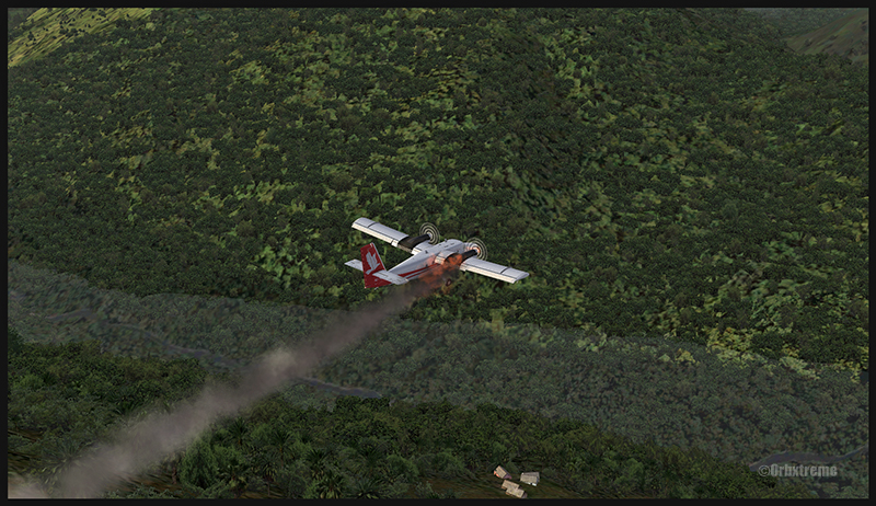
Keep a close watch on the area near the little house at the end of the runway. The DHC-6 was really shaken while turning around for take-off. One of the propellers hit the ground but no problems were detected…until the aircraft was airborne. The fire alarm then went off, just as the aircraft was passing the runway threshold, seconds before flying over a cliff.
A virtual DHC-6 Twin Otter with its right engine on fire is just airborne from the Yongai (KGH) bumpy runway in Papua New Guinea PNG (FSX)
So much for the planned trip… and it was out of the question to return to Yongai on one engine. I had to pull the handle to stop the fire, feather the prop, cut the fuel where it was not needed anymore then head to the Kokoda airport as it was a sure alternative, having a long runway and an elevation that did not require the use of extra power.
KSP (Kosipe)
A relatively short runway that requires good calculations from the pilot, since it is located high in the mountains.
A virtual Cessna C-185F is enroute to the Kosipe (KSP) airport in Papua New Guinea PNG (FSX)
The Cessna C-185F is a very well suited aircraft for that runway. Make sure not to be too heavy on the brakes, as new C-185 propellers are hard to find in Kosipe. You can land in both directions. Ensure that the mixture is set properly as the airport is above 6300 feet.
A virtual Cessna C-185F is rolling after touching down on the Kosipe (KSP) runway in Papua New Guinea PNG (FSX)
A virtual Cessna C-185F is airborne from the Kosipe (KSP) runway in Papua New Guinea PNG (FSX)
ONB (Ononge)
A curved and very bumpy runway! For those who like low flying. Make sure you choose the good aircraft here; there is not much manoeuvering area once on the ground.
A Virtual Piper Pacer on approach for the Ononge (ONB) curved runway in Papua New Guinea PNG (FSX)
Ononge looks really scary when you show up on final for the first time. You wonder if the little trail that you see can really be a runway. For that kind of situation, the little Piper Pacer is an excellent aircraft, approaching slowly and braking on a dime. The runway is curved in the middle so you will need a bit of right rudder to keep the aircraft aligned with the runway.
A Virtual Piper Pacer on the Ononge curved runway in Papua New Guinea PNG (FSX)
I guess all those people with their cargo are waiting for a bigger airplane than mine…
A Virtual Piper Pacer is airborne from the Ononge curved runway in Papua New Guinea PNG (FSX)
TAP (Tapini)
A challenging one-way sloped runway nestled in a tight valley. You can even use an ILS to arrive there!
A virtual DHC-4 Caribou on short final for the Tapini (TAP) sloped runway in Papua New Guinea PNG (FSX)
This is a superbly designed area and airport. I visited it with the DHC-4 Caribou but any other big STOL aircraft would have fitted there. There is enough room to manoeuver. It is not too bumpy. There is an interesting slope: it starts downward and ends upward: this helps to slow down the aircraft after landing.
A virtual DHC-4 Caribou on the ground at the Tapini (TAP) airport in Papua New Guinea PNG (FSX)
A virtual DHC-4 Caribou is airborne from the Tapini (TAP) airport in Papua New Guinea PNG (FSX)
WTP (Woitape)
Looks like a no brainer, but there is no margin of error on this one-way slightly sloped runway. Very precise calculations and settings are required if you want to land there with something else than a small aircraft.
A virtual De Havilland DHC-7 on final approach for the Woitape airport (WTP) virtual airport in Papua New Guinea (FSX)
I found the runway to be very slippery with the De Havilland DHC-7. I must say that there was a good crosswind, as I was flying with real life weather and winds. The DHC-7 behaves like a big boat while decelerating on such a runway.
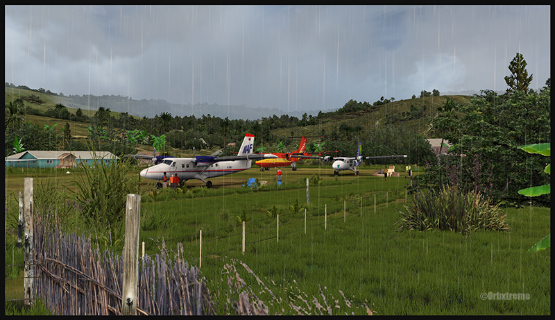
A virtual De Havilland DHC-7 on the ground with two Twin Otters at the Woitape airport (WTP) in Papua New Guinea (FSX)
The Woitape scenery is gorgeous. It is nice to have all those well designed virtual aircrafts, people and animals on site as this makes the scenery so much more realistic.
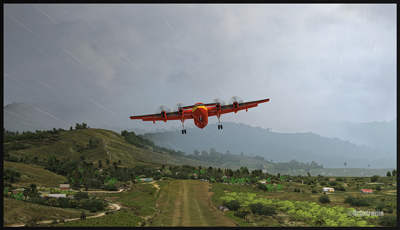
A De Havilland Virtual DHC-7 is airborne from the Woitape airport (WTP) in Papua New Guinea (FSX)
I love this new Orbx product. When you fly in such a realistic scenery, the brain does not make much difference between what is real and what is virtual. It really works! And if you use real life weather downloaded from the internet, it’s even better.
I tried the seven airports included in the “Tapini” virtual scenery and they are quite demanding. Yongai was the most challenging airport of them all. I had to do two missed approaches there since I ended up too high on the approach. I eventually got it right, like in real life!
I used the Microsoft flight simulator X (FSX) for all the virtual flights, but other platforms would have worked as well (Dovetail Games FSX Steam edition (FSX: SE) and all versions of P3D). The following products were also installed on my flight simulator: FTX Global, FTX Global Vector and Holgermesh, as well as Pilot’s FS Global 2010.
It is a totally immersive virtual experience and you have to forget everything else when undertaking those challenging virtual flights… if you want to make it “virtually” alive!
For more articles on flight simulation on my web site, click on the following link : Flight simulation