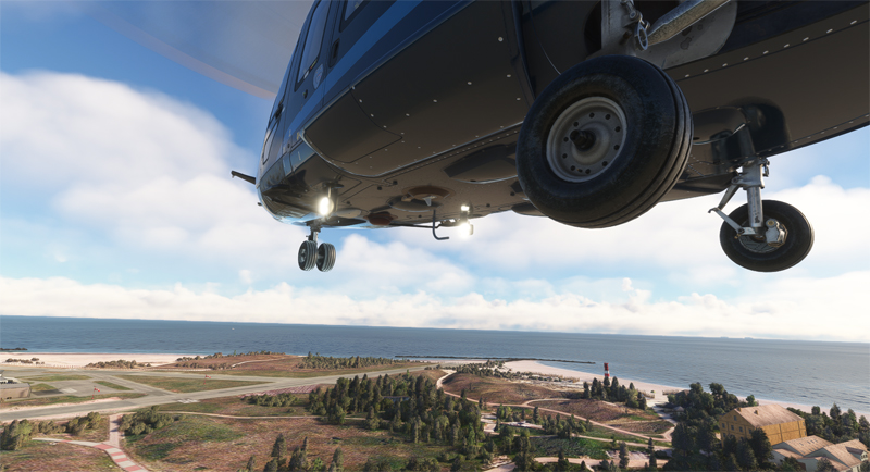
Airbus H160 helicopter leaving Helgoland (EDHX) for an oil platform in the North Sea
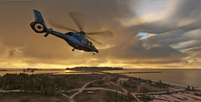
This twelfth leg of the round-the-world flight simulation trip features a precision landing. Indeed, there is a stopover on an oil platform in the North Sea. The code name of this facility in the Netherlands is EHFD F3-FB-1A. As usual, we’re using the MSFS flight simulator.
Airbus virtual H160 helicopter in flight towars the EHFD F3-FB-1A oil platform in flight simulation.
We are airborne in the evening from the island of Düne, in Germany. We shall reach the oil platform around dusk.
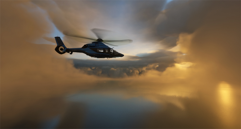
Virtual H160 helicopter approaching a wind farm in the North Sea with MSFS.
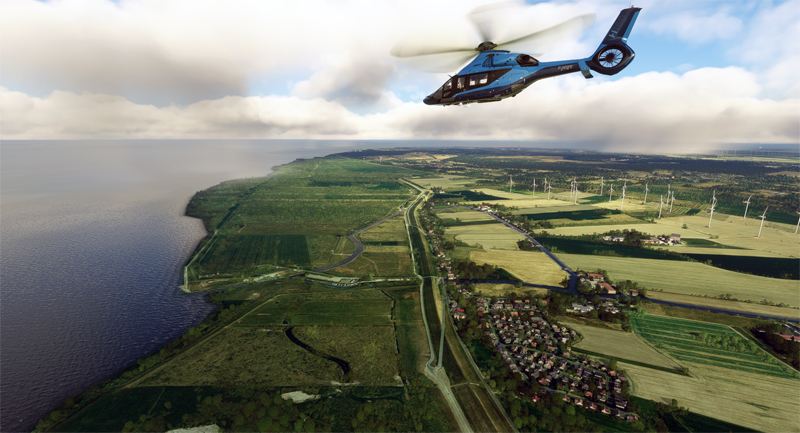
The photo above shows a wind farm straight ahead in the North Sea. In the event of a ditching, the H160 helicopter is equipped with floats that can be activated by the captain.
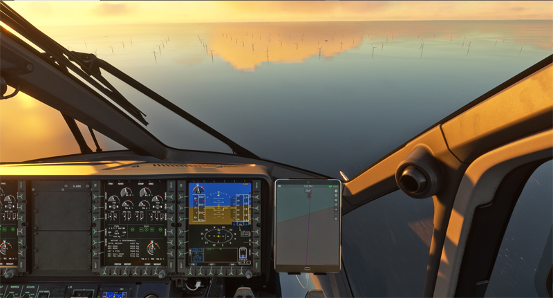
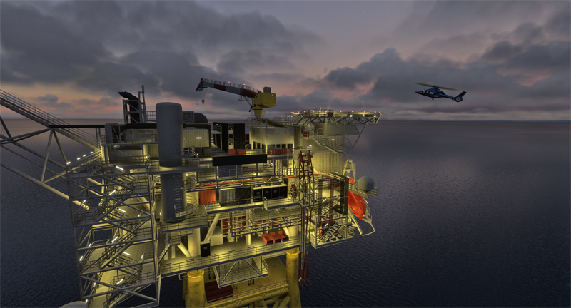
The night approaches as the H160 approaches the oil platform in MSFS
The virtual flight takes place in real weather conditions. As the day draws to a close, the sky takes on superb hues.
A few minutes later, the rig becomes visible.
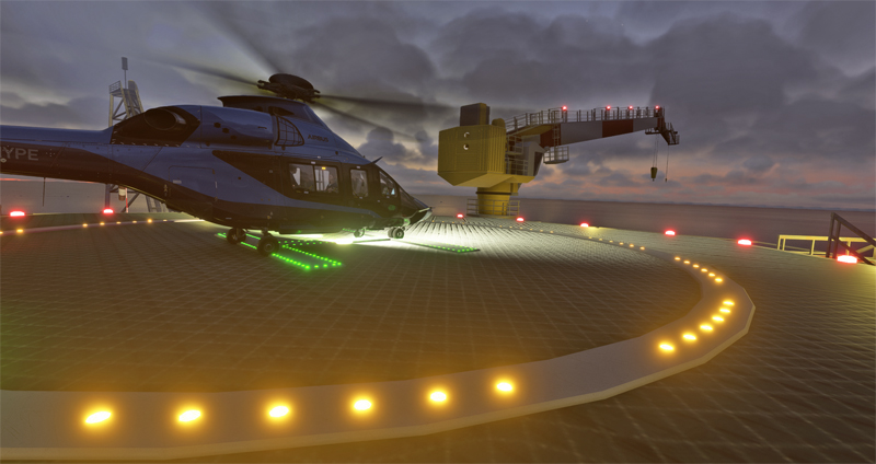
Very windy for an H160 landing at EHFD F3-FB-1A oil platform in the North Sea with MSFS
Generally, the winds remain at a fairly high speed for the approach to the helipad. In addition, the crane constantly moves from left to right not too far from the landing zone. As a result, the helicopter needs to be in the appropriate place. Moreover, turbulence near the building complicates manoeuvres. Therefore, two approaches become necessary before landing safely.
H160 helicopter landed on the EHFD F3-FB-1A oil platform in flight simulation
The helicopter will finally spend the night on the platform. Crew and passengers will certainly enjoy a well-deserved rest. Tomorrow, our mandate is to make the connection to a second drilling rig. This one is located further north, in the territory of Norway. For flight simulation fans who’d like to try it out, the code name is ENXB Eldfisk B.
For this eleventh leg of the flight simulation world tour, we depart from Padderborn Lippstadt Airport (EDLP) for Helgoland, Germany.
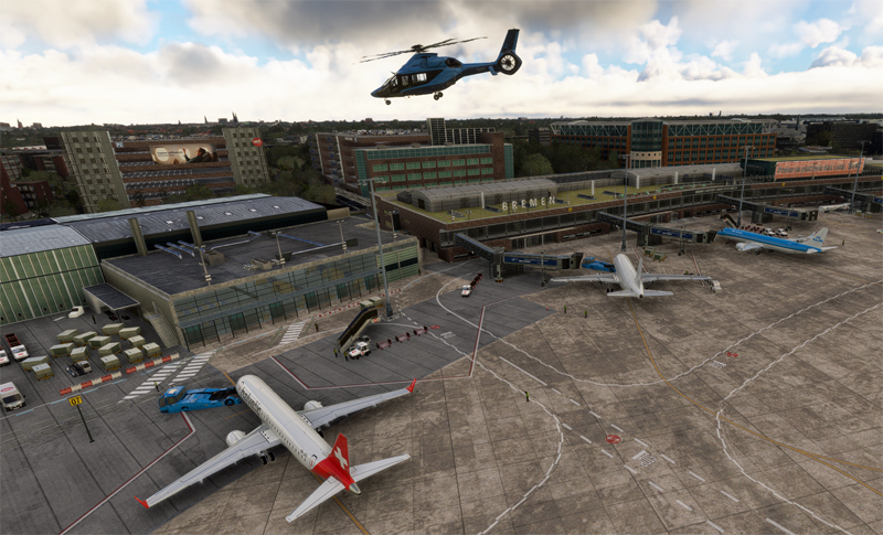
As our sponsor has an unlimited budget, we’ll be flying in an Airbus H160 Luxury helicopter. En route to the destination, we’ll be stopping off at Bremen airport (EDDW).
Airbus H160 helicopter over Bremen airport in MSFS 2020
For aviation buffs, the route from Bremen reads: EDDW DCT DO DCT DW271 DCT DW285 DCT WSN DCT NDO DCT EDXH (Helgoland). I use the following software: Navigraph, Simbrief, FSLTL and the MSFS 2020 flight simulator. The flight is carried out in real weather (injected via the Internet).
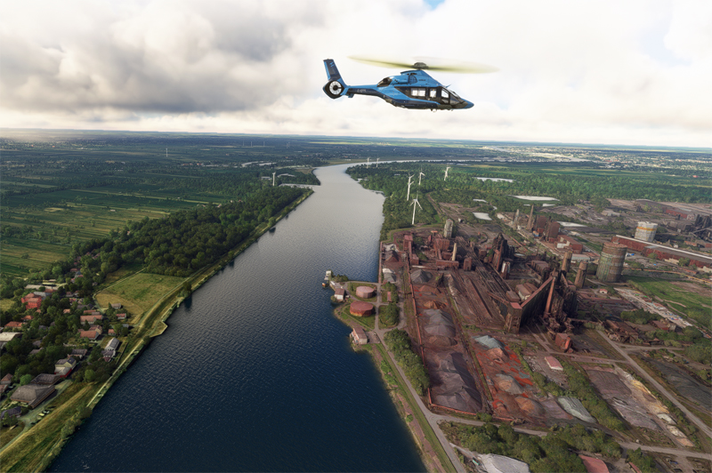
After take-off, we fly over some of Bremen’s industrial facilities.
H160 Airbus helicopter over Bremen industrial installation in MSFS2020
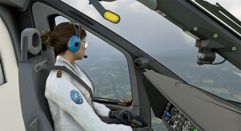
I have a co-pilot to help me with the job when I’m taking photos. I can’t say she’s very chatty, but the main thing is to get to the airport safely.
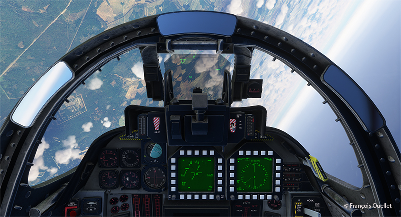
View from the cockpit in the Airbus H160 helicopter
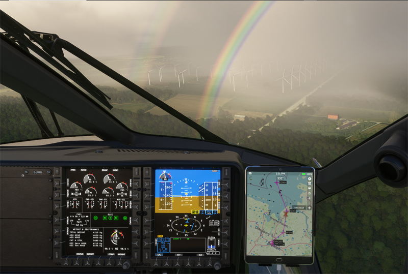
As we approach the North Sea, the coastline is briefly laden with low cloud and visibility diminishes. A few raindrops fall, while a double rainbow forms and a little turbulence is felt.
Precipitation isn’t really a problem, as it doesn’t last long. But with an outside temperature of -5 C, we have to watch out for icing.
Rainbow and updrafts before reaching the North Sea from Bremen in flight simulation
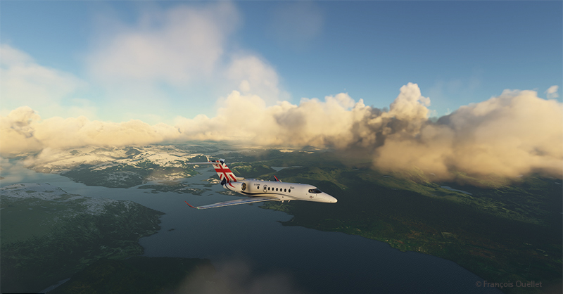
The weather returns to VFR and we head out over the water towards Helgoland.
Airbus H160 Luxury helicopter over Germany heading to Helgoland aiport
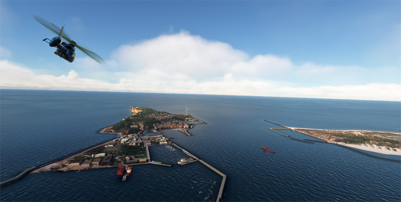
Helgoland has changed ownership many times over the decades, as a result of armed conflicts. The site has belonged to Great Britain, Denmark and is now part of Germany. It was a strategic military site whose installations were dynamited (and solidly!) by the British at the end of the Second World War.
H160 helicopter arriving to Helgoland in flight simulation
We look out over the cliffs of Helgoland before heading for the destination of our trip, the small island of Düne, in the background in the photo below.
The cliffs of Lummenfelsen at Helgoland, Germany, in flight simulation
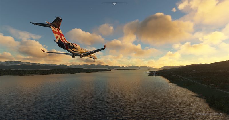
Although not sporty, the landing requires a few precautions due to gusts of 23 knots. On landing, the aircraft floats for a few seconds, behaving like a boat on rough water. But in the end, all goes well.
Landing of a virtual Airbus H160 at Helgoland, Germany with MSFS
The next virtual flight will be to an oil platform located in Denmark in the North Sea. For those who’d like to try the landing, the code name is EHFD F3-FB-1A.
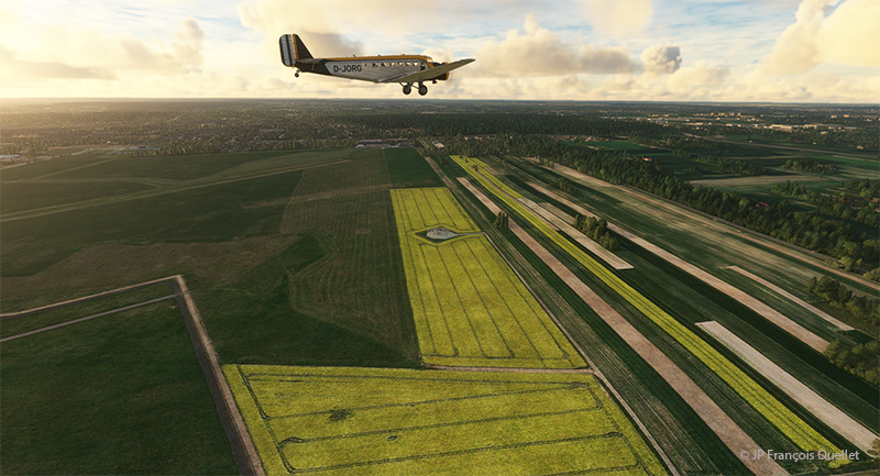
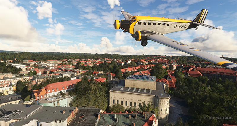
Leg 10 of this round-the-world flight simulation trip takes place between Poland and Germany. Two very different aircraft will be used to complete the journey during this day of VFR flying: an old Junkers Ju 52/3m and a modern business helicopter, the Airbus H160.
Junkers JU 52 airborne from the Lublin airport (EPLB) in Poland.
Departure is from Lublin airport (EPLB) in Poland. The Junkers Ju 52/3m takes off without a hitch over a short distance. The big three-engine tailwheel is as predictable as the Cessna C-170B I used in real life to cross Canada in 1981. Above, one can see the cultivated fields of Poland.
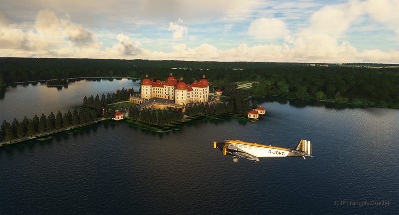
Junkers JU 52 and the Moritzburg Castle in Germany in flight simulation
It’s shaping up to be a beautiful morning, weather-wise. The first leg of the trip takes us over Moritzburg Castle (Schloss Moritzburg), northwest of Dresden. Built in 1542, it was originally the hunting lodge of the Duke of Saxony.
Junkers JU 52 enroute to the Landesmuseum für Vorgeschichte Halle in Germany
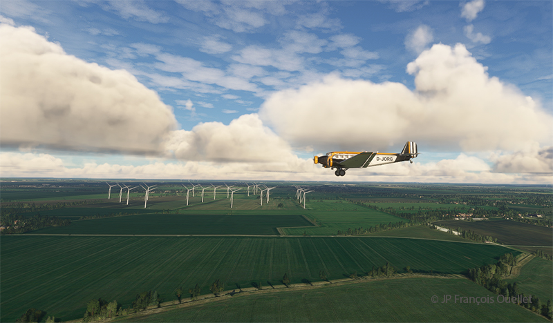
On the way to Halle is a large wind farm. Germany, like Europe, is rapidly developing its green energy. Russia’s recent attitude to Europe’s natural gas supply has drastically changed energy planning in neighboring countries.
A Junkers JU 52 flying over the State Museum of Prehistory Halle in Germany in flight simulation
Above, in the center of the photo, is a partial view of the National Museum of Prehistory in Halle (Landesmuseum für Vorgeschichte Halle), not far from Leipzig. It is one of Central Europe’s leading archaeological museums.
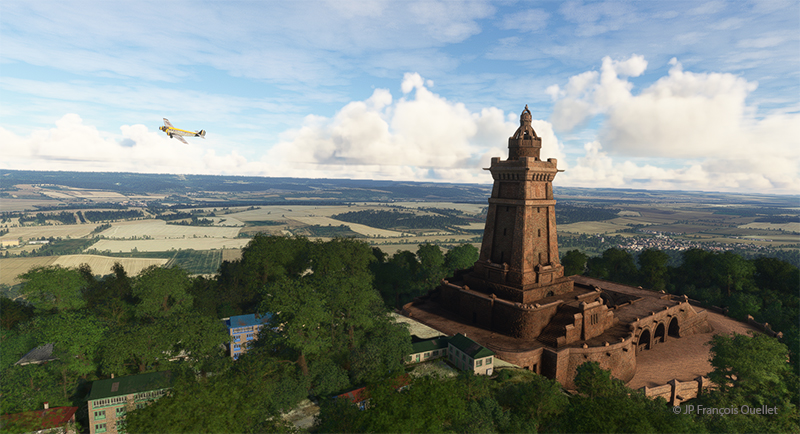
Fly-by of the Kyffhaüser-Denkmal in Germany by a Junkers Ju 52 in flight simulation
Before reaching Calden airport to change aircraft, we gaze at the Kyffhaüser monument (Kyffhaüser Denkmal). Once in Calden, we jump into a modern Airbus-built H160 helicopter and head for Göttingen, more precisely over the Münchhausenstrasse.
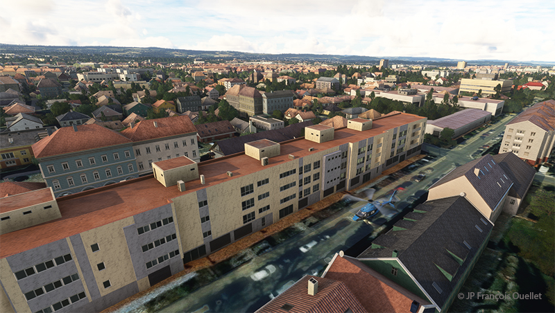
We’ve obtained permission to fly over this thoroughfare at very low altitude, just long enough to say hello to an old acquaintance. This dubious authorization will probably cost Germany’s Minister of Transport his job.
Streets of Göttingen, Germany, in flight simulation
A flyover of this Göttingen street is necessary to verify the extent of the traffic.
Helicopter descending on Münchhausenstrasse, Göttingen, Germany, in flight simulation.
The descent is gradual between the buildings. We hover just above the cars. Pedestrians seem to wave at us, but we may misinterpret the gesture. Our friend is at the window and takes the time to stop his reading of an excellent comic strip to wave at us. We then continue on our way to Padderborn Lippstadt Airport (EDLP), our destination for today.
Helicopter H160 landing at the Padderborn Lippstadt (EDLP) in Germany in flight simulation.
Still, there’s a fair amount of activity at the airport. Immediately after landing, we’ll start planning leg 11 of this round-the-world flight simulation and real weather trip.
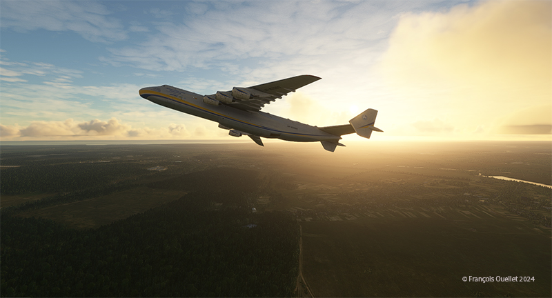
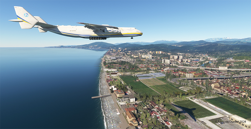
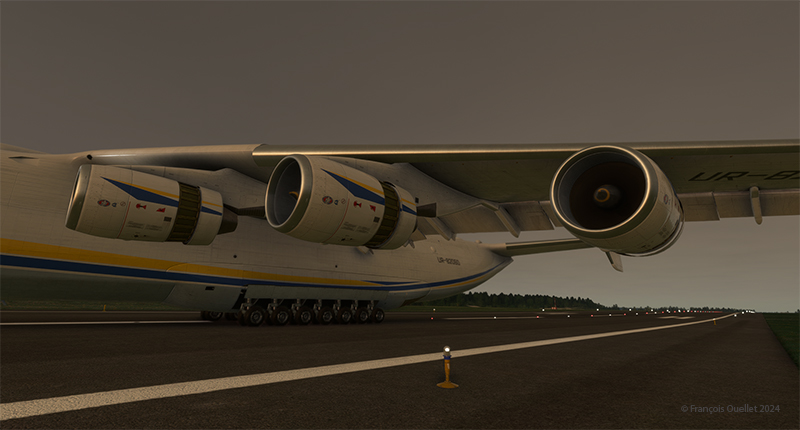
The Antonov 225 taking-off from the Antonov airport (UKKM) in Ukraine heading to Sochi, Russia.
Today, the Antonov 225 is reborn for another leg of this world tour of flight simulation. In reality, this aircraft was destroyed by Russia during its invasion of Ukraine. At the time of writing, war is still raging between the two nations. But in virtual mode, we have more latitude to alter the course of events and simulate peace.
So, we leave Ukraine’s Antonov airport (UKKM), fly over Crimea and then stop off in Sochi, Russia (airport code USSR). Our destination is Lublin airport (EPLB) in Poland.
The weather is looking good, with clear skies for the arrival in Sochi. The scenery around Sochi is splendid, and it’s best to land in good weather.
Take-off is a breeze, but the Antonov 225’s heaviness takes some getting used to. The weight of the aircraft means that every time the pilot makes a maneuver with the flight controls, initially nothing happens. Then, the aircraft slowly begins to obey. So, you have to expect delays and anticipate the outcome of maneuvers.
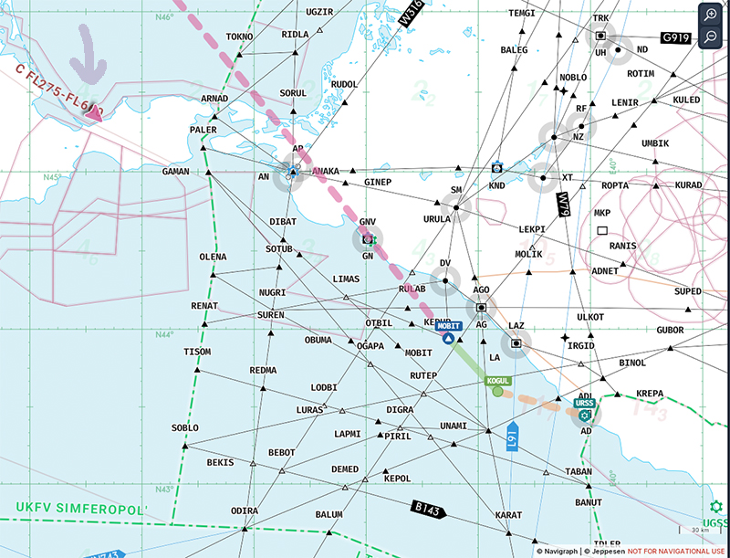
Navigraph is used for navigation. Of course, I plan to deviate from the initial route to fly over Crimea and then on to Sochi.
The pink triangle indicates the position of the Antonov 225 entering Crimea on its flight to Sochi in Russia and then Poland.
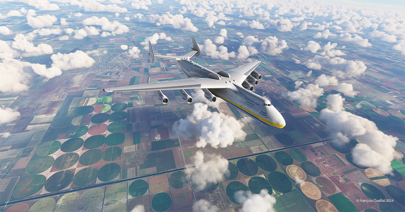
Below, the ploughed fields of the Ukraine. Ukraine is considered the breadbasket of the world.
The Antonov 225 over the cultivated fields of Ukraine.
Crimea is a beautiful region from the air, but fiercely contested on the ground. A pilot would say that today, it’s more turbulent down there than up.
The Antonov 225 entering Crimea on its flight to Russia then Poland
A few minutes later, the flight over the Sea of Azov begins in the direction of Sochi.
The approach is spectacular, with the surrounding mountains. As with all large aircraft, the Antonov has to be stabilized well in advance to avoid overcorrecting on final.
Antonov 225 on long final for runway 06 in Sochi (USSR), Russia.
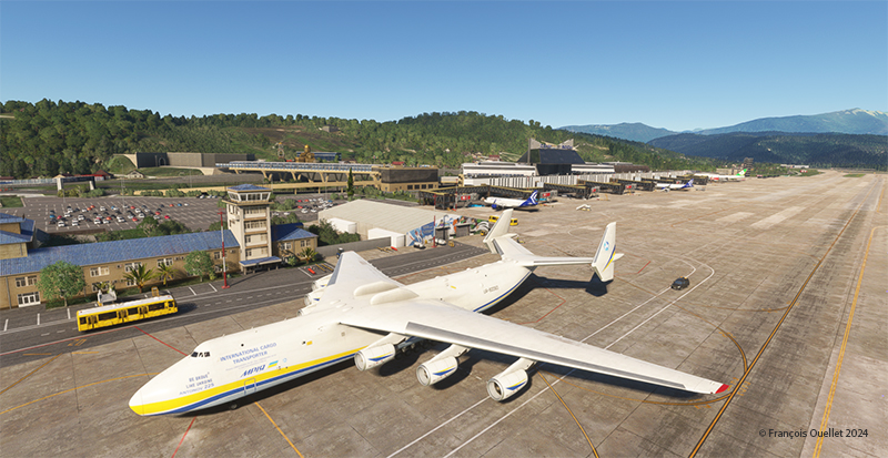
The cargo plane stops in an extremely short distance for such a heavy aircraft. When the thrust is reversed on six engines, there’s no need to set the brakes to maximum, especially in Sochi. We make a short stopover.
Antonov 225 parked for a short stopover at Sochi (USSR), Russia.
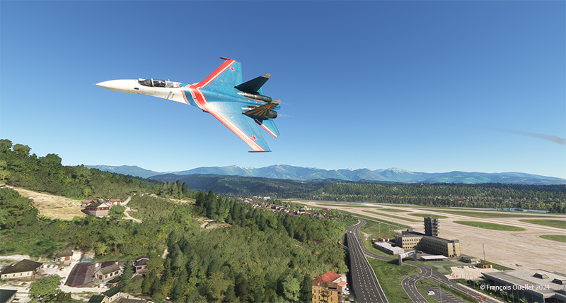
Just after our arrival, a Russian Sukhoi 27 military jet makes a low pass near the tower. The fighter jet was created at the time in response to the construction of the American F-15.
A Sukhoi Su-27 makes a low pass at the Sochi Airport (USSR), Russia.
The flight resumes in the late afternoon. Below, the Antonov 225 is on final approach to runway 25 at Lublin airport in Poland.
Antonov 225 on final for rwy 25 at Lublin airport, Poland
The thrust reversers allow the aircraft to exit onto the taxiway in the middle of the runway.
Antonov 225 with thrust reversers after landing at Lublin (EPLB) airport in Poland.
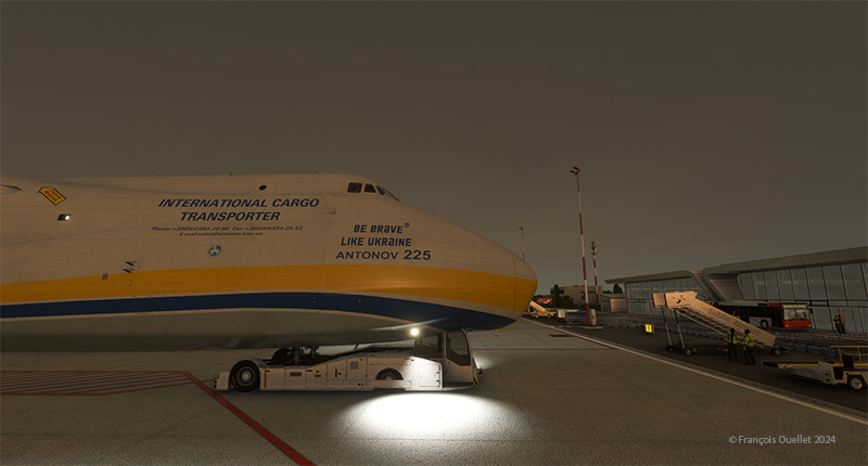
We get a little help with parking.
Antonov 225 with some help for the parking at Lublin airport, Poland
The next stage of this round-the-world flight simulation will be with a smaller aircraft, heading for Germany. A flight over Göttingen is planned with a helicopter (D-JORG). The trip will end at Paderborn Lippstadt Airport (EDLP).
The world’s only example of this aircraft was destroyed at the start of the Russian invasion of Ukraine in February 2022. However, no one can prevent a virtual aircraft from surviving (even computer) attacks. Note that the entire purchase price of the virtual aircraft in the Microsoft store is reserved for the eventual reconstruction of the real aircraft.
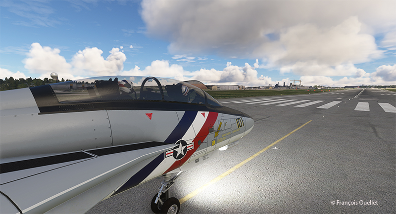
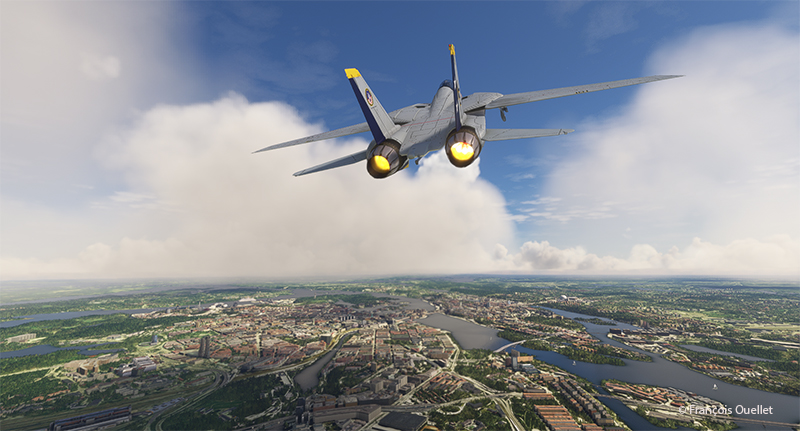
F14D Tomcat military jet ready for departure at Stockholm-Bromma virtual airport (ESSB) with Microsoft Flight Simulator.
For the trip, a quick overflight of Belarus will be necessary. A decommissioned, unarmed F-14 Tomcat should do the trick.
F-14D Tomcat airborne from the Stockholm-Bromma (ESSB) virtual airport in flight simulation.
The flight will take place at speeds above the sound barrier.
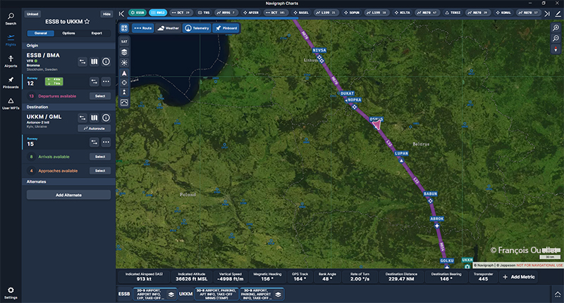
Navigraph chart of the flight from ESSB to UKKM Antonov International airport
The Navigraph map above shows the planned route. The pink triangle shows the F-14 entering Belarus.
F-14D Tomcat in a dive for a low pass ate high speed over Belarus.
A change of itinerary is in order for a few minutes, with a dive into Belarusian territory. But, as the military say, this flight “never happened”.
F-14D Tomcat on a low pass at high speed over Belarus.
We’re obviously not invited to perform a high-speed pass. But it seems to be becoming the norm in this part of the world in recent years, so why not us?
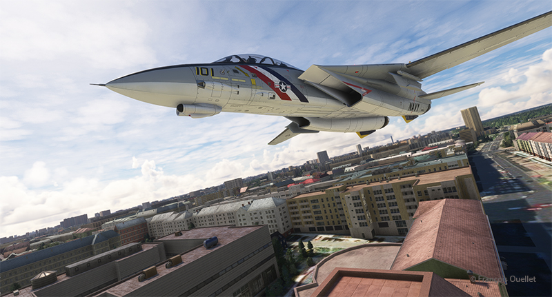
F-14D Tomcat heading to Kyiv Hostomel airport (GML) in flight simulation
The flight to Antonov International Airport continues at top speed. We’ll soon be there.
F-14D Tomcat turning final for the Antonov International airport (UKKM) in flight simulation.
Above, the F-14 makes a descent turn for the final approach to Antonov airport, with landing gear down and flaps adjusted. In real life, the runway has been damaged by the Ukrainians themselves to prevent the Russians from easily establishing a beachhead in their country. But we’re in virtual mode, so anything goes.
A F-14D Tomcat and Ukrainian soldiers on the Antonov International airport (Hostomel) (UKKM) in flight simulation.
As we taxi, we pass a few Ukrainian army soldiers greeting the arrival of the foreign pilots.
The virtual Antonov 225 is in its hangar, the very place where it was destroyed at the start of the conflict. I’ll be using this aircraft for the next leg of my round-the-world trip, flying over Crimea, landing in Russia and finally finishing the leg in Poland. We mustn’t leave the virtual Antonov 225 in Russia, as a matter of principle.
A surprise awaits us as we depart from the Sandane airport (ENSD) for Sweden, Stockholm-Bromma airport (ESSB).
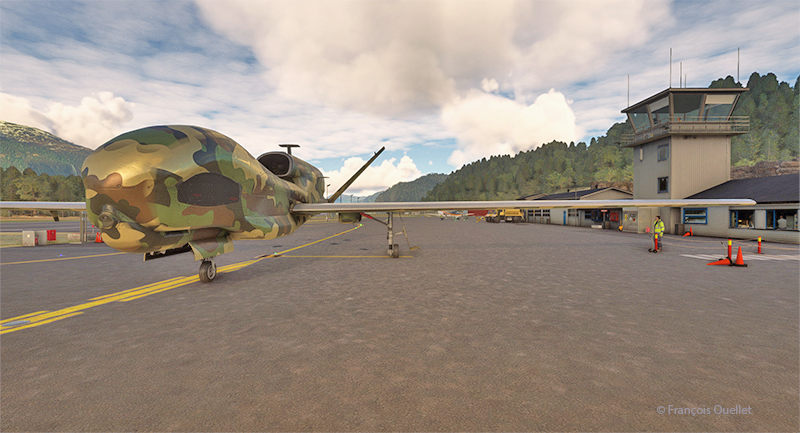
Drone on the ground at Sandane airport (ENSD) in Norway.
A Northrop Grumman RQ-4 Global Hawk drone is at the airport. This long-range surveillance aircraft has an autonomy of around 35 hours and a range of 22779 kilometers. It flies at altitudes of up to 60,000 feet (18288 meters). Its maximum speed is 635 km/h, and each hour of operation costs $24,000.
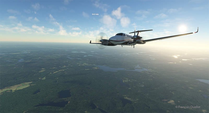
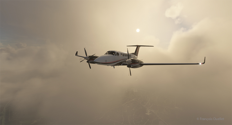
Beech 350I airborne from the Sandane Airport (ENSD) heading to Stockholm-Broma airport (ESSB)
Today, we’re repositioning a twin-engine Beechcraft King Air 350I that hasn’t flown in ages. The usual checks have been carried out to ensure that no birds have nested under the engine cowling. We also checked that there was no condensation water at the bottom of the fuel tanks. Finally, we ran the engines for a long time on the ground. The aircraft takes off from Sandane for a planned altitude of 18,000 feet.
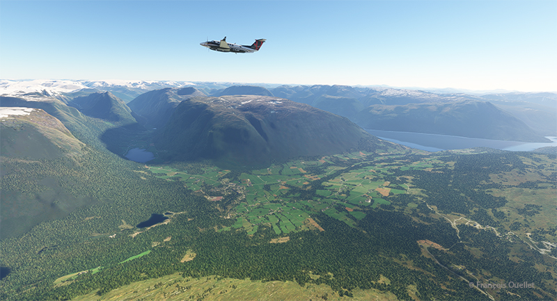
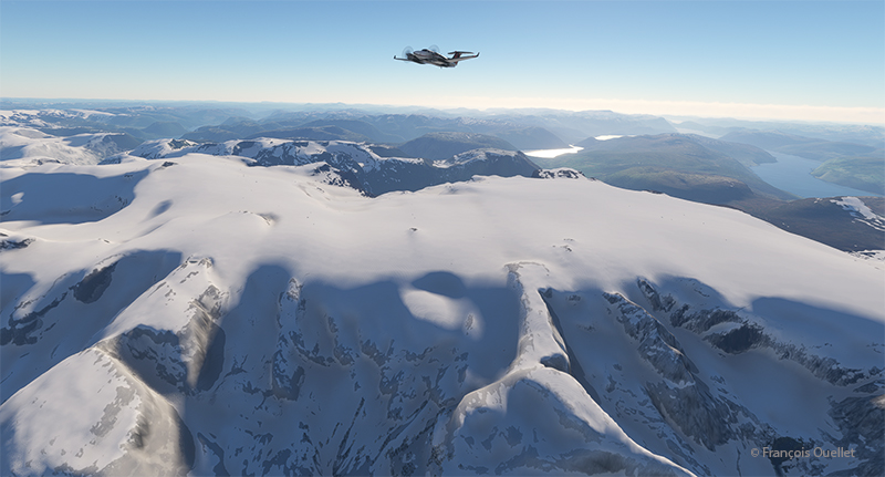
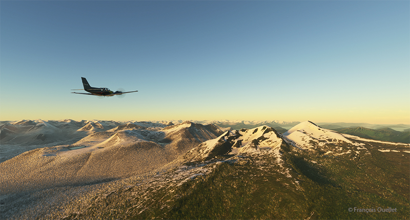
Over Norway snowcapped mountains heading to Sweden in flight simulation.
We fly over the mountains of Norway towards Sweden. Everything goes according to plan.
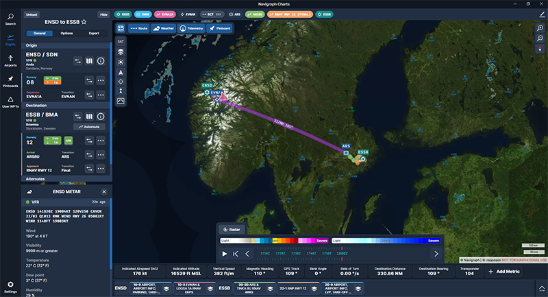
Navigraph chart showing a flight from Sandane (ENSD) to Stockholm-Bromma (ESSB)
The Navigraph map shows the planned route between the two countries.
Engine failure on a twin engine aircraft with Microsoft Flight Simulator.
Suddenly, the left engine experiences problems. It stops and the propeller feathers to minimize drag. Since we’re approaching the runway at Stockholm-Bromma airport, we choose to continue on our way, as we benefit from a large airstrip and emergency response services. Now unsure about the reliability of the second engine, we keep a slightly higher altitude than a normal approach would generally dictate.
Double engine failure on a twin engine with Microsoft Flight Simulator.
A few minutes later, the second engine stops. The plane becomes a large glider. The clouds prevent a good view of the surrounding area, but we feel our altitude is sufficient to attempt an approach to the airport when the runway is in sight.
On final for Stockholm-Bromma airport with a double engine failure
The flaps and landing gear will only be extended once we’re established on final and the aircraft is stabilized and certain of reaching the runway. Microsoft’s flight simulator doesn’t allow us to do just anything with an aircraft. If we exceed the aircraft’s structural capabilities when attempting to reach the airport, the flight will stop immediately.
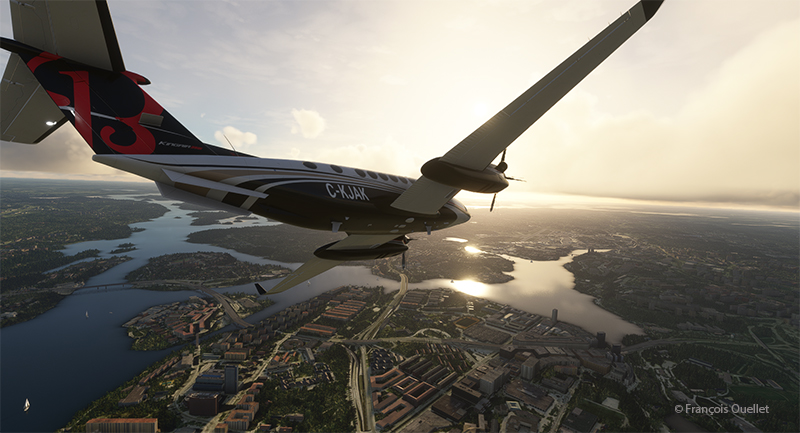
On the ground at Stockholm-Bromma with a double engine failure on a Beechcraft 350I in flight simulation.
The final approach and taxiing caused no problems. The aircraft gradually slows down until it comes to a complete stop on the runway. The poor air traffic controllers now have to apply Plan B to reorganize air traffic around the airport, with the main runway temporarily blocked.
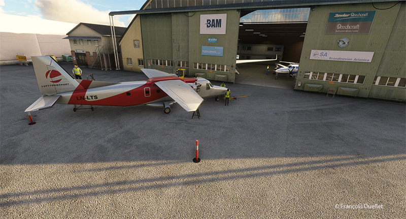
Beechcraft maintenance hangar at the Stockholm-Bromma virtual airport
Fortunately, Beechcraft offers maintenance services at Stockholm-Bromma airport. So, we’ll leave the aircraft for major repairs and find something faster for the next flight to Ukraine. Why not an F-14 Tomcat? It is not in military service anymore and thus its presence in the air should not worry too much.
P.S. This story is based on a real even that happened in Quebec several years ago. An acquaintance of mine (Paul B.) was scheduled to fly from the Val-d’Or airport (CYVO) to Rouyn-Noranda (CYUY) in a light twin-engine aircraft that hadn’t flown in a long time. Halfway between CYVO and CYUY, the first engine failed. The pilot decided to continue. With the runway in sight in the distance, the second engine stopped. The pilot hovered the aircraft and managed to land on route 117, just behind a large truck which accelerated to give way to the aircraft he could see descending in his rear-view mirror. The aircraft landed safely and without damages!
The sixth leg of this world tour of flight simulation continues with a journey from the Molde (ENML) airport to the Sandane/Anda (ENSD) airport in southern Norway.
Ready for departure from Molde (ENML) virtual airport to Sandane (ENSD) airport.
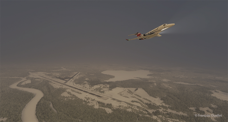
The destination can’t accommodate a private jet like the Cessna Citation Longitude, as runway 08/26 is only 3182 feet long. A good old light twin-engine plane, repainted a hundred times over, will have to be rented for the trip, and we’ll just have to hope the engines hold out.
Enroute to the virtual Sandane airport (ENSD) in Norway with Microsoft Flight Simulator
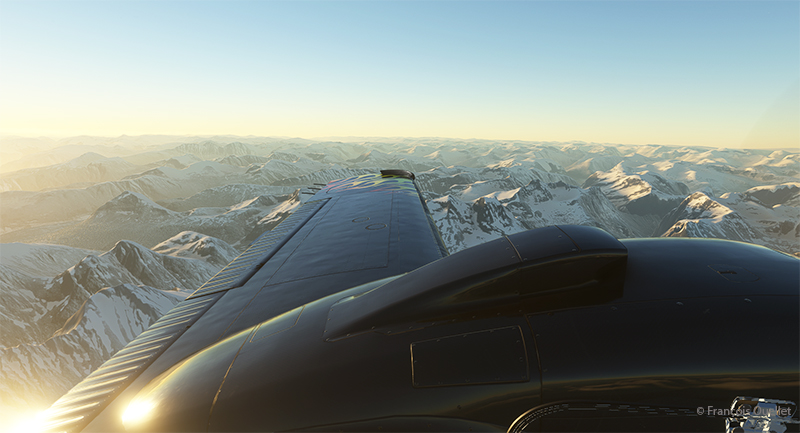
The mountains of Norway come into view, and the ascent continues gradually to ensure that the highest peaks along the route pose no problems.
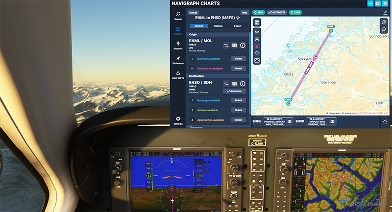
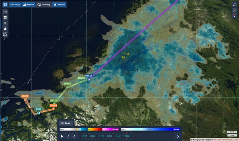
The navigraph tool for flight simulation and the VFR map from ENML to ENSD.
Above, a view of the aircraft’s instrument panel as it climbs, with a Navigraph map showing the route flown in visual flight. Virtual weather is integrated in real time whenever a new weather report is issued by a ground observation station around the world.
View of the Norwegian mountains from the pilot seat
Morning sun over the Norwegian mountains with Microsoft Flight Simulator.
Another sunrise view that brings Norway’s magnificent mountain landscape to life.
Approaching the Sandane virtual airport in flight simulation.
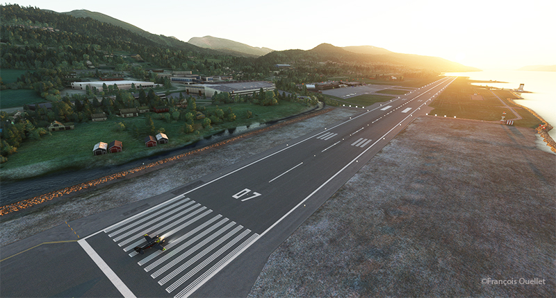
We are now almost at our destination. The plane is in left base for runway 08 at Sandane/Alda airport.
Turning final for runway 08 at Sandane (ENSD) virtual airport in Norway.
Over the still-frozen Innvikfjorden, the final turn is made to stabilize the aircraft on final runway 08. On short final, there’s a cliff just short of threshold 08, and a difference in runway height to take into account for the landing.
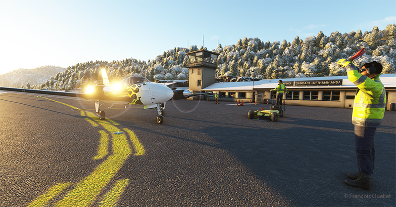
View of the Sandane (ENSD) virtual airport with Microsoft Flight Simulator.
Above, a view of the Sandane/Alda virtual airport (ENSD) using Microsoft Flight Simulator. There is no margin for error, as the two runway thresholds are bordered by a cliff and a stretch of water.
Help for parking is offered at the Sandane (ENSD) virtual airport in Norway.
Service at the airport is excellent. Two employees are waiting to help us park our aircraft.
Sandane is known for its magnificent panoramas, waterfalls, Briksdalsbreen glacier and horseback riding. The village is nestled inland from the Gloppe Fjord. If you’re traveling there in summer, you’ll need to be prepared for a fair amount of precipitation.
The next flight is from Sandane to Stockholm-Bromma in Sweden with a Beechcraft King Air 350I which has not flown for a long time. We’ll have to fly over the high mountains of the Jostedalsbreen Nasjonalpark before reaching our destination.
Airborne from the Ivalo virtual airport (EFIV) in northern Finland.
The fifth leg of this world tour in flight simulation continues with a journey from Ivalo airport (EFIV) in Finland to Molde airport (ENML) in southern Norway. It’s hard to see daylight through the cloud cover as we take off.
In anticipation of this and subsequent flights, I subscribed to Navigraph to make the experience even more immersive. The map below shows the choices for arrival procedures at Molde airport. In green are the reporting points for the arrival and in orange those for the approach. The aircraft follows these points automatically, thanks to the on-board computer.
Navigraph informations for the arrival in Molde (ENML)
I’m only just getting to grips with Navigraph and am still going through a trial-and-error process when it comes to using the data. But I’m making progress…
Heading towards the Molde (ENML) airport in Norway with MFS2020.
Once through the cloud layer, the aircraft finally reaches flight level FL380 (38,000 feet).
The runway at Molde airport is 2221 metres (7287 feet) long, and lies on the shore of Moldefjorden. It’s perfect for the Cessna Citation Longitude, but there are mountains on the approach.
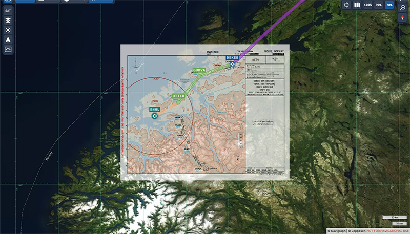
Navigraph map superposed on the geography on approach for the Molde airport (ENML)
The data provided by Navigraph helps the pilot to use the correct altitude limits to maintain a safe height above the terrain at all times. You can also track the aircraft’s progress along the chosen route. Several types of maps are also available to help prepare take-offs and landings. When required, maps can be overlaid with the Navigraph system, while maintaining the aircraft’s planned route over the local geography.
Cessna Citation Longitude descending towards the Molde airport (ENML) airport in Norway in flight simulation.
We start the descent to Molde airport. The cloud cover is relatively thin and visibility is not a problem.
Descending for Molde airport (ENML) in Norway with Microsoft Flight Simulator.
The setting sun makes for beautiful scenes on the descent to Molde.
Approaching the virtual Molde airport (ENML) with the Cessna Citation Longitude
Once out of the clouds and in ideal weather, the autopilot is disconnected and the approach is made visually.
On final for runway 25 at the Molde virtual airport (ENML) in flight simulation.
Winds oriented almost in line with runway 25 facilitate the approach.
Exiting runway 25 at the Molde airport (ENML) in Norway.
The Cessna Citation leaves runway 25 and parks for a few days in Molde, a Norwegian town renowned for its beautiful mountains and numerous parks and rose gardens. This town was saved from famine in 1740 by the presence of herrings. The town’s coat of arms features a whale hunting herrings in a barrel as a reminder of this period. Thanks to its position along the fjords and the foehn effect, winters in Molde are relatively mild (and very mild compared to Canada).
Soon the sixth leg of the flight will take place, from Molde to Sandane (ENSD), a Norwegian airport surrounded by beautiful mountains.
Cessna 700 airborne from the virtual Vagar (EKVG) airport in the Faroe Islands with Microsoft Flight Simulator.
The fourth leg of this world tour in flight simulation continues with a trip between Vagar airport (EKVG) in the Faroe Islands (Kingdom of Denmark) and Finland‘s northernmost airport, (EFIV).
Below is a diagram showing the route, which takes approximately two hours.
From the Vagar airport (EKVG) to the Ivalo airport (EFIV).
I’m using Microsoft Flight Simulator for the trip. The tanks are only 50% full, as we need to limit the aircraft’s weight to allow a safe takeoff on this 5908-foot runway. The aircraft requires a minimum of 4810 feet, to which must be added a strong crosswind component this morning. What’s more, the runway is soggy. If we add too much fuel, we risk ending up in the bay at the end of runway 30.
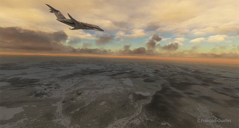
Cessna Longitude enroute to Ivalo (EFIV) Finland in flight simulation.
The virtual Cessna Longitude is now at its planned cruising altitude. Thick clouds cover the coast of Norway, but the weather is much more favorable in northern Finland, where our destination lies.
Virtual Cessna 700 starting the descent towards Ivalo (EFIV) Finland.
After waiting as long as possible before starting the descent, to save the remaining fuel, it’s time to descend into the cloud layer for the approach to Ivalo.
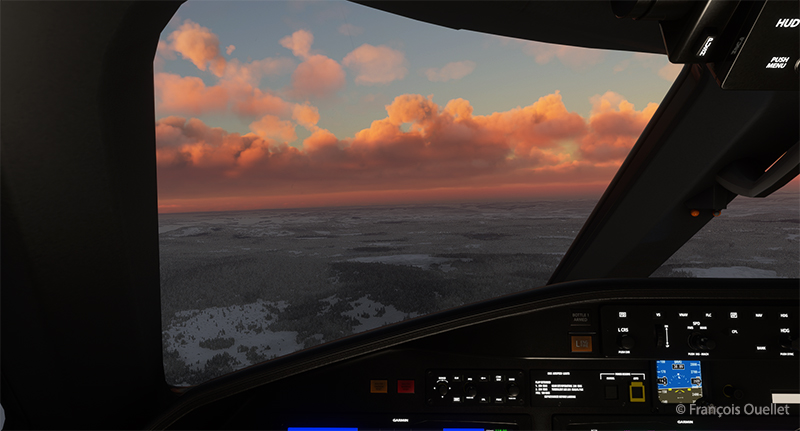
Virtual Cessna Longitude over the frozen northern land of Finland
On the way down to the airport, the aircraft passes through several layers of cloud. Finland, still frozen in March, is clearly visible.
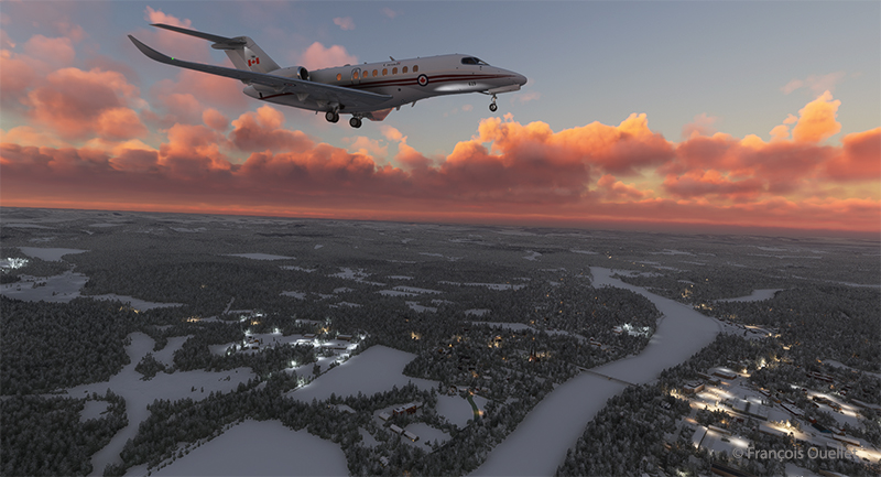
Visual approach to the Ivalo (EFIV) virtual airport in Finland
We have to wait until the last moment to extend the landing gear and flaps to maximize fuel economy. Near the airport, I’m treated to a magnificent spectacle as the sun reaches the horizon.
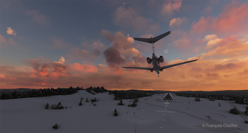
Long final for runway 22 of the Ivalo virtual airport (EFIV) in Finland
Landing gear down. Flaps to follow shortly. An alarm has just gone off in the cockpit to indicate a low fuel level in the tanks. But there’s still around 350 lbs for each engine. On final approach, the view is superb.
Cessna Citation on short final runway 22 for the Ivalo (EFIV) virtual airport in Finland.
Winds are 220 degrees at 7 knots, directly in line with Runway 22. The runway is 8199 x 148 feet. The flaps are down and the approach is smooth.
Ivalo (EFIV) the northernmost aiport in Finland with Microsoft Flight Simulator copie
Welcome to Lapland! Ivalo Airport (EFIV) was Finland’s ninth busiest airport in 2024. The region attracts winter sports enthusiasts as well as those keen to observe the Northern Lights.
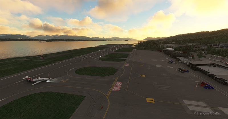
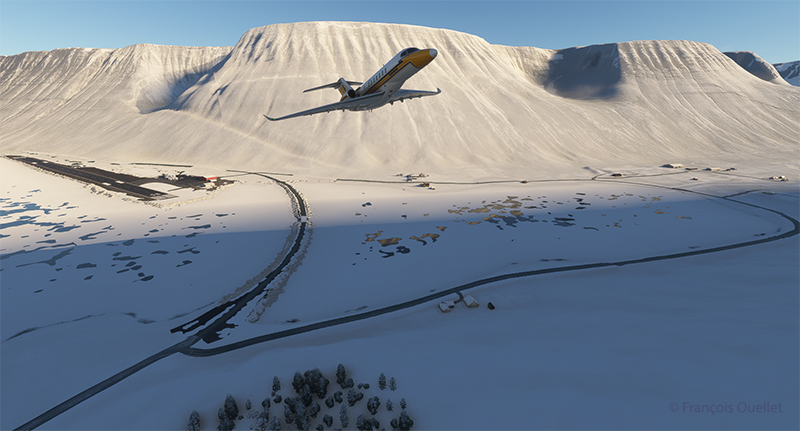
Airborne from the Isafjordur airport (BIIS) In Iceland with Microsoft Flight Simulator.
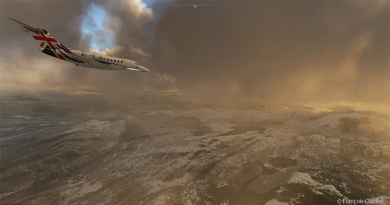
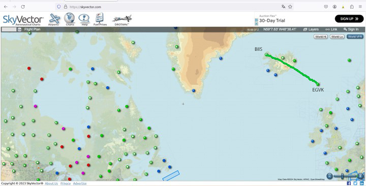
The third leg of the round-the-world flight simulation begins with a departure from Isafjordur (BIIS) in Iceland and ends at Vagar airport (EKVG) in the Faroe Islands, an autonomous archipelago belonging to the Kingdom of Denmark.
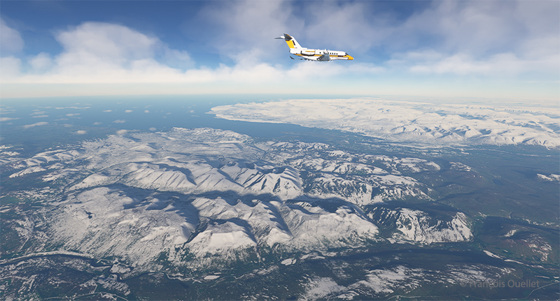
The departure from Isafjordur faces a mountain. You can see the shadows on the ground. But as visibility is perfect, this is no problem at all, as long as the rate of climb is sufficient.
Virtual flight BIIS EGVK
The Cessna Citation Longitude is airborne from the Isafjordur airport (BIIS) in Iceland with Microsoft Flight Simulator.
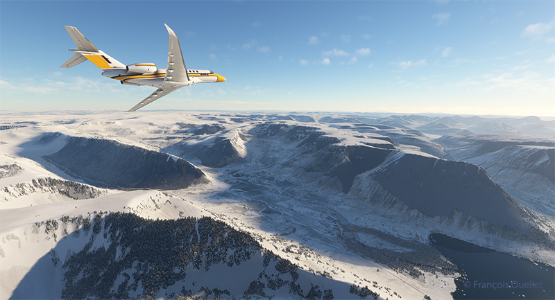
A left turn over the superb Icelandic landscape establishes the Cessna Citation Longitude on course for the Faroe Islands. The FMS ensures that the aircraft will stay on course. But it’s important to remain vigilant: there’s a lot of other equipment that can cause surprises along the way.
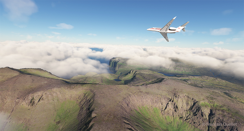
The Cessna Citation is climbing slowly over Iceland.
The climb continues over a magnificent landscape. There’s no turbulence today; if there were, the flight simulator would make sure the plane was harder to control, even for the autopilot. I set the virtual flight to observe real air traffic during the flight, but the route between Iceland and the Faroe Islands is off the most popular routes, so it’s normal not to encounter too many aircrafts.
The Cessna Citation Longitude is heading to the Vagar airport (EKVG) in Feroe Islands
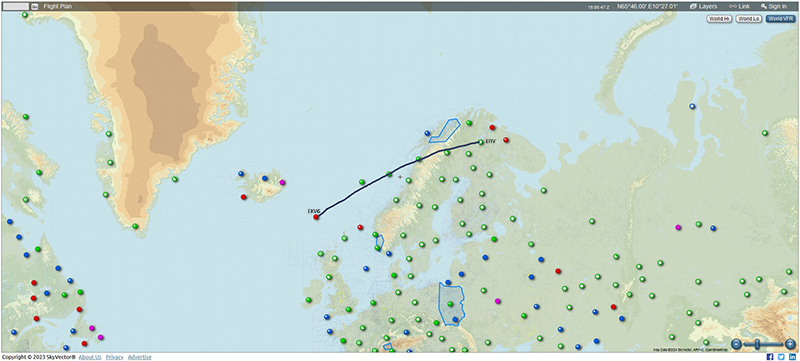
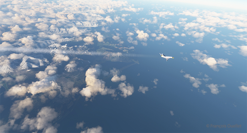
We are now established at our cruising altitude, leaving Iceland’s eastern border to fly over the Atlantic Ocean.
Visual approach for runway 12 at the Vagar airport (EKVG) Feroe Islands
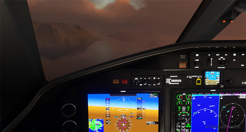
We disconnect the autopilot to give us a free hand on the visual approach to Vagar (EKVG) airport. A small white dot, the lights of runway 12, can be seen straight ahead in the distance. The landing gear is down, as are the flaps, and the speed has stabilized at around 140 knots for the moment.
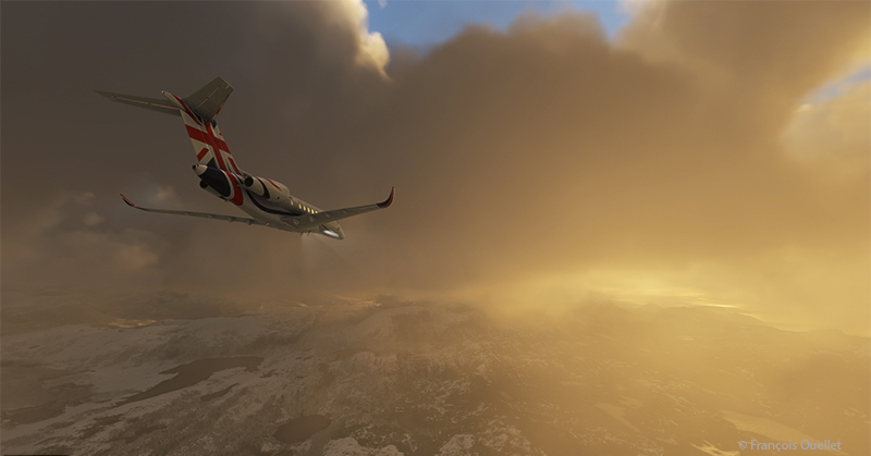
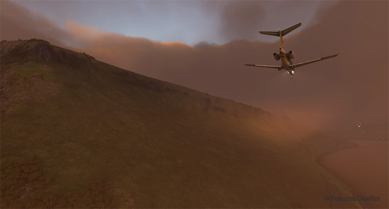
The Cessna Citation is on long final for runway 12 of the Vagar airport (EKVG) Faroe Islands
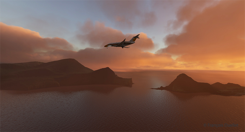
It’s an ideal time to arrive in the Faroe Islands, with the setting sun coloring all the surrounding clouds.
The Citation Longitude on visual approach to runway 12 at the Vagar airport (EKVG)
Runway 12 is visible on the far right in the photo above. The uneven cloud cover sometimes blocks the view of the airport for a few seconds, but the wind quickly blows the clouds away, preventing a missed approach. Virtual weather ensures a constant renewal of weather conditions.
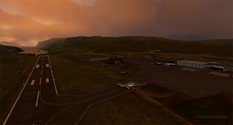
The Cessna Citation exits runway 12 at the Vagar airport (EKVG) in Faroe Islands with Microsoft Flight Simulator
Landing is trouble-free, as the Vagar runway is long enough (5902 x 98 feet) to accommodate such a private jet.
Some 53,000 people lived in the Faroe Islands as of 2021. One of the most popular activities is bird and plant watching. To make it easier for residents and tourists to get around, tunnels have been built between some of the archipelago’s 18 islands.
The fourth leg of the round-the-world virtual flight will take place between Vagar and Ivalo (EFIV) in Finland. This is Finland’s northernmost airport.