The flight simulator enthousiast will have fun trying this short flight ( 14 minutes) from the Eagle County virtual airport (KEGE) to the Telluride virtual airport (KTEX). The virtual flight, using FSX, was made during winter, on January 8th. The shots below represent an idea of what is visible while flying toTelluride. Use 14,000 feet, it should do it…
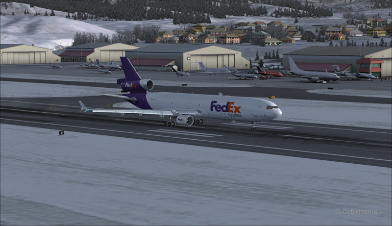
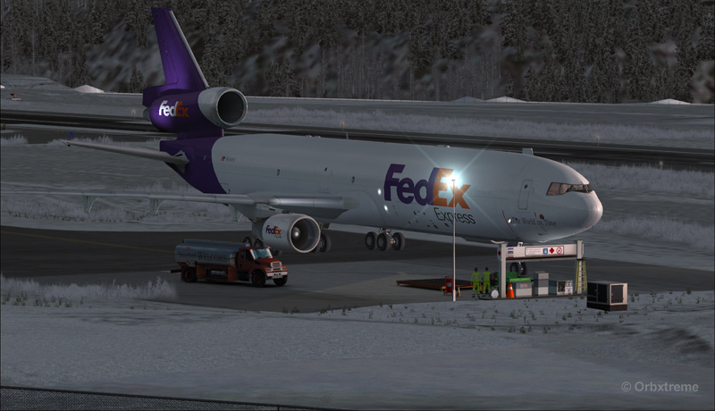
FedEx MD-11 on the take-off run at the Eagle County airport (KEGE) (FSX)
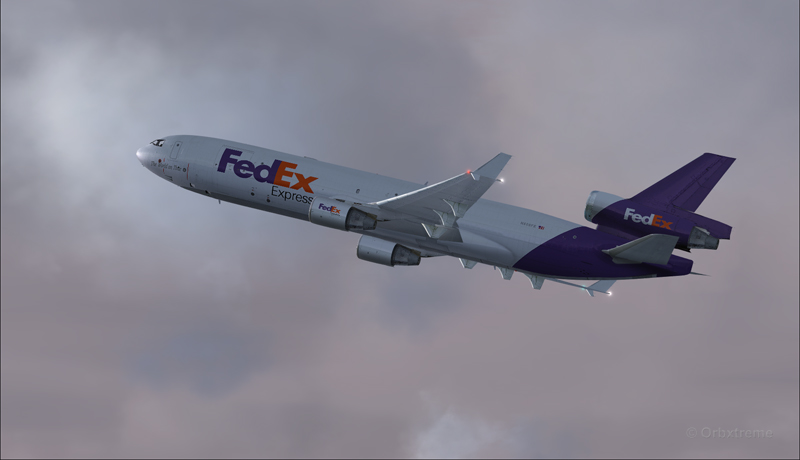
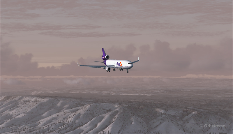
FedEx MD-11 airborne from the Eagle County airport (KEGE) (FSX)
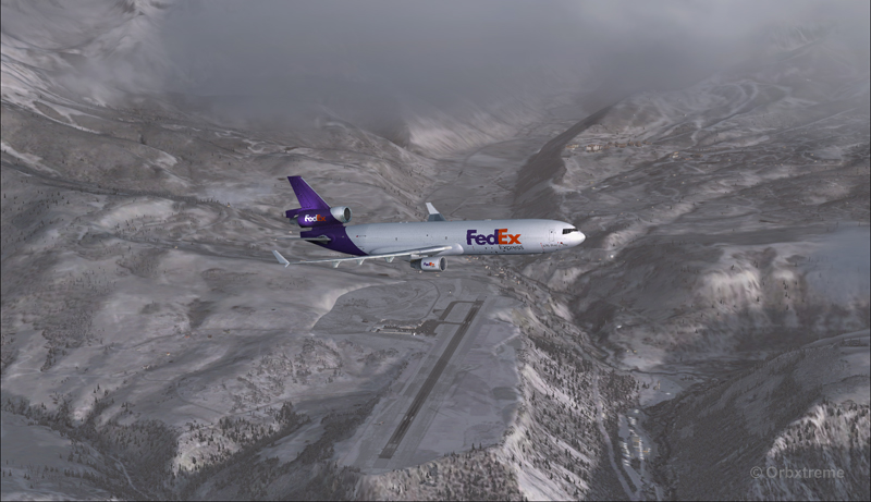
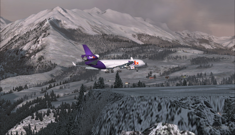
FedEx MD-11 between Eagle County airport (KEGE) and Telluride airport (KTEX) (FSX)
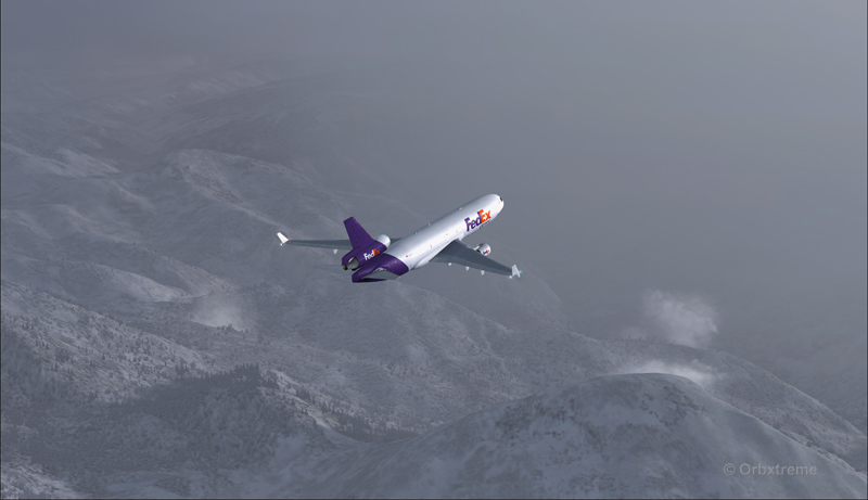
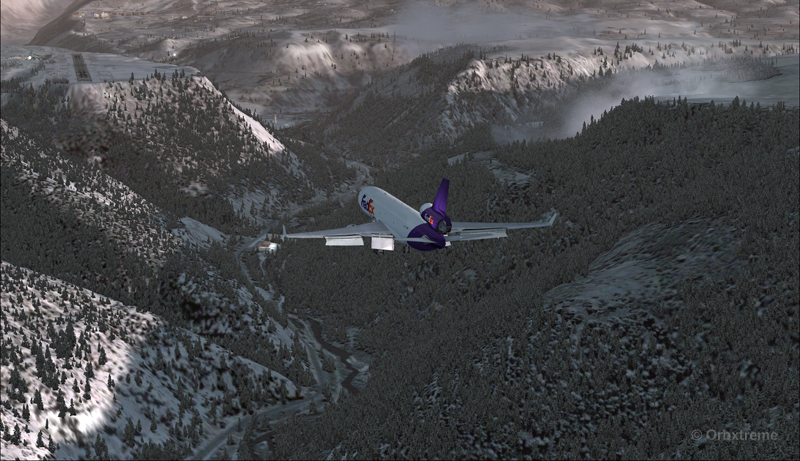
There are lots of beautiful mountains between KEGE and Telluride, and also some unpredictable weather…
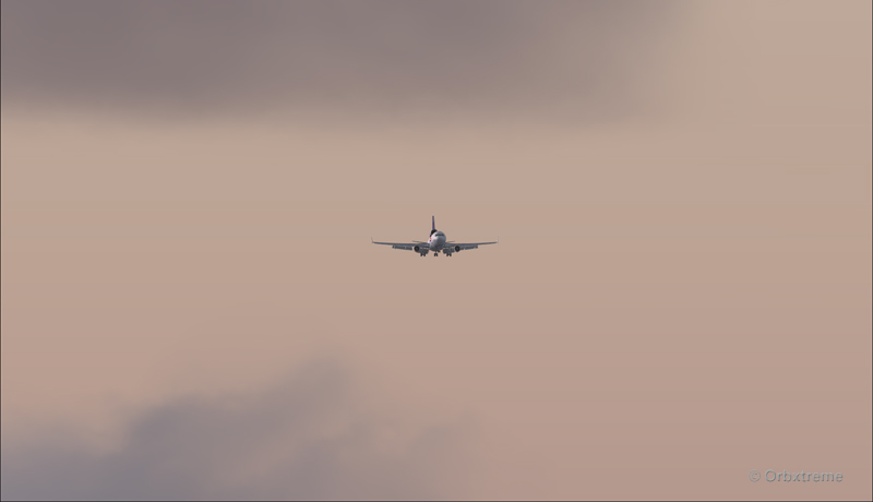
FedEX Md-11 entering bad weather
The expected ceiling at Telluride was 8500 ft. On the way to the airport, the clouds and visibility were sometimes obscuring the mountains.
A FedEx MD-11 on a flight Eagle County (KEGE) to Telluride (KTEX) (FSX)
Telluride is a very inviting airport for a MD-11. The 7000 feet runway itself does not represent a big challenge, although its 100 feet are a bit narrow: this aircraft would normally require a 150 feet wide landing surface.
The virtual VFR approach made with the MD-11 was the most expensive way to do the trip, since it required a fly-by and a 270 degree turn to the right to align with runway 09.
FedEx MD-11 flies by the Telluride airport KTEX) (FSX)
The 270 degree turn at a 10-20 degree bank allowed to transit from 14,000 to 10,000 ft without doing anything radical. Just a turn while descending and gradually loosing speed to arrive at around 160 kts on final. The aircraft was now installed on long final, with flaps set at 50 degrees.
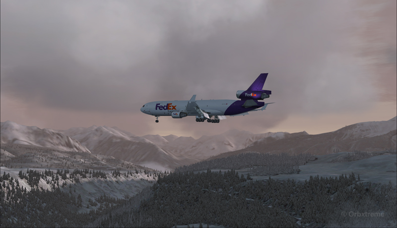
A FedEx MD-11 on long final runway 09 for the Telluride airport (KTEX) (FSX)
The high altitude runway’s 9078 feet msl elevation meant the pilots dealt with lower air density and heavy weight when approaching and, as such, the airspeed had to be adjusted accordingly to prevent stalling on final.
A FedEx MD-11 on final runway 09 for the Telluride airport (KTEX) (FSX)
Here is a view from the Telluride tower…
View from the Telluride airport (KTEX) (FSX) of a FedEx MD-11 on final for runway 09
Now with a view like that, you would not consider coming in IFR…!
A FedEx MD-11 inbound from KEGE on final for runway 09 at the Telluride airport (KTEX) (FSX)
To prevent an overshoot and some additional expenses in fuel (which are already skyrocketing), an optimal approach was required.
Most accidents with the MD-11 happen when the pilot pushes on the stick when there is a rebound with the nose wheel, thus creating an even stronger rebound. When there is a rebound, there is no need to push on the stick, just wait and the aircraft sets itself quickly.
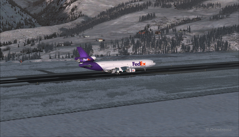
A FedEx MD-11 over the threshold runway 09 at the Telluride airport (KTEX) (FSX)
Now with max breaking and thrust reversers…
A FedEX MD-11 slowing down at the Telluride airport (KTEX) (FSX)
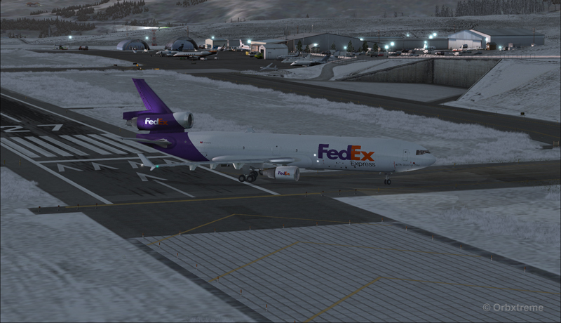
The MD-11 can easily turn at the first taxiway at Telluride. But in order to capture a wider view of the airport, I exited at the last taxiway (again adding to the already enormous expense in fuel…)
A FedEX Md-11 is exiting runway 09 at the Telluride airport (KTEX) (FSX)
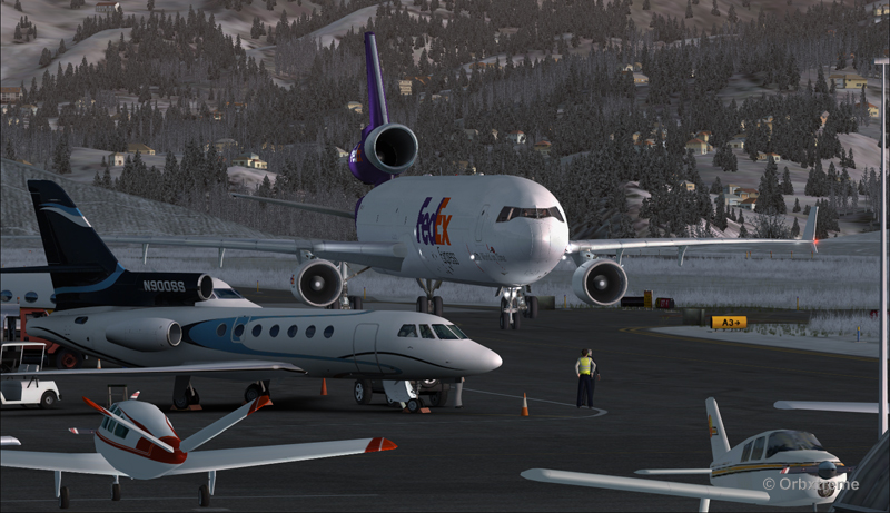
The employee on the ramp was worried that the MD-11 lower winglet would scratch N900SS while taxiing. But there was plenty of space (11 inches)…
A FedEX Md-11 is taxiing on the ramp at the Telluride airport (KTEX) (FSX)
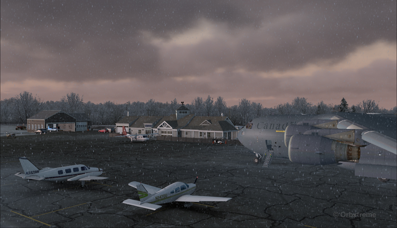
The MD-11 was parked temporarily in a spot needed by every aircraft. It was necessary to unload quickly the precious cargo and get out of the way.
Temporary parking for a FedEx MD-11 at the Telluride airport (KTEX) (FSX)
Some expert handling would be needed to help move back that MD-11 close to the runway. But that was the Telluride’s airport manager problem and he had promised he would have something ready!
FedEx Md-11 parked at the Telluride airport (KTEX) (FSX)
The virtual scenery from departure to destination is a creation of ORBX programmers and the virtual MD-11 is made by PMDG Simulations (I am not sure it works with P3D though). For the weather, I used REX Simulations as the weather engine and REX and Cumulus X for the cloud textures. (Edit: PMDG does not support it’s MD-11 anymore).
For other challenging virtual flights, head towards the flight simulation section of my web site, under “challenging virtual flights”: there is something for everyone!
For more articles on flight simulation on my web site, click on the following link : Flight simulation
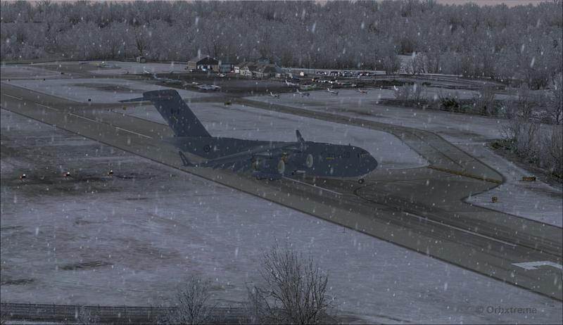
Alex Geoff, the ORBX Block Island (KBID) virtual airport designer, asked flight simulator enthousiasts to try to operate the biggest aircraft possible on that airport ‘s 2502 ft runway.
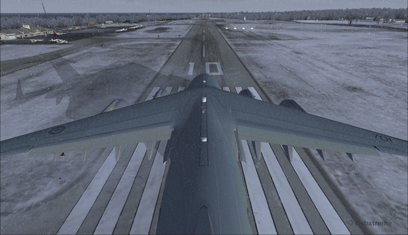
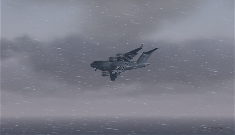
Canadian military aircraft C17-A ready for take-off runway 10 at the Block Island (KBID) virtual airport in United States (FSX)
Naturally, we are talking about a virtual flight. You must then forgive the landing of an aircraft which, in real life, would destroy the runway. You also have to disregard the fact that numerous trees would have to be chopped if the aircraft would elect to use the taxiway. I was almost forgetting the pilots and airport manager that would have to be fired following the authorized manoeuver.
The context of the flight having been presented, here is the data that will allow flight simulator enthousiasts to replicate the circuit around the Block Island airport with a Virtavia C-17A.
Contrary to the Cessna type aircrafts normally evolving around the airport, the total weight of the canadian military C-17A used for the flight was 405,000 pounds. The fuel was adjusted to 50% in all four tanks. Both pilots agreed to skip lunch in order to avoid adding any extra weight to the beast…
Flaps were adjusted to 2/3. I backed the aircraft to the beginning of the runway, applied the brakes, applied full throttle, waited for maximum regime, released the brakes and used ground effect to lift the aircraft before it was too late. The take-off was done on runway 10 with a 12 kts and 70 degree crosswind.
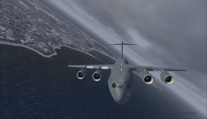
Canadian military aircraft C17-A airborne runway 10 at the Block Island (KBID) virtual airport in United States (FSX)
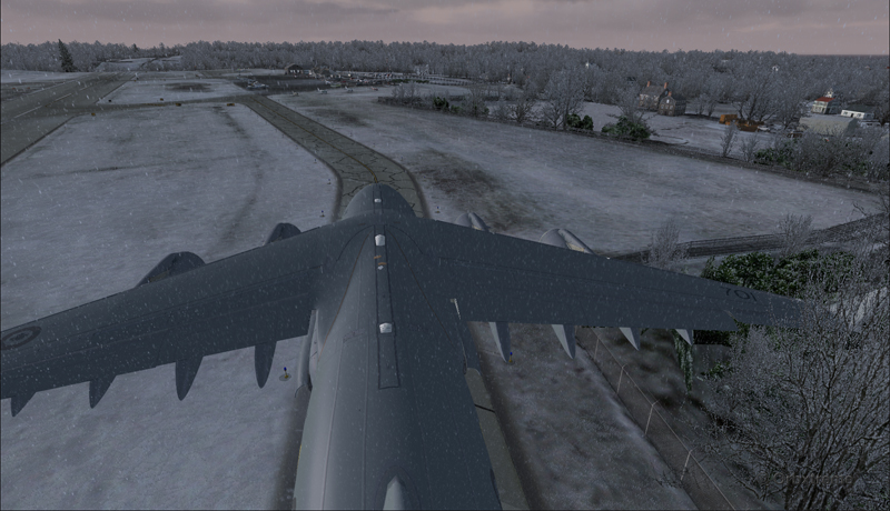
Then, four right turns were made : 190°, 280°, 010° and 100°. During the flight, the aircraft’s altitude never went above 2000 feet.
Canadian military aircraft C17-A turning downwind runway 10 at the Block Island (KBID) virtual airport in United States (FSX)
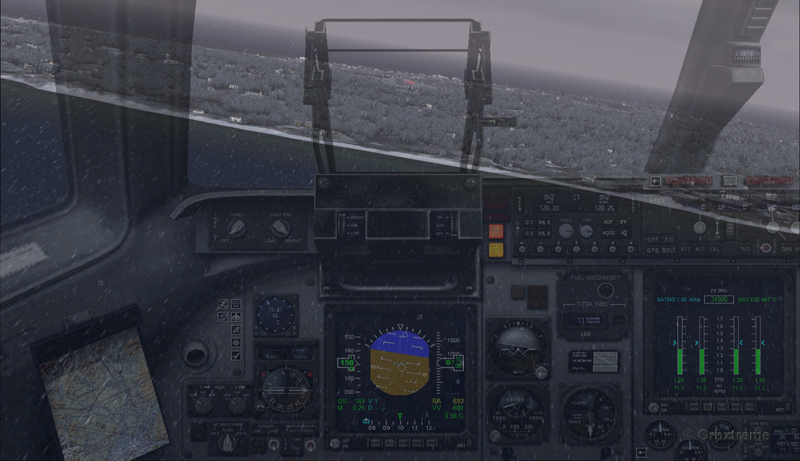
Wheels and flaps were brought down in base so that I did not have to make serious adjustments on final.
Canadian military aircraft C17-A turning base runway 10 at the Block Island (KBID) virtual airport in United States (FSX)
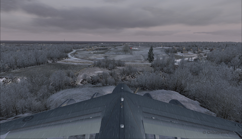
Canadian military aircraft C17-A on long final runway 10 at the Block Island (KBID) virtual airport in United States (FSX)
Canadian military aircraft C17-A short final runway 10 at the Block Island (KBID) virtual airport in United States (FSX)
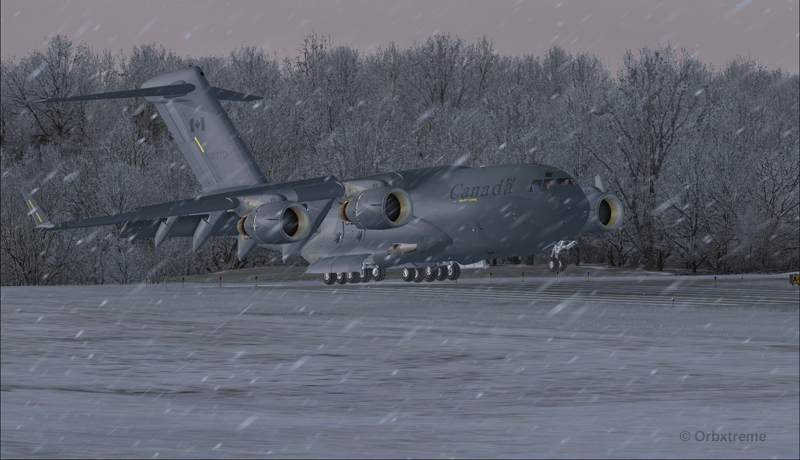
The speed eventually went down to 128 kts and, while the aircraft was still about two feet in the air, I used the airbrakes. The thrust reversers were fully activated two feet before touch-down (continued pressure on F2) since they take time to rev up. That is not necessarily the proper way to do it and you can wait one more second, until the wheels touch the runway, to use the reversers. The main gear touched at the very beginning of the runway and maximum breaking was then applied.
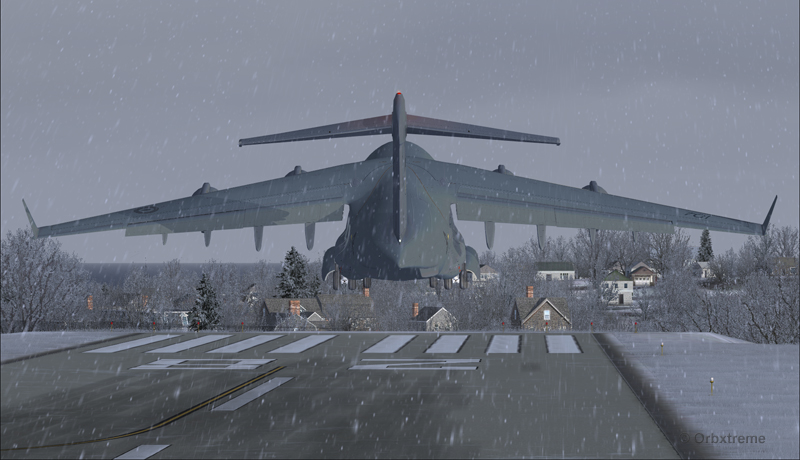
Canadian military aircraft C17-A landing at the Block Island (KBID) virtual airport in United States (FSX)
It was possible to exit on the taxiway without having to back-track on the runway. The environment always coming second, some trees were cut so that there were no contacts with the aircraft.
Canadian military aircraft C17-A exiting runway 10 at the Block Island (KBID) virtual airport (FSX) in United States
Canadian military aircraft C17-A taxiing at the Block Island (KBID) virtual airport (FSX) in United States
If you decide to try it out, think of saving the flight when you are on final, in case you are not satisfied with your performance during the landing (scrapped aircraft, destroyed houses and vehicles in the neighborhood, burned forest at the end of runway 10, collateral victims, etc.).
Canadian military aircraft C17-A at the Block Island (KBID) virtual airport (FSX) in United States
Good luck!
For other challenging virtual flights, head towards the flight simulation section of the present web site.
For more articles on flight simulation on my web site, click on the following link : Flight simulation
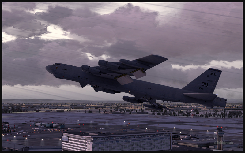
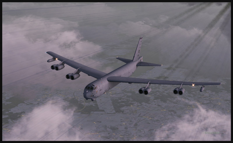
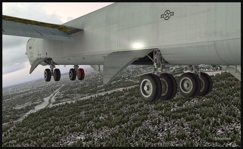
Boeing B-52 (FSX) airborne from Montréal Pierre-Elliott-Trudeau Intl to Anchorage, Alaska
Boeing B-52 (FSX) building up speed between Montréal and Anchorage
The Boeing B-52 is a Captain Sim creation and the Montreal airport is made by FlyTampa. The remaining scenery is designed by ORBX. Here are few basic informations for those of you who would be tempted to try a flight immediately after the download is completed. For the takeoff: pitot heat, 100% flaps down, YAW SAS Switch Engage, stabilizer trimmed, full throttle within four seconds, climb between 1500 and 2000 ft/min. The climb with flaps down is done at 180 kts. Adjust the thrust so that you have time to bring the flaps in totally; use 230 kts as maximum for zero degree flaps. Once in flight, brake to stop the wheels rotation then bring the gear up (although not before reaching 1000 ft agl).
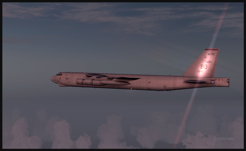
B-52 at cruising altitude (FSX)
Boeing B-52 inbound to Anchorage, Alaska (FSX)
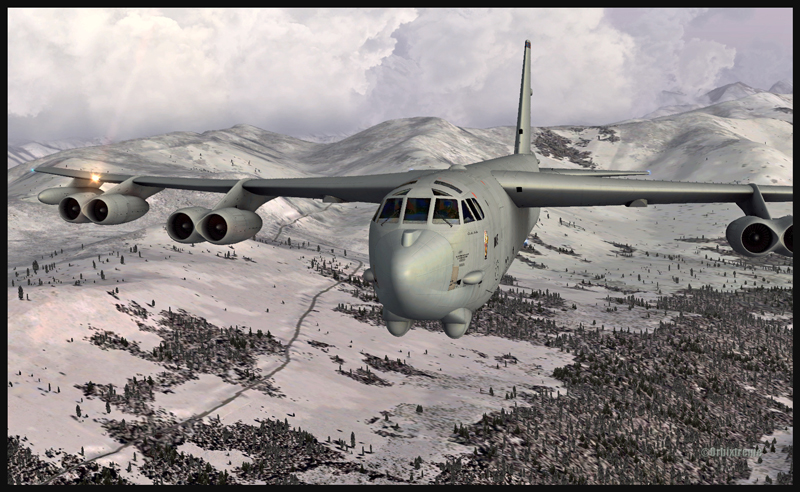
For a normal descent: (note: keep 20 kts in surplus of the proposed speed when the aircraft is turning). The descent is done at about 240 kts, with airbrakes 4, gear down, throttle to idle. À 220 kts, you may start applying flaps (they take 60 secondes to be fully extended). Once in downwind, use153 kts with airbrakes 4 (for 225,000 lbs). No more than 30 degrees turns. The rollout is done at no more than133 kts.
Boeing B-52 with flaps and gear out on the approach for Anchorage (FSX)
Boeing B-52 with runway in sight in Anchorage (FSX)
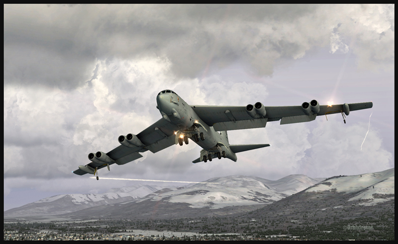
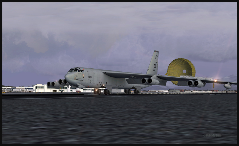
Boeing B-52 and the parachute on the arrival at Anchorage (FSX)
The touchdown with airbrakes full up is done at 110 kts IAS. The drag chute is then deployed (never above 135 kts). Keep a slight angle only, with the rear wheels touching first. When taxiing, turn the YAW switch and the airbrakes to “OFF”. Those are only basic infos. By the way, when the drag chute is deployed, you will not see a difference in the breaking distance; the chute is there only for “graphic” reality. Have a good flight!
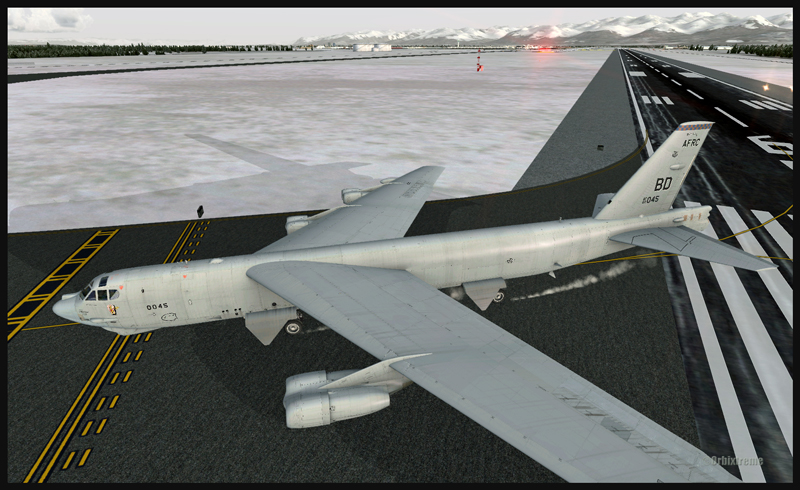
Boeing B-52 leaving the runway in Anchorage (FSX)
For more articles on flight simulation on my web site, click on the following link : Flight simulation
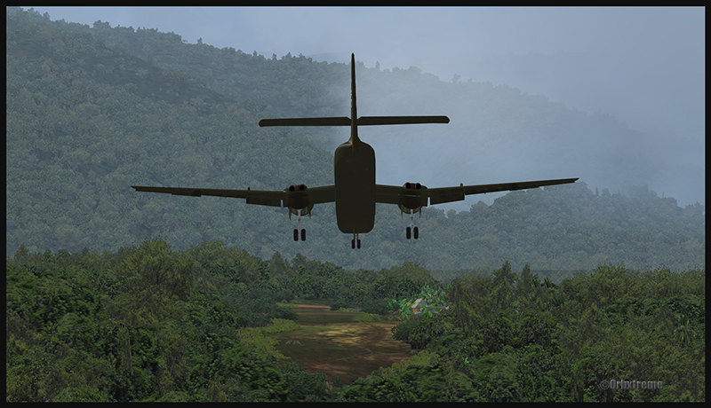
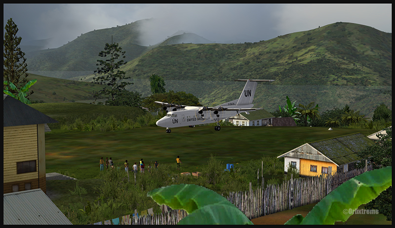
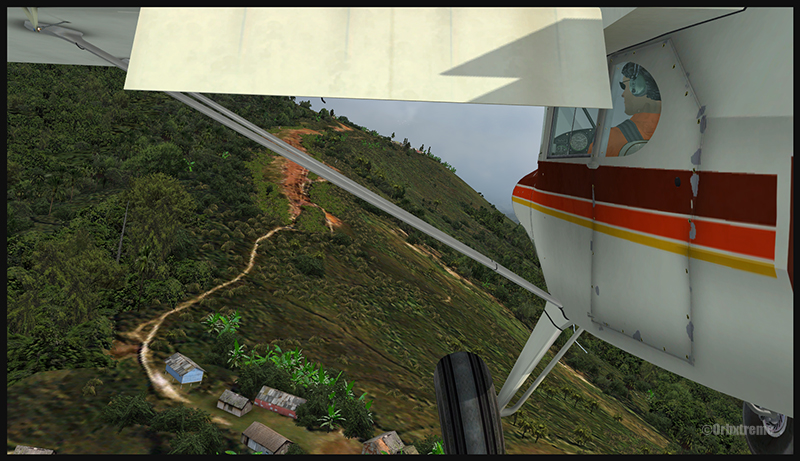
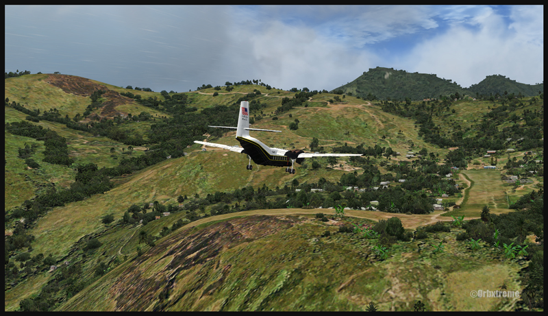
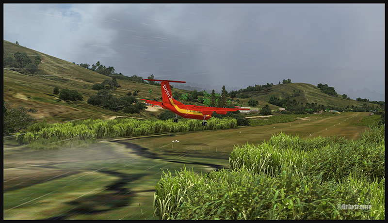
A virtual DHC-6 Twin Otter enroute for Kokoda after a fire on the right engine while departing Yongai (KGH) in Papua New Guinea PNG (FSX)
Ken Hall and Tim Harris have created a new virtual scenery for flight simulation enthousiasts. It is called “Tapini” and sold by ORBX. Their penultimate creation, AYPY Jackson’s International, allowed the virtual pilot to fly in very demanding virtual airports along the Kokoda Trail in Papua New Guinea. “Tapini” represents a whole new challenge and I have included several screen captures to show you how the different runways look in this new virtual scenery.
“Tapini”, still in Papua New Guinea, allows the virtual pilot to test his skills on seven new runways located in difficult areas of the Owen Stanley Range. Those airports also constitute a serious test for any aircraft, like in the picture above where damages to the right engine were sustained at Yongai.
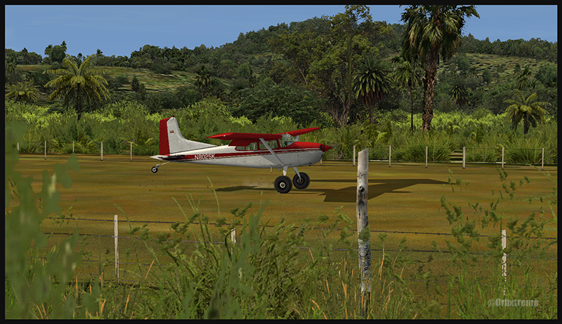
A virtual Piper Pacer virtuel is about to land on the Ononge (ONB) curved runway in Papua New Guinea PNG (FSX). (It is possible to see the curve starting on the top of the image)
To improve the virtual clouds while flying between the different airports, I used either REX or FSGRW weather engines. The cloud textures and weather effects were improved by one or many of the following products: Cumulus X, PrecipitFX, REX Texture Direct and REX Soft Clouds.
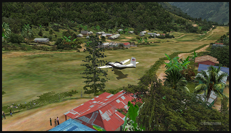
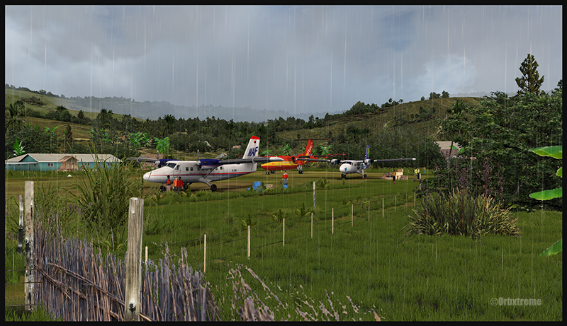
A virtual Dash 7 has just landed in Woitape (WTP) in Papua New Guinea PNG (FSX)
As variety is more fun, and also due to the different challenges created by those runways, the following virtual aircrafts were used: Carenado C-185F, Lionheart Creations PA-18, Virtavia DHC-4, Aerosoft DHC-6 Twin Otter and Milton Shupe DHC-7.
The “Tapini” scenery gives the pilot a choice between the seven following runways:
ASB (Asimba)
A tricky, very short runway near a river.
A DHC-4 Caribou virtual aircraft is on approach for Asimba’s sloped runway (ASB) in Papua New Guinea PNG (FSX)
This is a very interesting runway, best done with a STOL aircraft like the Caribou DHC-4. The inhabitants might have to help you clear out some branches along the runway, considering the size of the aircraft. The runway slopes down on take-off, which helps to build up speed.
A DHC-4 Caribou virtual aircraft is on a stopover at Asimba (ASB) in Papua New Guinea PNG (FSX)
A DHC-4 Caribou virtual aircraft is airborne from Asimba (ASB) in Papua New Guinea PNG (FSX)
FNE (Fane)
A one-way, really challenging 12 degree sloped runway, with unpredictable winds.
A De Havilland DHC-7 virtual aircraft on final for the Fane (FNE) airport’s sloped runway in Papua New Guinea PNG (FSX)
The runway sits on top of a hill. It is an amazing experience to land there. No wonder there are a lot of people watching the arrivals and departures.
If you slow down too quickly with an aircraft as big as the DHC-7 on that sloped runway, the twelve degree angle prevents you from moving forward. You must let the aircraft come down the runway very slowly, using the power to control the descent and the rudder to stay aligned on the runway, then apply take-off power for a few seconds to build just enough momentum to get above the hill.
A De Havilland DHC-7 virtual aircraft just finished taxiing uphill on the Fane (FNE) airport’s sloped runway in Papua New Guinea PNG (FSX)
To turn the aircraft around, it’s a combination of power and reverse thrust until you clear all the obstacles (any humans venturing behind the aircraft will also be cleared during the operation…).
A De Havilland DHC-7 virtual aircraft is airborne from the Fane (FNE) airport’s sloped runway in Papua New Guinea PNG (FSX)
There is a not so friendly man with a rifle watching the airport’s operations. Even the United Nations staff do not stay longer than necessary…
KGH (Yongai)
A very bumpy one-way sloped runway. A real bush aircraft is needed here!
A virtual DHC-6 Twin Otter on approach for the Yongai (KGH) bumpy runway in Papua New Guinea PNG (FSX)
Even with a real bush aircraft, there is a possibility that one of the aircraft’s propellers hits the ground while taxiing on the runway. There are so many deep holes that are hard to see, I can only wish the best of lucks to everyone trying out this airport!
A virtual DHC-6 Twin Otter on the Yongai (KGH) bumpy runway in Papua New Guinea PNG (FSX)
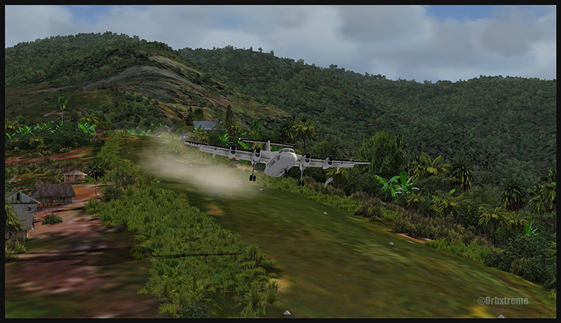
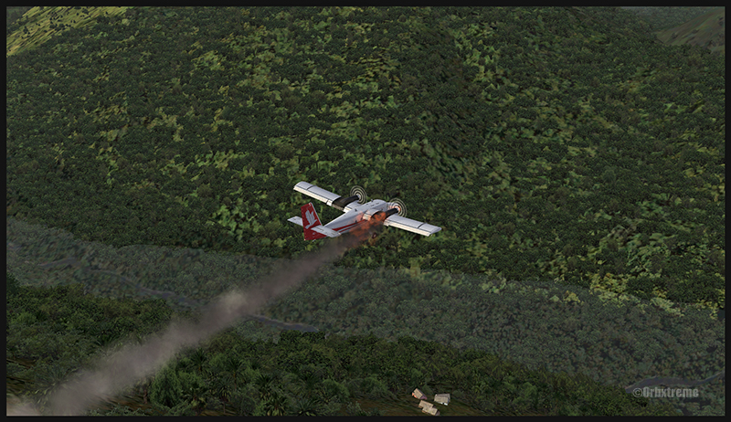
Keep a close watch on the area near the little house at the end of the runway. The DHC-6 was really shaken while turning around for take-off. One of the propellers hit the ground but no problems were detected…until the aircraft was airborne. The fire alarm then went off, just as the aircraft was passing the runway threshold, seconds before flying over a cliff.
A virtual DHC-6 Twin Otter with its right engine on fire is just airborne from the Yongai (KGH) bumpy runway in Papua New Guinea PNG (FSX)
So much for the planned trip… and it was out of the question to return to Yongai on one engine. I had to pull the handle to stop the fire, feather the prop, cut the fuel where it was not needed anymore then head to the Kokoda airport as it was a sure alternative, having a long runway and an elevation that did not require the use of extra power.
KSP (Kosipe)
A relatively short runway that requires good calculations from the pilot, since it is located high in the mountains.
A virtual Cessna C-185F is enroute to the Kosipe (KSP) airport in Papua New Guinea PNG (FSX)
The Cessna C-185F is a very well suited aircraft for that runway. Make sure not to be too heavy on the brakes, as new C-185 propellers are hard to find in Kosipe. You can land in both directions. Ensure that the mixture is set properly as the airport is above 6300 feet.
A virtual Cessna C-185F is rolling after touching down on the Kosipe (KSP) runway in Papua New Guinea PNG (FSX)
A virtual Cessna C-185F is airborne from the Kosipe (KSP) runway in Papua New Guinea PNG (FSX)
ONB (Ononge)
A curved and very bumpy runway! For those who like low flying. Make sure you choose the good aircraft here; there is not much manoeuvering area once on the ground.
A Virtual Piper Pacer on approach for the Ononge (ONB) curved runway in Papua New Guinea PNG (FSX)
Ononge looks really scary when you show up on final for the first time. You wonder if the little trail that you see can really be a runway. For that kind of situation, the little Piper Pacer is an excellent aircraft, approaching slowly and braking on a dime. The runway is curved in the middle so you will need a bit of right rudder to keep the aircraft aligned with the runway.
A Virtual Piper Pacer on the Ononge curved runway in Papua New Guinea PNG (FSX)
I guess all those people with their cargo are waiting for a bigger airplane than mine…
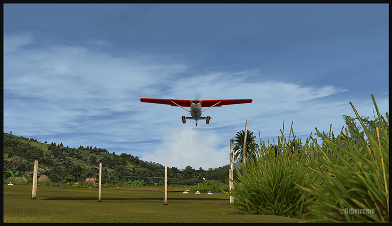
A Virtual Piper Pacer is airborne from the Ononge curved runway in Papua New Guinea PNG (FSX)
TAP (Tapini)
A challenging one-way sloped runway nestled in a tight valley. You can even use an ILS to arrive there!
A virtual DHC-4 Caribou on short final for the Tapini (TAP) sloped runway in Papua New Guinea PNG (FSX)
This is a superbly designed area and airport. I visited it with the DHC-4 Caribou but any other big STOL aircraft would have fitted there. There is enough room to manoeuver. It is not too bumpy. There is an interesting slope: it starts downward and ends upward: this helps to slow down the aircraft after landing.
A virtual DHC-4 Caribou on the ground at the Tapini (TAP) airport in Papua New Guinea PNG (FSX)
A virtual DHC-4 Caribou is airborne from the Tapini (TAP) airport in Papua New Guinea PNG (FSX)
WTP (Woitape)
Looks like a no brainer, but there is no margin of error on this one-way slightly sloped runway. Very precise calculations and settings are required if you want to land there with something else than a small aircraft.
A virtual De Havilland DHC-7 on final approach for the Woitape airport (WTP) virtual airport in Papua New Guinea (FSX)
I found the runway to be very slippery with the De Havilland DHC-7. I must say that there was a good crosswind, as I was flying with real life weather and winds. The DHC-7 behaves like a big boat while decelerating on such a runway.
A virtual De Havilland DHC-7 on the ground with two Twin Otters at the Woitape airport (WTP) in Papua New Guinea (FSX)
The Woitape scenery is gorgeous. It is nice to have all those well designed virtual aircrafts, people and animals on site as this makes the scenery so much more realistic.
A De Havilland Virtual DHC-7 is airborne from the Woitape airport (WTP) in Papua New Guinea (FSX)
I love this new Orbx product. When you fly in such a realistic scenery, the brain does not make much difference between what is real and what is virtual. It really works! And if you use real life weather downloaded from the internet, it’s even better.
I tried the seven airports included in the “Tapini” virtual scenery and they are quite demanding. Yongai was the most challenging airport of them all. I had to do two missed approaches there since I ended up too high on the approach. I eventually got it right, like in real life!
I used the Microsoft flight simulator X (FSX) for all the virtual flights, but other platforms would have worked as well (Dovetail Games FSX Steam edition (FSX: SE) and all versions of P3D). The following products were also installed on my flight simulator: FTX Global, FTX Global Vector and Holgermesh, as well as Pilot’s FS Global 2010.
It is a totally immersive virtual experience and you have to forget everything else when undertaking those challenging virtual flights… if you want to make it “virtually” alive!
For more articles on flight simulation on my web site, click on the following link : Flight simulation
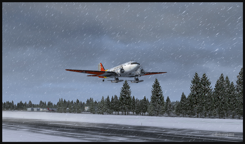
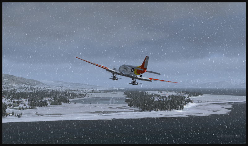
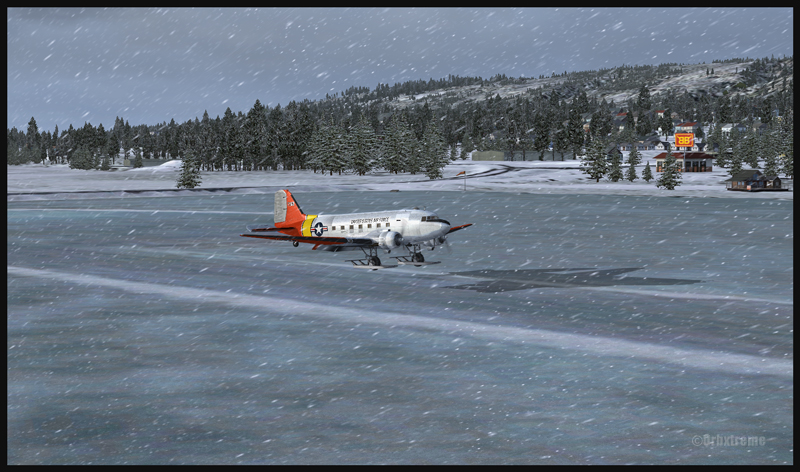
DC-3 at the Homer (PAHO) virtual airport in Alaska (FSX)
If you feel like attempting a virtual landing on an ice runway, an opportunity is offered by ORBX through their Homer (PAHO), Alaska virtual airport. For the flight, I used the FSX platform but it could have been also done under P3D.
DC-3 on skis airborne from the Homer (PAHO) virtual airport in Alaska (FSX)
The ice runway is just a short distance away from the regular Homer asphalted runway. The DC-3 is an excellent aircraft for the task since its approach speed is very low and it is one of the few virtual aircrafts equipped with skis.
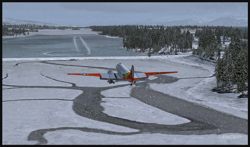
A DC-3 on skis is turning final for the Homer ice runway in Alaska (FSX)
If you want to try that flight, make sure to adjust the flight simulator configuration settings so that the Homer ice runway option is activated, otherwise you’ll end up under water…
In order to add a bit of challenge as well as winter realism, you can add a bit of crosswinds or some snow using the standard « heavy snow » option in FSX. The program PrecipitFX helps a lot if you are looking for a better definition of precipitations, be it snow or rain. For this flight, the Cumulus X program was also activated.
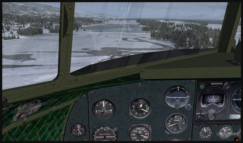
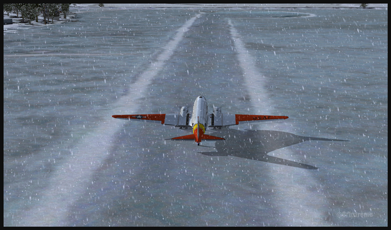
Cockpit view of a virtual DC-3 on final for the Homer (PAHO) ice runway in Alaska (FSX)
Virtual DC-3 on skis on short final for the Homer (PAHO) ice runway in Alaska (FSX)
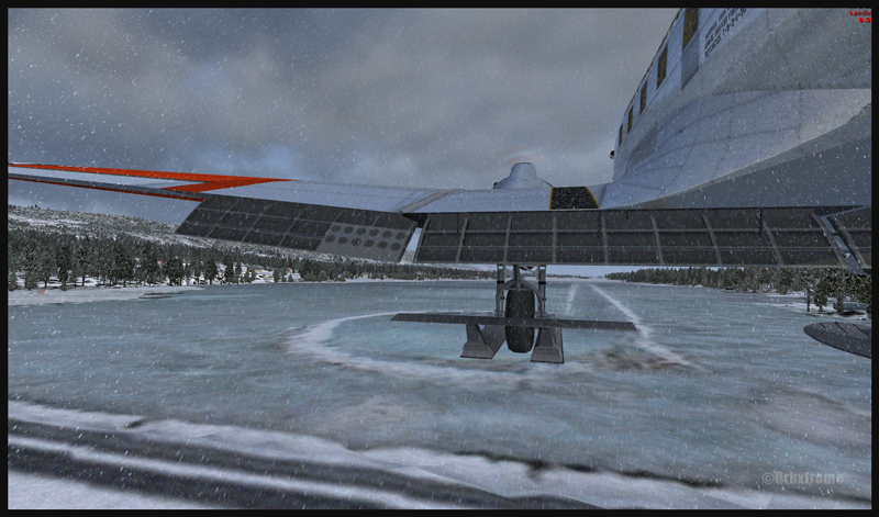
Virtual DC-3 on skis about to touch the threshold of the Homer ice runway in Alaska (FSX)
The short flight proved to be an interesting experience, since the runway was narrow and there were some crosswinds. I thought that it would be very slippery but it was not the case. Maybe one day Orbx, in association with the FSX Steam (Dovetail Games) professionals, will work at modifying the flight simulation platform and add a CRFI (JBI) index of .40 or less to increase the difficulty in slowing down and controlling the virtual aircraft?
A DC-3 on skis flying few feet over the Homer (PAHO) (FSX) ice runway, a product of the ORBX company
A virtuel DC-3 on skis after a landing on the Homer (PAHO) ice runway in Alaska (FSX)
A DC-3 virtual on skis backtracking the Homer (PAHO) ice runway in Alaska (FSX)
As this flight is not a super though exercise, I have placed it in the “standard virtual flights”, in the flight simulation section of my website. For more of those flights, click on the following link: Other standard virtual flights
Have fun trying this one! Later on, I’ll present another ice runway located on Antarctica, which virtual scenery was made by Aerosoft. Even the C-17 Globemaster III is approved there…
For more articles on flight simulation on my web site, click on the following link : Flight simulation
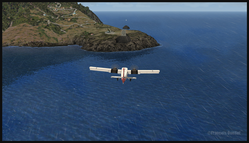
Well, let’s start with a real life video showing that there is no margin for error when landing in St.Barths :
In that video, you can clearly see that the speed on the approach seemed excessive and the aircraft floated precious seconds over the runway. Very soon, there wasn’t enough runway left to stop the aircraft safely. So the trick is to use a reasonable approach speed and be ready to do a missed approach if the wheels do not touch early on the runway.
40014 Runway in sight at St Barths TFFJ on the left and in the middle of the island (FSX)
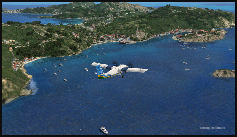
40015 A Solomons Twin Otter is on final for runway 10 at St Barths TFFJ (FSX)
An approach with a virtual aircraft of your choice can be done in St.Barths (TFFJ) since FlyTampa St Maarten scenery includes that airport. I tried a circuit with the Aerosoft Twin Otter, under FSX, and it went very well, since this aircraft can fly at a very low speed and can break on a dime. It might have been a different story with the same aircraft that pilot was flying in the video…
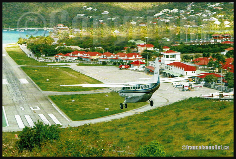
Cessna 208B N208SG landing at Saint Barthelemy Airport, Guadeloupe (on aviation postcard)
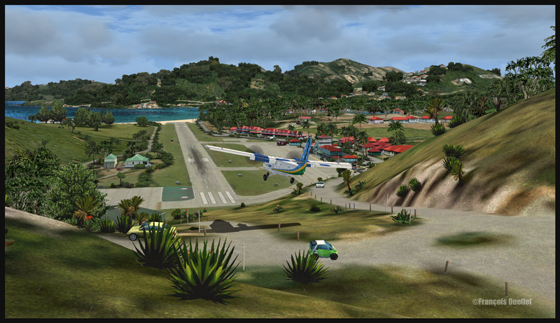
40016 The Twin Otter is now on short final for runway 10 in St Barths TFFJ (FSX)
40017 The Twin Otter lands on the threshold of runway 10 at St Barths TFFJ (FSX)
For your information, the St.Barths 10-28 runway is 2133 ft long. For the landing, the winds where blowing from 031/10G20, which provides for a good crosswind. The biggest aircraft to have landed in St Barthélémy is a Canadian built de Havilland DHC-7.
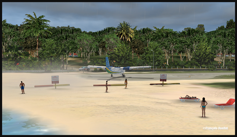
40021 A bit of sand is blown on tourists in St Barths TFFJ (FSX)
40022 A Solomons Twin Otter leaves the runway at St Barths TFFJ (FSX)
Good luck and have fun trying out that virtual flight!
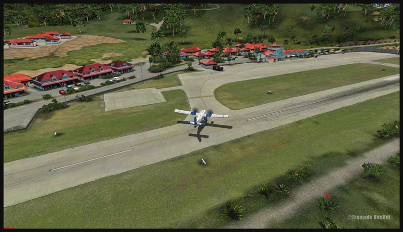
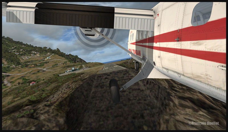
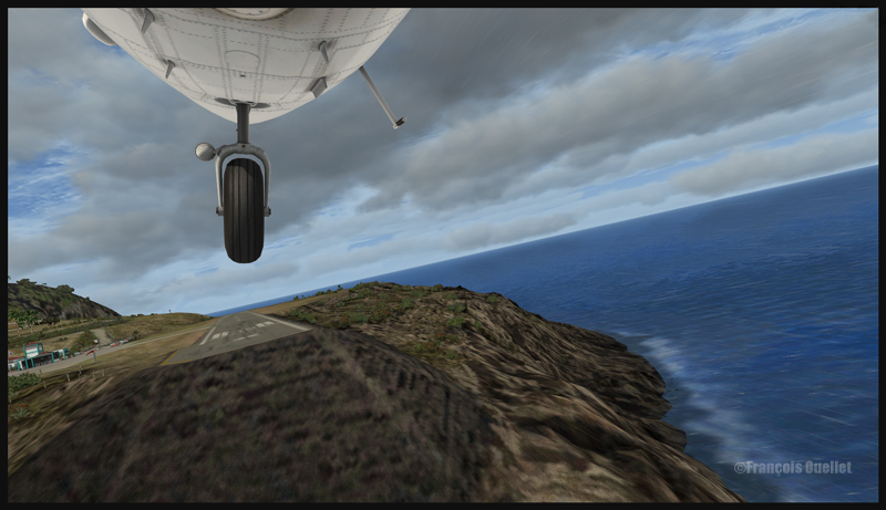
One nice challenging virtual flight in FSX is to operate from the Juancho E. Yrausquin Airport, the shortest commercial runway in the world.
The runway is 1299 ft long (396m) and 60 ft (18m) above sea level. The IATA code is SAB, and the ICAO code TNCS.
30314 A Twin Otter aircraft is on long final for Saba (FSX)
30315 A Twin Otter aircraft is on short final for Saba (FSX)
The ideal virtual aircraft for that runway is the Twin Otter (DHC-6) or the Britten Islander (BN-2). If you want something bigger, the De Havilland DHC-7 is going to be your perfect choice. Forget about jet aircrafts, the runway is too short.
30316 A last correction for the wind in Saba (FSX)
To add to the pleasure, use runway 30 and add a strong crosswind component, with gusts. In the screen captures below, I set the winds to 030 degrees at 10G20. For the flight, I also used Cumulus X and PrecipitFX to improve the visual effects.
30317 A Twin Otter aircraft is arriving in Saba (FSX)
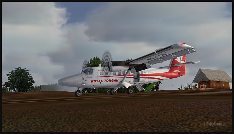
30320 A Royal Tongan Twin Otter aircraft is leaving the runway in Saba (FSX)
For an even more realistic experience, I suggest you get the FlyTampa St.Maarten scenery, which will offer you three airports, which are all very well designed and present real challenging approaches : the Juancho E. Yrausquin airport, on Saba Island,the spectacular St.Barths airport and the Princess Juliana international airport in St.Maarten.
In the « challenging virtual flights » section of my website, I have already included an approach to Princess Juliana airport in St.Maarten, with the MD-11. The approach to St.Barths (TFFJ) will soon be included.
You will enjoy every minute trying to make perfect landings at those three airports. For other challenging virtual flights, visit the flight simulation page of my website.
Have fun!
For more articles on flight simulation on my web site, click on the following link : Flight simulation
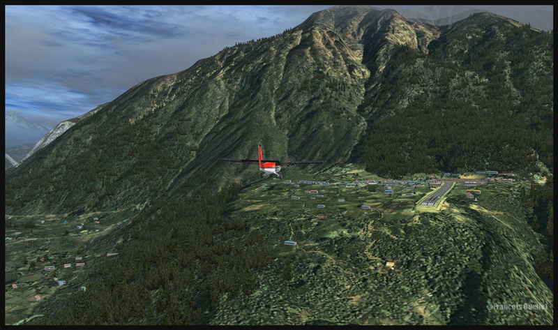
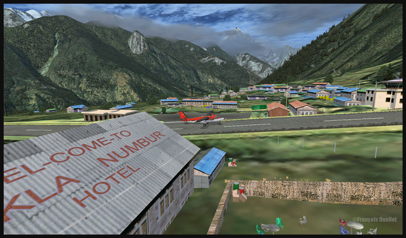
If you are looking for a challenging virtual flight, why don’t you try the route Syangboche –Lukla with the Aerosoft Twin Otter? It is a very short flight, few minutes only, where the aircraft will be constantly descending until its destination.
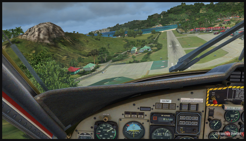
A Twin Otter aircraft is on descent from Syangboche towards the Lukla runway
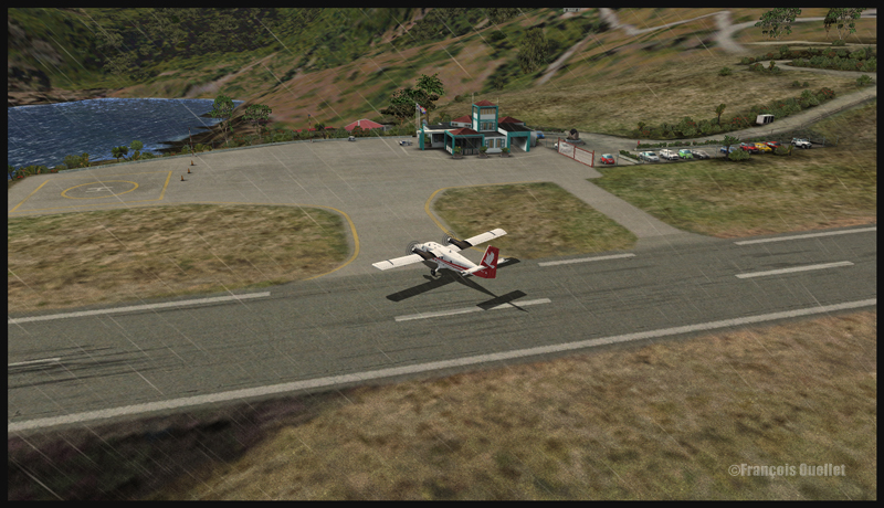
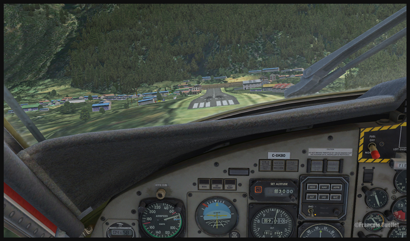
A Twin Otter aircraft is on approach for runway 06 at Lukla
The approach in Lukla can be tricky due to a 12 degree sloping runway. You have a feeling of coming in too quickly, but you must resist the temptation to reduce speed since, at this altitude, the stalling speed increases with all aircrafts.
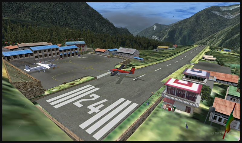
Runway 06 is used for landing, and 24 is for departures. There is no possibility of a missed approach. You either succeed or you crash since there is a high rock wall at the end of runway 06.
A Twin Otter aircraft is on final for runway 06 at Lukla
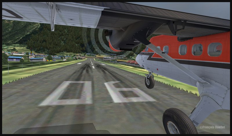
A Twin Otter is about to land on runway 06 in Lukla
So the flight is made from Syangboche (OACI code:VNSB, altitude : 3748m and a 400m runway) towards Lukla (OACI code:VNLK, altitude 2860m and a 460m runway).
A Twin Otter aircraft is landing on runway 06 in Lukla
The scenery and objects around Syangboche are a creation of ORBX. Once you get closer to Lukla, you will notice a change in the scenery details, since you are entering the Aerosoft Lukla scenery (you have to buy this additional scenery to make the flight more realistic).
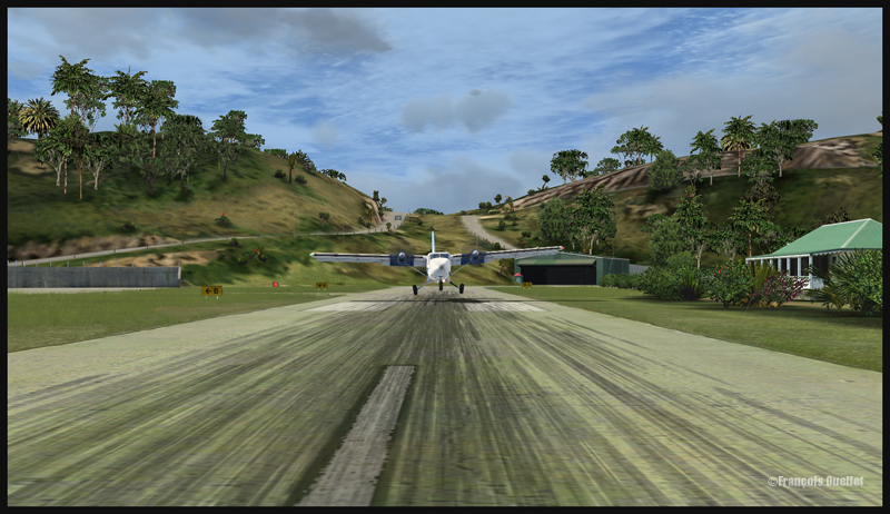
A Twin Otter aircraft has just landed on the runway at Lukla
A Twin Otter aircraft exits the runway in Lukla
The integration of the two scenery styles is very well achieved.
This flight will require all your attention. Good luck! For other challenging virtual flights, visit my website.
For more articles on flight simulation on my web site, click on the following link : Flight simulation
FSGRW is a weather generator and it uses downloaded data from the internet to simulate actual real weather all around the world (24,000 + airports).
The program simulates very well what is going on in the atmosphere up to FL520, including the depiction of hurricanes and tropical cyclones.
FSGRW does not come with its own cloud texture packages. Like for ASN(Active Sky Next) or OpusFSI, you must add a texture package from a third party (like REX for example). FSGRW will then use those beautiful textures to represent the downloaded weather from the internet, instead of the old cloud files that were created years ago by Microsoft.
FSGRW was not created to give you access to all kind of fancy options like automatic connections to the weather radar of big airliners. It is a simple but very efficient program that aims at representing the weather accurately.
FSGRW includes some well-known local weather effects.
Icefield in sight! A screen capture realized with the following products: FSX, FSGRW, REX, and a combination of Orbx creations. Final editing with a photo editing software (slight corrections only)
FSGRW is compatible with FS2004, FSX, ESP, P3D, Steam and X-Plane.
FSGRW gives you the possibility to use the actual weather present at one airport and transfer it to another airport. You have access to historic weather through a file-mode option. You may also choose to fly with dynamic or static weather. The weather updates are made every six minutes now that version 027 has been issued.
You can create your own flight plan and weather sequence.
FSGRW can be used through a network.
I own FSGRW and use it in combination with REX texture packages. I am very satisfied of the result. But I don’t doubt that ASN, OpusFSI or REX weather engines can provide excellent results as well. The only thing to remember is that you have to buy a weather engine AND cloud texture packages in order to improve the virtual weather’s visual aspect.
The weather engine ASN (Active Sky Next), like FSGRW, OpusFSI or REX updates the weather by downloading the latest information from the internet. There is also a possibility to use historical data (up to two years back).
ASN, FSGRW and OpusFSI use the default FSX cloud texture sets. So those weather engines can benefit from additional cloud texture sets (from REX for example) for a better visual depiction.
The cloud locations and coverage are accurate as well as realist. Thick overcast layers can be displayed. The cloud transitions are smooth, as well as the vertical variations in temperature, wind speed and wind direction.
Cloud-based effects include in-cloud reduced visibility, related turbulence (in cloud or when entering or exiting a cloud formation), accurate position of precipitation according to the type of clouds and to your position relative to the cloud formation.
Microbursts, wind shears, hail, turbulence as well as updrafts and downdrafts effects are modelled for thunderstorms. There are aural wind shear alerts when flying through a thunderstorm cell: That will nonetheless not be of great help if you attempt to cross a strong thunderstorm as, like in real life, you might not succeed…
You can use the radar to navigate through bad weather since radar and cloud positions are synchronized. The radar shows the intensity of precipitations as well as the echo tops.
Voiced warnings will be triggered when new Airmets and Sigmets are issued. They cover the world and can be viewed on a map. Associated icing and turbulence are added according to the warnings.
In flight, you can receive voiced weather updates through ATIS, FlightWatch or FSS.
ASN corrects the problems sometimes associated with low-level clouds, like inaccurate coverage and wrong position of the clouds, or layers that are really too thin.
Like with other weather engines, there is a flight planning mode. You can enter, import, or build a flight plan, as well as change the flight plan and waypoints at any time before or during a flight.
The weather, airports and navaids are displayed and can be edited, added or erased. The forecasts are available through graphics or text. If, along your route, there is no Metar issued for few hours, the engine will use the forecast to update the weather.
The thermals are modeled using the temperature and surface of terrain.
The wake turbulence trails are visible and, like in real life, are moving with the wind.
ASN does not rely only on interpolation to cover the oceanic areas and other territories where there are few weather stations.
The developers of ASN say that they have created a realistic hurricane simulation based on actual hurricane data. Their program would automatically disregard the ground data that seems incorrect. I cannot comment about the realism of that simulation since I have not tried it yet. But if it is correctly modelled, this function should interest whoever wants to experiment what it is to fly in or near a hurricane.
ASN is compatible with FSX, FSX: SE and the P3D versions up to P3DV4. It can support a multi-monitor setup.
I am not listing all the characteristics of this interesting software since there are always new options added. If you want more details, I provided the link below. Like with all the other weather engines, take the time to see what each has to offer since they have quite different features and spectrum of options.