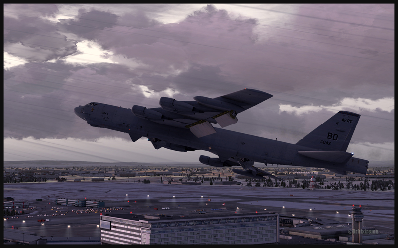
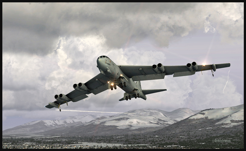
Boeing B-52 (FSX) airborne from Montréal Pierre-Elliott-Trudeau Intl to Anchorage, Alaska
Boeing B-52 (FSX) building up speed between Montréal and Anchorage
The Boeing B-52 is a Captain Sim creation and the Montreal airport is made by FlyTampa. The remaining scenery is designed by ORBX. Here are few basic informations for those of you who would be tempted to try a flight immediately after the download is completed. For the takeoff: pitot heat, 100% flaps down, YAW SAS Switch Engage, stabilizer trimmed, full throttle within four seconds, climb between 1500 and 2000 ft/min. The climb with flaps down is done at 180 kts. Adjust the thrust so that you have time to bring the flaps in totally; use 230 kts as maximum for zero degree flaps. Once in flight, brake to stop the wheels rotation then bring the gear up (although not before reaching 1000 ft agl).
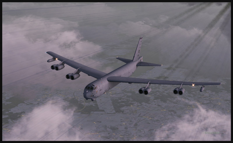
B-52 at cruising altitude (FSX)
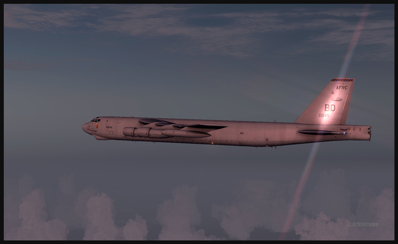
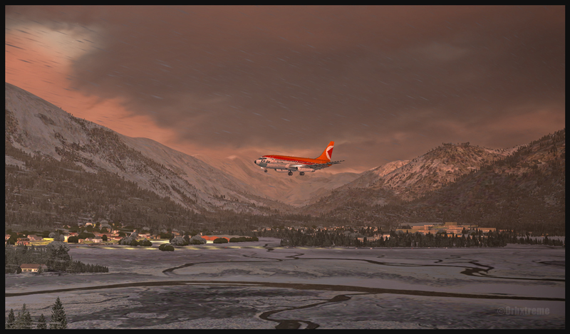
Boeing B-52 inbound to Anchorage, Alaska (FSX)
For a normal descent: (note: keep 20 kts in surplus of the proposed speed when the aircraft is turning). The descent is done at about 240 kts, with airbrakes 4, gear down, throttle to idle. À 220 kts, you may start applying flaps (they take 60 secondes to be fully extended). Once in downwind, use153 kts with airbrakes 4 (for 225,000 lbs). No more than 30 degrees turns. The rollout is done at no more than133 kts.
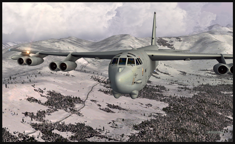
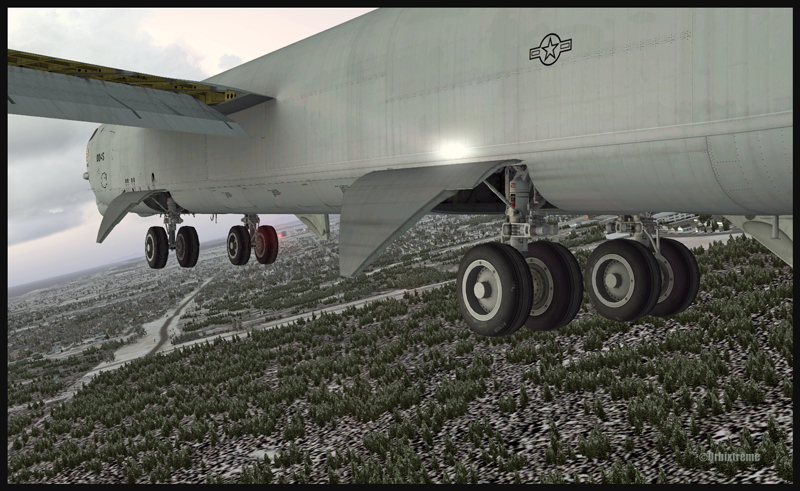
Boeing B-52 with flaps and gear out on the approach for Anchorage (FSX)
Boeing B-52 with runway in sight in Anchorage (FSX)
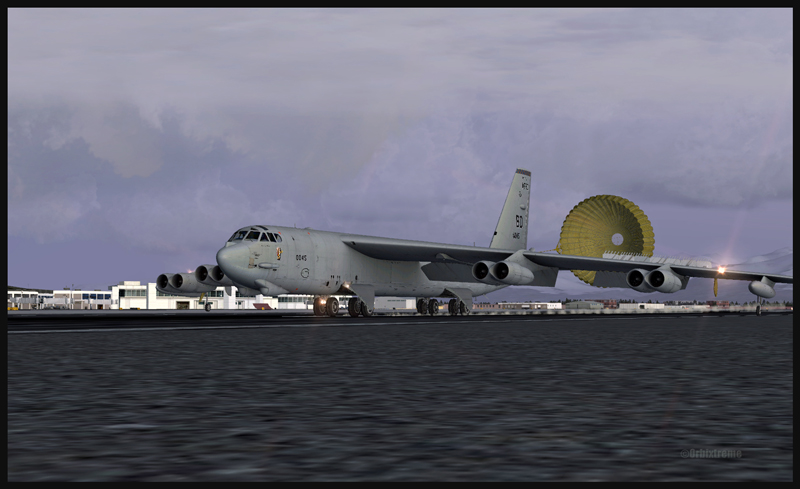
Boeing B-52 and the parachute on the arrival at Anchorage (FSX)
The touchdown with airbrakes full up is done at 110 kts IAS. The drag chute is then deployed (never above 135 kts). Keep a slight angle only, with the rear wheels touching first. When taxiing, turn the YAW switch and the airbrakes to “OFF”. Those are only basic infos. By the way, when the drag chute is deployed, you will not see a difference in the breaking distance; the chute is there only for “graphic” reality. Have a good flight!
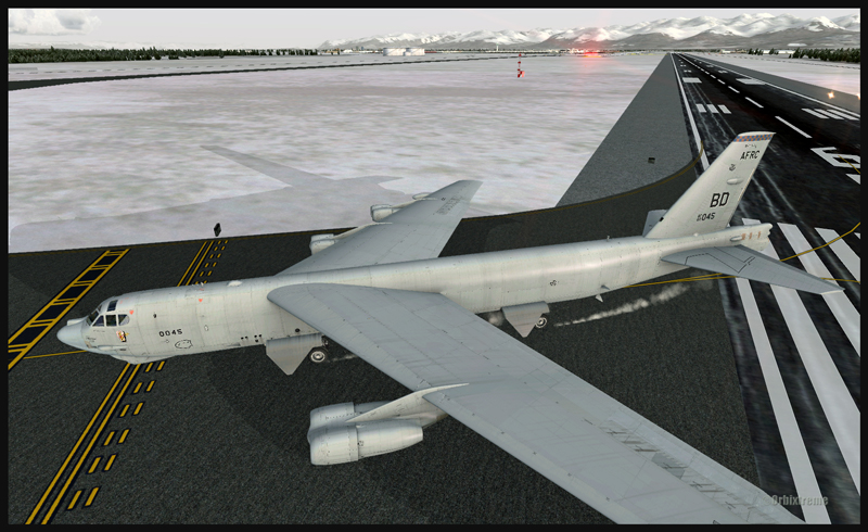
Boeing B-52 leaving the runway in Anchorage (FSX)
For more articles on flight simulation on my web site, click on the following link : Flight simulation
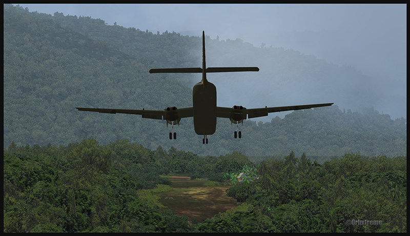
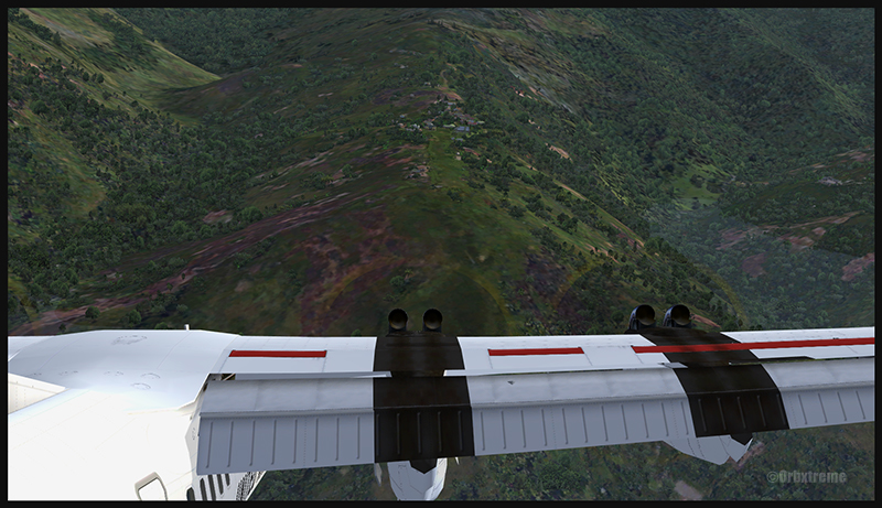
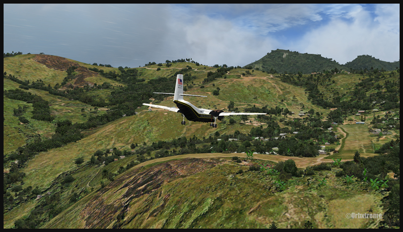
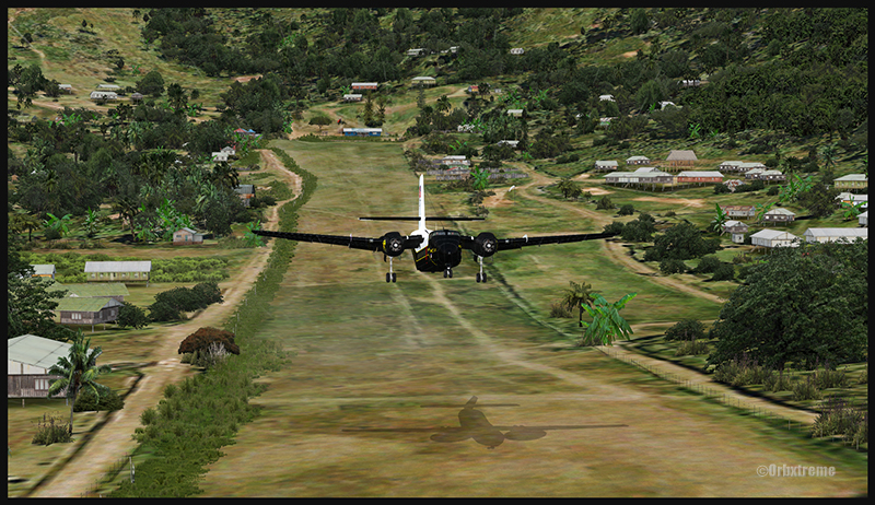
A virtual DHC-6 Twin Otter enroute for Kokoda after a fire on the right engine while departing Yongai (KGH) in Papua New Guinea PNG (FSX)
Ken Hall and Tim Harris have created a new virtual scenery for flight simulation enthousiasts. It is called “Tapini” and sold by ORBX. Their penultimate creation, AYPY Jackson’s International, allowed the virtual pilot to fly in very demanding virtual airports along the Kokoda Trail in Papua New Guinea. “Tapini” represents a whole new challenge and I have included several screen captures to show you how the different runways look in this new virtual scenery.
“Tapini”, still in Papua New Guinea, allows the virtual pilot to test his skills on seven new runways located in difficult areas of the Owen Stanley Range. Those airports also constitute a serious test for any aircraft, like in the picture above where damages to the right engine were sustained at Yongai.
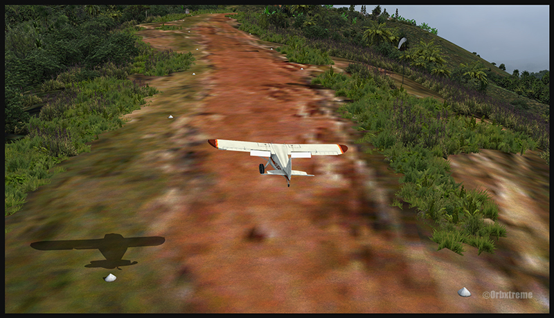
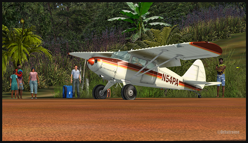
A virtual Piper Pacer virtuel is about to land on the Ononge (ONB) curved runway in Papua New Guinea PNG (FSX). (It is possible to see the curve starting on the top of the image)
To improve the virtual clouds while flying between the different airports, I used either REX or FSGRW weather engines. The cloud textures and weather effects were improved by one or many of the following products: Cumulus X, PrecipitFX, REX Texture Direct and REX Soft Clouds.
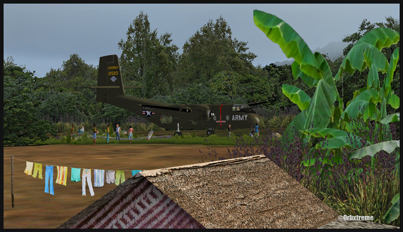
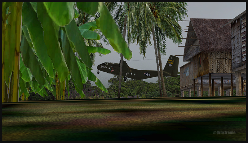
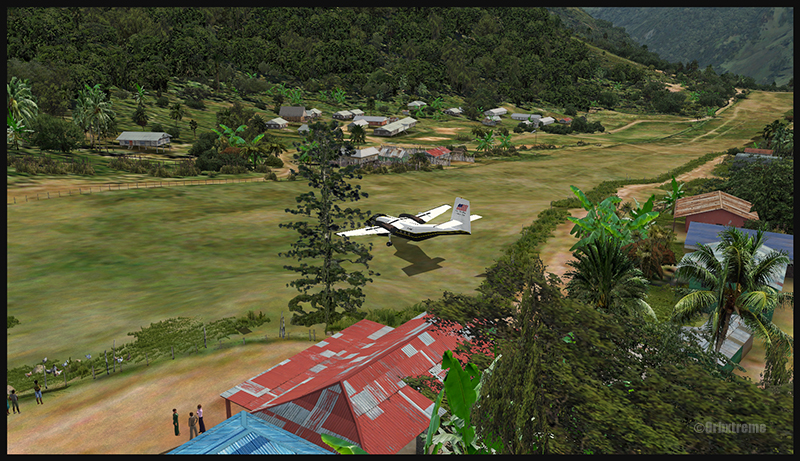
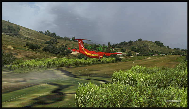
A virtual Dash 7 has just landed in Woitape (WTP) in Papua New Guinea PNG (FSX)
As variety is more fun, and also due to the different challenges created by those runways, the following virtual aircrafts were used: Carenado C-185F, Lionheart Creations PA-18, Virtavia DHC-4, Aerosoft DHC-6 Twin Otter and Milton Shupe DHC-7.
The “Tapini” scenery gives the pilot a choice between the seven following runways:
ASB (Asimba)
A tricky, very short runway near a river.
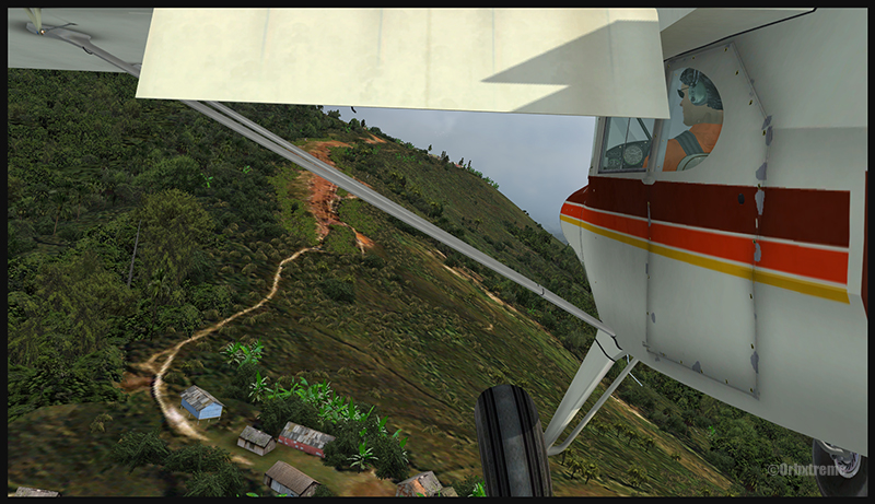
A DHC-4 Caribou virtual aircraft is on approach for Asimba’s sloped runway (ASB) in Papua New Guinea PNG (FSX)
This is a very interesting runway, best done with a STOL aircraft like the Caribou DHC-4. The inhabitants might have to help you clear out some branches along the runway, considering the size of the aircraft. The runway slopes down on take-off, which helps to build up speed.
A DHC-4 Caribou virtual aircraft is on a stopover at Asimba (ASB) in Papua New Guinea PNG (FSX)
A DHC-4 Caribou virtual aircraft is airborne from Asimba (ASB) in Papua New Guinea PNG (FSX)
FNE (Fane)
A one-way, really challenging 12 degree sloped runway, with unpredictable winds.
A De Havilland DHC-7 virtual aircraft on final for the Fane (FNE) airport’s sloped runway in Papua New Guinea PNG (FSX)
The runway sits on top of a hill. It is an amazing experience to land there. No wonder there are a lot of people watching the arrivals and departures.
If you slow down too quickly with an aircraft as big as the DHC-7 on that sloped runway, the twelve degree angle prevents you from moving forward. You must let the aircraft come down the runway very slowly, using the power to control the descent and the rudder to stay aligned on the runway, then apply take-off power for a few seconds to build just enough momentum to get above the hill.
A De Havilland DHC-7 virtual aircraft just finished taxiing uphill on the Fane (FNE) airport’s sloped runway in Papua New Guinea PNG (FSX)
To turn the aircraft around, it’s a combination of power and reverse thrust until you clear all the obstacles (any humans venturing behind the aircraft will also be cleared during the operation…).
A De Havilland DHC-7 virtual aircraft is airborne from the Fane (FNE) airport’s sloped runway in Papua New Guinea PNG (FSX)
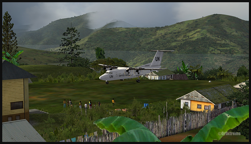
There is a not so friendly man with a rifle watching the airport’s operations. Even the United Nations staff do not stay longer than necessary…
KGH (Yongai)
A very bumpy one-way sloped runway. A real bush aircraft is needed here!
A virtual DHC-6 Twin Otter on approach for the Yongai (KGH) bumpy runway in Papua New Guinea PNG (FSX)
Even with a real bush aircraft, there is a possibility that one of the aircraft’s propellers hits the ground while taxiing on the runway. There are so many deep holes that are hard to see, I can only wish the best of lucks to everyone trying out this airport!
A virtual DHC-6 Twin Otter on the Yongai (KGH) bumpy runway in Papua New Guinea PNG (FSX)
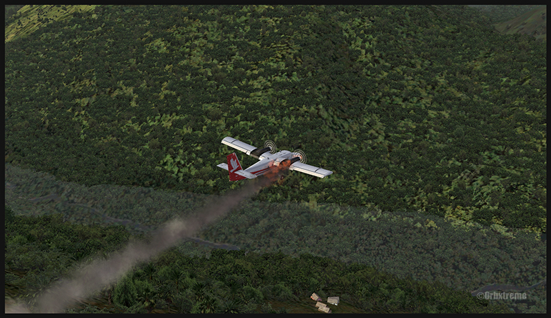
Keep a close watch on the area near the little house at the end of the runway. The DHC-6 was really shaken while turning around for take-off. One of the propellers hit the ground but no problems were detected…until the aircraft was airborne. The fire alarm then went off, just as the aircraft was passing the runway threshold, seconds before flying over a cliff.
A virtual DHC-6 Twin Otter with its right engine on fire is just airborne from the Yongai (KGH) bumpy runway in Papua New Guinea PNG (FSX)
So much for the planned trip… and it was out of the question to return to Yongai on one engine. I had to pull the handle to stop the fire, feather the prop, cut the fuel where it was not needed anymore then head to the Kokoda airport as it was a sure alternative, having a long runway and an elevation that did not require the use of extra power.
KSP (Kosipe)
A relatively short runway that requires good calculations from the pilot, since it is located high in the mountains.
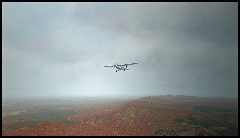
A virtual Cessna C-185F is enroute to the Kosipe (KSP) airport in Papua New Guinea PNG (FSX)
The Cessna C-185F is a very well suited aircraft for that runway. Make sure not to be too heavy on the brakes, as new C-185 propellers are hard to find in Kosipe. You can land in both directions. Ensure that the mixture is set properly as the airport is above 6300 feet.
A virtual Cessna C-185F is rolling after touching down on the Kosipe (KSP) runway in Papua New Guinea PNG (FSX)
A virtual Cessna C-185F is airborne from the Kosipe (KSP) runway in Papua New Guinea PNG (FSX)
ONB (Ononge)
A curved and very bumpy runway! For those who like low flying. Make sure you choose the good aircraft here; there is not much manoeuvering area once on the ground.
A Virtual Piper Pacer on approach for the Ononge (ONB) curved runway in Papua New Guinea PNG (FSX)
Ononge looks really scary when you show up on final for the first time. You wonder if the little trail that you see can really be a runway. For that kind of situation, the little Piper Pacer is an excellent aircraft, approaching slowly and braking on a dime. The runway is curved in the middle so you will need a bit of right rudder to keep the aircraft aligned with the runway.
A Virtual Piper Pacer on the Ononge curved runway in Papua New Guinea PNG (FSX)
I guess all those people with their cargo are waiting for a bigger airplane than mine…
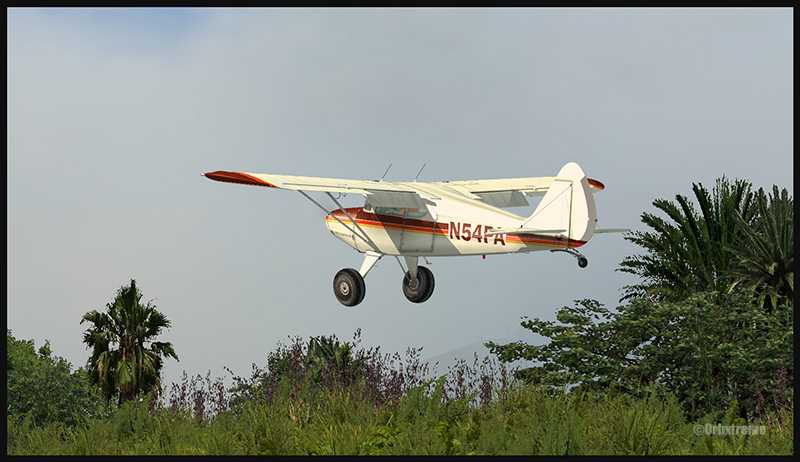
A Virtual Piper Pacer is airborne from the Ononge curved runway in Papua New Guinea PNG (FSX)
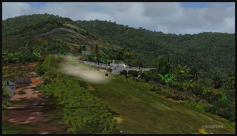
TAP (Tapini)
A challenging one-way sloped runway nestled in a tight valley. You can even use an ILS to arrive there!
A virtual DHC-4 Caribou on short final for the Tapini (TAP) sloped runway in Papua New Guinea PNG (FSX)
This is a superbly designed area and airport. I visited it with the DHC-4 Caribou but any other big STOL aircraft would have fitted there. There is enough room to manoeuver. It is not too bumpy. There is an interesting slope: it starts downward and ends upward: this helps to slow down the aircraft after landing.
A virtual DHC-4 Caribou on the ground at the Tapini (TAP) airport in Papua New Guinea PNG (FSX)
A virtual DHC-4 Caribou is airborne from the Tapini (TAP) airport in Papua New Guinea PNG (FSX)
WTP (Woitape)
Looks like a no brainer, but there is no margin of error on this one-way slightly sloped runway. Very precise calculations and settings are required if you want to land there with something else than a small aircraft.
A virtual De Havilland DHC-7 on final approach for the Woitape airport (WTP) virtual airport in Papua New Guinea (FSX)
I found the runway to be very slippery with the De Havilland DHC-7. I must say that there was a good crosswind, as I was flying with real life weather and winds. The DHC-7 behaves like a big boat while decelerating on such a runway.
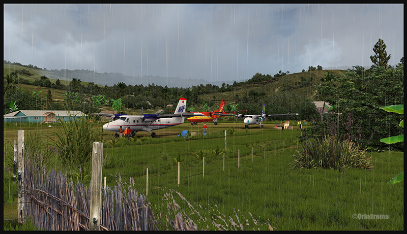
A virtual De Havilland DHC-7 on the ground with two Twin Otters at the Woitape airport (WTP) in Papua New Guinea (FSX)
The Woitape scenery is gorgeous. It is nice to have all those well designed virtual aircrafts, people and animals on site as this makes the scenery so much more realistic.
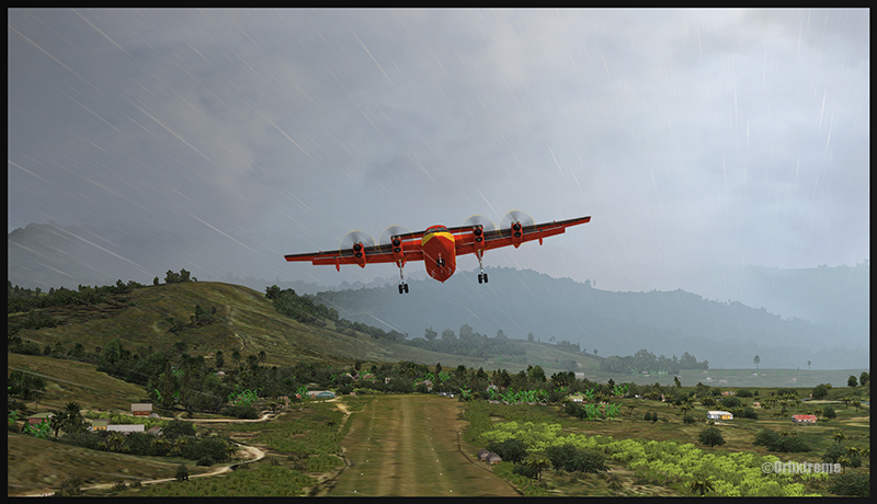
A De Havilland Virtual DHC-7 is airborne from the Woitape airport (WTP) in Papua New Guinea (FSX)
I love this new Orbx product. When you fly in such a realistic scenery, the brain does not make much difference between what is real and what is virtual. It really works! And if you use real life weather downloaded from the internet, it’s even better.
I tried the seven airports included in the “Tapini” virtual scenery and they are quite demanding. Yongai was the most challenging airport of them all. I had to do two missed approaches there since I ended up too high on the approach. I eventually got it right, like in real life!
I used the Microsoft flight simulator X (FSX) for all the virtual flights, but other platforms would have worked as well (Dovetail Games FSX Steam edition (FSX: SE) and all versions of P3D). The following products were also installed on my flight simulator: FTX Global, FTX Global Vector and Holgermesh, as well as Pilot’s FS Global 2010.
It is a totally immersive virtual experience and you have to forget everything else when undertaking those challenging virtual flights… if you want to make it “virtually” alive!
For more articles on flight simulation on my web site, click on the following link : Flight simulation
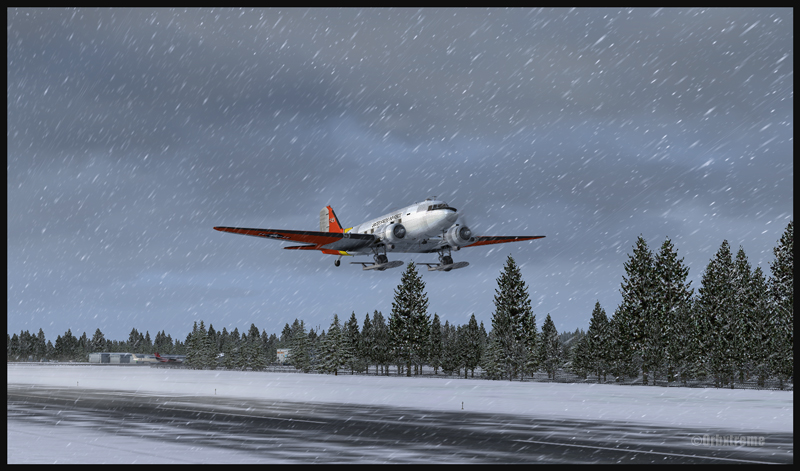
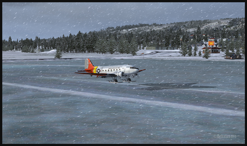
DC-3 at the Homer (PAHO) virtual airport in Alaska (FSX)
If you feel like attempting a virtual landing on an ice runway, an opportunity is offered by ORBX through their Homer (PAHO), Alaska virtual airport. For the flight, I used the FSX platform but it could have been also done under P3D.
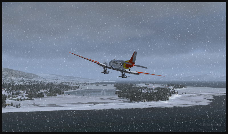
DC-3 on skis airborne from the Homer (PAHO) virtual airport in Alaska (FSX)
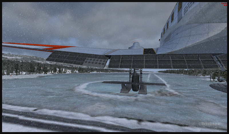
The ice runway is just a short distance away from the regular Homer asphalted runway. The DC-3 is an excellent aircraft for the task since its approach speed is very low and it is one of the few virtual aircrafts equipped with skis.
A DC-3 on skis is turning final for the Homer ice runway in Alaska (FSX)
If you want to try that flight, make sure to adjust the flight simulator configuration settings so that the Homer ice runway option is activated, otherwise you’ll end up under water…
In order to add a bit of challenge as well as winter realism, you can add a bit of crosswinds or some snow using the standard « heavy snow » option in FSX. The program PrecipitFX helps a lot if you are looking for a better definition of precipitations, be it snow or rain. For this flight, the Cumulus X program was also activated.
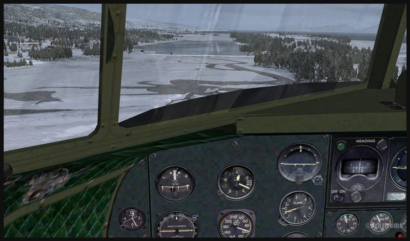
Cockpit view of a virtual DC-3 on final for the Homer (PAHO) ice runway in Alaska (FSX)
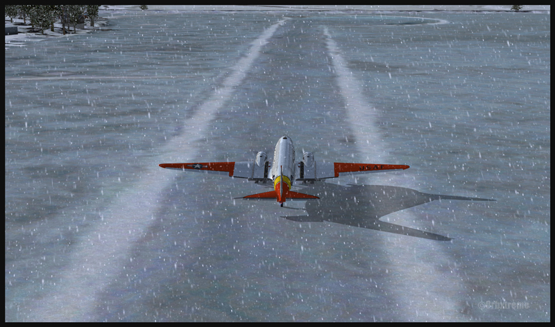
Virtual DC-3 on skis on short final for the Homer (PAHO) ice runway in Alaska (FSX)
Virtual DC-3 on skis about to touch the threshold of the Homer ice runway in Alaska (FSX)
The short flight proved to be an interesting experience, since the runway was narrow and there were some crosswinds. I thought that it would be very slippery but it was not the case. Maybe one day Orbx, in association with the FSX Steam (Dovetail Games) professionals, will work at modifying the flight simulation platform and add a CRFI (JBI) index of .40 or less to increase the difficulty in slowing down and controlling the virtual aircraft?
A DC-3 on skis flying few feet over the Homer (PAHO) (FSX) ice runway, a product of the ORBX company
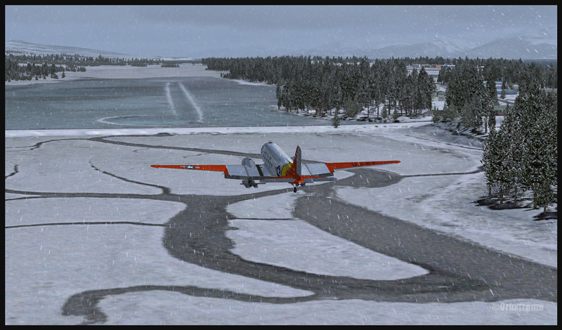
A virtuel DC-3 on skis after a landing on the Homer (PAHO) ice runway in Alaska (FSX)
A DC-3 virtual on skis backtracking the Homer (PAHO) ice runway in Alaska (FSX)
As this flight is not a super though exercise, I have placed it in the “standard virtual flights”, in the flight simulation section of my website. For more of those flights, click on the following link: Other standard virtual flights
Have fun trying this one! Later on, I’ll present another ice runway located on Antarctica, which virtual scenery was made by Aerosoft. Even the C-17 Globemaster III is approved there…
For more articles on flight simulation on my web site, click on the following link : Flight simulation
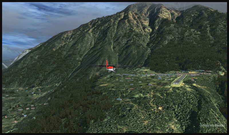
If you are looking for a challenging virtual flight, why don’t you try the route Syangboche –Lukla with the Aerosoft Twin Otter? It is a very short flight, few minutes only, where the aircraft will be constantly descending until its destination.
A Twin Otter aircraft is on descent from Syangboche towards the Lukla runway
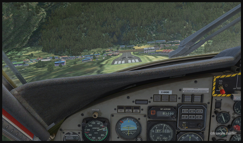
A Twin Otter aircraft is on approach for runway 06 at Lukla
The approach in Lukla can be tricky due to a 12 degree sloping runway. You have a feeling of coming in too quickly, but you must resist the temptation to reduce speed since, at this altitude, the stalling speed increases with all aircrafts.
Runway 06 is used for landing, and 24 is for departures. There is no possibility of a missed approach. You either succeed or you crash since there is a high rock wall at the end of runway 06.
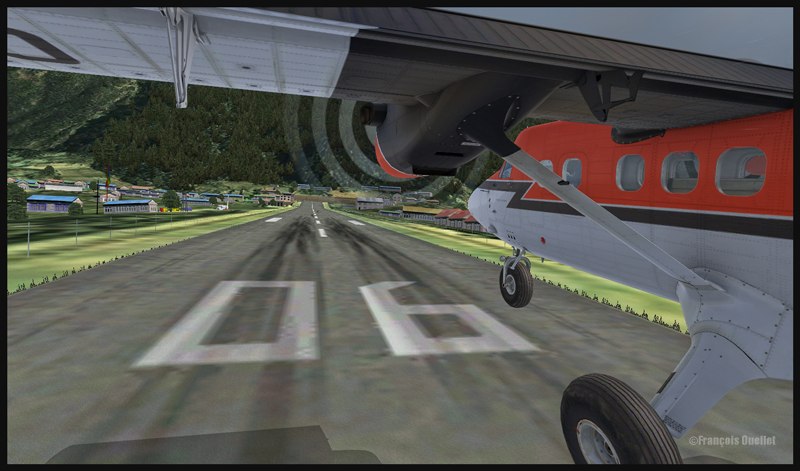
A Twin Otter aircraft is on final for runway 06 at Lukla
A Twin Otter is about to land on runway 06 in Lukla
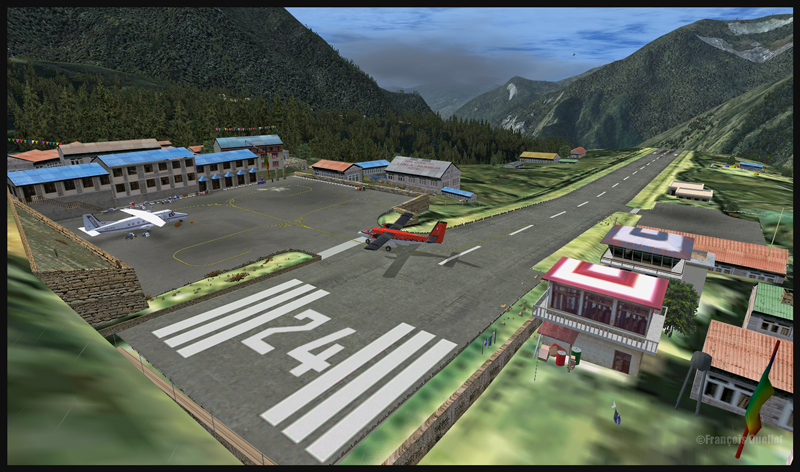
So the flight is made from Syangboche (OACI code:VNSB, altitude : 3748m and a 400m runway) towards Lukla (OACI code:VNLK, altitude 2860m and a 460m runway).
A Twin Otter aircraft is landing on runway 06 in Lukla
The scenery and objects around Syangboche are a creation of ORBX. Once you get closer to Lukla, you will notice a change in the scenery details, since you are entering the Aerosoft Lukla scenery (you have to buy this additional scenery to make the flight more realistic).
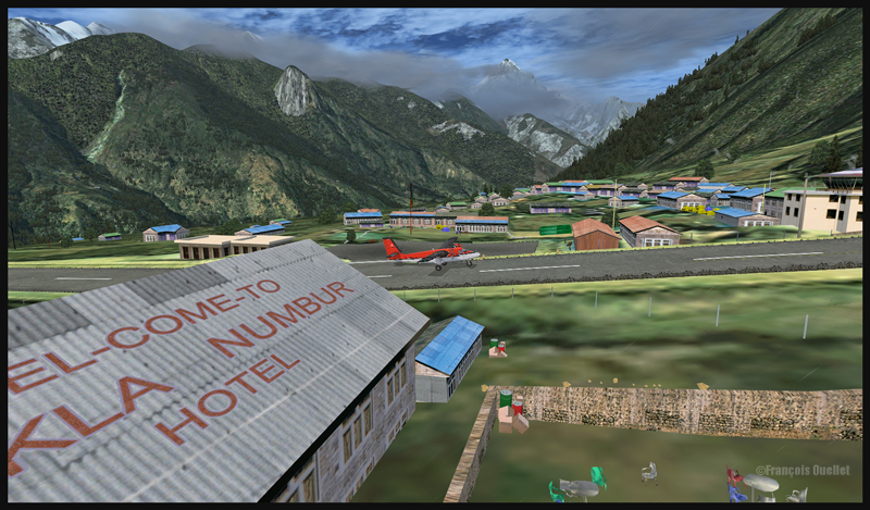
A Twin Otter aircraft has just landed on the runway at Lukla
A Twin Otter aircraft exits the runway in Lukla
The integration of the two scenery styles is very well achieved.
This flight will require all your attention. Good luck! For other challenging virtual flights, visit my website.
For more articles on flight simulation on my web site, click on the following link : Flight simulation
CP Air B-737 on approach for the Juneau airport in Alaska
Here is a slightly modified screen capture showing a CP Air B-737 in a virtual flight towards the Juneau runway in Alaska. The Boeing is a creation of the Captain Sim company and the scenery is the result of the hard work of the ORBX pros.The meteorological system is a combination of three elements: Cumulus X, the “Heavy snowstorm” selection in FSX and the improvements to snow appearance obtained through PrecipitFX.
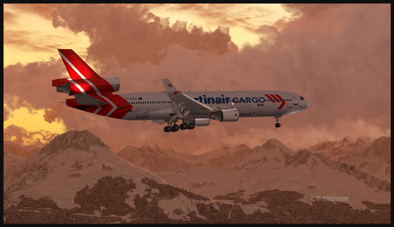
This screen capture represents the PMDG MD-11 inbound for the Valdez virtual airport in Alaska. The scenery is made by Orbx. This virtual MD-11 is a real fun to fly in manual mode since it requires a lot of attention. A 6,500 feet runway is enough for a MD-11 but it does not offer much margin of manoeuver. (Edit: This aircraft is not supported anymore by PMDG).
Flying over the Eastern Townships in Quebec under MVFR always represents a problem due to the terrain. Here is a screen capture of a flight from the Quebec international airport to the Sherbrooke airport, to show what a virtual flight looks like during autumn. The terrain has been modelized by Orbx.
A2A Simulations C182T Skylane in the Eastern Townships region in Québec
Here are the first few hills visible but, rapidly, the top of mountains will be obscured in clouds. The downloaded weather is managed by the FSGRW weather engine and the cloud textures are the result of a combination between REX Texture Direct and REX Soft Clouds. A photo software has been used to enhance the contrasts.
The aircraft is a C182T Skylane from A2A Simulations. The similarities between a real aircraft and this virtual aircraft is really unbelievable. The pilot must take care of all corrections, even the gyroscopic precession, otherwise the ADF will indicate the road to follow while the compass sends you in a totally different direction!
C182T airborne from the Parry Sound airport in Ontario, Canada.
In order to celebrate autumnal colors, here is a screen capture of an A2A Simulations C182T Skylane airborne from the Parry Sound (CNK4) airport in Ontario, Canada.
The airport was created by Vlad Maly, for ORBX. FSGRW was the weather engine used to follow the actual weather around Georgian Bay. REX Texture Direct was used for the cloud textures.
The screen capture of this virtual flight was slightly retouched by means of a photo software in order to add a bit more intensity to the autumnal scene.
For more articles on flight simulation on my web site, click on the following link : Flight simulation
Icefield in sight! A screen capture realized with the following products: FSX, FSGRW, REX, and a combination of Orbx creations. Final editing with a photo editing software (slight corrections only)
The screen capture above, titled “Icefield in sight”, represents a virtual flight using the FSX platform. A combination of FSGRW and REX has been used to improve the cloud effects.
As the basic FSX program does not offer a very realistic representation of clouds, it is necessary to get better cloud sets from a third party provider. In the present screen capture, the clouds are a creation of REX, through their Texture Direct and Soft Clouds used in combination.
It is one thing to have access to realistic clouds but you also need a good weather engine. This engine will download real-weather data and, if you wish, will update it every few minutes when you fly.
Many weather engines are available. In the above picture, I used FSGRW (PILOT’S version 1.7, build 29).
To represent the mountains and the icefield, ORBX creations like SAK, Vector and Open LC Canada-Alaska were used. The DC-3 livery is available as a free download from major sites like FlightSim.com or AVSIM .
Last point: when you take a screen capture, it is possible to use a photo editing software (there are many good ones on the market) to slightly improve a particular aspect of the picture. It takes very little effort to learn how to use few basic functions that will enhance your captures.
For more articles on flight simulation on my web site, click on the following link : Flight simulation
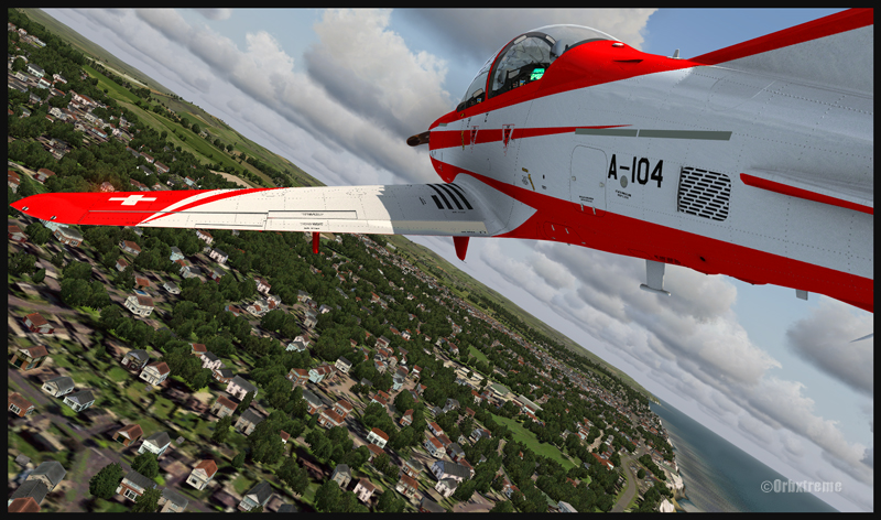
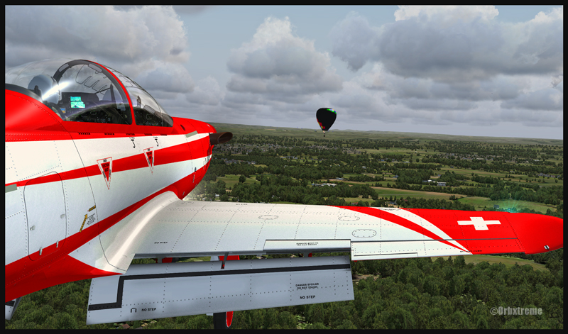
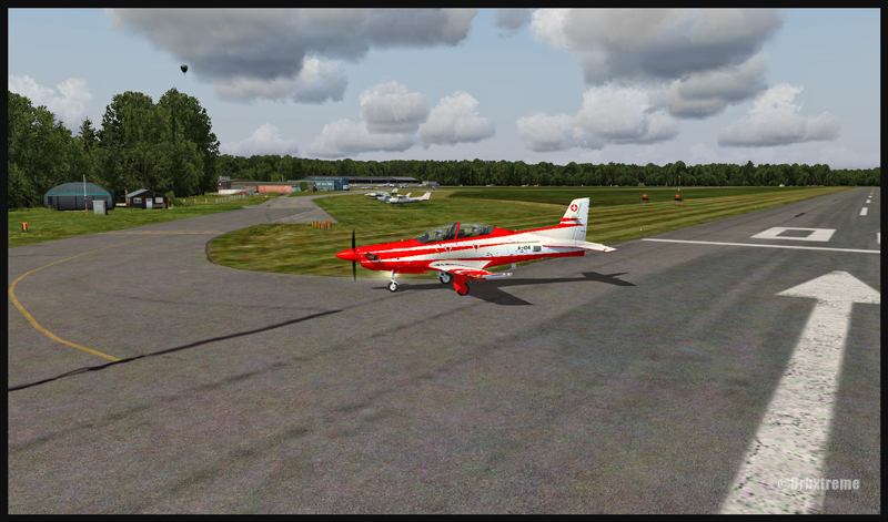
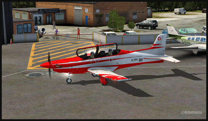
A Pilatus PC-21 aircraft over Shoreham, United Kingdom
Near the Fairoaks airport, United Kingdom. Flaps and gear down on the Pilatus PC-21
The IRIS Pilatus PC-21 Pro Training Series is a high performance aircraft. It is equipped with a five blade graphite propeller as well as a Pratt-Whitney PT6A-68B engine able to develop 1600 SHP. Until the PC-21 was created, there were only jet aircrafts that could provide such performance when it comes to pilot training. The PC-21’s maximum airspeed is 370 knots, its service ceiling 38,000 feet and it can climb at a rate of 4000 feet/minute.
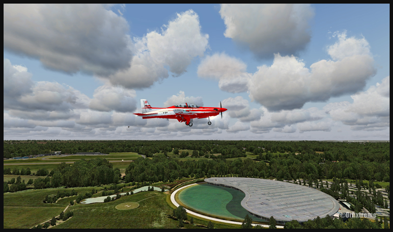
PC-21 aircraft near the Fairoaks airport, United Kingdom
The above sequence of pictures represents a familiarization flight with that aircraft, before trying to attempt to land in Fairoaks. I have included this flight under the “flight simulation” section of the site, under “standard virtual flights”.
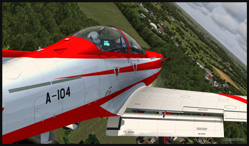
PC-21 turning final for Fairoaks airport, United Kingdom
The takeoff was done from Southampton and the route included Shoreham, Gatwick, Heathrow to finally end in Fairoaks. Along the route, different exercises were practiced like slow flight, inverted flight and other manoeuvers that allowed to learn the behavior of the machine under all kind of configurations.
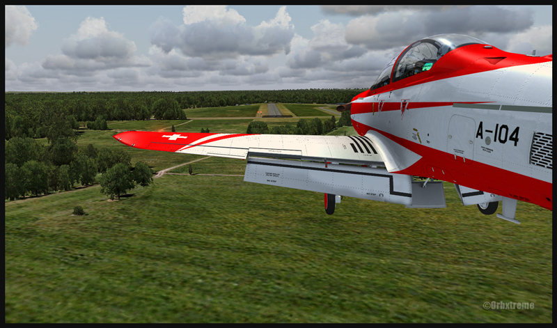
PC-21 aircraft on final for the Fairoaks airport, United Kingdom
A PC-21 aircraft and the Fairoaks airport, United Kingdom
IRIS created that virtual Pilatus. ORBX is responsible for the Southampton, Shoreham and Fairoaks virtual airports, as well as sceneries generated by their well known Global, Vector, Open LC and Trees HD products. FSX was used for the flight. Clouds were generated by REX and CumulusX. For an even more realistic experience, UK2000 virtual airports like London Gatwick and London Heathrow could have been used since they are of excellent quality.
Pilatus PC-21 on the Fairoaks airport (FSX)
Beware of the approach in Fairoaks. There are trees near the threshold of the runway and the landing surface is relatively short, measuring only 813m (2667 feet). Flying an aircraft equipped with such a powerful engine and whose stall speed approximates 150 kmh with flaps and gear down will require much attention on the approach. It will be the difference between a successful landing or having your name in the first page of Fairoaks local newspaper the next day.
For other ideas of virtual flights that do not require a lot of experience, click on the following link: Standard virtual flights
For more articles on flight simulation on my web site, click on the following link : Flight simulation