Categories
Graphic novels and comics

Graphic Novel: Wagner

The graphic novel "Wagner", l'histoire secrète des mercenaires de Poutine.
The graphic novel “Wagner”, l’histoire secrète des mercenaires de Poutine.

Wagner” is a top-quality graphic novel, the fruit of serious research based on numerous known and confidential sources.

Thanks to the large concentration of relevant data in a single volume, readers will quickly gain a better understanding of the international role played by this mercenary group supported by Vladimir Putin, which has gradually established itself in Mali, the Central African Republic, Libya and Syria, before attacking the Ukrainians.

The book includes the names of numerous companies, corporations and foundations (Concord, IRA [Internet Research Agency], SEWA Security Services, Lobaye Invest, M-Finance, M-Invest, Meroe Gold, Midas Resources, First Industrial Company, International Global Logistic [IGL], Alpha Development, Marko Mining, Prime Security, etc.) and a host of players who played a major role in sharing control of natural resources (mines, forests, etc.) in the Central African Republic and Mali.

The book shows how the short-sightedness of certain politicians and intelligence services enabled Wagner to gain a foothold in Africa without too much difficulty. It sheds light on the hasty departure of the French in Mali and the Chinese south of Bamako.

African leaders and customs officials turn a blind eye to the transfer of gold and diamonds to Russia. But I don’t have to dig very far in my memory to point out that many great powers have enjoyed similar treatment in other places on our beautiful planet.

Scriptwriter and illustrator Thierry Chavant is careful not to over-censor the actions of Wagner’s mercenaries, who sometimes think of themselves as soldiers. The explicit drawings shed light on the crimes committed by these killers, including rape, torture and the systematic elimination of hundreds of people at a time.

Despite these radical methods, the mercenaries do not have it easy against determined opponents. Wagner lost many fighters to the jihadists in Africa, but far fewer than in Ukraine, where the group suffered a literal debacle, with tens of thousands killed and wounded.

Even Yevgeny Prigozhin and Dmitry Utkin lost their lives when the private jet they were in exploded over Russia. The question I still ask myself today: how can anyone be so stupid as to continue to fly calmly over Russia after having tried to seize power by force a few weeks earlier?

The book confirms that international geostrategy has two faces: an acceptable side, where diplomats and businessmen work hard to gain advantages for themselves or their countries. But there’s also a much more violent side, where the main principles give way to the desire to win new territories with the wealth they contain. And there, any means are good enough to achieve the goal, be it obscure financing, threats, summary executions, overthrowing governments or even modern-day slavery.

Click on the link for more graphic novels and comics on my blog.
Title: Wagner

Investigation: Matthieu Olivier and Benjamin Roger

Script and drawing: Thierry Chavant

Colour: Mathilda

Authors: Thierry Chavant

Publisher: Les arènes BD

© 2024

ISBN: 979-10-375-1111-9

Categories
Photos of Canada Photos of Quebec

A Spring day in 2024 on Île d’Orléans.

Profiting from the strong winds at île d'Orléans 2024
Profiting from the strong winds at île d’Orléans 2024

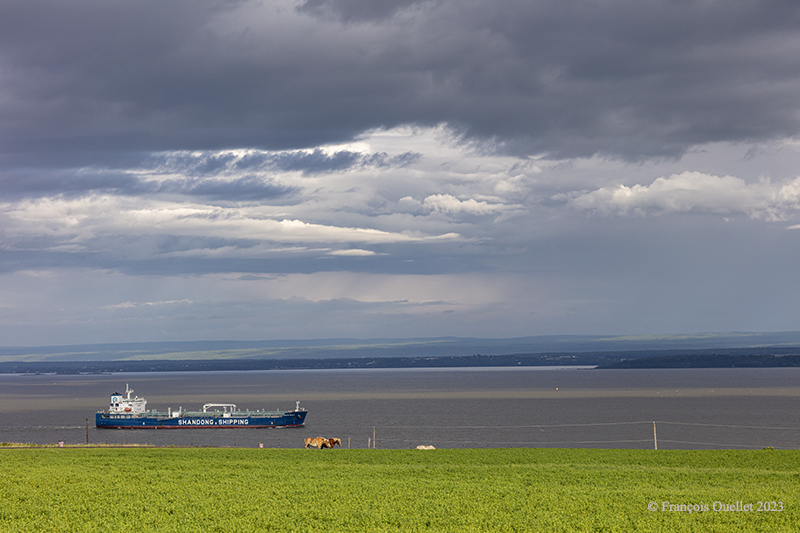
A single-day visit to Île d’Orléans for a photography session was enough to capture a wide variety of cloudy conditions in April 2024. In spring, when unstable, humid air crosses the mountain range north of the St. Lawrence River, you can expect anything on the island. Above, a kitesurfing enthusiast practises his art between localized showers. All he cares about is strong winds.

Coloured houses of Île d'Orléans. Spring 2024.
Coloured houses of Île d’Orléans. Spring 2024.

A few kilometers from route du Mitan, colourful houses and a bit of blue-sky contrast with the showers elsewhere on the island. You can see that the cloud layer in the distance is not very thick.

Looking north from île d'Orléans, Spring 2024.
Looking north from île d’Orléans, Spring 2024.

Above, a towering cumulus (TCU) approaches the St. Lawrence River in the late afternoon from the north. It is likely to cross the river towards the island, if it has not lost some of its strength, in the meantime, due to subsidence, the phenomenon that forces air to compress and warm as it is forced down a mountain range.

Sailboats on île d'Orléans. Spring 2024.
Sailboats on île d’Orléans. Spring 2024.

The shape of the clouds in the photo above gives a good indication of the strength of today’s winds. You can hear it whistling through the ropes and between the masts of the sailboats at the marina in the municipality of St-Jean, île d’Orléans. At the time of my visit, some owners were preparing their boats for the warmer periods of May.

A house on île d'Orléans, Spring 2024.
A house on île d’Orléans, Spring 2024.

I really like the scene above, but I admit that some might find it dark, if not sinister. It was this slightly disturbing aspect that caught my attention and that I tried to capture.

A boat requires repainting on île d'Orléans, Spring 2024.
A boat requires repainting on île d’Orléans, Spring 2024.

In this last photo, the sky is practically clear. It is then easier to obtain better contrasts. A pseudo-HDR treatment brings out the paintwork on a boat that has seen better years.

Click on the link for more photos of Quebec City and Île d’Orléans in Spring on my blog.

Categories
Flight Simulation

Around the world in flight simulation (4)

Cessna 700 airborne from the virtual Vagar (EKVG) airport in the Faroe Islands with Microsoft Flight Simulator.

The fourth leg of this world tour in flight simulation continues with a trip between Vagar airport (EKVG) in the Faroe Islands (Kingdom of Denmark) and Finland‘s northernmost airport, (EFIV).

Below is a diagram showing the route, which takes approximately two hours.

From the Vagar airport (EKVG) to the Ivalo airport (EFIV).

I’m using Microsoft Flight Simulator for the trip. The tanks are only 50% full, as we need to limit the aircraft’s weight to allow a safe takeoff on this 5908-foot runway. The aircraft requires a minimum of 4810 feet, to which must be added a strong crosswind component this morning. What’s more, the runway is soggy. If we add too much fuel, we risk ending up in the bay at the end of runway 30.

Cessna Longitude enroute to Ivalo (EFIV) Finland in flight simulation.

The virtual Cessna Longitude is now at its planned cruising altitude. Thick clouds cover the coast of Norway, but the weather is much more favorable in northern Finland, where our destination lies.

Virtual Cessna 700 starting the descent towards Ivalo (EFIV) Finland.

After waiting as long as possible before starting the descent, to save the remaining fuel, it’s time to descend into the cloud layer for the approach to Ivalo.

Virtual Cessna Longitude over the frozen northern land of Finland

On the way down to the airport, the aircraft passes through several layers of cloud. Finland, still frozen in March, is clearly visible.

Visual approach to the Ivalo (EFIV) virtual airport in Finland

We have to wait until the last moment to extend the landing gear and flaps to maximize fuel economy. Near the airport, I’m treated to a magnificent spectacle as the sun reaches the horizon.

Long final for runway 22 of the Ivalo virtual airport (EFIV) in Finland

Landing gear down. Flaps to follow shortly. An alarm has just gone off in the cockpit to indicate a low fuel level in the tanks. But there’s still around 350 lbs for each engine. On final approach, the view is superb.

Cessna Citation on short final runway 22 for the Ivalo (EFIV) virtual airport in Finland.

Winds are 220 degrees at 7 knots, directly in line with Runway 22. The runway is 8199 x 148 feet. The flaps are down and the approach is smooth.

Ivalo (EFIV) the northernmost aiport in Finland with Microsoft Flight Simulator copie

Welcome to Lapland! Ivalo Airport (EFIV) was Finland’s ninth busiest airport in 2024. The region attracts winter sports enthusiasts as well as those keen to observe the Northern Lights.  

Click on the link for more flights around the world in flight simulation on my blog.

Categories
Graphic novels and comics

Graphic novel: “L’expert”.

The graphic novel "L'expert" by Jennifer Daniel.
The graphic novel “L’expert” by Jennifer Daniel.

The story takes place in 1977 in West Germany. A road accident that claims the lives of a woman and her child attracts the attention of a morgue employee, a man with high standards of professionalism and who is well regarded by his general manager.

This employee is Monsieur Martin, a former soldier who once fought in the Second World War and for whom the word “responsibility” weighs heavily in his existence as an older man. He conducts his own investigation, and naturally upsets people in high positions who have decided to look the other way to preserve their reputations.

Such a theme will always be relevant, as it affects not only German society but all nations across the planet, where individuals who have the most to lose in a given situation choose to disregard their obligations, despite the injustices.

The graphic novel “L’expert”  is very well done. I like the drawings, the scenario, the choice of colours, the period and the location where the story takes place. The Germans must certainly have appreciated its publication in 2022.

Click on the link for more graphic novels in my blog.

Title: The Expert (original German version as “Das Gutachten”)

Author: Jennifer Daniel

Publisher: Casterman, ©2024 for the French translation. Original German edition Carlsen Verlag GmbH, © 2022.

ISBN: 978-2-203-28080-9

Categories
Flight Simulation

Around the world in flight simulation (3)

Airborne from the Isafjordur airport (BIIS) In Iceland with Microsoft Flight Simulator.

The third leg of the round-the-world flight simulation begins with a departure from Isafjordur (BIIS) in Iceland and ends at Vagar airport (EKVG) in the Faroe Islands, an autonomous archipelago belonging to the Kingdom of Denmark.

The departure from Isafjordur faces a mountain. You can see the shadows on the ground. But as visibility is perfect, this is no problem at all, as long as the rate of climb is sufficient.

Virtual flight BIIS EGVK
The Cessna Citation Longitude is airborne from the Isafjordur airport (BIIS) in Iceland with Microsoft Flight Simulator.

A left turn over the superb Icelandic landscape establishes the Cessna Citation Longitude on course for the Faroe Islands. The FMS ensures that the aircraft will stay on course. But it’s important to remain vigilant: there’s a lot of other equipment that can cause surprises along the way.

The Cessna Citation is climbing slowly over Iceland.

The climb continues over a magnificent landscape. There’s no turbulence today; if there were, the flight simulator would make sure the plane was harder to control, even for the autopilot. I set the virtual flight to observe real air traffic during the flight, but the route between Iceland and the Faroe Islands is off the most popular routes, so it’s normal not to encounter too many aircrafts.

The Cessna Citation Longitude is heading to the Vagar airport (EKVG) in Feroe Islands

We are now established at our cruising altitude, leaving Iceland’s eastern border to fly over the Atlantic Ocean.

Visual approach for runway 12 at the Vagar airport (EKVG) Feroe Islands

We disconnect the autopilot to give us a free hand on the visual approach to Vagar (EKVG) airport. A small white dot, the lights of runway 12, can be seen straight ahead in the distance.  The landing gear is down, as are the flaps, and the speed has stabilized at around 140 knots for the moment.

The Cessna Citation is on long final for runway 12 of the Vagar airport (EKVG) Faroe Islands

It’s an ideal time to arrive in the Faroe Islands, with the setting sun coloring all the surrounding clouds.

The Citation Longitude on visual approach to runway 12 at the Vagar airport (EKVG)

Runway 12 is visible on the far right in the photo above. The uneven cloud cover sometimes blocks the view of the airport for a few seconds, but the wind quickly blows the clouds away, preventing a missed approach. Virtual weather ensures a constant renewal of weather conditions.

The Cessna Citation exits runway 12 at the Vagar airport (EKVG) in Faroe Islands with Microsoft Flight Simulator

Landing is trouble-free, as the Vagar runway is long enough (5902 x 98 feet) to accommodate such a private jet.

Some 53,000 people lived in the Faroe Islands as of 2021. One of the most popular activities is bird and plant watching. To make it easier for residents and tourists to get around, tunnels have been built between some of the archipelago’s 18 islands.

The fourth leg of the round-the-world virtual flight will take place between Vagar and Ivalo (EFIV) in Finland. This is Finland’s northernmost airport.

Click on the link for more flights around the world in flight simulation on my blog.

Categories
Photos of Canada Photos of Quebec

The Parc national de la Jacques-Cartier during winter.

Hiker entering the Jacques-Cartier National Park's forest, Winter 2024.
Hiker entering the Jacques-Cartier National Park’s forest, Winter 2024.

The province of Québec offers in 2024 a free admission to Parc national de la Jacques-Cartier a few days a week. This means more visitors than ever before head for the park. Hikers seeking absolute peace and quiet should opt for the paid days.

Even so, if you look carefully, it’s always possible to spot a lone walker, as in the photo above. Most people take the marked trails for ease, but others, like the individual above, venture out on snowshoes near the Jacques-Cartier River, which is completely covered in snow at this time of year.

Jacques-Cartier National Park's landscape, Winter 2024.
Jacques-Cartier National Park’s landscape, Winter 2024.

Approximately three kilometres from the Discovery and Services Chalet is a bridge. From here, the hiker can capture some very beautiful scenes. In winter, an interesting effect can be achieved by positioning yourself close to the banks.

November in the Jacques-Cartier National Park in Quebec, 2023

This scenery relaxes me so much, yet there are no spectacular elements. Rather, all the components are in perfect harmony: reflections in the water, some bluish snow here and there, brushes and a few leaning trees lit from the side by a soft late afternoon light. As the large trunks occupy the majority of the scene, I chose a vertical format for the photographic composition.

Photo of the Jacques-Cartier national park, Winter 2024.

Above, the landscape attracts the eye with its combination of horizontal, vertical and oblique lines, as well as its alternating black and white in the foreground. I positioned myself to include in the scene a large branch that enters the photo from the top right-hand corner.

The foreground features open water, snow-covered ice, pure ice and snow-covered ice again. In the middle ground, coniferous and deciduous trees. In the background, a forest revealing the snow on the mountain floor. I’ve left only a hint of sky, as the latter offers no particular interest on this cloudy February day, other than to add some white to complete the alternation of colours.

Click on the link for more photos of the City of Québec and Île d’Orléans in Winter on my blog.

Categories
Novels

A new novel by Régis Jauffret : « Dans le ventre de Klara ».

Novel cover "Dans le ventre de Klara" by Régis Jauffret
Novel cover “Dans le ventre de Klara” by Régis Jauffret

[For the presentation of this book published in French, I did my best to translate some sentences in English, but a professional translation would have better reflect the quality of Régis Jauffret’s writing].

In July 1888, around Saint James’s Day, Uncle made me pregnant”. So begins Régis Jauffret‘s novel “Dans le ventre de Klara” (In Klara’s Belly) , that master of punchlines and synthesis. The Klara in question is Klara Hitler, who at the time of the story is carrying within her an Adolf Hitler already capable of infusing her on occasion with visions of the disaster he would orchestrate years later.

The author has found a unique way to position Klara’s terrible premonitions in the text. They are suddenly imposed in the midst of the mother-to-be’s daily reveries, often right in the middle of a paragraph or sentence.

In this tale of fact and fiction, the wife must stay in her place and hope for nothing. The writer has Klara say: “I’m afflicted with the mania of hoping for something other than my fate“. The husband decides everything. The local church’s confessor would love to have as much control as the spouse, but this proves more difficult than expected. The husband and abbot are a good example of the excessive power they wield over women in this era. A military officer with little combat experience who dictates his conduct to his wife as if she were a soldier, and a fanatical abbot who imposes the arbitrary rules of a sickening religion, enslaving women and imposing his dogmas on couples from a distance.

Back cover of the novel "Dans le ventre de Klara" by Régis Jauffret
Back cover of the novel “Dans le ventre de Klara” by Régis Jauffret

Speaking of God and women, the author writes: “A Christian woman must bear children, help to populate the Earth He has given us as a theater for our sins”. And when Klara finds herself back in the confessional and being chastised by the priest: “Far from the voice of Christ gone, it was now Abbé Probst who was busy putting me through the wringer of language. Sentences as long as straps. Words as heavy and blunt as bludgeons. Subtle, sharp words, in places bristling with reddened spikes. Punctuation like broken glass […].” You get the idea…

I particularly appreciate Régis Jauffret’s writing, having read many of his works, including “La ballade de Rikers Island“, “Le dernier bain de Gustave Flaubert“, “Papa” and the three volumes entitled Microfictions, published respectively in 2007, 2018 and 2022. He even won the Goncourt short story award for the 2018 edition.

Régis Jauffret explains the intention behind his latest novel in a video on Youtube, if you’re interested in digging deeper into the subject.

Happy reading!

Click on the link for other novels on my blog.

Title: Dans le ventre de Klara

Author: Régis Jauffret

Publisher: Récamier

© Régis Jauffret and Editions Récamier, 2024

ISBN : 978-2-38577-057-0

Categories
Flight Simulation

Around the world in flight simulation (2)

Climbing from Iqaluit (CYFB) to Kangerlussuaq (BGSF)

For this second leg of the round-the-world flight simulation, the aircraft departs from Iqaluit (CYFB) in appalling weather conditions, but soon find itself above cloud and approaching an area of high pressure. The sky becomes increasingly clear as I approach runway 09 Kangerlussuaq (BGSF) in Greenland.

Virtual flights CYFB BGSF BIIS

The map shows the planned itinerary: departure from Iqaluit (CYFB), stopover in Kangerlussuaq (BGSF) and arrival at destination in Iceland, at Isafjordur airport (BIIS).

Cessna Citation Longitude on the final approach for the Kangerlussuaq virtual airport (BGSF)

Above, the approach to runway 09. You really need to be well prepared for a destination like BGSF. If the pilot arrives after the tower is closed, the fines are very steep. You can generally expect a little mechanical turbulence on the approach to Runway 09, as the mountains on either side of the aircraft change the airflow.

When I worked at the Iqaluit Flight Service Station (CYFB), many pilots would come up to the tower to plan their flight to BGSF. The most frequent problem was the closing time of the control tower in Kangerlussuaq. They knew that a hefty fine awaited them if they arrived late, often due to stronger-than-expected winds or a departure time that was too tight from Iqaluit. Most of the time, they chose to sleep in Iqaluit and leave the next day, rather than force the issue and end up with a $1500.00 bill to pay.

We also had pilots ferrying single-engine planes over the ocean from Europe to America. In this case, the weather had to be excellent, and the captain had to have the necessary equipment on board to attempt (and I do mean attempt) to survive in the ocean in the event of engine failure.

Cessna Longitude parked at Kangerlussuaq (BGSF)

Above, a partial view of Kangerlussuaq’s virtual airport (BGSF), with the Cessna Citation Longitude at a standstill. On the other side of the runway (invisible here), the airport receives military aircraft.

Climbing from (BGSF) Kangerlussuaq to (BIIS) Isafjordur

The next day, after a stopover in Kangerlussuaq, it’s time to continue on to Isafjordur. Take-off is on runway 27. The pitot tube heating system and icing protection are activated before entering the cloud layer.

Airborne from the Kangerlussuaq (BGSF) airport

Flying in real weather makes for unexpected screenshots.

The Cessna Longitude arrives over Iceland in flight simulation

Above, the relief of Iceland shortly before arrival at Isafjordur airport (BIIS). As expected, the sky is clear.

Approaching Isafjordur (BIIS) with the Asobo Cessna Citation Longitude

The approach to Isafjordur is demanding, especially when flying a jet like the Cessna Citation Longitude. You have to save extra speed in the sharp left turn to avoid stalling. I made the turn downhill at 160 knots to get to the runway threshold at the right height. Towards the end of the approach, as the angle of the turn decreases, you immediately reduce speed to around 135 knots.

The Cessna Citation Longitude exits the runway at the Isafjordur virtual airport (BIIS)

Contrary to real life, it is difficult to have a constant view on a runway when doing a virtual approach in a steep turn. A flight simmer would need 3D glasses to quickly look at the runway and then check the instruments. After two unsuccessful attempts where I found myself a little too high above the runway threshold, I nonetheless managed to land. The instrument panel indicated, however, that the brakes worked pretty hard to slow down the plane, which didn’t really surprise me. There are more relaxing approaches…

The next leg on this trip around the world will be a departure from Isafjordur to Vagar (EKVG) in the Feroe Islands.

Click on the link for more flights around the world in flight simulation on my blog.

Categories
Biography and autobiography

Race to the South Pole: « Un monde au-delà des hommes ».

The novel "Un monde au-delà des hommes" by Catherine Hermary-Vieille.
The novel “Un monde au-delà des hommes” by Catherine Hermary-Vieille.

The novel ” Un monde au-delà des hommes” will be of particular interest to readers whose knowledge of early Antarctic expeditions is limited. If you don’t know whether Norway’s Roald Amundsen or Britain’s Robert Scott reached the South Pole in Antarctica first, don’t do the research before opening this book. You’ll find it much more interesting.

In the days of the great conquests of the planet’s uncharted territories, explorers risked their lives for the glory of their country. Here, Norway and Great Britain race to reach the South Pole first.

This historical novel runs to just 134 pages, allowing the author to concentrate on the essentials. She has divided the book into two parts. The first focuses on Amundsen, the second on Scott. The two men used very different methods to achieve their ends. At the beginning of the book, she includes a map showing the routes chosen by each team and the stopovers they agreed on.

Author Catherine Hermary-Vieille discusses the preparation of the journey, the strategic choices made regarding objectives, the obstacles encountered along the way, not to mention the mental attitude adopted by each explorer and the members of the expedition.

Back cover of the novel "Un monde au-delà des hommes" by Catherine Hermary-Vieille.
Back cover of the novel “Un monde au-delà des hommes” by Catherine Hermary-Vieille.

On this trip, one of the two expedition leaders will use sledge dogs as their main means of transport, while the other will try to make progress with mules. One will have only one objective in mind, the other will have several goals to achieve. One will behave as a flexible leader, the other will be more intransigent. The choices and attitude of each explorer will have a direct impact on the success of the expedition.

It’s worth noting that the two competitors don’t start their journey to Antarctica at the same time, so there’s an imbalance right from the start as to when they’ll arrive at the South Pole. But even so, once you know this, there’s still a frozen continent to cross, men to feed, crevasses to avoid and frostbite to treat. You also have to be able to come back alive.

A novel like this can be read in a day. We can forgive a few sketchy descriptions and even a small error like the one on page 19, where the name of the Inuit dog “Funcha” appears twice in the list. These distractions don’t detract from the intensity of the story. These are, after all, the stories of men who went to the very end of themselves for the glory of their country.

Today, we’re witnessing a similar race between countries to send humans to the planet Mars. Which country will get there first? And once it gets there, will it have the right to claim a planet for itself at the expense of Earth’s other humans?

Click on the link for more biography books on my blog.

Title: Un monde au-delà des hommes.

Author: Catherine Hermary-Vieille

© Éditions Albin Michel,

2023

ISBN: 978-2-226-44240-6

Categories
Flight Simulation

Around the world in flight simulation (1)

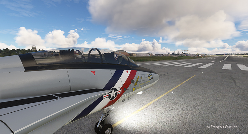
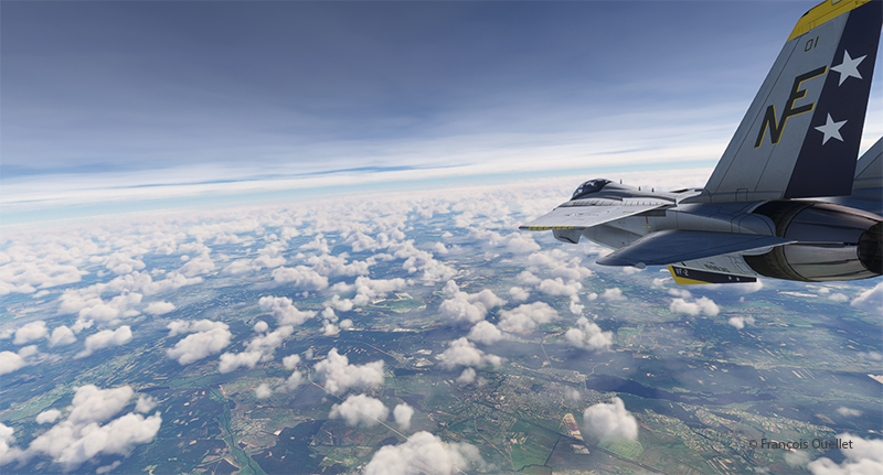
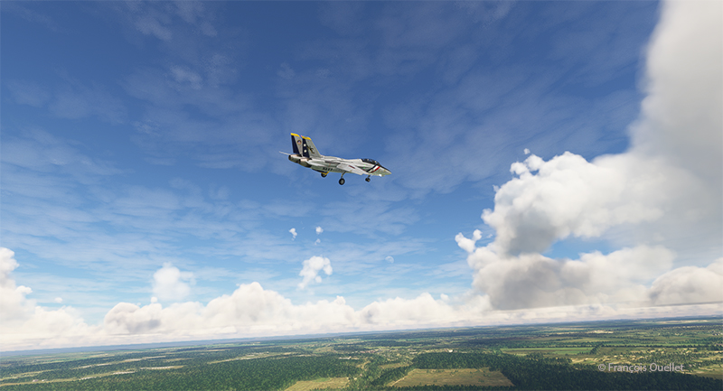
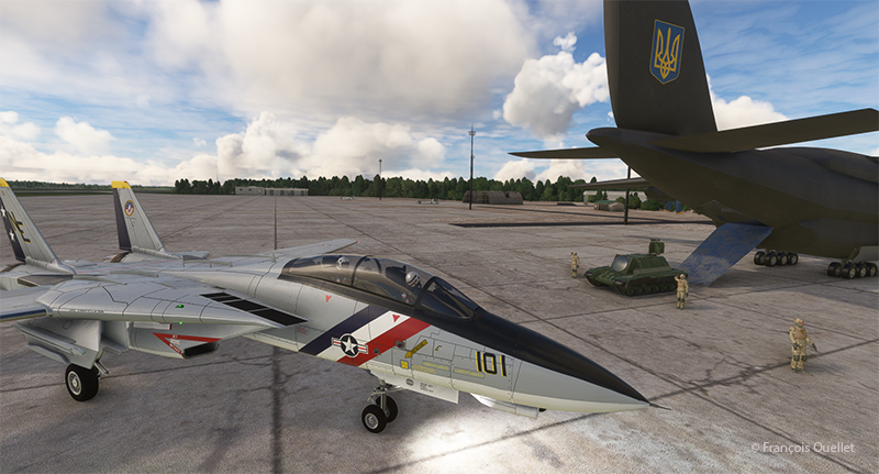
F-14 Tomcat at work over the sea

The flight simulation with Microsoft Flight Simulator lets you fly over the planet like never before from the comfort of your own home. As airports around the world transmit weather observations at all times, it’s possible to import this data into the flight simulator and fly virtually in the real weather conditions reported around the globe.

This data enhances the feeling of reality for the virtual pilot, but at the same time complicates his task, as he has to take into account the presence of thunderstorms and icing, surface and upper-level winds, changes in cloud cover, visibility, pressure, and so on.

Today’s virtual pilot must also anticipate that failures of all kinds may affect the flight, especially if he or she owns a high-quality virtual aircraft. The engine(s) may fail, a structural problem may affect the aircraft’s controls and navigation equipment may cease to function. Good planning is essential, just as in real life. And since the brain doesn’t differentiate too much between the real and the virtual, there’s plenty of fun to be had.

So, I’ve decided to fly around the world as a millionaire, at my own pace, i.e., using the types of aircraft that tempt me, and flying the routes that are of particular interest. All of this will be done in real weather, with all its joys and obstacles. I’ll be publishing one of these routes on my blog from time to time.

The initial route departs from Quebec’s Jean-Lesage airport (CYQB), passes through Goose Bay (CYYR), in the Canadian province of Newfoundland and Labrador, heads north to Kuujjuaq and ends in Iqaluit (CYFB).

Virtual Flight 2 will present a few photos of the Atlantic crossing from Iqaluit to Kangerlussuaq (BGSF) in Greenland, to Isafjordur (BIIS) in Iceland .

Isafjordur airport has a challenging approach. I don’t know if the Cessna Citation Longitude will be able to land there in one piece, but I intend to give it a try.

Virtual flight 1.

Virtual flights CYQB CYYR CYVP CYFB
Enroute from Quebec City (CYQB) to Goose Bay (CYYR)

Above, the setting sun illuminates the clouds and the Cessna Citation Longitude en route from Quebec City to Goose Bay. At high altitude, the pilot sets the altimeter to the standard atmospheric pressure of 29.92 inches of mercury. Since all the other pilots are doing the same, a safe separation between the aircraft is ensured.

Approaching the Kuujjuaq airport (CYVP) in Quebec.

The next day, the aircraft is seen approaching Kuujjuaq (CYVP) in Nunavik. The altimeter is set to the airport’s atmospheric pressure to reflect the correct height of the runways in relation to the aircraft. Near the airport, the autopilot is disconnected, and the approach is made manually and visually. The desired speed is around 135 knots for the final.

Departing Kuujjuaq airport (CYVP) with the Cessna Citation Longitude

Above, the jet takes off from Kuujjuaq bound for Iqaluit (CYFB) on Baffin Island in Nunavut.

Enroute to Iqaluit airport (CYFB)

The setting sun illuminates the aircraft’s windows. The approach to Iqaluit has begun. The descent is gradual, so as not to cause discomfort to the virtual passengers…

On final for runway 34 of the Iqaluit airport (CYFB)

Above, the aircraft is on final for runway 34 at Iqaluit (CYFB).

The yellow Iqaluit flight service station (FSS) in Iqaluit (CYFB)

The first leg of our virtual flight around the world ends in Iqaluit, the airport where I worked for two and a half years as Flight Service Specialist (FSS) in the yellow tower on the left of the photo.

Flight service specialists at work at the Iqaluit flight service station in 1989

Above, a photo of the interior of the Flight Service Station at the time. One FSS worked on arrivals and departures at the airport, while the other handled transatlantic flights between Europe and mainly the western USA.

Click on the link for more flights around the world in flight simulation on my blog.