Categories
Photos of Quebec

An 80 kilometers bike ride in Kamouraska

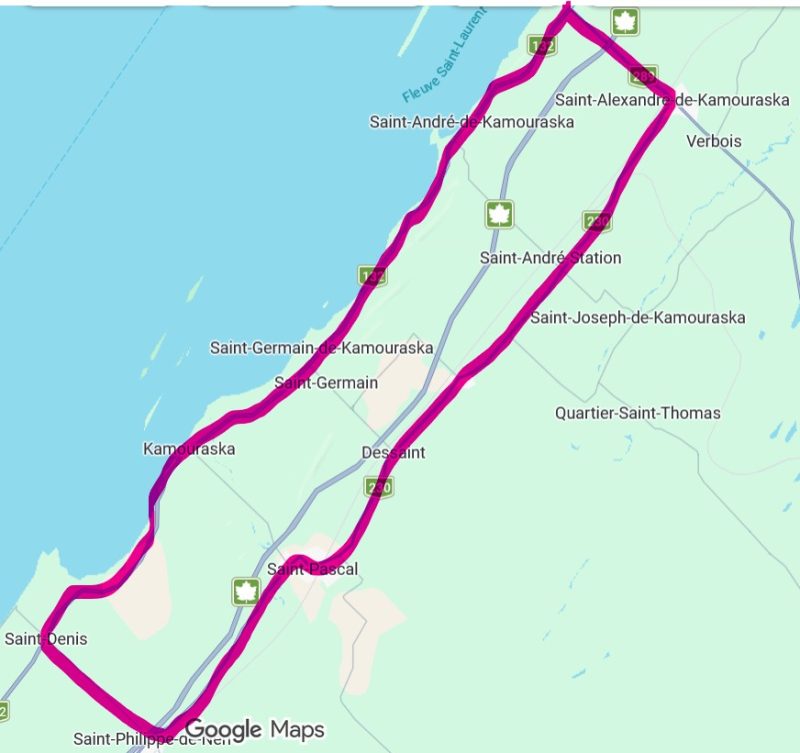
Map of a 77 km bike ride in the Kamouraska region.

This intermediate-level, 77-kilometer bike route in the Bas-Saint-Laurent runs entirely on paved roads, unlike Vélo Québec’s Églantiers loop (55 km), which includes a 14-kilometer gravel section. The cycling tour follows a sort of elongated rectangle running parallel to the St. Lawrence River.
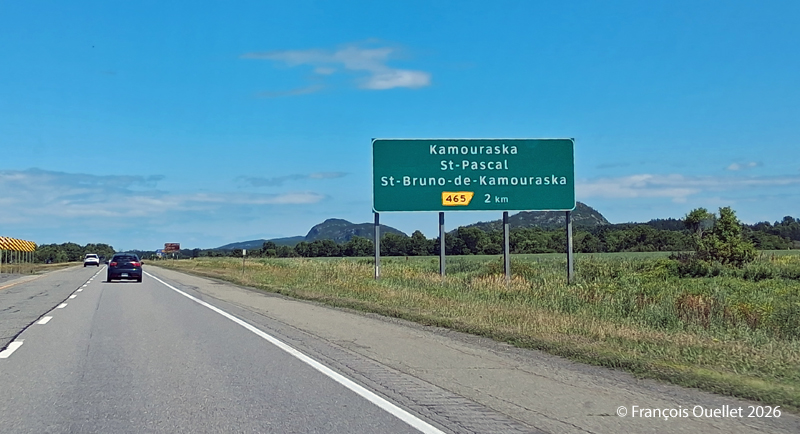
Exit for St-Pascal and Kamouraska

To get there by car, take the St-Pascal exit and head toward Kamouraska. Parking at the village church is free.

The bike route begins heading southwest, first along Route 132 toward Saint-Denis-De La Bouteillerie. Cyclists are treated to beautiful views along the way, whether of ancestral houses, flower-filled or plowed fields, farms, monadnocks, the river, or the mountains in the distance. When I was there, a massive drone controlled from the roadside was spraying crops.

Once you reach Saint-Denis-De La Bouteillerie, turn left onto Route 287 and continue toward Saint-Philippe-de-Néri. Eventually, you’ll pass under Highway 20 and reach Route 230. There, turn left again and ride along Route 230 to Saint-Alexandre-de-Kamouraska. Generally speaking, the route heads northeast.
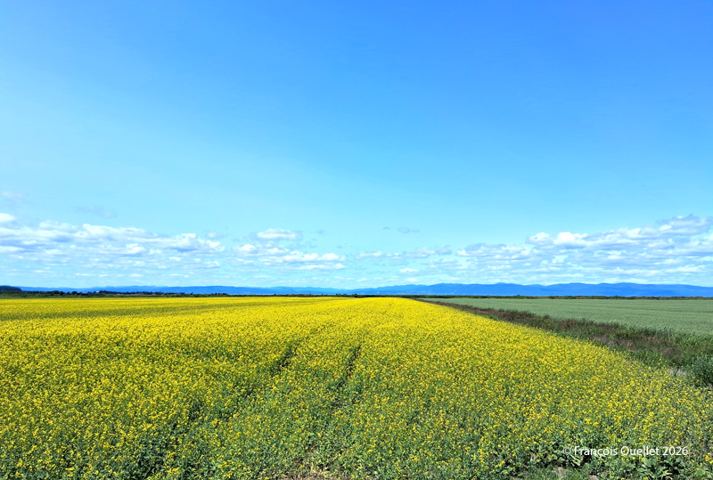
Kamouraska fields, Summer 2026.

In Saint-Alexandre-de-Kamouraska, a left turn brings you onto Route 289, which you follow until you reach Route 132, near the river. Along the way, a long downhill stretch allows for a bit of a break and allows to reach a speed of 60 km/h. For reference, by the time you turn onto Route 289, you’ll have already covered about 50 kilometers.

Once you reach Route 132, turn left to ride along the river and head back toward Kamouraska. At this point, there are between 15 and 20 kilometers left to go. A possible stopover is the small lighthouse in Saint-André de Kamouraska.
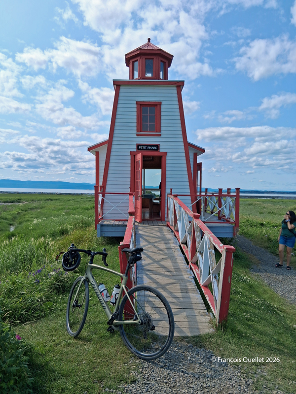
Small lighthouse of Saint-André de Kamouraska

Throughout this hike, there are several opportunities to take a shortcut inland to reach Kamouraska more quickly. This can be helpful if you’re tired, injured, or for any other reasons.

Once you’re back in the village of Kamouraska, there are a few interesting spots worth visiting to grab a bite, pick up some unique souvenirs, and even take a walk near the beach.

Have a great trip!
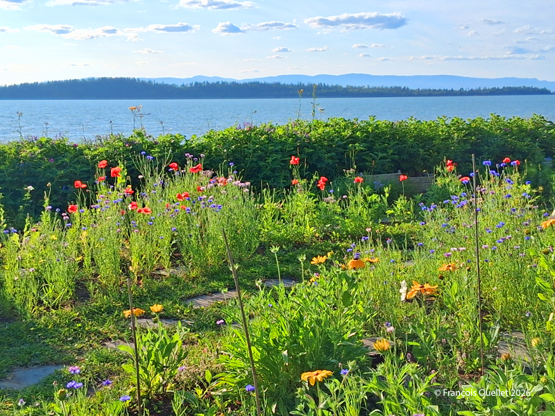
Seaside and flowers at Kamouraska

Seaside and flowers at Kamouraska

Click the link to see more photos of Quebec City on my blog.
Categories
Photos of Canada Photos of Quebec

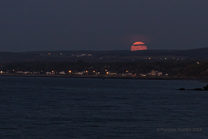
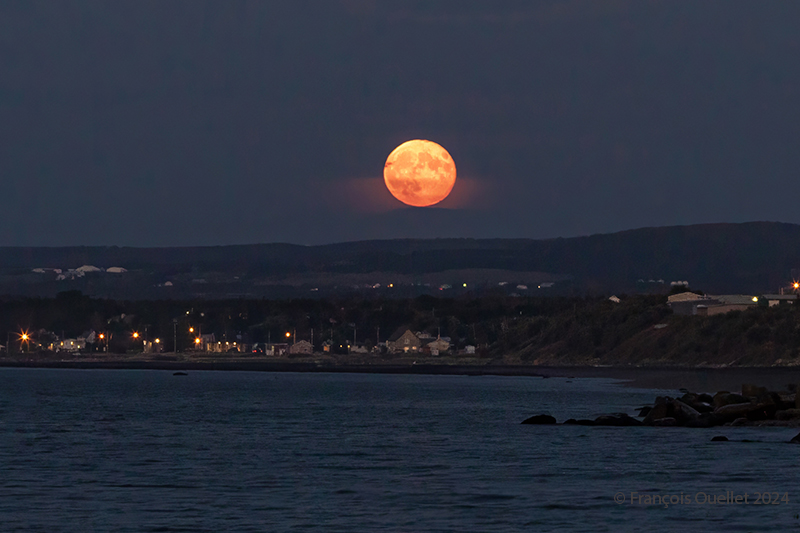
The full harvest moon of September 2024.

The full harvest moon rises in the Matane sky in September 2024.

The photo above was taken in Matane, Quebec, in September 2024. It’s more a matter of chance than planning. I was on the beach photographing the sunset, and when the sky got too dark, I turned around to see if there was anything interesting left to capture. And I came across this full harvest moon rising in the firmament.

Photographing a full moon is a good challenge. We often capture only an almost white, very bright disk, losing the nuances of colour and the details of the lunar geography.

The advice available on the Internet on how to successfully shoot a full moon with a normal camera goes in all directions. But one thing’s for sure: to improve your chances of success, it’s best not to wait until nightfall, because then the very high luminosity of the star becomes impossible to attenuate while still retaining a view of the planetary topography.

Most of the time, the choice is between an excellent photo of a full moon, but a very dark surrounding earth relief where nothing is discernible, or a visible earth relief of acceptable quality, but a moon that represents nothing more than a large, white circle of light.

The method that works for the photo above is as follows: you have to be on the spot at the right time, i.e., during the blue hour and not the whole night. So, in my case, I was lucky because it wasn’t planned.

You need a tripod and an extension cable. There are two reasons to avoid long exposures: firstly, the moon is a moving object. The longer the exposure, the more the disk moves. You end up with an oval rather than a round moon. A long exposure also picks up more light, and the moon’s disk turns completely white.

Full harvest moon rising in Matane, Québec 2024

Compromises become necessary. Trying to get a perfect moon and foreground at exactly the right brightness is quite a challenge. By the time every attempt has been made to achieve a flawless result, the moon is already too high in the sky. We have to act quickly.

We’re advised to lower the ISO to 200, but if I do that, I’m increasing the exposure time and introducing too much light into the camera. Instead, I use a higher ISO to reduce exposure, and use all the camera functions likely to reduce the amount of light entering the camera: higher shutter speed, if necessary, strong negative exposure compensation, and so on.

By not overdoing the settings and using RAW files, there’s still enough flexibility to bring out the foreground, in this case the houses lining Matane’s beaches and the surrounding lights.

In short, shoot during the blue hour, act quickly, accept compromises, limit exposure time in every way possible and use RAW files to facilitate post-production work.

Click on the link for more photos from the province of Quebec on my blog.

Categories
Photos of Canada Photos of Quebec

Pointe-au-Père and L’Islet 2023

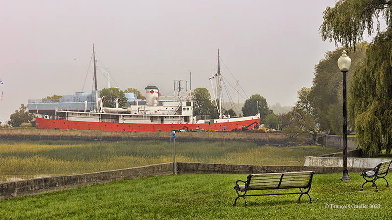
Musée maritime du Québec in l'Islet 2023
Musée maritime du Québec in l’Islet 2023

While in L’Islet, a stop at the Musée maritime du Québec is a must. Above, the icebreaker Ernest Lapointe, responsible for clearing the St. Lawrence River between Montreal and Trois-Rivières for 37 years.

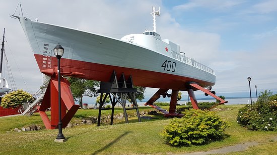
The Bras d'Or hydrofoil at the Musée de l'Islet
The Bras d’Or hydrofoil at the Musée de l’Islet

Also on the grounds is the famous HMCS Bras d’Or. This hydrofoil was created in Canada during the Cold War to monitor Canadian waters against possible Soviet submarine intrusion. As this museum boat explains, “it was compulsory to have a dual pilot’s licence for aircraft and navigation in order to operate this self-supporting winged craft“.

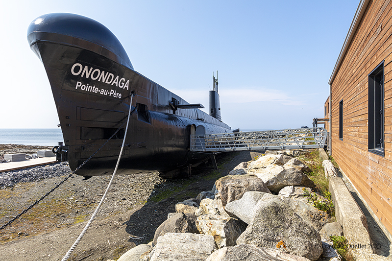
HMCS Onondaga submarine museum in Pointe-au-Père, Québec 2023

A little further east, we reach Pointe-au-Père, in the Rimouski region. Here you’ll find Canada’s only submarine museum.Visitors can tour the interior of the HMCS Onondaga, used until 2000. Travelers pass through 17 stations to learn about life aboard a submersible.

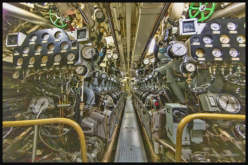
Inside the canadian submarine HMCS Onondaga in Pointe-au-Père

The mechanic worked for periods of two months at a time, monitoring the engines in this noisy, diesel-smelling environment. A German spy disembarking from a submarine at night in Gaspésie was spotted in a bus because it smelled strongly of diesel.

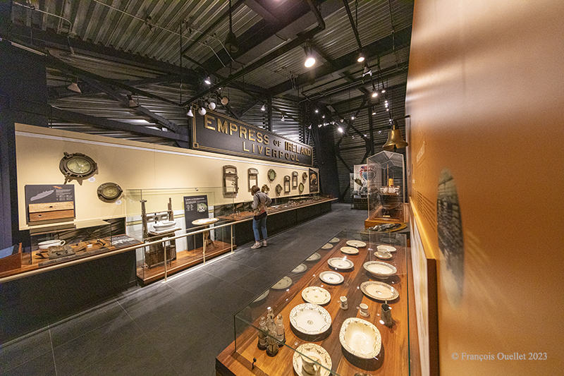
Empress of Ireland museum in Pointe-au-Père, Québec 2023

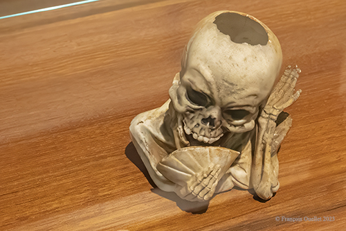
Above, a shot of one of the rooms in the Museum of the Empress of Ireland. Her sinking in the St. Lawrence River was the second most costly in human lives after the Titanic. Among all the objects recovered from the wreck is this porcelain skeleton that one of the passengers had in his cabin.

Skeleton head found in the Empress of Ireland

Click on the link for more photos from the province of Quebec on my blog.