Beginning of the bike ride between Saint-Roch-des-Aulnaies and Rivière Ouelle
Since cycling tourism is very popular, I’d like to suggest a beautiful bike ride between Saint-Roch-des-Aulnaies and Rivière-Ouelle in the Bas-Saint-Laurent region. This round-trip route, which is about 43 kilometers long, takes you along the St. Lawrence River and offers a few spots where you can stop to enjoy the view.
There is free parking very close to the highway exit, though it’s slightly off the main road. You’ll find it fairly easily. Very early on in the bike ride, you’ll see a small side path that leads to the St. Lawrence River. (Photo below)
Two ladies discussing at the halte de la Pointe Rouge near the Grande-Anse bike path.
On the Grande-Anse bike path, cyclists ride completely protected from cars. On one side is Highway 20, and on the other are trees and the St. Lawrence River.
On the Chemin des Berges between Saint-Roch-des-Aulnaies and Rivière Ouelle
The Chemin des Berges trail, which starts in Saint-Roch-des-Aulnaies, is a gravel path.
Bike path between Saint-Roch-des-Aulnaies and Rivière Ouelle
As you approach Rivière-Ouelle, you’ll ride a very short distance on Route 132, and then, after the Rivière-Ouelle bridge, turn left onto a paved secondary road with little traffic. This road leads cyclists to Rivière-Ouelle Beach.
Second section of the bike ride between Saint-Roch-des-Aulnaies and Rivière Ouelle
At the end of the trail, you have direct access to the beach for at least one kilometer. There are a few benches and even a picnic table.
Stopover at Rivière Ouelle during a bike ride in Québec in 2026
Then it’s time to head back to Saint-Roch-des-Aulnaies. The total distance of the hike is about 43 kilometers. It’s an easy hike, as it has only one hill and the distance is reasonable.
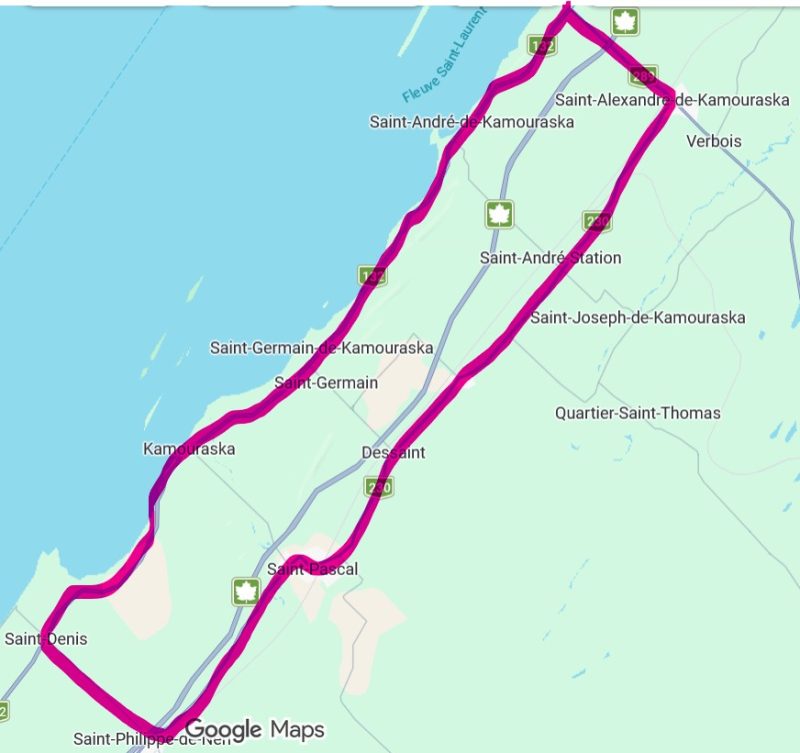
Map of a 77 km bike ride in the Kamouraska region.
This intermediate-level, 77-kilometer bike route in the Bas-Saint-Laurent runs entirely on paved roads, unlike Vélo Québec’s Églantiers loop (55 km), which includes a 14-kilometer gravel section. The cycling tour follows a sort of elongated rectangle running parallel to the St. Lawrence River.
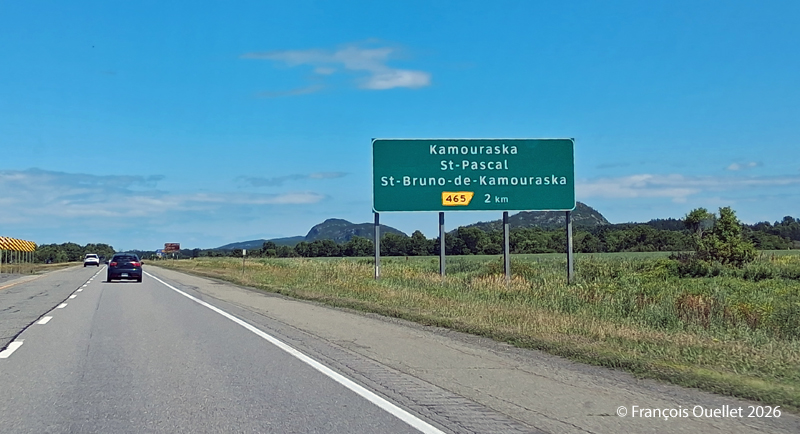
Exit for St-Pascal and Kamouraska
To get there by car, take the St-Pascal exit and head toward Kamouraska. Parking at the village church is free.
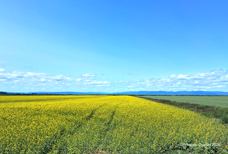
The bike route begins heading southwest, first along Route 132 toward Saint-Denis-De La Bouteillerie. Cyclists are treated to beautiful views along the way, whether of ancestral houses, flower-filled or plowed fields, farms, monadnocks, the river, or the mountains in the distance. When I was there, a massive drone controlled from the roadside was spraying crops.
Once you reach Saint-Denis-De La Bouteillerie, turn left onto Route 287 and continue toward Saint-Philippe-de-Néri. Eventually, you’ll pass under Highway 20 and reach Route 230. There, turn left again and ride along Route 230 to Saint-Alexandre-de-Kamouraska. Generally speaking, the route heads northeast.
Kamouraska fields, Summer 2026.
In Saint-Alexandre-de-Kamouraska, a left turn brings you onto Route 289, which you follow until you reach Route 132, near the river. Along the way, a long downhill stretch allows for a bit of a break and allows to reach a speed of 60 km/h. For reference, by the time you turn onto Route 289, you’ll have already covered about 50 kilometers.
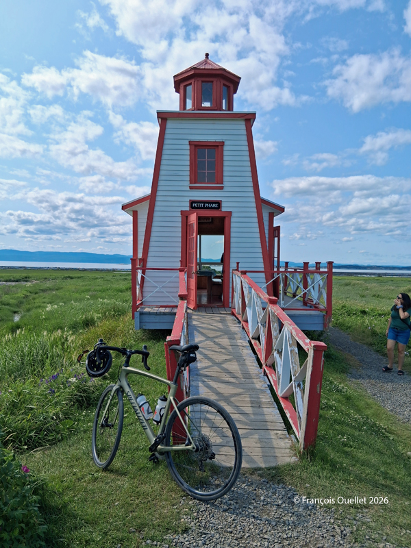
Once you reach Route 132, turn left to ride along the river and head back toward Kamouraska. At this point, there are between 15 and 20 kilometers left to go. A possible stopover is the small lighthouse in Saint-André de Kamouraska.
Small lighthouse of Saint-André de Kamouraska
Throughout this hike, there are several opportunities to take a shortcut inland to reach Kamouraska more quickly. This can be helpful if you’re tired, injured, or for any other reasons.
Once you’re back in the village of Kamouraska, there are a few interesting spots worth visiting to grab a bite, pick up some unique souvenirs, and even take a walk near the beach.
The exploration of the planet in flight simulation continues. Today we’re flying from Bruray / Out Skerries (EG78 or OUK for the IATA code) to the Barra beach airfield (EGPR). It’s a demanding virtual flight, especially when it comes to taking off from Out Skerries. The winds are strong and quite sideways to the small runway. You can see this by observing the windsock from the cockpit.
Virtual DHC-4 Caribou ready for crosswind take-off at EG78 Out Skerries aerodrome with MSFS
The crew opted to use a good old DHC-4 Caribou, which has proved its worth in difficult landings and take-offs. The virtual clouds reflect the current situation in the Shetland Islands.
With both feet on the brakes, the flaps adjusted and the steering wheel turned to the right to limit the effect of the wind on the right wing, the crew push the throttle to maximum while releasing the brakes. The aircraft moves a little to the left as it rolls, but by using rudder, it stays on the runway long enough to take off.
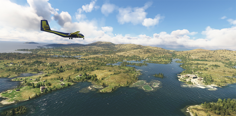
DHC-4 Caribou virtual aircraft airborne out of Out Skerries (EG78) in Scotland
The flight is made in VFR mode under cloud. Eventually, the sky clears and we can enjoy the scenery as we approach Barra beach. The low tide makes for a smooth landing.
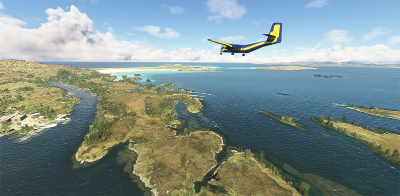
DHC-4 Caribou enroute to the Barra (EGPR) virtual airport on the beach with MSFS
The photo below shows the Caribou in right base for Barra beach. What a great day for visual flying!
Barra (EGPR) sand runway in sight with the virtual DHC-4 Caribou with MSFS
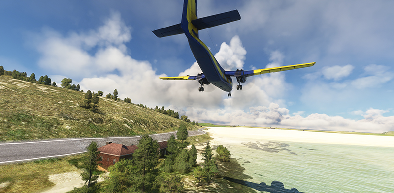
DHC-4 Caribou on final for the sand runway at Barra virtual airport (EGPR) with MSFS
The DHC-4 is now on short final for the sand runway. Even though it’s a large twin-engine aircraft, its short take-off and landing capabilities mean that it will only need a very small portion of the available range.
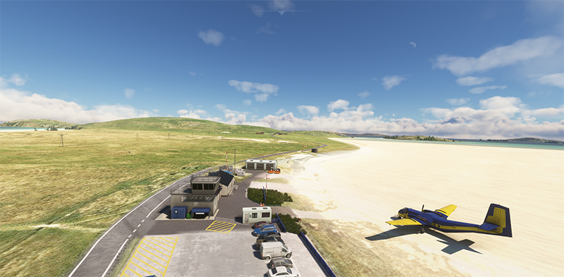
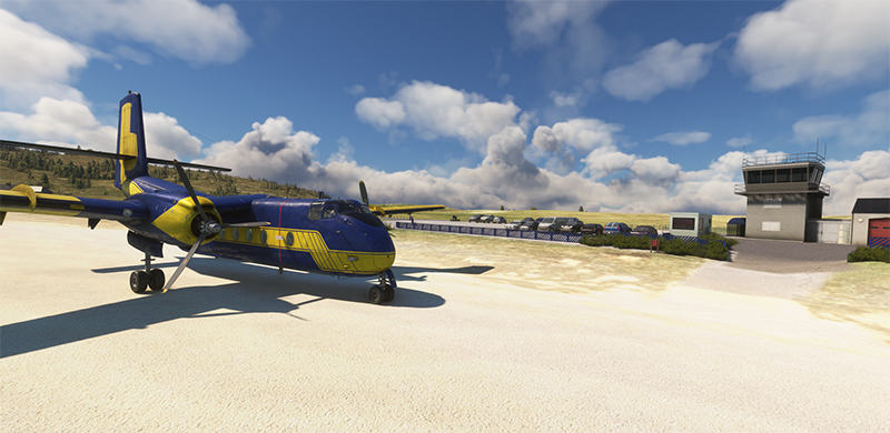
The virtual Barra airport (EGPR) and the DHC-4 Caribou on a stopover in flight simulation with MSFS.
A few passengers seem to have already arrived, unless they’re curious onlookers who heard the aircraft approaching. This is certainly a very rare visit by a DHC-4 to Barra!
Virtual DHC-4 Caribou landed on the beach at Barra airport (EGPR) with MSFS
Airport management refuses to reveal the aircraft’s destination. In any case, this won’t be the first time a Caribou has made special flights on demanding runways.
Ultimate luxury with sleeping pods for the future passengers of a virtual DHC-4 Caribou with MSFS
A final photo shows the interior of the Caribou. Impressive luxury, with berths available for first-class passengers. There’s no stopping progress!
Stage 17 of this round-the-world flight simulation will take place between Barra and Donegal (EIDL) in Northern Ireland. The virtual Britten Norman BN2A Trislander MK III will make the journey using the Microsoft Flight Simulator 2020 (MSFS) flight simulator.
Through the videos on Youtube, I see that a runway called Out Skerries (EG78 or OUK) in the Shetland Islands attracts interest for its challenging landing. It is only 1195 feet long.
The tiny airstrip will therefore be the destination for leg #15 of our round-the-world flight simulation tour with the MSFS flight simulator.
To increase the fun, we choose a twin-engine aircraft, which is heavier and requires a longer breaking distance.
We take off from Dundee (EGPN) with a virtual Diamond DA-62 and arrive at dusk. It’s probably a bit tight for a short, unlit runway, but we’ll give it a go.
DA-62 aircraft taking off from Dundee airport, Scotland, with Microsoft Flight Simulator
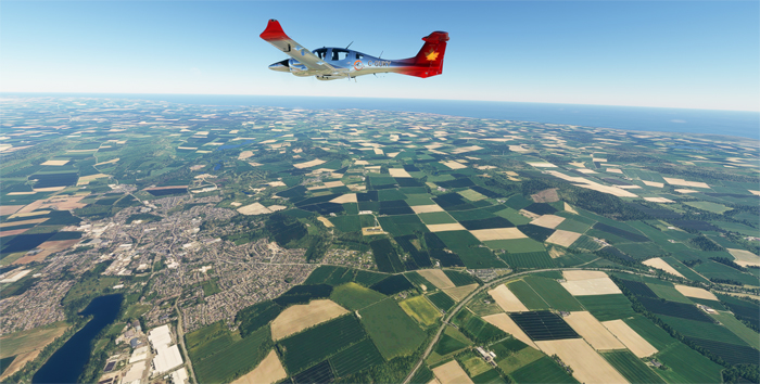
The stall speed of the DA-62 in landing configuration is 68 knots, which will help us to succeed in our undertaking. We take a 018-degree northerly course to reach the islands from Dundee. Ground speed is around 155 knots for this 250 nautical mile journey.
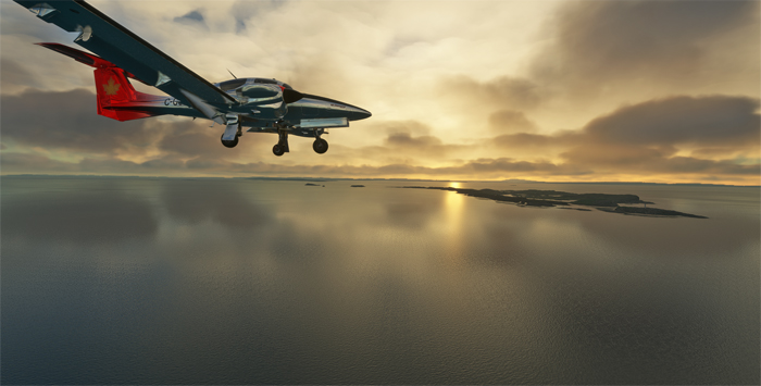
Virtual DA-62 over Scotland enroute to the Shetland Islands
DA-62 aircraft near Fair Isle in the Shetland Islands with Microsoft Flight Simulator
We have to fly off Fair Isle on the way to our destination. I learn from some research that Fair Isle knitwear remains one of Shetland’s most famous products. I imagine that fish products are also very popular.
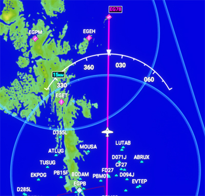
Flight trajectory towards Out Skerries (EG78) on the Shetland Islands, Scotland
Approaching Out Skerries (EG78) airport in Scotland with the DA62 virtual aircraft
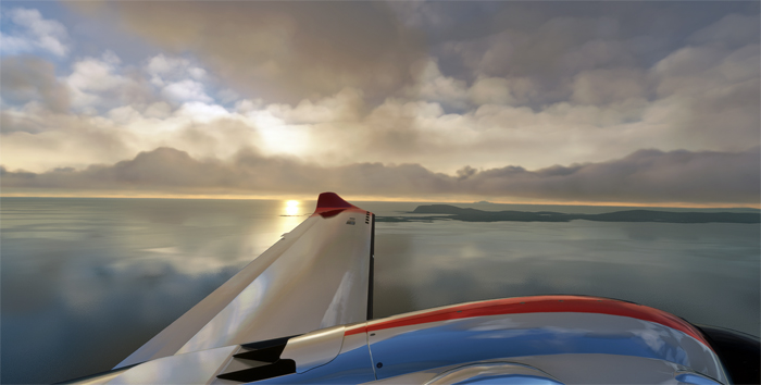
Here we are, approaching Out Skerries. The absence of runway lights makes the operation tricky.
The surrounding hills block the pilot’s view at low altitude, and what is considered a landing strip is not visible until fairly late in the approach. There are no other aids to help locate the facilities.
The omnipresent winds complicate the task, as does the turn on approach. One of the runway thresholds ends in a cliff ready to receive ill-prepared aviators.
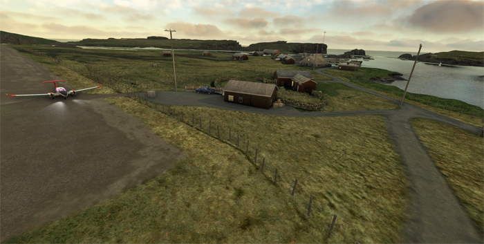
After landing at Out Skerries airport (EG78) with Microsoft Flight Simulator
We see the runway threshold at the last moment. Since the DA-62 weighs more than a single-engine model, the aircraft requires a longer braking distance.
Ground contact is harder than usual, but without bouncing. If there’s a bounce, the pilot has to climb back up and repeat the approach.
You really have to glue the aircraft to the ground at the runway threshold, immediately raise the flaps while pulling back on the stick to maximize braking efficiency. In real life, we’d add that braking must be performed without locking the wheels.
I classify this exercise as a challenging virtual flight.
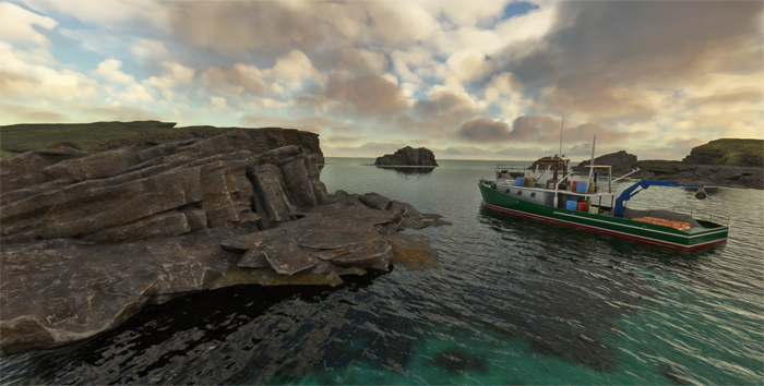
Fishing boat around the Shetland Islands with Microsoft Flight Simulator
Once the flight is over, the crew visits the surroundings. Many fishing boats come and go around the islands.
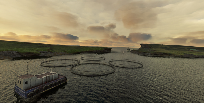
Mussel farming around the Shetland islands in Scotland, with Microsoft Flight Simulator.
On our next flight, we head for Barra Airfield (EGPR). It’s located in Scotland’s Outer Hebrides and is the only airport in the world “where scheduled services land on a beach”. We’ll be sure to check the tide before take-off…
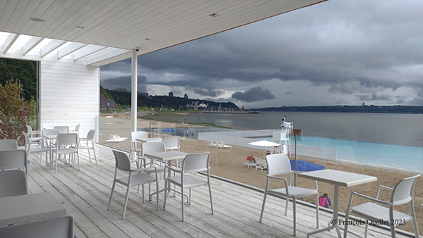
Comfortably seated on the new terrace of Quebec City’s Station de la Plage, I wrote this article sheltered from the elements.
Phase 3 of the Promenade Samuel-De Champlain in Quebec City will have cost around $190 million. A site foreman confides: “The most complex part of all this was complying with the actual government requirements. We had to do a lot of digging and install infrastructure to prevent wastewater from being discharged into the St. Lawrence River. We also had to deal with the sudden increase in inflation: to avoid a $50 million overrun, we had to shorten the width of the children’s romper and cut where it had to least impact “.
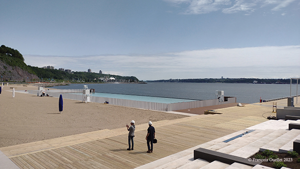
While out cycling, I took the opportunity to snap a few shots of the construction progress around what will develop into the “station de la Plage”.
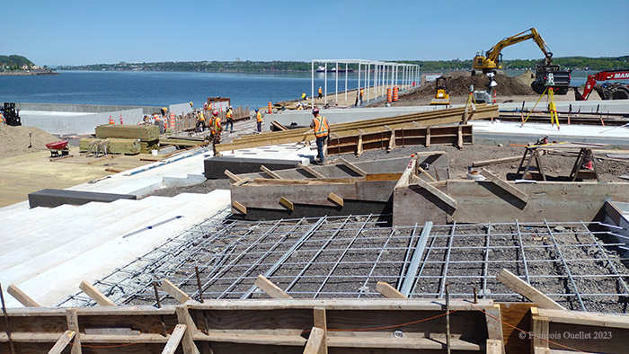
Construction of the stairs at the “station de la Plage”, Quebec City.
The picture above shows the production of the reinforced concrete for the main staircase.
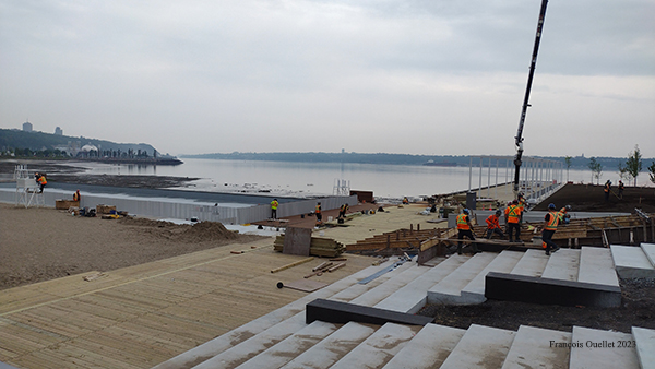
Below, the finished steps can be seen. What will become the swimming pool (on the left of the photo) receives its first coat of paint. A modification to the pool’s depth necessitated the installation of a fence.
Painting the swimming pool at the “station de la Plage” and installing the fence.
It can disappear completely into the ground as soon as swimming is allowed. However, its operation is currently causing serious problems, as with all novelties. When the motor exerts too much force to raise a section of fence, it falls back down on its own. The presence of sand in the vicinity may have been ignored, or at least its effect underestimated, when the railing was designed. Sand is inserted into the gears with each day’s activity. And there’s no question of using grease to make it easier to raise and lower the panels: the sand would stick to the lubricant and further complicate operations. A technician has been working for weeks to rectify the situation.
The “station de la Plage” is almost completed.
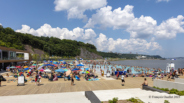
The pool has now received a coat of blue paint. This creates a clear demarcation with the color of the river water, an effect that will also benefit photographers. Only a few preparations remain before the population can officially access the site. The Commission de la capitale nationale de Québecwants people to be able to bathe just in time for the Fête nationale des Québécois, on June 24.
From now on, the incredible popularity of the site with the public will have to be managed. Indeed, in their eagerness to access the beach, few individuals bother to read the current regulations. This task will fall to the security staff, who will have to utilize their teaching skills and diplomacy to get the message across.