Categories
Photos of Quebec

Bike ride between Saint-Roch-des-Aulnaies and Rivière-Ouelle.

Beginning of the bike ride between Saint-Roch-des-Aulnaies and Rivière Ouelle

Since cycling tourism is very popular, I’d like to suggest a beautiful bike ride between Saint-Roch-des-Aulnaies and Rivière-Ouelle in the Bas-Saint-Laurent region. This round-trip route, which is about 43 kilometers long, takes you along the St. Lawrence River and offers a few spots where you can stop to enjoy the view.

There is free parking very close to the highway exit, though it’s slightly off the main road. You’ll find it fairly easily. Very early on in the bike ride, you’ll see a small side path that leads to the St. Lawrence River. (Photo below)

Two ladies discussing at the halte de la Pointe Rouge near the Grande-Anse bike path.

On the Grande-Anse bike path, cyclists ride completely protected from cars. On one side is Highway 20, and on the other are trees and the St. Lawrence River.

On the Chemin des Berges between Saint-Roch-des-Aulnaies and Rivière Ouelle

The Chemin des Berges trail, which starts in Saint-Roch-des-Aulnaies, is a gravel path.

Bike path between Saint-Roch-des-Aulnaies and Rivière Ouelle

As you approach Rivière-Ouelle, you’ll ride a very short distance on Route 132, and then, after the Rivière-Ouelle bridge, turn left onto a paved secondary road with little traffic. This road leads cyclists to Rivière-Ouelle Beach.

Second section of the bike ride between Saint-Roch-des-Aulnaies and Rivière Ouelle

At the end of the trail, you have direct access to the beach for at least one kilometer. There are a few benches and even a picnic table.

Stopover at Rivière Ouelle during a bike ride in Québec in 2026

Then it’s time to head back to Saint-Roch-des-Aulnaies. The total distance of the hike is about 43 kilometers. It’s an easy hike, as it has only one hill and the distance is reasonable.

Have a great hike!

Click the link to see more photos of Quebec on my blog.
Categories
Photos of Quebec

An 80 kilometers bike ride in Kamouraska

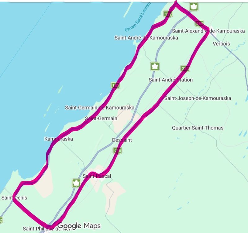
Map of a 77 km bike ride in the Kamouraska region.

This intermediate-level, 77-kilometer bike route in the Bas-Saint-Laurent runs entirely on paved roads, unlike Vélo Québec’s Églantiers loop (55 km), which includes a 14-kilometer gravel section. The cycling tour follows a sort of elongated rectangle running parallel to the St. Lawrence River.

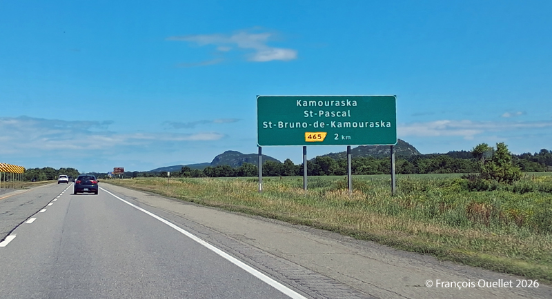
Exit for St-Pascal and Kamouraska

To get there by car, take the St-Pascal exit and head toward Kamouraska. Parking at the village church is free.

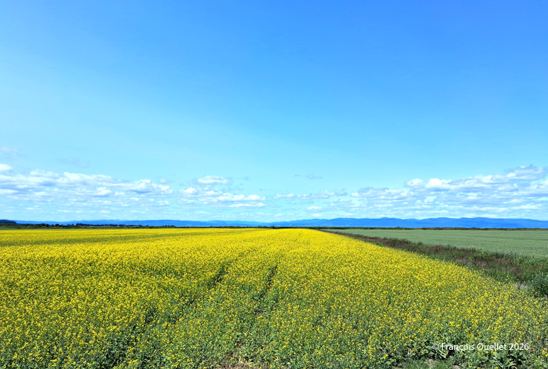
The bike route begins heading southwest, first along Route 132 toward Saint-Denis-De La Bouteillerie. Cyclists are treated to beautiful views along the way, whether of ancestral houses, flower-filled or plowed fields, farms, monadnocks, the river, or the mountains in the distance. When I was there, a massive drone controlled from the roadside was spraying crops.

Once you reach Saint-Denis-De La Bouteillerie, turn left onto Route 287 and continue toward Saint-Philippe-de-Néri. Eventually, you’ll pass under Highway 20 and reach Route 230. There, turn left again and ride along Route 230 to Saint-Alexandre-de-Kamouraska. Generally speaking, the route heads northeast.

Kamouraska fields, Summer 2026.

In Saint-Alexandre-de-Kamouraska, a left turn brings you onto Route 289, which you follow until you reach Route 132, near the river. Along the way, a long downhill stretch allows for a bit of a break and allows to reach a speed of 60 km/h. For reference, by the time you turn onto Route 289, you’ll have already covered about 50 kilometers.

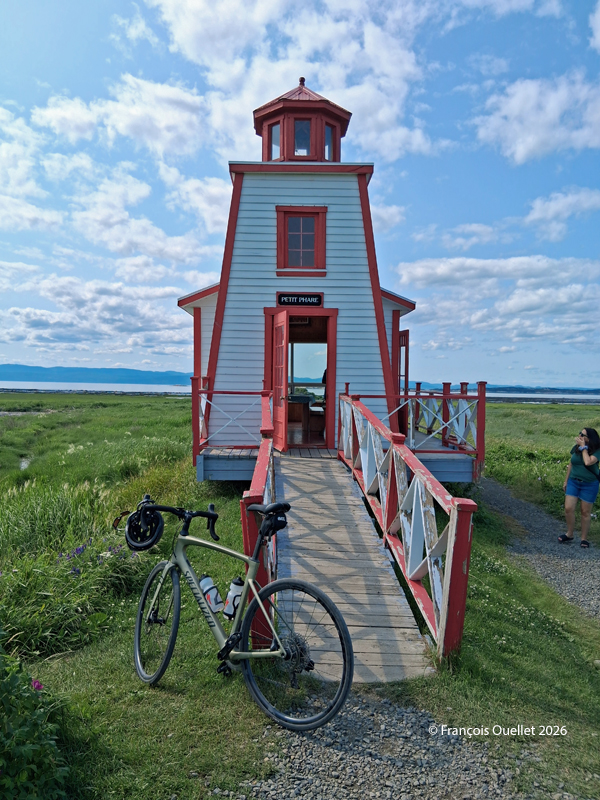
Once you reach Route 132, turn left to ride along the river and head back toward Kamouraska. At this point, there are between 15 and 20 kilometers left to go. A possible stopover is the small lighthouse in Saint-André de Kamouraska.

Small lighthouse of Saint-André de Kamouraska

Throughout this hike, there are several opportunities to take a shortcut inland to reach Kamouraska more quickly. This can be helpful if you’re tired, injured, or for any other reasons.

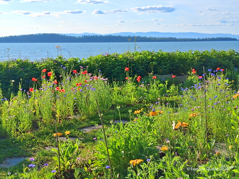
Once you’re back in the village of Kamouraska, there are a few interesting spots worth visiting to grab a bite, pick up some unique souvenirs, and even take a walk near the beach.

Have a great trip!

Seaside and flowers at Kamouraska

Seaside and flowers at Kamouraska

Click the link to see more photos of Quebec City on my blog.

Categories
Photography Photos of Quebec

Station de la Plage, Québec City.

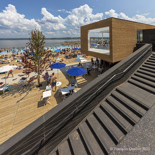
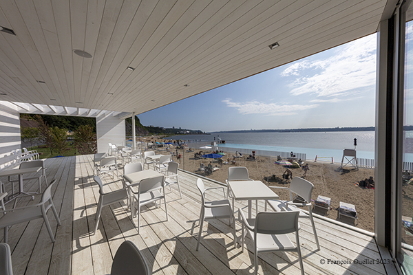
Building architecture at the "station de la Plage", Quebec City.
Building architecture at the “station de la Plage”, Quebec City.

With phase three of the Promenade Samuel-De Champlain now complete, the Commission de la capitale nationale du Québec must adjust to the popularity of its new facilities with the public.

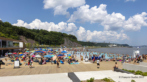
Station de la Plage in Quebec City

In fact, the “station de la Plage” and “station de la Voile” are so popular that the planners had to quickly rethink parking management. On sunny days, thousands of people come to relax on the sites. Cars arrive laden with children and beach equipment, and everyone hopes to find a space for their vehicle.  But by 10 a.m., there’s nothing left.

The two beach and building attendants have their hands full observing everything that moves, correcting habits and arguing with people. Because, in addition to the scarcity of parking spaces, pedestrians are not tolerated strolling alongside their bicycles, either near the beach or on the elevated terrace.

Raised deck at "station de la Plage", Québec City.
Raised deck at “station de la Plage”, Québec City.

However, the rules and regulations posted on the National Capital Commission’s website are confusing. They stipulate that you must walk on the site and that bicycle traffic is prohibited. You might think that a person walking with his bike at his side would be complying with the requirements, since he’s not straddling it, but that’s not the case.

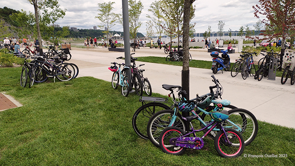
A month into the operation, a security guard tells me: “We’ve already notified over 400 visitors who were walking while holding a bike”. He wants the word to get out. But the facilities for accommodating bicycles are not keeping up with demand. The tree trunks near the main building help out, and serve as a place to put a padlock on busy days.

Trees used to lock bikes at the station de la Plage in Quebec City.

What’s more, with bicycles becoming increasingly expensive, many cyclists are reluctant to leave them unattended for a few hours, even when locked. Experienced thieves are notoriously quick. This first year of operations will therefore require some modifications to procedures and installations.

If you’d like to have your say, use this address: Commission de la capitale nationale du Québec. You can also request a follow-up by checking the appropriate box.

Click on the link for more Summer photos of Quebec City and Île d’Orléans on my blog.