Categories
Flight Simulation

Challenging virtual flight in Idaho using MSFS 2020

MSFS 2020 map for the flight 3U2 to C53 in United States

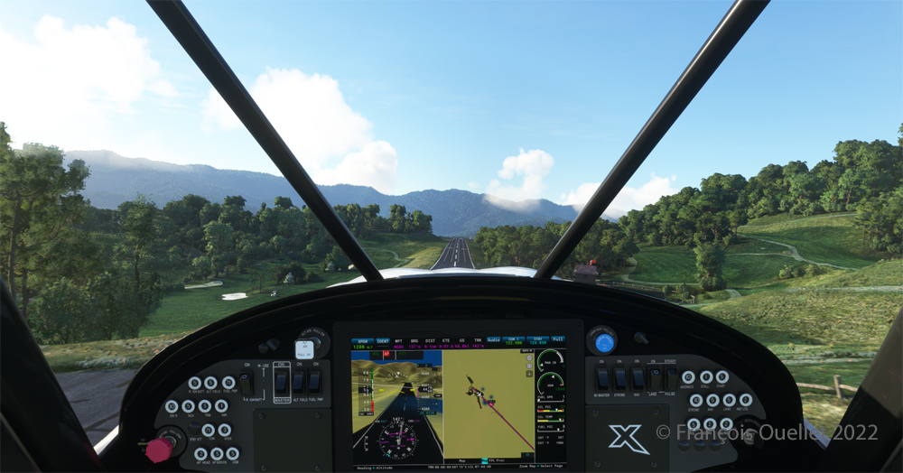
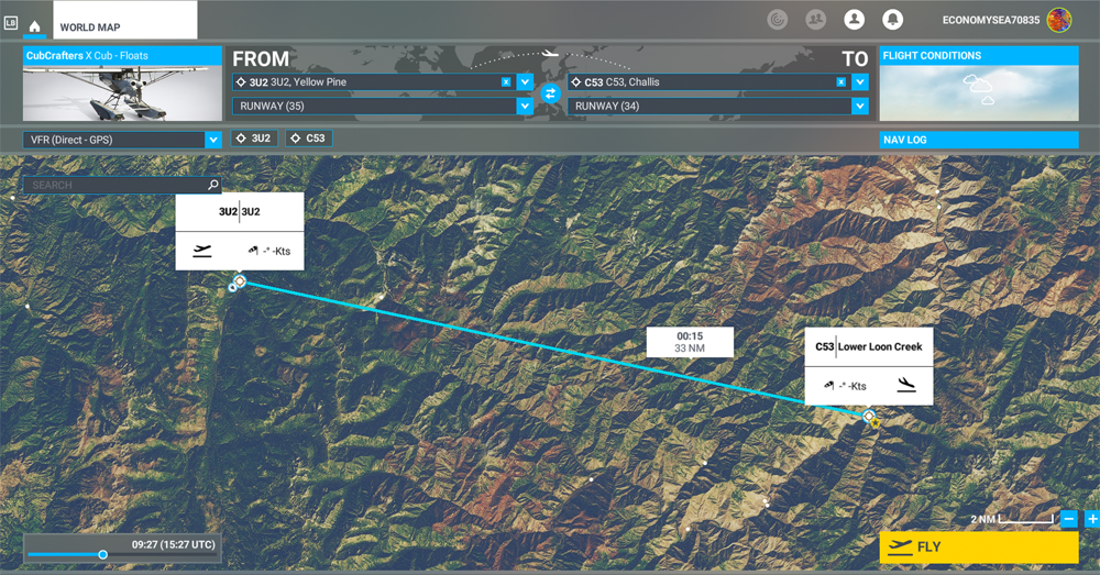
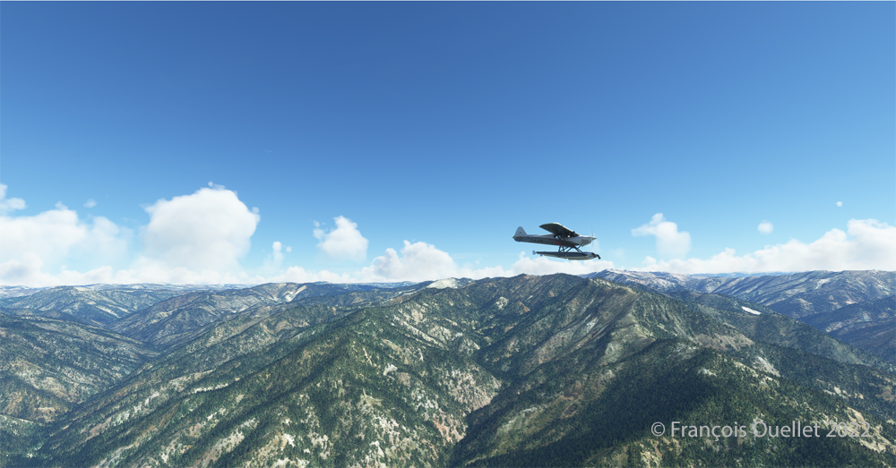
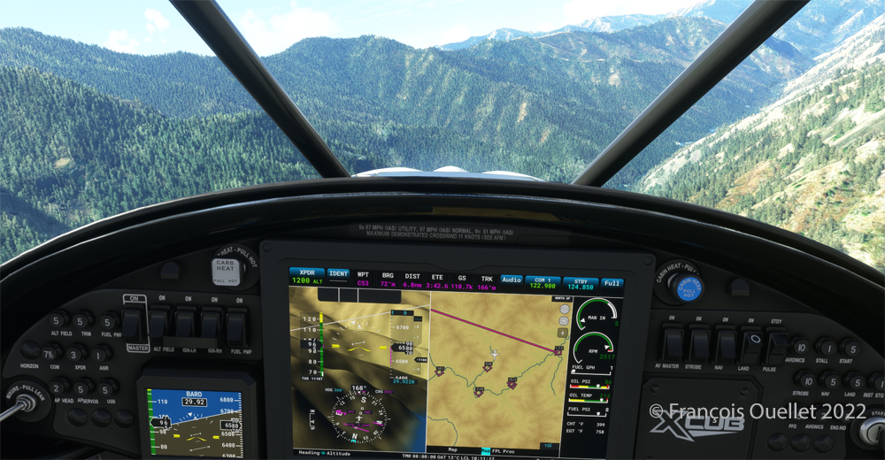
The challenging virtual flight is from Johnson Creek Airport (3U2) to the Lower Loon Creek Airstrip (C53) in the United States, using the MSFS 2020 flight simulator. The software map shows the type of aircraft chosen, a CubCrafters X Cub on floats, as well as the trajectory over the Idaho mountains.

The idea of using an amphibious aircraft for this flight is a bit far-fetched, but the goal is to make the pilot’s job a little more difficult by adding weight to the aircraft.

Johnson Creek (Yellow Pine) airport 3U2 with MSFS 2020

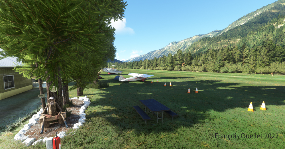
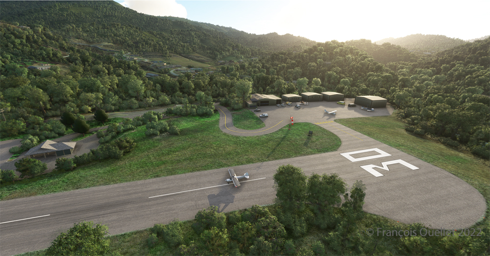
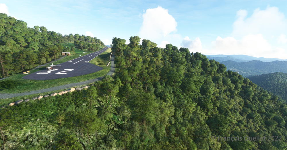
Johnson Creek Airport (3U2) is a creation of Creative Mesh. It is charming, with tents here and there planted near the planes. The runway is 3480 feet long by 150 feet wide. It is oriented on a 17/35 axis and still quite high at 4960 feet above sea level (MSL).

Amphibian CubCrafters X Cub ready for departure at the Johnson Creek 3U2 virtual airport with MSFS 2020.

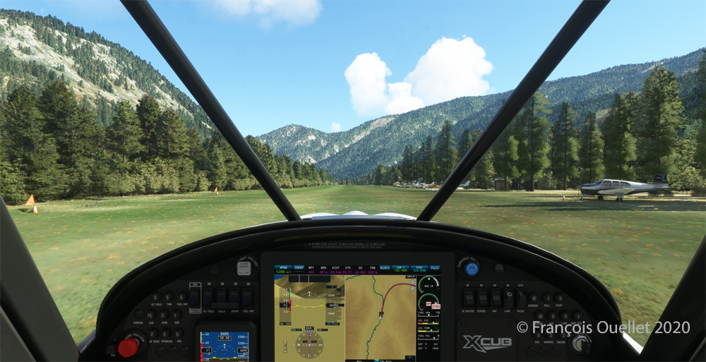
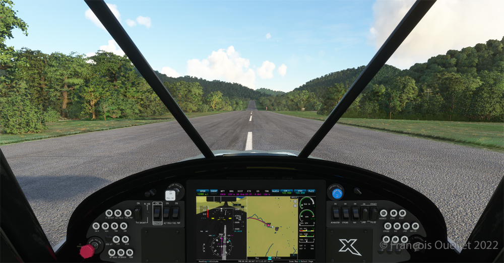
Given the departure altitude, one must not forget to adjust the air/fuel mixture so as not to lose power on takeoff, especially since there is a mountain at the end of the runway and the floats increase the weight of this small aircraft. The air is also thinner as the flight takes place in summer and at a high altitude; this represents another obstacle to the aircraft’s performance.

Avoiding obstacles after take-off from the 3U2 Johnson Creek virtual airport using MSFS 2020.

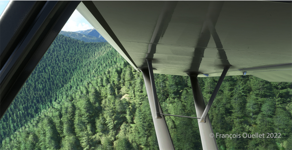
The mountains near the runway present a significant obstacle. The virtual pilot must use the best possible angle of climb without worrying about the route recommended by the GPS. The flaps are kept slightly extended during the initial climb.

Flying over the Idaho mountains in flight simulation with MSFS 2020.

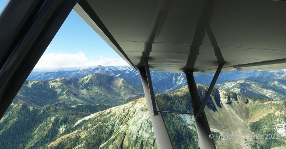
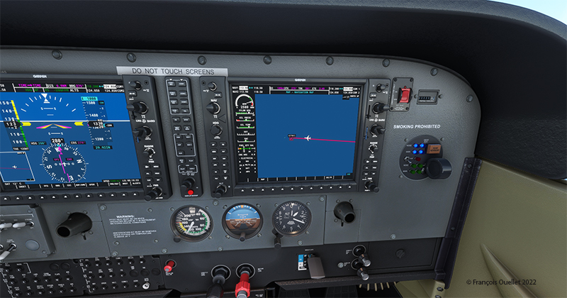
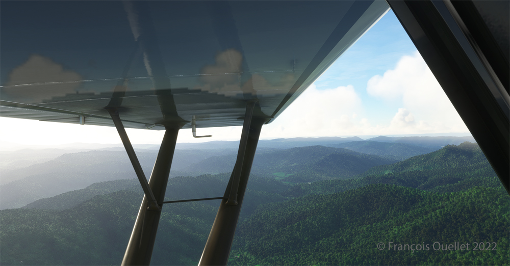
Once at a safe altitude and back on the GPS suggested route, the view of Idaho’s spectacular mountains is more enjoyable. Throughout the climb, the air-fuel mixture and altimeter (“B” on MSFS 2020) have to be adjusted.

CubCrafters X Cub floatplane over the Idaho mountains in flight simulation MSFS 2020

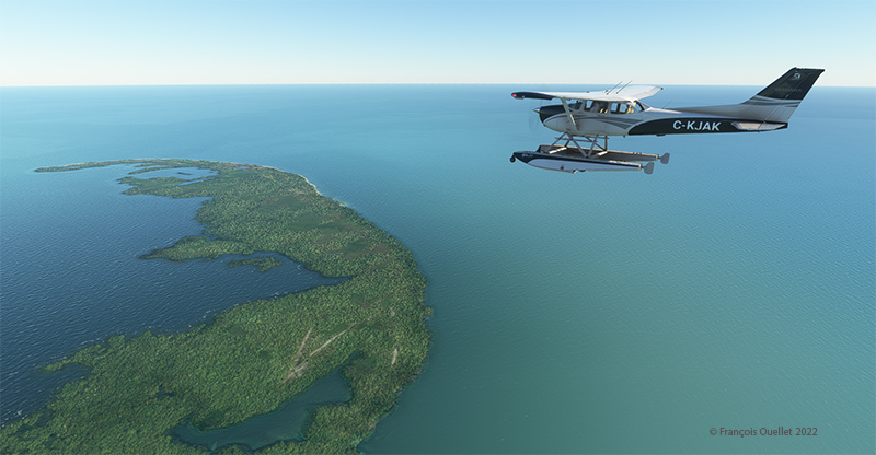
An altitude of almost 10,000 feet ASL makes it possible to fly over the mountains without risk of collision.

Descending in the valley towards the ID8 Marble Creek airport in Idaho in fligh simulation.

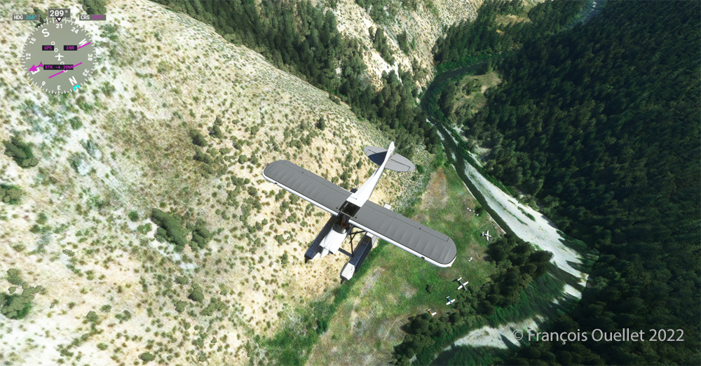
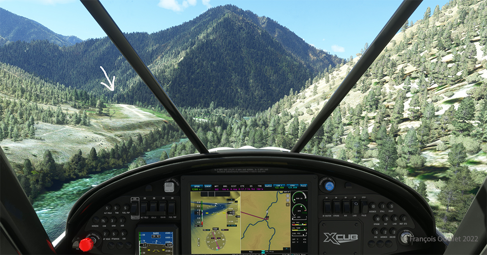
At the right moment, when the small surrounding airports and the river appear on the GPS, we leave our GPS road, until now in straight line, and we align in the valley to fly over the river until our destination, avoiding the surrounding mountains. In the photo above, the descent has already begun, with a necessary gradual adjustment of the air-fuel mixture.

Flying over the (ID8) Marble Creek airport in Idaho using the MSFS 2020 flight simulator.

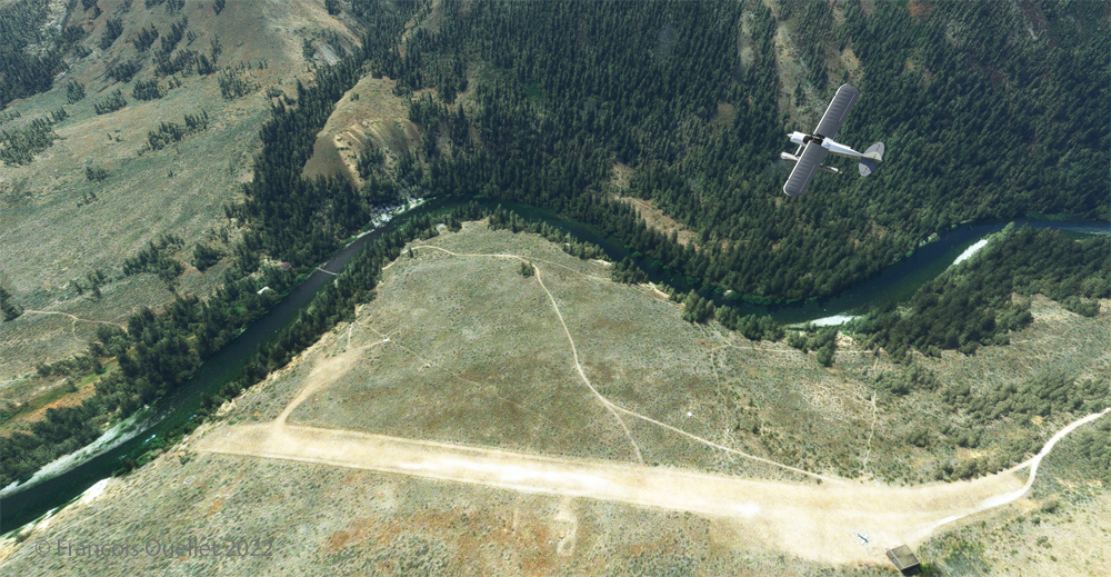
We fly over a first small airport. The picture above shows the planes parked on the runway of Marble Creek airport (ID8), which dimension is 1160 x 20 feet. For those which would be interested in trying a landing there, the orientation of the runway is 03/21 and the altitude of 4662 feet MSL.

Flying over the 2U8 Thomas Creek Airport in Idaho using the MSFS 2020 flight simulator.

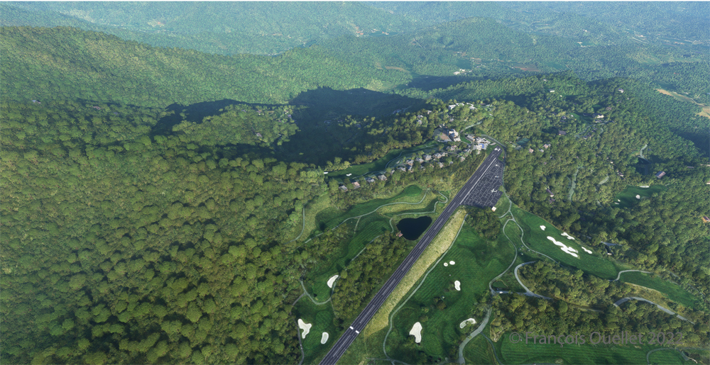
On the way towards our final destination, we also fly at low altitude over the Thomas Creek (2U8).

Following the river towards the C53 Lower Loon Creek airstrip using the MSFS 2020 flight simulator.

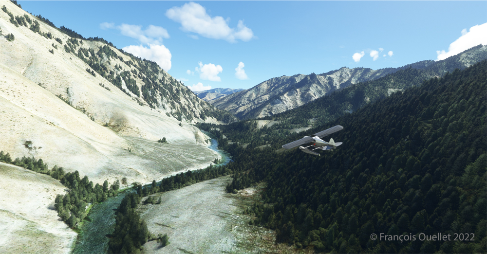
The mountains on either side of the river require close attention, as the poor performance of a small aircraft equipped with floats does not allow for easy correction of navigational errors.

By the time the runway suddenly becomes visible, the plane will not be on course but 90 degrees off the ideal course. It will be necessary to quickly turn left into the valley, make a fairly sharp 180-degree turn to the right to avoid the mountains, and then get back on course to land. It is only at this point that the landing gear will be extended.

On final for Lower Loon Creek airstrip with MSFS 2020

The photo above shows the aircraft on final for the Lower Loon Creek dirt and grass runway (C53). It is located at 4084 feet MSL and is only 1200 feet long by 25 feet wide. Note that the approach should be made on runway 16 when possible.

Amphibian CubCrafters X Cub rolling down the C53 Lower Loon Creek airstrip in Idaho after landing.

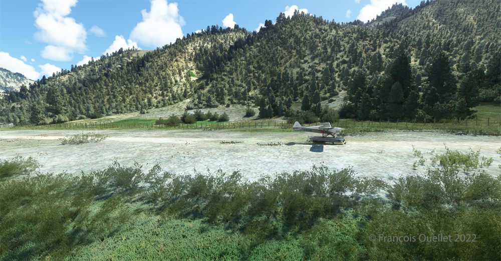
As always, a stabilized aircraft on final makes landing easier, regardless of the conditions.

Amphibian CubCrafters X Cub parked at the C53 Lower Loon Creek airstrip using MSFS 2020 flight simulator.

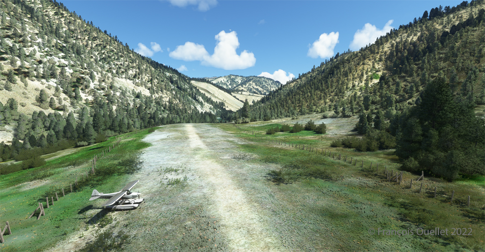
We park the plane and rest a bit. Today, there is no one else here. But that’s not always the case in real life, as this video of a landing at Lower Loon Creek shows it.

Click on the link for more challenging virtual flights on my blog.

Categories
Flight Simulation

Virtual flight around Key West with MSFS 2020

The Key West (KEYW) virtual airport by FSDreamteam for the MSFS 2020 flight simulator.

This is the Key West Airport (KEYW) in Florida, as reproduced for flight simulation by FSDreamteam for the Microsoft MSFS2020 flight simulator.

There is a clear advantage to acquiring this virtual airport rather than using the MSFS2020 airport. Indeed, the FSDreamteam KEYW airport doesn’t come alone: the company offers two other sites in accompaniment and for the same price: Fort Jefferson and the Loggerhead lighthouse.

A small virtual flight with a Cessna C-172 on floats allows you to fly over these sites and land on the water when appropriate.

Airborne from Key West KEYW with the MSFS 2020 flight simulator.

The Cessna takes off from Key West under ideal weather conditions.

Part of the Key West Wildlife National Refuge using MSFS 2020

Shortly after takeoff and established at 3000 feet, we fly over the Key West National Wildlife Refuge.

Descending towards Fort Jefferson with MSFS 2020

The Garmin G-1000 allows a stable flight during screen captures.

Flying over Fort Jefferson in Key West with MSFS 2020.

This is Fort Jefferson photographed as the Cessna flies at about 1500 feet ASL. The winds have increased slightly and foam is becoming visible on the waves.

Flying over Loggerhead Lighthouse in Key West using thge MSFS 2020 flight simulator.

A little further along the flight path is the Loggerhead Lighthouse. The beach is beautiful and gently sloping. It will be possible to do a water landing, put the landing gear down while on the water and then park on the beach.

Making a sea-landing by Loggerhead Lighthouse in Key West, with MSFS 2020.

The landing is done without too much difficulty.

On the beach at Loggerhead Lighthouse, in Florida, using MSFS 2020.

With a little engine power, it is possible to get out of the water and park on the beach for a while. After turning off the engine, the MSFS2020 flight simulator allows the pilot to listen to the sound of the waves and wind in a realistic way. If there are birds in the area, it will also be possible to hear them.

For those who want to repeat the experience, it is only a matter of programming the starting point in MSFS2020 as KEYW and the destination KYW1 (Fort Jefferson). Once through Fort Jefferson, continue straight for a few minutes and you’ll arrive at the Loggerhead Lighthouse. Take a few moments to relax and listen to the waves before taking off again…!

Click on the link for more standard virtual flights on my blog using either MSFS2020 or FSX.

Categories
Flight Simulation

Elk River (NC06) to Mountain Air County Club (2NC0) with MSFS 2020.

Ready for departure at the Elk River airport (NC06) created by Cloud Studio.

Today’s twenty-minute virtual flight is conducted using Microsoft MSFS 2020 flight simulation software. The virtual airport at Elk River (NC06)   in the United States, modeled here by Pilot’s, is located at approximately 3468 feet (ft) above sea level (MSL). Its sloped 12/30 runway can accommodate many types of aircraft as its dimensions are still 4600 feet long by 75 feet wide. A golf course is located near the airport facilities.

The sloped runway of the Elk River airport (NC06) with the MSFS 2020 flight simulator.

In the distance, the end of runway 30 can be seen rising rapidly. The trip to Mountain Air County Club Airport (2NC0), modeled by Cloud Studio, is made with a single engine Cubcrafters NX Cub.

Enroute towards the Mountain Air County Club (2NC0) airport from Elk River (NC06) with MSFS 2020.

In direct flight with GPS, the virtual pilot will have to climb at around 7000 feet msl to avoid the surrounding mountains. It is therefore important to adjust the air/fuel mixture during climb and descent for the destination. Also, don’t forget to adjust the altimeter (press “B”) as you move away from the point of departure. Near the summits, you will experience mechanical turbulence, which is normal.

Aerial view of the Mountain Air County Club (2NC0) airport created by Pilot's.
Aerial view of the Mountain Air County Club (2NC0) airport created by Pilot’s.

The photo above shows the virtual airport of Mountain Air County Club (2NC0) with the MSFS 2020 flight simulator. The sloped runway is 2900 feet long and only 50 feet wide. A golf course surrounds this airport located at 4432 feet MSL. Since the winds are light, the approach will be on runway 14.

On final for the sloped runway of the Mountain Air County Club (2NC0) airport using MSFS 2020.

On final approach, it is easy to see the uphill angle of this airstrip, which is slightly more damaged than the one at Elk River.

A view of the cliff at the threshold of runway 32 at the 2NC0 Mountain County Air Club airport created by Pilot's pour MSFS 2020.
A view of the cliff at the threshold of runway 32 at the 2NC0 Mountain County Air Club airport created by Pilot’s pour MSFS 2020.

As we continue to taxi to the end of runway 14, we notice the cliff that awaits the pilot who has not properly prepared his landing. No forgiveness!

View from above of the Mountain Air County Club airport 2NC0 with the MSFS 2020 flight simulator.

An elevated view shows the threshold of runway 14 and the buildings associated with the golf club. A few golf loving pilots have already parked their aircraft to the left of runway 14. For this screenshot, I used the excellent X-BOX drone.

Buildings and flowers at the Mountain Air County Club airport (2NC0) created by Pilot's for MSFS 2020.
Buildings and flowers at the Mountain Air County Club airport (2NC0) created by Pilot’s for MSFS 2020.

A final photo shows the buildings and flowers associated with the golf club. The bird recordings are easily heard, which enhance the scene. Flight simulation enthusiasts wishing to repeat the experience should do so under VFR conditions to keep an eye on the mountain tops during the approach.

Click on the link for more challenging virtual flights under MSFS 2020 and FSX on my blog.

Categories
Ship photography

The ship MSC Maria Pia in front of Quebec City.

The MSC Maria Pia vessel on the St.Lawrence Seaway by Quebec City.

Here is a last picture of the winter of 2022 before going into spring mode. We can see the MSC Maria Pia sailing through the ice on the St. Lawrence River between Quebec City and Lévis, with a temperature of -27C.

The container ship Maria Pia belongs to the Mediterranean Shipping Company (MSC). It was built in 1997 and flies the Panama flag. The ship passed by the Quai des Cageux at just the right time, as the very soft light of a late afternoon winter day is always more conducive to photography.

Click on the link for more photos of ships on my blog.

Categories
Geopolitics

Germany and rearmament.

Vladimir Putin claims that he feels trapped by NATO. To improve his strategic position, he invades Ukraine and destroys most of its important installations, both civilian and military, killing and starving thousands in the process.

The great powers, and especially the dictatorships, find it infinitely difficult to think out of the box when they know that they have access to a military solution. Soldiers and bombs will settle a long-standing dispute.

By adopting a pattern of thinking from the Middle Ages, Vladimir Putin has created a rebound effect. Many neighboring countries now live in fear of an unwarranted attack. Rather than diminishing the military capacity of neighboring countries as he would like, Putin has only succeeded in strengthening their will to unite and rearm.

For example, Germany was to develop, in partnership with other countries, the next fighter jet to fly in the European sky. This would, of course, take years to design, but little thought was given to it. The country had clearly been on the path of pacifism for decades. The invasion of Ukraine changed everything. The Germans are ramping up the pace so much that they are now ordering existing aircraft already on the market. To hell with research, delays and especially the fact that the aircraft will come from the United States.

The German government has chosen the American F-35. This military jet has the characteristic of being able to transport the nuclear weapon in a stealthy manner.

Russia will now have to redouble its efforts to monitor the skies over Europe for this powerful aircraft which is difficult to detect and capable of inflicting heavy losses in the event of a conflict.

It has also been noted that the majority of damage in Ukraine has come from air attacks. Because the Patriot missile defense system is only effective at short range, the Germans recently visited Israel to learn more about the Arrow 3. This defensive interceptor system is capable of destroying missiles at medium and long ranges, even those flying outside the earth’s atmosphere.

A nuclear-capable US stealth fighter for the German Air Force? A long-range missile defense system on German territory? The country was a long way from any of these discussions in early 2022. Vladimir Putin’s actions in Ukraine have reignited the arms race for many countries.

Click on the link for other geopolitics articles on my blog.

Categories
Graphic novels and comics

Tintin and the black island (2 of 2)

Acrylic painting in progression of Tintin and the Black Island.

Welcome to the second and last part of Tintin and the Black Island. The photo above shows the clouds almost completed. The yellow sky was a problem, because once on the canvas, the color became too dark as it dried. I had to find a recipe for a lighter yellow than the one on the original cover so that as it dried the color would get darker and match the color of the album.

Details of the castle of Tintin and the black island.

The photo above shows the progression of the castle and the island, but this time with the birds as a bonus. Hergé drew a lot of black birds around the castle, which adds to the sinister look of the place. But he also thought of drawing two larger birds in the foreground, of which one seems to be heading towards Tintin.

Painting in progress of Tintin and the Black Island.

The painting is progressing rapidly. I have already worked on it for about a hundred hours to get to this point. The sea has received all its touches of black paint to form the appearance of waves.

Scale copy of Tintin and the Black Island.

The picture above gives an idea of the size of the painting. The painting must often be placed on a table to paint the elements that require great precision.

In the background of the photo, a journalist from the Canadian news channel RDI is seen on television. He is commenting on the street blockage situation in Ottawa by truckers during the Covid-19 pandemic. The protesters fight for their rights, but do not respect the rights of the citizens of Ottawa who, for weeks, are trapped in their neighborhoods. The Canadian government finally put an end to the situation by invoking the Emergency Measures Act with the added bonus of a $306 million lawsuit brought by residents against the protesters.

24x36 picture of Tintin and the Black Island completed.
24×36 picture of Tintin and the Black Island completed.

Above is the completed painting. You will notice that the white tones of the boat differ on the back and side. There is white combined with black and a touch of yellow for the side of the boat, rather than the pure white required for the back. It took some experimenting with colors to finally realize the need for yellow.

The waves flattened by the boat are now just rounded bubbles behind the boat. However, on the sides, the appearance differs because the movement of the boat breaks the waves: Hergé therefore ensures a different treatment of the foam. He thought of everything, as usual!

It is now time to move on to another project. I am not sure yet, but I am thinking of “Blake and Mortimer” these heroes of Edgar P. Jacobs, a great master of the clear line style who initially worked with Hergé.

Glénat just published a book titled “Edgar P. Jacobs le rêveur d’apocalypses”, if you want to learn more on the subject…

Click on the link for more graphic novels and comics on my blog.

Categories
Graphic novels and comics

Tintin and the black island (1 of 2).

Figurines of Tintin and Doctor Müller.

In the photo above, you may have recognized Tintin dressed as a Scotsman as he faces the evil Dr. Müller. These two characters are from the comic book Tintin and the Black Island. A majority of French speakers probably read this album in their youth. And, even as adults, some of us (myself included) have revisited this work by Hergé to get a fresher look at the album.

The restrictions and confinement of the Covid-19 pandemic allowed me to devote more time to drawing and painting. I decided to copy the cover of the Tintin album “The Black Island” using acrylic. 

The scale drawing of a Tintin album is close to a 2:3 ratio and so the 24″ by 36″ format was almost a perfect fit. Below, you can compare the difference in scale between the original book and the drawing in the making.

Pencil and scale drawing of Tintin.

A 2H graphite pencil for drawing on canvas will require less dedication when it comes to erasing the most obvious strokes and laying down the paint. The one I used (HB) was too dark and required more work than expected.

Reproducing a Tintin album leads us to progressively notice the genius of Hergé, this Belgian creator. We linger on his editorial choices, the composition, the angles. Drawing the rocks of the Black Island and their shadows is, in this respect, very revealing.

24x36 drawing of Tintin and the black island
24×36 drawing of Tintin and the black island

In the photo above, Tintin is heading towards the Black Island. We can feel him anxious, hence his slightly forward-leaning posture. He scans the island straight ahead. Hergé could have drawn him straight on his boat, confident. He chose to position him as an observer of a problematic situation. Similarly, Snowy looks at us with a worried expression and we have to repeat his expression exactly so as not to change the atmosphere of the scene.

Still missing are the black birds around the island, one of which seems to be heading straight for Tintin. You will see them in the next article: they are numerous, black and do not seem very friendly.

The sky, meanwhile, is not covered with pretty cumulus clouds but rather with streaky, tapered clouds invading the horizon, many of them dagger-like. Placed obliquely across the cover for added dynamism, Hergé also gave them a slightly circular shape.

The sky is painted first on Tintin's picture.
The sky is painted first on Tintin’s picture.

When painting the letters, one realizes the editorial choices of Hergé. Several of these features require attention, including the letter “O” which is not round but oval and leaning to the side. Also, Hergé aligns the two words of the title to the right and this has an impact when calculating the spaces between the letters.

In trying to reproduce a color exactly, one must make several attempts to discover the recipe. Often, three or four colors are combined to achieve a satisfactory result. And when we are satisfied with the tone, a surprise awaits us: once placed on the canvas, the acrylic paint changes color and becomes much darker as it dries. Trying to predict the result after drying is therefore a must.

(to be continued…)

Click on the link for more graphic novels and comics in my blog.

Categories
Geopolitics

Vladimir Putin and Germany

Vladimir Putin‘s war against Ukraine has finally had an unexpected effect: Germany has woken up to its national security and its responsibility to NATO. The Germans have announced that they will now invest massively to equip themselves with military forces worthy of the name. German Chancellor Olaf Scholz has spoken of spending around 100 billion euros over the next few years.

Russia’s unwarranted invasion of Ukraine has certainly brought back old memories in Germany. With Operation Barbarossa in 1941, Hitler had attacked Russia by surprise, despite having given his word, resulting in the biggest battle of all time. Millions of people died in this one conflict.

A non-aggression agreement between two countries remains valid only until one of the two partners changes his mind. That is as good as it gets. The Germans showed this to Russia in 1941.

With Russia invading a free country like Ukraine, Germany has realized that it cannot take anything for granted anymore. Today the country is in a vulnerable position and needs to increase its autonomy in the face of a potential attack, especially since most NATO members do not take seriously their responsibility towards military spending.

Moreover, it can no longer really count on the intervention of the United States. American foreign policy and its vision of NATO are now likely to change every four years, depending on whether Trump or one of his allies is elected. This is nothing to secure Europe. Putin put an end to daydreaming.

Click on the link for more articles on geopolitics in my blog.

Categories
Photos of Canada Photos of Quebec

Cycling around L’Îsle-aux-Coudres

Bank of St-Joseph-de-la-Rive in Québec in 2021.

Cycling around L’Îsle-aux-Coudres is a good exercise and even a photography project for landscape photography enthusiasts. The following information will therefore help you both for the exercise and for planning a photography trip …

The ferry is taken at St-Joseph-de-la-Rive, just down the Côte des Éboulements. Transportation is free, but make sure you’re in the queue thirty minutes before departure: if you make it at the last minute, you’ll have to take the next ferry, an hour later. The trip only takes about 15 minutes to L’Îsle-aux-Coudres.

Once you have reached the island with the car, you drive up the hill (no other choice) to the first intersection and you immediately see a church on the left: this is where motorists carrying bicycles park, free of charge.

Man relaxing at L'Isle-aux-Coudres in 2021.
Man relaxing at L’Isle-aux-Coudres in 2021.

Cycling around L’Îsle-aux-Coudres is not really difficult, as the distance to be covered is only 23 kilometers. There are only a few hills to climb and they can be walked up alongside the bike if the challenge is too great. Along the route you will find rest stops, small craft shops and a few restaurants.

Bank of L'Îsle-aux-Coudres 2021.
Bank of L’Îsle-aux-Coudres 2021.

Driving around the island in the low season is ideal if you don’t enjoy driving in the presence of too many cars. I was there in September and really wasn’t bothered by traffic. The photo above shows the view in the fall, from the south side of the island. For several kilometers, the cyclist enjoys a perfect view of the St. Lawrence River and the road is directly on the edge of the banks.

The Îsle-aux-Coudres region in 2021.

There are some beautiful views along the way. Above, a view of the distant mountains that lie on the north shore of the St. Lawrence.

The MSC Annick vessel in front of l'Îsle-aux-Coudres in 2021.
The MSC Annick vessel in front of l’Îsle-aux-Coudres in 2021.

Wind is the main factor to consider when traveling around the island. In the photo above, the wind is strong enough for the smoke from the MSC Annick ship’s chimney to flow in the same direction as the boat, rather than gradually drifting astern.

This means that on days with high winds, there is a side of the island where you will have to put more effort as a cyclist, but you will then be rewarded with a good tail wind in the second portion of the journey.

Effect of the wind on the cirrus clouds over Baie St-Paul in 2021.

One last photo taken on the return trip by ferry. Strong winds aloft visibly have an effect on cloud structure.

Have a good ride, and possibly a good photo shoot!

For other pictures of the province of Québec on my site: Québec, Québec City and Île d’Orléans in autumn, Québec City and Île d’Orléans in spring, Québec City and Île d’Orléans in summer, Québec City and Île d’Orléans in winter.

Categories
History of cities

Boston’s North End Sector.

The Italian North End sector of Boston.

The photo above was taken in 2019 in Boston’s North End on the Feast of St.Anthony’s one hundredth anniversary festivities. The North End area experienced strong Italian immigration at the start of the twentieth century and is recognized today for its many Italian restaurants.

Gathering in Boston's Italian North End's area in Boston 2019.
Gathering in Boston’s Italian North End’s area in Boston 2019.

In the photo above, citizens of the area are gathered around a table placed directly on the street for the time of the festivities.

Food stands in Boston's North End sector 2019.
Food stands in Boston’s North End sector 2019

People gathered along the main streets of the area to feast on the many Italian dishes offered in restaurants as well as along the streets. They also took the opportunity to watch the parade carrying the banner of San Antonio di Padova.

Members of the St. Anthony Society in Boston.

Residents and tourists alike could drop some cash on the banners as the parade led by members of the St. Anthony Society passed. I managed to clear a small place for myself to take a few pictures, but I wouldn’t have made any friends if I had tried to get closer …

Here is the link for other pictures of United States on my site.