I have reviewed and edited my list of the Orbx freeware and payware airports, with runway description and airport elevation. It includes most airports that were created up to Halloween 2020.
The addition of airports are based on what Orbx releases on its “Orbx Release Announcements” section. There are airports for Microsoft 2020 (MSFS), X-Plane, P3DV4+, AFS2 and FSX.
Payware airports often come with secondary, smaller virtual airports included in their package. The data is included in the list.
There are several airports included in the older Orbx regions on the west coast of USA that are not shown here. So the list is not perfect, but it does help the flight simmer. For the rest of the planet, the list is pretty accurate.
I have reviewed and edited my list of the Orbx freeware and payware airports, with runway description and airport elevation. It includes most airports that were created as of March 27th, 2020.
I have added many airports based on what Orbx has released since last year on its “OrbxDirect Release Announcements” section. I have also corrected some mistakes that I noted on my list. Every new virtual airport for X-Plane, P3DV4, AFS2 and FSX has been added to this list.
Payware airports often come with secondary, smaller virtual airports included in their package. I reviewed several payware airports and added those smaller airports with their runway description and elevation.
I use the list to plan my virtual flights and find possible challenging situations. The list might not be perfect but it is certainly good enough to be enjoyed by most flight simulation enthusiasts.
You have access to a free download PDF file on my website. Just click on the following secured link.
The complete edition of the Orbx freeware and payware virtual airports, dated June 09 2019, is in the downloadable file below. The runway details and airport elevation is included. It will be updated regularly.
The information in the PDF file is in colour. The airports in black are part of the global pack freewares. The airports in green are freewares that are not part of the global packs. The airports in blue are payware airports.
When a runway is in orange, it means that the length of the runway is 2000 ft or below, and/or the width is 60 ft or below. The water aerodrome are defined by the word “water” in blue. Finally, the elevation of the airport is in red at the end of the runway details.
The fourth edition of the Orbx freeware and payware virtual airports, dated June 02 2019 is in the downloadable file below. The list of airports is complete. I still have to add runway details to several airports.
The information in the PDF file is in colour. The airports in black are part of the global pack freewares. The airports in green are freewares that are not part of the global packs. The airports in blue are payware airports.
When a runway is in orange, it means that the length of the runway is 2000 ft or below, and/or the width is 60 ft or below. The water aerodrome are defined by the word “water” in blue. Finally, the elevation of the airport is in red at the end of the runway details.
The third edition of the Orbx freeware and payware virtual airports, dated May 26 2019 is in the downloadable file below. The list is not completed yet, but there is constant progress.
The information in the PDF file is in colour. The airport in black is part of the global pack freeware. The airport in green is a freeware that is not part of the global pack. The airport in blue is a payware airport.
When a runway is in orange, it means that the length of the runway is 2000 ft or below, and/or the width is 60 ft or below. The water aerodrome are defined by the word “water” in blue. Finally, the elevation of the airport is in red at the end of the runway details.
My second edition of the Orbx freeware and payware virtual airports, dated May 19 2019 is in the downloadable file below (the link in green). The list is not completed yet.
The information in the PDF file is in colour. The airport in black is part of the global pack freeware. The airport in green is a freeware that is not part of the global pack. The airport in blue is a payware airport.
When a runway is in orange, it means that the length of the runway is 2000 ft or below, and/or the width is 60 ft or below. The water aerodrome are defined by the word “water” in blue. Finally, the elevation of the airport is in red at the end of the runway details.
The virtual sceneries shown below were used for flight simulation exercises. They are all available online, for sale or free, at ORBX.
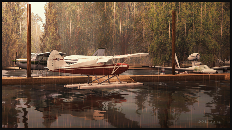
Piper Pacer approaching the dock at Robert’s Lake in Ontario, Canada.
In the scenery above, the red Piper Pacer, which is made by Lionheart Creations Ltd , arrives at a Pier at Robert’s Lake, in Canada. This lake was modelized jointly with the Parry Sound (CNK4) virtual scenery.
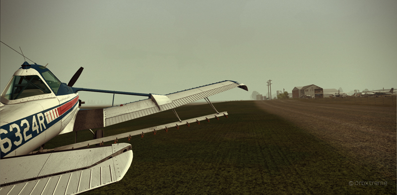
Virtual Cessna C188B Agtruck near Claresholm Industrial Park in Alberta, Canada.
In the picture above, a virtual Cessna C188B Agtruck created by the Alabeo company is parked near the Claresholm Industrial Park (CEJ4), in Canada. The virtual airport is available for free download at ORBX. Who said that nothing in life is free?!
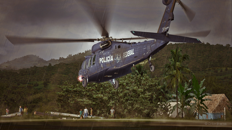
A virtual UH-60L Black Hawk belonging to the Columbian Police Force is hovering in the jungle.
Above, a UH-60L Black Hawk virtual helicopter created by the Cerasim company is flying over the Papua New Guinea territory. It should normally be hovering over Columbia, but the ORBX company has not yet developed very well defined airports for that country. It was more interesting to fly over an area that was already well modelized.
The three screen captures were slightly digitally improved following each virtual flight. The FSX flight simulation platform, although still interesting, is getting a bit old. The original screen captures often benefit from additional digital processing, especially when it comes to posting for the international contest held monthly by the ORBX company.
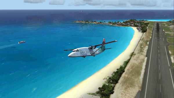
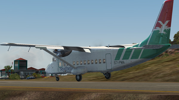
In the unhinged virtual flights section of my blog, you can now find a flight with the Shorts 360 between the St.Maartens (Princess Juliana Intl) airport and the Juancho E. Yrausquin (SABA, SAB or TNCS) airport.
The Shorts 360 at the Princess Juliana Intl, ready for take-off for the Juancho E. Yrausquin airport.
The Juancho E. Yrausquin is normally used by a DHC-6, a BN-2 and some helicopters.
The Shorts 360 is airborne from the Princess Juliana Intl airport.
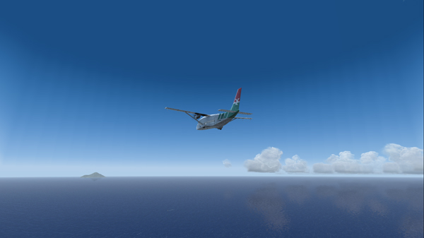
The island is in sight…
The Shorts 360 and the Saba island in sight.
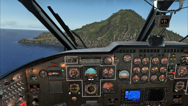
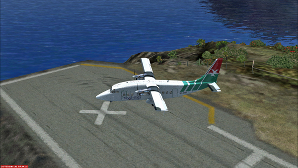
The official landing and take-off distances required for the Shorts 360 are longer than what the Juancho E. Yrausquin (SAB), with its 1299 ft short runway, has to offer.
But for the flight simulation enthousiast (FSX), SABA offers an interesting challenge since a very well adjusted approach, at about 90 knots, is necessary in order to use only the authorized part of the runway.
Le Shorts 360 and the SABA island.
Runway 12 in sight, on the extreme left side of the photo. The speed and altitude are adjusted.
The approach is made on runway 12. The winds blow from 180/07. The approach is made with full flaps.
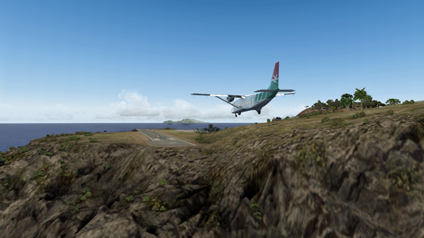
The Shorts 360 is on short final for runway 12 at the Juancho E. Yrausquin airport.The Shorts 360 is about to land at the SABA airport.
The aircraft is immobilized within the authorized portion of the runway. The rest of the runway is used to turn around and head for the apron.
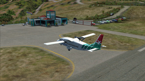
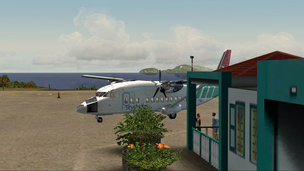
The Shorts 360 after its landing on runway 12 at the Juancho E. Yrausquin airport.The Shorts 360 is exiting runway 12 at the Juancho E. Yrausquin airport.The Shorts 360 is parked at the Juancho E. Yrausquin airport.
The Shorts 360 can also barely leave the airport using the authorized portion of the runway. The speed on take-off varies between 100 and 110 kts and the flaps are adjusted to 2/3.
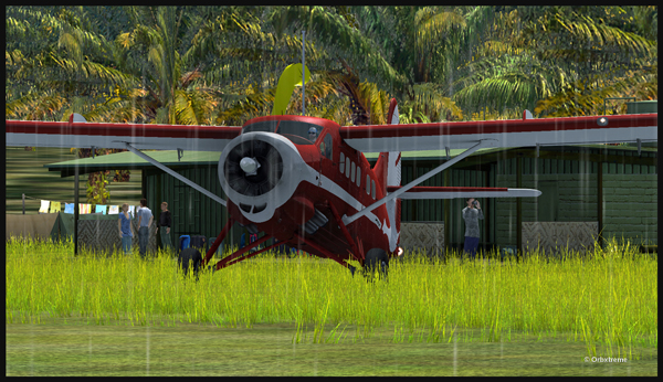
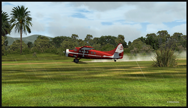
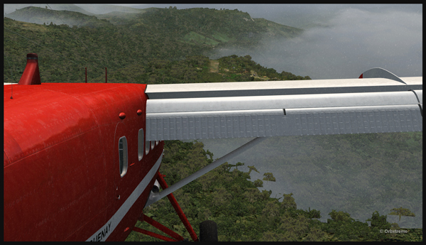
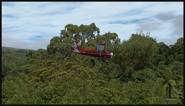
An Air Saguenay DHC-3 Otter has made it from Québec to Kokoda, in Papua New Guinea. It is expected to work around the remote mountain airfields for a while.
The Air Saguenay Otter is taxiing for the Kokoda runway towards Launumu in Papua New Guinea.
Today, the Otter heads for Launumu, a mountain airfield that is at an elevation of 5082 ft asl and 1200 feet long.
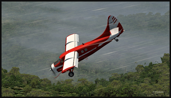
The Air Saguenay Otter departing Kokoda.
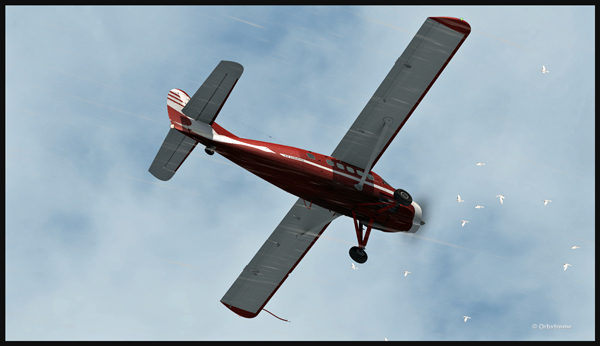
The pilot has to watch for the birds in order to avoid any collision in flight…
Otter aircraft and birds.
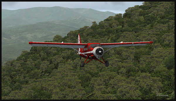
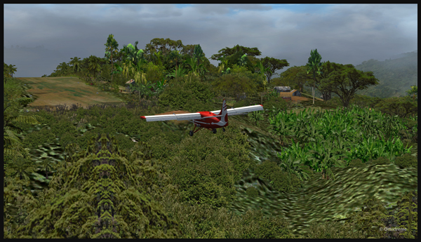
Following the Kokoda trail is a good way to reach Launumu.
The Otter in the Papua New Guinea mountains, following the Kokoda Trail.
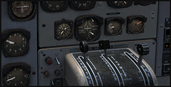
If the mixture is not adjusted, the Otter will lose a lot of steam trying to climb up to 7,500 feet to cross the first line of mountains.
Inside the Otter cockpit, with the mixture adjusted.
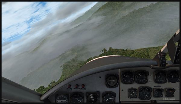
Anybody landing and departing from Launumu deals with high density altitude. This is not only due to the elevation of the airfield but also to the very warm and moist air present in the region. Consequently, some additional airspeed is required on the approach and on the departure.
The Launumu runway is in sight.
When a pilot lands southwestward in Launumu coming from Kokoda, he must dive in a valley to lose altitude, which will increase the aircraft’s airspeed. The Launumu runway is in sight.
If the airspeed is not promptly corrected, the approach to the Launumu runway will be too fast. Any airspeed above 60 knots forces the pilot to overshoot (unless you are ready to virtually die a few times while trying).
Losing altitude while respecting the flaps speed limit.
So, once the higher mountains are crossed, a good way of losing altitude without gaining airspeed is to use flaps (at the corresponding airspeed) and do a tight 360 degree coordinated turn while descending. That way, the pilot will end up in line with the runway and at the speed you want, which is around 50 knots.
Turning and descending in the valley during an approach for Launumu.
The Otter floats endlessly because of its huge wings.
The Air Saguenay Otter is on approach for the Launumu short runway in Papua New Guinea.
On final for Launumu, the pilot might end up having to deal with the bushes that are close to the runway. It is not unusual for the Otter or the Beaver to complete a difficult approach with bushes wrapped around the landing gear.
A Air Saguenay Otter is on final for the Launumu mountain runway.
A Otter aircraft is arriving on the Launumu high altitude runway.
Launumu has a surprise for the newcomers. If the pilot lands southwestward, like it was just done here, and the aircraft is not stopped within approximately 600 feet, it starts accelerating since there is a pronounced slope downward in the second half of the runway. This slope leads to a cliff. In case of a missed approach, the pilot can use the slope downwards and dive in the valley at the end of the runway to build up airspeed and start a new approach.
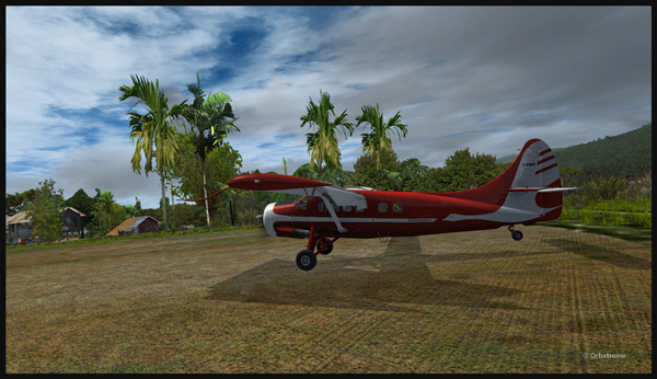
Now that the hard work is done, it is time to wait for the passengers and cargo, and plan the next leg…
A Otter aircraft is backtracking the Launumu runway after landing.
A Otter aircraft is parked on the Launumu runway in Papua New Guinea.
The virtual scenery and clouds required softwares like REX, REX Texture Direct, Cumulus X, FTX Global, FTX Global Vector and Pilot’s FS Global 2010.
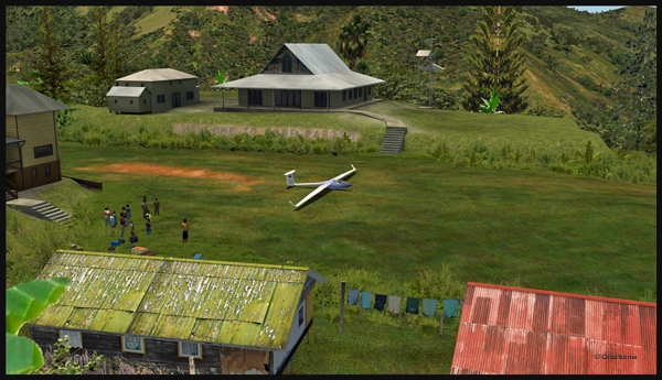
Well, that is it! The first glider just arrived at the Fane Parish airport in Papua New Guinea…
Glider on the Fane Parish short grass runway in Papua New Guinea.
Before it is officially offered as a tourist attraction for the region, some attempts at taking-off and landing must be done. The first trial attracts a few people!
Aircraft and glider on the Fane Parish mountain airfield.
The descent along the twelve degree sloped runway is a bit rough for the glider’s low wings, as there are some bushes that will have to be trimmed!
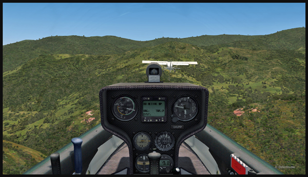
An aircraft pulls a glider after the take-off from the Fane Parish sloped runway in Papua New Guinea.
The weather is nice and very warm. The only potential problem is the mountain ahead.
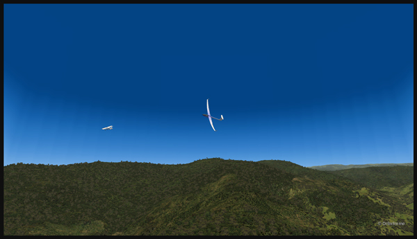
Glider being towed by an aircraft after the take-off from the Fane Parish mountain airfield.
Finally, the pilot cuts the link. He is free to go!
The link is cut between the plane and the glider after the take-off from Fane Parish.
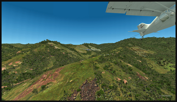
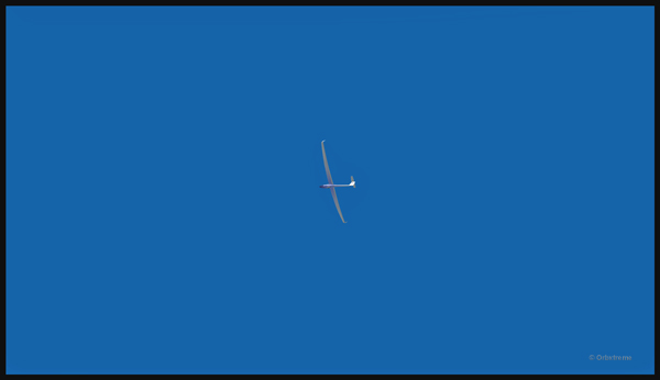
The glider flies silently over the lush area of Papua New Guinea.
Virtually gliding over the Papua New Guinea territory (FSX).
Using the rising warm air currents, the glider gains altitude.
The glider gains altitude.
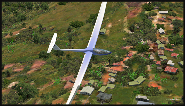
Why not a pass over Fane?
Gliding over the Fane Parish village.
Here is another isolated village alongside a mountain.
Flight with a virtual glider over an isolated village of Papua New Guinea.
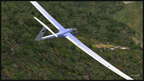
A last steep turn in order to realign for the approach at Fane Parish.
Last steep turn for a short landing on the Fane Parish mountain sloped runway.
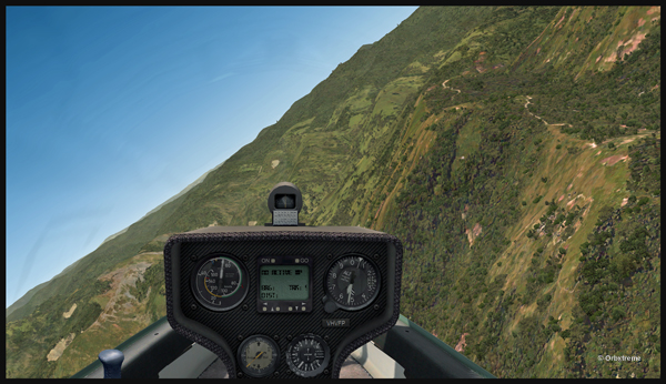
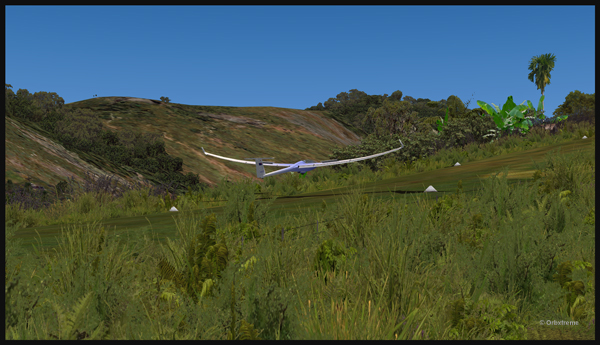
The airbrakes are out and the speed reasonable. The sloped runway is just ahead, on top of the mountain to the right.
Approach of a glider on the elevated airfield at Fane Parish in Papua New Guinea. The speed and angle of approach are right on target.
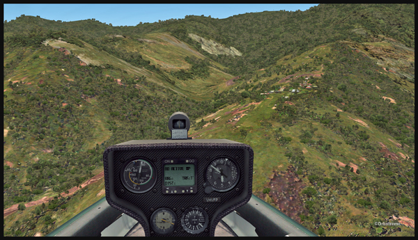
Keeping just enough altitude on the approach to be safe.
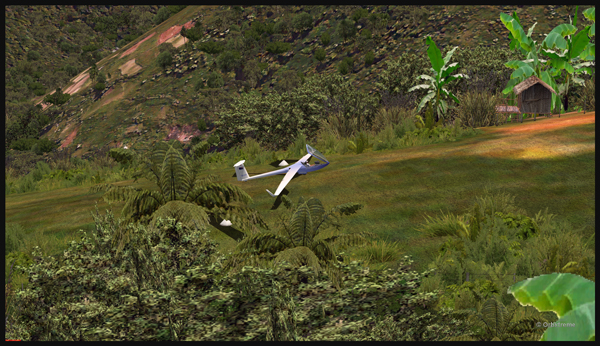
Glider approaching the 12 degree sloped runway of the Fane Parish aerodrome.
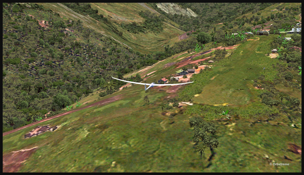
Now that the landing is a sure thing, it is time to use the airbrakes again to slow down as much as possible.
Virtual glider arriving over the Fane Parish runway in Papua New Guinea. The airbrakes are being used.
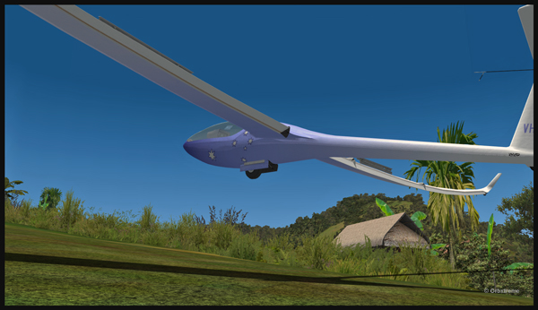
Keeping in mind that this mountain airfield as a good slope, it is better to have a bit of extra speed. Nobody likes to stall a few feet over a runway!
Virtual glider with airbrakes over the Fane Parish runway
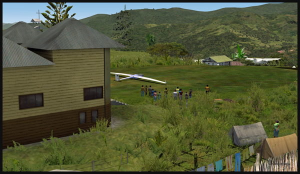
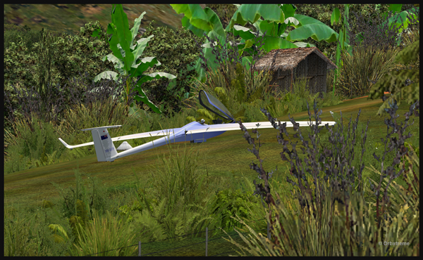
What an experience it was! But I’ll need some help to pull the glider up the slope!
Glider on the Fane Parish runway
The virtual flight was great, the view was worth every penny, and I think that this could become a new touristic attraction for the region and the more wealthy visitors…
The glider has landed on the runway at the Fane Parish airport in Papua New Guinea.