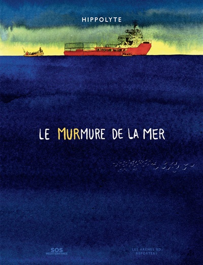
The graphic novel “Le murmure de la mer” is a tribute to the work of the Ocean Viking’s crew, the rescue ship belonging to the SOS Méditerranée group. Its mission is to rescue migrants leaving North Africa, particularly the Libyan inferno.
Those refugees find themselves overcrowded on makeshift boats, drifting endlessly in the middle of the sometimes raging Mediterranean Sea. Often, the rafts brush up against Libyan oil platforms. Day and night, the coast guards pursue the migrants and brutally drag them back to Libya.
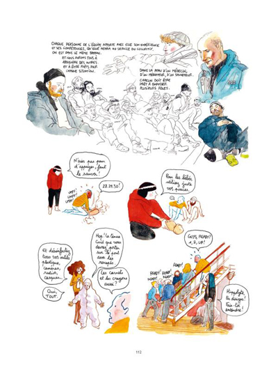
After a first blocked attempt to participate in a rescue, the author climbs aboard the Ocean Viking in 2020 as a journalist, cartoonist and crew member. He’s directly involved in the salvage operations, and recounts his experience in a series of beautiful sketches and touching photos.
Readers appreciate the great discipline and preparation required to carry out salvage missions in an orderly and safe manner for all concerned. Sentimentality has no place when rescuing migrants in crisis. Not following procedures can result in further deaths, including those of crew members.
We bear witness to the crew’s successes and failures in their attempts to rescue as many people as possible. The sailors of the Ocean Viking face administrative blockades from Italy, which seeks to limit the considerable arrival of refugees.
First among these attempts to hinder rescue operations is the obligation for the ship to remain docked for long periods for different reasons.
Next is the requirement to transfer the new migrants to ports far from the Ocean Viking’s position. These ports are deliberately chosen by the Italian government to generate fuel costs and lengthy delays between each recovery mission. This drag prevents thousands of refugees from being salvaged.
We must, however, question the involvement of other states when it comes to admitting migrants. The misfortune of people living in countries disadvantaged by ruthless dictatorships, climate change or poverty accelerated by the plundering of wealth is everyone’s responsibility.
Once the refugees are on the boat, the crew still has to secure them, care for them and prepare them for transfer to their next land of welcome. We all know the story of those vessels which have picked up hundreds of Africans in difficulty, and which remain immobilized for weeks while awaiting clearance to transfer the survivors to a new territory. Yet the law of the sea states that any ship’s captain who learns that human beings are in peril on a body of water must render assistance.
In short, a fascinating and informative read. It increases our understanding of the challenges faced by crews helping humans in danger on the Mediterranean Sea.
Click on the link for more graphic novels and comics on my blog.
Title: Le murmure de la mer
Author: Hippolyte
Publisher: Les Arènes, Paris, 2024.
ISBN: 979-10-375-1156-0