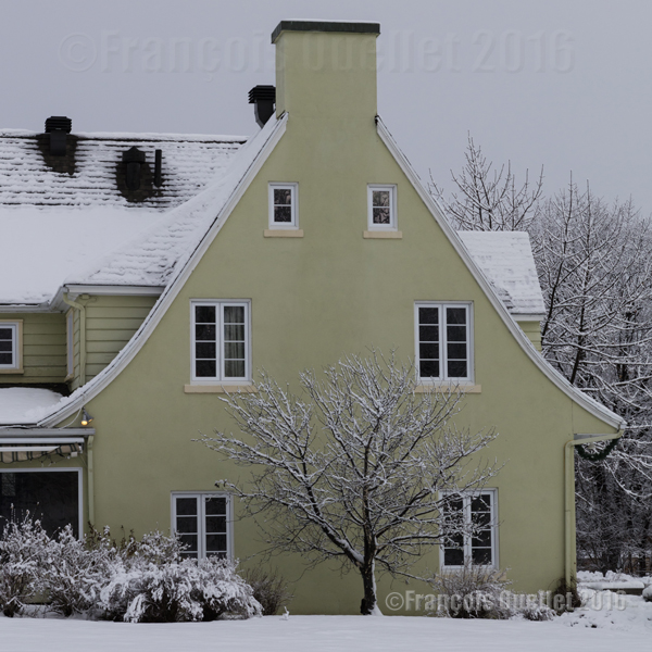
In 2018, marijuana will probably become a legal substance in Canada. But for now, it is still considered an illegal drug by Canadian authorities.
In the picture above, a “plant” dealer, acting as a “florist”, does not hesitate to publicize his business in British Columbia. He chose to modify the reality until it finally meets his goal.
The “florist” above proceeds in the same way as Sean Spicer, the White House Speaker, who gives new meaning to words during his press conferences in order to make sense of some of Donald Trump’s electoral promises.
Street photography is often unplaned, as it is the case here. But I had with me the necessary equipment to capture the van before it got away.
For other street photography pictures posted on my site, click on the following link:
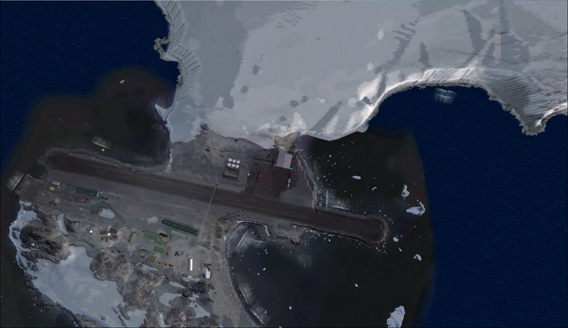
Aerial view of the Rothera research station in Antarctica.
For this flight, you will need the Antarctica X flight simulation software made by Aerosoft.
The maintenance of BAS Twin Otters and their Dash-7 is done in Calgary, Canada, and head to Antarctica during the austral summer, between October and March. So if you want to try a flight simulation with a Twin Otter or a Dash-7 from Chile to Antarctica, pick one of those months as it is more realistic.
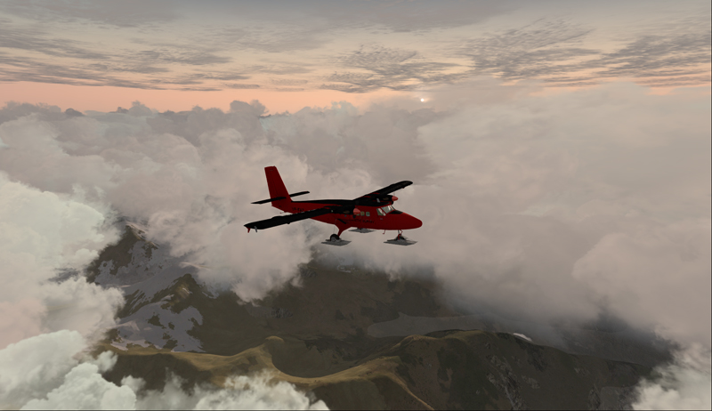
Since it would be a bit long to make all the virtual flights from Canada to Antarctica, I chose to do the last three legs to see what the landscape looks like.
A Twin Otter is normally approved for a maximum take-off weight of 12,500 pounds. But with skis weighing 800 pounds and additional fuel required to fly longer legs, BAS (British Antarctic Survey) has arranged to have their Twin Otters approved at 14,000 pounds. Even at this weight, the aircraft could still operate on one engine.
First, the aircraft departs La Florida airport (SCSE) in Chile, after a mandatory fuel stop before its next destination, the El Tepual de Puerto Montt airport (SCTE), also in Chile.
Airborne from La Florida, Chile, after refueling.
This virtual flight with the Twin Otter last about 4:25 hours (696 nm) with a heading of 185 degrees.
In flight towards El Tepual de Puerto Montt, Chile.
For the screen captures, FTX Global, FTX Vector and Pilot’s FS Global 2010 were installed. Orbx has also reworked the original El Tepual de Puerto Montt airport to include some people, aircrafts and new buildings. It makes for a more interesting destination.
Twin Otter on final approach for El Tepual de Puerto Montt, Chile.
Ready for refueling at the El Tepual de Puerto Montt, Chile.
The next flight is from the El Tepual de Puerto Montt airport (SCTE) to Punta Arenas (SCCI), both in Chile.
Twin Otter aircraft airborne and heading to Punta Arenas, Chile.
This flight, made low across the Andes, absolutely requires good weather. You will have to climb to 17,000 feet to make the direct route between the airports.
Twin Otter over the Andes climbing for17,000 feet
There are often spectacular views available to the virtual pilot. Yes, the BAS Twin Otter is flown by only one pilot, but there is always somebody else accompanying him.
Don’t forget to lean the mixture during the climb. Also use some additional oxygen (!!) if you don’t want to start singing and flying in circles after a while. Again, pay attention to the mixture during the descent, considering that you will be losing close to 17,000 feet.
Refueling at Punta Arenas, Chile.
The Punta Arenas airport, straight from FSX, is not an interesting airport to look at. It is a very bare airport, with just a single building and a VOR.
But since the BAS pilot do that mandatory leg just before heading to Antarctica, I chose not to change the route. The general direction for the flight to Punta Arenas was 164 degrees and the duration approximately 4:28 hours. You can obviously accelerate the process once the aircraft is established at its flying altitude.
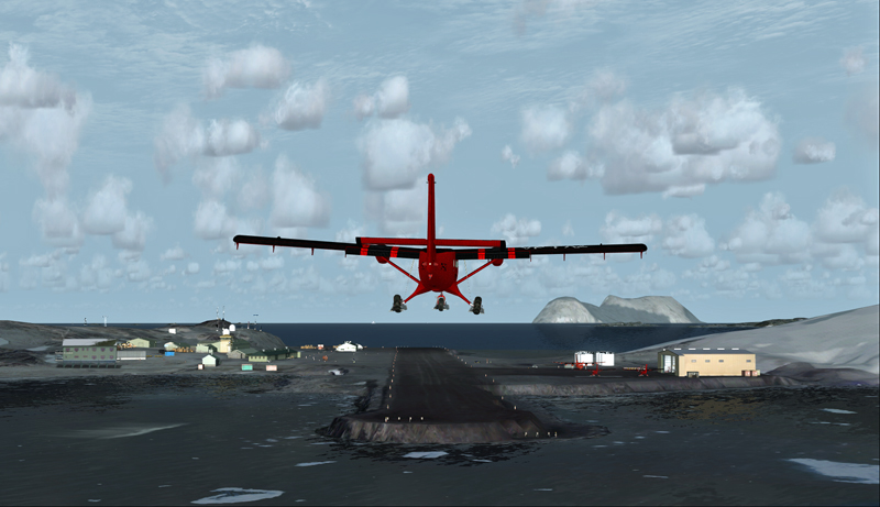
The last flight is from Punta Arenas, Chile, to Rothera, Antarctica.
Twin Otter aircraft heading for the Rothera airport in Antarctica.
The Twin Otter will take between six and seven hours on an average heading of 162 degrees to cover the distance between Punta Arenas (SCCI) and Rothera (EGAR).
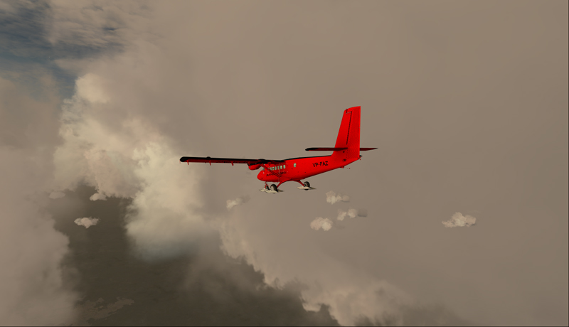
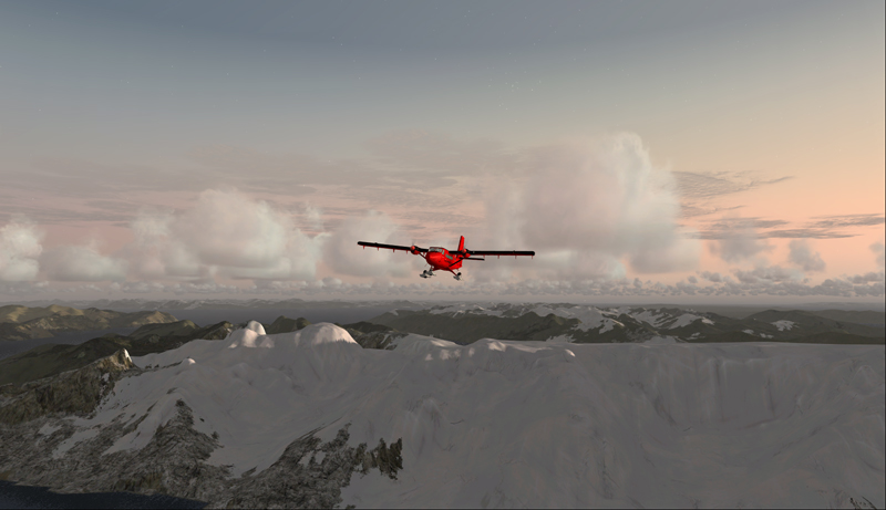
Over the snowy mountains of Chile towards Rothera, Antarctica
Carrying extra fuel on the flight towards Rothera, Antarctica.
The runway at Rothera is made of gravel and is 2953 feet long. That is plenty for the Twin Otter and the DASH-7. Before you make the flight, go into the aerosoft/Antarctica X file in your flight simulator and click on the “LOD 8.5” option (the default is at LOD 4.5). It will give you much better details when you are approaching Antarctica.
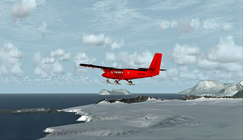
The antarctic Rothera research station is in sight
Twin Otter aircraft on final at Rothera, Antarctica.
The Airliner World magazine had an excellent article on the BAS operations in Antarctica in its March 2017 edition. It included plenty of interesting pictures and detailed explanations on what is expected from pilots and personnel working for BAS. I compared the Rothera virtual airport with the real one through the available pictures in Airliner World and was pleasantly surprised with the level of accuracy of the details.
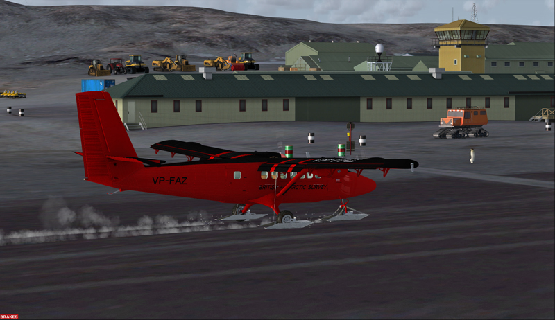
A British Antarctic Survey Twin Otter aircraft is landing on the Rothera runway, Antarctica
The BAS always prepares itself for the worst: “[It] carries parts valued at around $5m, including a replacement engine for each aircraft, spare props and undercarriage components”.
Twin Otter aircraft after a landing on the Rothera runway, Antarctica
“A new development for the Air Unit has been its work with the RAF, using C-130 Hercules transports to airdrop supplies into the field. They fly from Punta Arenas and drop fuel to support our science programmes on the Ronne Ice Shelf. […] It is all part of their training system and the accuracy they drop to is very impressive. They might drop 250 drums, think how many Twin Otter trips that would have been for us (48 or more than 400 flying hours)”.
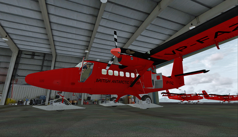
The main hangar in Rothera, Antarctica.
Aerosoft has made an excellent job in replicating the buildings in Rothera, BAS’s main research station in Antarctica. The biggest hangar can accommodate three Twin Otters and a Dash-7 altogether.
Inside the main hangar at the Rothera research station, Antarctica.
When your flight is over, do not forget to change the settings back to LOD 4.5 for Antarctica in your aerosoft/Antarctica X files.
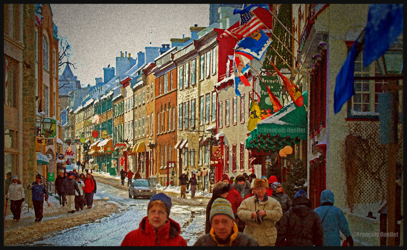
Here is a night picture that speaks volume about the ambiance that generally prevails in Quebec City. Wherever he walks, the photographer will notice citizen and tourists admiring the town.
The photo was captured with a Canon 5D MKII full-frame camera equipped with a Canon EF 50mm f/1.4 fixed lens. This kind of maximal aperture allows to take pictures at this time of the day without the need of a tripod and without grossly increasing the ISO, thus protecting the picture’s quality. The use of a tripod is always giving better results, but for the occasions where the photographer does not have one with him, the maximal aperture of 1.4 (or even better 1.2 for the lucky ones) can save the day.
The stars surrounding the city lights do not result from using a special photography equipment. Instead, they are produced by the multiple elements present in the Canon EF 50mm f/1.4 fixed lens. Since every lenses available on the market are not of equal quality, some lenses naturally offer a much nicer bokeh than others.
It is quite difficult to obtain something else than human silhouettes when the light is so weak. The lower third of the image also proves to be a problem for the camera, as the luminosity created by the streetlights is much more intense. Nonetheless, it was not too difficult to correct the contrasts using an image editing software, since the photo was taken using RAW files.
For other photos on the province of Quebec and also Quebec City, click on the following links from my blog:
In 2017, Quebec City has opted for a decentralization of the Carnival activities which where always organized on the Plains of Abraham. Part of Grande-Allée was blocked to traffic and other activities where also held in the parc de l’Amérique-Française, the parc de la Francophonie and at Place d’Youville, in the hearth of the touristic sector.
Quebec Carnival 2017 symbols
This new formula seems to be a success, according to the number of people met during my photography sessions on the different sites. Children, as usual, were not really bothered by the cold temperature et found a way to have fun. The picture below was taken while the wind chill factor was -20C.
Child playing at the parc de l’Amérique-Française during the 2017 Quebec Carnival
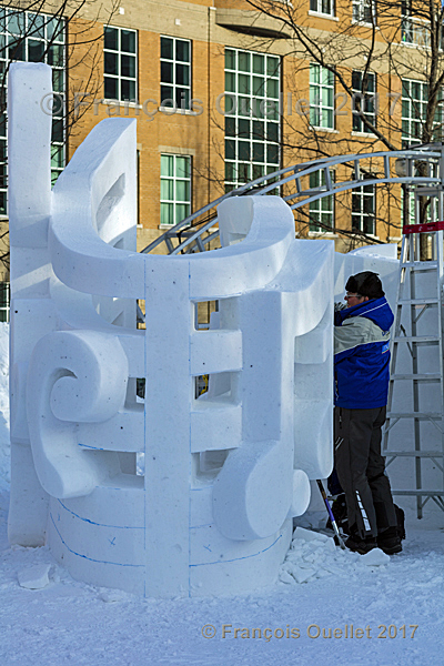
The parc de l’Amérique-Française was receiving the international snow sculpture contest. Many countries were present: Argentina, Canada, France, Germany, Italy, Mexico, Morocco, Peru and the United States. Italy won the first prize with an excellence award from the Quebec Carnival, added to an award from the public and the benevolent staff. The Italian sculptors were Pietro Germano, Samuel Bonapace and Gino Casagranda. The picture below represents one Italian sculptor at work.
An Italian sculptor at work during the 2017 Quebec Carnival.
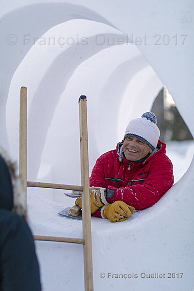
The second prize, with a Government of Quebec award, was offered to the team from France, who was composed of Pascal Veuillet, André Marastoni and Éric Margery. The pictures below show the work in progress and a French sculptor taking a few minutes to talk with a citizen. He does not seem too annoyed by the cold weather…
French sculptor at the 2017 Quebec Carnival
A French sculptor at the 2017 Quebec Carnival
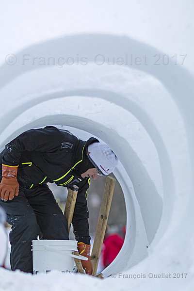
The team from Canada won the third prize, with an award from Quebec City. In the team were Jessy Armand, Michel Proulx and Mathieu Béchard. The pictures below represent two of the Canadian sculptors at work.
A Quebec sculptor at work on the Canada snow sculpture during the 2017 Quebec Carnival
French Canadian sculptor at the 2017 Quebec Carnival
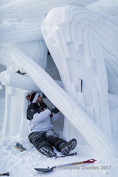
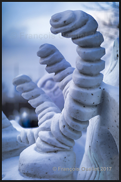
Some sculptures had a really original look. Instead of capturing the whole creation, I decided to frame a section of one of the sculpture in order to emphasize the artwork.
Section of a snow sculpture at the 2017 Quebec Carnival.
All the pictures have been taken using a Canon 5DSR full-frame camera equipped with a Canon EF 85mm f/1.2 II USM lens, with or without tripod, depending on the amount of light available. The picture above was shot using a 1.2 aperture to maximize the blurred effect in the background. It was then reworked using two different image editing softwares.
For a better idea of all the activites organized by the Quebec Carnival, head towards the following official and bilingual site: Quebec Carnival official site
For other photos on the province of Quebec and also Quebec City, click on the following links from my blog:
The Quebec Islamic community has just lost six of its members. I want to offer them my sincere condolances as a Quebecer from Quebec City and as a Canadian.
It is hard for me to realize that in my city, which is so beautiful and peaceful, such a tragedy can happen. But all the citizens who have lived the same tragedy in their city tell themselves the same thing. Talk about it to the French or the Berliners. Quebec is not different.
The Quebec City mayor, Régis Labeaume, was recently mentioning how good the statistics were in Quebec when it came to violent acts : there had been only one homicide in twenty-one months. And now, in full Quebec Carnival period, at a time where the City invites its citizens and tourists to get out and be together enjoying the winter season, one Quebecer attacks his peaceful compatriots.
The word « terrorism »
I do not know why exactly but it seems that the Sainte-Foy, January 29th 2017 murders that have just been commited will be classified as a « terrorist » act. Possibly because it targeted a specific community that has a different religion than the shooter. Or because the act is aimed at terrorizing people. Or both.
The word « terrorism » is popular. In United States, the Donald Trump government has just closed its boundaries to selected countries, in case a potential « terrorist » would arrive in USA.
It is easy to forget that there are American citizens already living in United States that are even more dangerous, those who kill tens of thousands of Americans yearly with all kinds of guns that they have the right to possess according to a Constitution that did not anticipate the consequences.
In spite of the blooshed that includes tens of children in schools, it is not « terrorism » so there are no drastic actions taken. Politicians talk and hesitate for weeks after a tragedy and then everything comes back to normal. The « terrorist » murder has obviously a much stronger social impact than any other murder. And it allows to disregard the widespread « laisser-faire » when it comes to the right of everybody in United States to acquire almost whatever he desires when it comes to guns and to use them at will. But if you come from Irak, now that’s dangerous!
A few nice Quebec City photos
I take the opportunity to post a few nice pictures of Quebec City, as I did for France after the terrorist acts. They have been taken with a Canon 5DSR. This is another way of saying to local citizens and tourists that Québec, as for Paris, Nice or Berlin, is a beautiful city, normally very peaceful and filled with happy people. And that we are not going to be told how to behave or think by the most violent and often mentally fragile individuals of our societies.
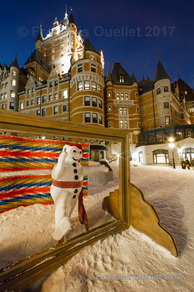
Bonhomme Carnaval and Château Frontenac, Québec 2017
The Price building, Québec 2017
Dufferin Terrace slide, Québec 2017
Snow, ice and wood creation made by a Sillery citizen in Quebec City in 2015.
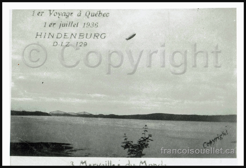
The Hindenburg airship over Quebec in 1936. The Quebec bridge is visible in the background.
The particularly rare picture above shows the LZ129 Hindenburg airship just after it completed its flight over Québec, Canada on its fourth crossing of the Atlantic from Germany to Lakehurst, United States, on July 1st 1936. This fly-by had not been announced since the trip was normally done directly between Germany and United States.
The Hindenburg was the biggest airship in the world and it was destroyed in 1937 on the arrival to Lakehurst. The explosion of the hydrogen on board the airship caused the death of 34 passengers and crew members.
Far away, we can see the Quebec bridge, the longest cantilever bridge in the world, while it was the sole link between the two shores of the St-Lawrence seaway.
An excellent source of information (in French) can be found on the internet link included below. It recalls the citizen’s comments while the airship was approaching, the trajectory followed by the airship over Quebec City and how the citizens learned of the Hindenburg’s approach:
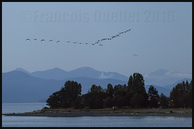
Canada Geese over the Strait of Georgia in British-Columbia, in 2016.
Night photography is not always planned and the photo above, taken late in the evening, was certainly not one I would have been able to take when I started as a photographer.
There was a superb sunset on the strait of Georgia, in British Columbia, and I had taken multiple pictures until late in the evening with my Canon 5DSR full-frame camera. The photography session was almost over.
Once I decided that it was time to pack-up for the night, I heard a flock of Canada Geese. They were flying in formation over the mountains to the west and were heading north in the darkness. In order to photograph those fast moving birds in the remaining light, drastically different settings would have to be made on the camera, and this, very rapidly.
The camera was equipped with a Canon 70-200 f2.8L IS II USM telephoto lens mounted on a tripod and facing west. It was on manual focus, the stabilizer was inactive and the ISO setting was very low. A ND graduated filter was already mounted on an adapter which was installed on the lens.
That meant dismantling the camera from the tripod, activating the automatic focus as well as the stabilizer, increasing the ISO, removing the ND graduated filter, limiting the aperture to insure sufficient shutter speed, composing the photo and taking few rapid shots before the geese were too far away.
Few seconds later, those birds and the landscape were becoming another souvenir of a beautiful summer holiday spent in British Columbia.
For more articles in the category « Photos of Canada », click on the following link : Photos of Canada
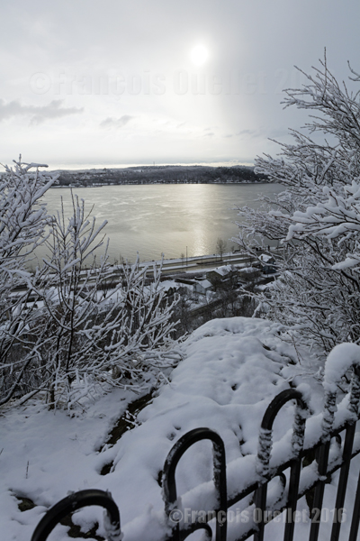
Quebec City in winter, in the Cap-au-Diable area (2016)
The picture above was taken in December 2016 at Cap-au-Diable, in Quebec City, with a Canon 5DSR full-frame camera equipped with a Canon EF 24-70mm f/2.8L US telephoto lens. A polarizing filter was not really needed here due to the soft light and the sun being in line with the lens. The exposure was still corrected by +1/3.
At this time of the year, the temperature is not too cold for the photographer’s bare hands and the light intensity is ideal throughout the day. The temperature hovering around 0 °C favors wet snow showers. This snow lightly sticks to the tree branches and, as long as the wind does not increase too much, it is possible to take interesting winter pictures. But it is necessary to act quickly
For the photo above, I was able to profit from a St-Lawrence Seaway that was still unfrozen, which allowed to capture the winter sun reflection. I had to proceed rapidly since there were clouds moving from the west, visible to the right of the picture. One minute later, the sun and its reflection were no longer visible.
The photos below were taken during in the same park.
Parc du Cap-au-Diable, Quebec City (2016)
A house in the Cap-au-Diable park, Quebec City (2016)
For other photos on the province of Quebec and also Quebec City, click on the following links from my blog:
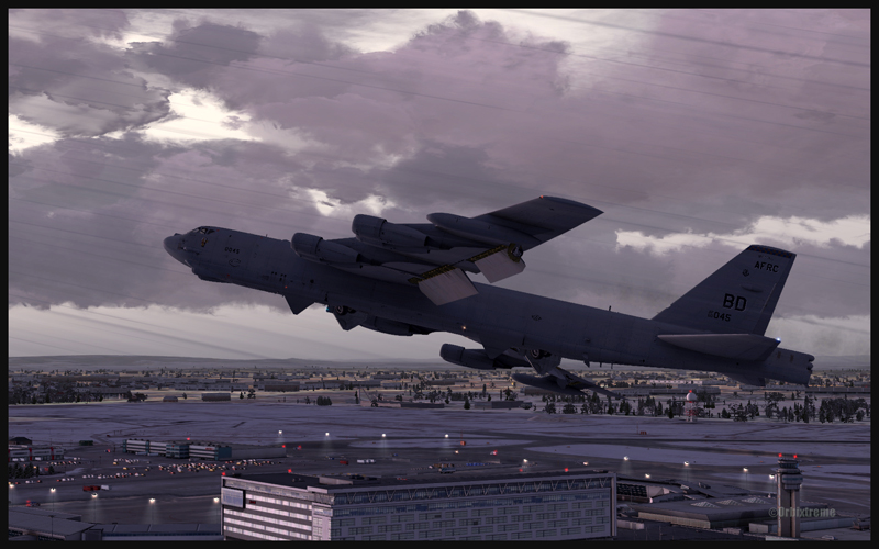
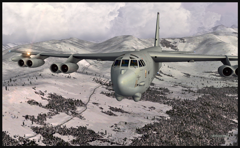
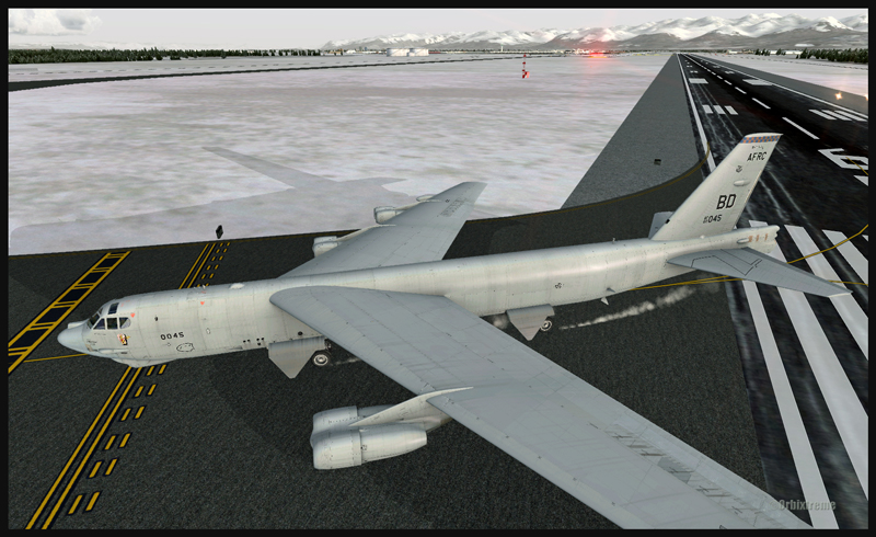
Boeing B-52 (FSX) airborne from Montréal Pierre-Elliott-Trudeau Intl to Anchorage, Alaska
Boeing B-52 (FSX) building up speed between Montréal and Anchorage
The Boeing B-52 is a Captain Sim creation and the Montreal airport is made by FlyTampa. The remaining scenery is designed by ORBX. Here are few basic informations for those of you who would be tempted to try a flight immediately after the download is completed. For the takeoff: pitot heat, 100% flaps down, YAW SAS Switch Engage, stabilizer trimmed, full throttle within four seconds, climb between 1500 and 2000 ft/min. The climb with flaps down is done at 180 kts. Adjust the thrust so that you have time to bring the flaps in totally; use 230 kts as maximum for zero degree flaps. Once in flight, brake to stop the wheels rotation then bring the gear up (although not before reaching 1000 ft agl).
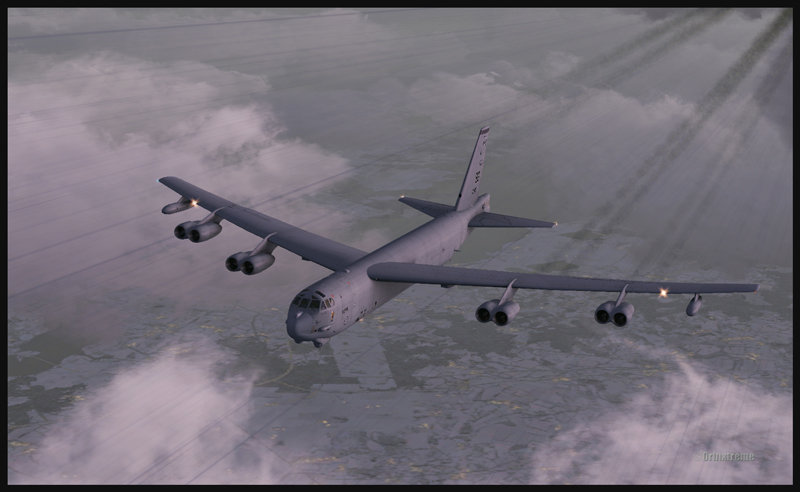
B-52 at cruising altitude (FSX)
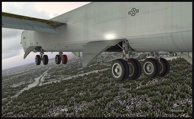
Boeing B-52 inbound to Anchorage, Alaska (FSX)
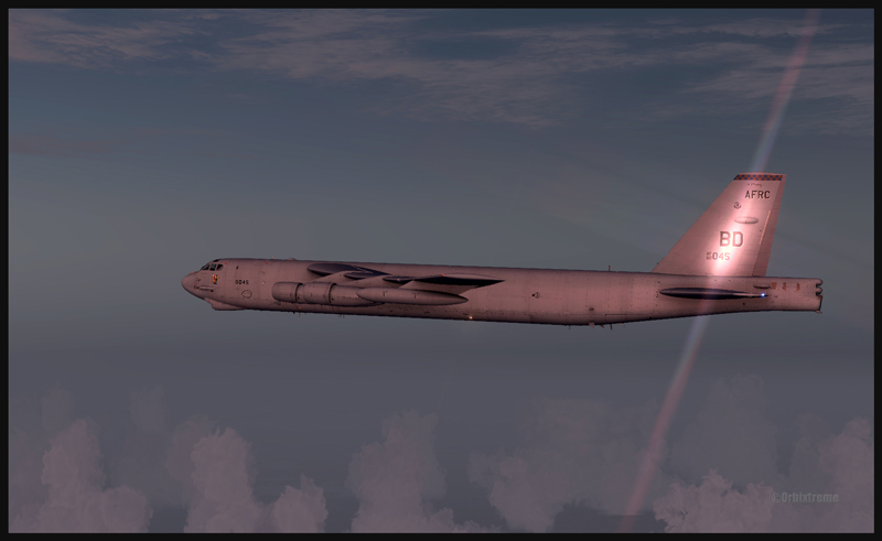
For a normal descent: (note: keep 20 kts in surplus of the proposed speed when the aircraft is turning). The descent is done at about 240 kts, with airbrakes 4, gear down, throttle to idle. À 220 kts, you may start applying flaps (they take 60 secondes to be fully extended). Once in downwind, use153 kts with airbrakes 4 (for 225,000 lbs). No more than 30 degrees turns. The rollout is done at no more than133 kts.
Boeing B-52 with flaps and gear out on the approach for Anchorage (FSX)
Boeing B-52 with runway in sight in Anchorage (FSX)
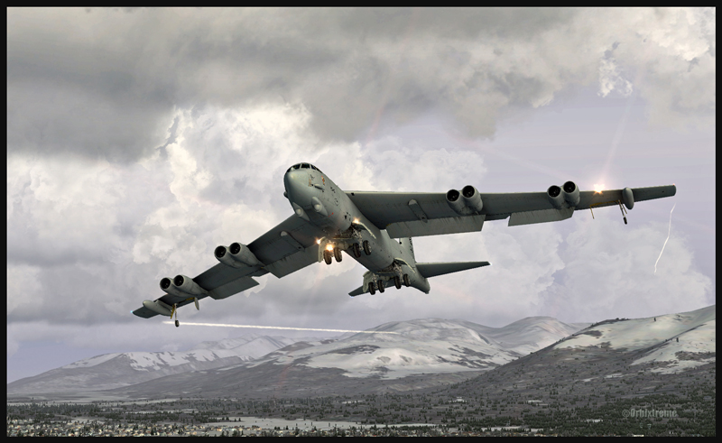
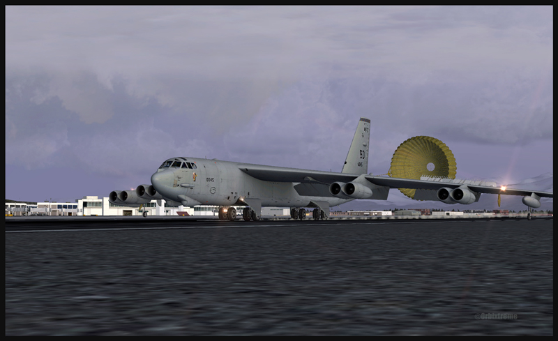
Boeing B-52 and the parachute on the arrival at Anchorage (FSX)
The touchdown with airbrakes full up is done at 110 kts IAS. The drag chute is then deployed (never above 135 kts). Keep a slight angle only, with the rear wheels touching first. When taxiing, turn the YAW switch and the airbrakes to “OFF”. Those are only basic infos. By the way, when the drag chute is deployed, you will not see a difference in the breaking distance; the chute is there only for “graphic” reality. Have a good flight!
Boeing B-52 leaving the runway in Anchorage (FSX)
For more articles on flight simulation on my web site, click on the following link : Flight simulation
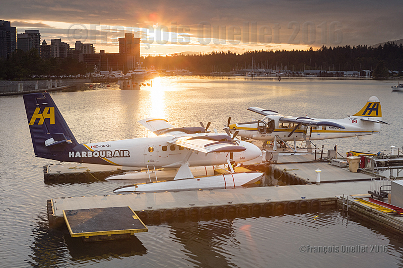
Harbour Air Twin Otter floatplane C-GQKN and Turbo Otter floatplane C-FODH in the sunset in the Port of Vancouver during summer 2016
The picture above has been taken with a Canon 5DSR full-frame camera in the Port of Vancouver, in British Columbia, during summer 2016. Following a very busy day of take-offs and landings, everything is now peaceful. The Harbour Air Twin Otter floatplane C-GQKN and Turbo Otter floatplane C-FODH are now parked for the night.
Pictures taken at dusk or dawn benefit from a unique light. Nonetheless, taking pictures of aircrafts against the light, with the last sunrays still visible, requires a special attention with regards to blown out highlights.
When contrasts are too important, it is possible to correct the situation by taking several pictures with different exposures and merging them using an image editing software like Photomatix (HDR photography). This is done in a few minutes only. Nonetheless, with floatplane aircrafts that are still slightly moving even when tied for the night, there is an increased risk of a blurred picture. The best way to proceed is to use a ND grad filter and to place it exactly where the light is the strongest. Naturally, there will still be some blown out highlights.
This being said, you still have a good margin of manoeuver, since there is no problem in showing a limited amount of over-exposed highlights in the brighter part of the sunrays, as there is not much details to lose there anyway. While purists would argue otherwise and spend hours in front of their computer trying to correct everything, you are making the best of another day of photographic exploration.
If the picture was taken using RAW files (or RAW with JPEG), it is possible to improve the scene even more by correcting some aspects like the contrasts, the brightness, the colours, the saturation and ambient light, etc. This also requires very limited time in front of the computer once you understand the basic principles of an image editing software.