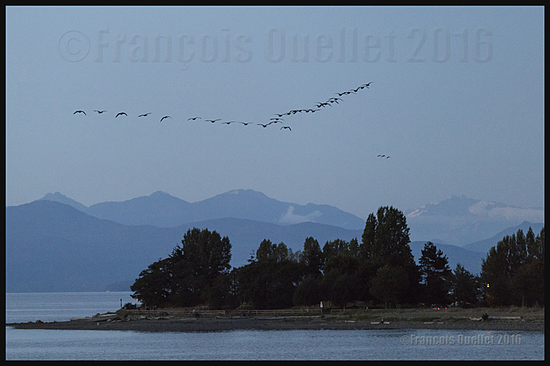
Canada Geese over the Strait of Georgia in British-Columbia, in 2016.
Night photography is not always planned and the photo above, taken late in the evening, was certainly not one I would have been able to take when I started as a photographer.
There was a superb sunset on the strait of Georgia, in British Columbia, and I had taken multiple pictures until late in the evening with my Canon 5DSR full-frame camera. The photography session was almost over.
Once I decided that it was time to pack-up for the night, I heard a flock of Canada Geese. They were flying in formation over the mountains to the west and were heading north in the darkness. In order to photograph those fast moving birds in the remaining light, drastically different settings would have to be made on the camera, and this, very rapidly.
The camera was equipped with a Canon 70-200 f2.8L IS II USM telephoto lens mounted on a tripod and facing west. It was on manual focus, the stabilizer was inactive and the ISO setting was very low. A ND graduated filter was already mounted on an adapter which was installed on the lens.
That meant dismantling the camera from the tripod, activating the automatic focus as well as the stabilizer, increasing the ISO, removing the ND graduated filter, limiting the aperture to insure sufficient shutter speed, composing the photo and taking few rapid shots before the geese were too far away.
Few seconds later, those birds and the landscape were becoming another souvenir of a beautiful summer holiday spent in British Columbia.
For more articles in the category « Photos of Canada », click on the following link : Photos of Canada
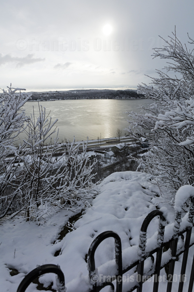
Quebec City in winter, in the Cap-au-Diable area (2016)
The picture above was taken in December 2016 at Cap-au-Diable, in Quebec City, with a Canon 5DSR full-frame camera equipped with a Canon EF 24-70mm f/2.8L US telephoto lens. A polarizing filter was not really needed here due to the soft light and the sun being in line with the lens. The exposure was still corrected by +1/3.
At this time of the year, the temperature is not too cold for the photographer’s bare hands and the light intensity is ideal throughout the day. The temperature hovering around 0 °C favors wet snow showers. This snow lightly sticks to the tree branches and, as long as the wind does not increase too much, it is possible to take interesting winter pictures. But it is necessary to act quickly
For the photo above, I was able to profit from a St-Lawrence Seaway that was still unfrozen, which allowed to capture the winter sun reflection. I had to proceed rapidly since there were clouds moving from the west, visible to the right of the picture. One minute later, the sun and its reflection were no longer visible.
The photos below were taken during in the same park.
Parc du Cap-au-Diable, Quebec City (2016)
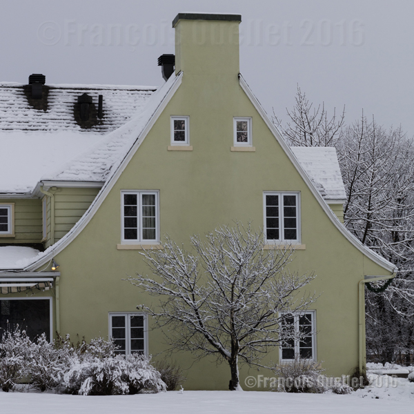
A house in the Cap-au-Diable park, Quebec City (2016)
For other photos on the province of Quebec and also Quebec City, click on the following links from my blog:
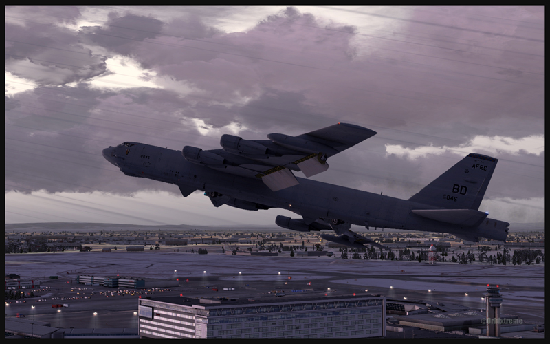
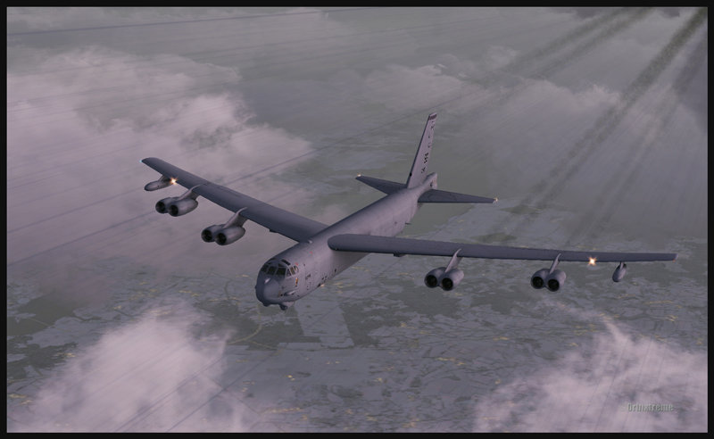
Boeing B-52 (FSX) airborne from Montréal Pierre-Elliott-Trudeau Intl to Anchorage, Alaska
Boeing B-52 (FSX) building up speed between Montréal and Anchorage
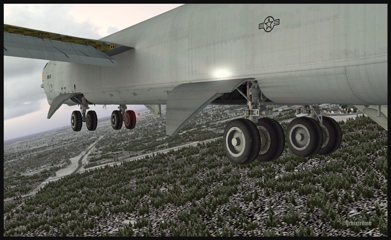
The Boeing B-52 is a Captain Sim creation and the Montreal airport is made by FlyTampa. The remaining scenery is designed by ORBX. Here are few basic informations for those of you who would be tempted to try a flight immediately after the download is completed. For the takeoff: pitot heat, 100% flaps down, YAW SAS Switch Engage, stabilizer trimmed, full throttle within four seconds, climb between 1500 and 2000 ft/min. The climb with flaps down is done at 180 kts. Adjust the thrust so that you have time to bring the flaps in totally; use 230 kts as maximum for zero degree flaps. Once in flight, brake to stop the wheels rotation then bring the gear up (although not before reaching 1000 ft agl).
B-52 at cruising altitude (FSX)
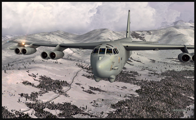
Boeing B-52 inbound to Anchorage, Alaska (FSX)
For a normal descent: (note: keep 20 kts in surplus of the proposed speed when the aircraft is turning). The descent is done at about 240 kts, with airbrakes 4, gear down, throttle to idle. À 220 kts, you may start applying flaps (they take 60 secondes to be fully extended). Once in downwind, use153 kts with airbrakes 4 (for 225,000 lbs). No more than 30 degrees turns. The rollout is done at no more than133 kts.
Boeing B-52 with flaps and gear out on the approach for Anchorage (FSX)
Boeing B-52 with runway in sight in Anchorage (FSX)
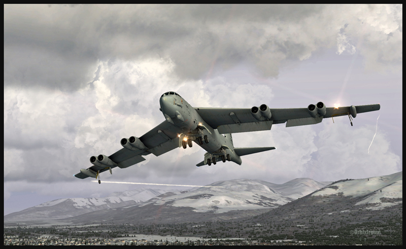
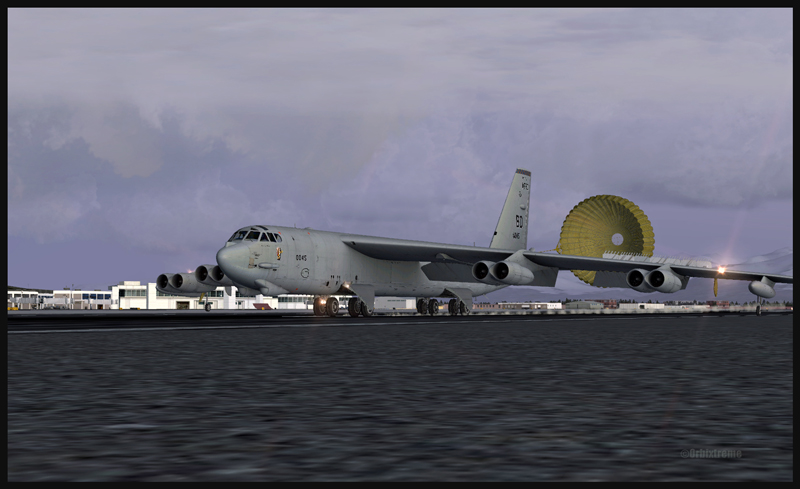
Boeing B-52 and the parachute on the arrival at Anchorage (FSX)
The touchdown with airbrakes full up is done at 110 kts IAS. The drag chute is then deployed (never above 135 kts). Keep a slight angle only, with the rear wheels touching first. When taxiing, turn the YAW switch and the airbrakes to “OFF”. Those are only basic infos. By the way, when the drag chute is deployed, you will not see a difference in the breaking distance; the chute is there only for “graphic” reality. Have a good flight!
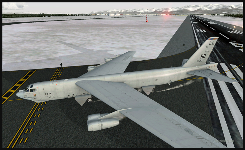
Boeing B-52 leaving the runway in Anchorage (FSX)
For more articles on flight simulation on my web site, click on the following link : Flight simulation
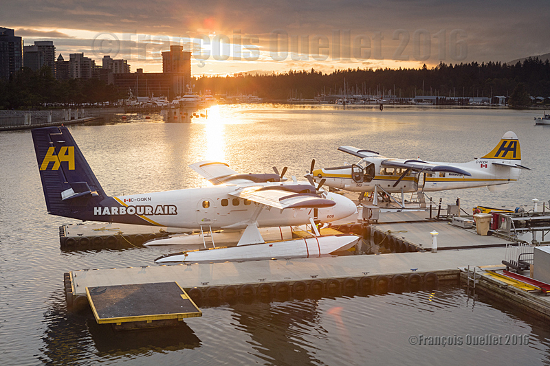
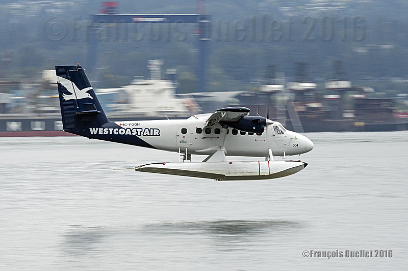
Harbour Air Twin Otter floatplane C-GQKN and Turbo Otter floatplane C-FODH in the sunset in the Port of Vancouver during summer 2016
The picture above has been taken with a Canon 5DSR full-frame camera in the Port of Vancouver, in British Columbia, during summer 2016. Following a very busy day of take-offs and landings, everything is now peaceful. The Harbour Air Twin Otter floatplane C-GQKN and Turbo Otter floatplane C-FODH are now parked for the night.
Pictures taken at dusk or dawn benefit from a unique light. Nonetheless, taking pictures of aircrafts against the light, with the last sunrays still visible, requires a special attention with regards to blown out highlights.
When contrasts are too important, it is possible to correct the situation by taking several pictures with different exposures and merging them using an image editing software like Photomatix (HDR photography). This is done in a few minutes only. Nonetheless, with floatplane aircrafts that are still slightly moving even when tied for the night, there is an increased risk of a blurred picture. The best way to proceed is to use a ND grad filter and to place it exactly where the light is the strongest. Naturally, there will still be some blown out highlights.
This being said, you still have a good margin of manoeuver, since there is no problem in showing a limited amount of over-exposed highlights in the brighter part of the sunrays, as there is not much details to lose there anyway. While purists would argue otherwise and spend hours in front of their computer trying to correct everything, you are making the best of another day of photographic exploration.
If the picture was taken using RAW files (or RAW with JPEG), it is possible to improve the scene even more by correcting some aspects like the contrasts, the brightness, the colours, the saturation and ambient light, etc. This also requires very limited time in front of the computer once you understand the basic principles of an image editing software.
Harbour Air Twin Otter floatplane C-GQKN on final for Vancouver Harbour, in British-Columbia, during Summer 2016. Photo taken with a Canon 5DSR full frame camera.
It looked like it would be an average day for a photography session at the Vancouver Harbour. The sky was quite ordinary, which means totally cloudless. But around noon, a new and more humid air mass made its way in British Columbia and rapidly the blue sky was replaced by clouds and precipitations. At the same time, the high intensity light that was prevailing around noon suddenly took more acceptable levels for photography.
Pilots of different bush floatplanes like the Twin Otter (DHC-6), Turbo Otter (DHC-3T) and Beaver (DHC-2) had to deal with the sudden weather deterioration in order to complete the daily planned flights. But one man’s loss is another man’s gain. For aviation photography, low clouds and light intensity meant that the pictures would be more interesting.
The photo above was taken with a Canon 5DSR full-frame DSLR camera equipped with a Canon 70-200 f2.8L IS II USM telephoto lens. In order to capture the moving propellers, I had to set a low shutter speed. The scene was then cropped to avoid visual distractions. The 50.6 megapixels full-frame sensor of the Canon 5DSR facilitates cropping when it is required.
In the foreground, there is a Harbour Air Twin Otter floatplane (C-GQKN) approaching to land in the Vancouver Harbour. In the background, far away and in the superior right corner of the photo, the pilot of a Turbo Otter floatplane also deals with worsening weather while ensuring that he maintains a visual contact with high ground obstacles surrounding the harbour.
« Passer par le Nord » (Northern Sea Route), by Isabelle Autissier and Érik Orsenna, is an essential book for the reader who wishes to learn more about the profound transformations brought on by global warming, with regards to geopolitical, economic and ecological issues in the Arctic.
The book is at the same time a lesson in geography, history, politics, ecology and economy. It will certainly captivate those who are interested in maritime traffic and the development of new maritime routes, as well as the race towards the appropriation and exploitation of the immense oil and gas resources of the North.
Book cover of “Passer par le Nord” by Isabelle Autissier and Érik Orsenna
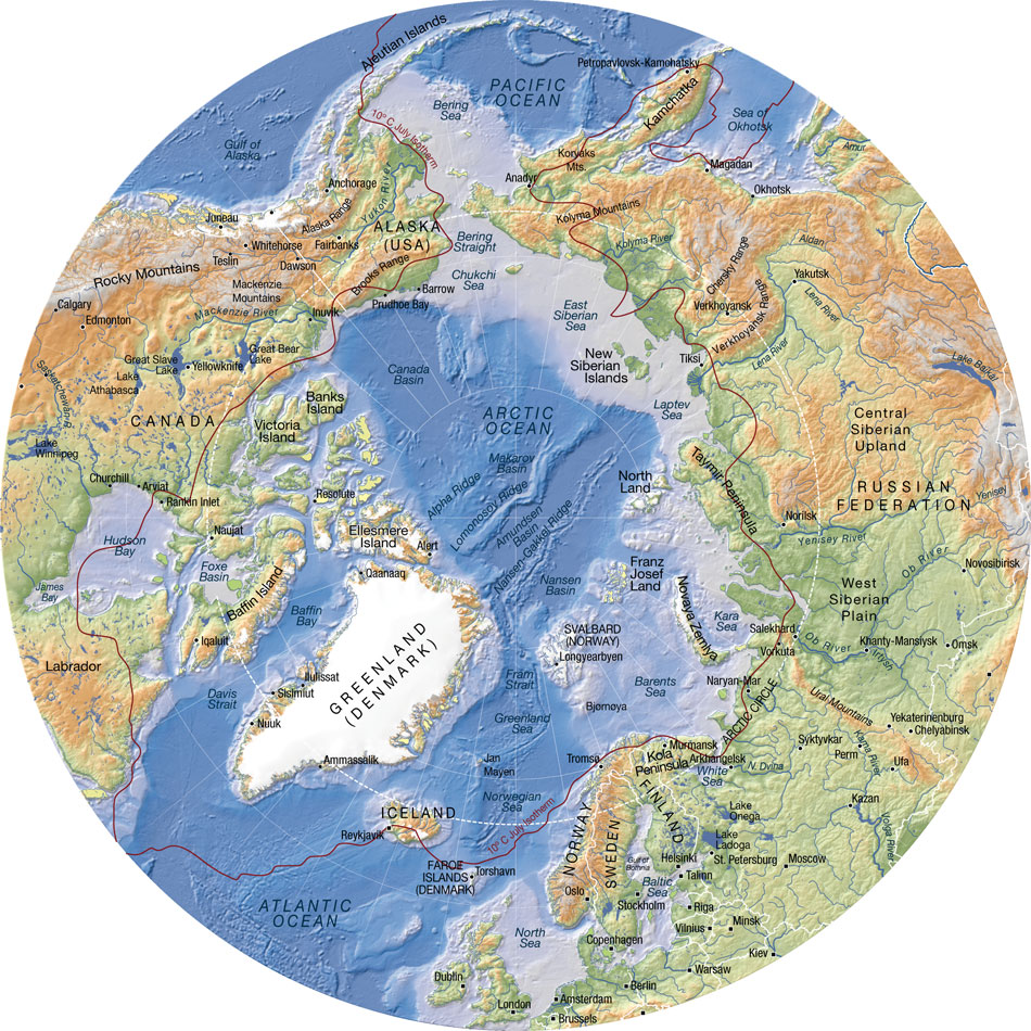
In order to sustain the reader’s interest, several maps are included in the book. They are very useful when comes the time to better understand the history and different uses, past and present, of the seas, islands and territories like: Kara Sea, Barents Sea, Laptev Sea, Franz Josef Land, Novaya Zemlya, Aleutian Islands, New Siberian Islands, North Land, Wrangel, Bering Strait, Svalbard, Spitzberg, Oslo, Tromsö, Kirkenes, Murmansk, etc.
Some of the seaways of Russia, which are among the longest in the world, are equally presented: Ob, Yenisei, Lena and Kolyma.
The numbers talk for themselves: to go from Rotterdam to Yokohama, a ship must travel 20,600 kilometers when passing through the Suez Canal. Only 12,800 kilometers are needed when using the northeast passage along the Siberian coast and 11,800 kilometers when traveling across the pole in the absence of ice during summer (this new transpolar route could be usable as soon as 2025). The need of resources by China and India, associated with melting ice in the poles, are rapidly taking Siberia out of its isolation.
Important people
The reader will certainly be interested by the information on the people who played a significant role in the discovery and exploitation of seas, islands and lands bordering the Northeast maritime route. Here are few of those names: the Viking Otar, Willem Barents, Simon Dejnev, Vitus Bering, Peter the Great, Alexander Baranov, Ivan Veniaminov, Adolf Erik Nordenskjöld, Ada Blackjack, etc.
The first northern crossing from the Atlantic to the Pacific belongs to a Swedish named Adolf Erik Nordenskjöld in 1879. Thirty-six years (1915) were needed to witness the second complete crossing, this time by Russian icebreakers under the command of Boris Vilkitski.
The importance of icebreakers
Icebreakers are extremely important for Russia, so much for protecting its recognized sovereignty and defending its new territorial claims than for economic reasons (insure the usability of the Northeast Passage and the continuous exploitation of the oil and gas resources along the Siberian coast).
The United States must also build icebreakers, so much for geopolitical and economic reasons than to insure the protection of a growing number of cruise ships that are about to use the narrow and risky channels of the Arctic.
An obvious collaboration exists between Russia and Norway with regards to fishing in the Barents Sea and in the south of Svalbard, a sector rapidly becoming more strategic with the northern migration of several fish species caused by the climatic changes. Ecosystems are nonetheless in danger due to the rapidly warming waters and insufficient time to adapt.
What are the obstacles presented by the Barents Sea towards tankers, ships and platforms? First the fog, which can last for weeks, than the “lows” which destroy vessels and twist superstructures. Finally,freezing spray adds excessive weight and freezes every crank on ships and platforms. In the event of an accident caused by oil or gas exploitation, the extreme meteorological conditions will present very important challenges.
One note on Siberia
The exploitation of mineral resources in Siberia was initially made possible, under Lenin, through work camps (gulags), since there were no volunteers ready to exile themselves in that hostile region.
The authors suggest, for whoever is interested in Siberia, the soon to be published book by Éric Hoesli. He has already published, in 2006, a very well documented book on the Caucasus: À la conquête du Caucase.
Oslo: Tschudi and Aker Solutions
The authors present two Norwegian companies based in Oslo which deal with logistics at sea: TSCHUDI and Aker Solutions.
Back cover of the book ” Passer par le Nord ” by Isabelle Autissier and Érik Orsenna
Shtokman and Yuzhno-Tambeyskoye natural gas reserves
The reader will certainly appreciate the chapter on the “eldorados glacés” (iced eldorados) which develops on the Shtockman and Yuzhno-Tambeyskoyenatural gas reserves fields (the latter holds 25% of the world reserve of natural gas). There are numerous challenges with regards to the exploitation of those fields: investments of twenty billion dollars, a necessary alliance between Russia, France (TOTAL) and China (CNPC), gigantic infrastructures to be built, the stabilization of all installations using thousands of posts, a constant fight against ice, the construction of thirty tankers (among them sixteen icebreakers), and the obligation to use the Northern maritime route.
Global warming
The book covers at length the accumulated effects of military, industrial and commercial activities on animal life and the environment. The fragility of the Arctic is well demonstrated. The reader will be surprised by the extent of nuclear wastes spread around the Novaya Zemlya.
The global warming favors the migration of species northward, an increase in the number of fishing vessels in the Arctic and political tensions between nations related to the ownership of the zone located between 12 and 200 miles along the different coasts. The native species are losing ground to the profit of the invasive species.
“[My translation] The diminishing polar ice will favor an increase in the number of ships in the Arctic with the added risk of collisions and the emission of all kind of noises that disrupt animals and prevent them from feeding correctly and communicate properly between them or with their offspring. Seismic tests or low-frequency sonars used by fishermen and militaries are particularly devastating.” (p.203)
“With few exceptions (Norway, Japan, Iceland), the moratorium on whale hunting is respected. The official predation by Inuit and the Russian poaching are limited.” (p.203)
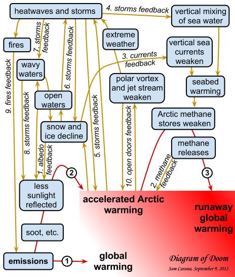
Map showing the links behind the accelerated warming of the Arctic (Source: http://arctic-news.blogspot.ca/2012/09/storm-enters-arctic-region.html)
Increase in extreme weather events
“[My translation] The diminishing pack ice will act on the oceanic currents, but also on the atmosphere by slowing down the higher jet streams. This phenomenon will favor an increase in extreme [weather] events (cold spells or heat waves, droughts or floods) at our mid-latitudes.”(p.219)
Response time when faced with an ecological disaster in the Arctic
The Bureau of Ocean Energy Management (USA) “[my translation] estimates that 61 000 barrels [of oil] would spill in the sea every day if a well exploded. The Shell Company indicates that it would need thirty-eight days to drill a relief well while it needed eighty-five in the Gulf of Mexico, infinitely more accessible and less dangerous. Admitting that it would show the same celerity as for Deepwater Horizon , which in itself would be a feat, more than 800 000 tons of oil would spill in the Arctic.
More likely, operating conditions in ice, fog and storms would prevent the realization of the work within only one summer. Once the polar night would set, a decision to let the well spill all winter would have to be taken, if not for many years in a row.” (p.229)
Methane
“[My translation] Methane has a greenhouse effect that is twenty-three time superior to that of the CO2, that is already presented as our worst enemy” (p.216)
“In the Laptev Sea, what looks like real fountains of several hundred of meters in diameter spew out methane. One can see the sea boil like if it was in a gigantic cauldron. 80% of surface waters and 50% of deep waters present methane concentrations varying from 8 to … 1 400 times the oceanic average!”(p.216)
Mammoth’s tusks poaching
There is a short passage in the book on the poaching of mammoth’s tusks buried in the ground on Liakhov Island. The operation is financed by Mafiosi. The tusks are carved then resold to Chinese collectors for a very good profit.
Global warming, and the thaw it provokes in Siberia, would indirectly protect the African elephant by allowing access to mammoth’s tusks. The new and important stock of ivory in Siberia drives the price down by increasing the offer, thus making the African elephant’s tusks less interesting financially.
Some names to remember
The Port of Kirkenes, in Norway, is one of the main ports of the new northern sea route. It has an ideal geographical position and its harbour is protected against storms. The city favors the development of the port. The efficiency of Norwegian employees is recognized. The Norwegians are used to deal with Russians, their immediate neighbours.
Murmansk, in Russia, is also expected to benefit from global warming. There are already dozens of mines in exploitation, with several of those mines producing rare earths which are vital for modern technology applications.
In the Arctic, the disappearance of the summer ice pack is expected between 2020 and 2030. The Northeast Passage could be accessible beyond the EEZ 200 miles, “which will favor Iceland “which could become a transport hub between America and Europe.”(p.218). “And it is said that some Beijing investors would be ready to offer 5 billion dollars to take control of the future Port of Reykjavik, the one that aims to be the hub of the North.” (p.245)
The Arctic Council
For a long time now, the Arctic has been a strategic area where numerous countries, among them few superpowers, claim an important part of the territory and resources. With the acceleration of the melting process, things get even more complicated.
In 1996, the Arctic Council was created to ease communications and reduce political tensions between the countries pretending to part of the Arctic territory and resources. These countries include Canada, Denmark, United States, Finland, Iceland, Norway, Sweden and Russia. Associations of indigenous population are also part of the group, but as “permanent members”.
Militarization of the North
The Cold War between Russia and United States forced the construction of the DEW line by Americans and Canadians, a line that was eventually replaced by the North Warning System.
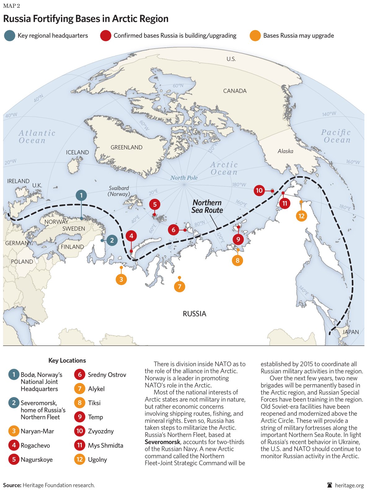
Today, the militarization of the area still goes on: “[my translation] Russia multiplies the signs and acts of militarization in the zone. Military exercises (parachuting, air patrols), reconstruction of installations in all of the islands (Wrangel, New Siberian, Novaya Zemlya, Franz Josef Land), orders of numerous ships among them new generation submarines (attack submarines and missile launchers), a complete program for the upgrading of the Boulava missiles … The [Northern Fleet] underwater base, near Murmansk (Severomorsk), seems to be in a state of complete reactivation.”(p.238)
Russia fortifying bases in Arctic region (Source: Heritage.org)
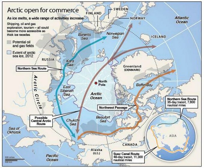
The transpolar maritime route
Geographic map showing the potential northern maritime routes (Source: www.businessinsider.com)
The Northeast Passage maritime route along the Siberian coast will be favored until the ice pack has melted at the pole (expected for 2025 instead of 2060 initially forecasted). So, in 2025, a new transpolar maritime route will be available to ship-owners. They will then be able to decide if they avoid the Siberian coast and the associated administrative hassle while they save an additional one thousand kilometers for a route from Rotterdam to Yokohama.
For more articles on geopolitics on my web site, click on the following link : Geopolitics
Westcoast Air Twin Otter floatplane C-FGQH arriving in Vancouver Harbour, in British-Columbia, during Summer 2016. The photo was taken with a Canon 5DSR camera.
The picture above was taken in British Columbia, during summer 2016, with a Canon 5DSR full-frame camera equipped with a Canon 70-200 f2.8L IS II USM telephoto lens.
A Westcoast Air (C-FGQH) Twin Otter floatplane (DHC-6) was about to land in the Vancouver Harbour. It is obvious that adjusting the shutter speed to 1/1200 would have given enough speed to obtain a clear image. But this would have taken away any movement sensation by freezing the propellers and background.
The shutter speed had to be slow enough to allow the rotation of propellers. It is clear that an aircraft’s propeller rotates more slowly on final for landing than during take-off. So the camera had to be adjusted for a shutter speed varying between 1/40 and 1/125.
A slower shutter speed increases the risk of getting a blurred photo, especially when the photograph must move with the camera to obtain the desired effect of movement. The fact that a telephoto lens is used also increases the possibility of a blurred picture. It is thus imperative to activate the stabilizer and horizontal panning function of the telephoto lens.
To obtain a background without any precise details, the camera is panning and follows exactly the aircraft’s movement. This requires a progressive acceleration of the panning, according to the aircraft’s position from the photographer.
When the Twin Otter gets closer, things get a bit more complicated as everything speeds up. It is necessary to already have positioned the feet in the appropriate direction in order to avoid a major switch in the body’s posture. The slightest useless or brisk movement would immediately be visible on the photo.
With a bit of practice, a photographer will achieve success by respecting the following elements: a shutter speed between 1/40 and 1/125, an appropriate position of the feet, no brisk movement while pivoting and a progressive acceleration of the body’s rotation aligned with the aircraft’s speed. A slower shutter speed will enhance the aircraft movement. But expect more blurred pictures when working with speeds between 1/40 and 1/60.
A last detail: as soon as the aircraft’s floats touch the water, the deceleration starts. The photographer’s pivoting speed must immediately slow down otherwise the photo will be blurred.
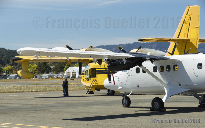
Twin Otter Series 400 parked in Victoria, British-Columbia, in 2016
Knowing I would spend some time in Victoria in 2016, I planned a visit of the Viking Air Ltd installations, the Canadian company who now builds the famous Twin Otter Series 400. This company is unknown from a majority of Canadians since its production is essentially exported. Out of one hundred aircrafts produced so far, only two were bought by a Canadian company. Viking also offers maintenance service for the Twin Otter Series 100 to 300 in activity around the world.
In the foreground, a Twin Otter Series 400 built by Viking in Victoria, British-Columbia. In the background, a CL-215 water bomber recently acquired by Viking. It will possibly be modified into the more powerful CL-415 version .
In the beginning of 2016, Bombardier and Viking sealed a commercial deal that now makes Viking the new owner of the patents and designs for the CL-215 and CL-415 water bombers. Viking not only services the existing Twin Otters but is evaluating the possibility of restarting the production of the CL-415 water bombers. All is resting on the demand. But with more extreme meteorological conditions fueling a growing number of major forest fires, one can expect that within the next few years Viking will reactivate the production.
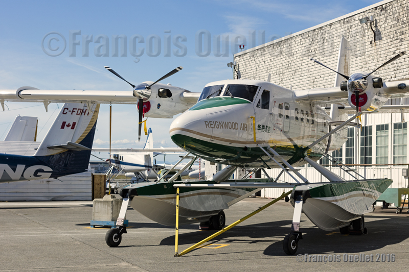
In Victoria, a Twin Otter Series 400 on floats built by Viking has been bought by Reignwood Air. It is ready for delivery to China (2016).
With the on-going regulatory changes actually taking place in China, Viking is confident to see an increase in its orders for the Twin Otter Series 400 on floats. The company will receive, at their Victoria installations in 2016, the first flight simulator essentially dedicated to training pilots on the Twin Otter on floats.
A Viking’s Twin Otter Series 400 in Victoria ready for delivery to Russia
For now, Russia is Viking’s most important customer despite the ups and downs linked to the political crisis between that country and Ukraine combined with a ruble devaluation that have forced a slowdown in the production of aircrafts destined to Russian companies. With the recent stabilization in the political situation, Viking has been able to hire back numerous workers which now brings the count to at least 350 employees, if my memory does not fail me.
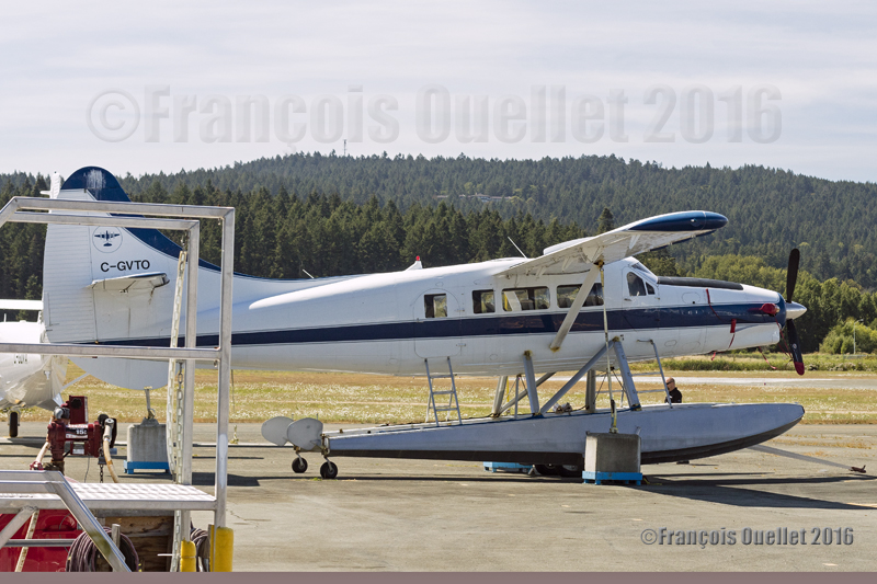
Turbo Otter DHC-3T C-GVTO in Victoria, Canada, in 2016
Nowadays, most Canadians ignore that a Canadian company has restarted the production of the Twin Otters and is evaluating the possibility of also relaunching the production of the CL-415 water bombers. In the meantime, some CL-215s recently acquired by Viking will possibly be transformed into the more powerful CL-415 version. The only thing now missing for Viking is an important order from a Canadian company: that would make its name as well-known as Bombardier or De Havilland.
For other articles on aviation and photography, click on the following link: Aviation photography
Here are some photos of Toronto that were taken in February 2016 with a Canon 5D MKII DSLR camera. The photos were all saved in RAW and JPEG files to facilitate any additional work that could have been required with an image editing software.
Architecture and photography both offering unlimited possibilities, I did not impose any limitations. The primary goal was to profit from any opportunity that would arise while profiting from the softer light offered by the winter season.
Toronto Harbourfront, Winter 2016
The first article with regards to photography in Toronto that was published on my website showed only one subject: the CN Tower. It was published during Winter 2016:
In the present article, I develop other angles of Toronto which is a city in constant evolution and where you can find multiple styles of architecture. In the picture below, a recent rain shower helped to add unexpected reflections.
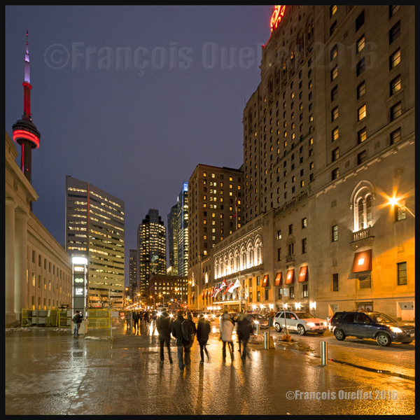
Toronto and CN tower by night. Winter 2016
Some architectural subjects are naturally imposing. This is the case when all you have to do is look straight ahead, enjoy what you see and immediately try to compose an interesting photo.
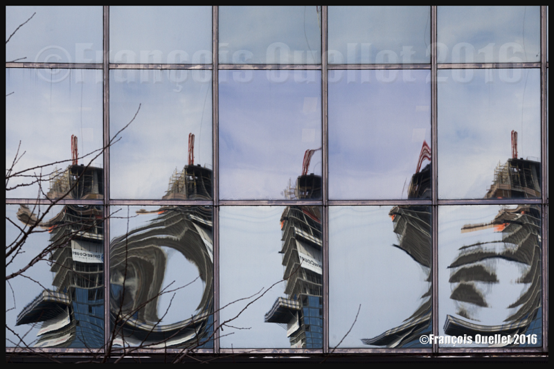
A good example is the interesting reflected shapes that can be seen on the windows of a building. I could not help to take the picture below as I was surprised that a windowed building could send back images that were so totally different from each other. I am curious why there is so much distortion between the windows…
Toronto building reflections (2016)
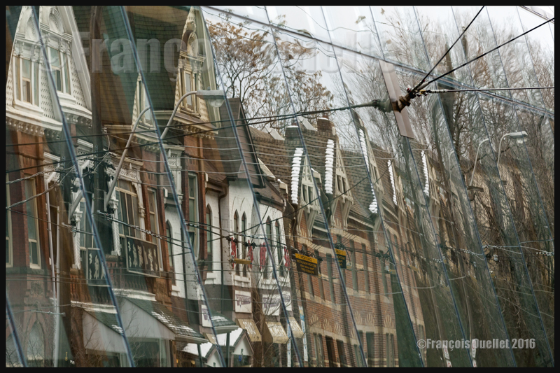
Instead of taking pictures of the newly designed Art Gallery of Ontario, I used its reflective properties to capture something a lot older, which was the design of the row of older houses on the other side of the street.
Some houses are reflecting on the Art Gallery of Ontario (2016)
It is also possible to add variety and fun to a photo session by looking for special shapes, angles or contrasts that are not already obvious.
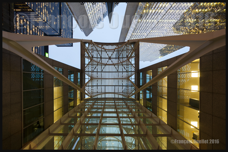
As I was walking downtown, I passed by the Brookfield head office. The architecture of this relatively new building is quite interesting. The architects were able to preserve the facades of older surrounding buildings by integrating them and assigning each one a role inside the new construction, possibly because the city required their protection in case of any new development.
But it is only once I was leaving the sky rise that I found the idea for the next photo: a vertical wide-angle shot from which all lines would be straight, all this possible by using the advantages of the Canon 5D MKII full frame sensor coupled to a Canon 14mm 2.8L wide-angle fixed lens. Image sharpness was insured through manual focus, a tripod, a remote trigger and the mirror lock-up function.
Toronto sky rise, Ontario 2016
The last photo is essentially about contrasts: the colour contrasts (light and dark) and the density contrasts that one can find in different constructions of Toronto.
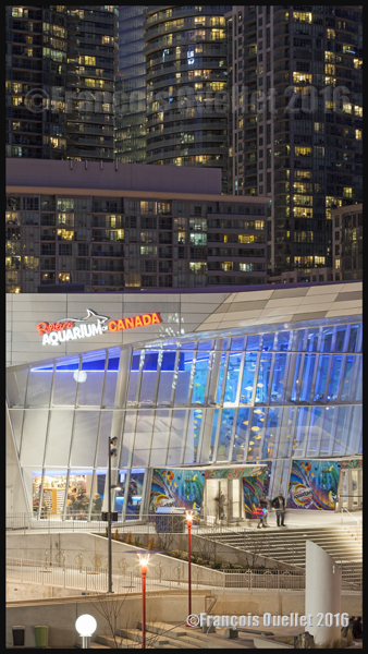
In the foreground, we see the aquarium, with its pale and inviting colours, as well as lots of space where only few people are visible. In the background, there is the exact opposite, with very dark high-density condo towers, very close to each other, where every inhabitant hopes to have an interesting view on the Lake Ontario. All this in a photo divided in two parts and cropped very tightly to increase the differences and eliminate any visual distractions.
Contrast between the Ripleys Aquarium of Canada and the condominiums in the background. Toronto, Ontario (2016)
For more articles in the category « Photos of Canada », click on the following link : Photos of Canada
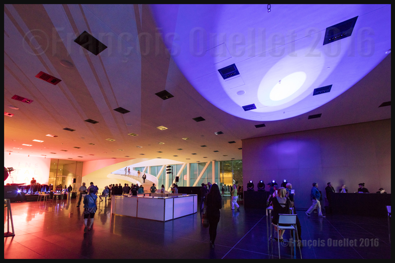
Official opening of the Pierre Lassonde Pavilion, which is part of the Musée National des Beaux-Arts de Québec, seen from Grande Allée on June 24th 2016
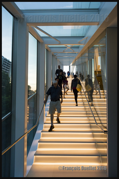
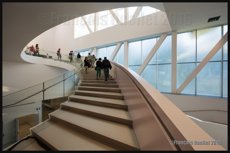
Pierre Lassonde Pavilion (Musée National des Beaux-Arts de Québec) intercommunication stairway on the day of official opening in June 2016
On June 24th 2016, during the National Holiday of Quebec, the new Pierre Lassonde pavilion of the Musée National des Beaux-Arts du Québec (MNBAQ) on Grande Allée in Quebec City was inaugurated. This pavilion, that has been expected for a very long time, will allow the Museum to expose art that had to be stored, up to now, due to lack of floor space. This new pavilion will double the exibition space.
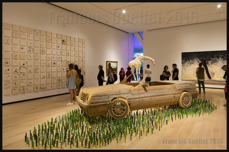
Artwork exibited in the Pavillon Pierre Lassonde du MNABQ on June 24th 2016
Many political personalities were present, among them the Prime Minister of Canada Justin Trudeau and Quebec’s Prime Minister Philippe Couillard, as well as the MNBAQ director Line Ouellet. International actuality caught up with the Canadian Prime Minister during his presence in Quebec and he had to comment on United Kingdom’s exit from the European Union (Brexit) which was voted on the precedent day.
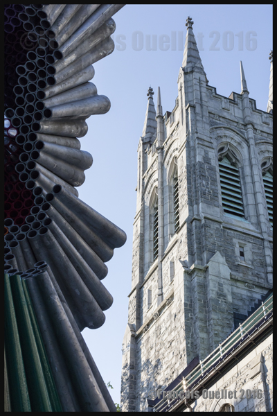
Part of a sculpture located outside of the Pierre Lassonde Pavilion at the Musée National des Beaux-Arts du Québec in 2016
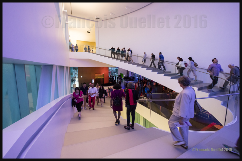
June 24th 2016 in the MNBAQ’s Pierre Lassonde Pavilion
The Pierre Lassonde pavilion architectural project, valued at about $103 millions, was the result of an international competition won by the American architectural firm OMA from New York. Fifteen thousand people were expected to show up for the inauguration. Instead, thirty thousand people visited the pavilion to get a glimpse of the creation directed by the architect Shohei Shigematsu.
Pierre Lassonde Pavilion’s intercommunication stairway on June 24th 2016. Photo taken with a Canon 5DSR equipped with a 14mm 2.8L fixed lens.
MNBAQ’s Pierre Lassonde Pavilion’s stairway on June 24th 2016
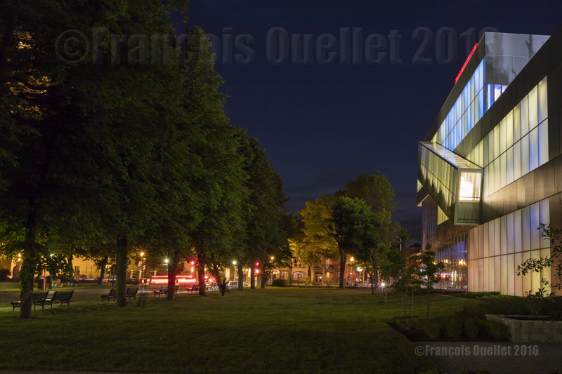
Lots of compromises to limit the expenses had to be made, like in all serious projects. Nonetheless, the pavilion is a success and I am eager to see what kind of atmosphere will be generated this coming winter when the light shines through the glass panels and colors the snow around the pavilion. This new building, with its original architecture and the light that emanates from it, already adds a new dynamic when night falls on Grande Allée.
MNBAQ’s Pierre Lassonde Pavilion on the evening of official opening. Photo taken with a Canon 5DSR on June 24th 2016
Intercommunication staircase in the Pierre Lassonde Pavilion at the MNBAQ on the day of official opening (June 24th 2016)
For those of you who are interested in photography, here are some details about the photographic equipment used for my photos : they were all taken with a DSLR Canon 5DSR camera. The Canon lenses that were used were : EF 14mm f/2.8L II USM, EF 50mm f/1.4 USM and telephoto lens EF 70-200 mm f/2.8L IS II USM. The use of a flash being forbidden inside the museum, I had to carefully adjust the ISO, speed and aperture settings, especially where the use of a tripod was not authorized. For those occasions, the EF 50 mm f/1.4 USM was of great help.
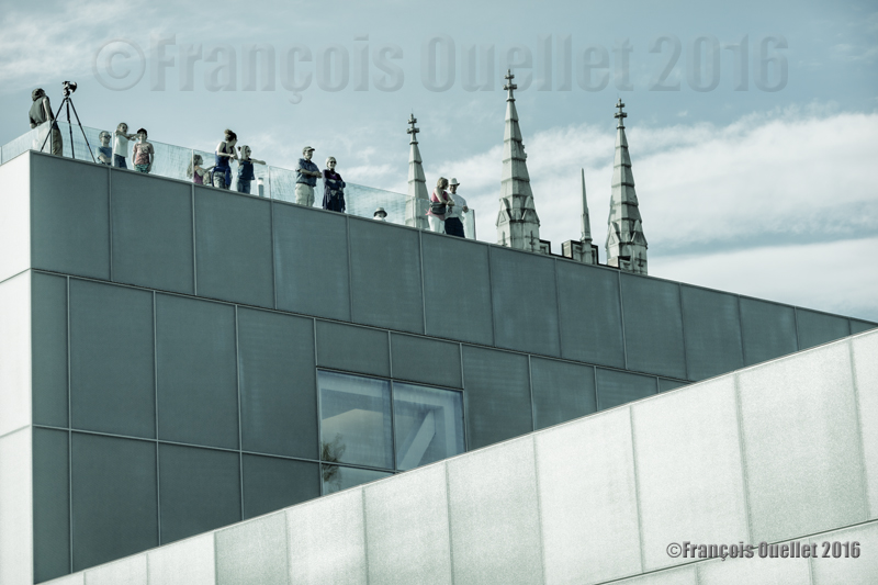
Visitors on the roof of the MNBAQ’s Pierre Lassonde Pavilion on June 24th 2016
For other photos on the province of Quebec and also Quebec City, click on the following links from my blog: