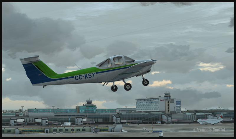
Piper Tomahawk PA-38 airborne from runway 28 at the Montreal Pierre-Elliott-Trudeau international airport, with the Montreal terminal in the background. (FSX)
All student pilots must practice touch-and-goes for hours . FlyTampa Montreal scenery for FSX, used jointly with MyTraffic2013 software and real weather makes for a realistic exercice for anybody who knows the metropolitan area around Montreal.
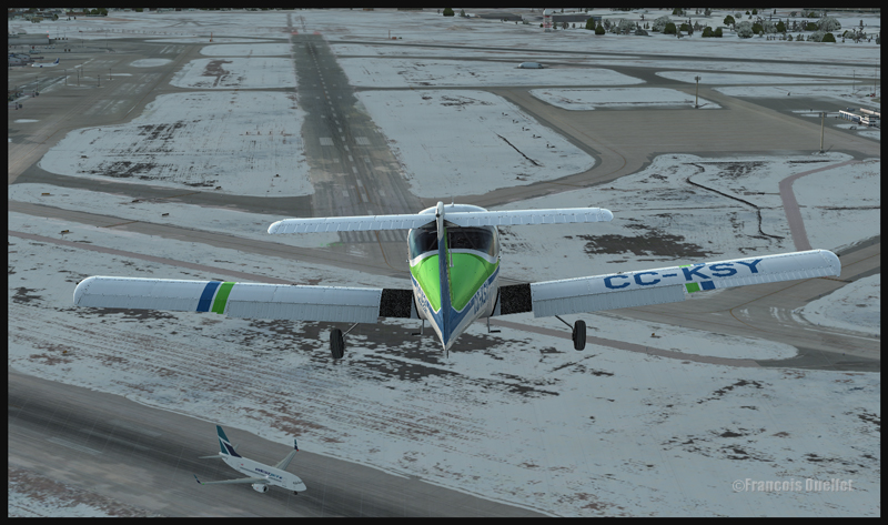
Piper Tomahawk PA-38 airborne from runway 28 for a left hand circuit at the Montreal Pierre-Elliott-Trudeau international airport (FSX)
A small aircraft like the ALABEO Piper PA-38 Tomahawk is a perfect choice. I chose a left hand circuit for runway28 since it allows a nice view of the terminal when taking-off or landing. Fly Tampa Montreal allows the virtual pilot to see local landmarks when flying around the airport, like the olympic stadium, the St-Joseph’s Oratory and Place Ville Marie.
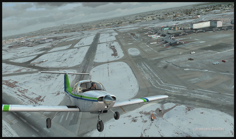
Piper Tomahawk PA-38 on downwind for runway 28 at the Montreal Pierre-Elliott-Trudeau international airport (FSX)
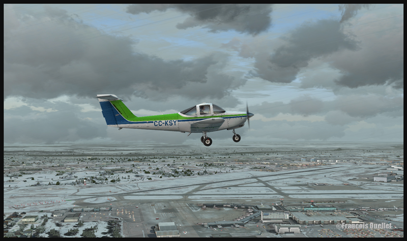
Piper Tomahawk PA-38 turning on final for runway 28 at the Montreal Pierre-Elliott-Trudeau international airport (FSX)
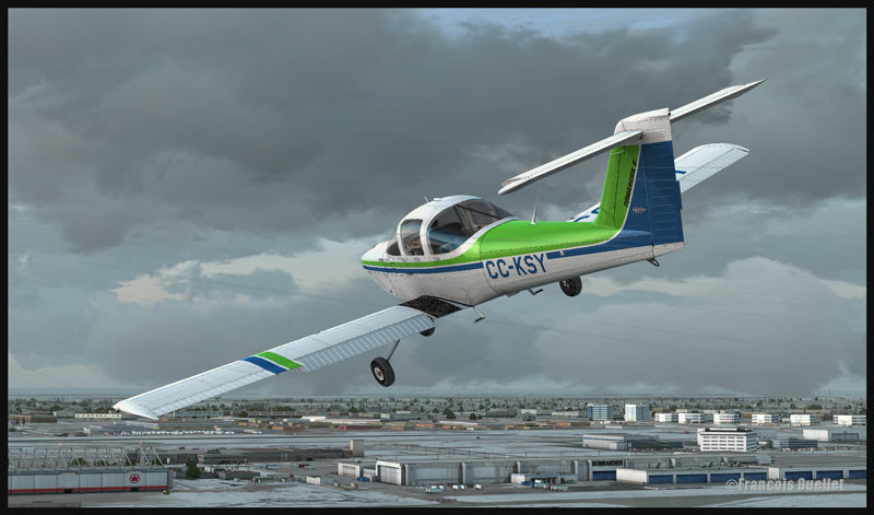
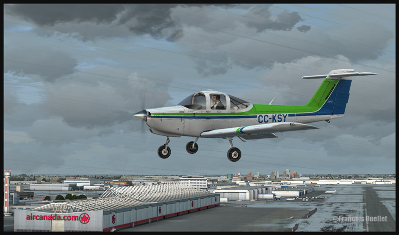
Piper Tomahawk PA-38 on final for runway 28 at the Montreal Pierre-Elliott-Trudeau international airport , while Westjet is rolling on runway 06R (FSX)
On downwind 28, if you fly during winter, you will be able to see that only parts of Lac St-Louis are frozen. On left base, Air Canada and Bombardier very well rendered buildings are visible. If you had landed on runway 24L, you would have seen other well known company names posted here and there on the surrounding buildings. That is a really well made scenery.
Piper Tomahawk PA-38 and the Bombardier and AirCanada buildings at the Montréal Pierre-Elliott-Trudeau international airport (FSX)
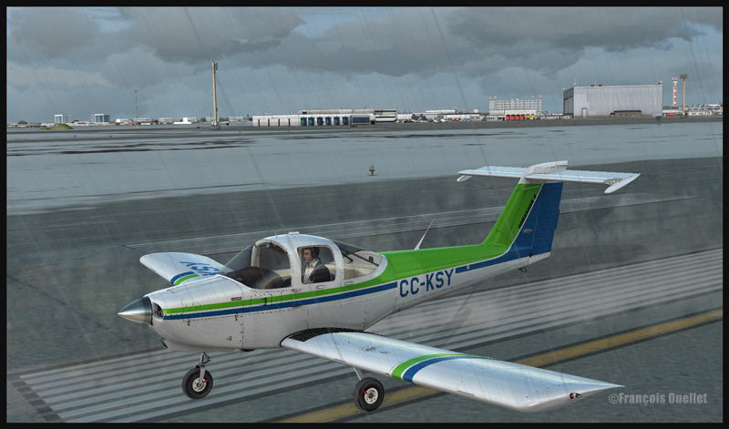
Piper Tomahawk PA-38 about to leave runway 28 of the Montréal Pierre-Elliott-Trudeau international airport (FSX)
The use of My Traffic software allows aircraft movements around the airport during your exercice; that makes the experience even more interesting. You will also be surprised by the realism in the depection of the snow patches along the runway sides when you are on the approach. So, have fun with this easy exercice in a really interesting setting made available by Fly Tampa Montreal.
Piper Tomahawk PA-38 parked at the Montréal Pierre-Elliott-Trudeau international airport (FSX)
For more articles on flight simulation on my web site, click on the following link : Flight simulation
A WACO YMF5 practicing aerobatic figures over Airdrie, Alberta.
The screen capture shows an Alabeo company Waco YMF5 in action. The background scene is a creation of ORBX. FSX has been used for this virtual flight over Alberta. The Waco is easy to fly and Alabao has programmed many point of views from which the virtual pilot can take pictures in flight. ( V on the keyboard). Airdrie Airpark, Claresholm Industrial Park and High River, all created by Vlad Maly, can be found near the training area. They are all quality products. The first airport must be bought but the two others are offered as freewares by Orbx. It is an interesting point of departure for a virtual pilot who would like to cross the Rockies towards Vancouver or Victoria.
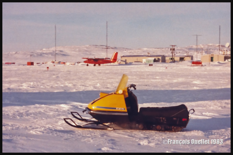
The Bell Canada Twin Otter in the background during a nice winter day in Inukjuak. In the foreground, an old ski-doo model.
One winter evening, in 1983, the Transport Canada flight service station (FSS) in Inukjuak (CYPH) received a radio call from a Bell Canada Twin Otter that was in trouble. The fog had invaded the Hudson Bay coast in several places, and landing at the planned alternate airports was now impossible. Weather conditions still being acceptable in Inukjuak, our airport became the last option for the pilot. Unfortunately, our runway lights were out of service and a solution had to be found quickly.
Phone calls were made. Several Inuits arrived in snowmobile and installed their machine on each side of the runway, in more or less regular intervals, so as to light the outside limits of the landing surface. The pilot made a normal approach and the aircraft landed without problem. This kind of service provided by the Inuit was not something new. The pilots were always happy to be able to rely on this emergency auxiliary lighting supplied by the inhabitants of northern Quebec villages when there was a sudden problem.
(Next story: acquisition of an Inuit sculpture in Inukjuak in 1982)
An American Trans Air Lockheed L-1011 is parked in front of the Iqaluit flight service station tower (Iqaluit FSS) in 1990.
The image above comes from a slide that was then digitalized 24 years later. Its quality is not optimal but the essential information is there: the presence in Iqaluit (CYFB), on Baffin Island, of a Lockheed L-1011 belonging to American Trans Air. During the refueling and customs procedures, the passengers were allowed to stretch their legs on the ramp. In the background is the Transport Canada flight service station (FSS) tower, where I used to provide air traffic services on VHF as well as HF frequencies to airliners crossing the atlantic ocean in the absence of satellite technology. Many heavy aircrafts were using Iqaluit on a regular basis as a stopover airport, like the extended DC8, Boeing B707, 727, 737. An Airbus A-380 even stayed for few days in order to be tested under extreme cold.
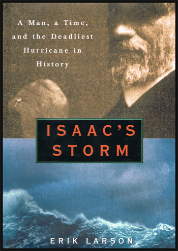
A Man, a Time and the Deadliest Hurricane in History
Isaac’s Storm
The book recounts the events surrounding a disaster caused by a major hurricane having taken place in the United States in 1900. The author ensures that the scientific notions connected with meteorology are explained in a simple manner, knowing very well that a big part of his readership has only elementary knowledge on the subject.
I appreciated the way the events were told, since Erik Larson’s book is not limited only to human or material disaster which ensued from the passage of the hurricane on Galveston and the surrounding cities. The reader can learn about the development of Meteorological Offices in the United States, the equipment used at that time as much as the help brought by ship captains with regards to weather observations. It is also interesting to read about all the political and commercial pressures felt by some staff of the US Weather Bureau.
The Galveston disaster was not due to the malfunction of the meteorological instruments nor their limitation. It was rather caused by the disproportionate egos of the forecaster Isaac Cline and some of his managers, as well as pressures of all kinds on Isaac as an observer and forecaster.
Isaac Cline: a disproportionate ego
Isaac had acquired an excellent reputation throughout the years. Little by little, his scientific approach gave way to a certainty of always being right and the desire to be perceived as the leading expert in the field of meteorology. In one of his papers, he refutes openly one hundred years of accumulated knowledge in meteorology.
The Galveston population had asked for a breakwater to be built in order to limit the potential damages caused by a major hurricane. But Isaac wrote an article in which he explained why Galveston was not susceptible to suffer the effects of a major hurricane. The breakwater not being seen any more as a pressing project, the idea of its construction was abandoned.
An ego bigger than nature from some administrators of the US WEATHER BUREAU
On the island of Cuba, in 1900, there were American observers working for the US WEATHER BUREAU and Cuban observers monitoring the weather for their own country. The Cubans, as natural residents of the island, had gradually acquired a huge experience in the prediction of the passage and the trajectory of major meteorological systems. Powerful countries having a natural tendency to underestimate the capacities and experience of inhabitants of smallest nations, warnings coming from the Cubans were regularly brushed aside.
If the US WEATHER BUREAU had been attuned to the Cuban weather observer comments in 1900, the terrible hurricane which destroyed Galveston would have had much less tragic consequences. But, in the “Isaac storm” book, we learn that the communication links were voluntarily cut between both countries by the US WEATHER BUREAU. The Cuban forecasters were considered like poor inhabitants capable of announcing a storm only when it had practically left the island.
“The same day that the Weather Bureau published in the newspaper of Havana that the last hurricane had reached the Atlantic, the Belen Observatory (Cuba) said in the same papers that the center had crossed the eastern portion of the island and that it would undoubtedly reach Texas. A few hours later the first telegraphic announcement of the ravages of the cyclone in Galveston was received”. Six days after the Galveston disaster, the War Department revoked the ban on Cuban weather cables and the communication of information was re-established.
Of pressures exercised by the Galveston businessmen on the forecaster and weather observer Isaac Cline
A first type of pressure on the observer was of commercial order: there was a competition between Houston and Galveston to determine which of both cities would become the major commercial center in the South of Texas. Galveston was however more vulnerable to hurricanes, because it is an island while Houston is farther away inland. Isaac Cline, the observer and forecaster based in Galveston, minimized the chances that his city could suffer the devastating effects of a major hurricane. It was out of question to depreciate Galveston in the eyes of potential investors.
Of strong pressures exercised by administrators of the US WEATHER BUREAU on the forecaster and weather observer
Another type of pressure on the observer resulted directly from Isaac’s managers, in the US WEATHER BUREAU. At the time, weather forecasts were only at an elementary stage and the US WEATHER BUREAU wanted to avoid alarming the population by using words like “hurricane”. They did not want to be the laughing stock of the population if the famous hurricane announced ended up to be only a standard storm. Isaac knew that his role consisted in delaying as much as possible the use of the word “hurricane”. Not wanting to go against the orders and to preserve his reputation with the Bureau, he possibly convinced himself that there was no major meteorological system approaching Galveston. He even told the population to stay put.
Galveston has always suffered and still does from an unfavorable geographical position. The hot waters in the Gulf of Mexico have always been an essential ingredient in the recipe of a major hurricane. This is where a storm will draw much of its energy. But, in the 1900 disaster, Galveston was also a victim of the combination of disproportionate egos, lack of judgment and commercial and political pressures exercised on the forecaster and the observer. All in all, approximately 10,000 people died in Galveston while thousands of others suffered the same fate in the surrounding cities.
If the population had been informed correctly, damage to property would nevertheless have been extremely important, but the losses of life would have been negligible.
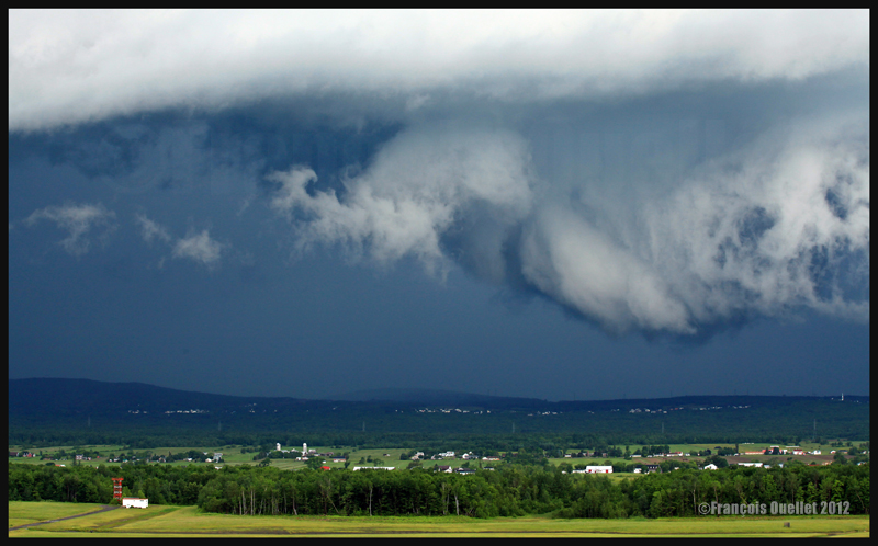
A roll arcus cloud in development ahead of a thunderstorm approaching Quebec in 2012
In the “Improve your pictures” section of this web site, there is a page titled “Photography and weather” . In few days, this page will hold about twenty pictures and information that can help photographers profit from the best that nature has to offer. The picture above represents a roll arcus cloud in development that is preceding a violent thunderstorm that was approaching Quebec City in 2012. The most interesting clouds were formed as the system was moving over the Val-Bélair hills near the airport.
(Precedent story: the Inuit who wanted to shoot Whites with a .303 caliber rifle)
In a Northern Quebec Inuit village, in the early ` 80s, there was still a fair amount of homes that were not equipped with toilets as we know them today. The occupants of these properties had to relieve themselves by sitting on a bucket covered with a garbage bag that people called “Honey Bag “. Fortunately for Environment Canada and Transport Canada flight service specialists (FSS)working in Inukjuak (CYPH), sanitary facilities were exactly like what could be found in southern cities and it was not necessary to use makeshift means.
The fact remains that a White male was hired as director of a local public institution and lived with his family in a house equipped with this type of “Honey Bag ” facility. On a beautiful Saturday, he and his wife were receiving guests for dinner and they were taking care of the final details. The wife had asked her husband, few days earlier, to take the “Honey Bag” out of the house and put a new bag on the toilet.
The man had neglected his task and the bag had gained volume and weight. But it was now Saturday, so he could no longer procrastinate. He grabbed the bag, closed it and crossed the living room heading toward the door. At the moment he was crossing the living room, the bag broke and all of its content spread on the carpet.
It was reported to us that there was an emergency clean-up throughout the afternoon to try to correct the situation. There was no way of knowing if the guests were able to enjoy the subtle aromas of the good wine served with the dinner…
(Next story: Inukjuak: last hope for a Twin Otter short on fuel)
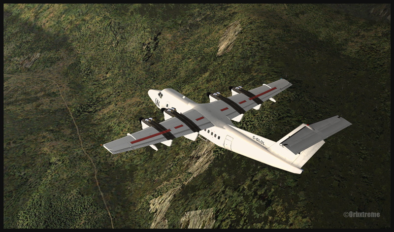
De Havilland Canada DHC-7 Dash 7 over the Kokoda trail in Papua New Guinea
Steep turn made by a Dash 7 (FSX) landing in Kagi, Papua New Guinea
If you are looking for a real challenge, try a flight from Kokoda airport to Kagi, using a DHC-7. Kagi is situated along the Kokoda Trail in Papua New Guinea. The runway has a 12.5 degree slope and is approximately 447m long (1466 ft). The airstrip’s altitude is about 3900 ft msl. You will need the ORBX scenery (AYPY) Jacksons Airport made by Ken Hall and Tim Harris, as well as other Orbx products such as Global, Vector and Holgermesh to do the flight and obtain the same views as above. In order to find the airports, two maps are included in the “User documents” included with AYPY.
A Dash 7 (FSX) on final for Kagi, Papua New Guinea
I adjusted the fuel at 50% in each tank. For payload, I used 5 passengers and luggages. Obviously, the aircraft could have been loaded with many more passengers and cargo. But since it was a first trial at Kagi with a Dash 7, I thought that a lighter payload would increase my chances of a successful landing by reducing the approach speed.
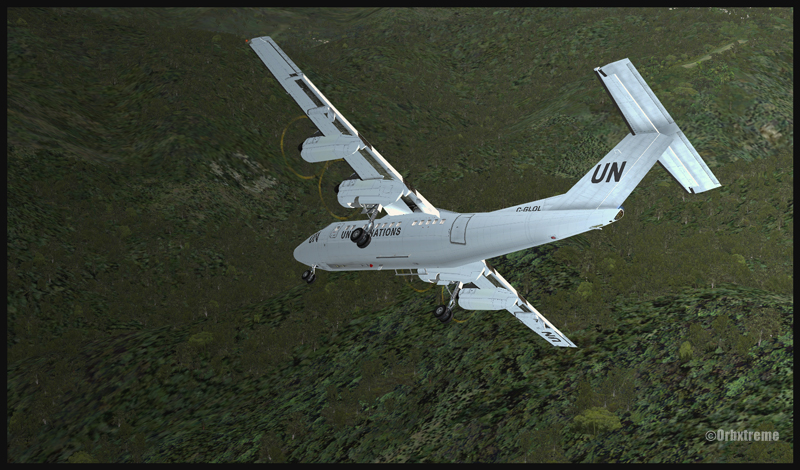
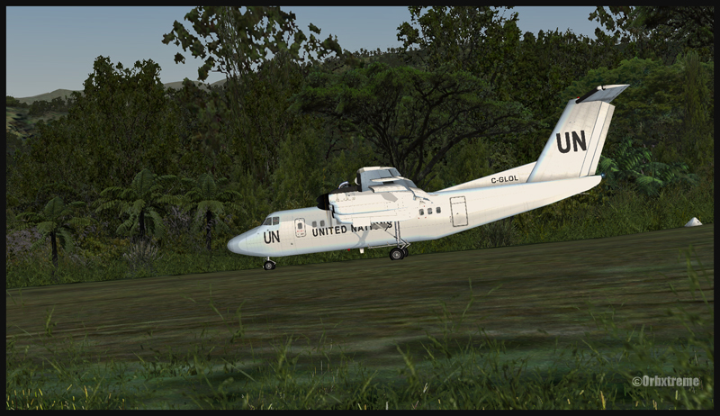
A United Nations Dash 7 after landing uphill on runway 07 in Kagi, Papua New Guinea
The landing in Kagi is made on runway 07 and the takeoff on runway 25. From Kokoda airport, follow the Kokoda trail then, when appropriate, make a right turn toward Kagi. There are few airports within a small area so it can get a bit confusing. The best way is to overfly the area slowly to ensure that what you see in flight and what is on the map are both the same airport.
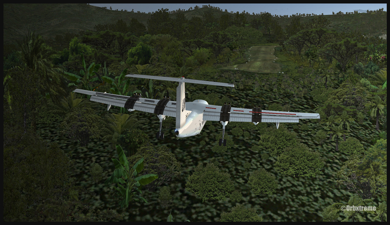
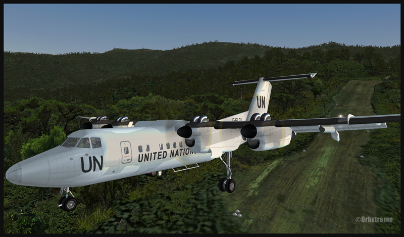
The two most difficult aspects of the approach are the steep turns required while flying close to the mountains in slow flight configuration, that is to say with full flaps and wheels out. The second problem to keep in mind is the sloped runway: 12.5 degrees is not negligeable. But once you are on the runway, the Dash 7 will almost stop by himself due to that slope. The takeoff on runway 25 is not a problem with that aircraft: with such a sloped runway, you will be airborne in no time.
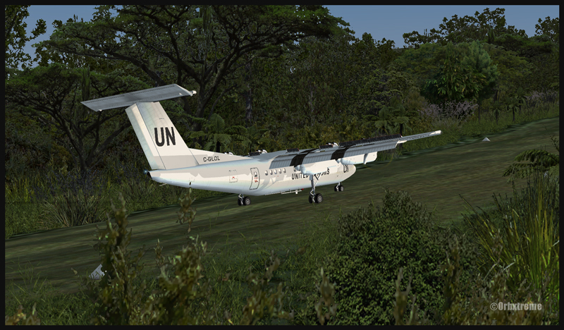
A United Nations Dash 7 ready for takeoff on runway 25 in Kagi, Papua New Guinea
De Havilland Dash 7 airborne from Kagi
I am convinced you will enjoy this demanding flight. There are lots of plants and trees included in the scenery, so it makes for a very realistic approach. Have fun and make sure your passengers will still have a smile on their face when they get out of the airplane!
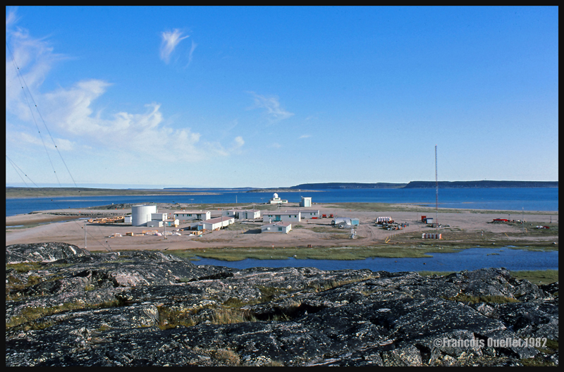
This is where we worked and lived in Inukjuak in 1982. One of the buildings holds the Transport Canada flight service station.
Note: It is only an out of the ordinary true life story. Normal relations between Whites and Inuit are entirely peaceful. Besides, we all know of situations in the southern cities where whites have tried to shoot people. The following story therefore presents an unusual and rare case.
In a Northern Quebec village named Inukjuak,in 1982-1983, the buildings layout was simple. On top of a nearby hill was the whole village, populated overwhelmingly by Inuit. Down the hill, near the airstrip and Hudson Bay, were the few buildings where Environment Canada employees and Transport Canada flight services specialists (FSS) could be found. There were only Whites living and working in this area.
One evening during winter` 82 -` 83, someone knocked on the door and entered immediately without waiting for an answer. It was the auxiliary police officer. He was an unarmed young man who occasionally helped the unique village policeman. He told us that the policeman was absent from the village and that he must fend for himself. He urged us: “Lock your doors and turn off the lights, do not go out unless it is essential, as there is one Inuit armed with .303 caliber rifle who wants to shoot white people.“
It was, of course, a complete surprise for everyone. It was easy to deduce that the shooter looking for Whites would choose the easiest solution and head towards our buildings to shoot somebody at random. Not wanting to be a sitting duck, I went to my room and grabbed a locked suitcase that had been sleeping for months on a shelf. I took out a Remington Classic 700 BDL Bolt Action and loaded the magazine.
We established a plan, with the other two persons in the house. Two of us would have to get out and head toward the flight service station, where there was an unarmed FSS female employee working alone. Chances were that she was not aware of what was going on. One of us would bring her back home and the other one would then complete her night shift at her place, since the station could not be left unattended.
While we would be gone, there would be one person left in the house with a gun to protect himself if necessary. This employee had just arrived in Inukjuak. I still remember his reaction when we were getting ready to leave. I can hear him say: “But what is this crazy place?“
We closed the outdoor floodlights and headed to the flight service station with our weapons. Walking in the dark, crouched like soldiers during wartime, we arrived at the Transport Canada building where we found the employee occupied at her normal duties, completely ignoring the possible presence of a nearby shooter. I took her place to complete the night shift while she returned home accompanied by an armed employee.
Once alone in the operating room, I shut the lights while keeping a small lamp to illuminate the console radio frequencies. I lay the rifle flat on a counter, the lock removed for faster use if needed. The radio console was located opposite a large window: it left us totally exposed to anyone who would decide to shoot through it. I therefore had to stay away from the normal working position, except when responding to radio calls, until we received fresh news about the shooter.
Twin Otter inbound for Inukjuak on a very windy day in 1982.
The improvised night shift ended without incident in the station, but I learned that multiple shots were fired at a vehicle traveling near our facilities. Projectiles pierced doors, but luckily they did not hit the vehicle occupants. Within hours of the event, a tactical response team of the Sûreté du Québec arrived in Inukjuak and controlled the shooter.
Even if this story took place decades ago, I still remember very well the atmosphere on that evening. When untrained civilians must load firearms to potentially use them against another human, it cannot be forgotten.
For bilingual readers, here is an excellent book filled with practical information that is not catering only to computer science specialists. It is filled with advice that should help you avoid trouble when using your electronic devices. But, before going any further, here are some facts that may be of some interest to you:
1. The Pentagon has to deal with 250,000 direct threats every hour against its computer systems. Since the attacks may sometimes use as much as one million computers simultaneously, the Pentagon uses seven million computers to protect its different systems.
2. A password using 10 characters (no punctuation signs, no special characters) can be deciphered within ten minutes (and not only by a pro). You must add punctuation and special characters in your password in order to make it more difficult to decode. This password must be at least 10 characters long.
3. In 2012, there were 250 million zombie computers across the planet. A zombie computer can be your own computer taken over to launch many types of attacks without you knowing. It uses the resources on your computer without your authorization. This book offers a simple method to verify the integrity of your operating system, which can be done in a few seconds. You do not need to hire expert help.
4. 80% of businesses ignore that they are victims of cyber spying. We had a good example with Sony’s movie, “ The Interview” in 2014.
5. The global cost of cyber crimes in Europe, in 2012, was estimated at 750 billion euros. One internet user out of four was a victim of some kind of cyber crime in 2012.
6. At least 100,000 people are working in total secrecy for the United States in order to prepare attacks against external servers. In China, it is estimated that 300,000 employees are working on the same goal. Naturally, many other countries make significant efforts in this endeavor, like Russia, Iran and Israel, to name a few.
The book includes numerous and simple explanations aimed at helping everyone to be aware of the methods used by cyber spies. Politicians and businessmen can certainly benefit from the suggested improvements with regards to the use of personal electronic devices.
Cyber criminality is also discussed, and excellent advice is given to help everyone fight malware programs. You are also provided with a simple method to show you how to react if you ever are victim of ransomware. Some practical information is also provided to help protect your personal data, particularly your confidential banking data.
The author explains the difference between a virus and an IT worm. Few extremely sophisticated IT worms are presented, like STUXNET. This worm was used against Iranian nuclear installations in order to slow down their research program. You can learn about other worms like FLAME, GAUSS and SHAMOON.
The indirect risks resulting out of the use of viruses and IT worms are not negligible. When an IT worm is discovered within a computer system, its architecture becomes accessible to everyone. Criminal networks can then replicate or try to modify the IT worm, through reverse engineering, to new ends.
The reader learns how a classical DDOS attack is performed. There is also information about radio electric attacks that target telecommunications.
The book offers a number of interesting website resources, including:
1. If you think that there is an intrusion in your network: http://sourceforge.net/projects/ipscan 2. To locate an IP address: cut and paste all the source code information included within the e-mail and analyse it through the following site: http://www.iptrackeronline.com/email-header-analysis.php 3. To encrypt your important data: http://www.truecrypt.org/ 4. For anonymous use of internet, the book suggests that you use a VPN: http://cyberghostvpn.com/. There is also a possibility to download the TAILS suite at: http://tails.boum.org/about/index.fr.html jointly with Gparted: http://gparted.sourceforge.net/. Tails uses TOR to connect to Internet.
The appropriate way to do back-ups is described in the book. If you are a social network user, you will have access to an entire chapter about Facebook and Twitter and others. The weaknesses in these networks as well as ways to protect yourself and the confidentiality of your personal information are described at length.
IT security within businesses is another important chapter. The author shows how the human factor is often neglected in the design of security strategy. The reader learns about the ways cyber spies manage to steal important data from companies. A few simple modifications of daily habits are sometimes just what is needed to prevent the loss of sensitive information.
In conclusion, this is a very interesting book that will help any reader to protect personal information stored in mobile devices and home or office computers.
Title: Menaces cybernétiques – Le manuel du combattant Author : Yves-Marie Peyry Éditions du Rocher, 2013 ISBN : 978-2-268-07513-6 Collection « Lignes de feu » directed by Daniel Hervouët