Categories
Flight Simulation

The regional jet CRJ-900ER and CRJ-700ER by Digital Aviation and Aerosoft

The reason for the delays and the positive side for the consumers
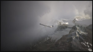
A virtual Bombardier regional jet CRJ-900ER (Aerosoft) with the Alaska Airlines colors is climbing after its departure from the Valdez virtual airport in Alaska (ORBX).

Digital Aviation & Aerosoft have finally completed their long awaited project to make a virtual CRJ-900ER and CRJ-700ER Bombardier regional jets. Months later than expected, the flight simulation enthusiasts can now try those two new virtual aircrafts. The CRJ is mostly used to link smaller airports and remote areas to the main hubs. The aircraft can rapidly reach its cruising altitude and stay there a long time, but it is not intended to be a really fast aircraft.

The company explains that, since the beginning, it had underestimated the complexity of the project and, because of ongoing delays, ended up having to catch up with the competition. In order to offer a superior product than the competition, Digital Aviation and Aerosoft had to review what it initially considered as an almost completed project.
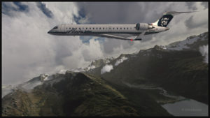
Virtual CRJ-700ER aircraft (Aerosoft) with the Alaska Airlines colors airborne from the Valdez virtual airport (ORBX)

The CRJ-900ER and CRJ-700ER had their exterior almost completely redone; the consumer now ends up with a much better looking aircraft. The project manager says that it is only due to the patience and kindness of potential customers that the project was saved. It pays to be nice!

The first flight with the CRJ
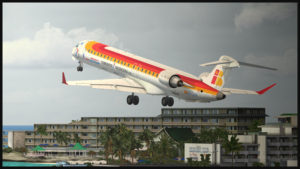
Virtual CRJ-900ER aircraft with the Air Nostrum colors departing the St. Maarten international airport (Fly Tampa St.Maarten)

For the first flight, the manual recommends to first choose and activate one of the default FSX aircraft with the engine running. The pilot then selects the CRJ of his choice. It seems that doing so will prevent a lot of problems.

The virtual 2D cockpit

The virtual 2D cockpit helps save a few FPS. An easy access to the different sections of the cockpit is available since it is divided in several logical panels numbered from 1 to 9.

Navigation

The virtual pilot has access to an updated NavDataPro (May 2017) database for air navigation. It is the world’s most used database in aircraft. The aircraft is also compatible with the popular Navigraph database.

How does a standard computer deals with the new CRJ?
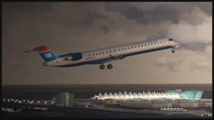
Virtual CRJ-900ER aircraft (Aerosoft) with the U.S. Airways colors airborne from the Denver International airport (Flightbeam Studios)

I have flown both aircrafts on several virtual airports like St. Maarten (Fly Tampa St. Maarten), Montreal international (Fly Tampa Montreal), Denver international (Flightbeam Studios) and Valdez (ORBX) without problems with regards to the computer’s processors and FPS. It was certainly out of question to try to land at the Courchevel airport (LLH Creations), with its short sloped runway, but a low pass at high speed caused no stutters.
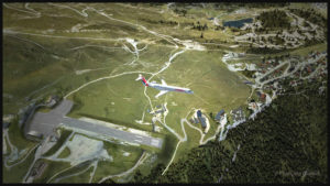
A virtual CRJ-700ER aircraft (Aerosoft) with the Air France HOP colors is in flight over the Courchevel virtual airport in France (LLH Creations)

Flying the CRJ at low speed

The CRJ offers a good margin of manoeuver when it comes to flying at low speed. But due to the position of the engines, the aircraft’s nose will raise rapidly when the throttle is brought back to idle. In a constant and progressive descent, that does not cause a problem. But if the manoeuver is done on short final when the aircraft is still above 50 feet, the rapid change in the aircraft’s attitude could induce a stall.

The air brakes

One cannot rely too much on the air brakes to slow down the CRJ. They have limited efficiency, both for the virtual and the real aircraft.

Floating tendency

If the aircraft arrives over the threshold at a higher speed than recommended, it will float for a long distance before finally touching down.

Landing and take-off distances
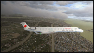
A virtual CRJ-900ER aircraft with the Air Canada colours (Aerosoft) is approaching the Montreal Pierre-Elliott-Trudeau virtual airport (Fly Tampa Montreal)

The CRJ-900 and CRJ-700 operate on relatively short runways. The CRJ-700 needs 5040 feet for take-off (at maximum weight) and landing, under the standard ICAO conditions. The CRJ-900 requires 6060 feet for take-off and 5260 feet for landing. The maximum range has been established to be around 1300 and 1400 nm.

Managers that facilitate the use of the CRJ

For the CRJ, Digital Aviation & Aerosoft have created managers that allow choosing the number of passengers, cargo, as well as calculating the fuel weight, the center of gravity and the amount of trim required. There is even a FS2 Crew option if desired. Another manager facilitated the addition of liveries.

The flight simulation enthusiasts had been anticipating the arrival of that regional jet for a long time; some did not believe anymore that it would one day become a reality (that includes the company too!). The flight simmers now have access to a world class and high quality regional jet.

For more articles on flight simulation on my web site, click on the following link : Flight simulation
Categories
Flight Simulation

Flight simulation: the Peyresourde Balestas mountain airfield when you’re looking for a challenging flight!

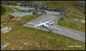
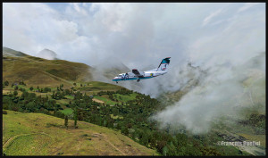
A Sat Airlines aircraft is on final for the Peyresourde mountain airfield

Flight simulation allows the use of all company liveries and types of aircraft. In the present case, a DHC-8-227Q from Sat Airlines, with the Sakhalin Energy logo, has mysteriously found itself inbound for the Peyresourde mountain airfield.

A Sat Airlines aircraft is on final for the Peyresourde mountain airfield
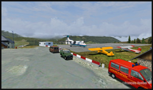
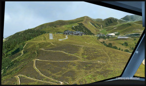
A Sat Airlines aircraft is on short final for Peyresourde mountain airfield

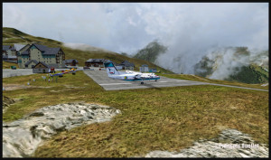
Peyresourde Balestas is located in the Pyrenees, at an altitude of 1580 meters. Its runway is only 335 meters long and has a 15 degree slope. The beginning of the James Bond movie “Tomorrow never dies” has been filmed there. The runway is long enough to accommodate the DHC-8-227Q as the plane’s excellent braking capacity is even improved by the sloped runway. If you touch early enough, you won’t even have to apply full braking power.

Sat Airlines Sakhalin Energy and the Peyresourde mountain airfield (fsx)

A Dash 7, with its superb ability to operate from any kind of field, would also fit in there, providing the amount of fuel and cargo is well calculated. Because what lands must also takeoff.

Peyresourde Balestas and the DHC-8-202Q Sat Airlines Sakhalin Energy (fsx)

The Peyresourde Balestas mountain airfield is made by LLH Créations, from France. The company has already produced four mountain airfields located in the French Alps. This is the first one in the Pyrenees.

Virtualcol FS Software created the Dash-8 used for this flight. For a very reasonable price, that company offers, in one bundle, an astonishing amount of liveries and all the types of DHC-8. Their product is detailed enough and really takes lower end computers into account when it comes to FPS (frames per second). Don’t expect the same realism as with the Q400 from Majestic Software though: Majestic’s Q400 is on a category by itself in the sim world and the price is adjusted accordingly.

The fun will not be over after you land. You will find that the takeoff is quite spectacular. Apply the brakes, full power and the necessary amount of flaps and let it go! You’ll see that the runway’s end is coming quickly and that you’re building speed like you never believed possible with a Dash 8!

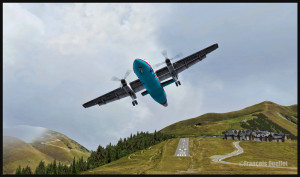
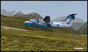
The Peyresourde Balestas airport and a DHC-8-202Q aircraft owned by Sat Airlines Sakhalin Energy
A DHC-8-202Q owned by Sat Airlines Sakhalin Energy is leaving the Peyresourde Balestas runway

Your passengers will certainly remember that mountain airfield. So will you!

If you want more ideas of flights that would test your nerves, just head to the “challenging virtual flight” section of this website.

For more articles on flight simulation on my web site, click on the following link : Flight simulation
Categories
Flight Simulation

Flight simulation: why not try a flight between two helipads located high in the Alps?

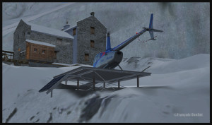
R66 helicopter on the Refuge du Requin helipad in the Alps (DZRR) FSX

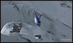
In the “flight simulation” section, under “challenging virtual flights”, I have added screen captures (also visible here for now) that show a flight that can be quite demanding and which consists of doing a VFR ride  with an helicopter between two helipads situated high in the Alps. The flight is made using FSX. In real weather conditions, the winds can really complicate things when you are on short final for your destination.

R66 helicopter airborne from the Refuge du Requin (DZRR) FSX
R66 helicopter approaching the Refuge de l'Argentière DZRA FSX
R66 helicopter approaching the Refuge de l’Argentière DZRA FSX

For this exercice, the ALABEO R66 has been chosen. You could add another degree of difficulty by using a DODOSIM helicopter.  The helipads are made by  LLH Créations. The virtual flight that you can see in the screen captures set  above shows a takeoff from the Refuge du Requin sur la Mer de glace (DZRR), which is at an altitude of 2510 meters, towards the Refuge de l’Argentière (DZRA), located at  2778 meters MSL. Two other mountain chalets could have been chosen: Chamonix (DZ des Bois , DZDB), at 1075 meters, and Promontoire (DZPR), near the Alpe d’Huez mountain airfield  and Grenoble airport,  at 3055 mètres in the mountains.

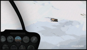
R66 on final for the Refuge de l'Argentière helipad DZRA FSX
R66 on final for the Refuge de l’Argentière helipad DZRA FSX

Before doing a flight, you can select one of the following three options: winter, summer and photographic scenery.  The documents provided help you out with the best settings as to the autogen, the complexity, the resolution, etc.

R66 helicopter on the Refuge de l'Argentière helipad DZRA FSX
R66 helicopter on the Refuge de l’Argentière helipad DZRA FSX
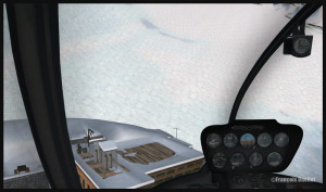
R66 on the roof of the Refuge de l'Argentière DZRA FSX
R66 on the roof of the Refuge de l’Argentière DZRA FSX

I am convinced that you will enjoy the experience. By using real weather, each flight becomes an adventure. With moderate winds, on an approach to the Refuge de l’Argentière, you will realize that there is not much margin of manoeuver!

Have a good flight!

For more articles on flight simulation on my web site, click on the following link : Flight simulation