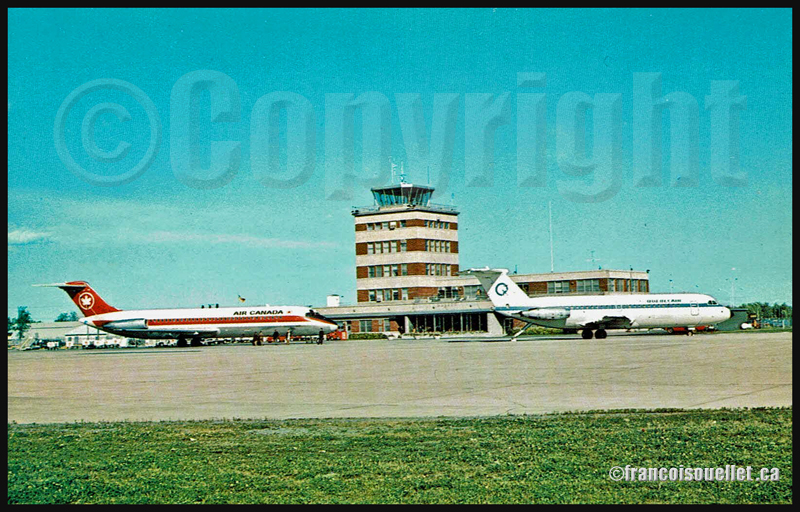
Old Quebec airport terminal with an Air Canada DC-9 and a QuebecAir BAC 1-11 (on aviation postcard)
Around 1996, during the summer, an Air Canada DC-9 captain visited the Transport Canada flight service station in Québec City (CYQB) to receive a last minute briefing on the weather conditions between Quebec and Toronto.
All the passengers were already on board, but the captain had noticed a rapid change in the size of thunderstorms approaching the Québec City airport. Wishing to make the best decision, he requested the latest information on the approaching line of thunderstorms before proceeding with the takeoff.
The weather radar and satellite pictures showed a wall of convective cells that a DC-9 would not be able to go through. It would not fly high enough nor be able to go around the system unless it made a detour through Val-d’Or to the north or the Tennessee to the south.
The captain already knew the consequences of his decision. He nonetheless took the phone and called Air Canada’s dispatch in Toronto, announcing that he would not leave Quebec until the weather was acceptable. He could envision the missed transfers in Toronto for most of his passengers, and their bad mood in face of the lengthy delays he expected in Québec City.
Nevertheless, his decision was made and he left the flight service station satisfied. He knew very well that a line of heavy thunderstorms had often been the cause of accidents and that no aircraft, whatever the size, was safe when dealing with a wall of severe thunderstorms.
The flight service specialists (FSS) were happy with the captain’s decision since, throughout the years, the FSS often witnessed far less commendable behaviour from pilots of all categories. Judgment is the capacity to evaluate consequences, and it is not given to everybody.
April 2013, at the Nav Canada Flight Information Center (FIC) in Québec City. This morning’s meterological forecasts indicate the possibility of dust devils. This type of obstacle to visibility is rare. The pilots call the flight service specialists (FSS) to know what “PO” means on the weather charts.
In spite of the calm winds and blue sky all over southern Quebec, the weather conditions can give birth to local wind shears. If they lift sand, dust or other small particles, those wind shears will become visible and cause dust devils five to ten meters in diameter.
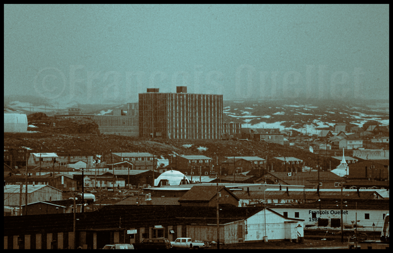
A pilot would have to be unlucky to cross a rare dust devil. However, I remember an event I witnessed thirty years ago while I was working at the Transport Canada Rouyn-Noranda flight service station.
On a hot summer day, an aircraft landed in Rouyn-Noranda after a cross-country flight from Montreal. The pilot was making a short stopover to have his logbook stamped at the flight service station. The weather conditions were ideal at the airport: dry air, calm winds and a cloudless sky.
Once his run-up was completed on the taxiway, the pilot slowly headed for the runway 26 threshold. Once aligned and ready for take-off, he made the last few adjustments.
Few seconds later, the flight service specialists heard an emergency locater transmitter signal. Looking again at the runway, they saw that the aircraft was still on the threshold, but upside down.
A strong windshear had overturned the single-engine aircraft. The airport wind speed indicator being located farther away from the threshold only indicated calm winds.
The souvenir of this story reminded me that nature can always surprise the best prepared pilot. I imagine that this event shocked the student pilot as he tried, like us, to figure out what had just happened. I do hope that this adventure did not discourage him from flying.
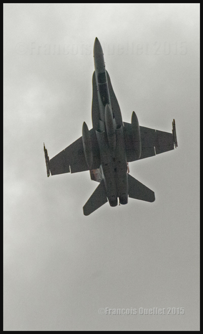
One of four F-18s over the National War Memorial in Ottawa on October 22nd 2015
During the September 11th 2001 crisis, the Canadian sky belonged, for a short period, to the military. The latter had taken the decision that every aircraft that had not taken-off yet had to stay on the ground, and those which were airborne had to expedite the landing.
There were a few exceptions for medical evacuations, but those flights were tightly monitored. All air traffic services units communicated with aircrafts in flight and agencies on the ground to advise them of the new rules now in place.
Generally speaking, regardless of the initial surprise, all pilots with whom the Transport Canada flight service specialists (FSS) in Quebec City had talked, through their multiple frequencies, offered no resistance.
But I remember the case of a pilot flying a twin-engine aircraft over the Laurentides region to whom the order of landing as soon as possible had been given. He refused to obey since it was out of the question for him to lose money on already booked charter flights, especially on a beautiful day.
The flight service specialists could understand his frustration. Nonetheless, it was not a good time to debate. It was, for all air traffic services units involved, a particularly busy day and nobody had extra time to argue at length about a request.
The message was repeated one more time. In view of his refusal to obey, NORAD (North American Aerospace Defense Command) was contacted. The reply came back quickly and the pilot was given two choices: either he landed or an CF-18 fighter jet would be launched to take care of the situation.
No need to add anything else. The pilot complied immediately.
On July 1st 1990, few months after having been released from twenty-seven years in jail, the South African President Nelson Mandela stopped in Iqaluit, on Baffin Island in the Nunavut. It was 03:30 AM and the aircraft had just arrived from Detroit in United States. Mandela participated in a special event linked to the three big American car manufacturers where he was invited to deliver a keynote speech.
I figured that this trip to Detroit must have brought him found memories since, in his autobiography, he mentioned that the first car he saw in his youth was a big black luxury car that he later recognized to be a Ford V8.
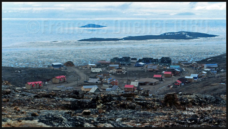
After Detroit, the jet carrying the Mandela couple followed an orthodromic line around the planet for the return to South Africa. It meant that a stopover for refuel was mandatory and Iqaluit, in Canada’s arctic, was chosen.
In anticipation for the VIPs arrival, the Transport Canada flight service station and the airport installations had been secured by the RCMP. Before meeting the VIP’s, the Mandela couple took some time to walk toward a group of persons outside the airport terminal. They discussed for a while, each group separated by the airport fence.
As reported by historian Kenn Harper in Nunatsiaq News in 2008, the security staff tried to rapidly bring back the Mandela couple inside as there were VIP’s waiting for them. But Mandela answered: “There are no more important people in this town tonight than these folks who have come out to talk with me. I’ll be in when I’ve finished speaking with them.”
In his memoir, Conversations with Myself, he wrote: “What struck me so forcefully was how small the planet had become during my decades in prison; it was amazing to me that a teenaged Inuit living at the roof of the world could watch the release of a political prisoner on the southern tip of Africa.”
Nelson Mandela and his book “Conversations with Myself”, image extracted from www.nelsonmandela.org on January 5th 2016
As they entered the Transport Canada installations, Nelson and Winnie Mandela were greeted by several persons, among which Iqaluit’s Inuit chief. A ceremony was held in a room next to where I was working, one floor lower, under the flight service station (FSS) tower.
Around 04:00AM, I came down from the FSS tower to transmit an important message regarding the return flight. At the bottom of the stairs, positioned on the other side of the door, was a huge policeman blocking our staff from accessing the corridor.
I tapped lightly on the windowed door and showed him that I had an urgent message for Mandela’s entourage. He refused to budge. The smooth way not bearing any results, I used the necessary means to achieve success. This did not go without a bit of noise.
The policeman finally let me go through, knowing very well that all flight service specialists were screened for security on a regular basis. But looking at his facial expression, it is obvious that we were not friends anymore.
Obviously, all my attempts at opening the door disrupted the ceremony a bit. As I was delivering the message, I saw the Mandela couple sitting in a nearby room, few meters away, attending a traditional Inuit dance performance. Drawn by the noise in the corridor, Nelson Mandela diverted his attention and we looked at each other for a short moment.
What surprised me the most was to see this remarquable man sitting straight in his chair, like a young man in his prime, showing no signs of fatigue, despite a very busy day and such a late hour that would not allow him to rest before 0500AM. That night, I understood a bit more what involved the responsibilities of a head of State and all the energy required day after day to occupy the position.
In 1989, News North journalist Cam Lockerbie wrote an article about the misadventure of passengers who were forced to stay longer than expected in Iqaluit because of a stopover that went wrong.
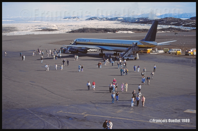
A Trans Ocean Airways DC-8 on a flight from San Francisco to Great Britain had stopped in Iqaluit, on Canada’s Baffin Island in the Nunavut, to refuel but experienced some problems during the refueling process. The aircraft would not be able to depart before the next day and 220 passengers had to find a place to sleep in Iqaluit.
Impressive efforts were deployed to help those stranded passengers since there was far from enough hotel rooms to accommodate everyone. Eventually, the passengers were dispersed throughout the town and, although there were not enough beds for everyone, there was at least a roof provided for the night.
The wing of a Trans Ocean Airlines DC-8 touches a hangar in Iqaluit
The spare parts needed for the broken DC-8 were delivered by charter jet directly from United States. After the repair was done, the DC-8 attempted to move but faced another problem. It had to find enough space to manoeuver between a hangar and an American Trans Air Lockheed L-1011 that was refueling. An airline company employee was requested to guide the DC-8 and ensure that it would not come into contact with the L-1011 or the hangar.
The newspaper article mentioned that the aircraft was not able to move past the hangar and that part of the wing had to be dismantled. What the journalist did not write, certainly because he ignored it, is that there was a contact between the hangar door and the wing tip, in spite of the person walking in front of the DC-8, like you can see on the picture above taken by an Iqaluit flight service station FSS.
On the return flight, the same DC-8 experienced an alternator problem but the engineer’s resourcefullness prevented the passengers to spend another night in Iqaluit. In the following year, the company declared bankruptcy.
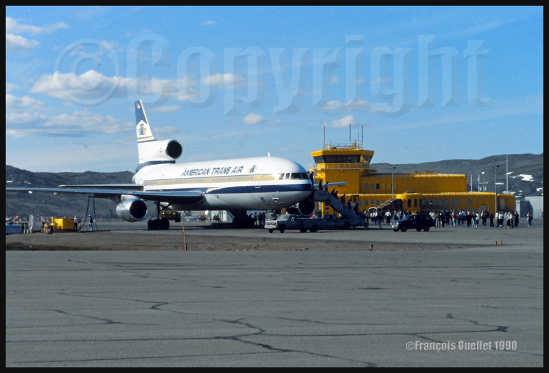
American Trans Air Lockheed L-1011 in front of the Iqaluit flight service station in 1989
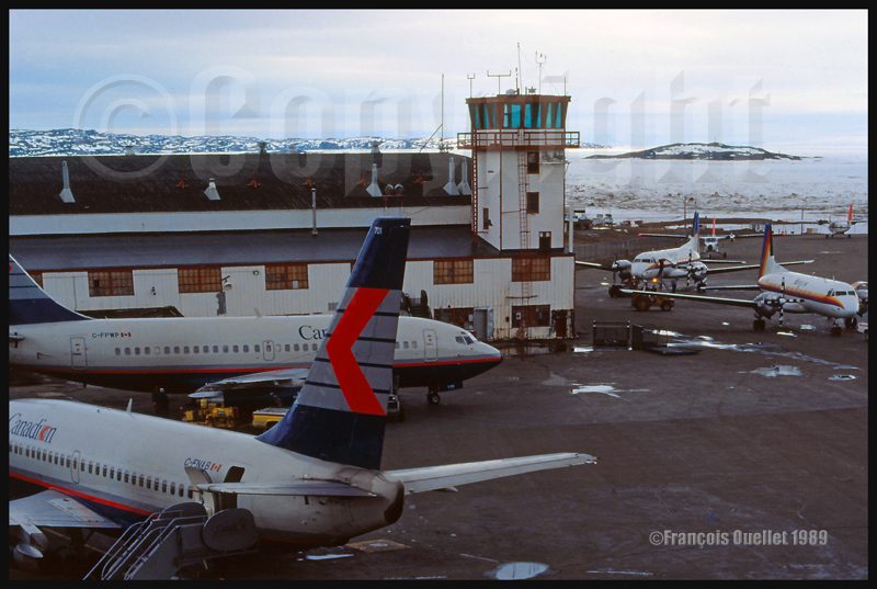
Canadian Airlines B-737 and Firstair HS-748 in Iqaluit in 1989
Their pilots had crossed 60 degree west without communicating with Iceland radio and it was now necessary to ensure that the projected passage time for 70 degree West and the altitude of the aircraft were still valid.
I tried to communicate with the crew using all means at my disposal, among which the SELCAL system which sent an alarm signal on board the aircraft. Nothing worked. Other airliners flying nearby the aircraft were requested to help by trying some calls on VHF emergency frequencies. But again, there were no replies.
Suddenly, about one hour after the moment that the pilots should have given some sign of life, I received an answer to my repeated calls. I told the crew that all the efforts had been made to contact them but without success. I asked them an official position report and an estimate for the next mandatory point of contact. Calmly, the pilot answered that he did not know why I had not received his calls and he immediately prepared an official position report.
It was kind of strange that on a day where the HF reception was excellent, and when all other companies were communicating with Iqaluit radio without any problem, this company stayed silent for such a long period of time.
I finally received the new position report but it clearly looked like an invention. If the data provided by the crew was correct, this aircraft would successfully fly 400 nautical miles in the next ten minutes. It would mean that at this speed, the crew expected to cross most of Canada in about one hour.
I advised the pilot to redo his calculations since, visibly, he seemed to have no idea of his position. He came back with new numbers, very different this time, which match what was expected.
I guessed that during the long transatlantic flight, both pilots slowly fell asleep while the automatic pilot kept the aircraft in flight. Suddenly woken up by the multiple calls, the crew did not take into account the movement of the aircraft during the hour where everybody was asleep and, worried not to get caught, rapidly transmitted totally erroneous calculations.
Nonetheless, the story ended well since the crew, now rested, provided exact information for the following position reports, allowing for a safe flight until destination.
February 1990 in Iqaluit, on Baffin Island, Canada. Activities have slowed down a bit today. A temperature of -43C combined with 35 mph north-west winds means that the wind chill factor has gone down to -85C (NOAA Wind Chill Chart). We see far fewer pedestrians and even less motor vehicles on the city’s few roads. Many engines refuse to start and the motor oil has almost the consistency of maple taffy.
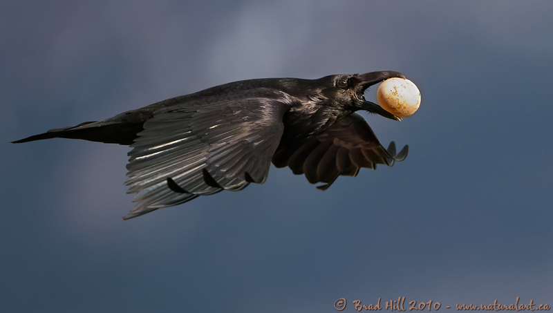
A special day indeed as, from the Transport Canada flight service station (FSS) tower, we can watch a very interesting performance. Huge ravens have picked that very windy day to have fun, regardless of the temperature. Flying under the wind near the FSS cab, they benefit from the venturi effect. There is no need flapping their wings. They just glide while occasionally correcting the angle of attack to adjust for the gusting wind.
The wind chill factor affecting living organisms, I find it quite spectacular to see those huge black birds having fun while we would expect that, with a -85C factor, ravens which must not absolutely fly would stay under cover until the weather improves a bit.
We can clearly hear the noise made by the wind on the wings of a huge raven when it glides over us. One day, I was walking near the Apex village under total silence. Suddenly I heard a raven glide low over my head. He was possibly checking if there was anything eatable out of that deformed shape transformed by multiple layers of winter clothing. There was only the rustling of the wind on its large open wings and no other sound. That was a very special experience.
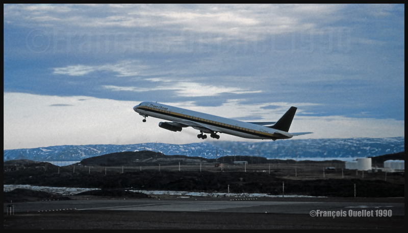
On a summer day of 1989, a DC-8-63F took-off from Iqaluit airport’s runway 36, on Baffin Island, heading towards Los Angeles. In order to do the flight without any stopovers, the tanks had been topped. The combined fuel, passengers and cargo weight required an extremely long ground run before the wheels could leave the runway.
Viewed from the Transport Canada flight service station tower, it seemed to us that the pilot had waited until the last moment to pull on the stick. Once airborne, the aircraft flew horizontally and stayed very low over the flat terrain to profit from the ground effect.
However, few kilometers from the threshold of runway 18, the terrain started to rise enough to request a positive climb rate. The pilot slightly pulled on the stick but avoided any turn to maximize lift.
Using binoculars, the flight service specialists (FSS) watched the aircraft as it should have made a left turn a long time ago. When the turn was finally attempted, the aircraft started to sink and lose much of the altitude precedently gained. We could follow the changes of altitude through the long trails of dark smoke left behind the aircraft.
Realizing the airplane was not ready to turn yet as it was going down, the pilot had started to fly it horizontally again. Moments later, the pilot tried again and the aircraft made a five to ten degree bank before starting to climb very gently. The aircraft would not have handled anything more.
It was the first time that we were considering pressing the red button used to alert airport emergency services. But this would not have been very useful since very little help could have been provided quickly enough, taking into account the position of the aircraft, its enormous amount of fuel on board and the total absence of roads in that isolated Arctic region.
N795AL DC-8-63 Trans Ocean airborne runway 18 in Iqaluit in 1990
In 1990, Stacey Campbell, a News North journalist, wrote an article that she titled: “Iqaluit Drug Haven”. She wrote that the Iqaluit airport was the main point of arrival for the entire drug being used all over the Baffin Island region, in the Nunavut. Mail was also another tool used by drug trafficker. It was quite easy to find marijuana, hashish and cocaine.
On the top floor of the eight stories building in which I lived, there were an increasing number of drug users. While only a year ago the place was relatively quiet, it was not the case anymore. From my small apartment, I could hear the shouting in the corridor or in the neighbouring rooms and the “OPEN THE DOOR!” ordered by the RCMP police officers.
There were cases of domestic violence, fights, people which I had to step over to walk in the corridor as they were lying down on the floor in their vomit, totally intoxicated. Near where I lived, somebody was thrown out of an apartment in a rather radical way: the door and its fittings were now missing and there was blood on the wall. The place is far less peaceful than last year.
At the center of the picture, a high rise building inhabited by single people in Iqaluit in 1988.
In a nearby room, several drug users met, mostly on Friday nights. Quite often, tension rose between card games. The place had become unsuitable for somebody trying to rest while on a seven days a week shift work providing air traffic services at the local Transport Canada flight service station.
I remember one time when somebody started to kick on my door while I was studying quietly in my room. I could hear him shout: “I am going to kick your ass!” Since I had no idea of what was going on and as it seemed that I was directly concerned, I opened the door.
I then recognized a person whom I politely asked, at least six months ago, to try to lower the noise level. All those months went by and tonight, in an altered state, he suddenly remembered that request. He visibly took my request as a personal insult. He was now under the influence of an unknown substance and was angry.
He was standing in the corridor. Any moderate reaction on my part seemed useless, considering his situation. It appeared that only a quick and radical move would bear some success.
I tried to slowly close the door but he blocked it with his hand. The situation was getting worse. I waited few seconds and tried again, calmly and without a word. In few seconds, if nothing was working, there would only be one solution left. I gently pressed on the door and he totally surprised me by letting go so that in about twenty seconds, the door was closed again.
All this was done in total silence. In my room, I stood few feet away from the door, expecting it to be slammed open but nothing happened. Only that silence all around. After few minutes of having stood still, waiting for the next logical step, I realized that everything was over. What a weird night! This would not have ended the same way in a big city down South.
I can really say that in 1990, Iqaluit was in fact a drug heaven. Moreover, the floor where I had my room was no exception. I was eventually able to move to another floor where there were people with a more balanced lifestyle and the need to sleep once in a while…
In 1982, Air UK ceased its charter flight operation. But five years later, the company was back in that business, under the name of Air UK Leisure. It started its operation by using three Boeing 737-200s but soon realized more aircrafts would be needed. In 1988, Air UK Leisure ordered seven new 737-400s, the first of their type in Europe.
Those 737-400s, built at Boeing Field in Seattle, had to fly to Europe by passing over northern Canada. The aircrafts could not do that long trip without stopping for fuel. They landed at the Iqaluit airport, on Baffin Island, in the Nunavut.
Air UK G-UKLB Boeing B737 arriving in Iqaluit
In the unique aviation photography above, taken from the local Transport Canada flight service station (FSS), you can see one of those new Boeings, a B737-4YO, G-UKLB.
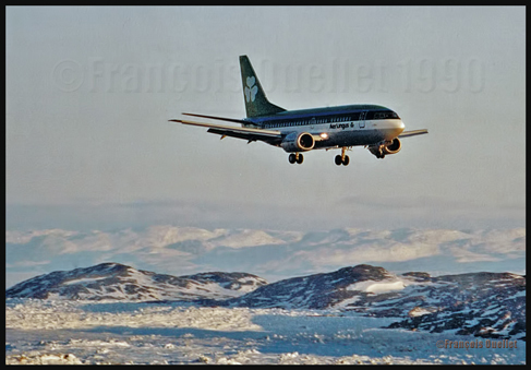
During the same period, many companies having recently acquired some B737-400s and 500s did the same trip from Seattle to Europe by stopping in Iqaluit. Among those, Aer Lingus and Hapag-Lloyd.
Aer Lingus B-737 on final in Iqaluit in 1990
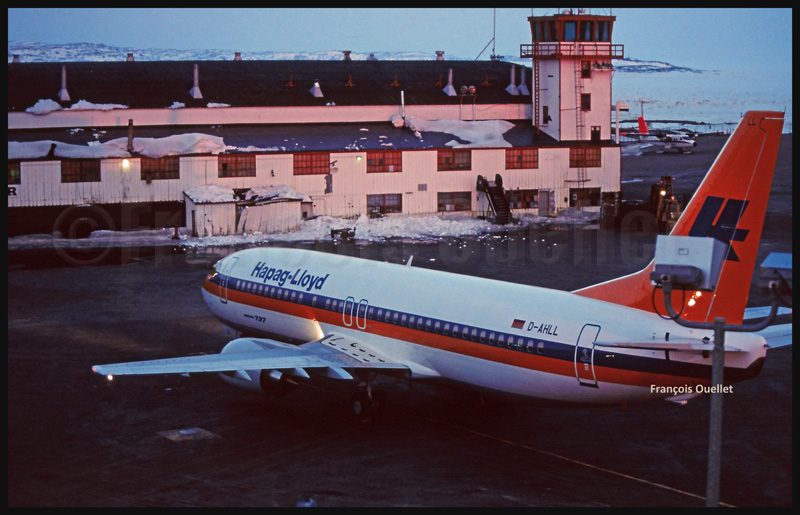
A new Hapag-LLoyd (D-AHLL) Boeing B-737 has just arrived from Boeing Field in Seattle. Next destination: Germany.